Nova Scotia Archives
Historical Maps of Nova Scotia
Results 1 to 15 of 207 from your search: F/230
Annapolis Townships Annapolis County Maps
Date: 1759
Reference: Nova Scotia Archives Map Collection: F/230 - 1759
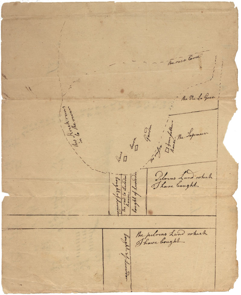
[The Plan of Lavender's Land]
Date: 1763
Reference: Nova Scotia Archives Map Collection: F/230 - 1763
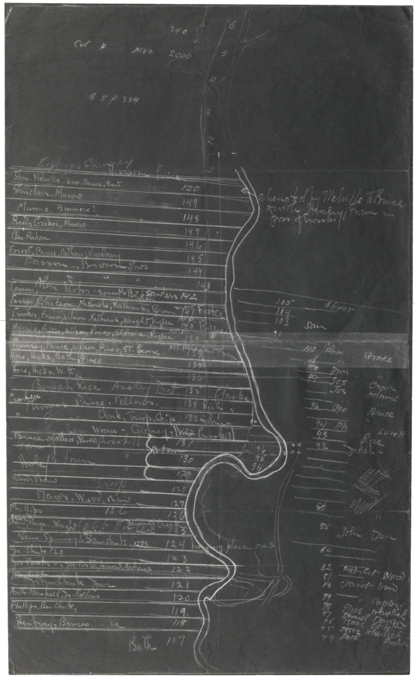
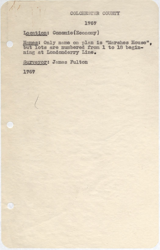
Colchester County Economy, 1767
Date: 1767
Reference: Nova Scotia Archives Map Collection: F/230 - 1767
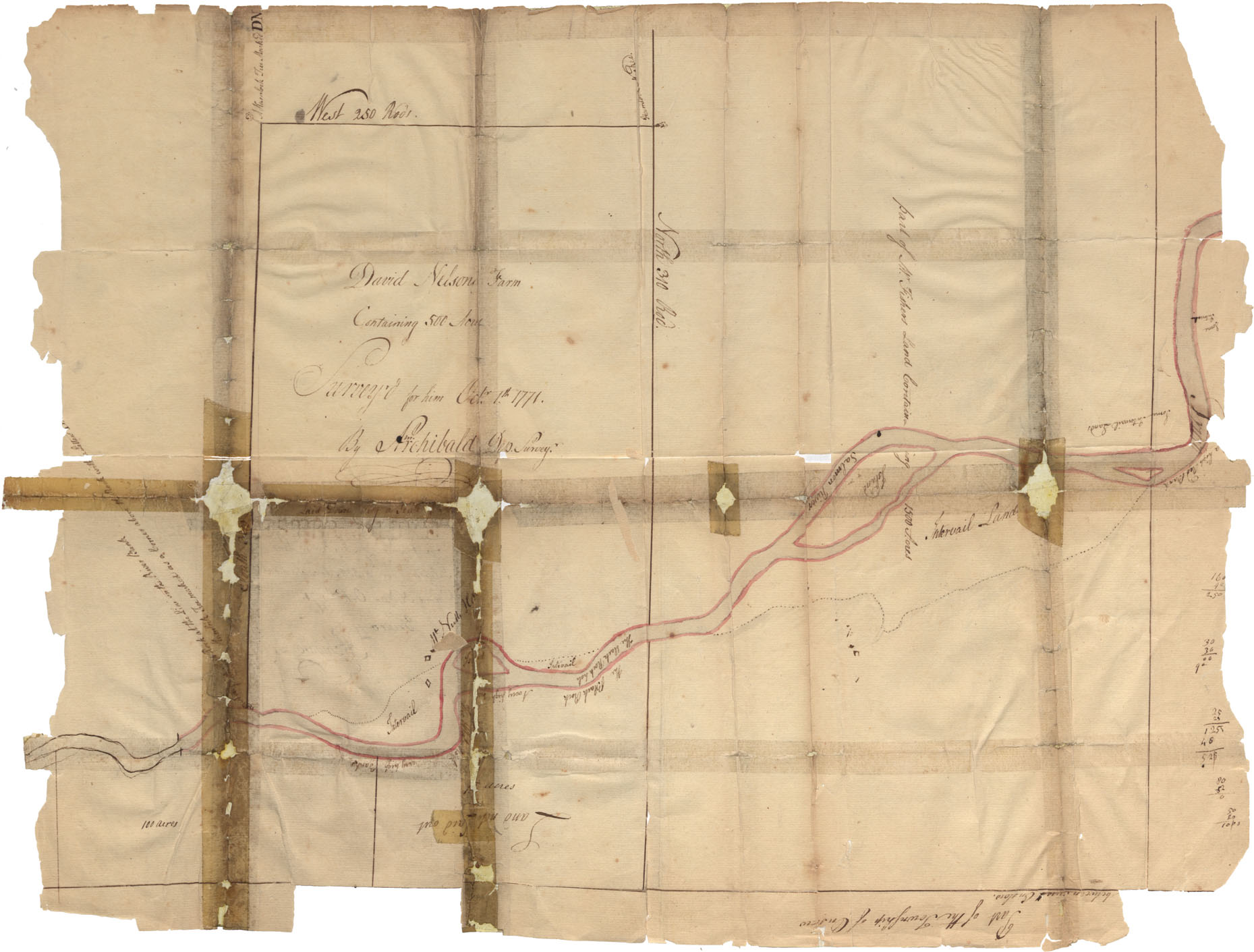
Colchester County Salmon River 1771
Date: 1 October 1771
Reference: Nova Scotia Archives Map Collection: F/230 - 1771
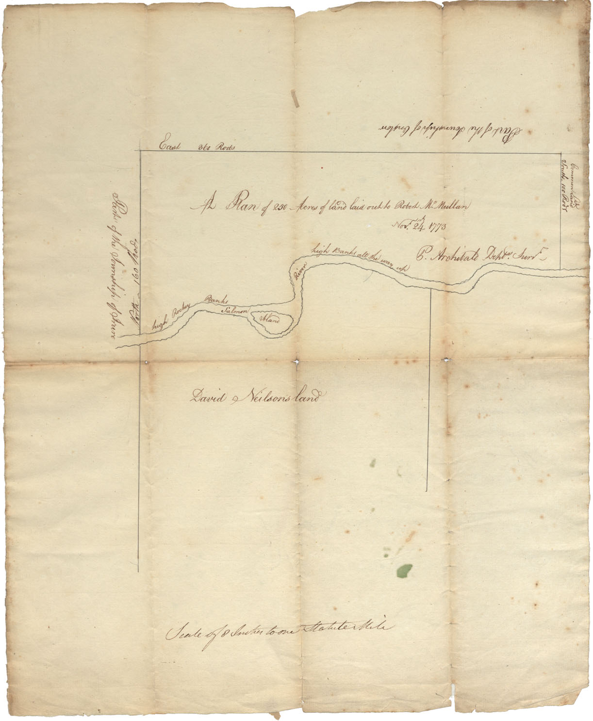
Colchester County Salmon River (high rocky banks) Common Land, township of Onslow & Truro, 1773
Date: 24 November 1773
Reference: Nova Scotia Archives Map Collection: F/230 - 1773
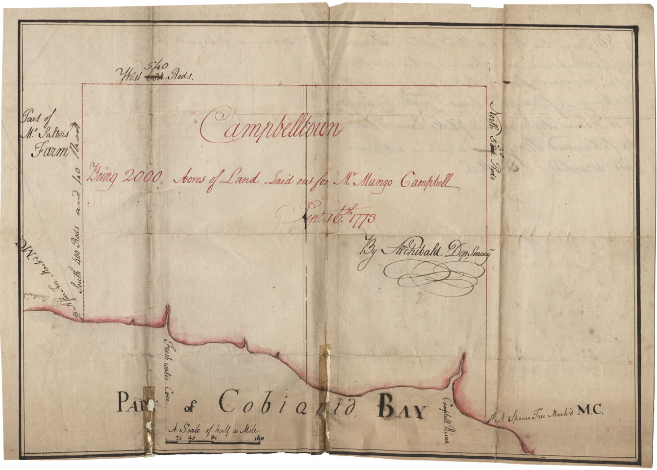
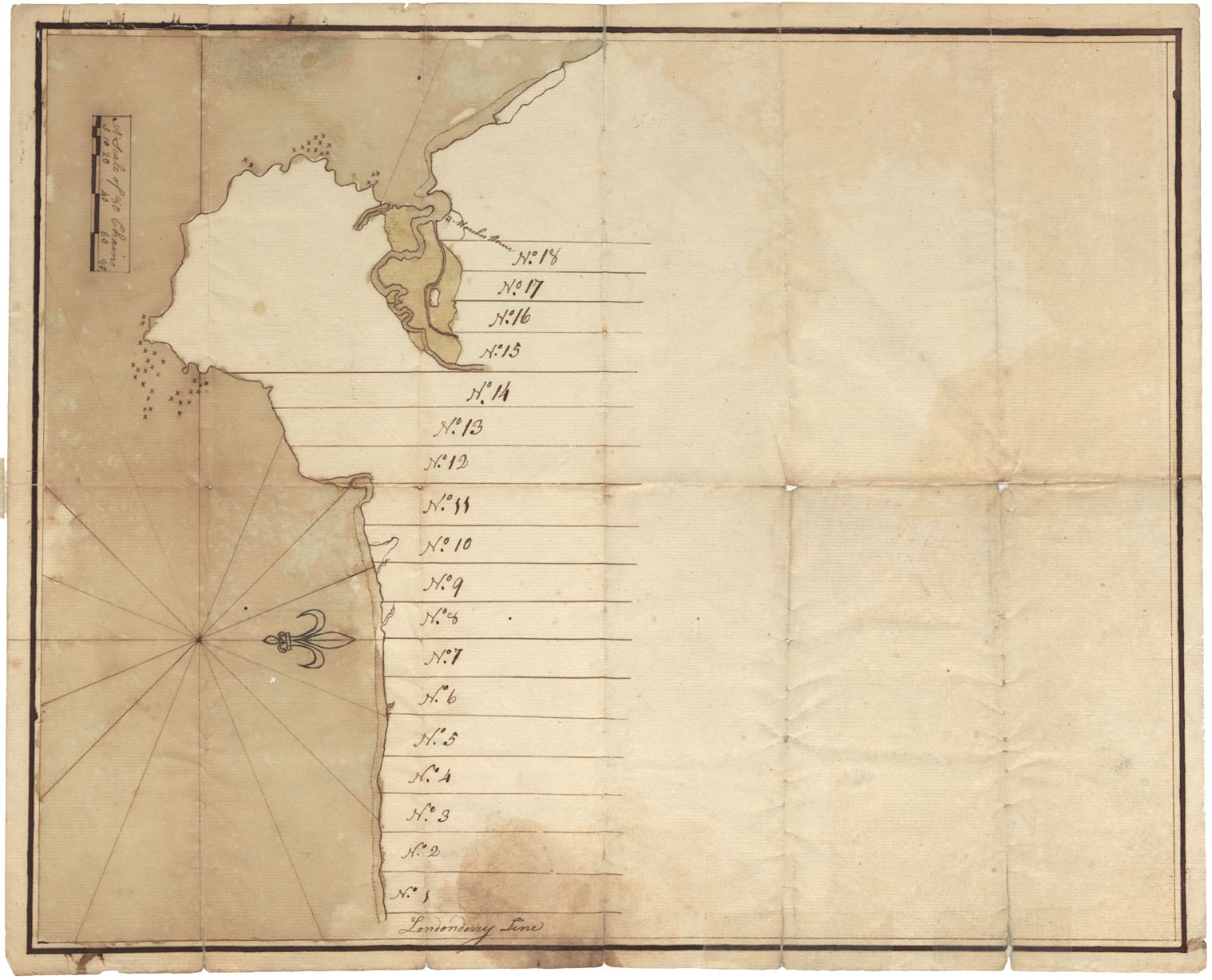
Plan of 2000 acrea of land laid out for Mrs. Mungo Campbell on Cobequid Bay
Date: 1773
Reference: Nova Scotia Archives Map Collection: F/230 - 1773
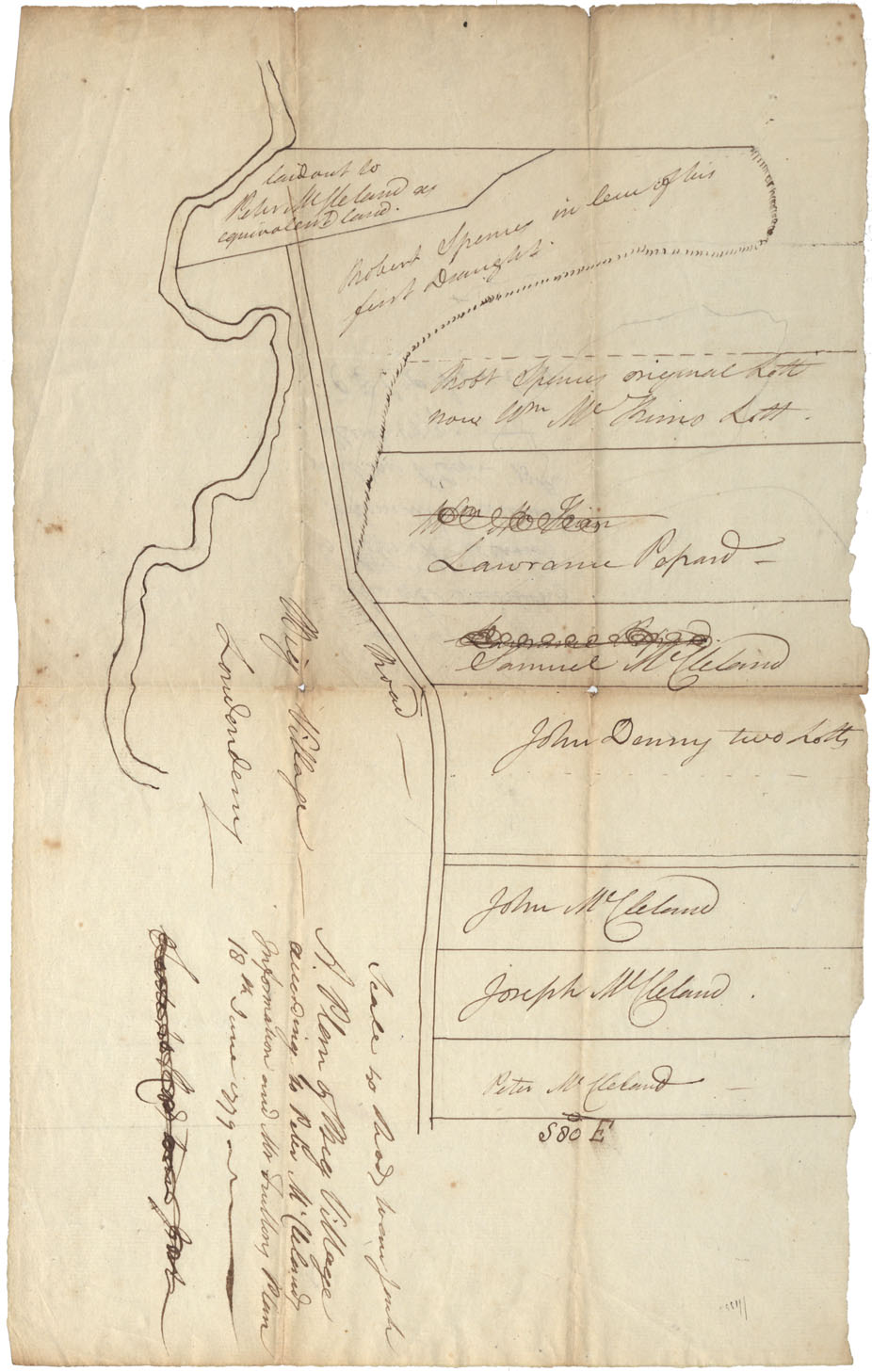
Colchester County Big Villiage, Londonderry, 1779
Date: 18 June 1779
Reference: Nova Scotia Archives Map Collection: F/230 - 1779
Colchester county onslow, 1781
Date: 22 February 1781
Reference: Nova Scotia Archives Map Collection: F/230 - 1781
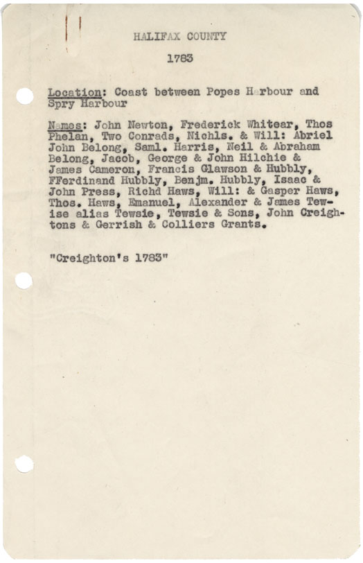
Halifax County Coast between Popes Harbour and Spry harbour 1783
Date: 1783
Reference: Nova Scotia Archives Map Collection: F/230 - 1783

Cumberland County Lots on river crossing road from Cumberland to Cobequid, 1784
Date: 1784
Reference: Nova Scotia Archives Map Collection: F/230 - 1784
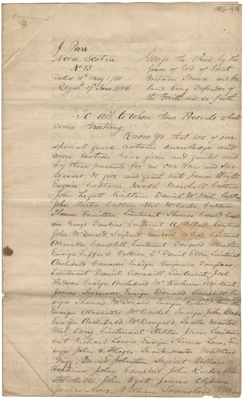
Grant to Carolina Royalists and Queens Rangers in Country Harbour, 1784
Date: 13th May 1784
Reference: Nova Scotia Archives Map Collection: F/230 - 1784
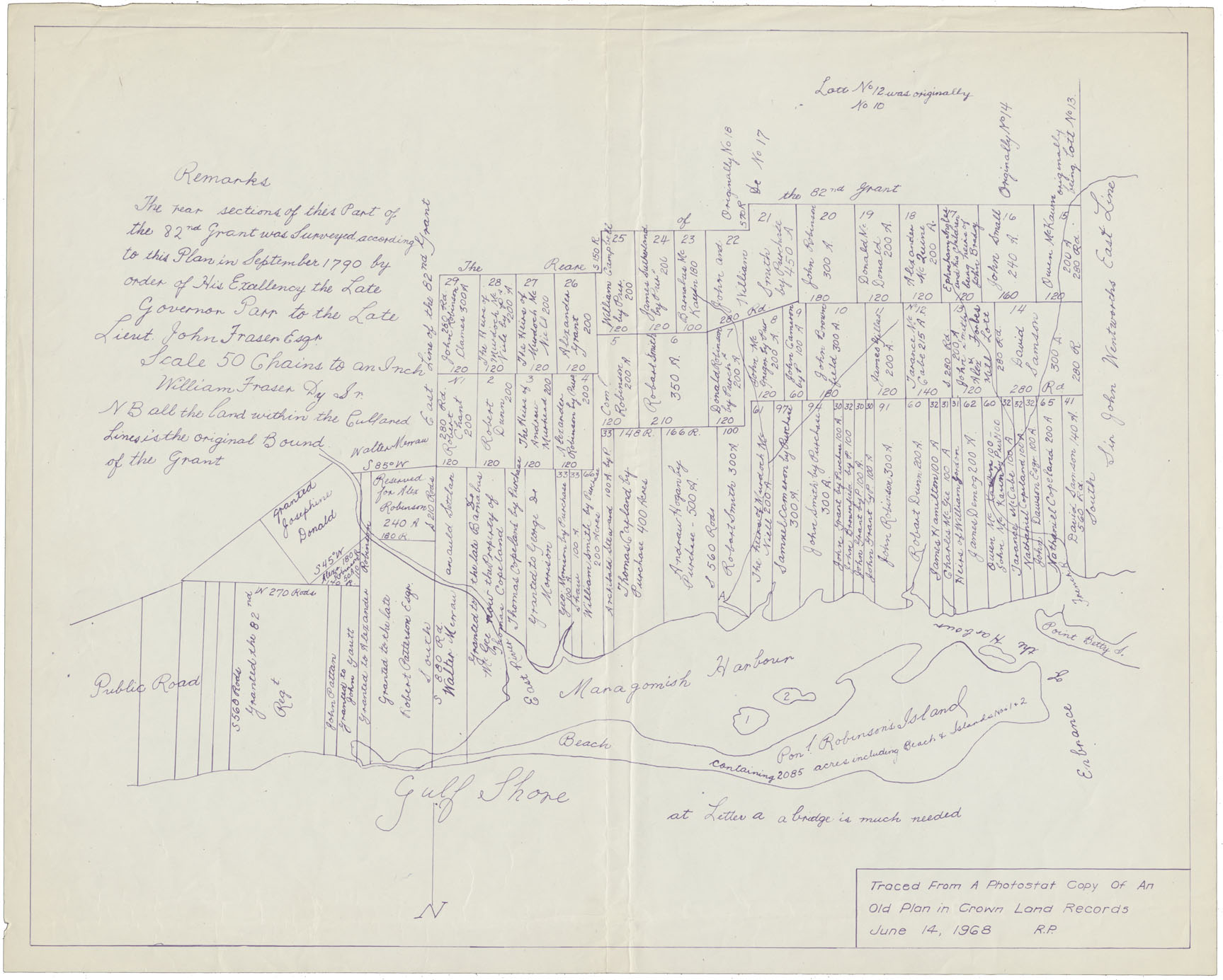
A Plan of Surveys made of lands granted disbanded soldiers, sailors and other loyal emigrants at Merigumish and Pictou done under the orders of His Excellency Govr. Parr by Charles Morris 1785
Date: 1785
Reference: Nova Scotia Archives Map Collection: F/230 - 1785
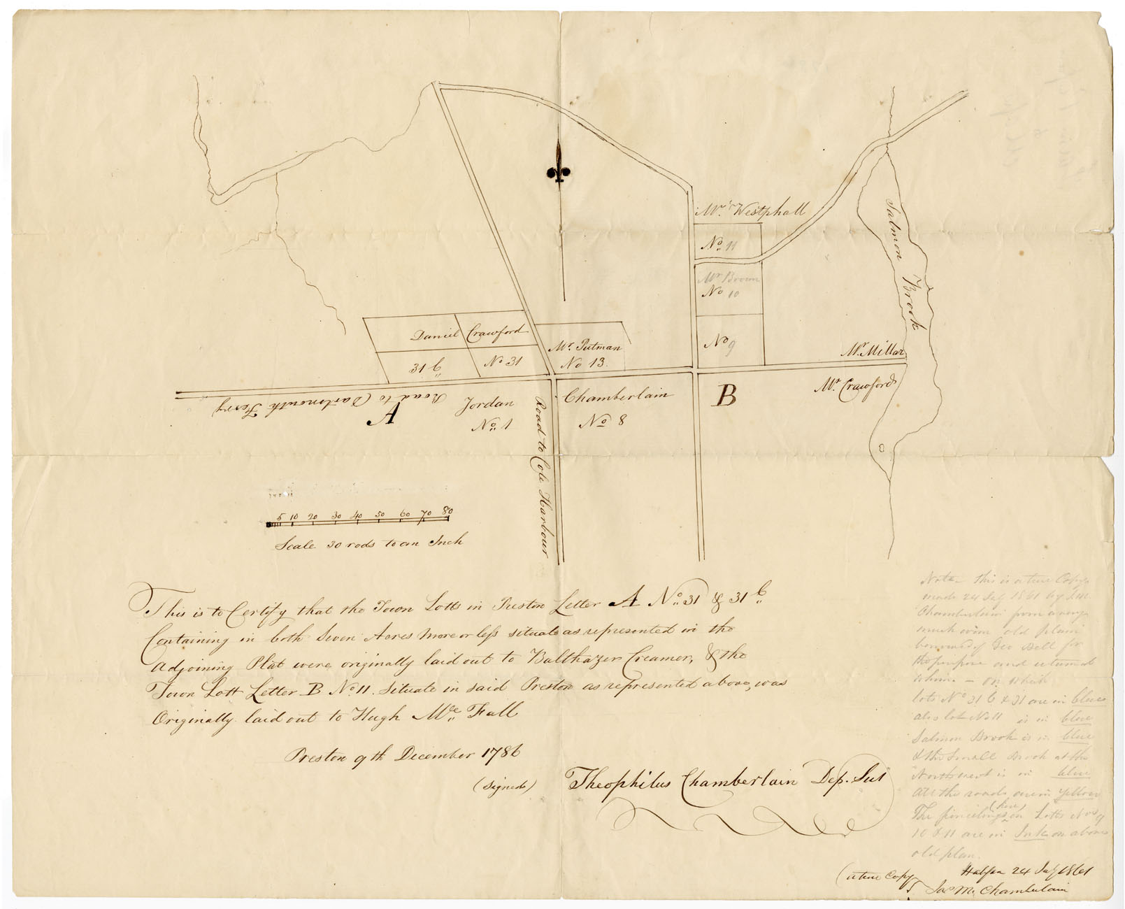
Preston Letter A and Letter B
Date: 9 December 1786
Reference: Nova Scotia Archives Map Collection: F/230 - 1786 African Nova Scotians
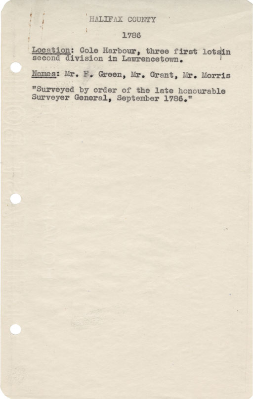
Halifax County Cole Harbour, three first lots on second division in Lawrencetown, 1786
Date: September 1786
Reference: Nova Scotia Archives Map Collection: F/230 - 1786
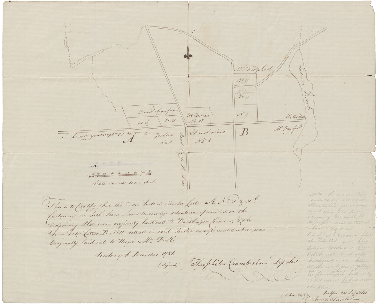
Lots laid out in Preston Letter A No31&31c. To B.Creamer and Town LoH.B No11 to Hugh McFall
Date: December 1786
Reference: Nova Scotia Archives Map Collection: F/230 - 1786