Nova Scotia Archives
Historical Maps of Nova Scotia
Results 46 to 60 of 207 from your search: F/230
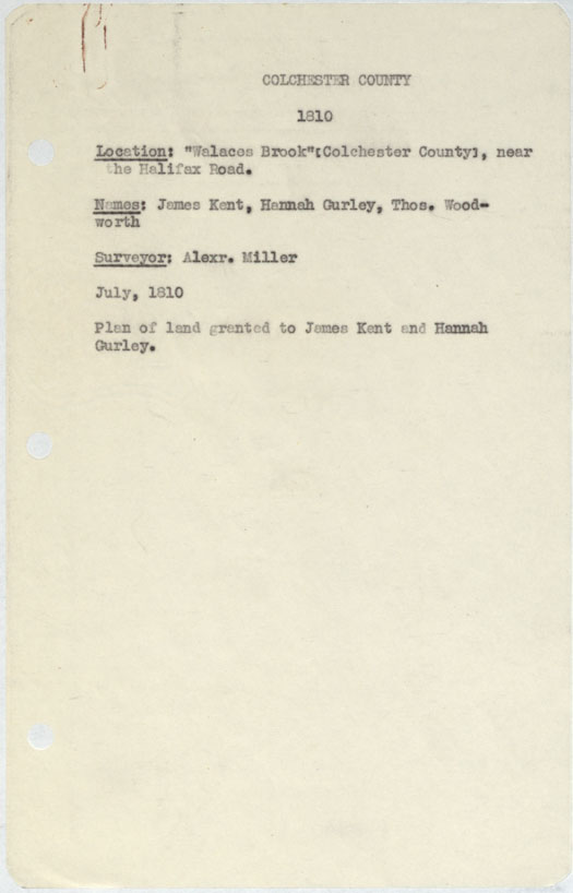
Colchester County "Walaces Brook", near Halifax Road 1810
Date: July 1810
Reference: Nova Scotia Archives Map Collection: F/230 - 1810
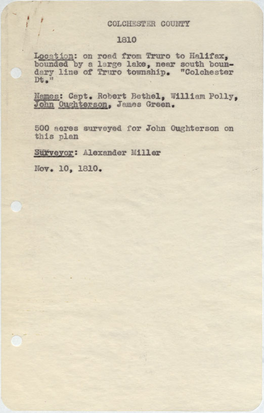
Colchester County On road from Truro to halifax, bounded by a large lake, near south boundary Truro Township 1810
Date: 10 November 1810
Reference: Nova Scotia Archives Map Collection: F/230 - 1810
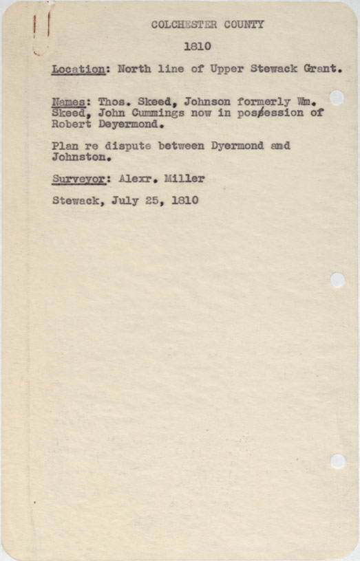
Colchester County North Line, Upper Stewiacke Grant 1810
Date: 25 July 1810
Reference: Nova Scotia Archives Map Collection: F/230 - 1810

Halifax County Road from Cobequid to halifax w.m.1810
Date: 1810
Reference: Nova Scotia Archives Map Collection: F/230 - 1810
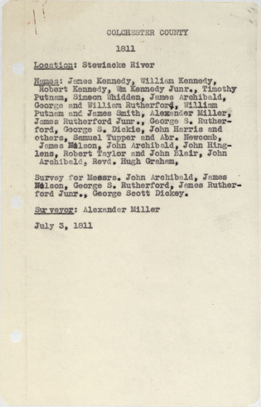
Colchester County Stewiacke River 1811
Date: 3 July 1811
Reference: Nova Scotia Archives Map Collection: F/230 - 1811
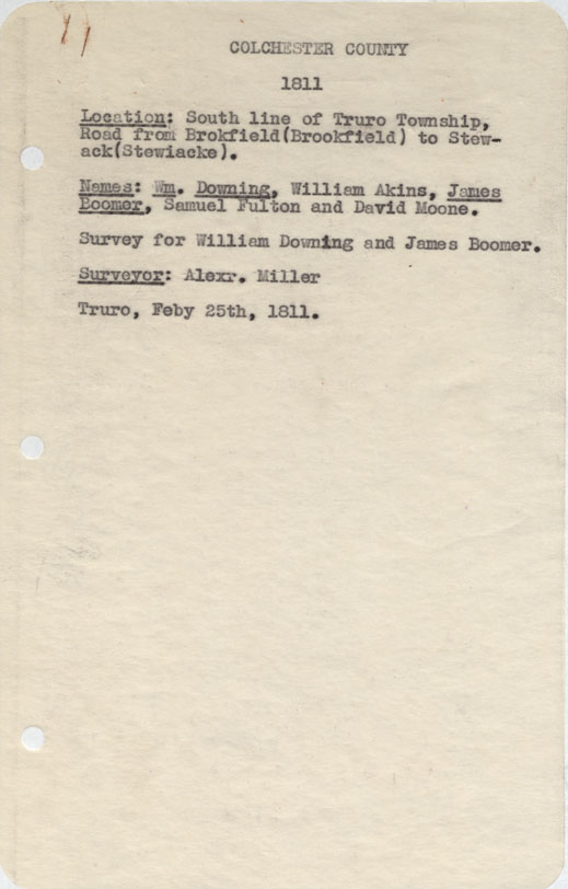
Colchester County South line of Truro Township, Road from Brokfield to stewiacke 1811
Date: 25 February 1811
Reference: Nova Scotia Archives Map Collection: F/230 - 1811
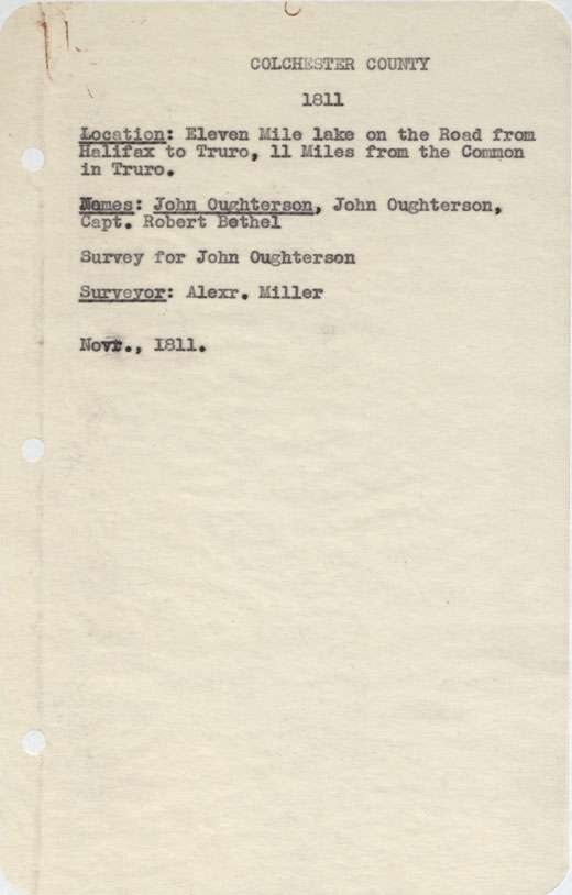
Colchester County Eleven Mile Lake on the Road from halifax to Truro, 11 miles from the Common in Truro. 1811
Date: November 1811
Reference: Nova Scotia Archives Map Collection: F/230 - 1811
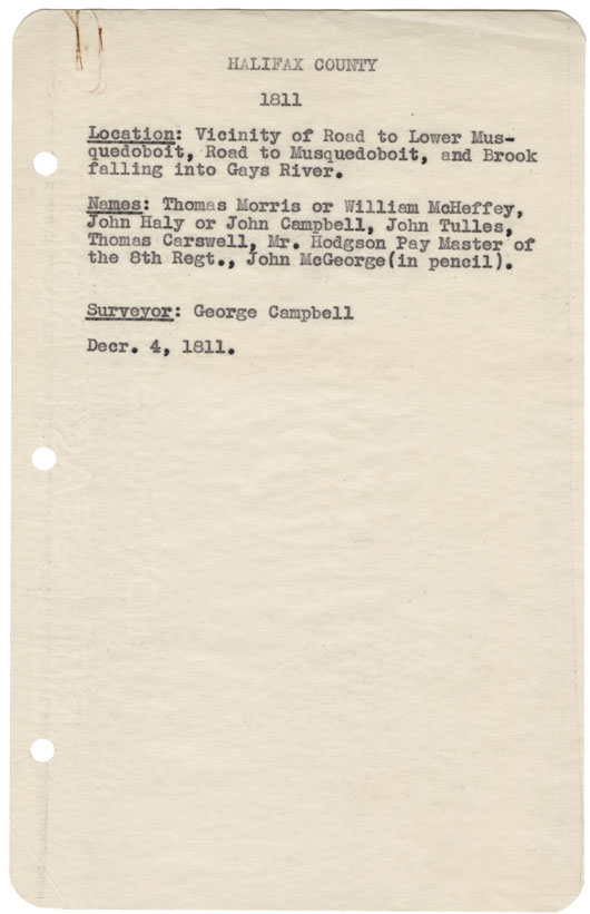
Halifax County Vicinity of Road to Lower Musquodoboit, Road to Musquodoboit, and Brook falling into Gay's River 1811
Date: 4 December 1811
Reference: Nova Scotia Archives Map Collection: F/230 - 1811
Halifax County East side of Ship harbour w.m.1811
Date: 1811
Reference: Nova Scotia Archives Map Collection: F/230 - 1811
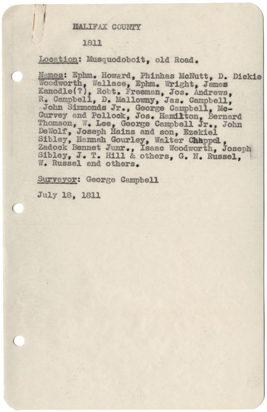
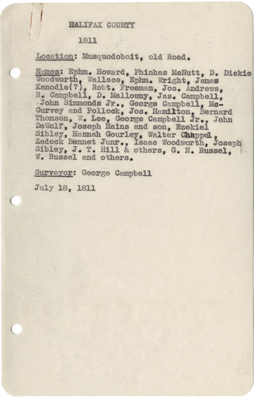
Halifax County Musquodoboit, Old Road
Date: 18 July 1811
Reference: Nova Scotia Archives Map Collection: F/230 - 1811
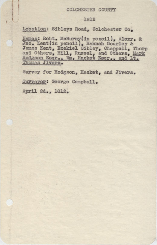
Colchester County Sibley's road, Col County
Date: 2 April 1812
Reference: Nova Scotia Archives Map Collection: F/230 - 1812
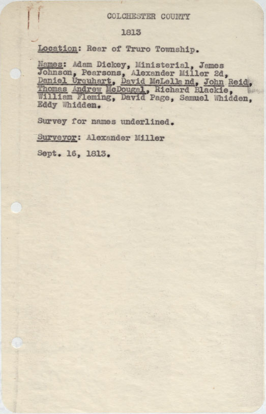
Colchester County Rear of Truro Township 1813
Date: 16 September 1813
Reference: Nova Scotia Archives Map Collection: F/230 - 1813
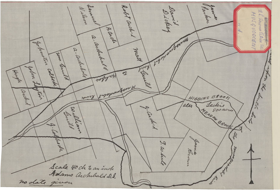
Lands in the Musquodoboit Area
Date: 1814
Reference: Nova Scotia Archives Map Collection: F/230 - 1814
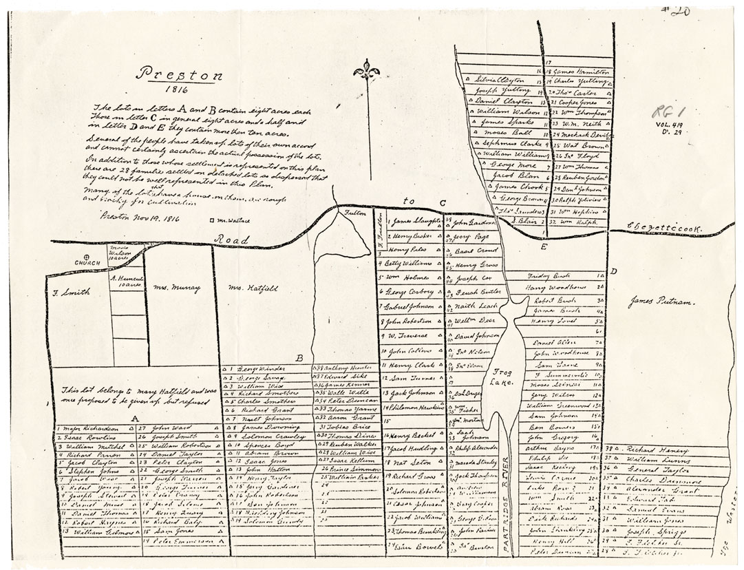
Preston
Date: 19 November 1816
Reference: Nova Scotia Archives Map Collection: F/230 - 1816 African Nova Scotians
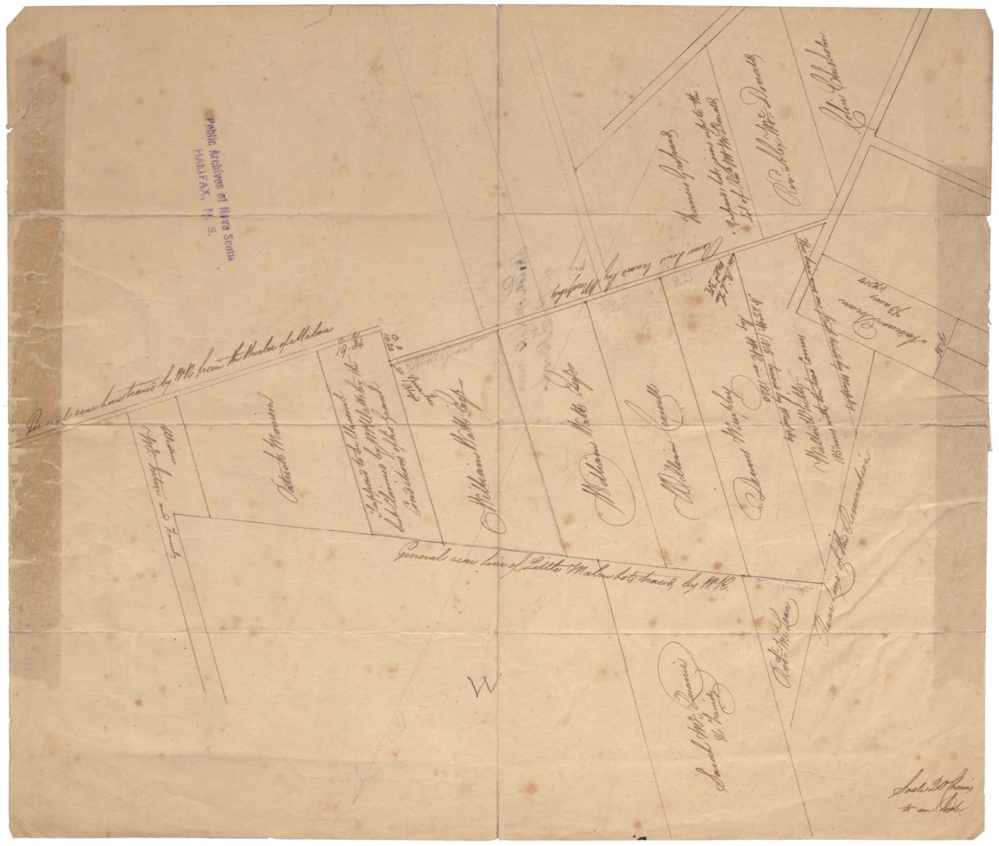
Cape Breton Sketch of Lots Near Port Hood, c.1816
Date: 1816
Reference: Nova Scotia Archives Map Collection: F/230 - 1816