Nova Scotia Archives
Historical Maps of Nova Scotia
Results 76 to 90 of 207 from your search: F/230
Clements TP. Lands Granted to Capt. Christopher Benson and others
Date: 1821
Reference: Nova Scotia Archives Map Collection: F/230 - 1821
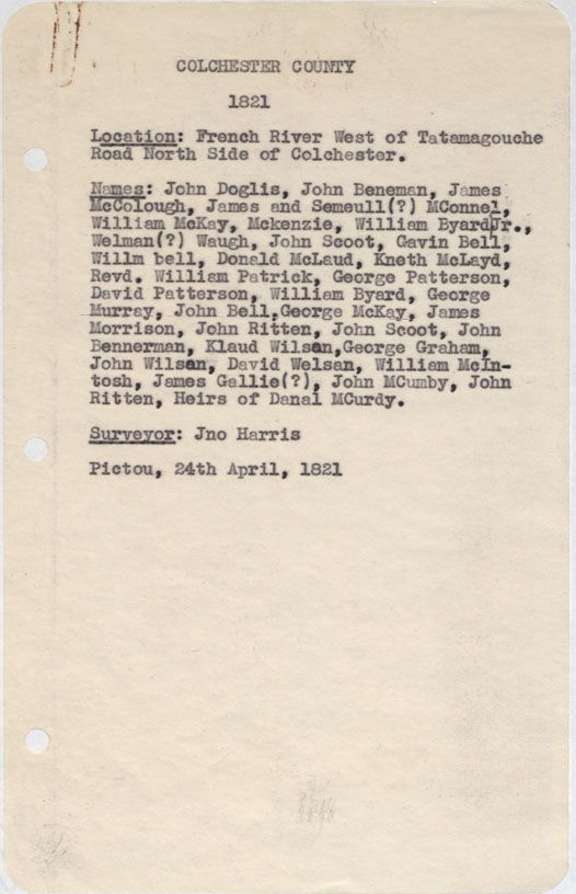
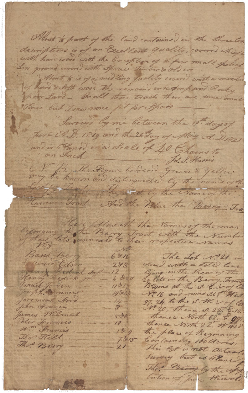
Colchester County French River west of Tatamagouche Road north side of Colchester 1821
Date: 24 April 1821
Reference: Nova Scotia Archives Map Collection: F/230 - 1821
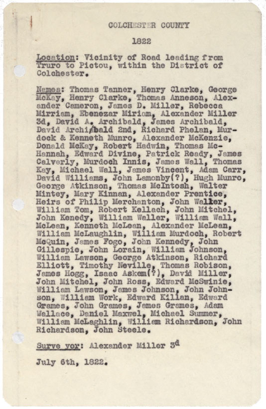
Colchester County Vicinity of Rd leading from truro to pictou within the District of Colchester 1822
Date: 6 July 1822
Reference: Nova Scotia Archives Map Collection: F/230 - 1822
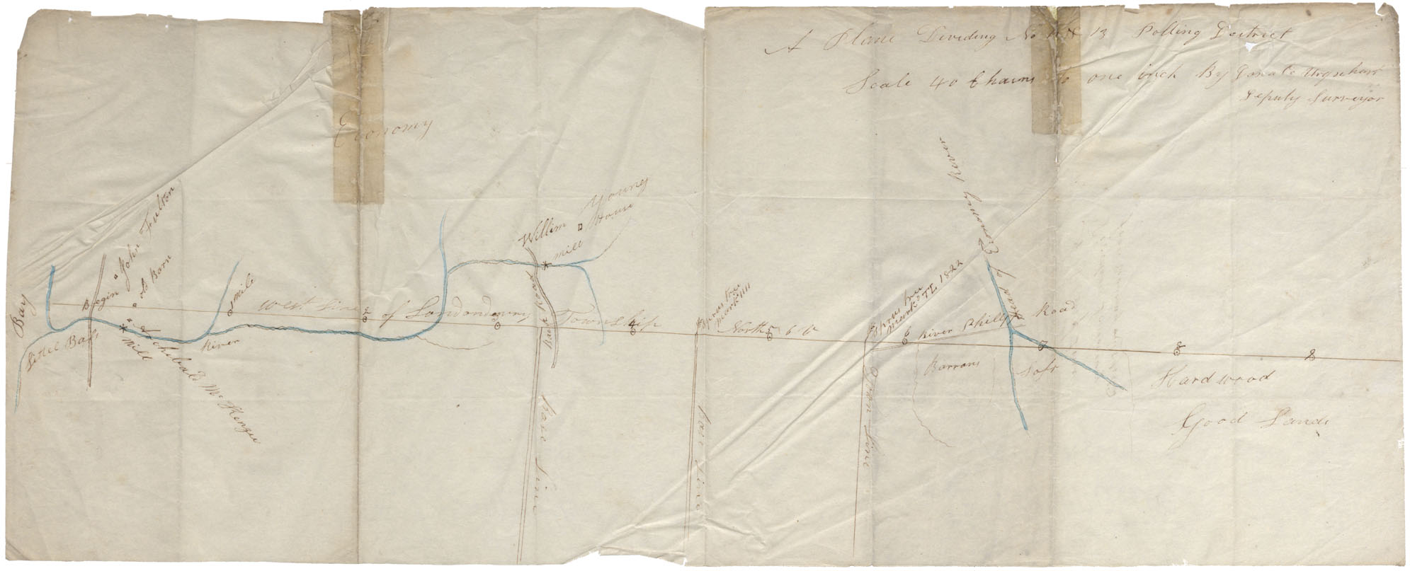
Colchester County West line of Londonderry Township from Little Bass Mill to River Phillips Road. Plan dividing No. 12 & 13 Polling District
Date: 1823
Reference: Nova Scotia Archives Map Collection: F/230
Division Line Between Annapolis and Kings County
Date: 1824
Reference: Nova Scotia Archives Map Collection: F/230 - 1824
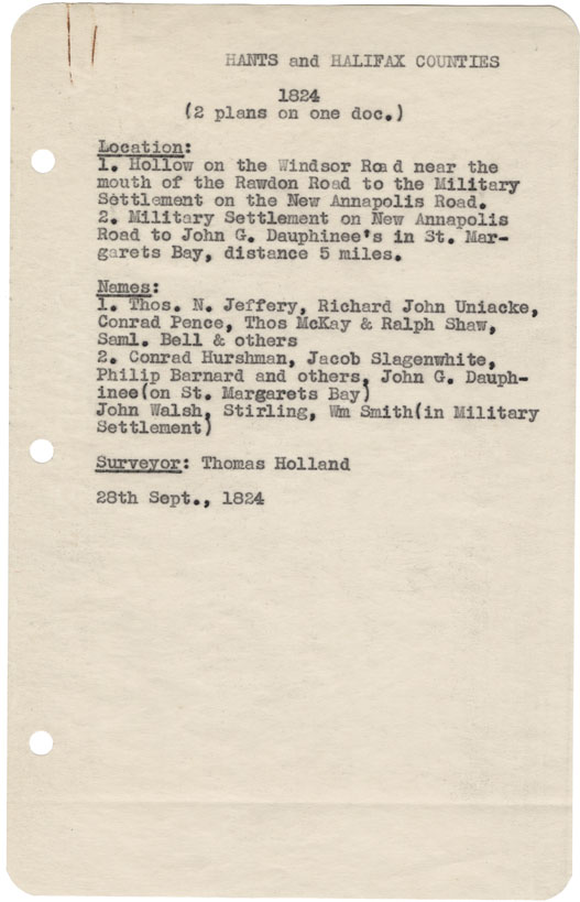
Hollow on the Windsor near the moth of the Rawdon Rd. to the military settlement on the new Annapolis Road. 2) Military settlement on New Annapolis Rd to John G. Dauphinee's in St.Margaret's Bay
Date: 28 September 1824
Reference: Nova Scotia Archives Map Collection: F/230 - 1824

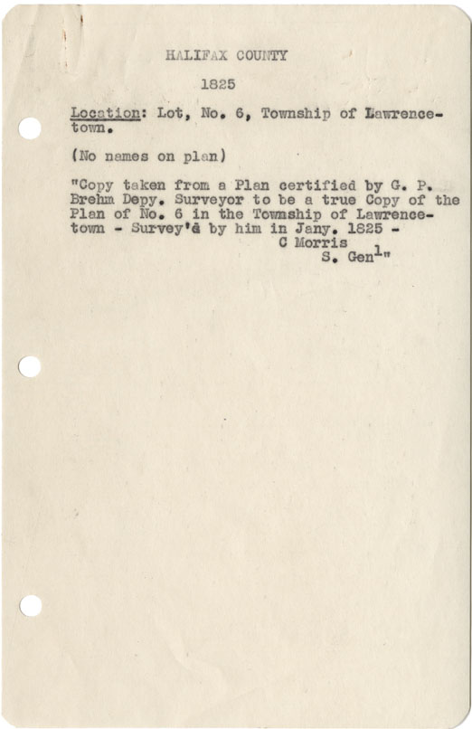
Halifax County Lot No6, Township of Lawrencetown 1825
Date: January 1825
Reference: Nova Scotia Archives Map Collection: F/230 - 1825
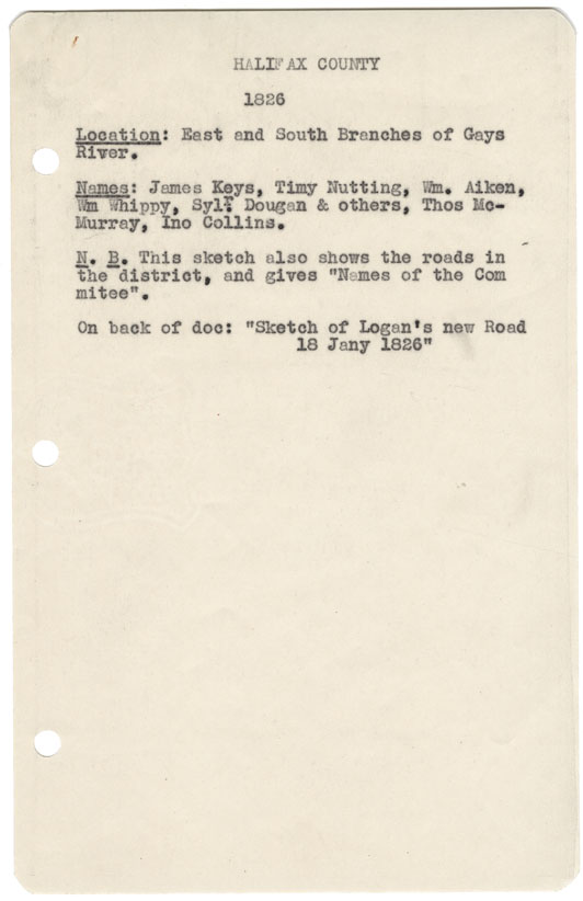
Halifax County East & South Branches of the Gays River, 1826
Date: 18 January 1826
Reference: Nova Scotia Archives Map Collection: F/230 - 1826

Colchester County District of Colchester between east boundary line of Londonderry north and road to Tatamagouche and north line of Township of Onslw, w.m.1827
Date: 1827
Reference: Nova Scotia Archives Map Collection: F/230 - 1827
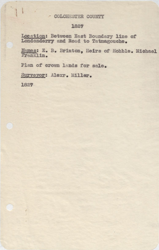
Colchester County Between east boundary line of Londonderry and road to Tatamagouche 1827
Date: 1827
Reference: Nova Scotia Archives Map Collection: F/230 - 1827
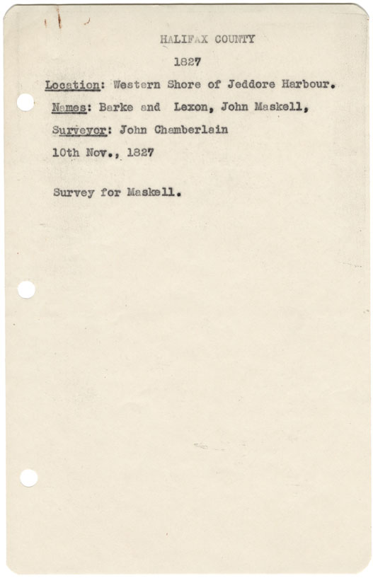
Halifax County Western shore of Jeddore Harbour 1827
Date: 10 November 1827
Reference: Nova Scotia Archives Map Collection: F/230 - 1827
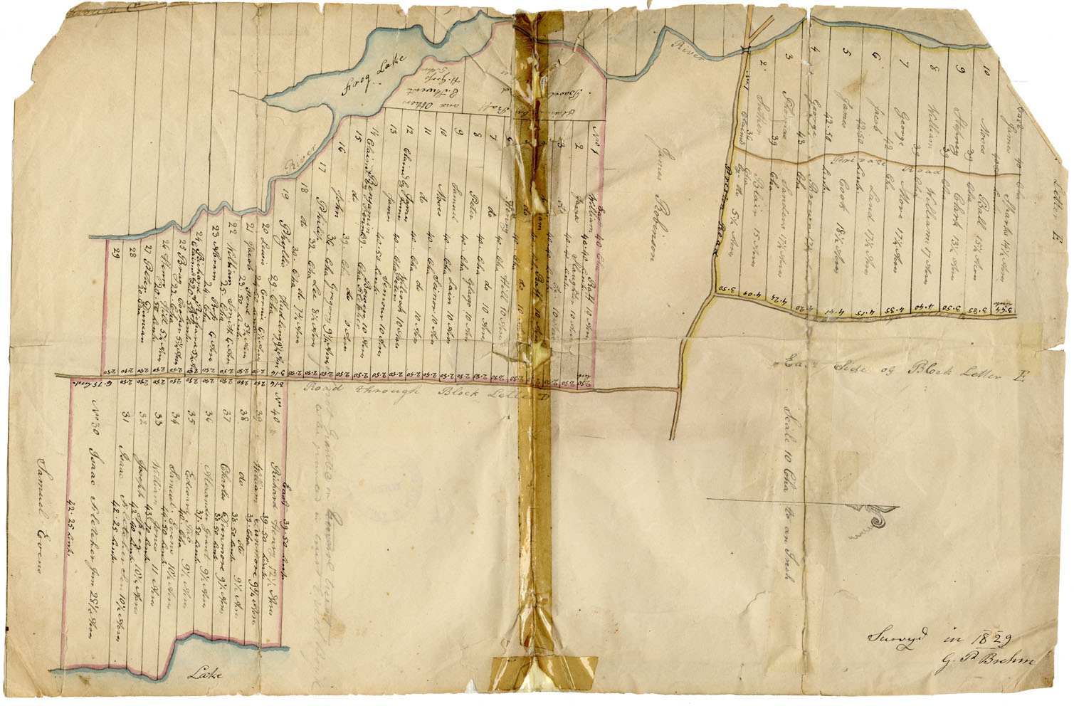
Plan - Letters D and E at Preston. Surveyed to the Blacks
Date: 1829
Reference: Nova Scotia Archives Map Collection: F/230 - 1829 African Nova Scotians
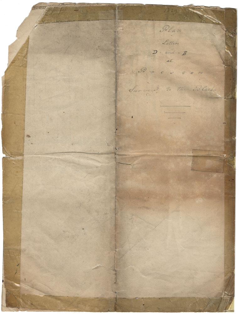
Preston Township Plan Letters D-and E at Preston
Date: 1829
Reference: Nova Scotia Archives Map Collection: F/230
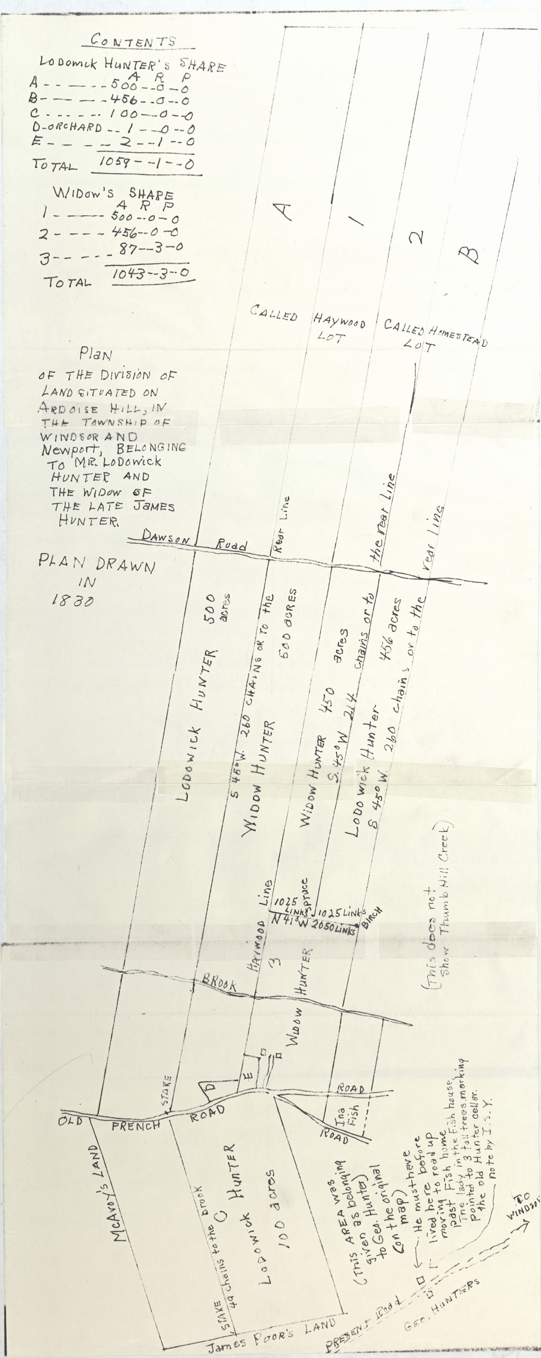
Plan of the Division of Land Situated on Ardoise Hill, in Township of Windsor and Newport
Date: 1830
Reference: Nova Scotia Archives Map Collection: F/230 - 1830