Nova Scotia Archives
Historical Maps of Nova Scotia
Results 61 to 75 of 207 from your search: F/230
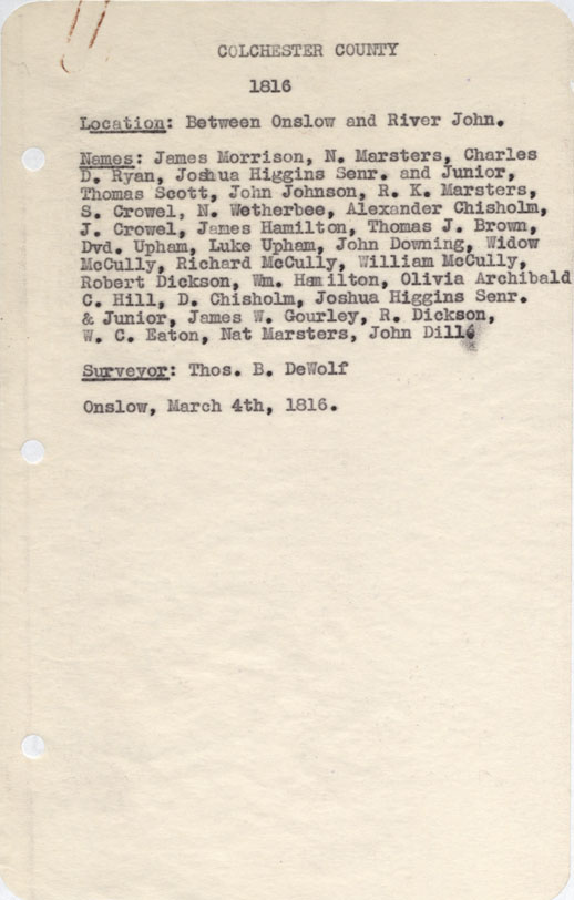
Colchester County Between onslow and River John 1816
Date: 4 March 1816
Reference: Nova Scotia Archives Map Collection: F/230 - 1816

Preston 1816 [Land Grants]
Date: 19 November 1816
Reference: Nova Scotia Archives Map Collection: F/230 - 1816
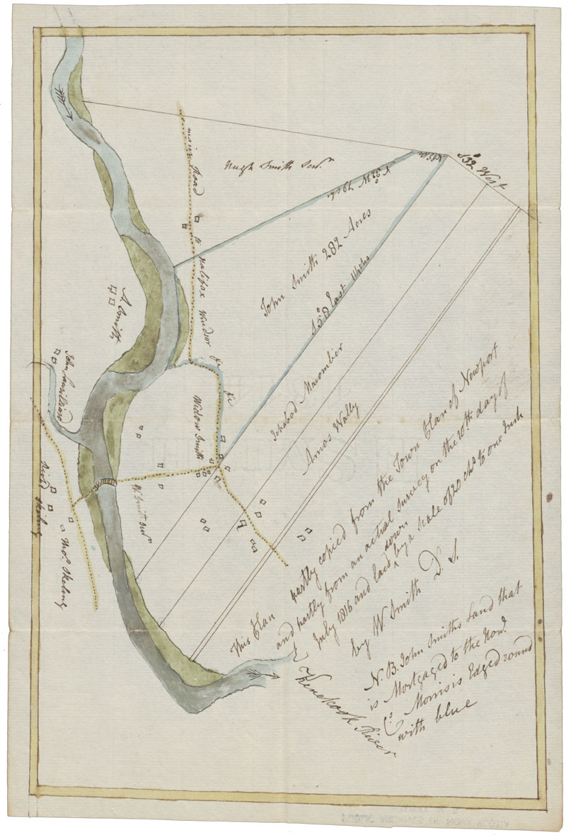
This plan partly copied from the Town Plan of Newport and partly from an actual survey.
Date: 10 July 1816
Reference: Nova Scotia Archives Map Collection: F/230 - 1816
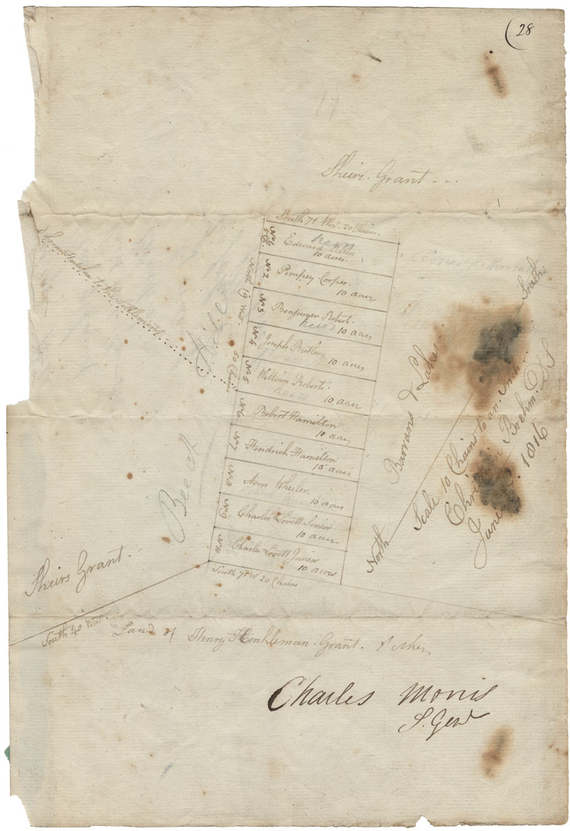
Refuge Hill Plan of Land laid out for Blacks
Date: 27 June 1816
Reference: Nova Scotia Archives Map Collection: F/230 - 1816
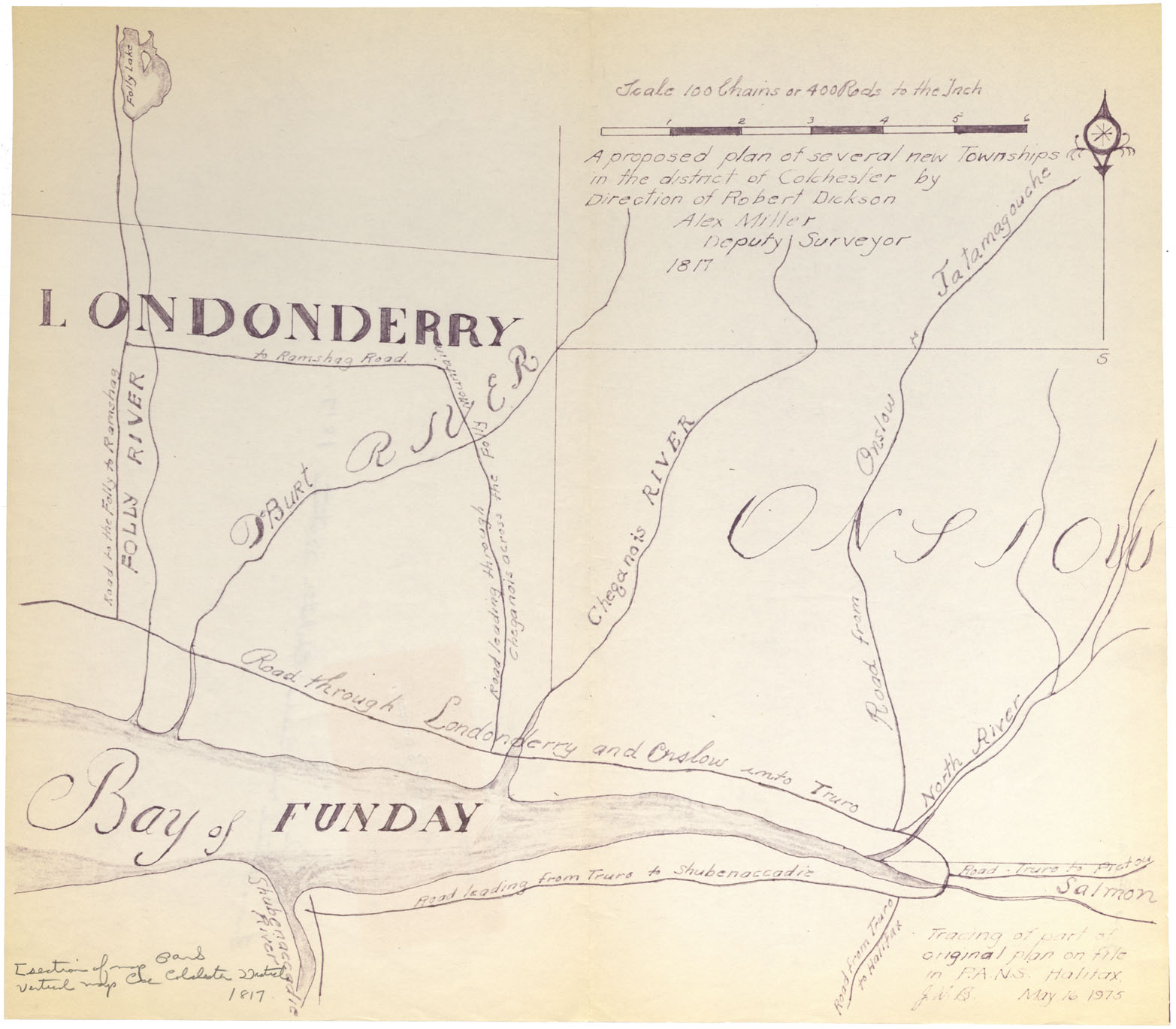
A proposed plan of several new townships in the District of Colchester by direction of Robert Dickson, Alex Miller D.S. 1817
Date: 1817
Reference: Nova Scotia Archives Map Collection: F/230 - 1817
Cape Breton Sketches Great Bras d"Or and Pt. Avone w.m.1818
Date: 1818
Reference: Nova Scotia Archives Map Collection: F/230 - 1818
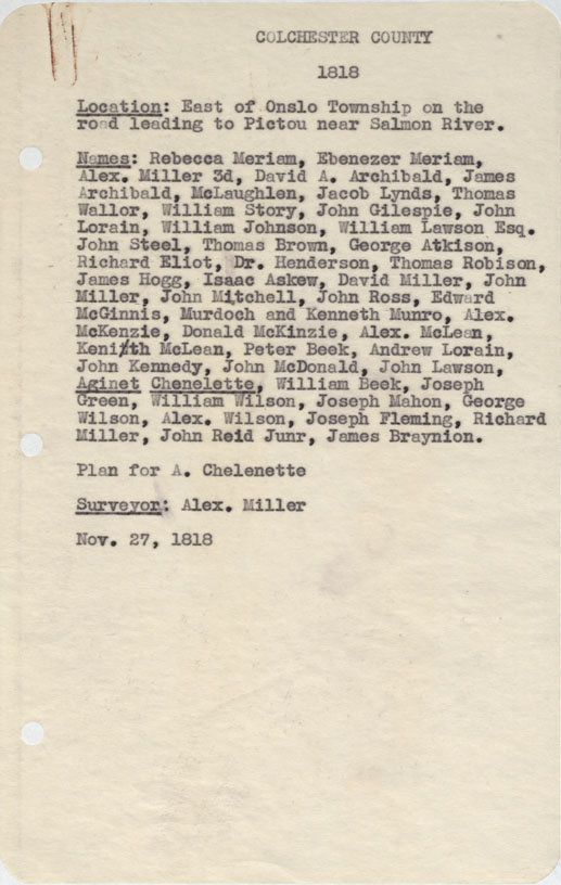
Colchester County East of Onslow Township on the road leading to Pictou near Salmon River 1818
Date: 27 November 1818
Reference: Nova Scotia Archives Map Collection: F/230 - 1818
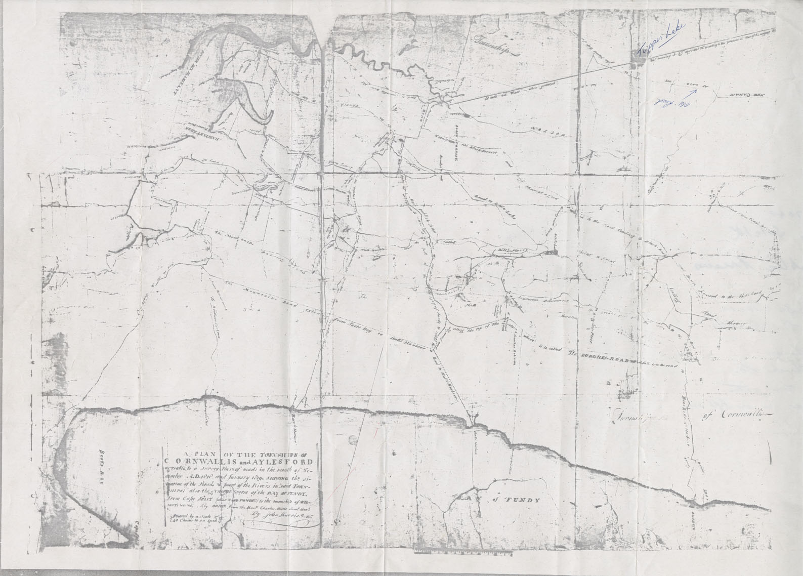
Cornwallis Township A Plan of the Townships of Cornwallis and Aylesford
Date: December 1818
Reference: Nova Scotia Archives Map Collection: F/230 - 1818/19
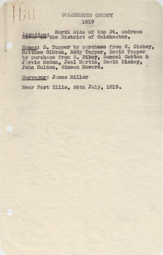
Colchester County North side of the St.Andrew's River in the District of Colchester, 1819
Date: 26 July 1819
Reference: Nova Scotia Archives Map Collection: F/230 - 1819
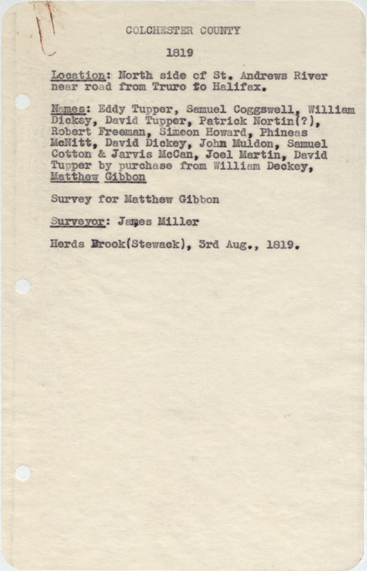
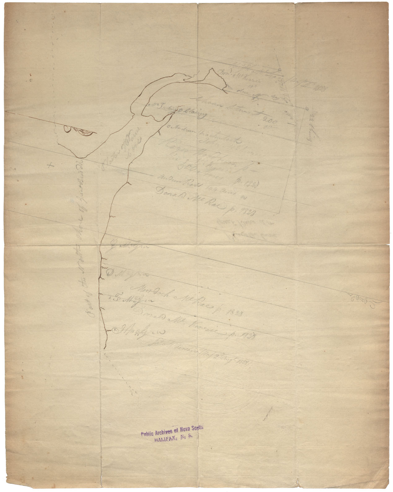
Colchester County North side of St.Andrew's River near road from Truro to halifax 1819
Date: 3 August 1819
Reference: Nova Scotia Archives Map Collection: F/230 - 1819
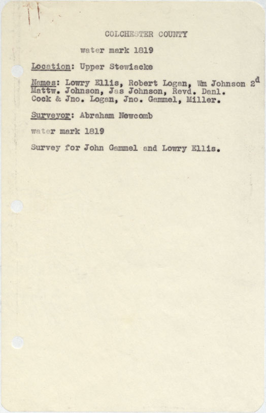
Colchester County Upper Stewiacke w.m.1819
Date: 1819
Reference: Nova Scotia Archives Map Collection: F/230 - 1819
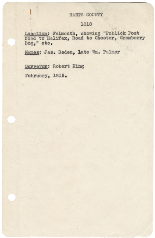
Hants County Falmouth showing "Publick Post Road to halifax, Road to Chester, Cranberry Bog etc 1818
Date: February 1819
Reference: Nova Scotia Archives Map Collection: F/230 - 1818
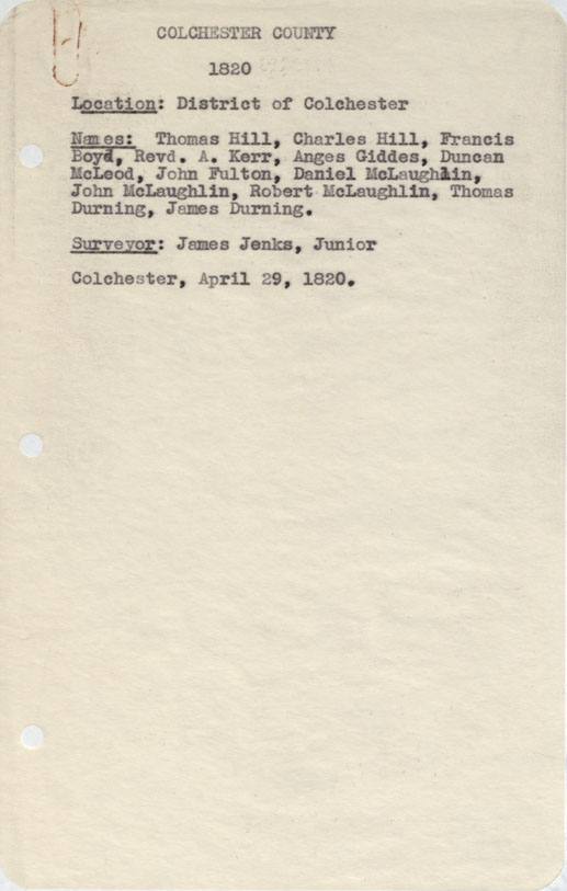
Colchester County District of Colchester, 1820
Date: 29 April 1820
Reference: Nova Scotia Archives Map Collection: F/230 - 1820
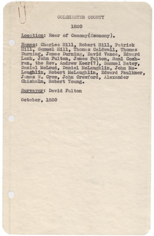
Colchester County Rear of Conomy (Economy) 1820
Date: October 1820
Reference: Nova Scotia Archives Map Collection: F/230 - 1820
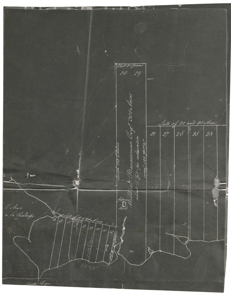
[Grant of Land to William Bannerman at Lennox, Richmond County. 1820]
Date: 1820
Reference: Nova Scotia Archives Map Collection: F/230 - 1820