Nova Scotia Archives
Historical Maps of Nova Scotia
Results 121 to 135 of 207 from your search: F/230
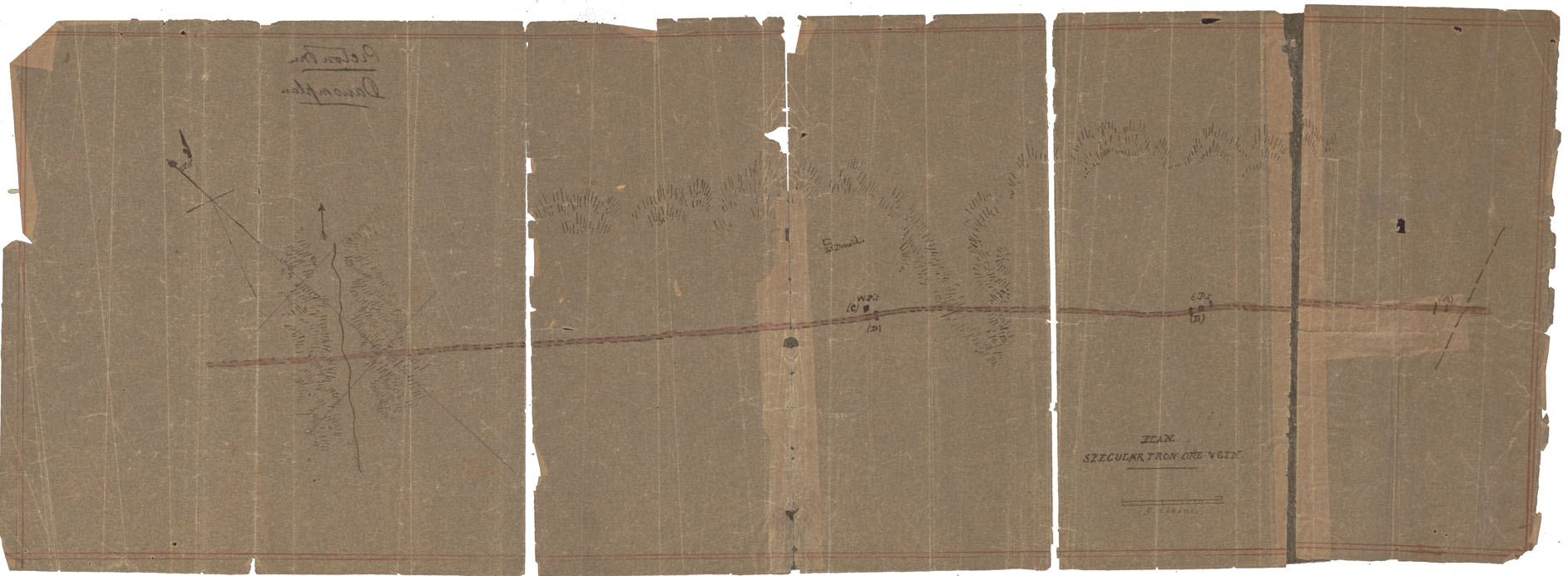
Plan Specular Iron ore ____ Pictou Co
Date: 1880
Reference: Nova Scotia Archives Map Collection: F/230 - 1880
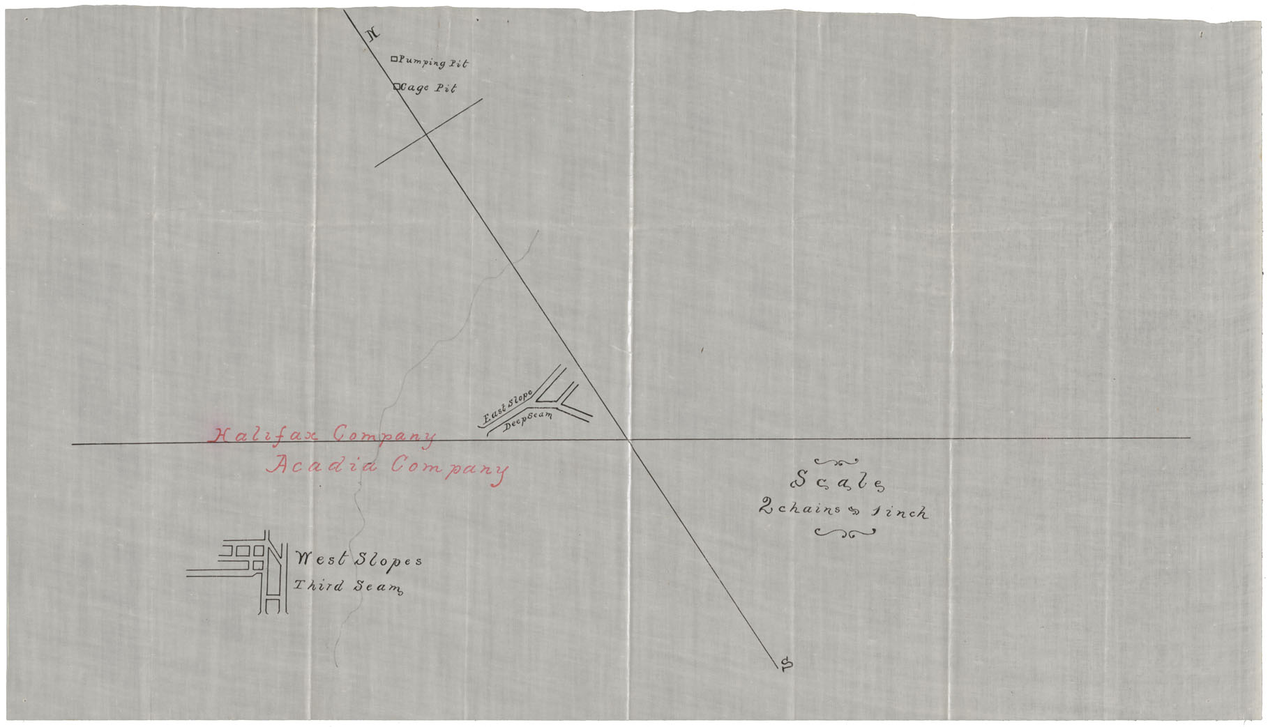
Trial Openings Deep & Third Seams Albion Mines, Pictou County During 1880-1881 Rec'd Mar 30 1881
Date: 30 March 1881
Reference: Nova Scotia Archives Map Collection: F/230 - 1881
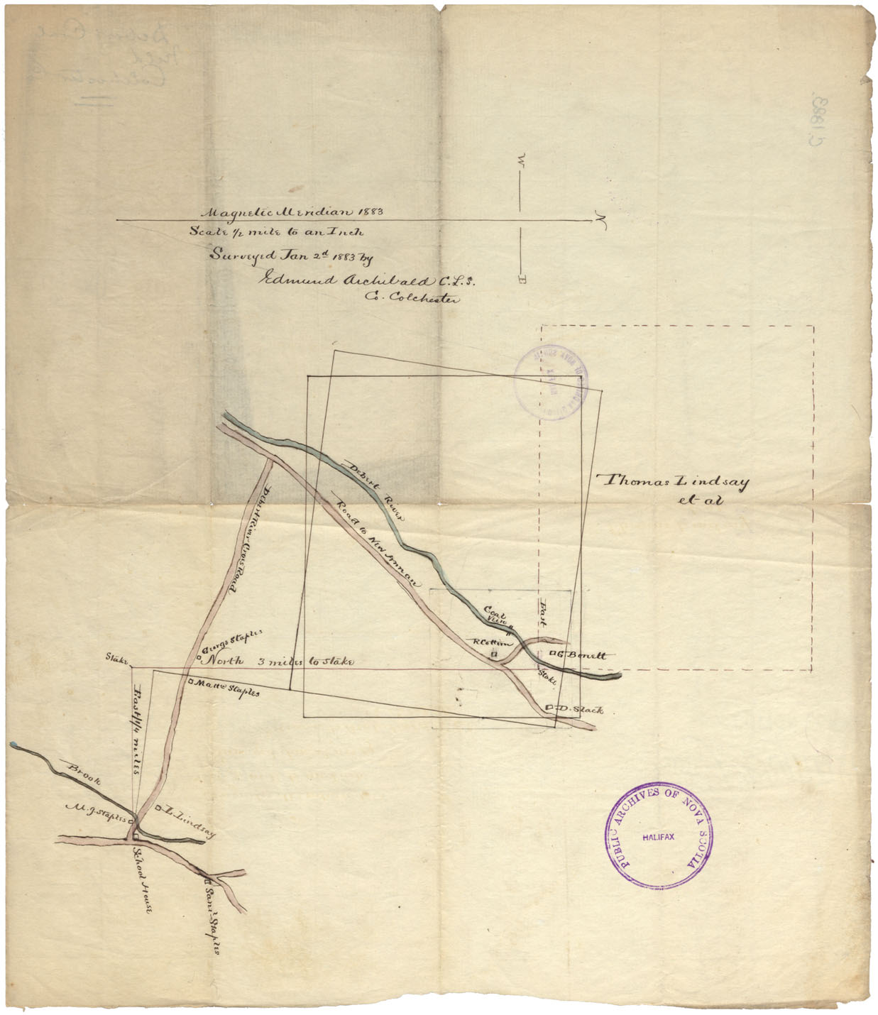
Debert Coal Field, Colchester County
Date: 2 January 1883
Reference: Nova Scotia Archives Map Collection: F/230 - 1883
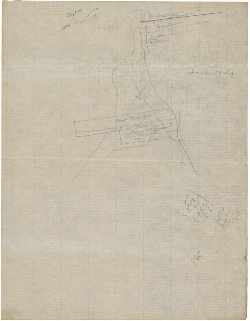
Sketch Watson Area 2 Sumy Brae Pictou Iron
Date: 29 September 1883
Reference: Nova Scotia Archives Map Collection: F/230 - 1883
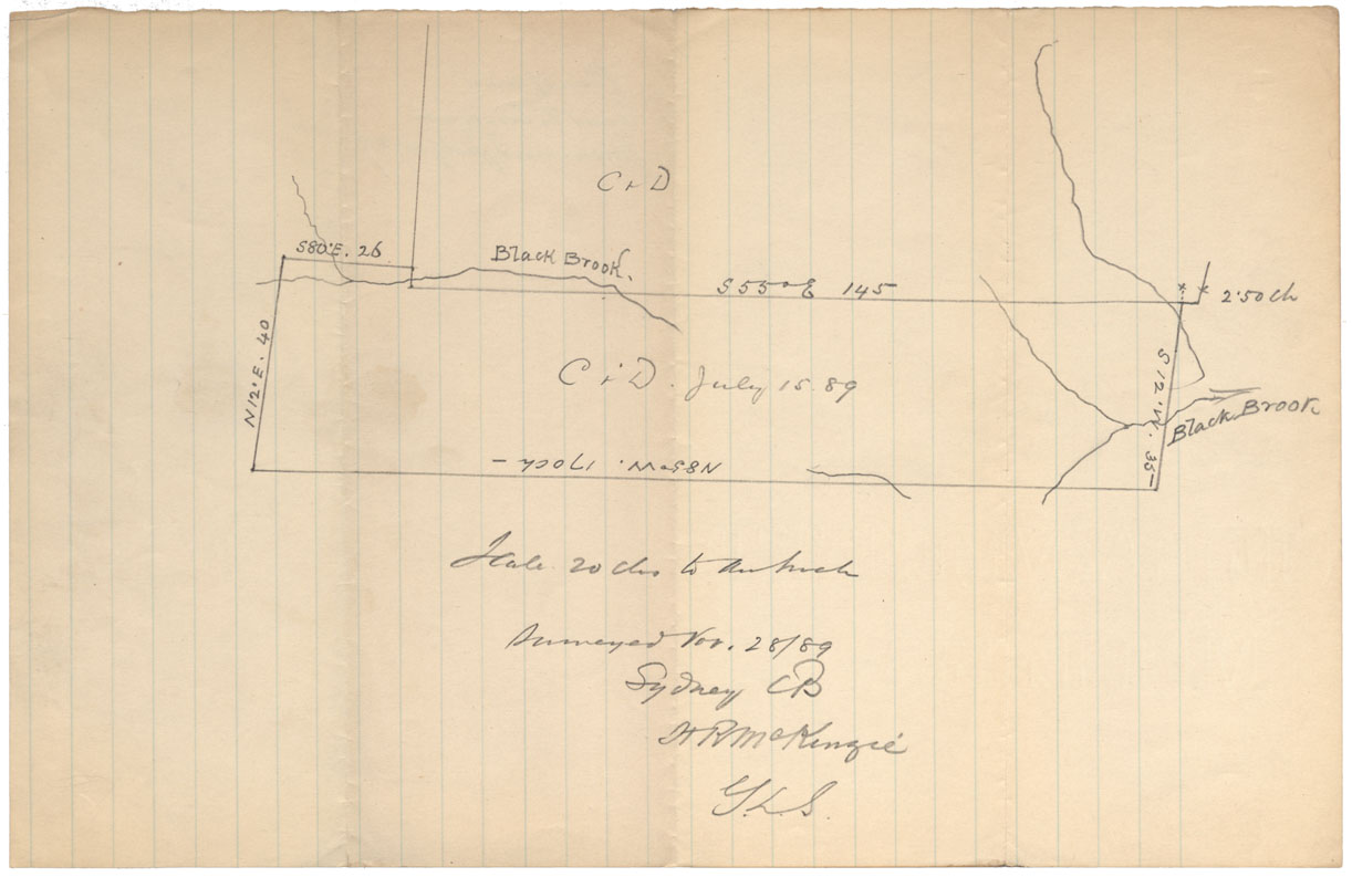
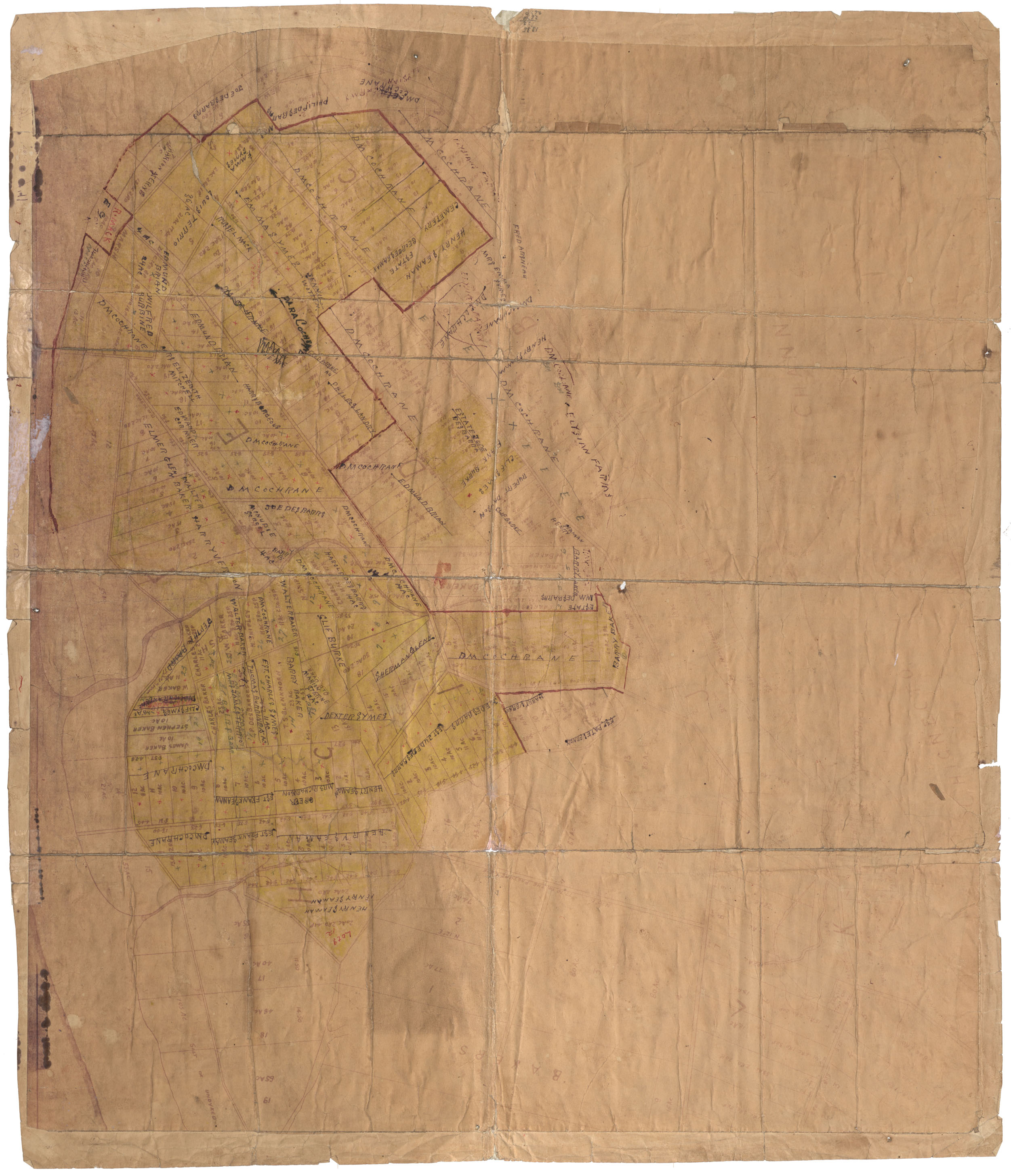
Plan of area, Black Brook Area
Date: July 15 1889
Reference: Nova Scotia Archives Map Collection: F/230 - 1889
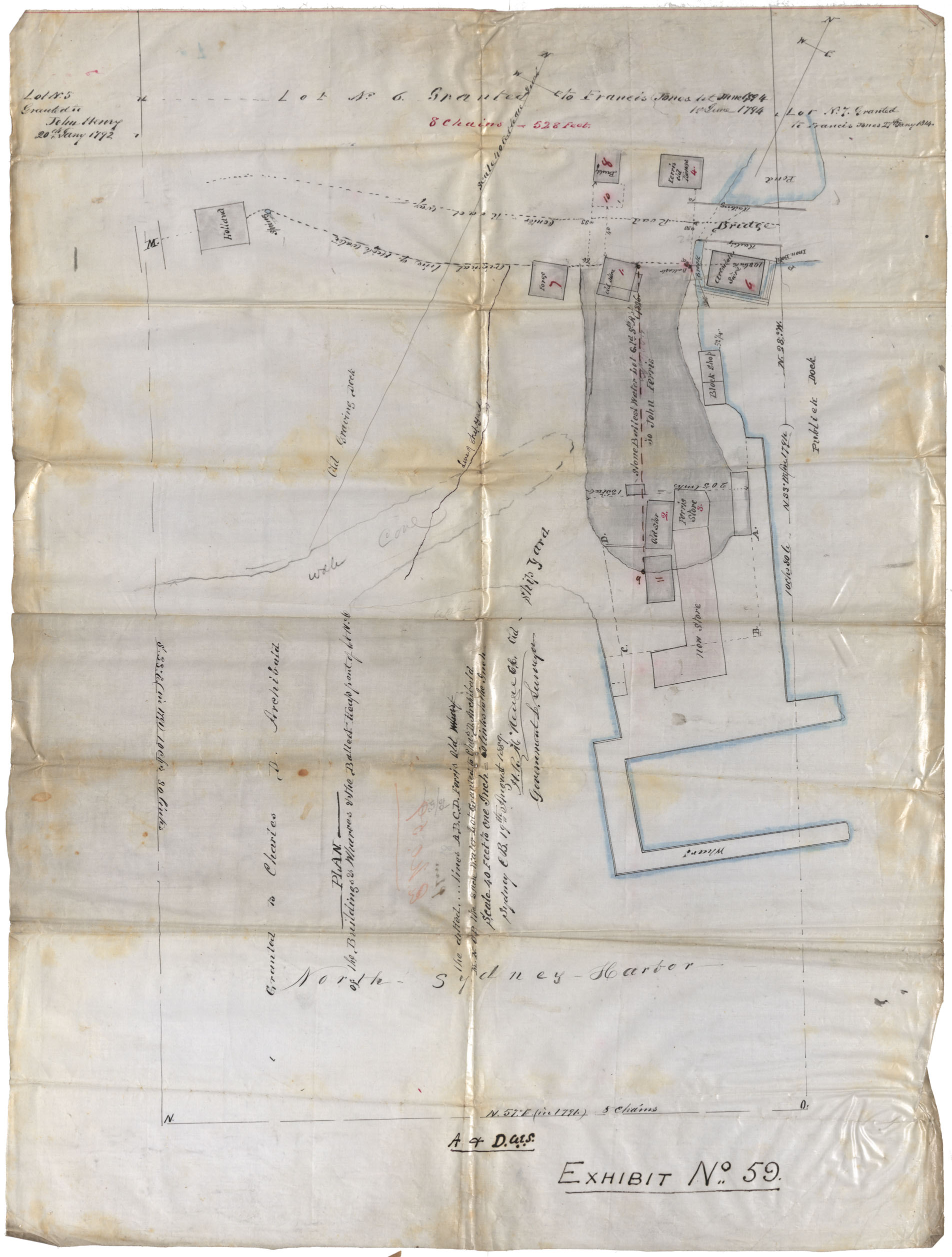
Cape Breton County Plan of Land Granted Charles D. Archibald 19 Aug 1889
Date: 19 August 1889
Reference: Nova Scotia Archives Map Collection: F/230 - 1889
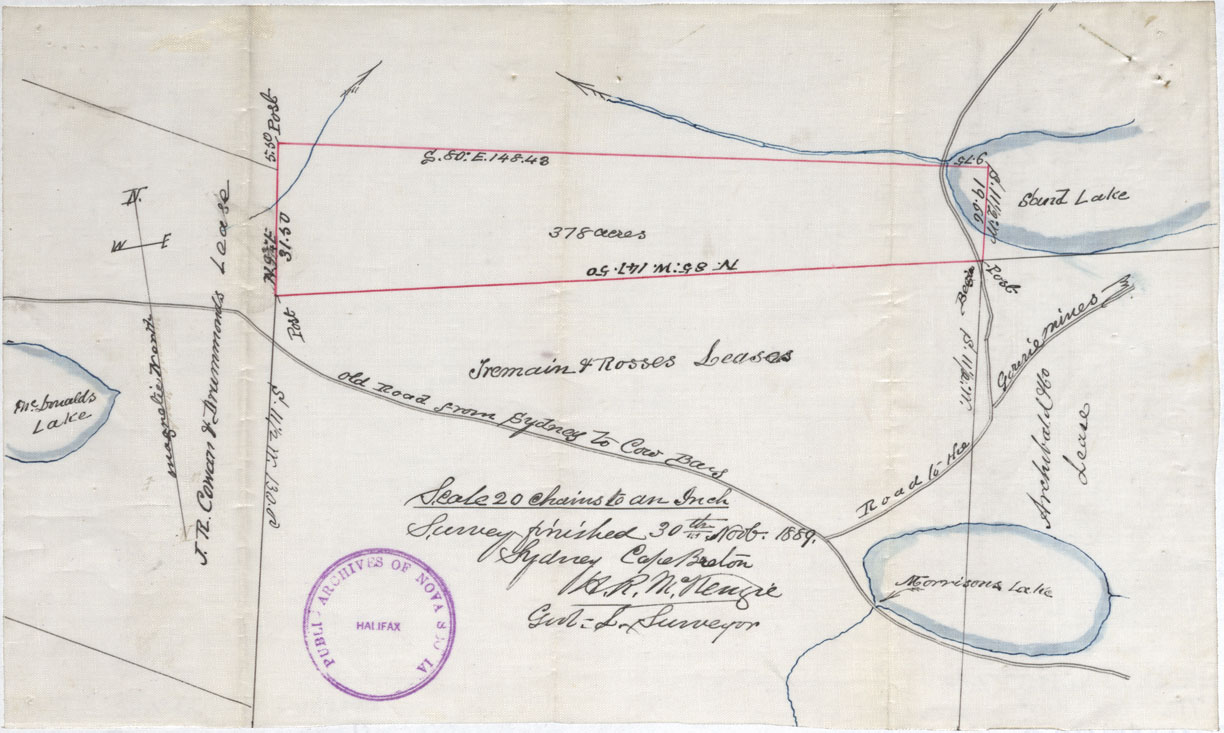
Coal Area Rear Cow Bay, Cape Breton
Date: 1889
Reference: Nova Scotia Archives Map Collection: F/230 - 1889
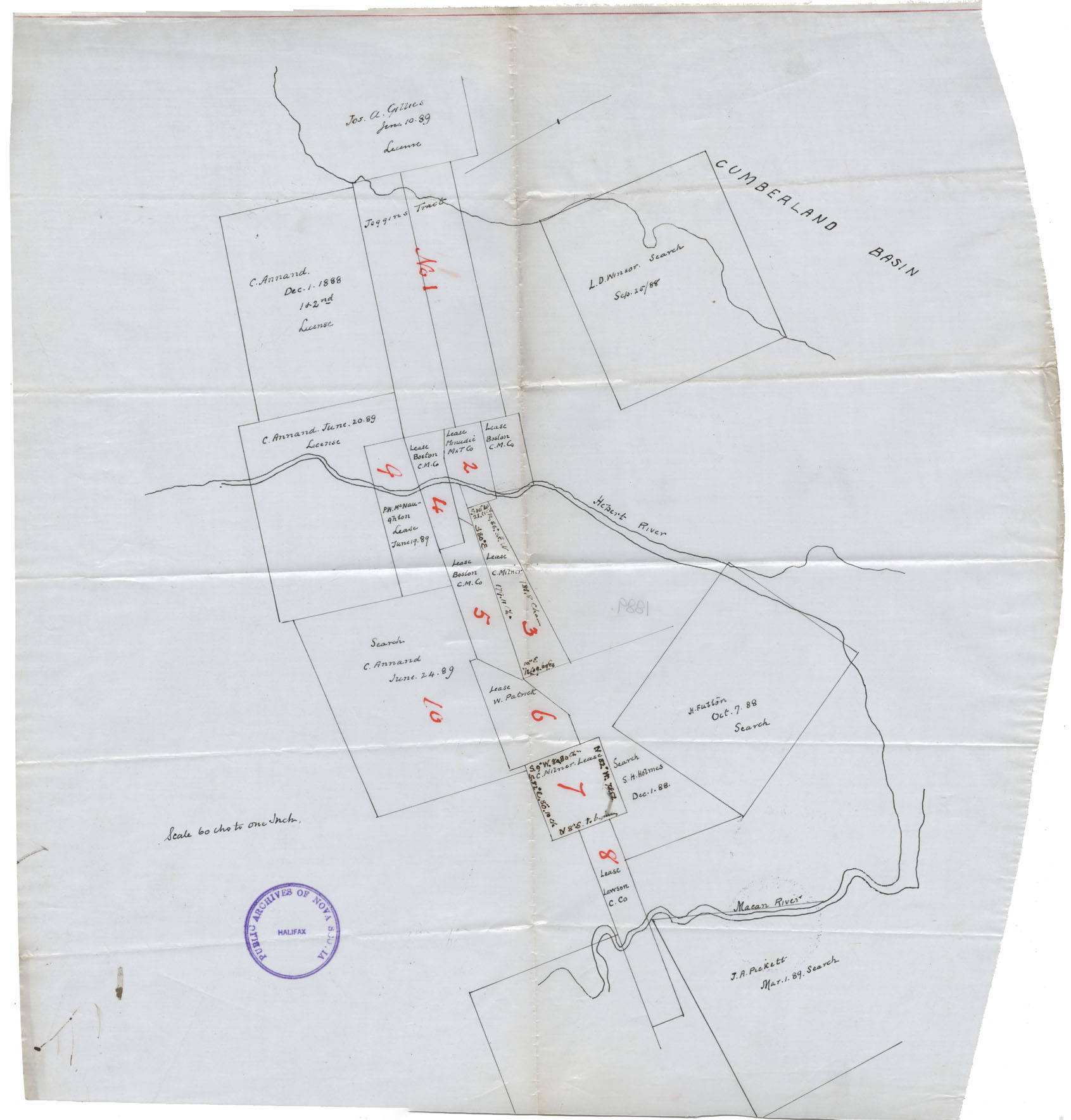
Leases on and near the Cumberland Basin
Date: 1889
Reference: Nova Scotia Archives Map Collection: F/230 - 1889
Milford, Graywood, Perotte, Land Grants and Granties
Date:
Reference: Nova Scotia Archives Map Collection: F/230
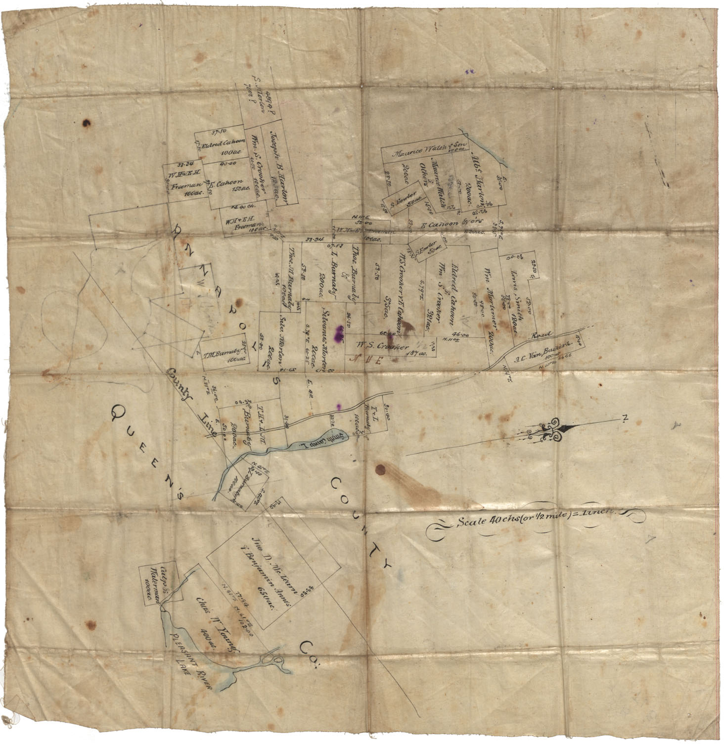
Annapolis County Corner of Annapolis & Queens County vicinity of Smith Camp Lake and Pleasant River Lake undated
Date:
Reference: Nova Scotia Archives Map Collection: F/230
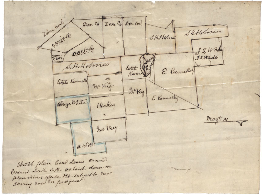
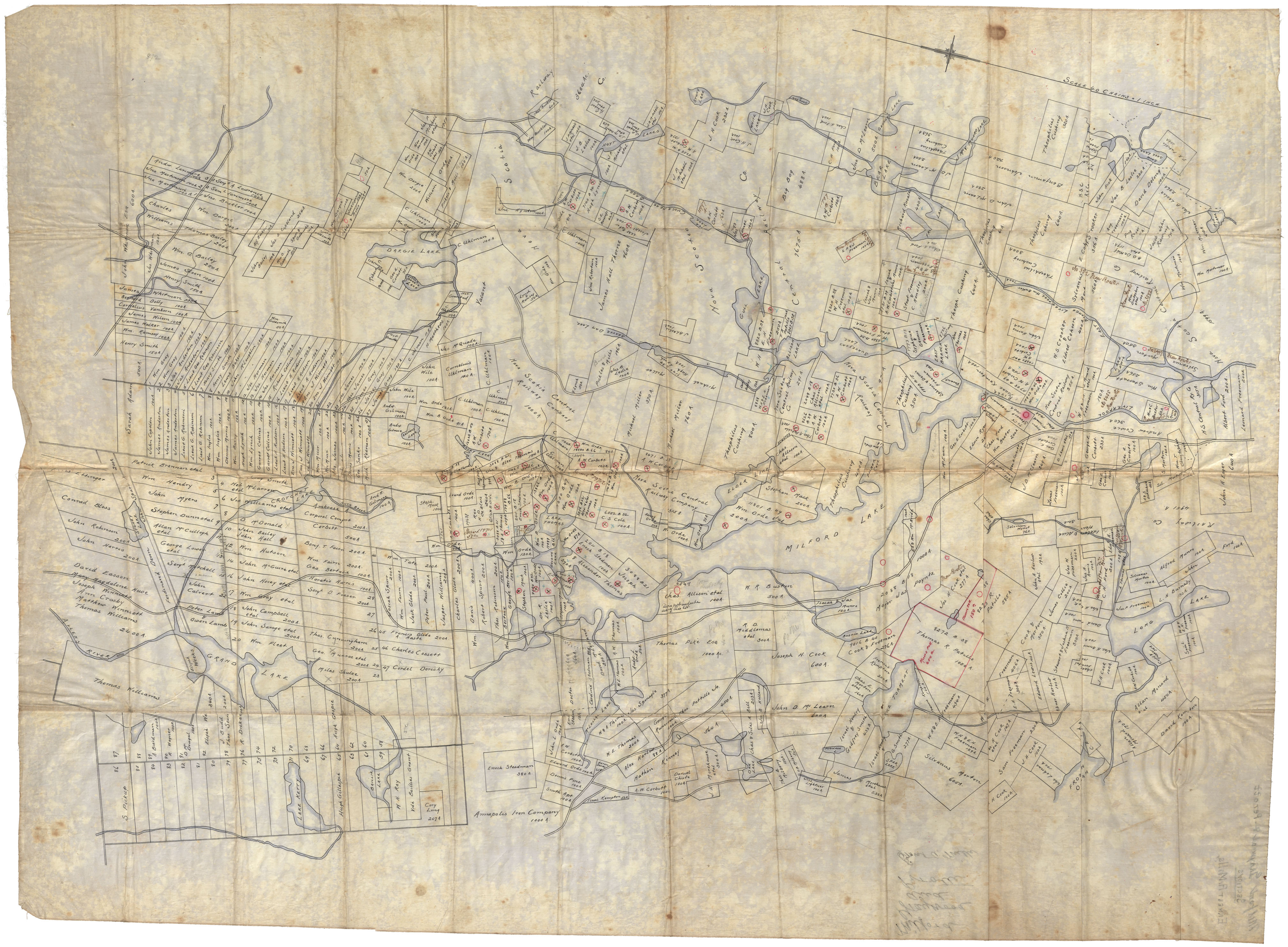
Sketch plan Coal Leases Grand Lake, Cape Breton Co
Date:
Reference: Nova Scotia Archives Map Collection: F/230
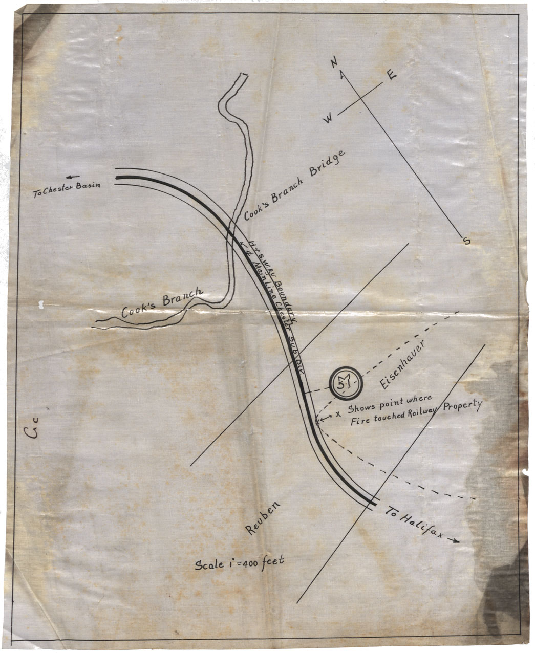
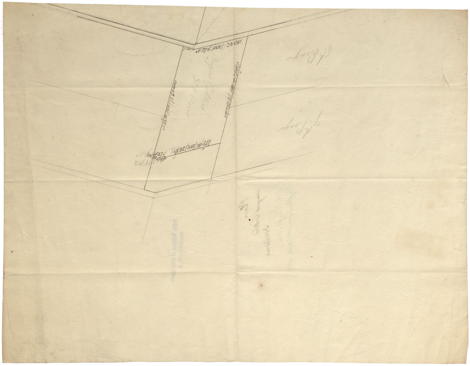
Chester Area (shows poit where fire touched railway property)
Date:
Reference: Nova Scotia Archives Map Collection: F/230