Nova Scotia Archives
Historical Maps of Nova Scotia
Results 106 to 120 of 207 from your search: F/230
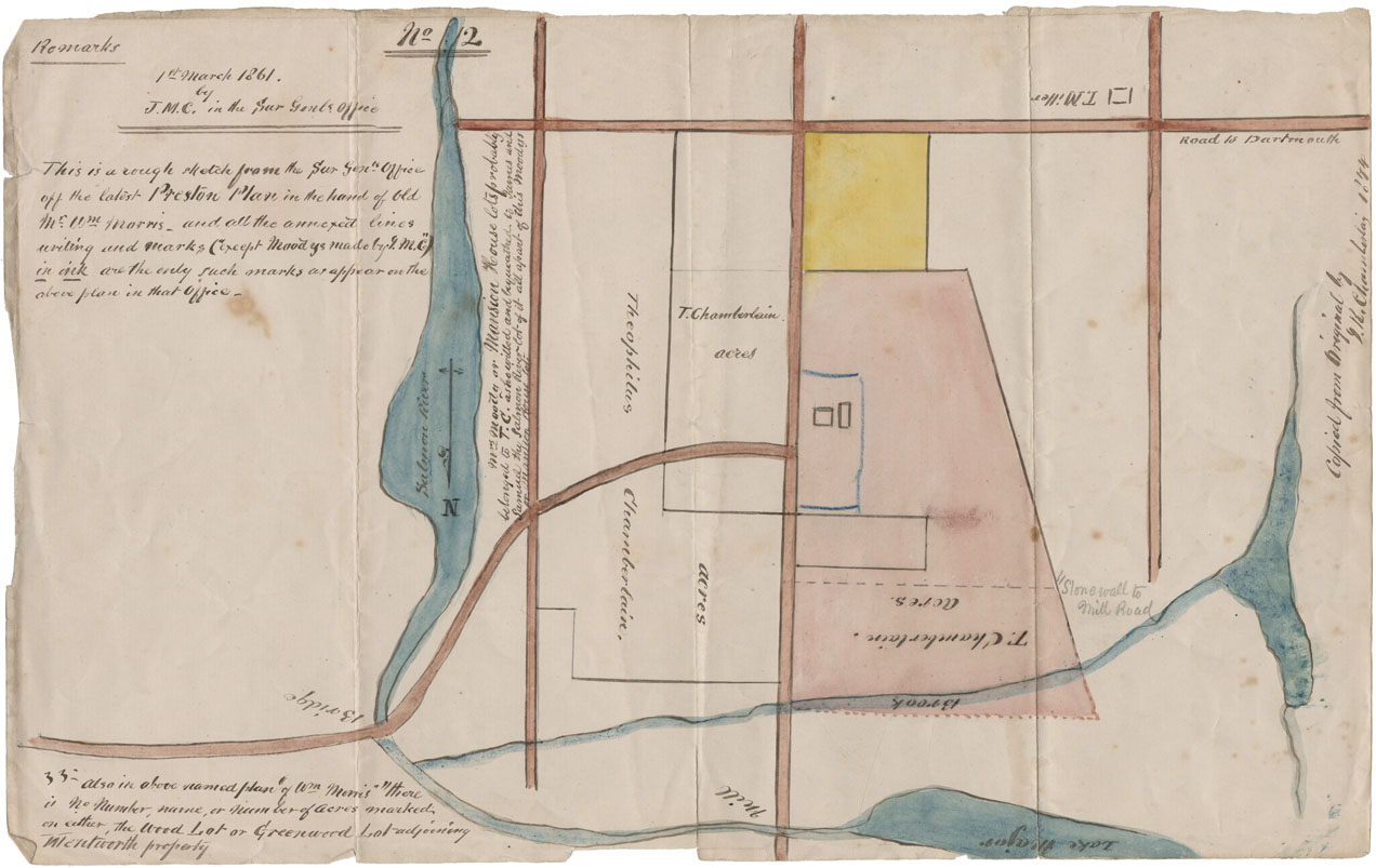
Rough Sketch latest Preston [Township] plan
Date: 1 March 1861
Reference: Nova Scotia Archives Map Collection: F/230 - 1861
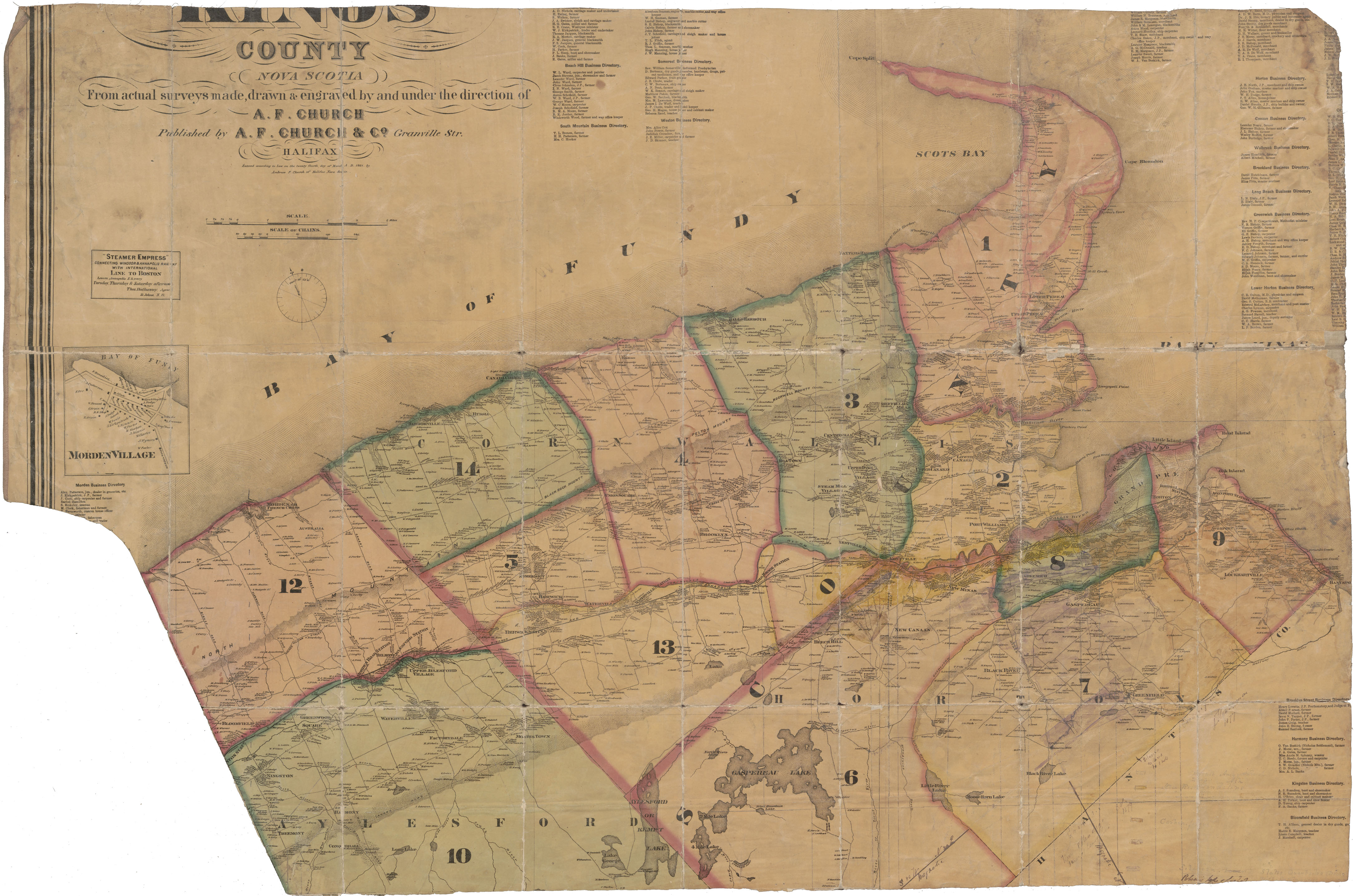
Part of A.F.Church's Topographical Township Map of Kings County
Date: 24 March 1864
Reference: Nova Scotia Archives Map Collection: F/230 - 1872
Plan of Survey of line between Rawdon & Douglas Townships
Date: 31 August 1865
Reference: Nova Scotia Archives Map Collection: F/230 - 1865

Glebe Lands on Roads from Lunenburg to Blue Rocks A Survey of Glebe Lands
Date: 15 April 1867
Reference: Nova Scotia Archives Map Collection: F/230 - 1867
Plan of Land between Folly Lake and the Old Cobequid Road
Date: 1867
Reference: Nova Scotia Archives Map Collection: F/230 - 1867

Map of the Pictou Coal Fields
Date: 1868
Reference: Nova Scotia Archives Map Collection: F/230 - 1868
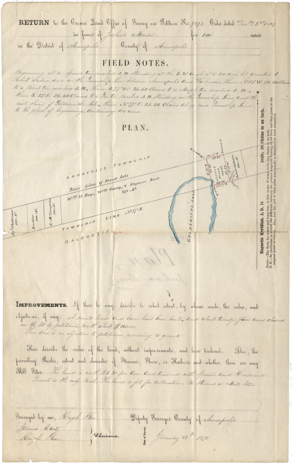
Annapolis County Annapolis & Dalhousie Townships near Goldsmith Lake 1870
Date: 28 January 1870
Reference: Nova Scotia Archives Map Collection: F/230 - 1870
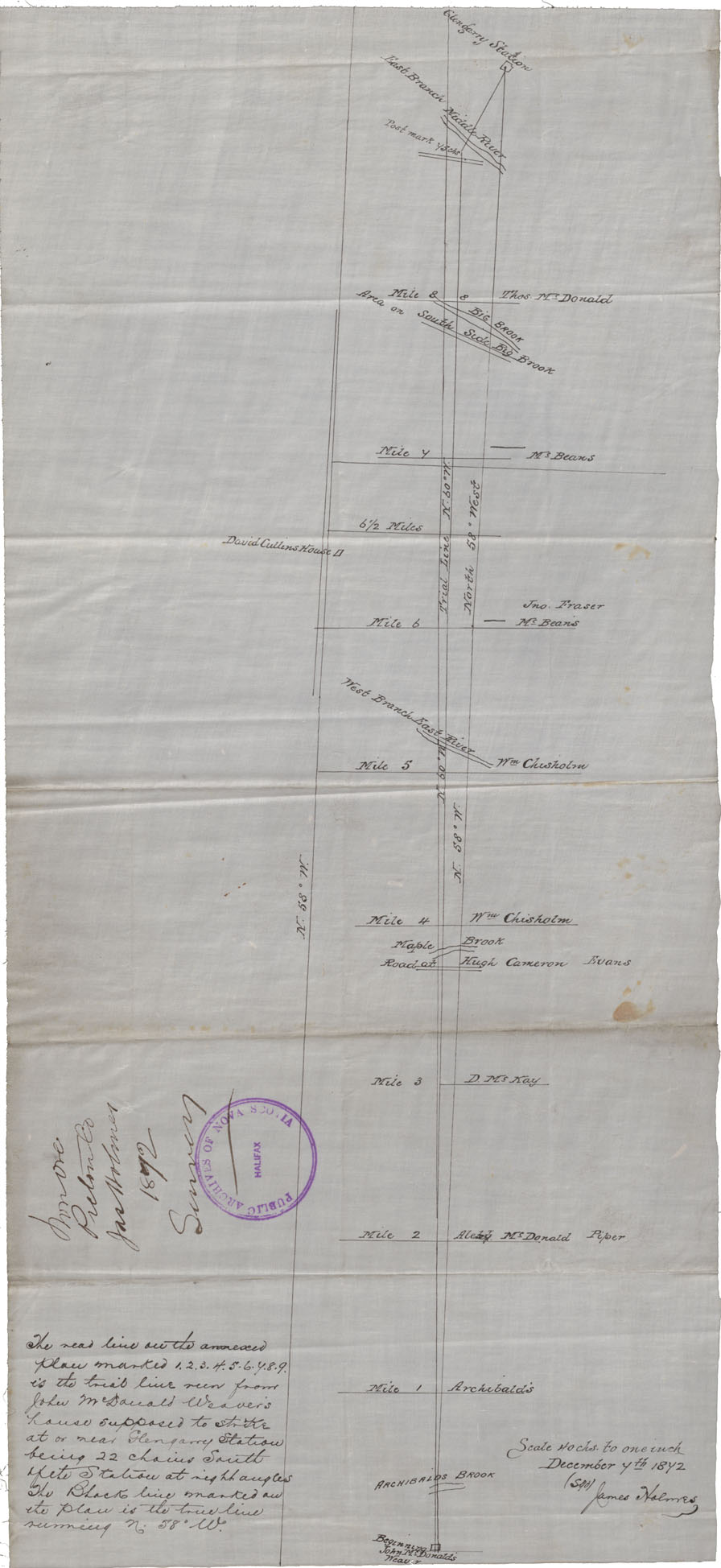
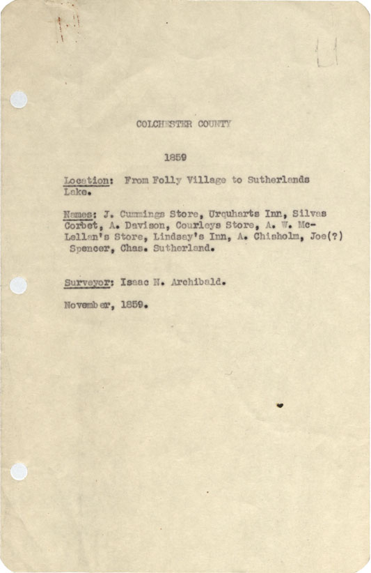
Colchester County From Londonderry township Westward to Moose River, 1873
Date: 14 June 1873
Reference: Nova Scotia Archives Map Collection: F/230 - 1873

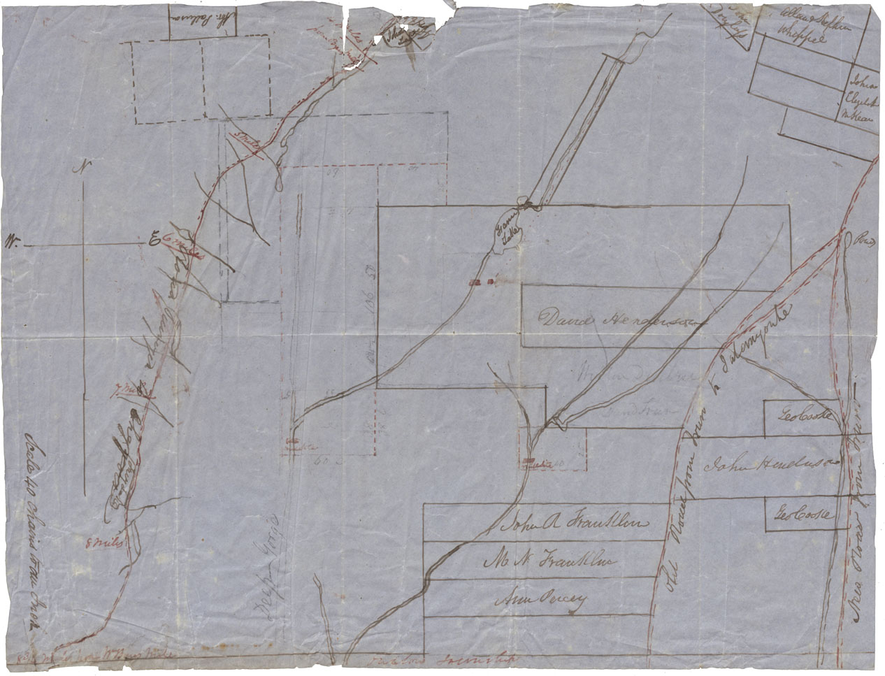
Sketch grants vicinity Eight Mile & Ten Mile Lakes, Queens County
Date: 1873
Reference: Nova Scotia Archives Map Collection: F/230 - 1873
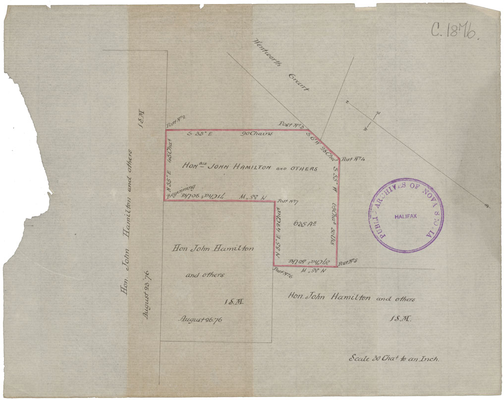
Coal leases of John Hamilton
Date: 26 August 1876
Reference: Nova Scotia Archives Map Collection: F/230 - 1876
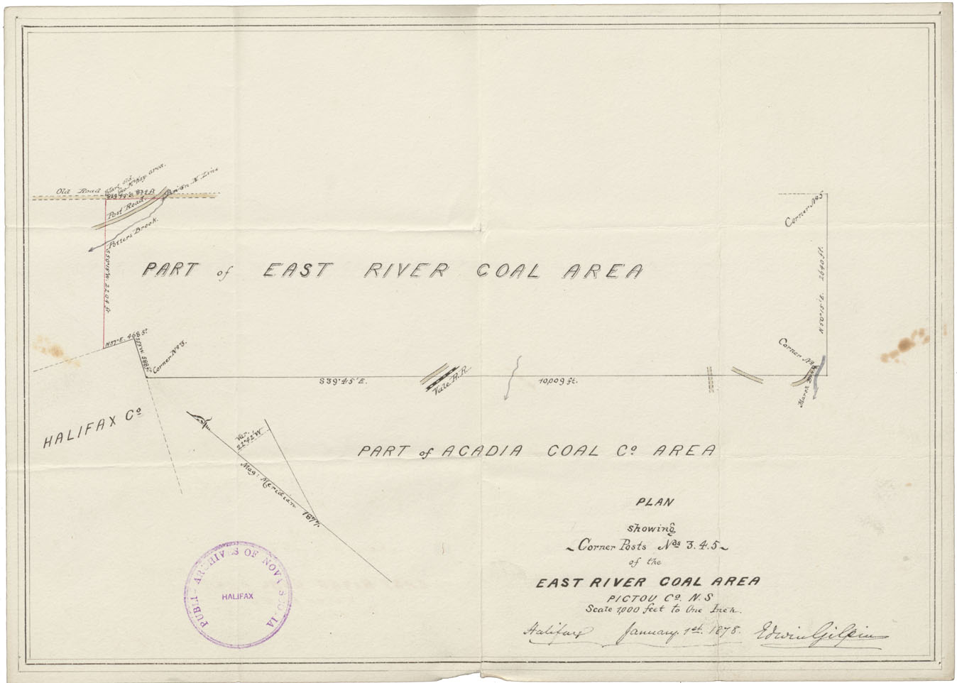
Plan showing Corner Posts No 3, 4, 5 of the East River Coal Area Pictou Co
Date: 1 January 1878
Reference: Nova Scotia Archives Map Collection: F/230 - 1878
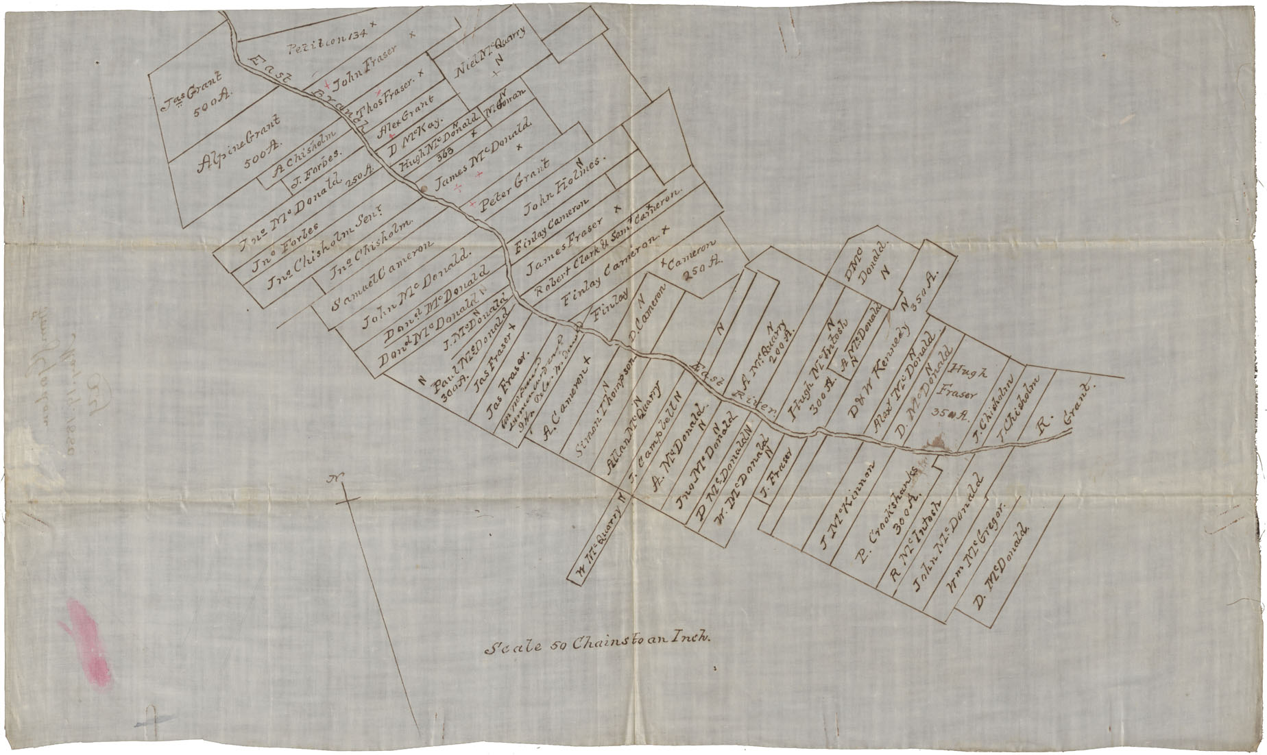
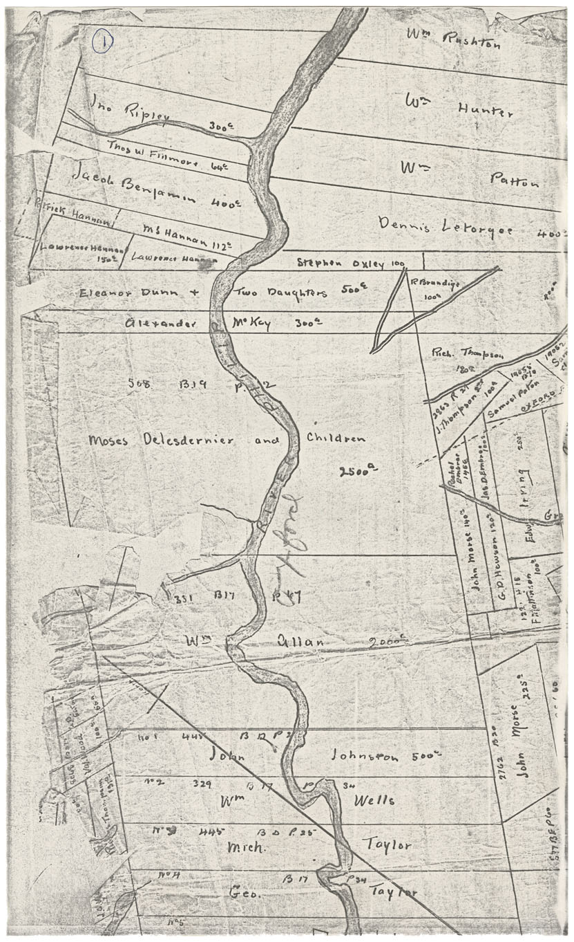
Property, Property Owners along East Branch East River
Date: 19 May 1880
Reference: Nova Scotia Archives Map Collection: F/230 - 1880