Nova Scotia Archives
Historical Maps of Nova Scotia
Results 601 to 615 of 905 from your search: 1800
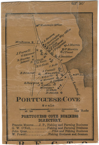
Portuguese Cove Halifax County
Date: 1864
Reference: Nova Scotia Archives Map Collection: F/239 - 1864
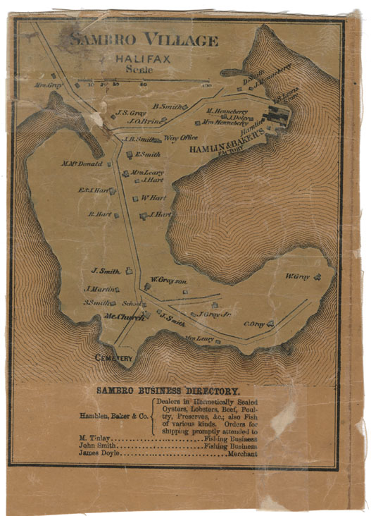
Sambro Village Halifax County
Date: 1864
Reference: Nova Scotia Archives Map Collection: F/239 - 1864
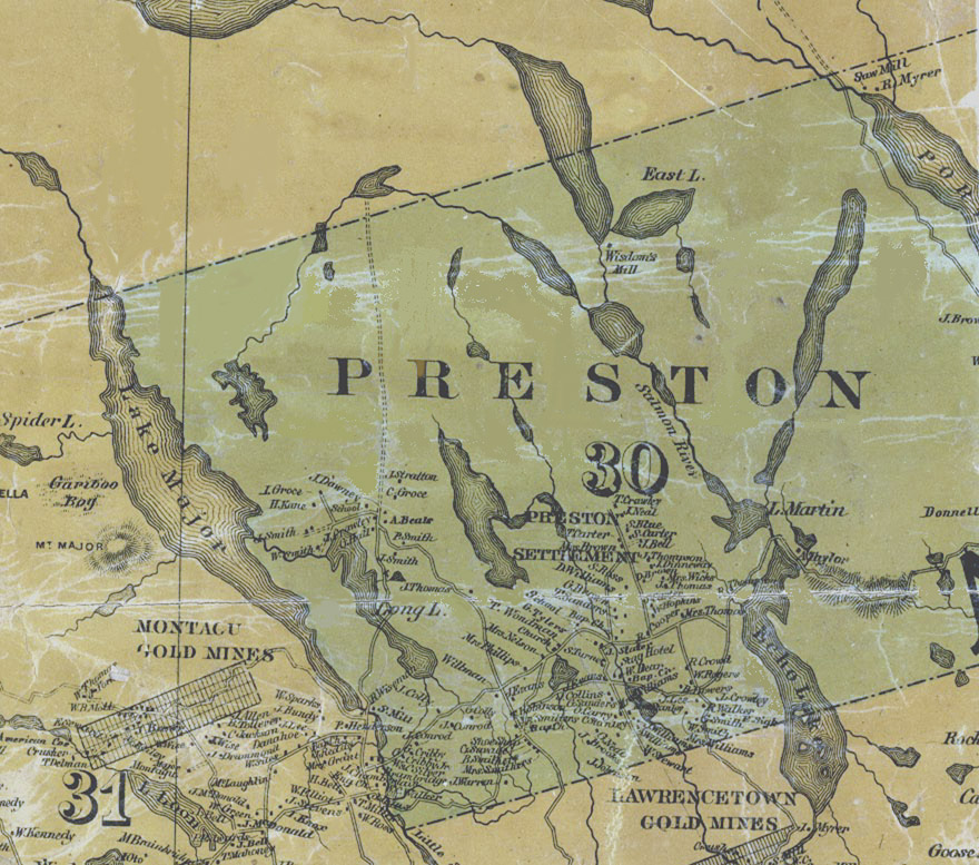
Map detail showing Preston
Date: 1865
Reference: Topographical Township Map of Halifax County, Nova Scotia Nova Scotia Archives Map Collection
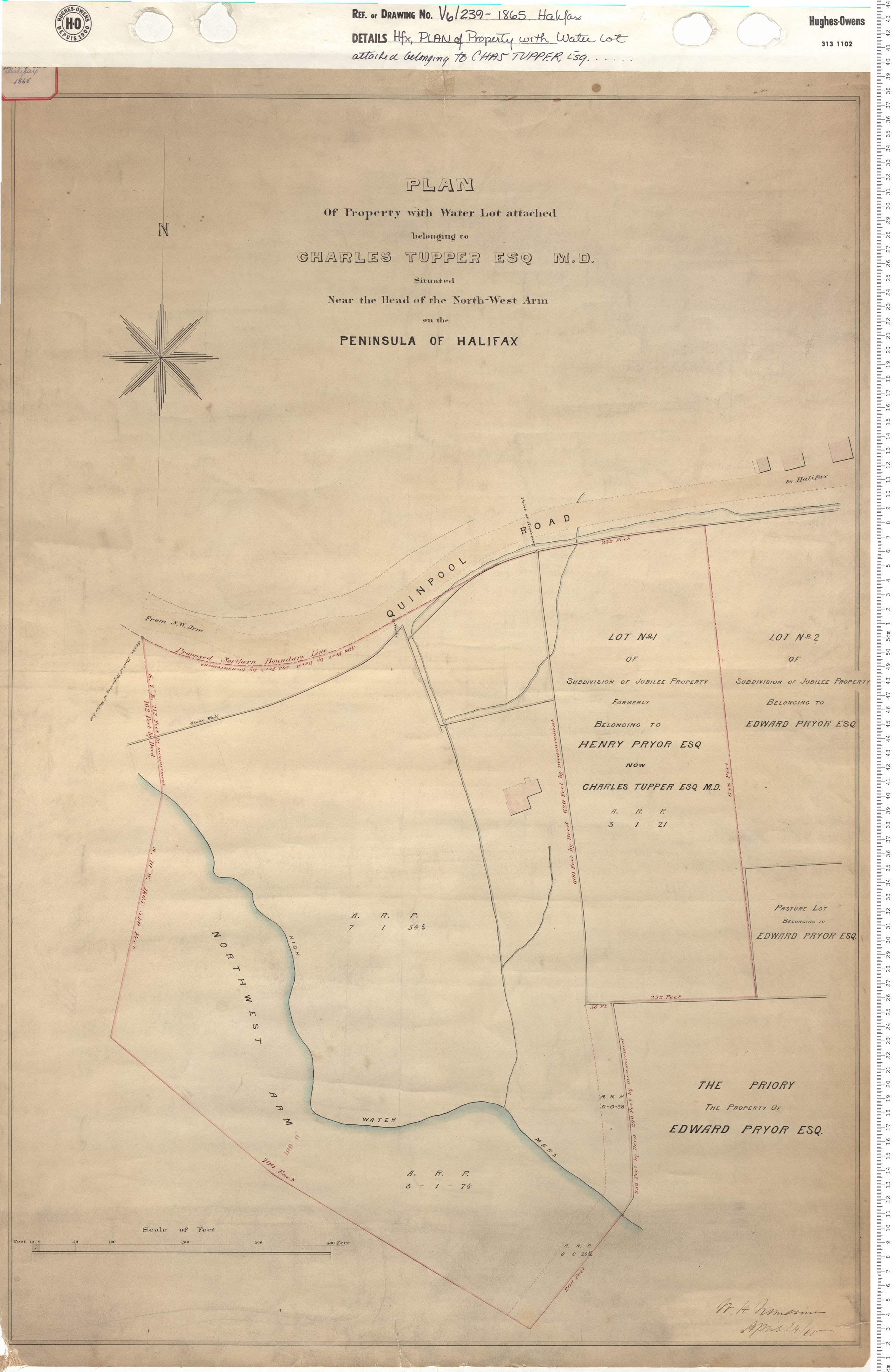
Plan of Property with Water Lot Attached belonging to Charles Tupper Esq. M.D. Situated Near the Head of the North West Arm on the Penninsula of Halifax
Date: 1865
Reference: Nova Scotia Archives Map Collection: V6 240 Halifax, Nova Scotia
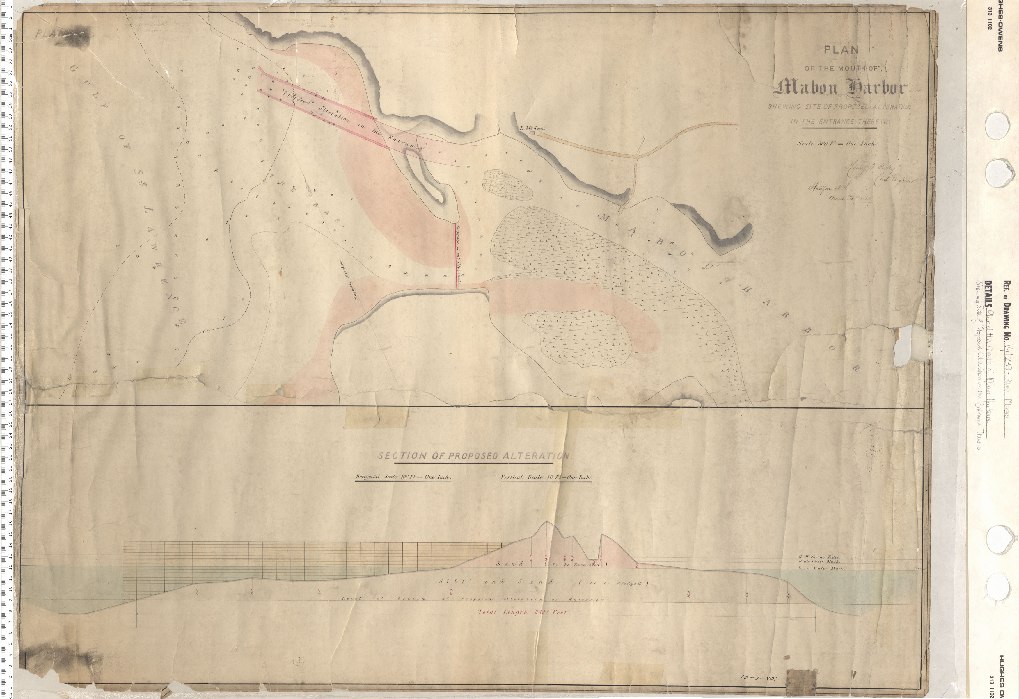
Plan of the Mouth of Mabou Harbour: Shewing site of proposed alteration in the entrance thereto
Date: 1865
Reference: Nova Scotia Archives Map Collection: V7 239 Mabou, Nova Scotia
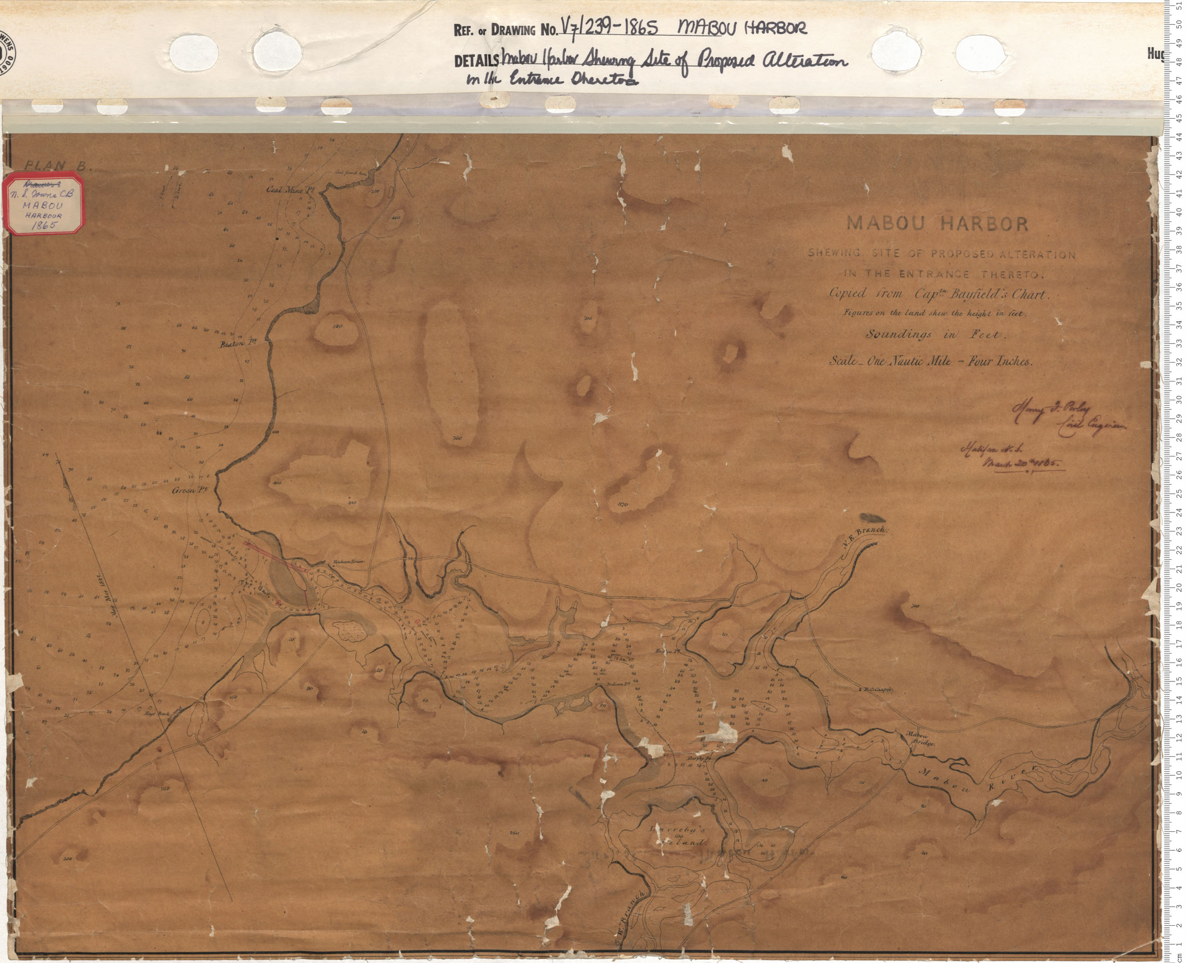
Mabou Harbour: Shewing site of proposed alteration in the entrance thereto
Date: 1865
Reference: Nova Scotia Archives Map Collection: V7 239 Mabou Harbour, Nova Scotia

New Glasgow Part 1
Date: 1865
Reference: Nova Scotia Archives Map Collection: V7 239 New Glasgow, Nova Scotia
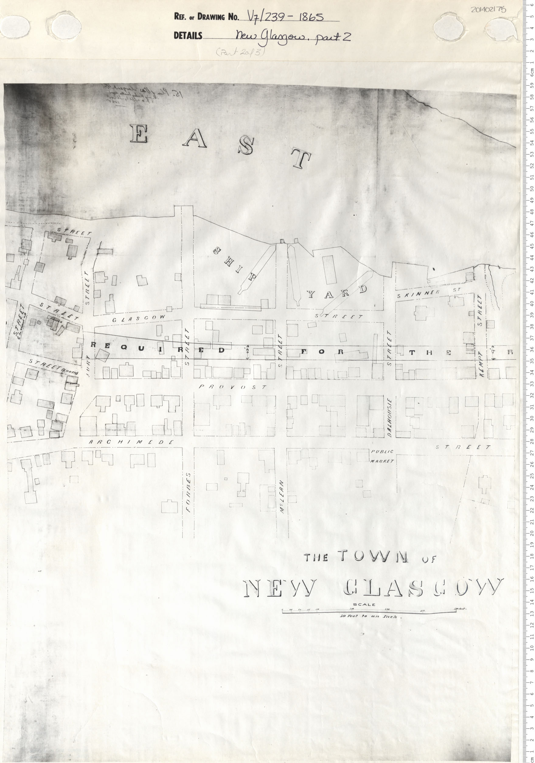
New Glasgow Part 2
Date: 1865
Reference: Nova Scotia Archives Map Collection: V7 239 New Glasgow, Nova Scotia
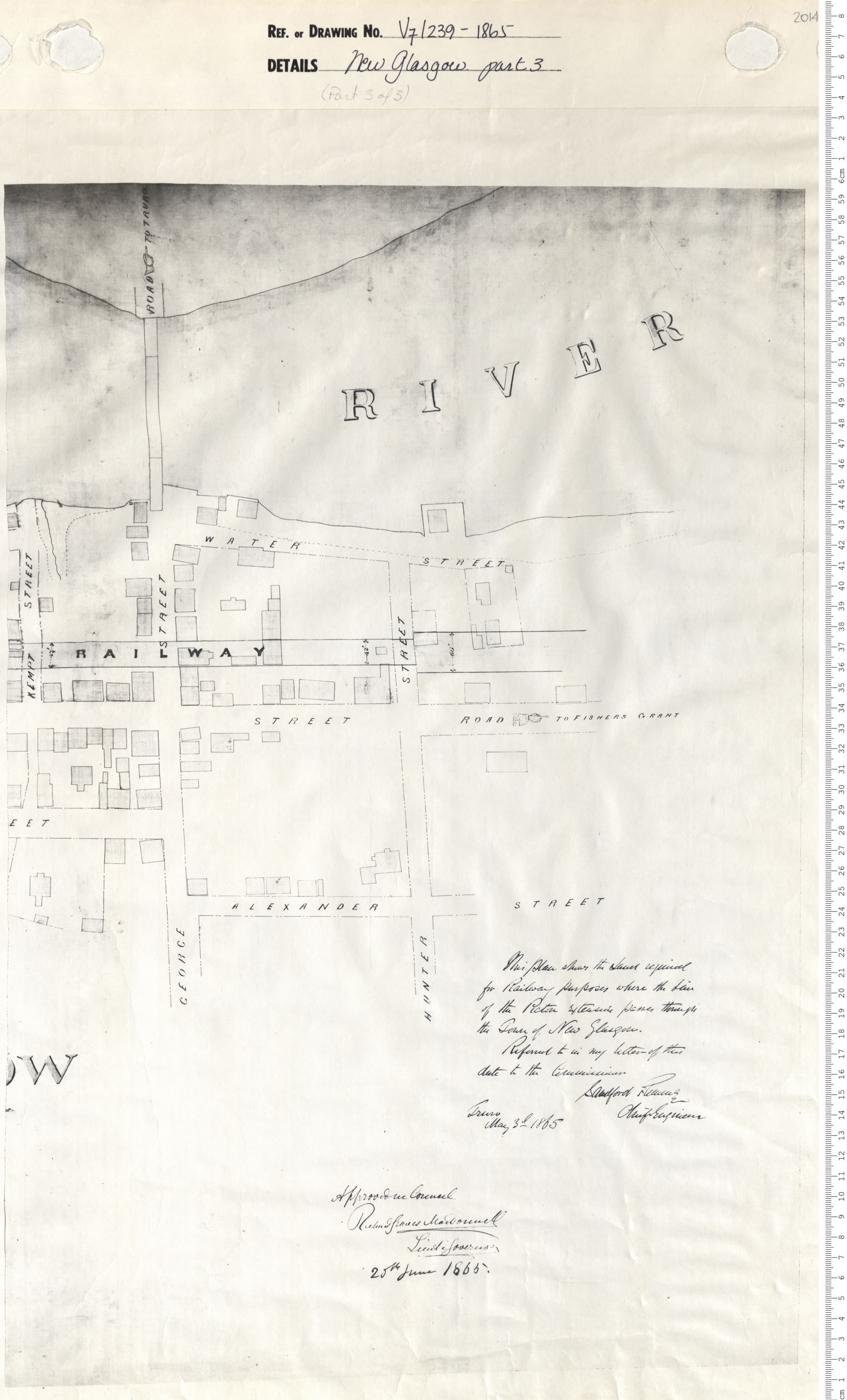
New Glasgow Part 3
Date: 1865
Reference: Nova Scotia Archives Map Collection: V7 239 New Glasgow, Nova Scotia
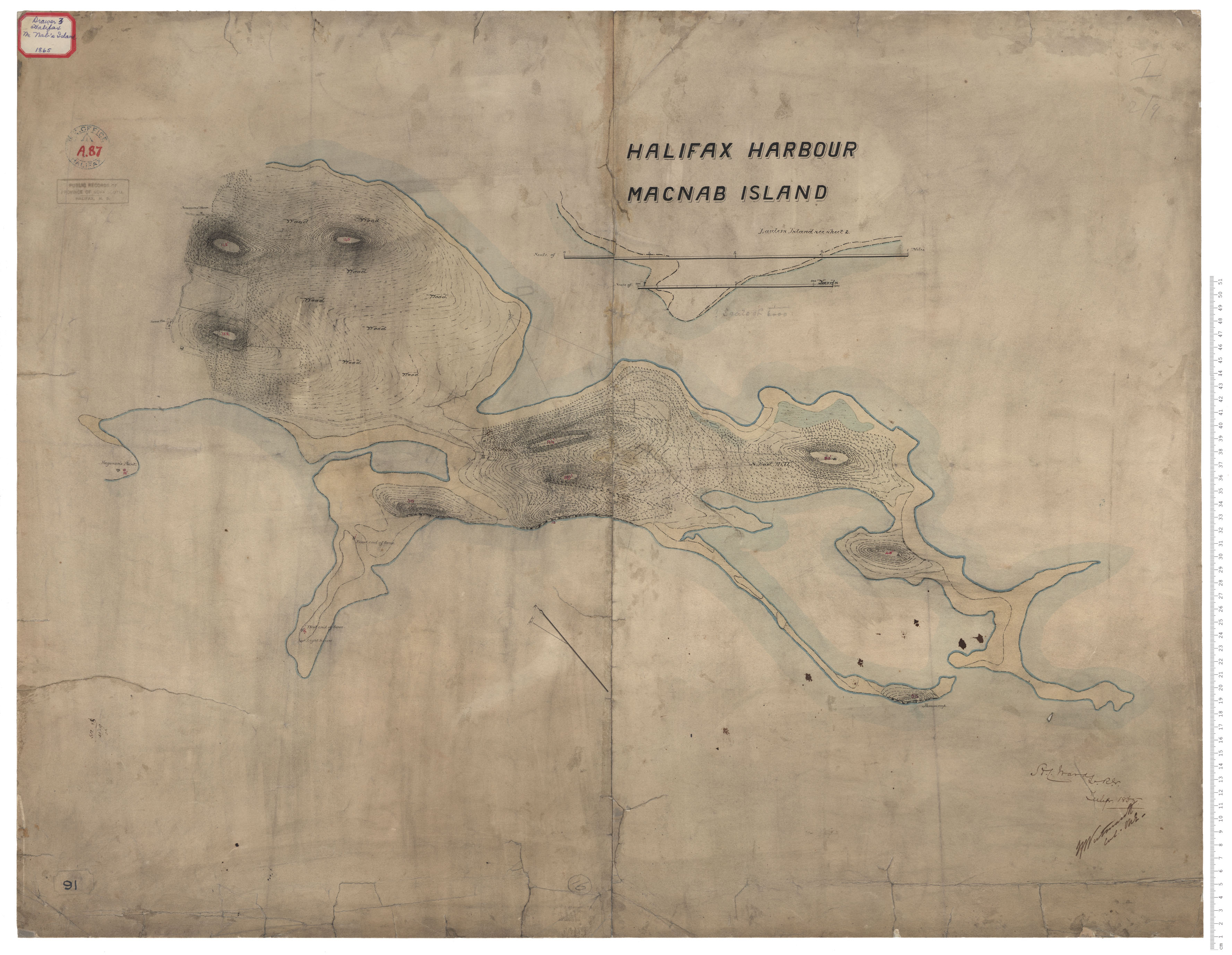
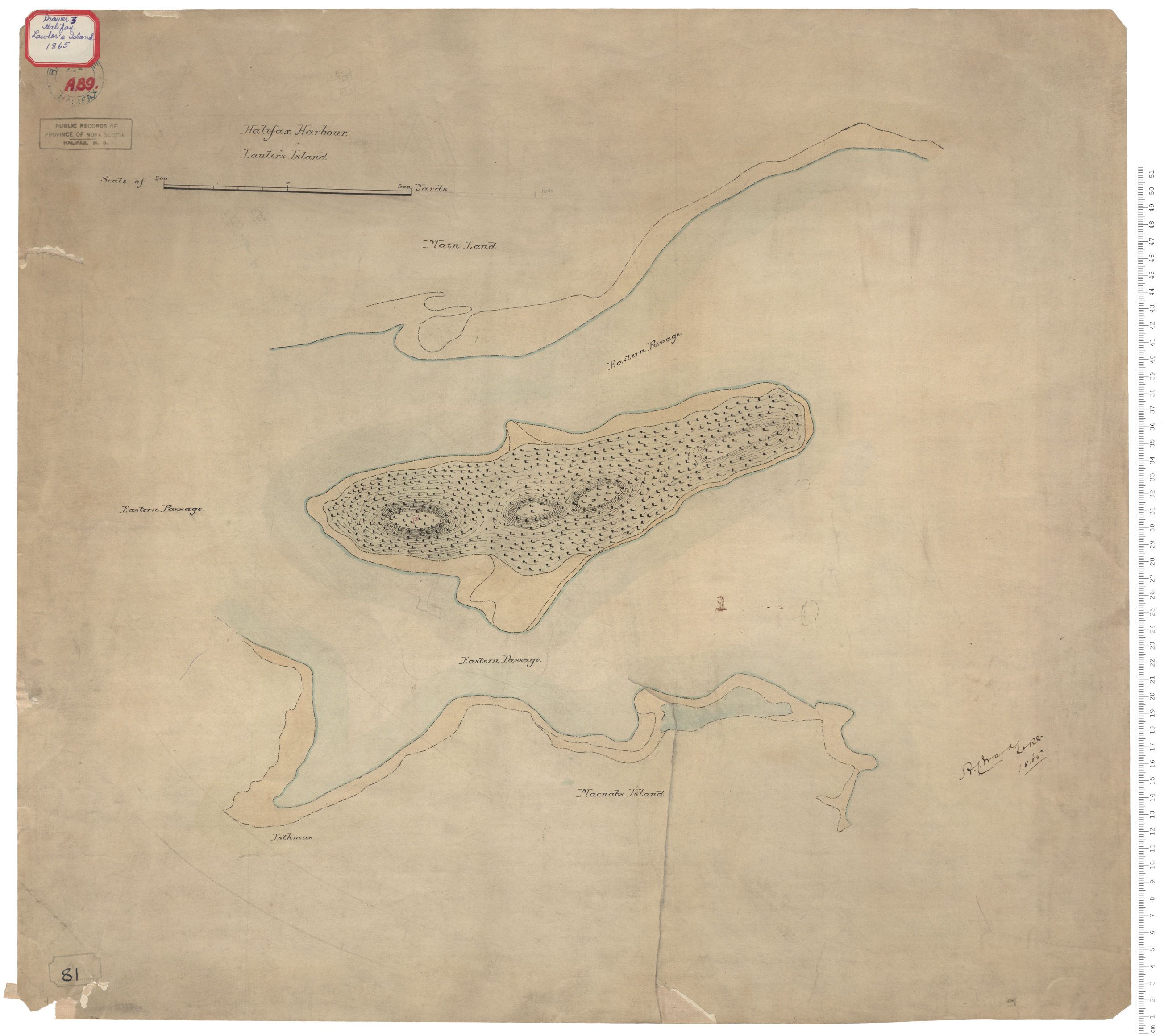
McNab's Island, Lawlor's Island
Date: 1 August 1865
Reference: Nova Scotia Archives Royal Engineers Maps and Plans A.89
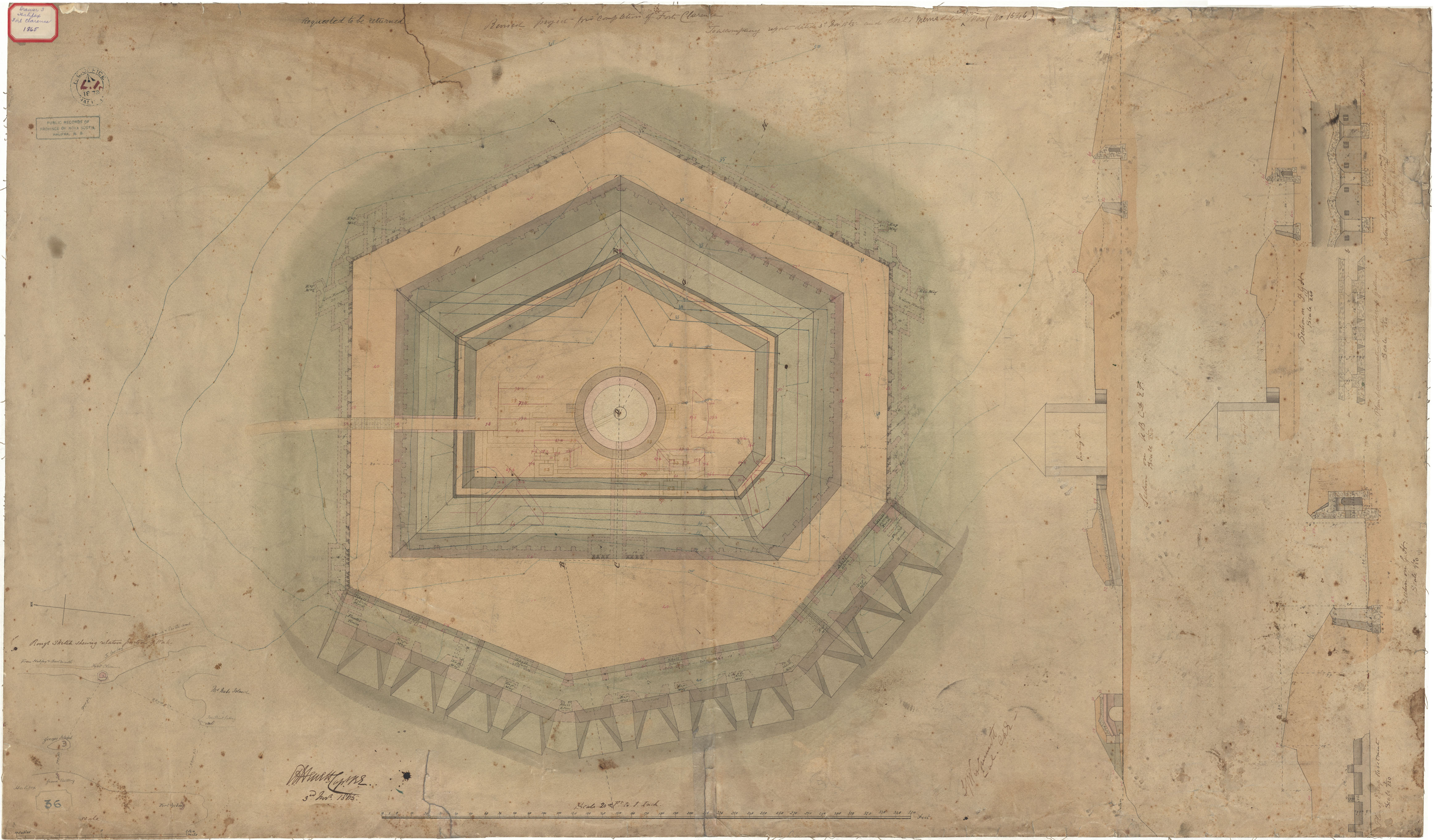
Fort Clarence
Date: 3 November 1865
Reference: Nova Scotia Archives Royal Engineers Maps and Plans L.01
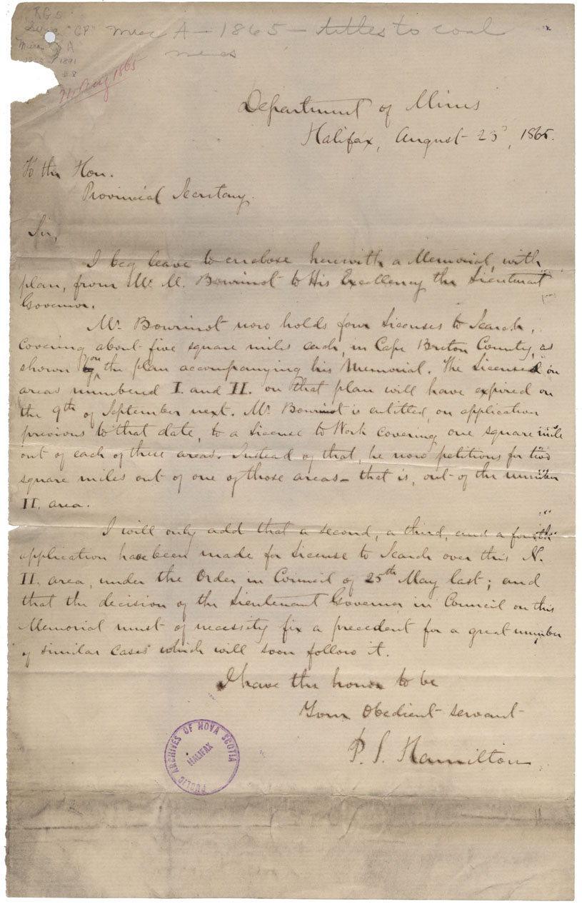
A Geological & Topographical Map of the Four Bourinot Coal Claims Near Cow & Galce Bay, C.B.
Date: February 1865
Reference: Nova Scotia Archives Map Collection: F/220 - 1865