Nova Scotia Archives
Historical Maps of Nova Scotia
Results 571 to 585 of 905 from your search: 1800
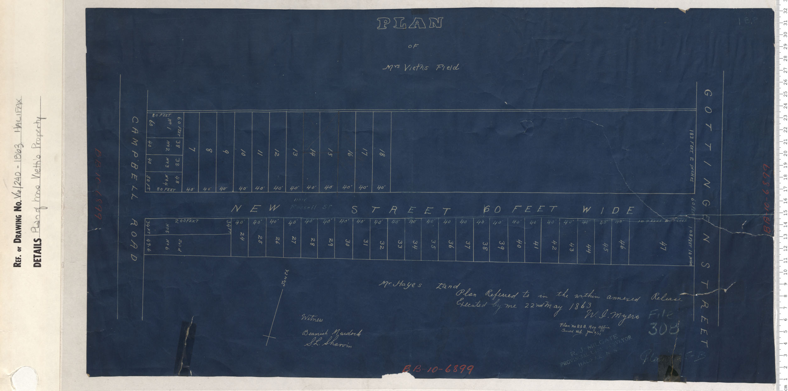
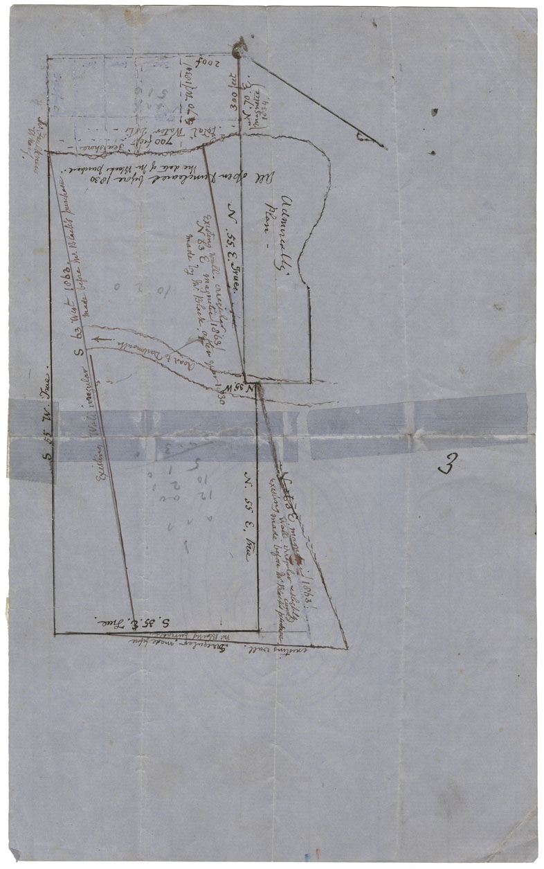
Plan of Mrs. Vieth's Field
Date: 1863
Reference: Nova Scotia Archives Map Collection: V6 240 Halifax, Nova Scotia
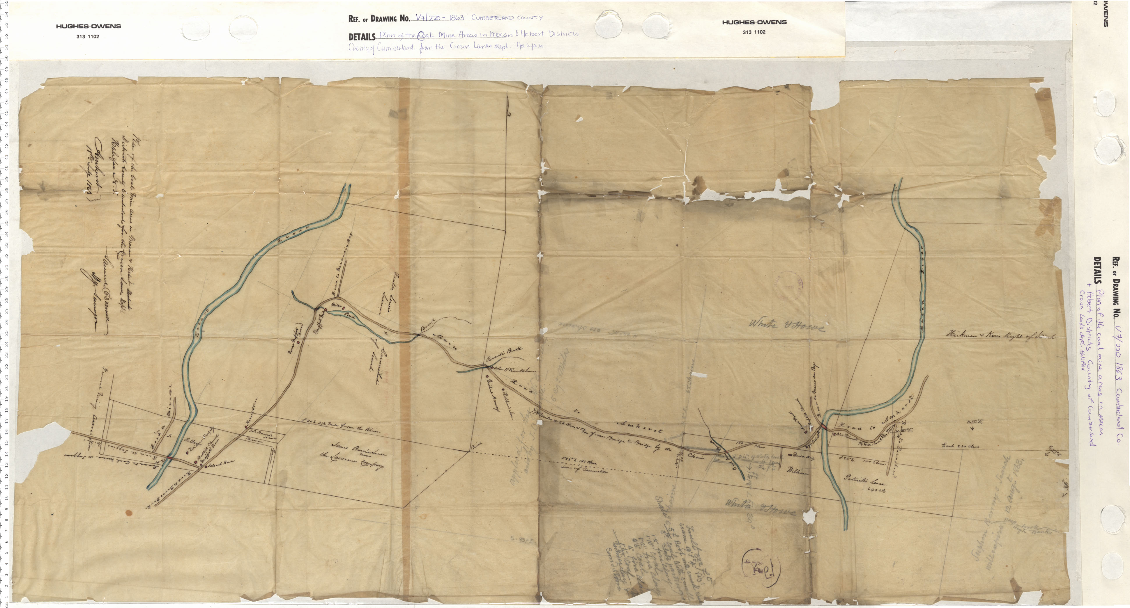
Plan of the Coal Mine Areas in the Macan and Herbert Districts, County of Cumberland from the Crown Lands dept. Halifax
Date: 1863
Reference: Nova Scotia Archives Map Collection: V7 220 Cumberland County, Nova Scotia
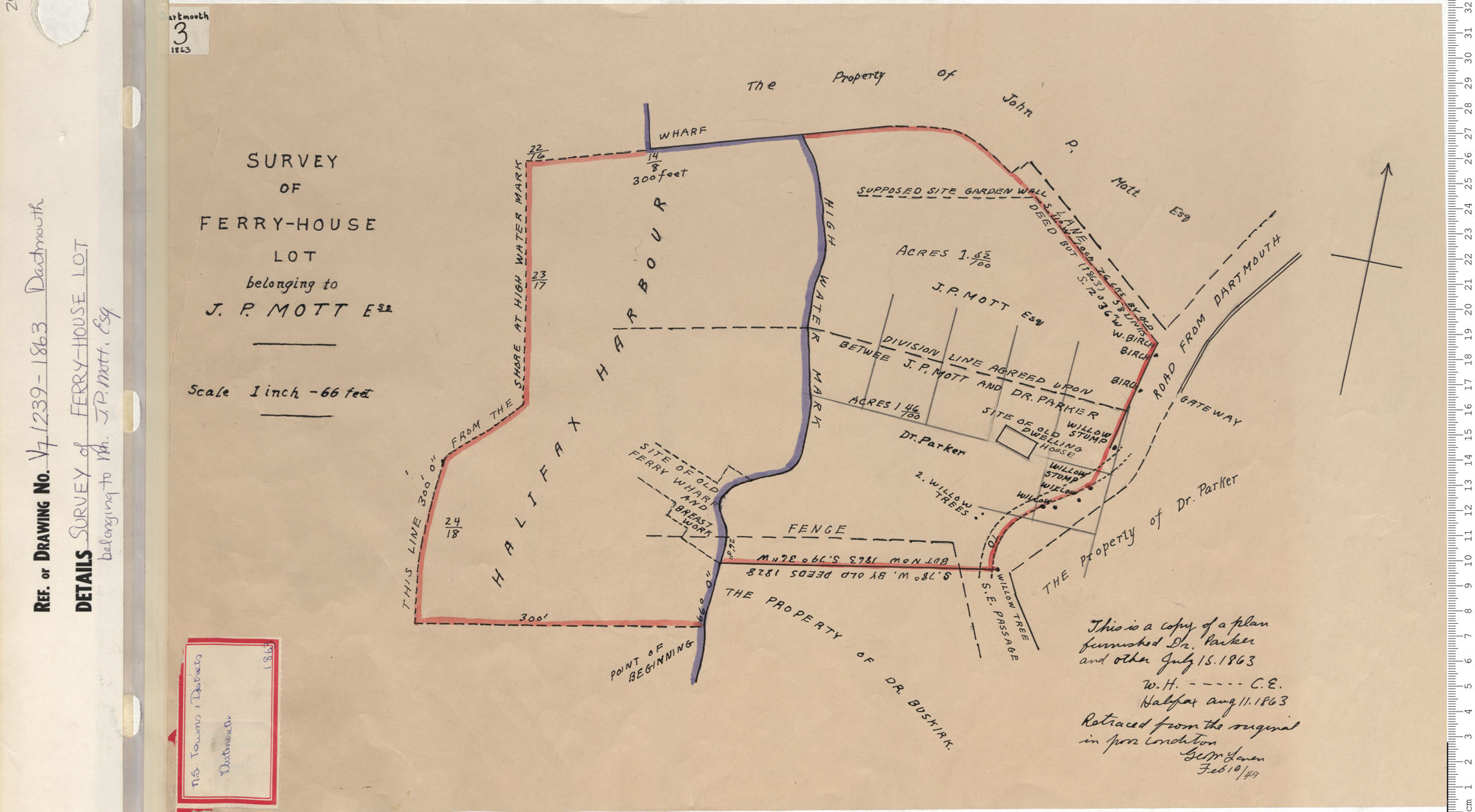
Survey of Ferry-House Lot belonging to J.P. Mott Esq.
Date: 1863
Reference: Nova Scotia Archives Map Collection: V7 239 Dartmouth, Nova Scotia
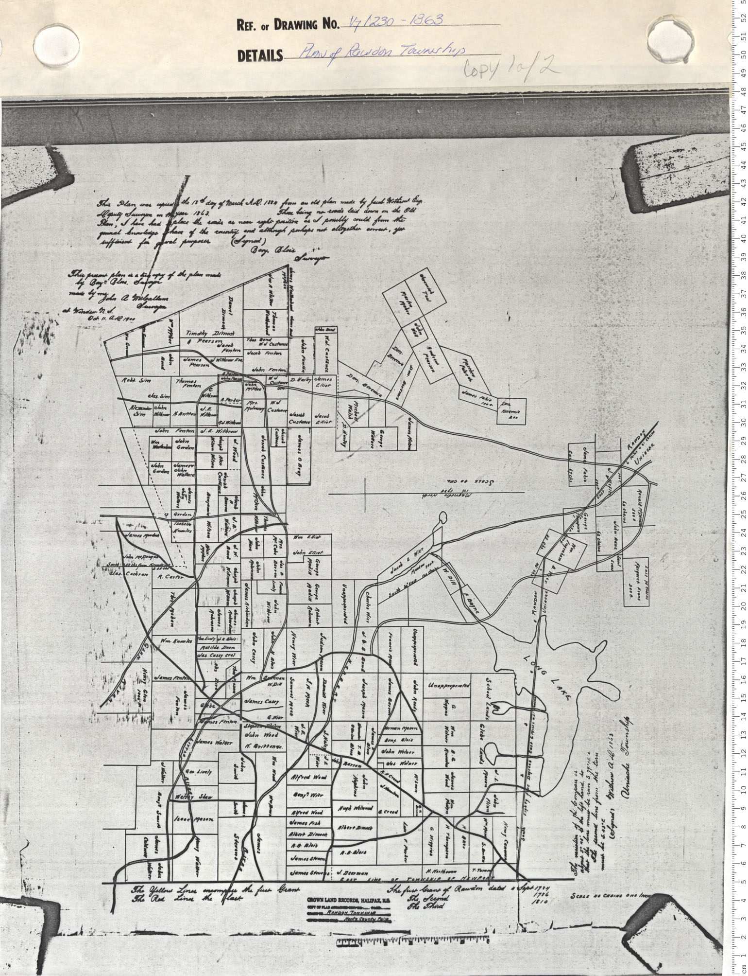
Plan of Rawdon Township
Date: 1863
Reference: Nova Scotia Archives Map Collection: V7 230 Rawdon, Nova Scotia
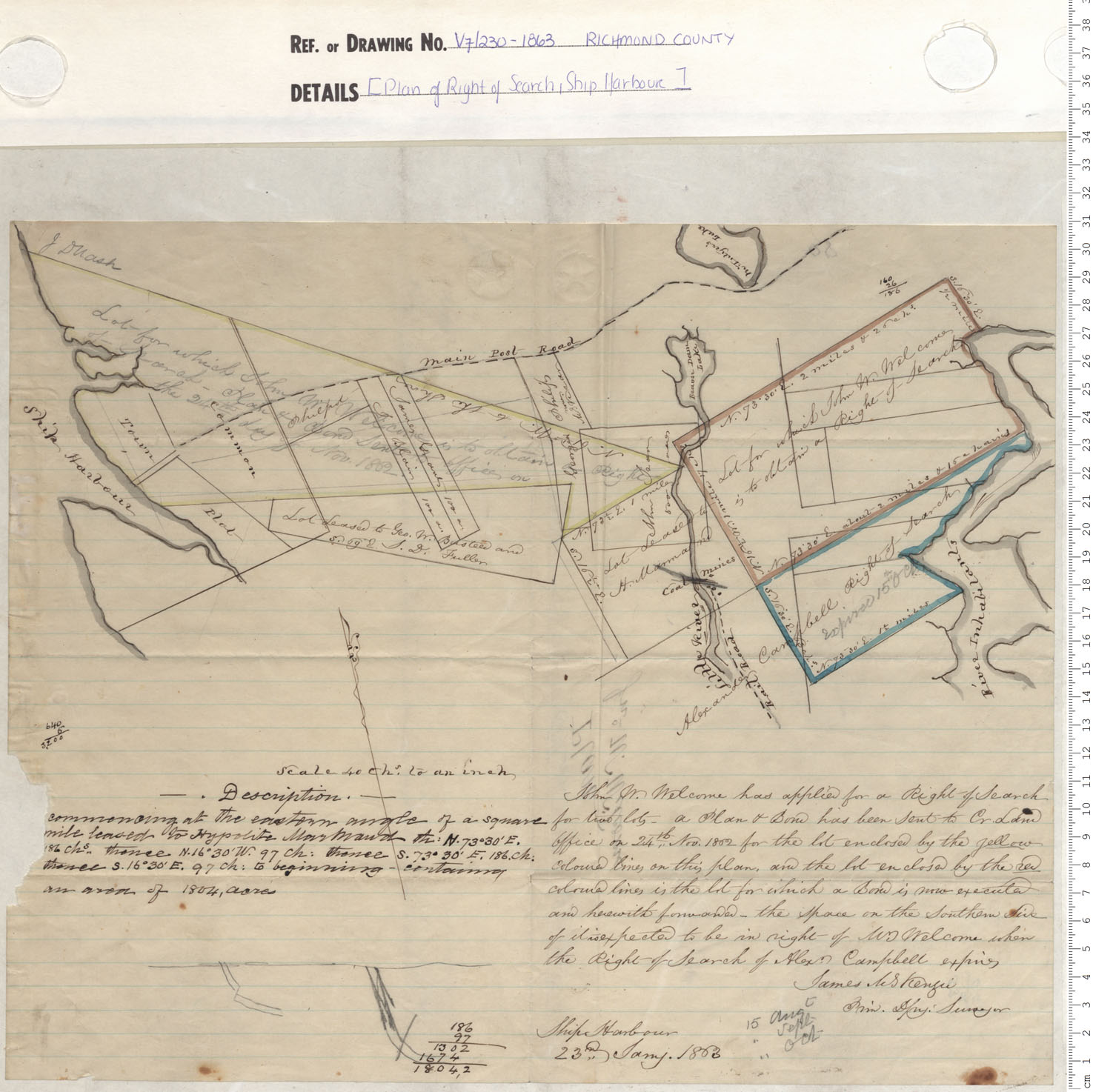
Plan of Right of Search, Ship Harbour
Date: 1863
Reference: Nova Scotia Archives Map Collection: V7 230 Richmond County, Nova Scotia
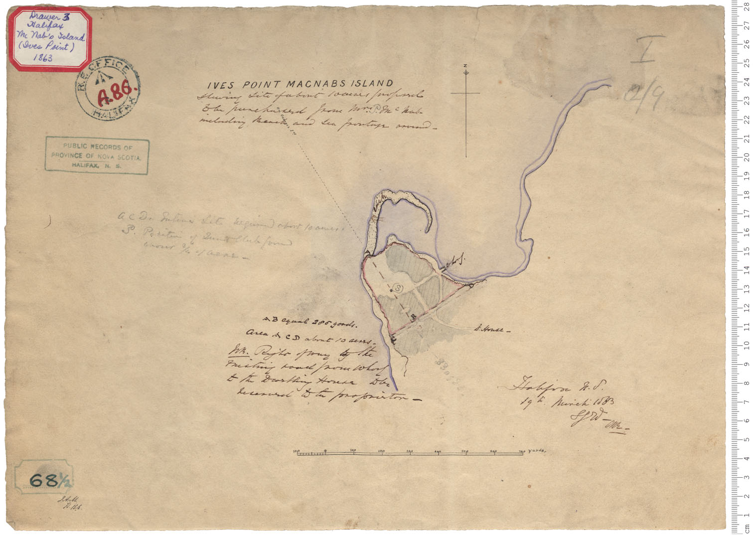
McNab's Island - Ives Point
Date: 19 March 1863
Reference: Nova Scotia Archives Royal Engineers Maps and Plans A.86
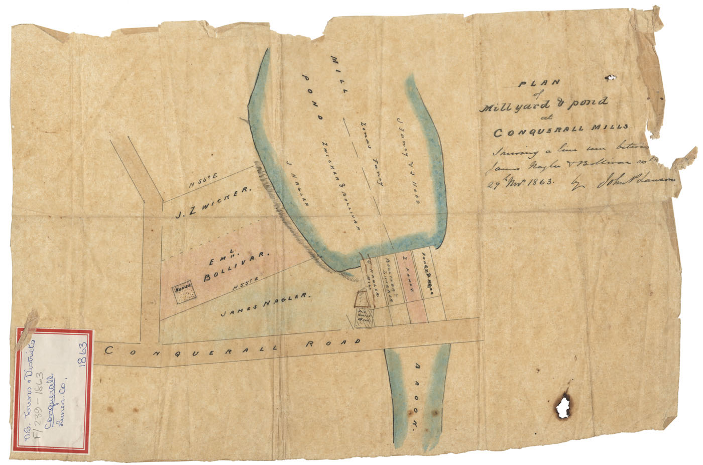
Plan of the Mill yard and pond at Conquerall Mills Lunenburg County Showing the line between James Nagler & Eml.Bolliva
Date: 29 November 1863
Reference: Nova Scotia Archives Map Collection: F/239 - 1863
PANS Vert Mss File: Dartmouth: Admiralty Property (Navy Watering Place?), c.1863
Date: 1863
Reference: Nova Scotia Archives Map Collection: F/239 - 1863
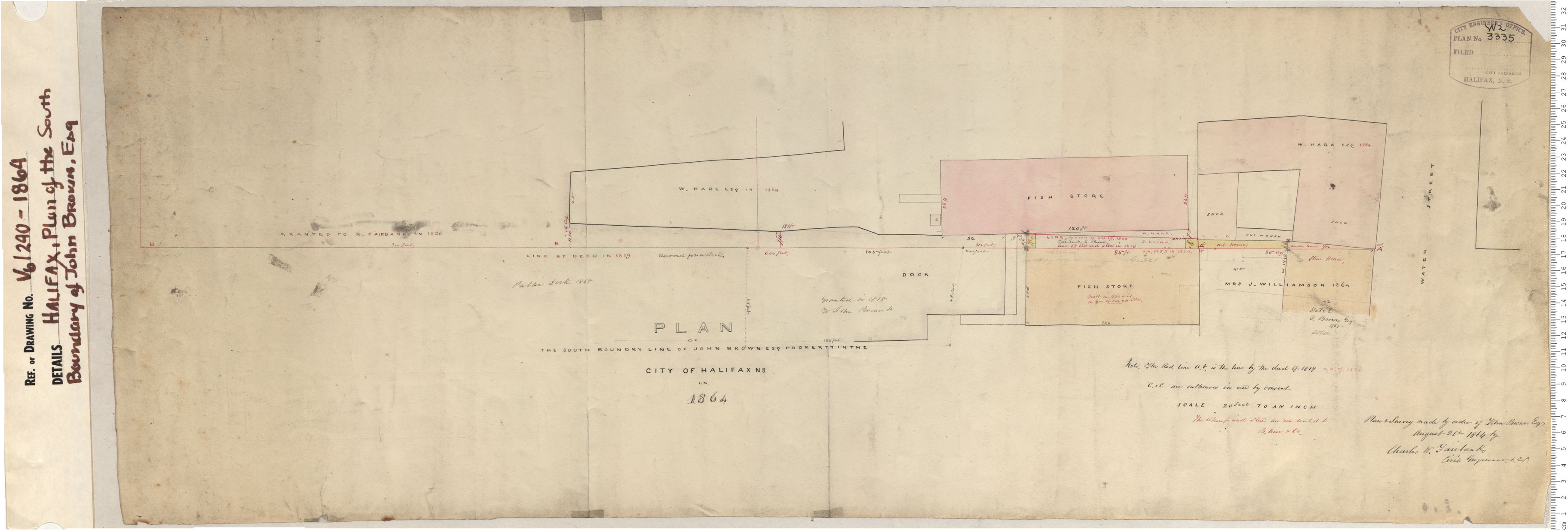
Plan of South Boundray of John Brown Esq.
Date: 1864
Reference: Nova Scotia Archives Map Collection: V6 240 Halifax, Nova Scotia
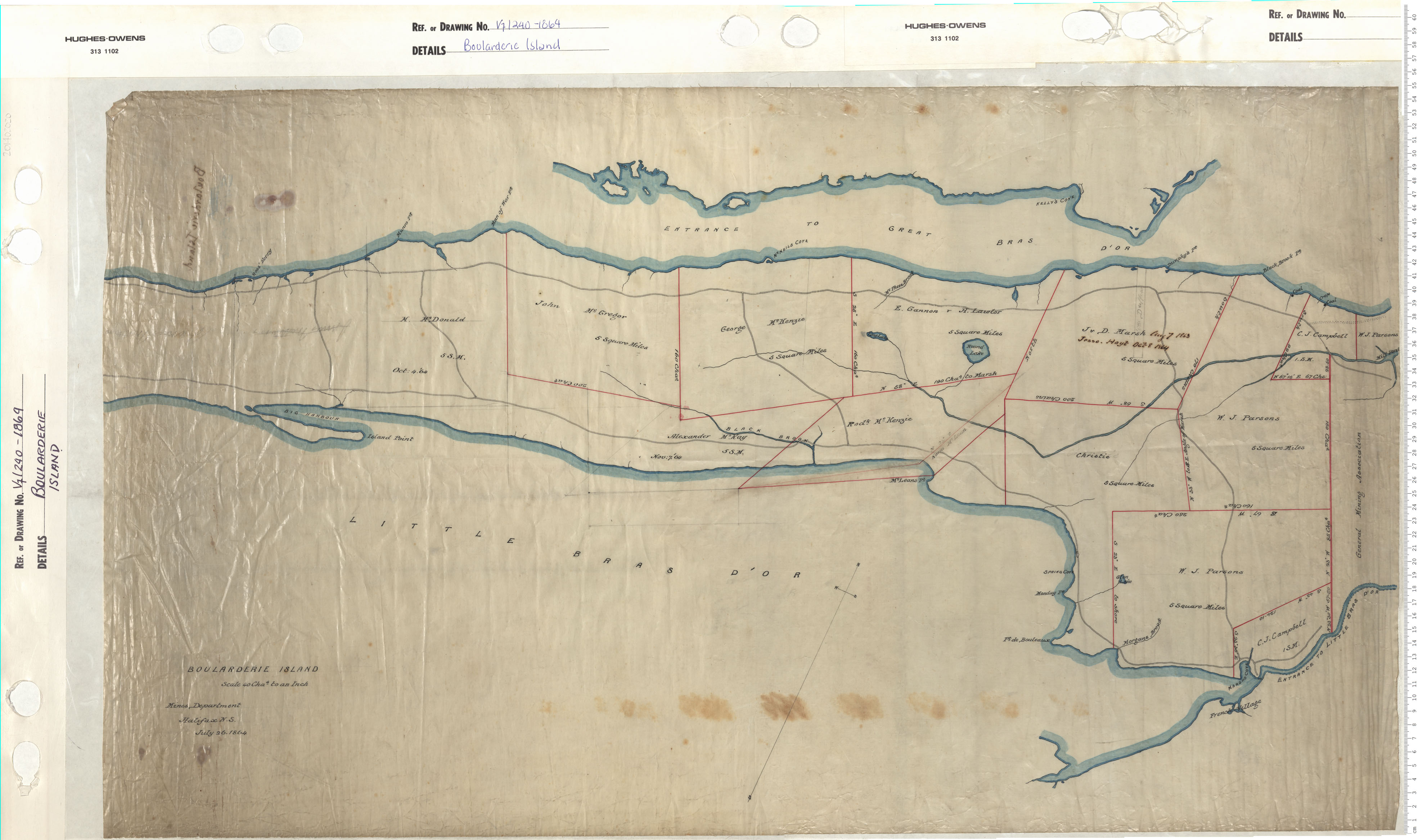
Boularderie Island
Date: 1864
Reference: Nova Scotia Archives Map Collection: V7 240 Boularderie Island, Nova Scotia
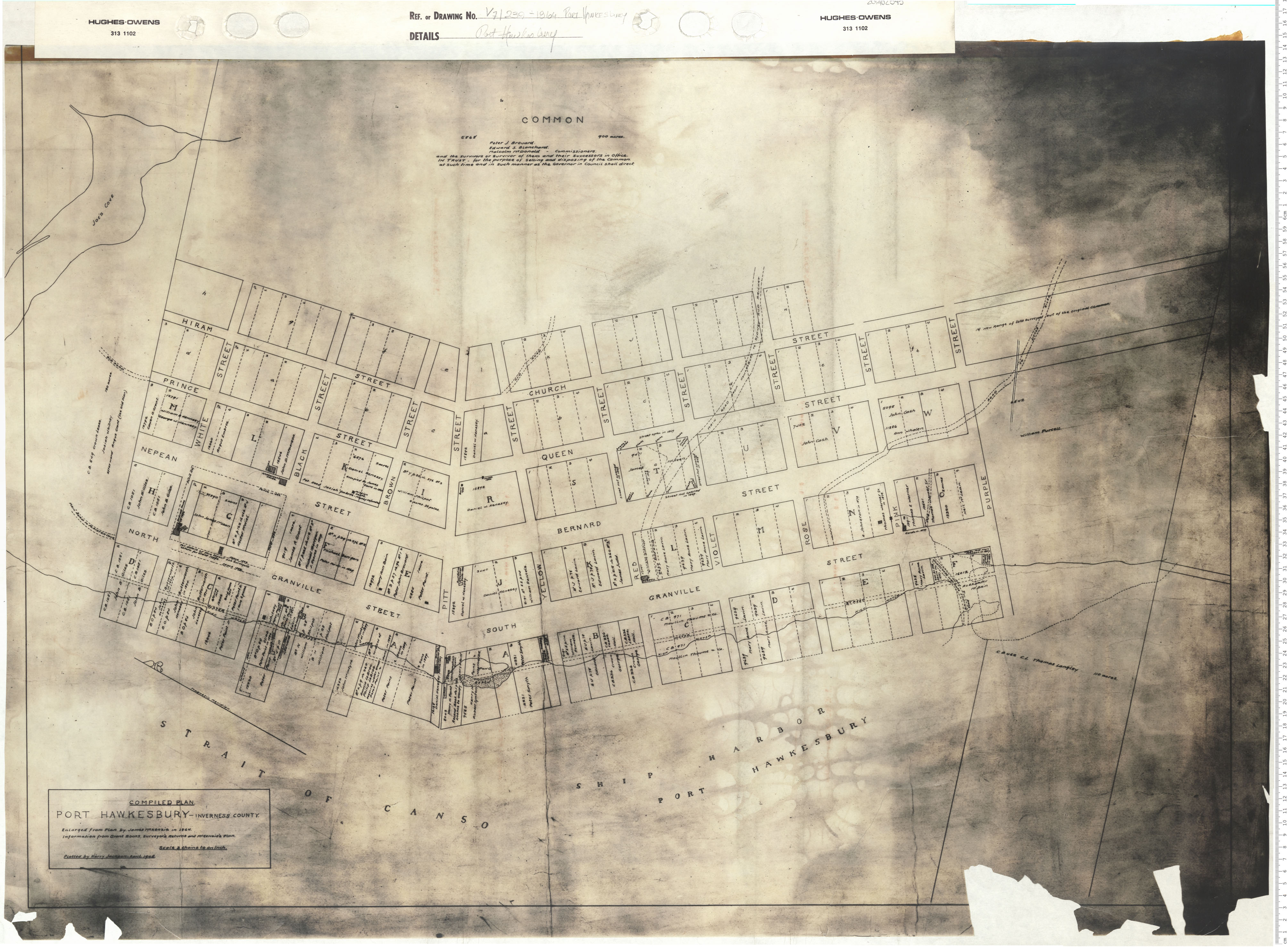
Port Hawkesbury
Date: 1864
Reference: Nova Scotia Archives Map Collection: V7 239 Port Hawkesbury, Nova Scotia
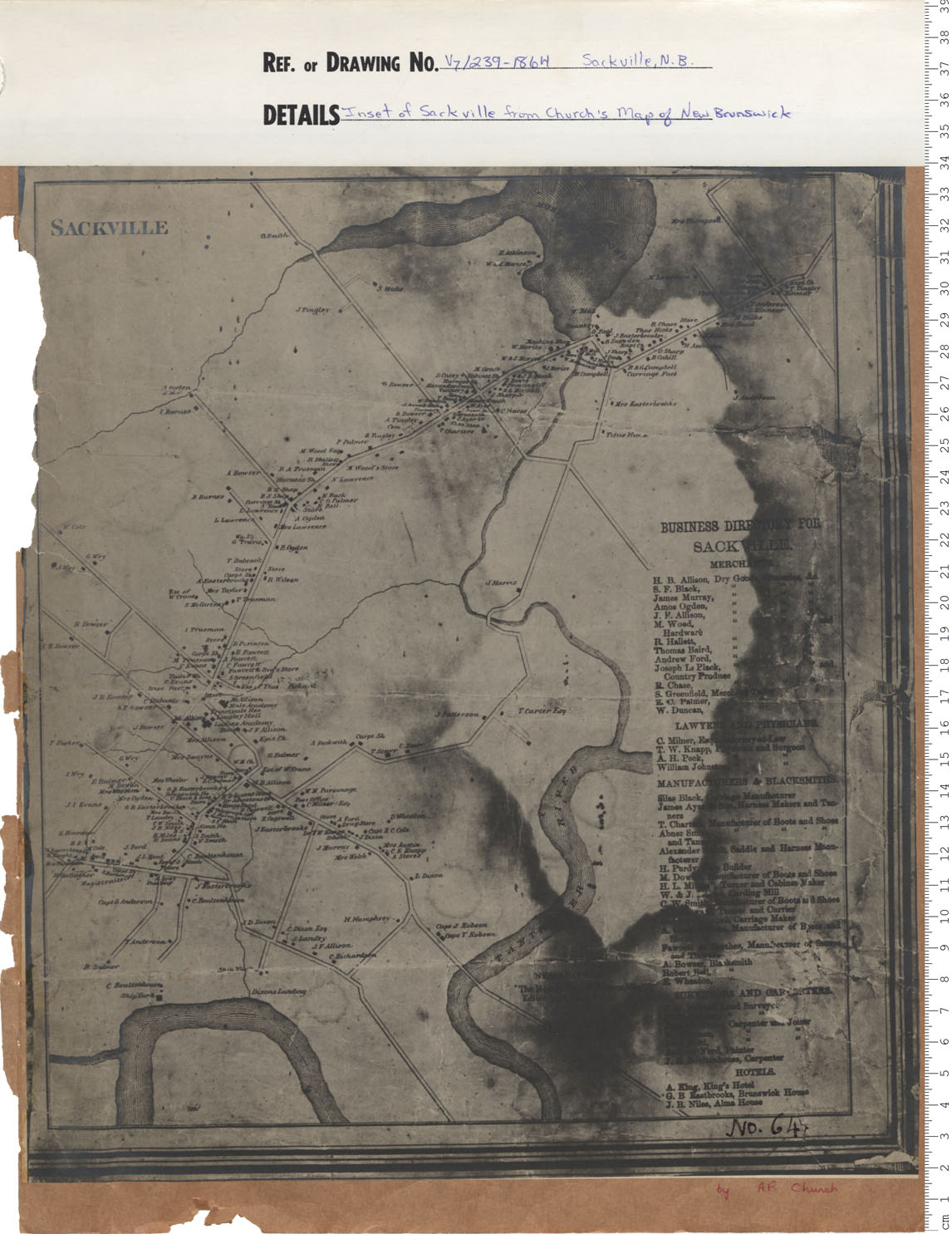
Inset of Sackville from Church's map of New Brunswick
Date: 1864
Reference: Nova Scotia Archives Map Collection: V7 239 Sackville, New Brunswick, Nova Scotia
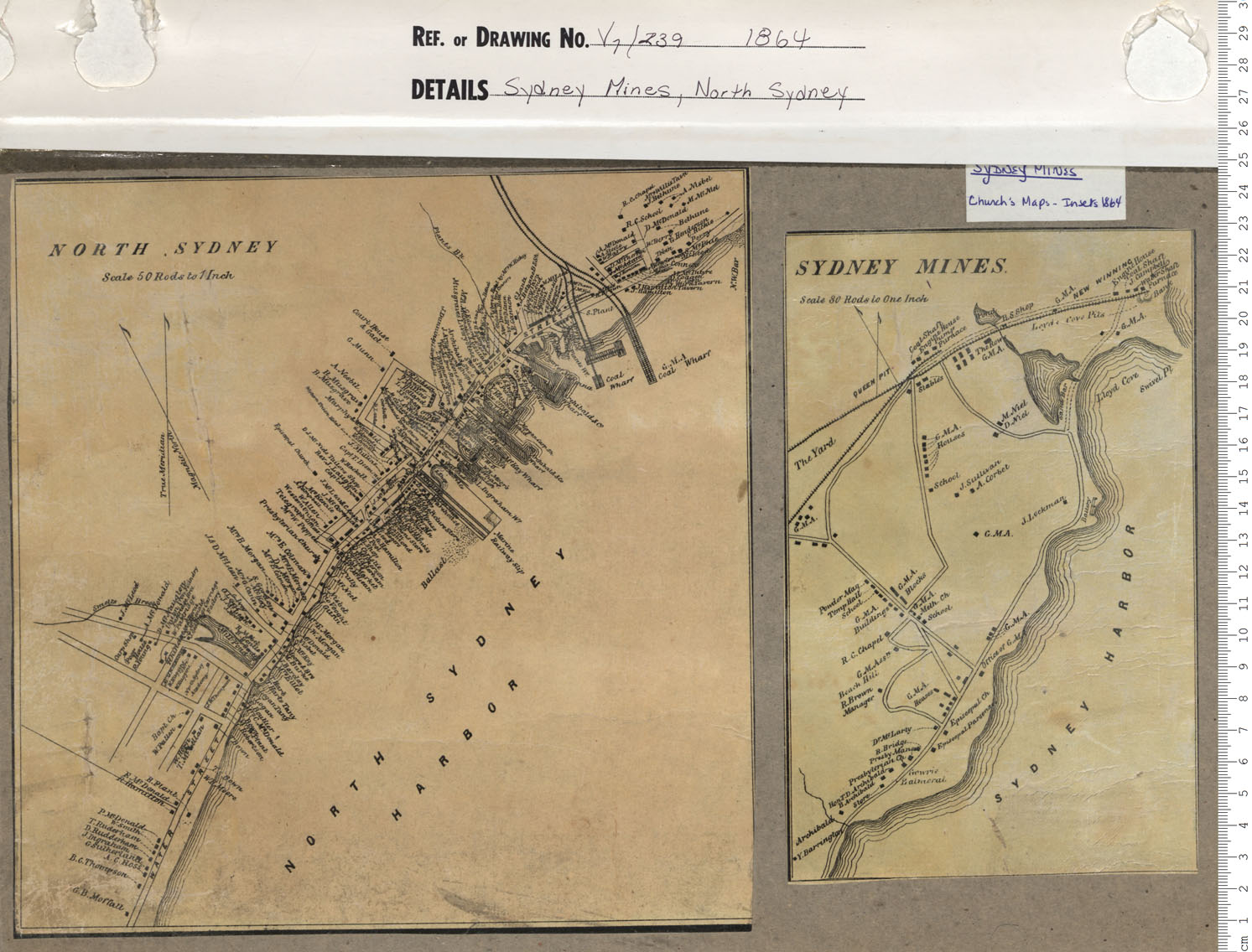
Sydney Mines, North Sydney
Date: 1864
Reference: Nova Scotia Archives Map Collection: V7 239 Sydney Mines, Nova Scotia
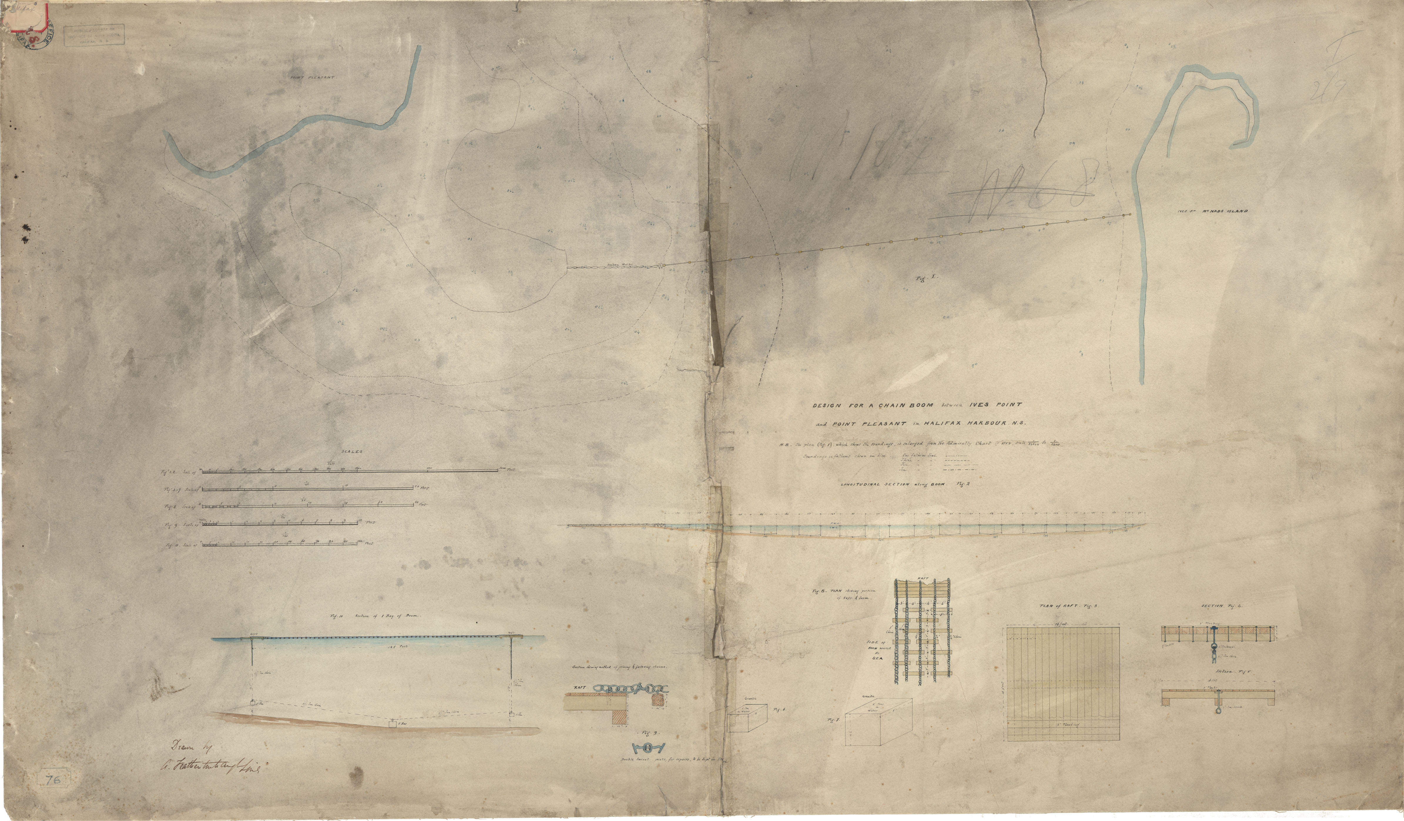
Chain Boom for Halifax Harbour
Date: 1864
Reference: Nova Scotia Archives Royal Engineers Maps and Plans M.08