Nova Scotia Archives
Historical Maps of Nova Scotia
Results 676 to 690 of 905 from your search: 1800
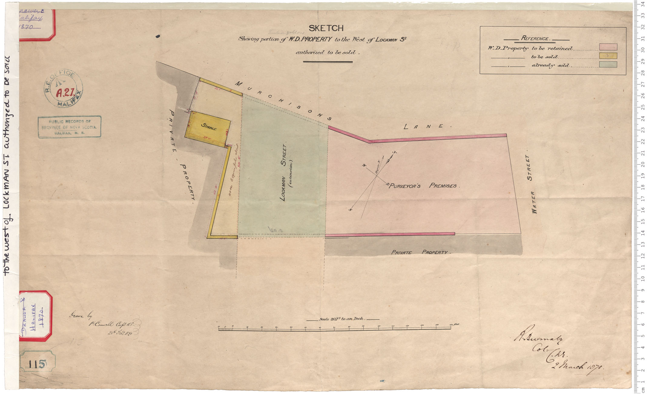
W.D. Property to west of Lockman Street
Date: 28 February 1870
Reference: Nova Scotia Archives Royal Engineers Maps and Plans A.21
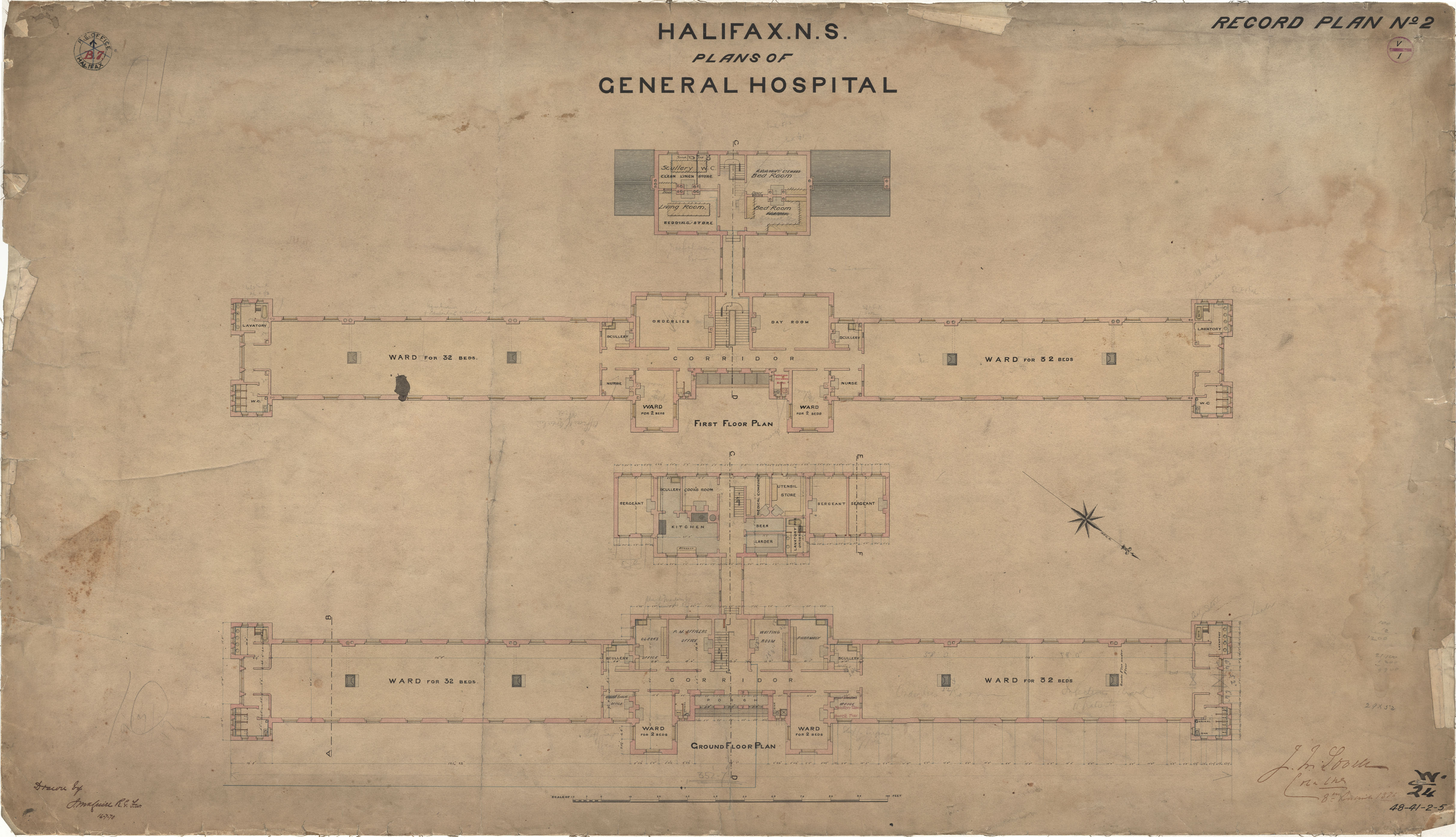
General Hospital
Date: 16 July 1870
Reference: Nova Scotia Archives Royal Engineers Maps and Plans 48 - 41 - 2 - 5
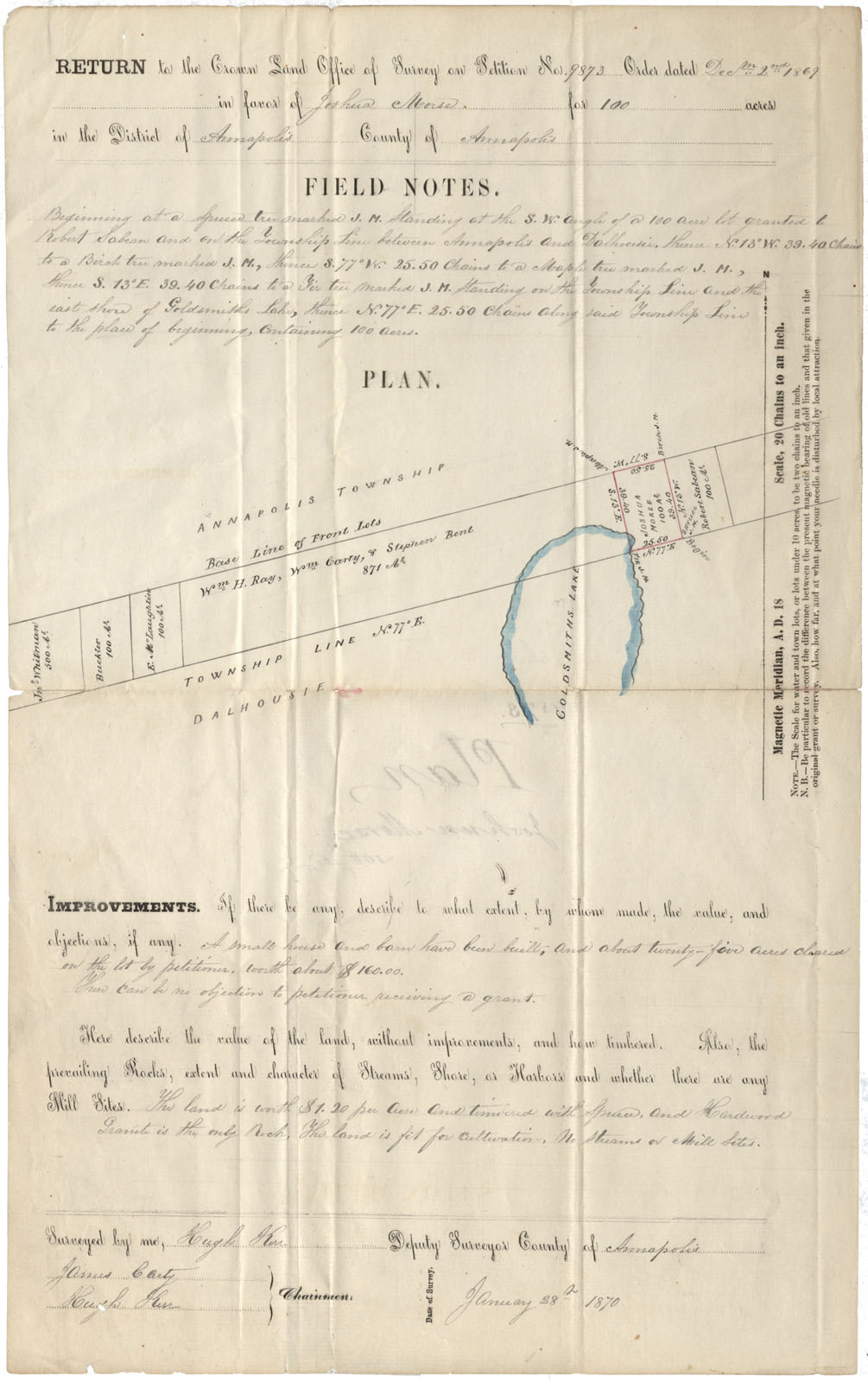
Annapolis County Annapolis & Dalhousie Townships near Goldsmith Lake 1870
Date: 28 January 1870
Reference: Nova Scotia Archives Map Collection: F/230 - 1870
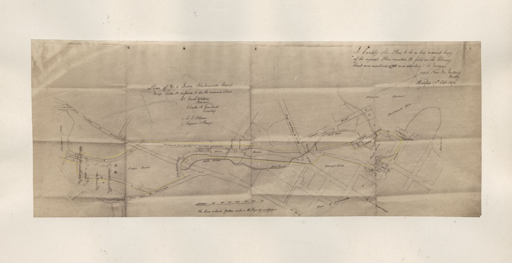
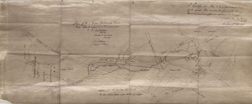
Plan of No1 Section, Shubenacadie Canal Map Letter B (copy photostat)
Date: 17 October 1870
Reference: Nova Scotia Archives Map Collection: F/239
Plan of No1 Section Shubenacadie Canal
Date: 1870
Reference: Nova Scotia Archives Map Collection: F/239 - 1870
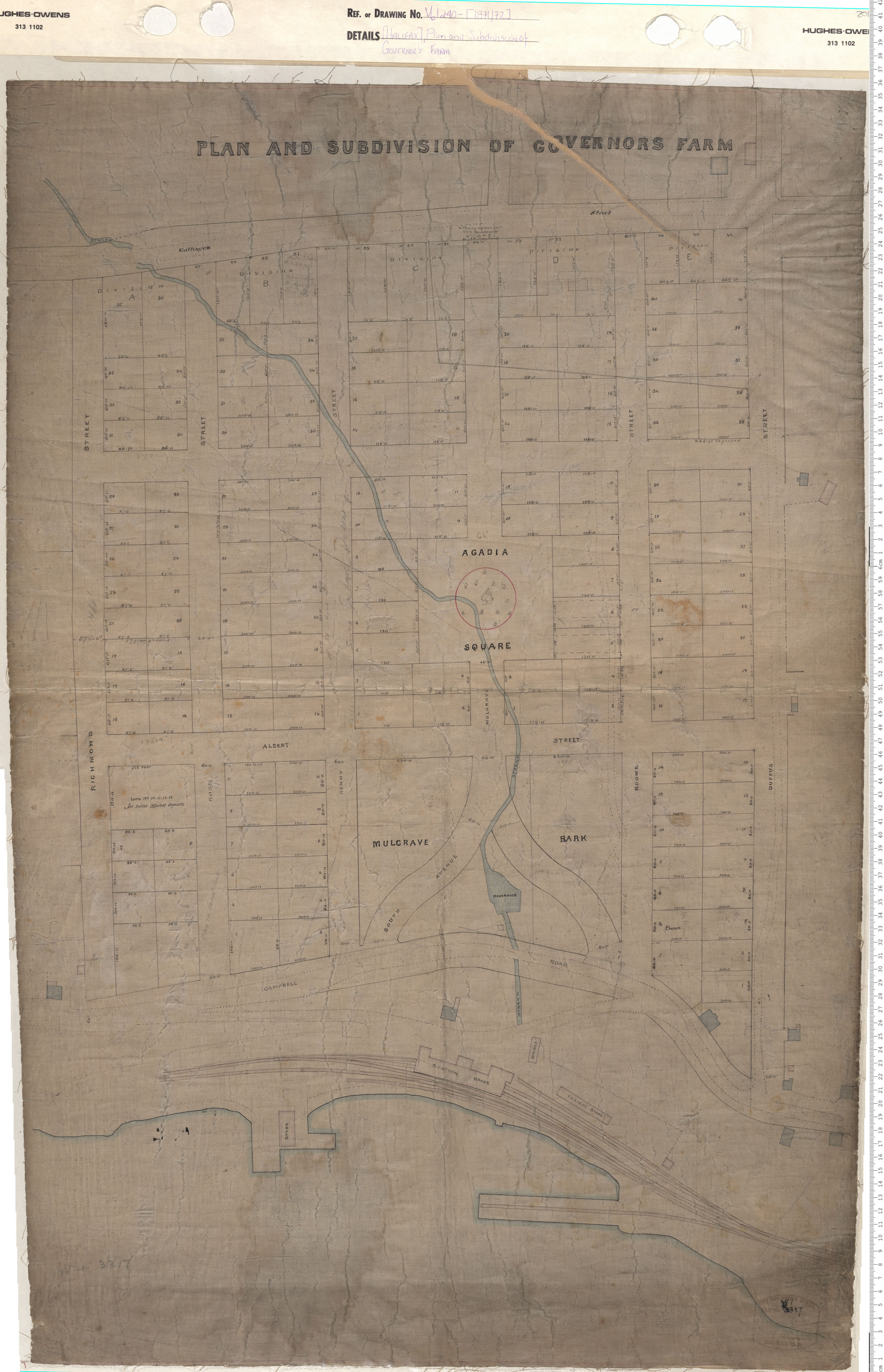
Plan and Subdivision of Governors Farm
Date: 1871/72
Reference: Nova Scotia Archives Map Collection: V6 240 Halifax, Nova Scotia
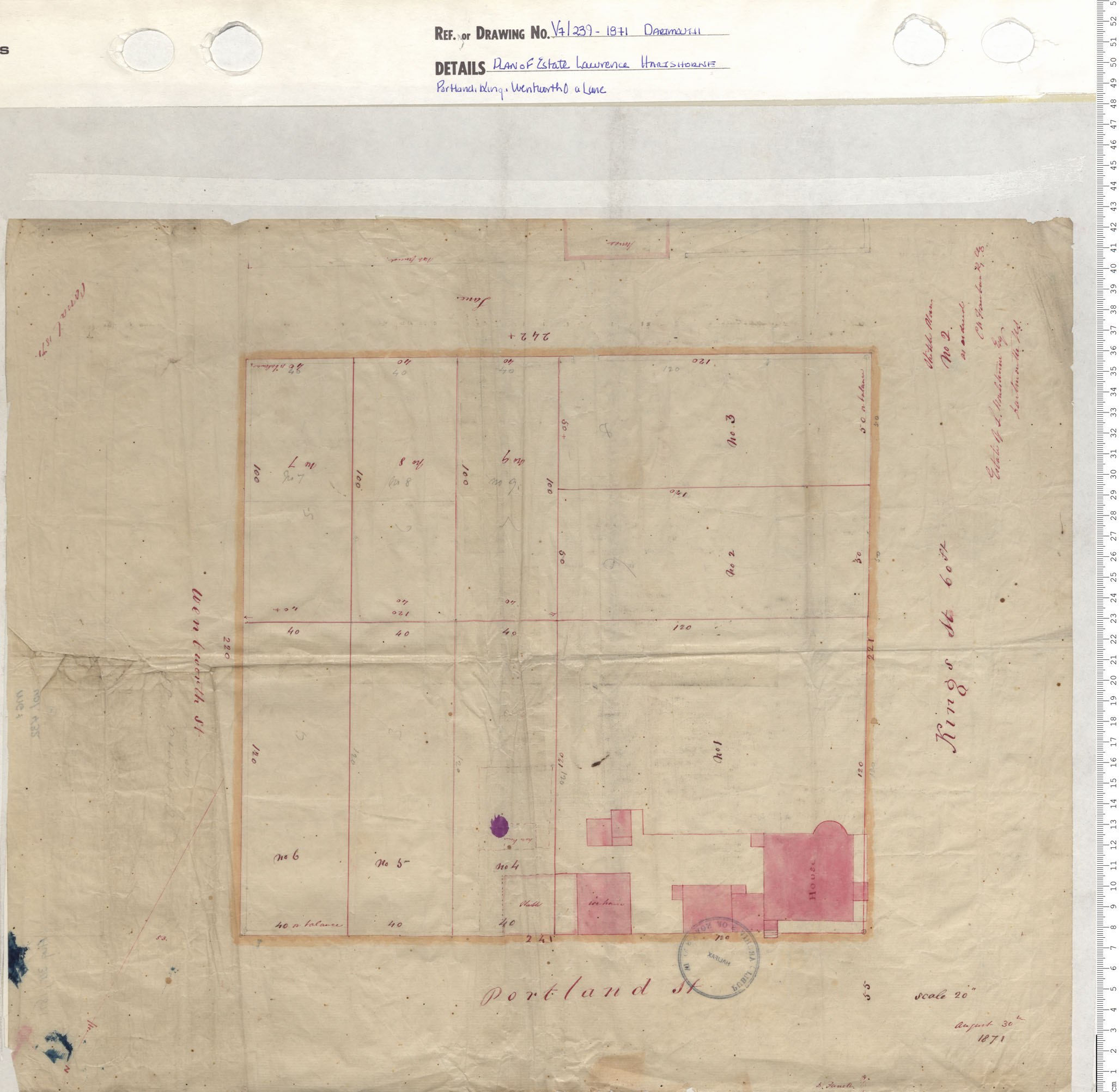
Plan of Estate Lawrence Hartshorne Protland, King, Wentworth & A. Lane
Date: 1871
Reference: Nova Scotia Archives Map Collection: V7 239 Dartmouth, Nova Scotia
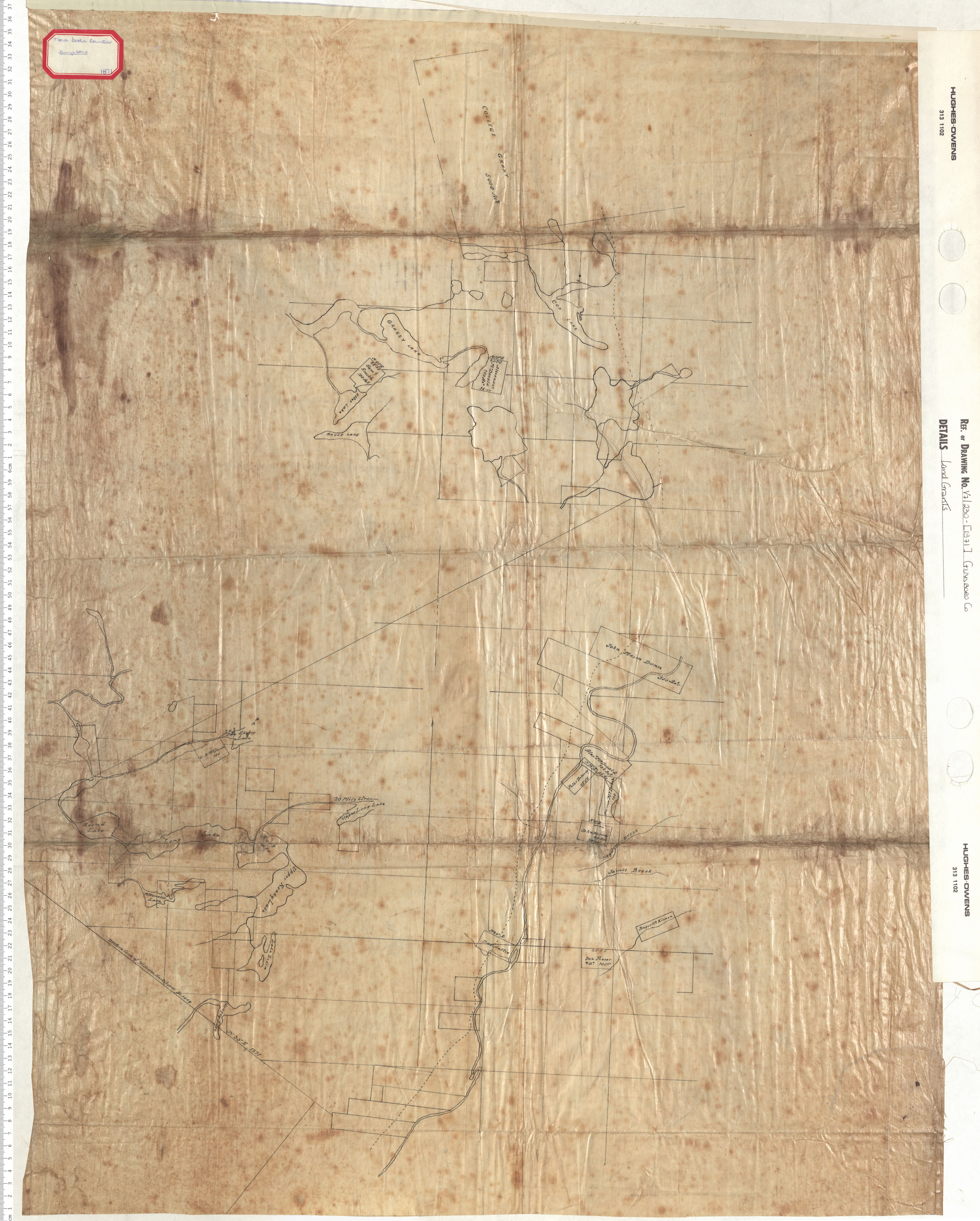
Land Grants
Date: 1871
Reference: Nova Scotia Archives Map Collection: V7 230 Guysborough County, Nova Scotia
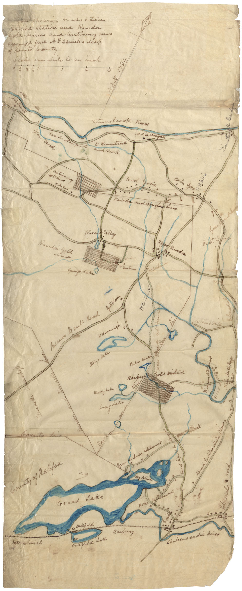
Plan showing roads between Enfield Station and Rawdon Gold Mines and Antimony Mines, arranged from A. F. Church's Map of Hants County
Date: 1871
Reference: Nova Scotia Archives Map Collection: F/209 - 1871
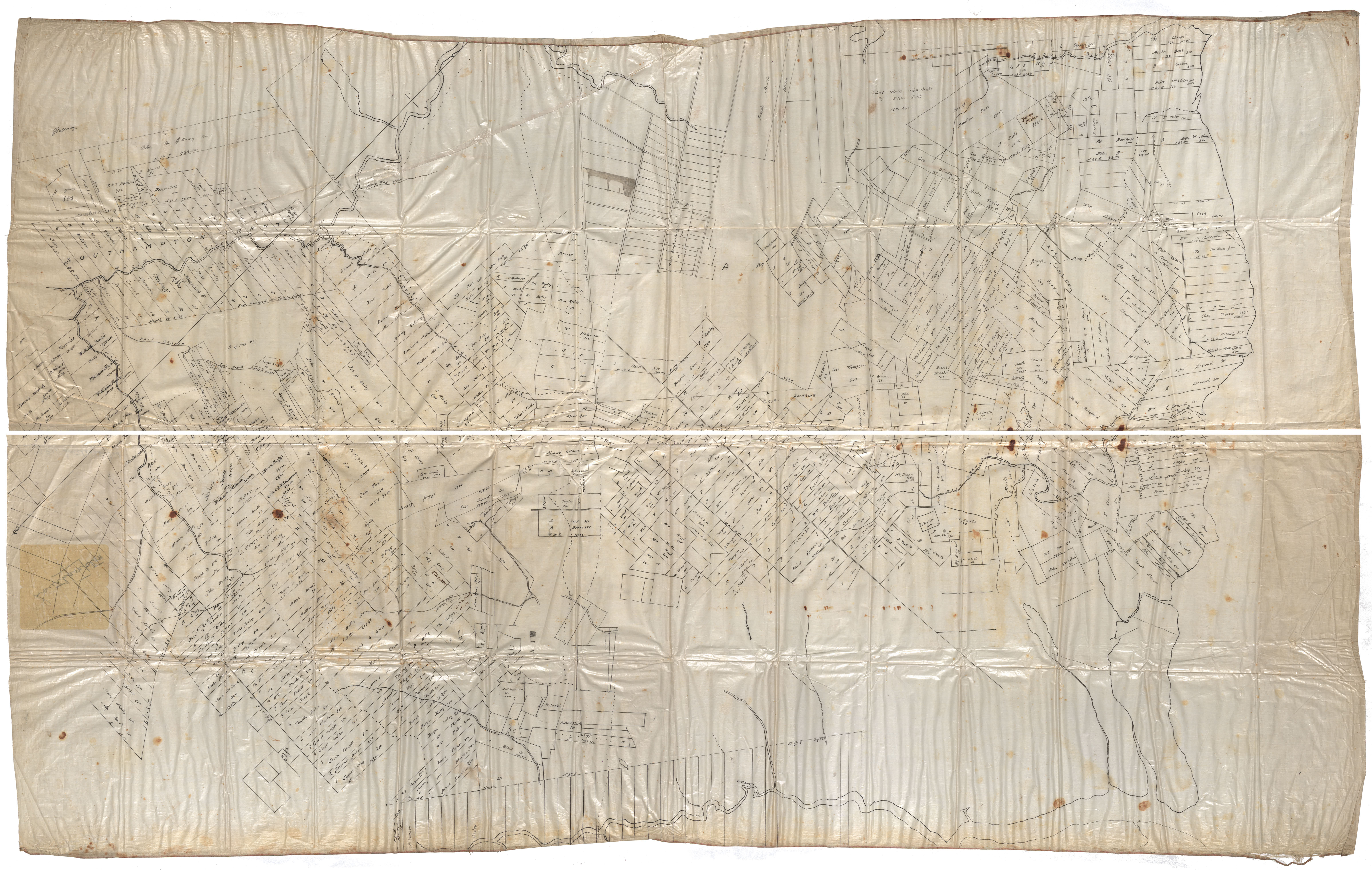
Land Grants Cumberland County
Date: 1871
Reference: Nova Scotia Archives Map Collection: F/220 - 1871
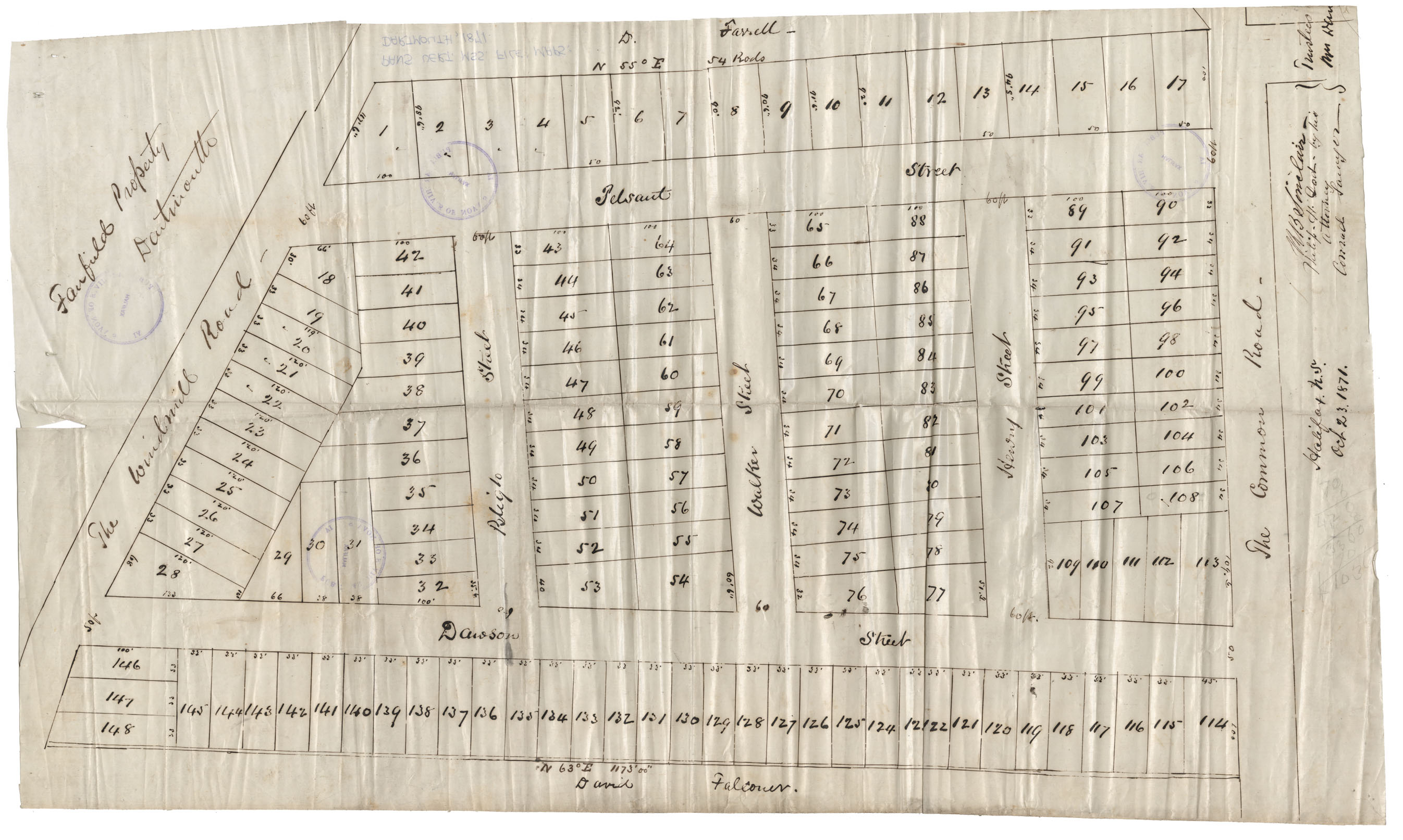
Maps: Dartmouth, 1871: Area bounded on West by the Windmill Rd, on East by Common Rd, on North by D.Fanell property, on South by David Falconer (Fairfield property)
Date: 23 October 1871
Reference: Nova Scotia Archives Map Collection: F/239 - 1871
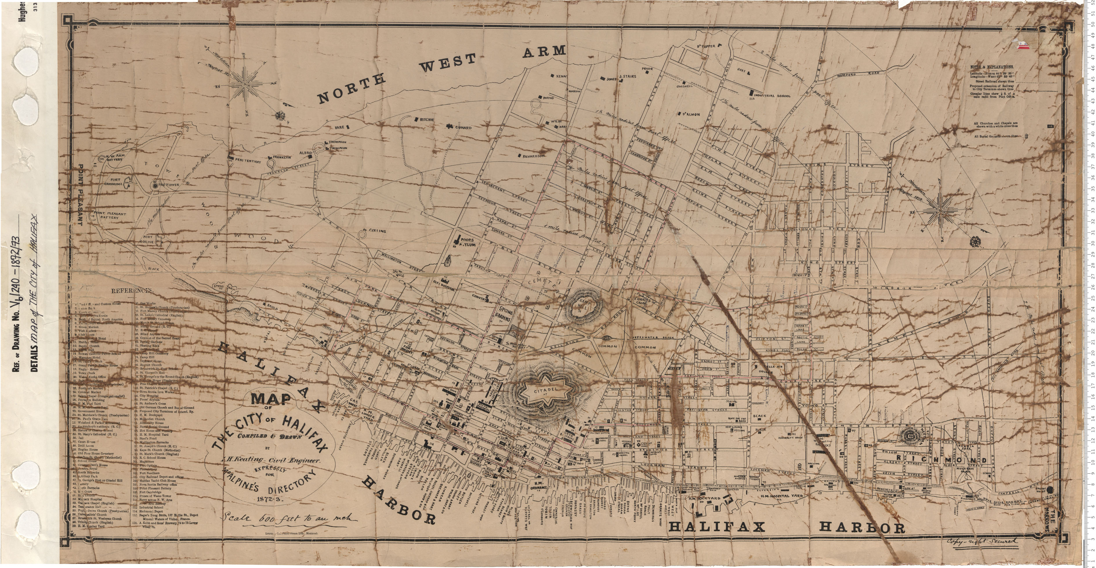
Map of the City of Halifax
Date: 1872/73
Reference: Nova Scotia Archives Map Collection: V6 240 Halifax, Nova Scotia
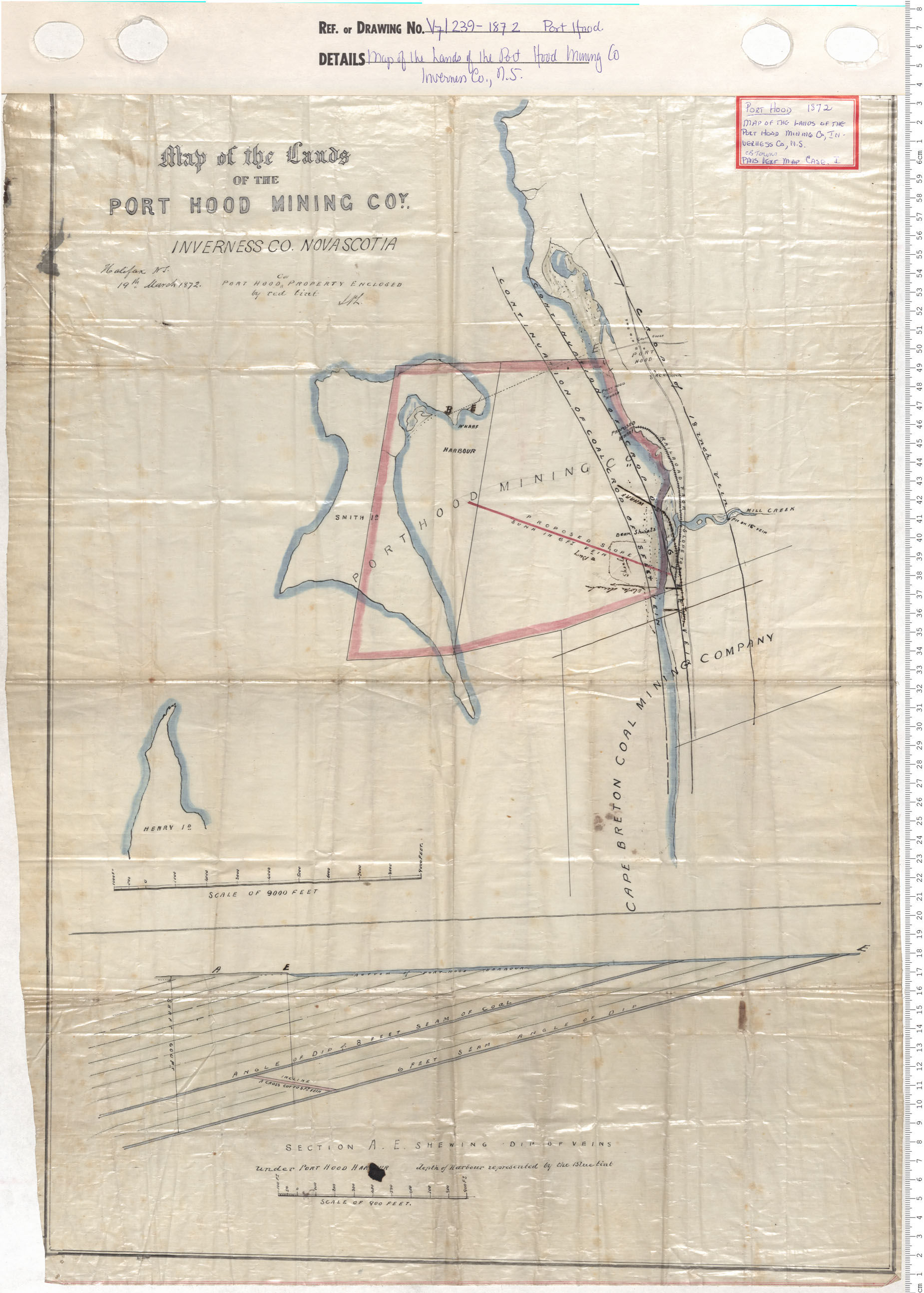
Map of the lands of Port Hood Mining Company, Inverness County
Date: 1872
Reference: Nova Scotia Archives Map Collection: V7 239 Port Hood, Nova Scotia