Nova Scotia Archives
Historical Maps of Nova Scotia
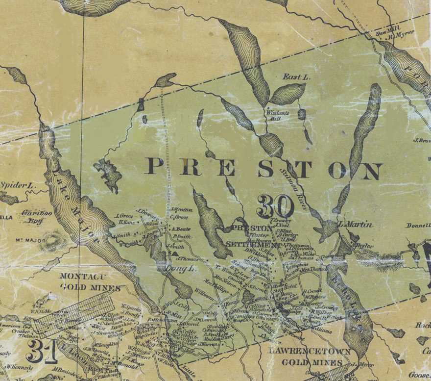
Map detail showing Preston

Map shows Preston some fifty years after it was settled by African American refugees of the War of 1812. It includes the names of property owners and location of significant buildings, including churches, schools and the famed Stag Inn, owned by William Dear.
Date: 1865
Cartographer: A.F. Church & County
Reference: Topographical Township Map of Halifax County, Nova Scotia Nova Scotia Archives Map Collection