Nova Scotia Archives
Historical Maps of Nova Scotia
Results 391 to 405 of 2074 from your search:
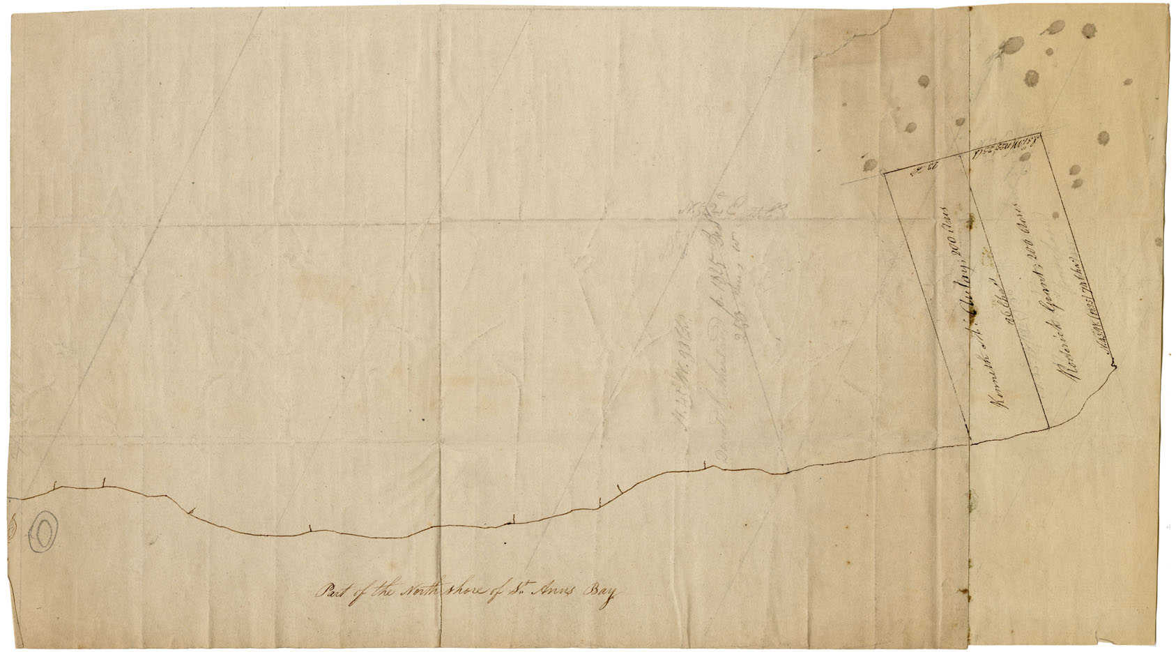
Cape Breton St Ann's Bay w.m.1822
Date: 1822
Reference: Nova Scotia Archives Map Collection: F/240 - 1822
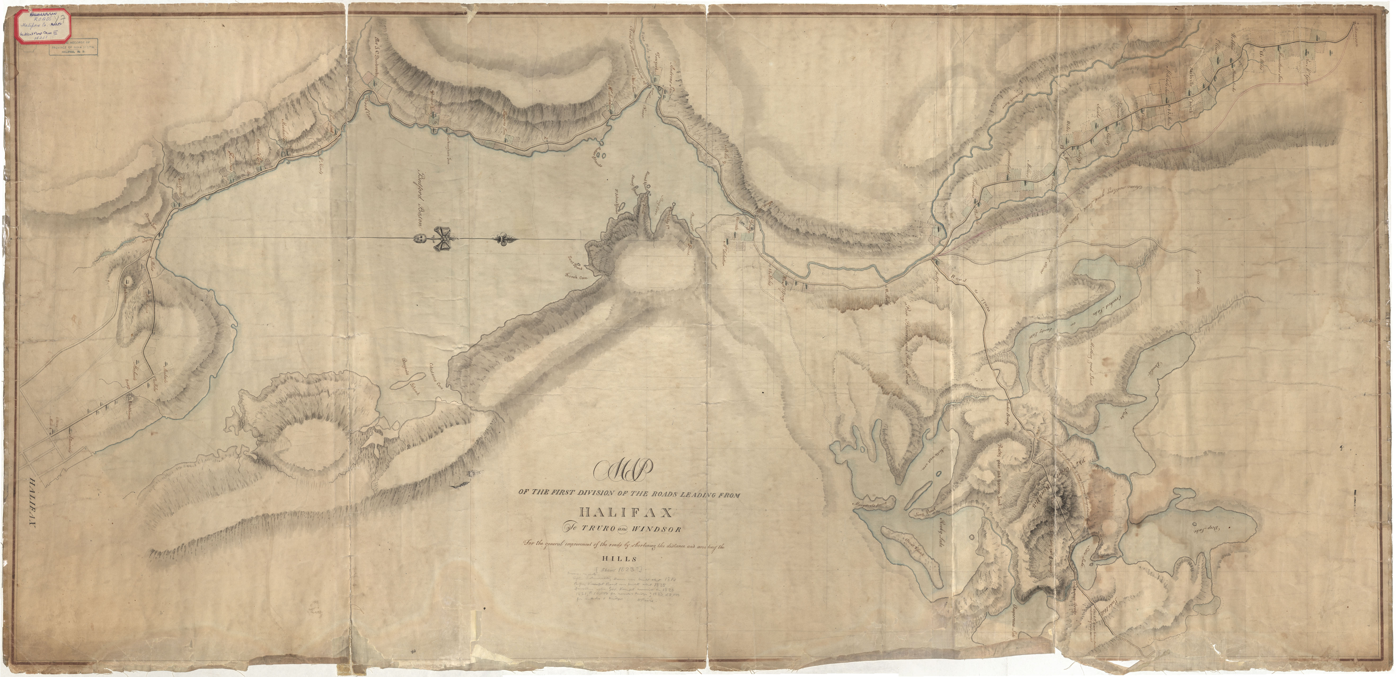
"Map of the First Division of the Roads Leading from Halifax to Truro and Windsor"
Date: 1823
Reference: Nova Scotia Archives Map Collection: R.E.O. Y7
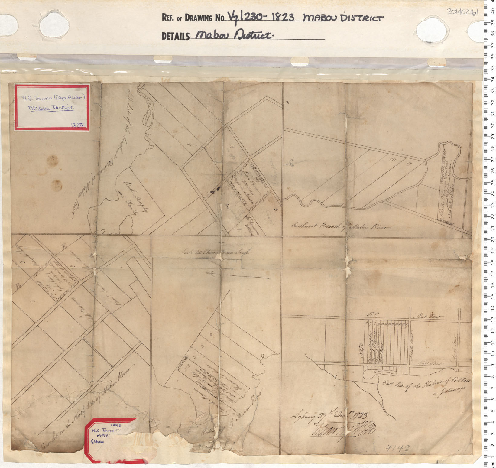
Mabou District
Date: 1823
Reference: Nova Scotia Archives Map Collection: V7 230 Mabou District, Nova Scotia
Roads from Halifax to Truro & Windsor
Date: 1823
Reference: Nova Scotia Archives Royal Engineers Maps and Plans Y.07
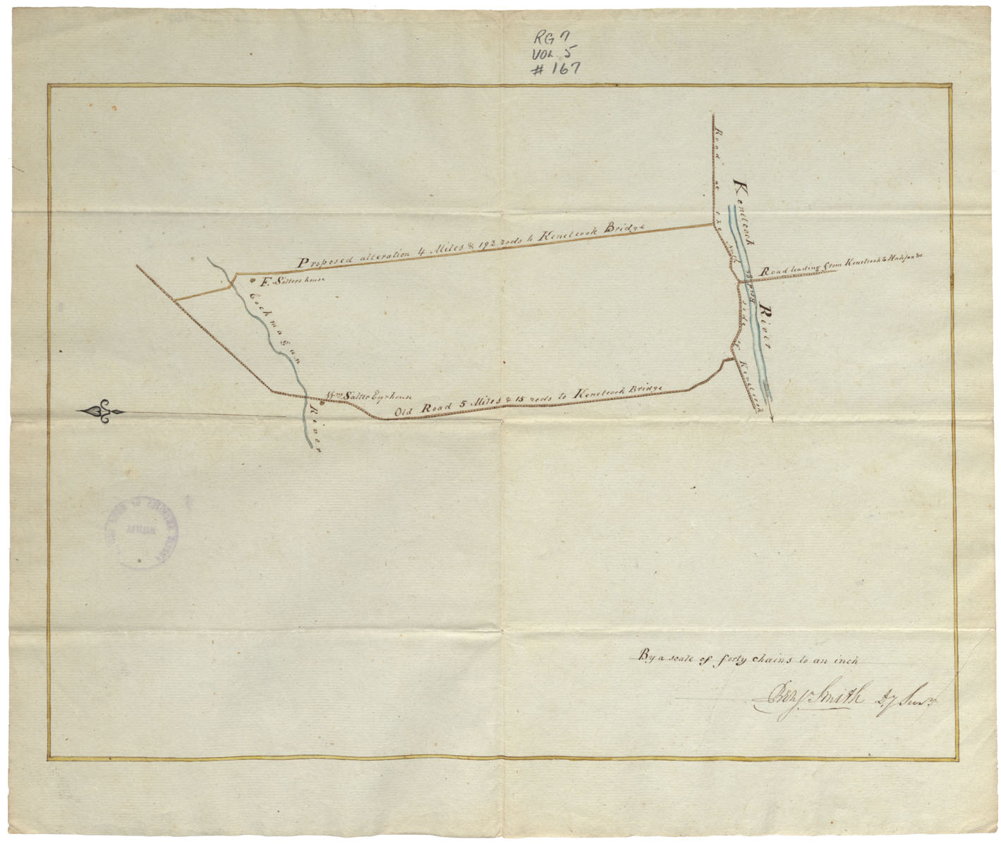
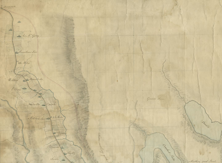
Proposed new road between the Cockmagun River and the Kennetcook R. in Hants County
Date: 1823
Reference: Nova Scotia Archives Map Collection: F/209 - 1823
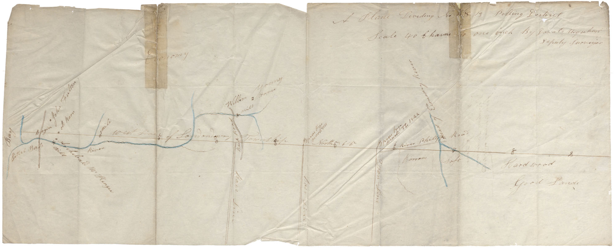
Colchester County West line of Londonderry Township from Little Bass Mill to River Phillips Road. Plan dividing No. 12 & 13 Polling District
Date: 1823
Reference: Nova Scotia Archives Map Collection: F/230
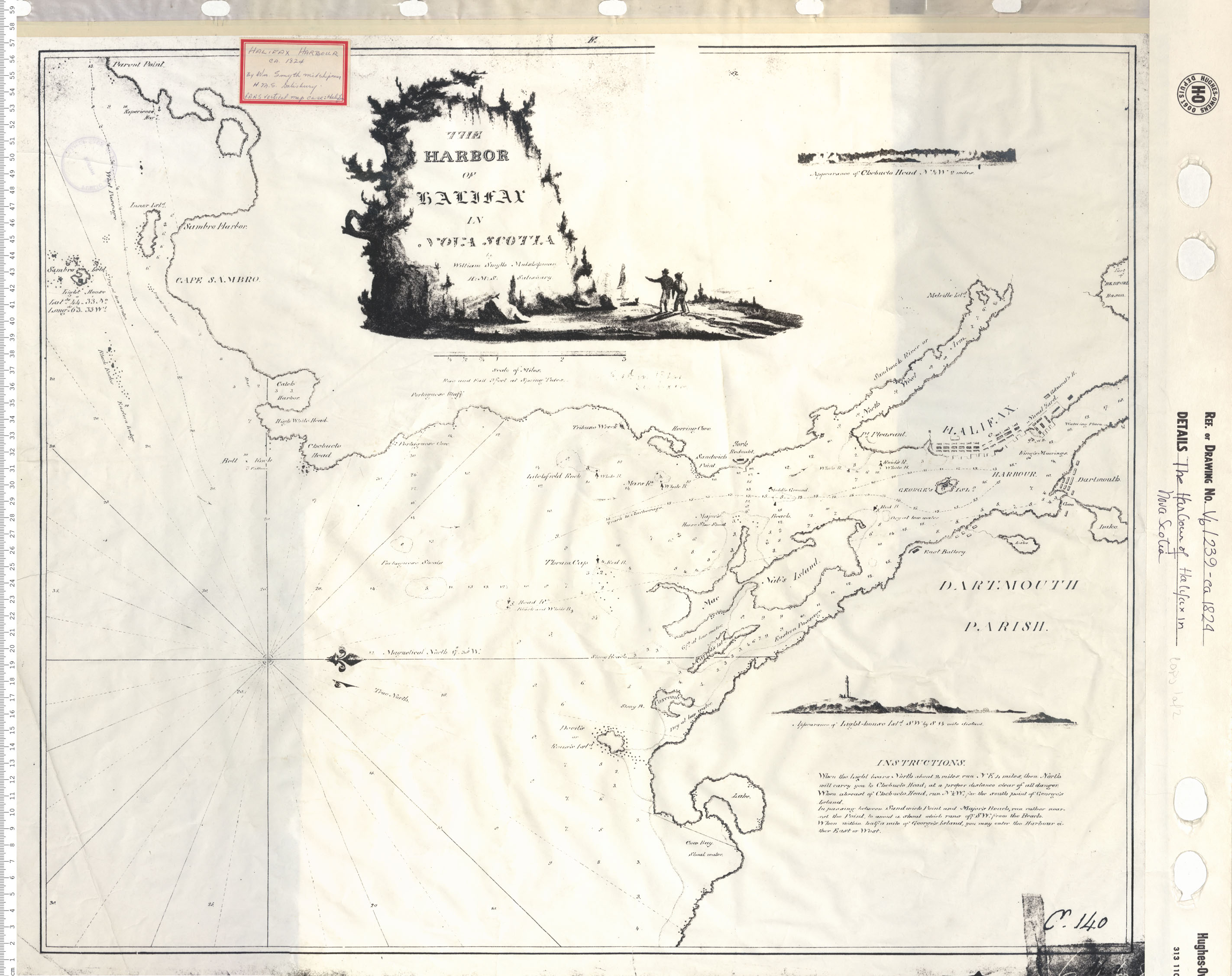
The Harbour of Halifax Nova Scotia
Date: 1824
Reference: Nova Scotia Archives Map Collection: V6 239 Halifax, Nova Scotia
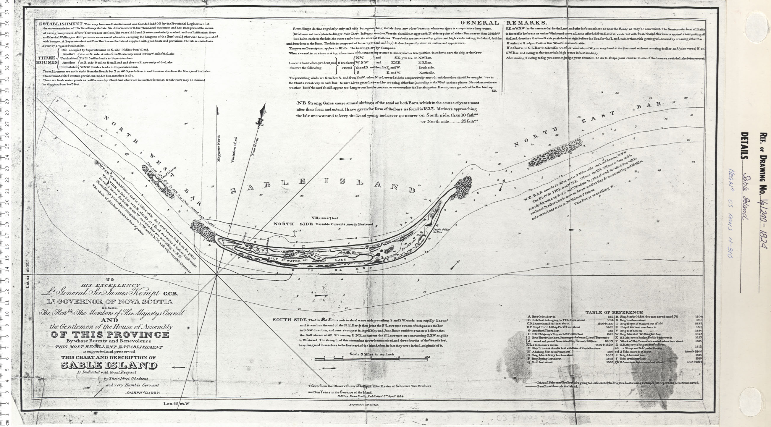
Sable Island
Date: 1824
Reference: Nova Scotia Archives Map Collection: V7 240 Sable Island, Nova Scotia
Division Line Between Annapolis and Kings County
Date: 1824
Reference: Nova Scotia Archives Map Collection: F/230 - 1824
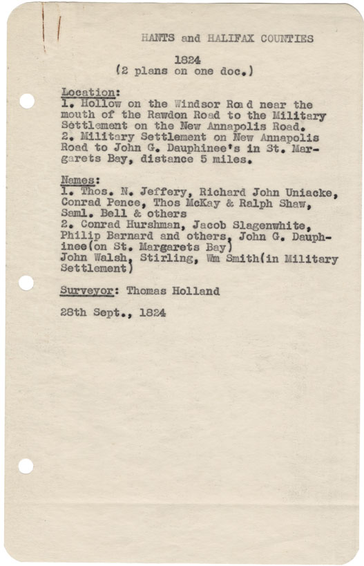
Hollow on the Windsor near the moth of the Rawdon Rd. to the military settlement on the new Annapolis Road. 2) Military settlement on New Annapolis Rd to John G. Dauphinee's in St.Margaret's Bay
Date: 28 September 1824
Reference: Nova Scotia Archives Map Collection: F/230 - 1824
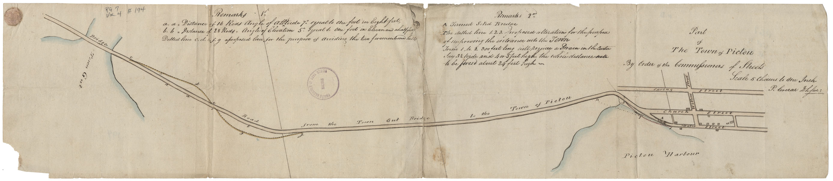
Part of the Town of Pictou By Order of the Commissioners of Streets
Date: 1824
Reference: Nova Scotia Archives Map Collection: F/239 - 1824
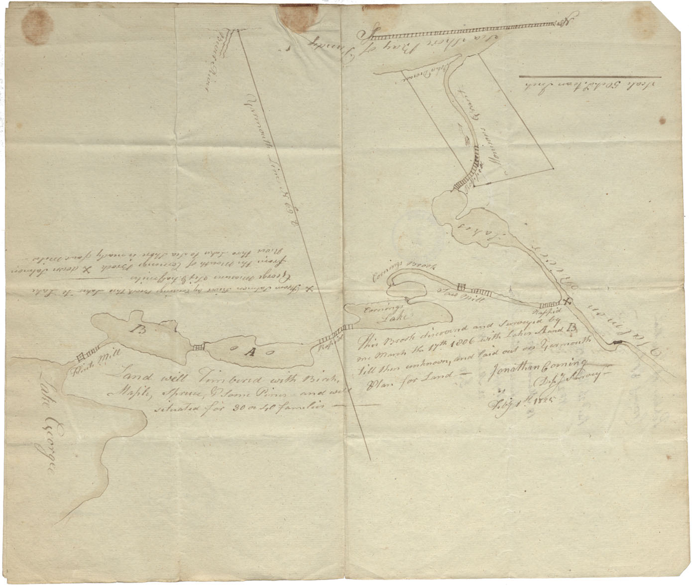
Plan from Lake George to Salmon River
Date: 1 February 1825
Reference: Nova Scotia Archives Map Collection: F/220 - 1825

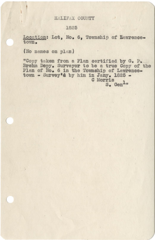
Halifax County Lot No6, Township of Lawrencetown 1825
Date: January 1825
Reference: Nova Scotia Archives Map Collection: F/230 - 1825
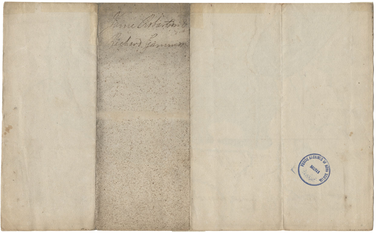
A true copy from the…original Plans of Lawrencetown
Date: 14 January 1825
Reference: Nova Scotia Archives Map Collection: F/239 - 1825