Nova Scotia Archives
Historical Maps of Nova Scotia
Results 346 to 360 of 2074 from your search:
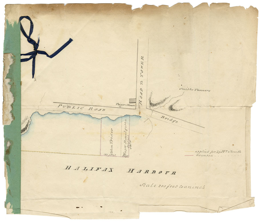
Water Lots at foot of Inglis Street
Date: 1816
Reference: Nova Scotia Archives Map Collection: F/240 - 1816
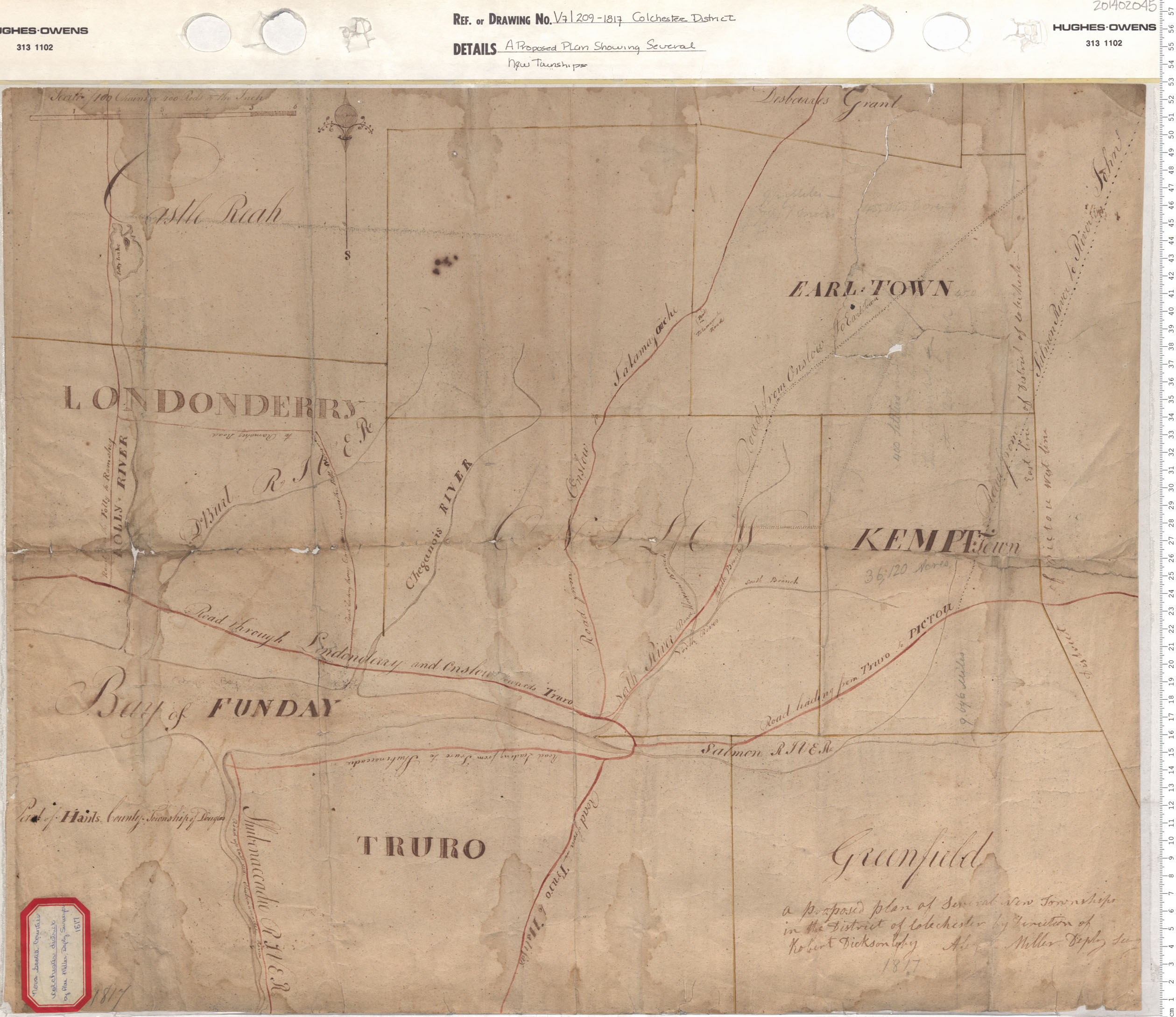
A Proposed Plan Showing Several New Townships
Date: 1817
Reference: Nova Scotia Archives Map Collection: V7 209 Colchester District, Nova Scotia
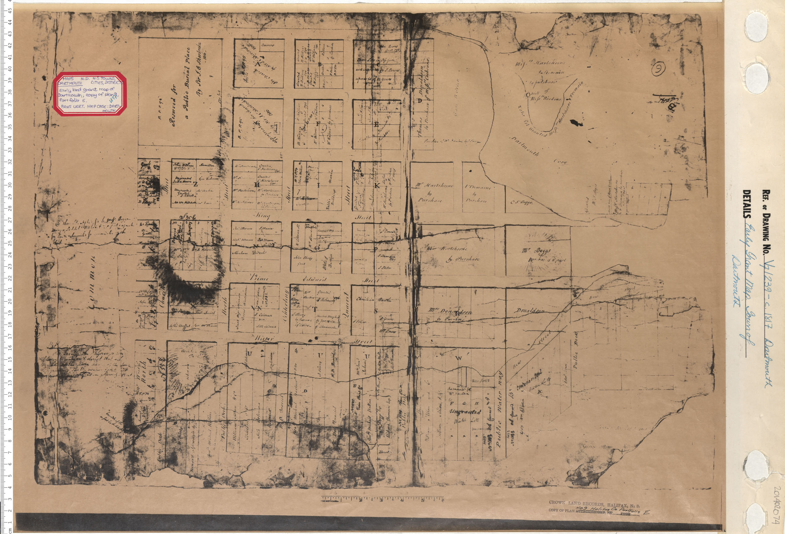
Early Grant Map. Town of Dartmouth
Date: 1817
Reference: Nova Scotia Archives Map Collection: V7 239 Dartmouth, Nova Scotia

Description of the Routs and Distances to different Place in the Province of New Brunswick
Date: 1817
Reference: Nova Scotia Archives Royal Engineers Maps and Plans R.07
Surveys of Roads from Halifax to Windsor; Halifax to Truro
Date: 1817
Reference: Nova Scotia Archives Map Collection: F/209 - 1817
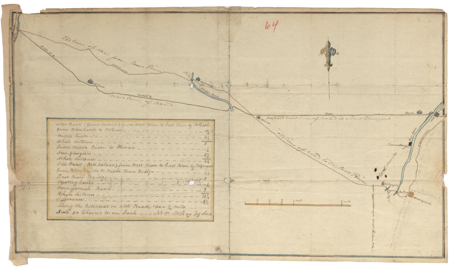
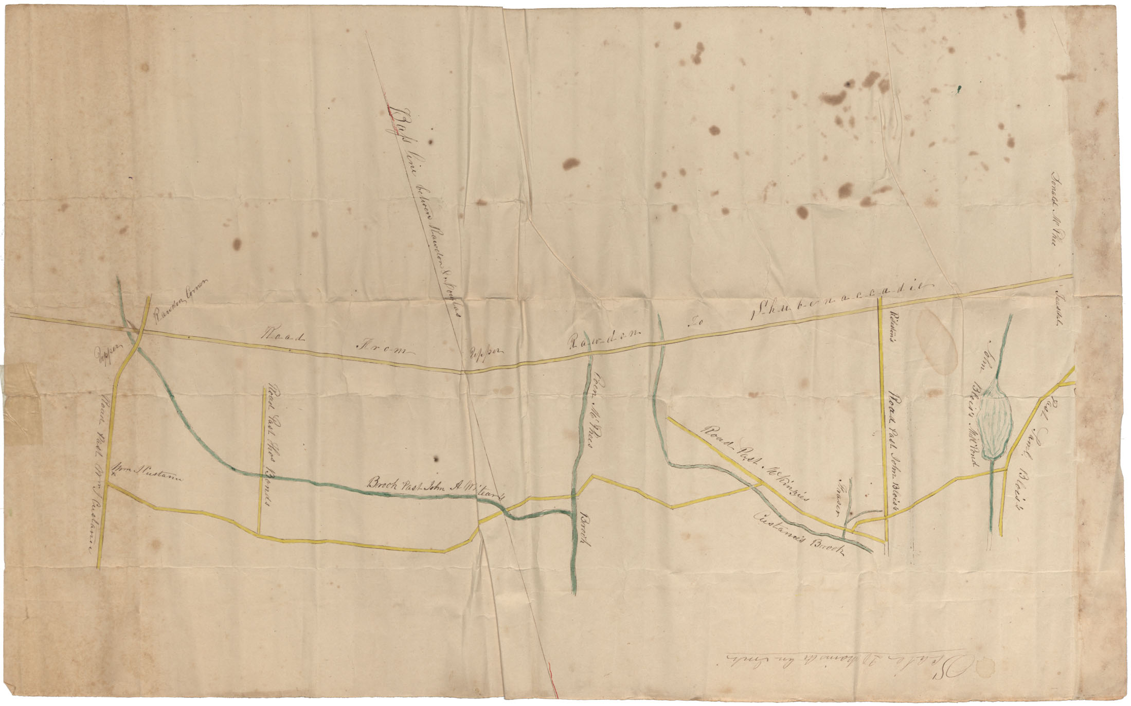
Road from West River (Blanchard's) to East River (New Glasgow)
Date: 1817
Reference: Nova Scotia Archives Map Collection: F/209 - 1817
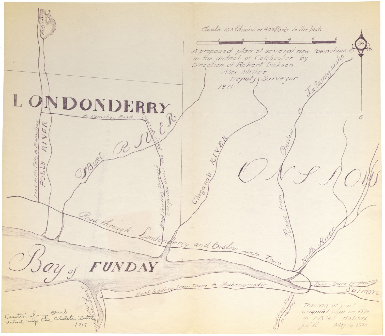
A proposed plan of several new townships in the District of Colchester by direction of Robert Dickson, Alex Miller D.S. 1817
Date: 1817
Reference: Nova Scotia Archives Map Collection: F/230 - 1817
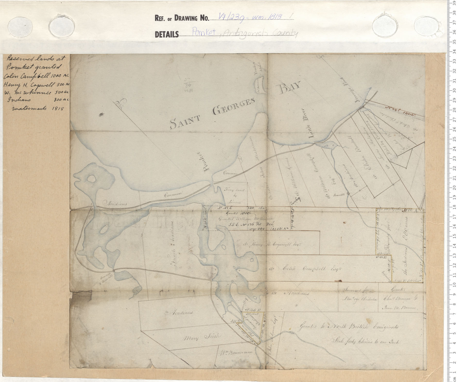
Pomket, Antigonish County
Date: 1818
Reference: Nova Scotia Archives Map Collection: V7 239 Pomket, Nova Scotia
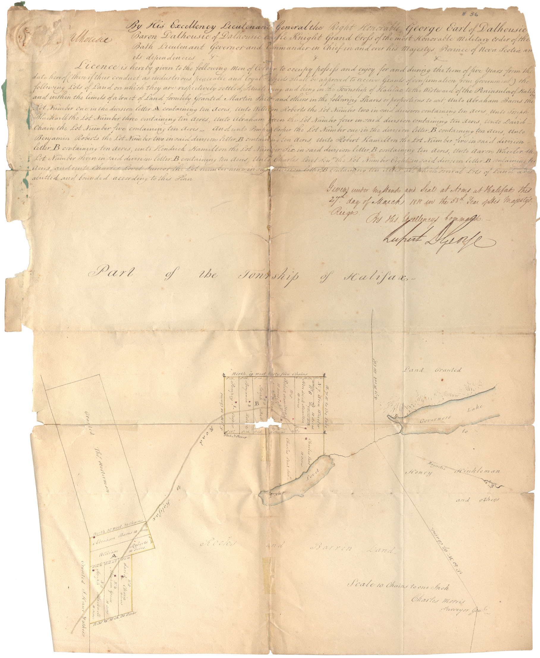
License men of Colour - Pompey Cooper and others, Refugee Hill, Township of Halifax
Date: 1818
Reference: Nova Scotia Archives RG 1 volume 419 number 36 in Map Collection: African Nova Scotians
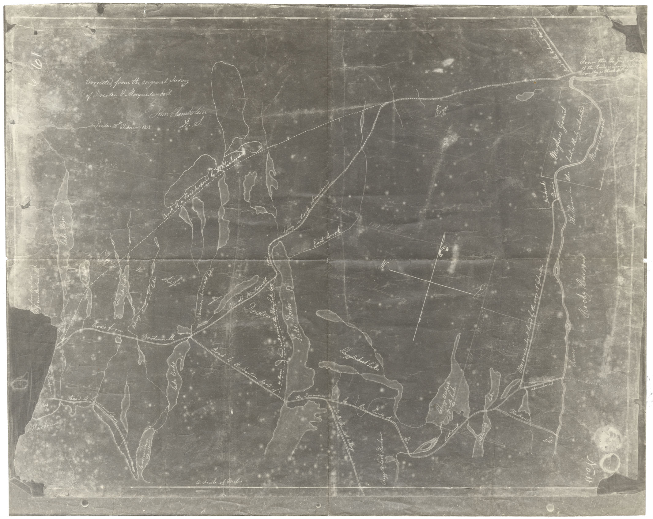
Corrected from Original Survey Preston & Musquodoboit
Date: 1818
Reference: Nova Scotia Archives Map Collection: F/209 - 1818
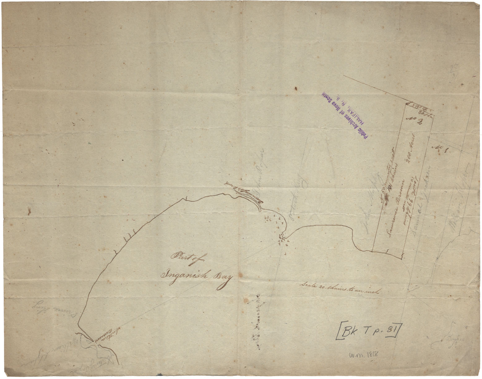
Cape Breton Ingonish Bay BK.T. p.81 w.m.1818
Date: 1818
Reference: Nova Scotia Archives Map Collection: F/210 - 1818
Cape Breton A Sketch of the lots at "Lake Horton" Gut of canso., w.c. 1818
Date: 1818
Reference: Nova Scotia Archives Map Collection: F/210 - 1818
Cape Breton Sketches Great Bras d"Or and Pt. Avone w.m.1818
Date: 1818
Reference: Nova Scotia Archives Map Collection: F/230 - 1818
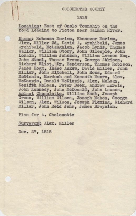
Colchester County East of Onslow Township on the road leading to Pictou near Salmon River 1818
Date: 27 November 1818
Reference: Nova Scotia Archives Map Collection: F/230 - 1818
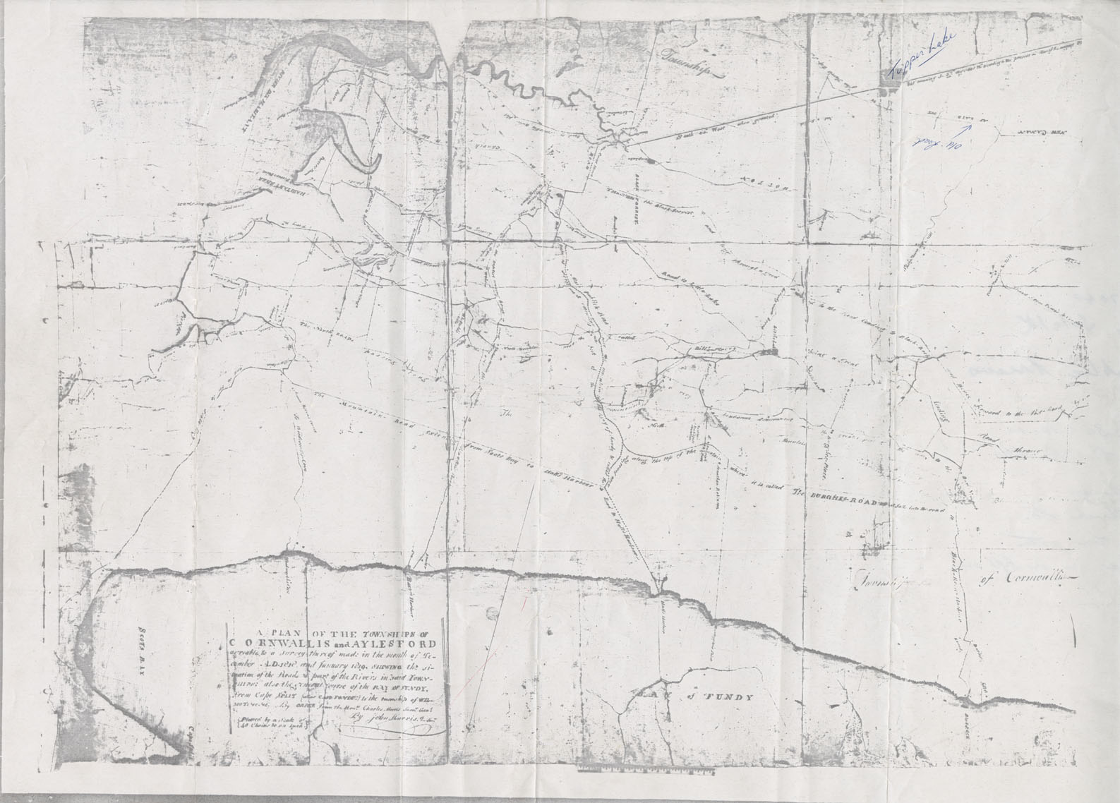
Cornwallis Township A Plan of the Townships of Cornwallis and Aylesford
Date: December 1818
Reference: Nova Scotia Archives Map Collection: F/230 - 1818/19