Nova Scotia Archives
Historical Maps of Nova Scotia
Results 1681 to 1695 of 2074 from your search:
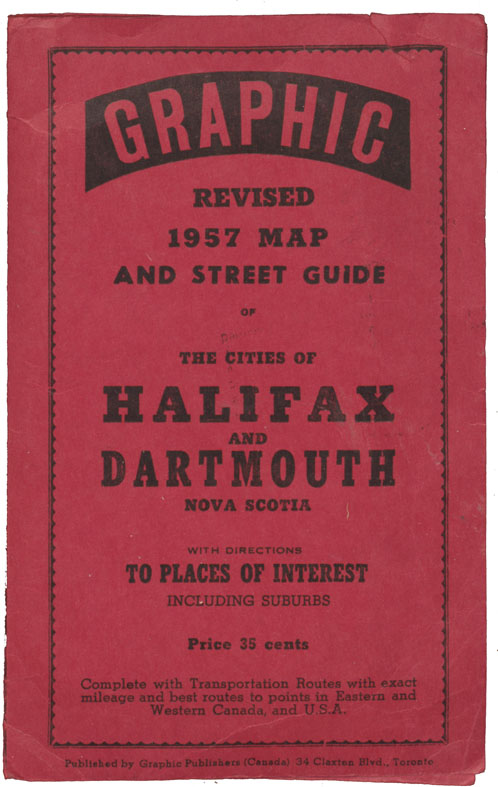
Graphic Revised 1957 Map and Street Guide Halifax & Dartmouth, N.S.
Date: 1957
Reference: Nova Scotia Archives Map Collection: F/239 - 1957
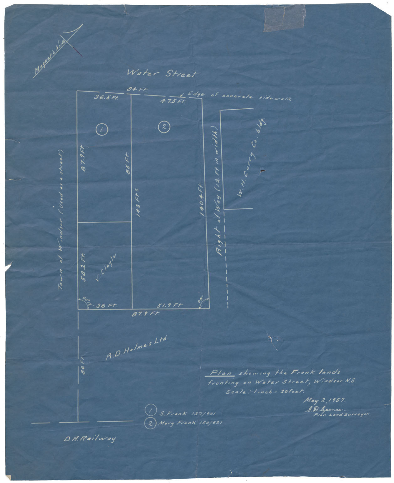
Windsor Plan showing the Frank Lands fronting on Water Street, Windsor, NS
Date: 2 May 1957
Reference: Nova Scotia Archives Map Collection: F/239 - 1957
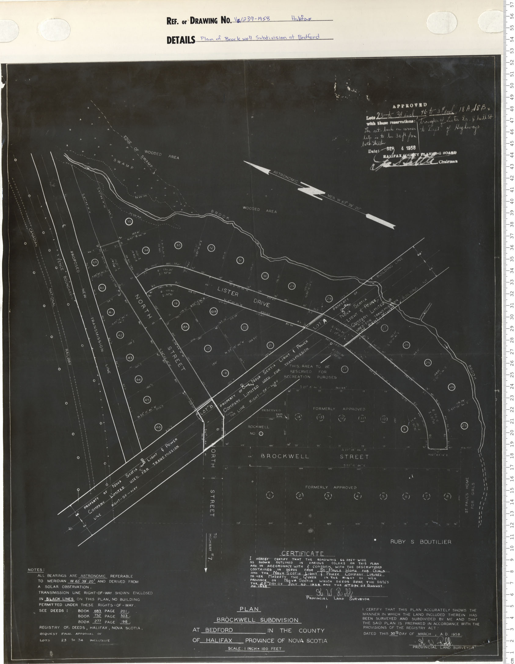
Plan of brockwell Subdivision at Bedford
Date: 1958
Reference: Nova Scotia Archives Map Collection: V6 239 Halifax, Nova Scotia
New Road Settlement
Date: 1958
Reference: Nova Scotia Archives Map Collection: V7 239 Halifax County, Nova Scotia
The Maritime Provinces Imperial Oil
Date: 1958
Reference: Nova Scotia Archives Map Collection: F/200 - 1958
Halifax Internation Airport Plan showing Lands affected by Zoning Requirements
Date: 13 March 1958
Reference: Nova Scotia Archives Map Collection: F/239 - 1958
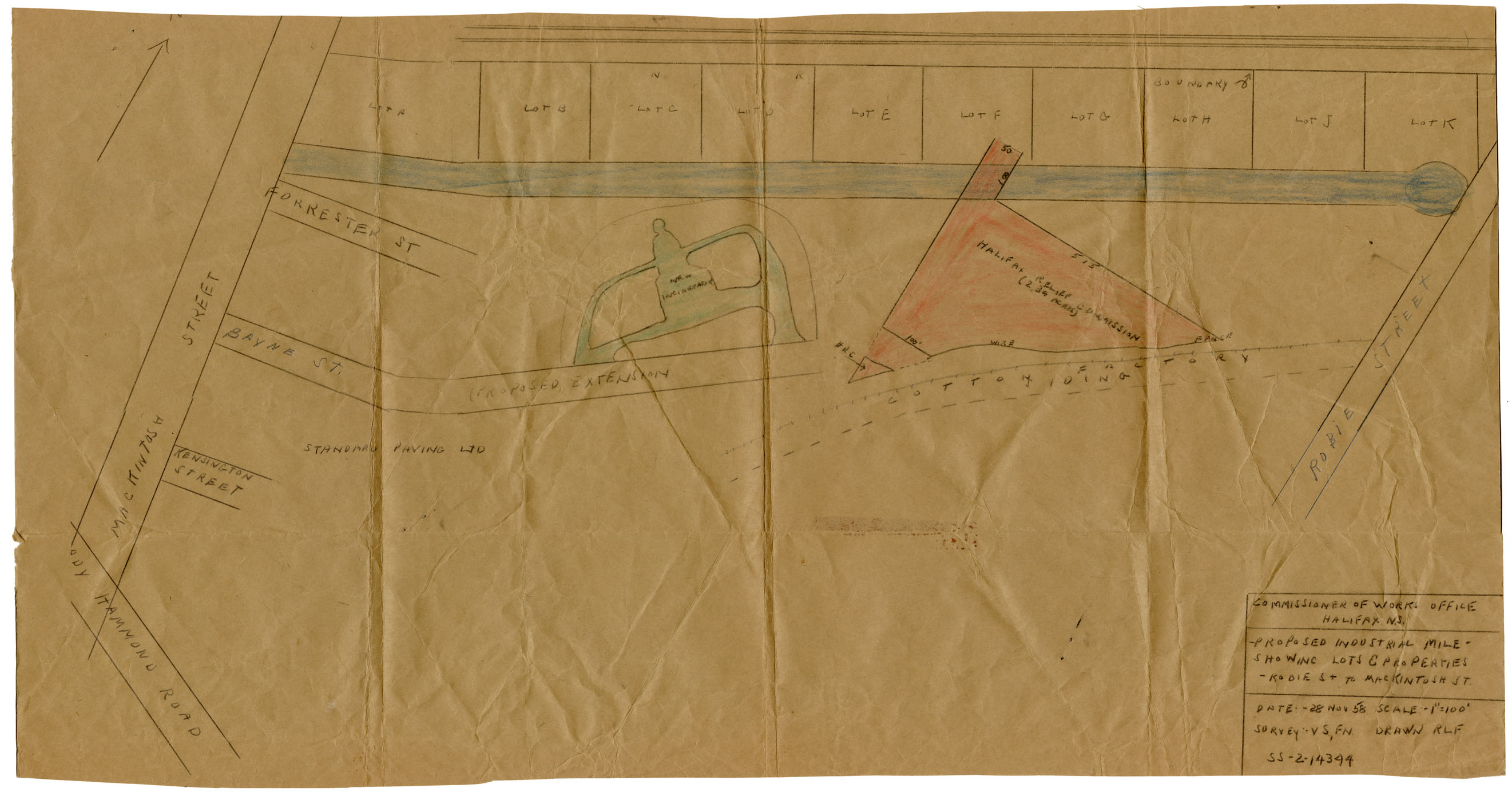
Proposed Industrial Mile Showing Lots and Properties Robie St to MacKintosh St
Date: 28 November 1958
Reference: Nova Scotia Archives Map Collection: F/240 - 1958
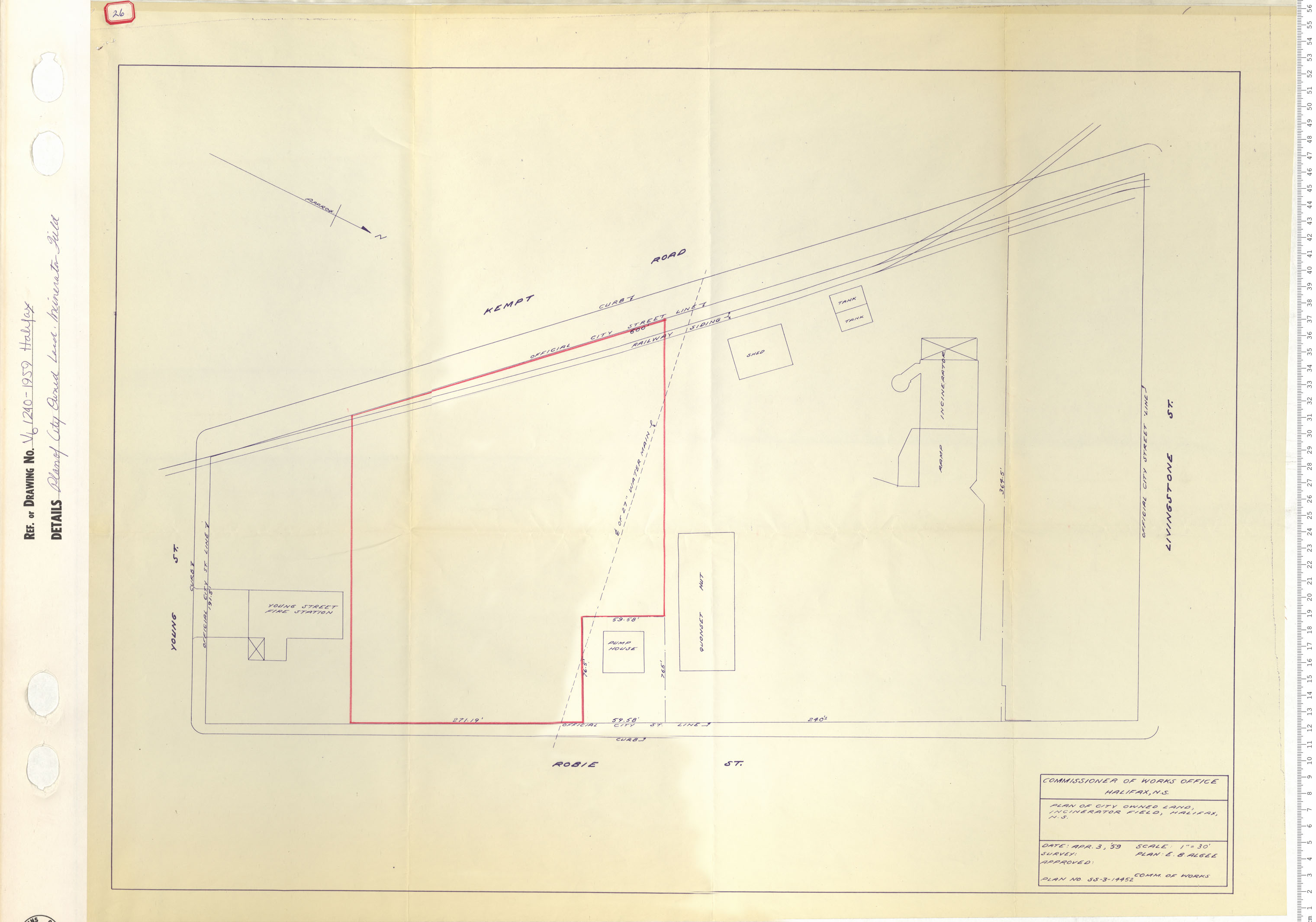
Plan of City owned Land Incinerator Field
Date: 1959
Reference: Nova Scotia Archives Map Collection: V6 240 Halifax, Nova Scotia
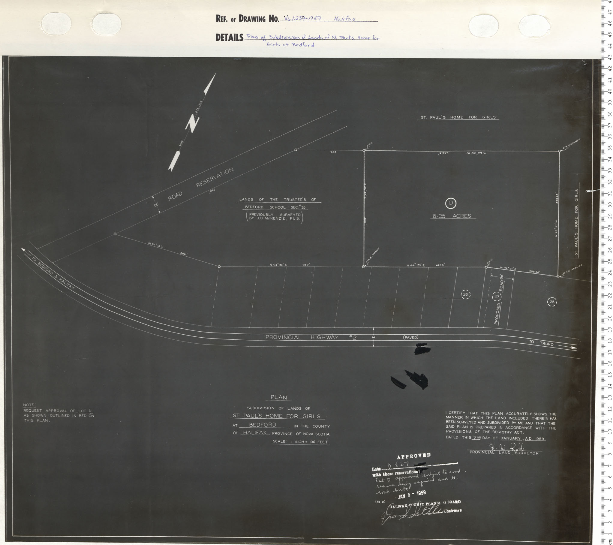
Plan Showing Property belonging to St Paul's Home for Girls at Bedford
Date: 1959
Reference: Nova Scotia Archives Map Collection: V6 239 Halifax, Nova Scotia
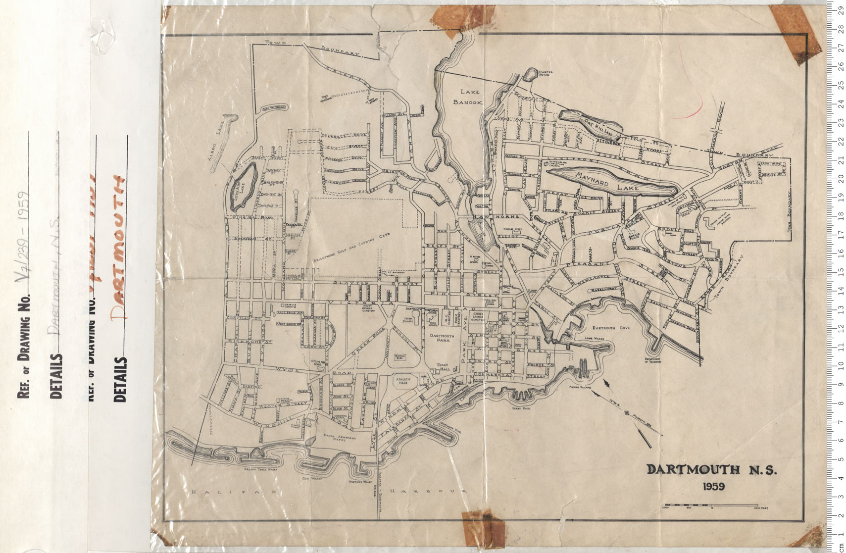
Dartmouth, N.S.
Date: 1959
Reference: Nova Scotia Archives Map Collection: V7 239 Dartmouth, Nova Scotia
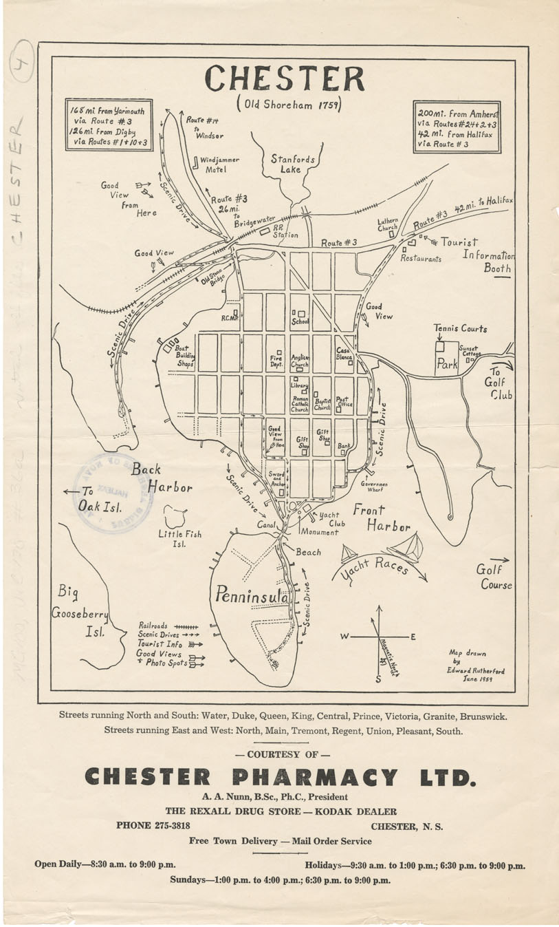
Chester (Old Shoreham 1759)
Date: June 1959
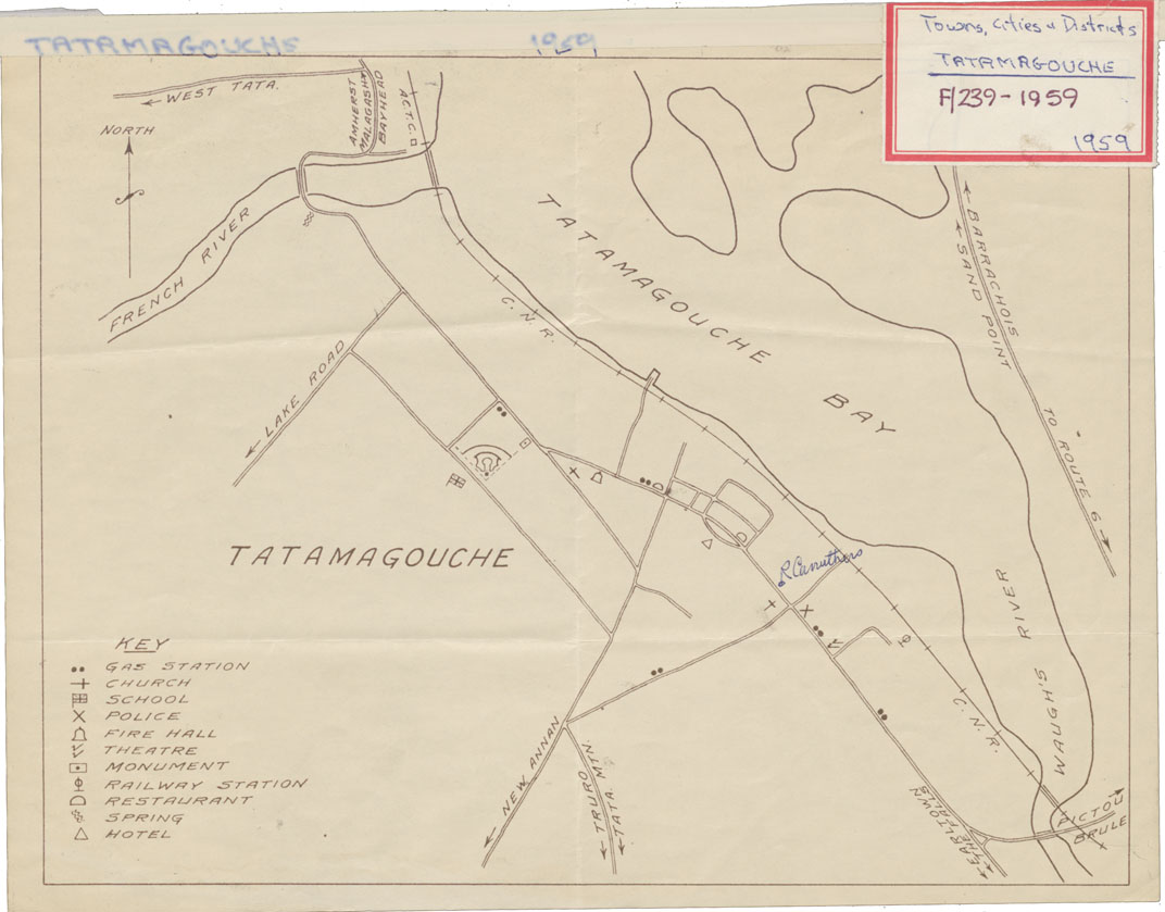
Reference: Nova Scotia Archives Map Collection: F/239 - 1959
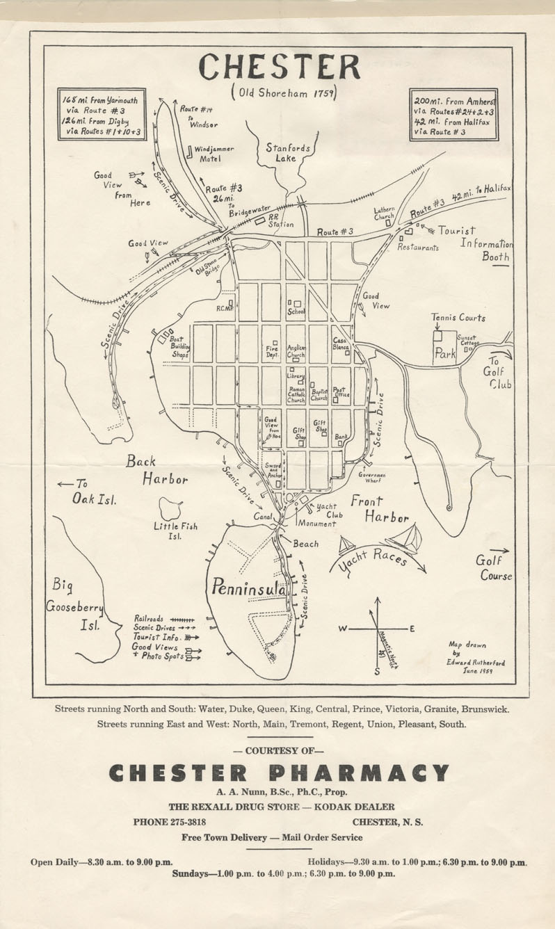
Chester (Old Shoreham 1759)
Date: June 1959
Reference: Nova Scotia Archives Map Collection: F/239 - 1959
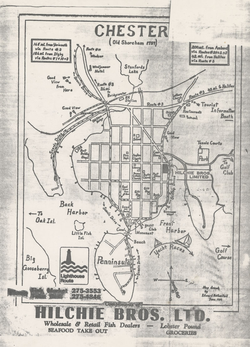
Chester (Old Shoreham 1759)
Date: June 1959
Reference: Nova Scotia Archives Map Collection: F/239 - 1959