Nova Scotia Archives
Historical Maps of Nova Scotia
Results 106 to 120 of 827 from your search: 1900
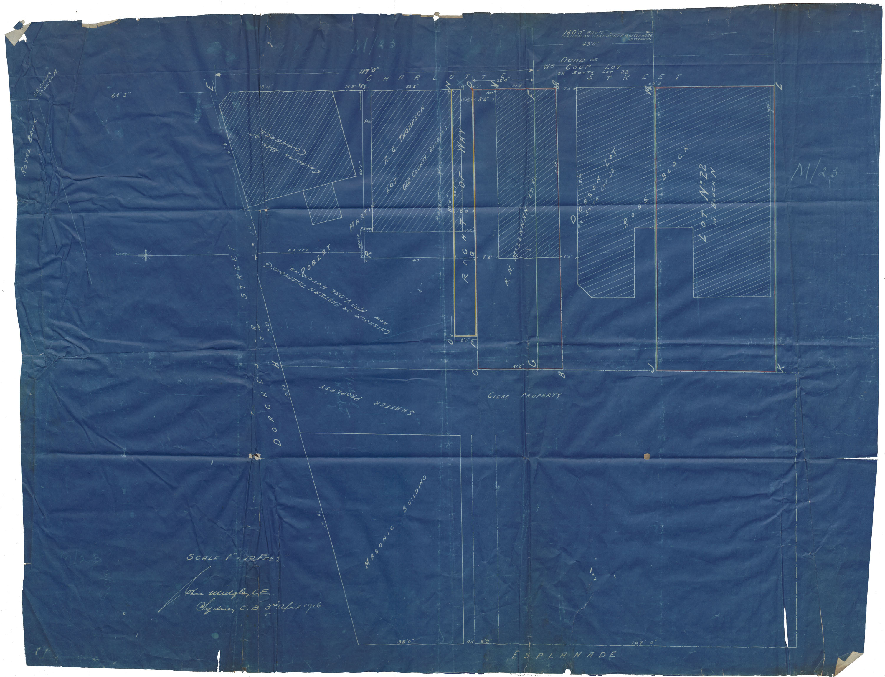
Plan of Sydney the block bounded by Dorchester & Charlotte
Date: 3 April 1916
Reference: Nova Scotia Archives Map Collection: F/240 - 1916
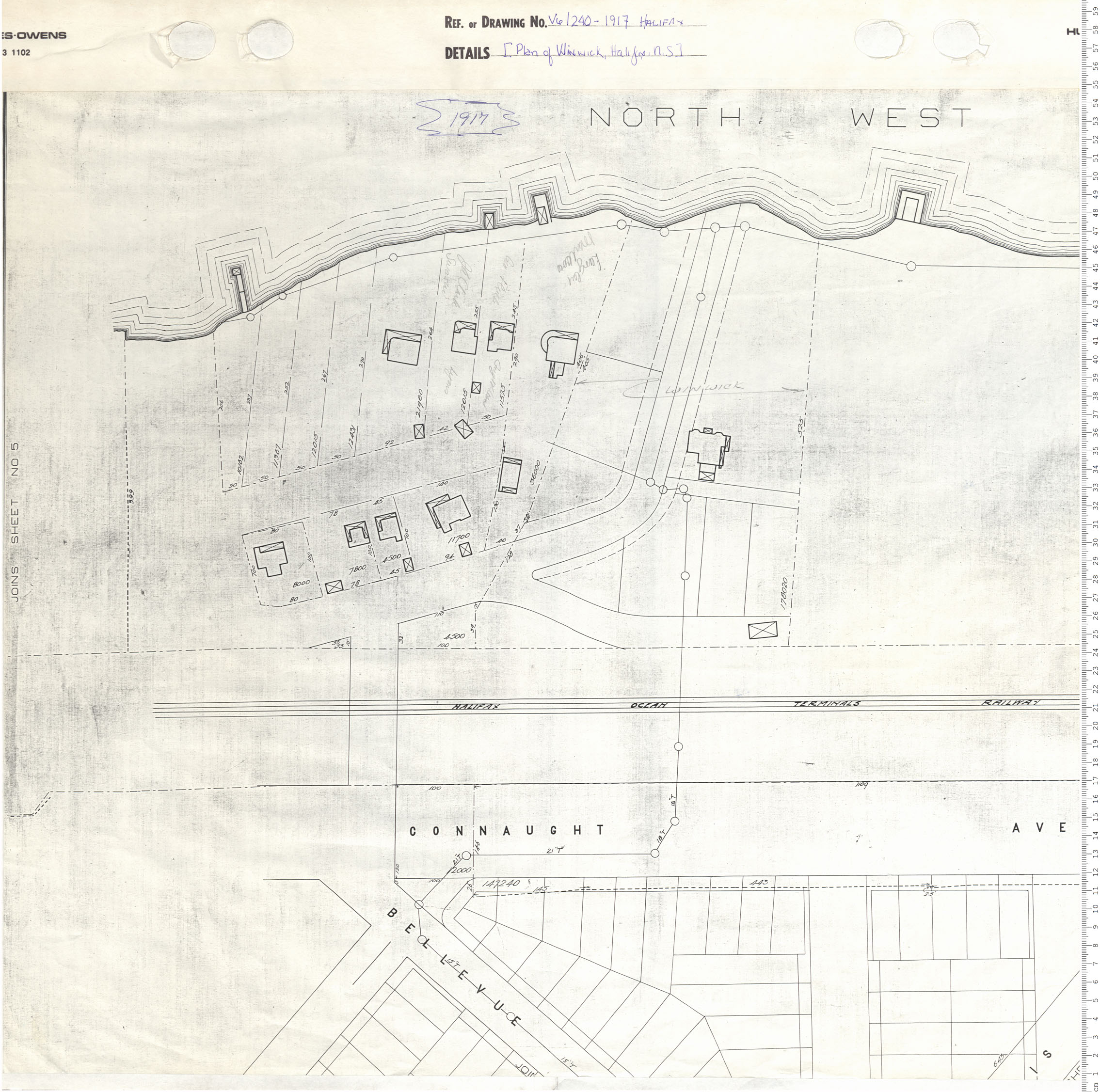
Plan of Winwick, Halifax, N.S.
Date: 1917
Reference: Nova Scotia Archives Map Collection: V6 240 Halifax, Nova Scotia
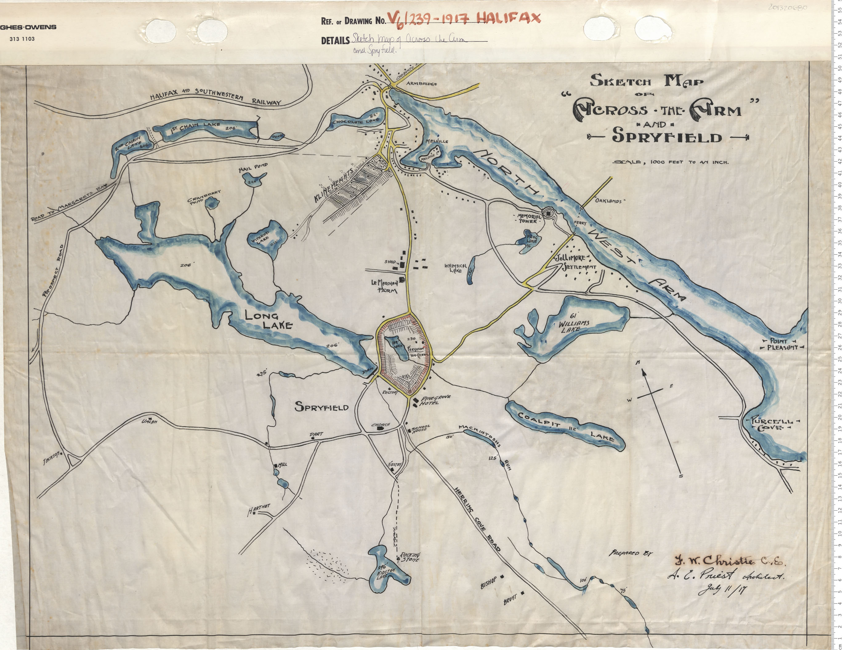
Sketch Map of Across the Arm and Srpyfield
Date: 1917
Reference: Nova Scotia Archives Map Collection: V6 239 Halifax, Nova Scotia
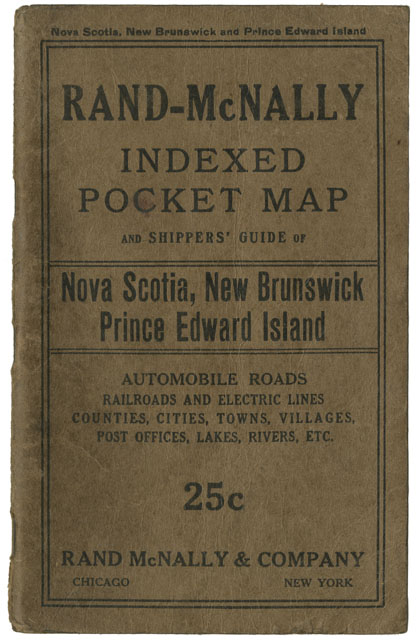
Rand-McNally Indexed Pocket map and Shipper's Guide of N.S., N.B., P.E.I.
Date: 1917
Reference: Nova Scotia Archives Map Collection: F/200 - 1917

Proposed Road Diversion at Woodside, Halifax Co, NS
Date: 1917
Reference: Nova Scotia Archives Map Collection: F/239 - 1917
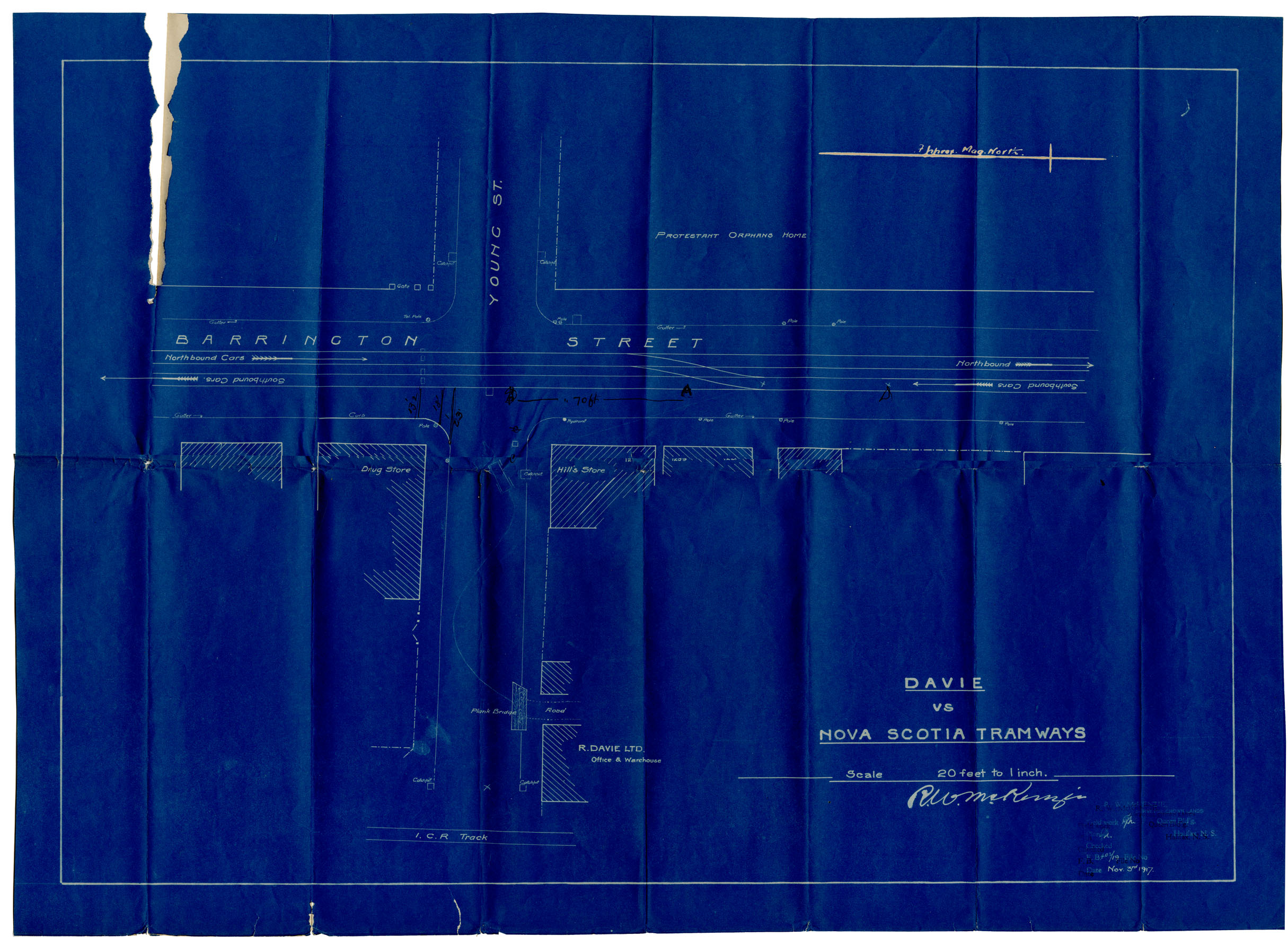
N.S. Tramway & Power County Ltd Plan showing Intersection of Young St & Barrington
Date: 3 November 1917
Reference: Nova Scotia Archives Map Collection: F/240 - 1917
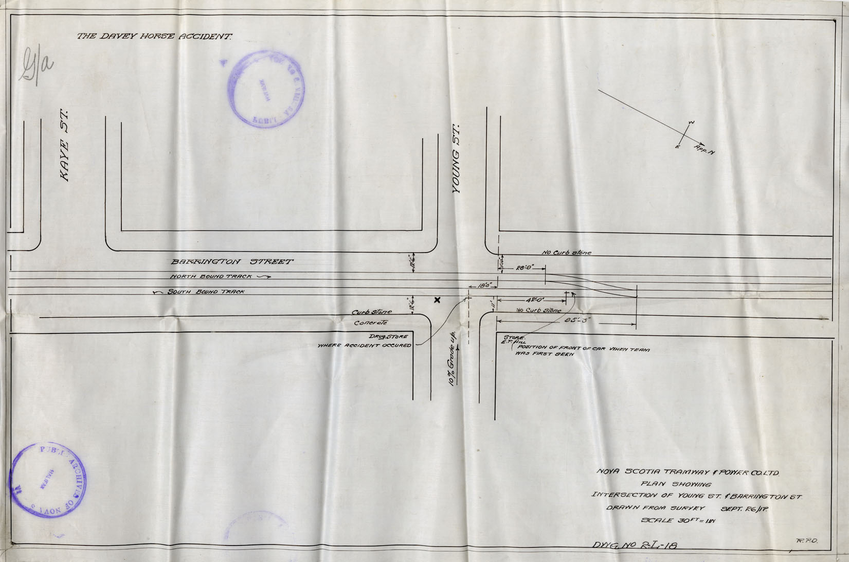
N.S. Tramway & Power County Ltd Plan showing Intersection of Young St & Barrington St
Date: 26 September 1917
Reference: Nova Scotia Archives Map Collection: F/240 - 1917

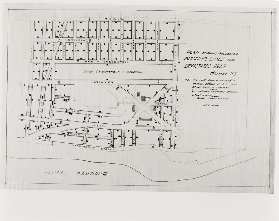
"Plan showing devastated area of Halifax City, N.S."
Date: 1918
Reference: N.S. Board of Insurance Underwriters Nova Scotia Archives Map Collection: V6 240
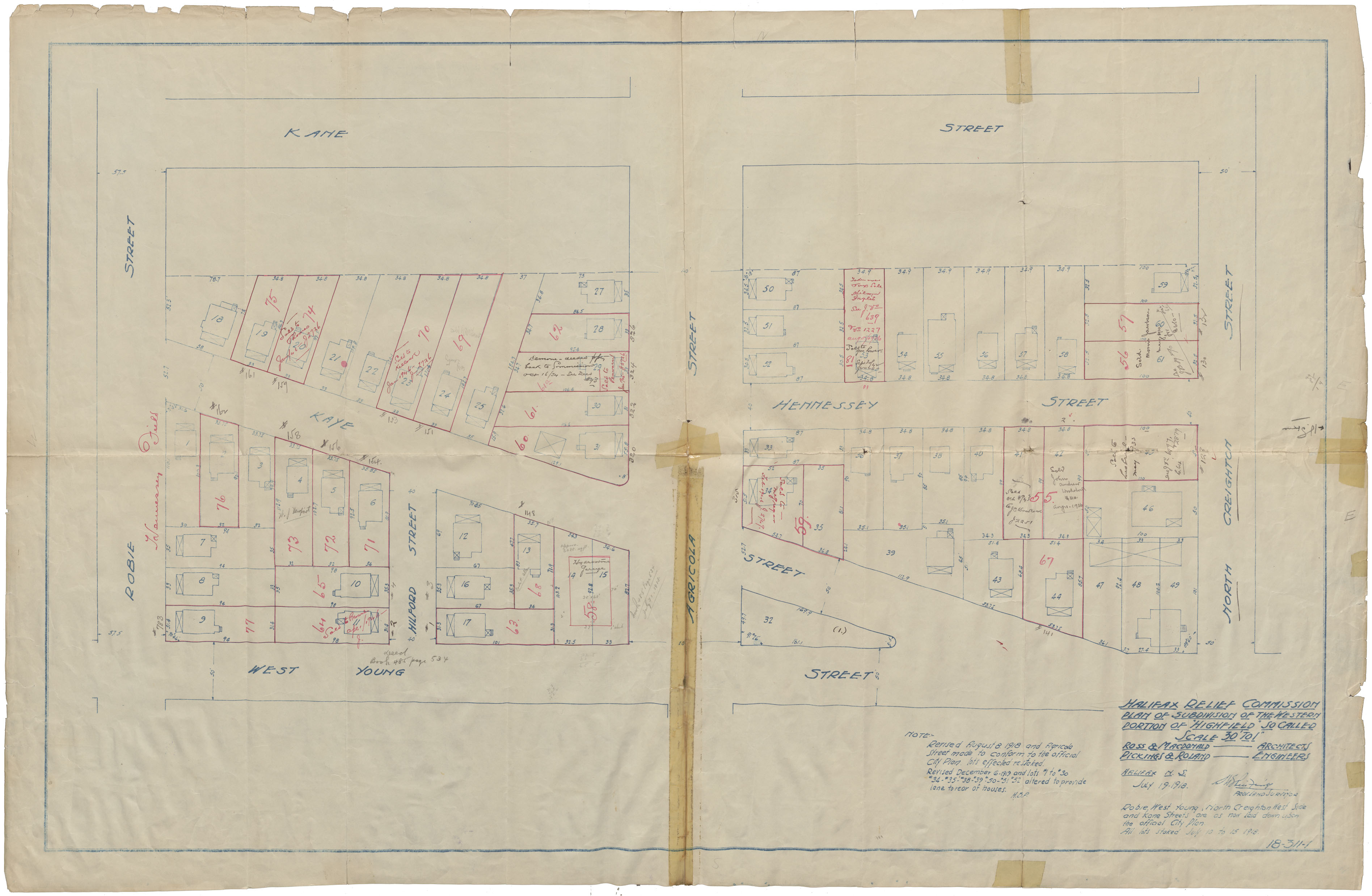
Halifax Relief Commission Plan of Subdivision of the Western Portion of "Highfield" so called
Date: 1918
Reference: Nova Scotia Archives Map Collection: F/240 - 1918
Halifax Re-housing Plan of Devastated Area Indicating Progress Re-housing Undertaken by H.R.C.
Date: 25 October 1918
Reference: Nova Scotia Archives Map Collection: F/240 - 1918
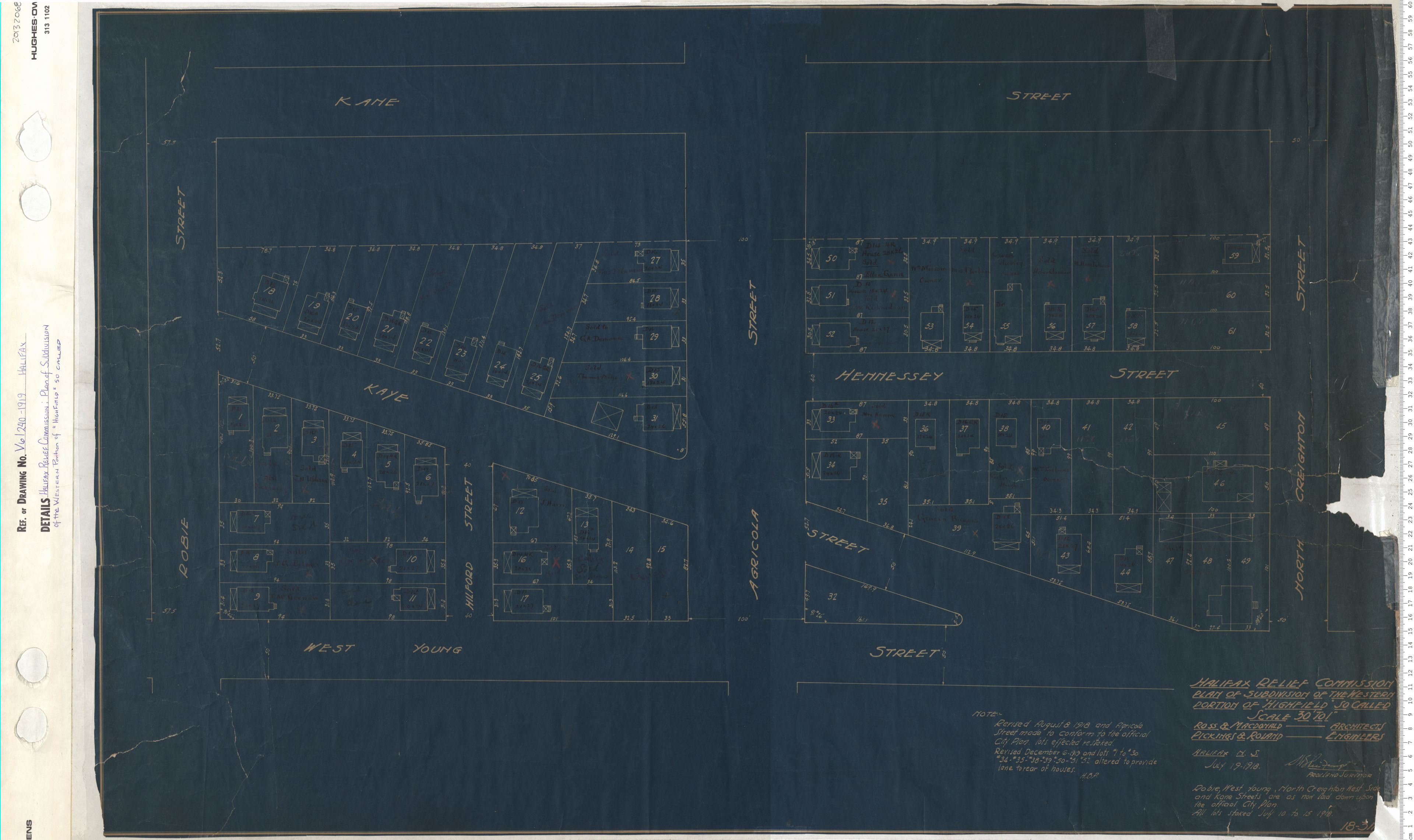
Halifax Relief Commission: Plan of Subdivsion of the Westren Portion of "Highfield" so called
Date: 1919
Reference: Nova Scotia Archives Map Collection: V6 240 Halifax, Nova Scotia
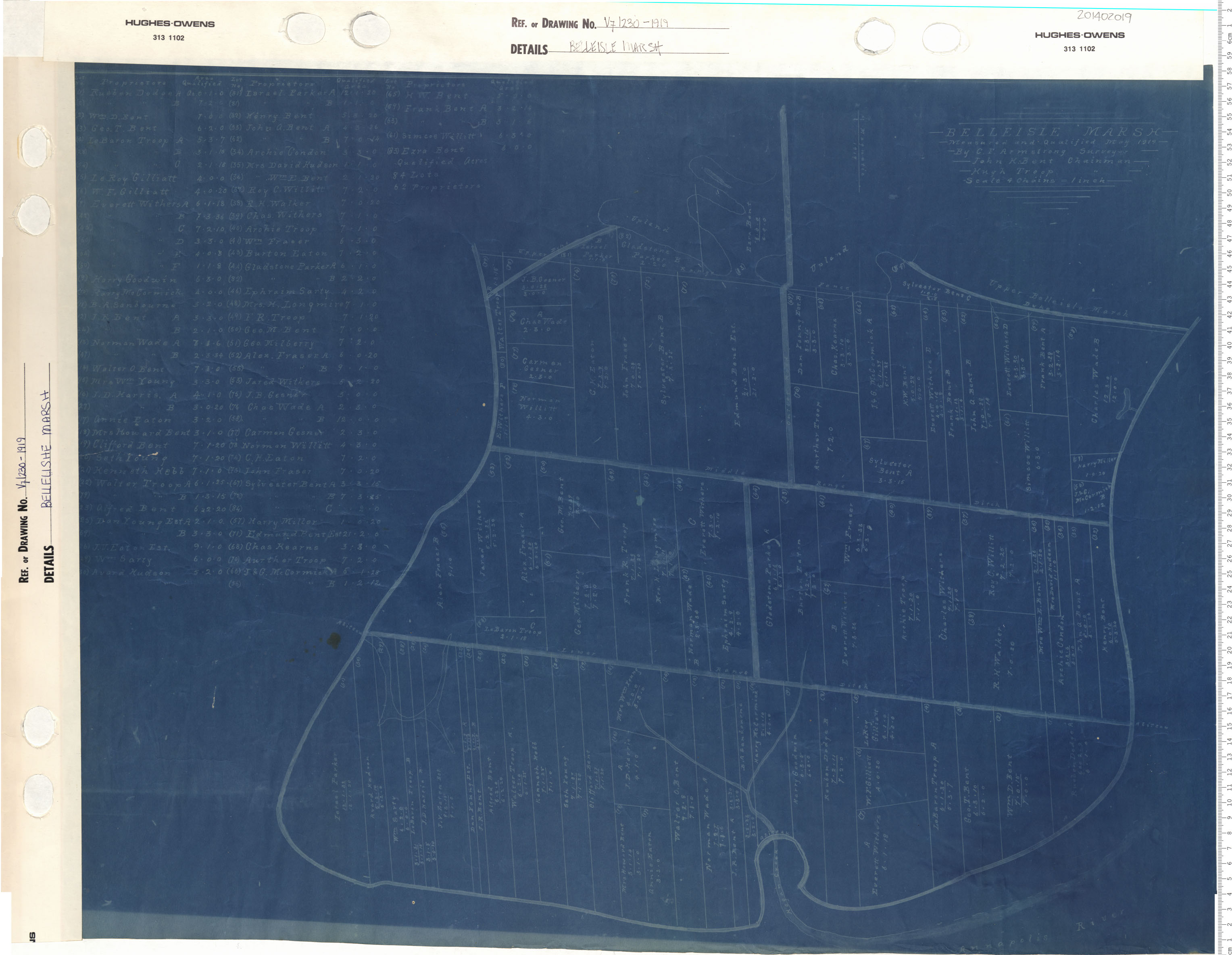
Belleisle Marsh Measured and Qualified May 1919
Date: 1919
Reference: Nova Scotia Archives Map Collection: V7 230 Belleisle Marsh, Nova Scotia
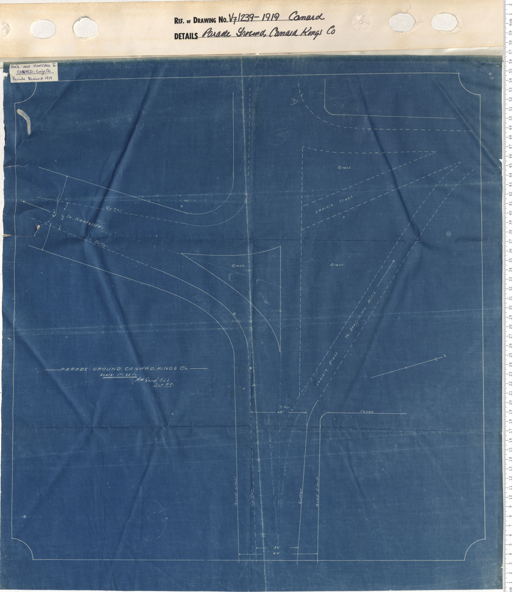
Parade Ground: Canard, Kings County
Date: 1919
Reference: Nova Scotia Archives Map Collection: V7 239 Canard, Nova Scotia
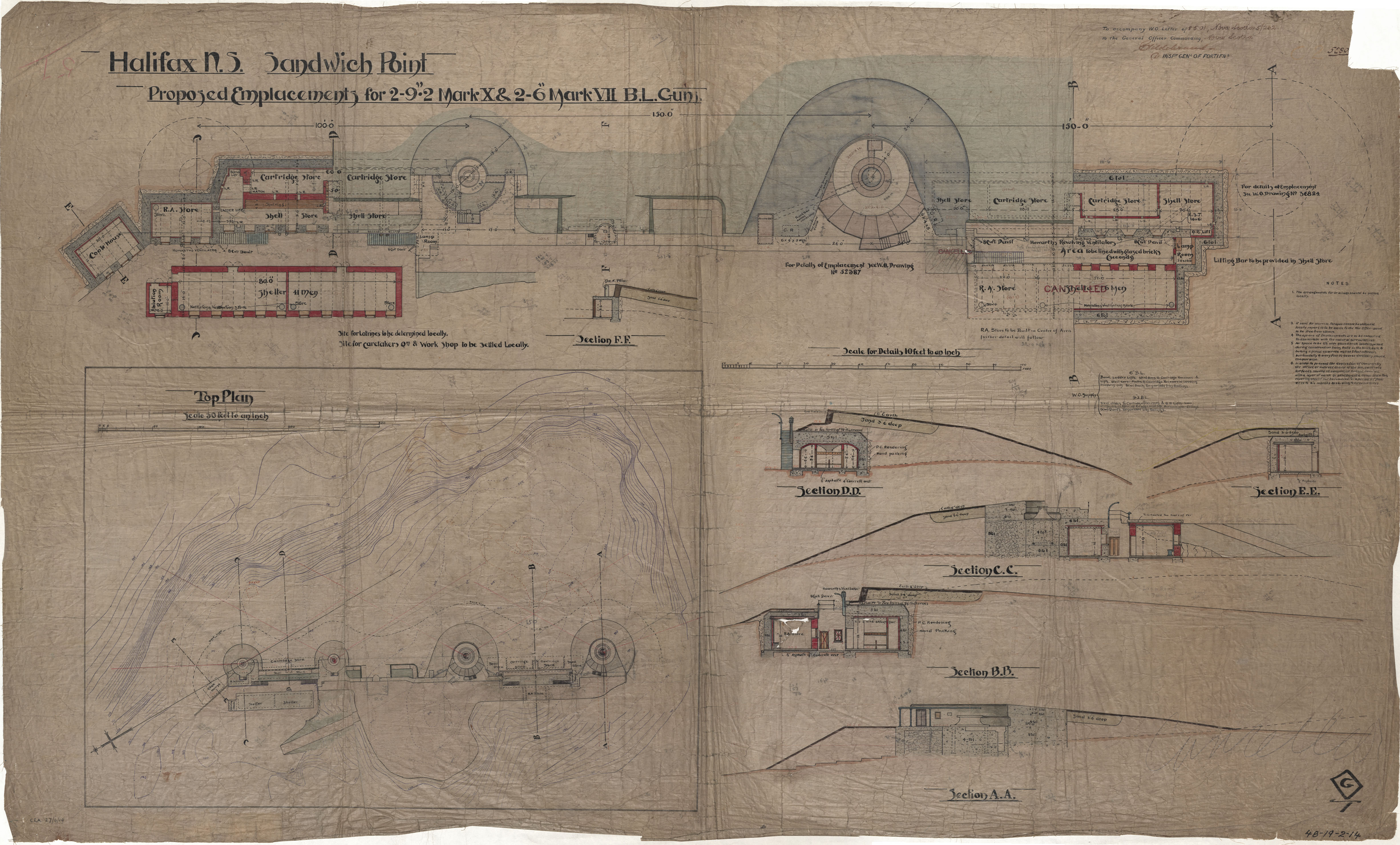
Sandwich Point
Date: 27 April 1919
Reference: Nova Scotia Archives Royal Engineers Maps and Plans 48 - 19 - 2 - 14