Nova Scotia Archives
Historical Maps of Nova Scotia
Results 151 to 165 of 827 from your search: 1900
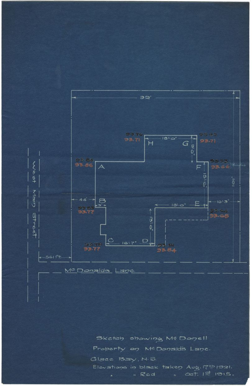
Sketch showing McDonell Property on McDonald Lane, Glace Bay, N.S.
Date: 1921
Reference: Nova Scotia Archives Map Collection: F/239 - 1921
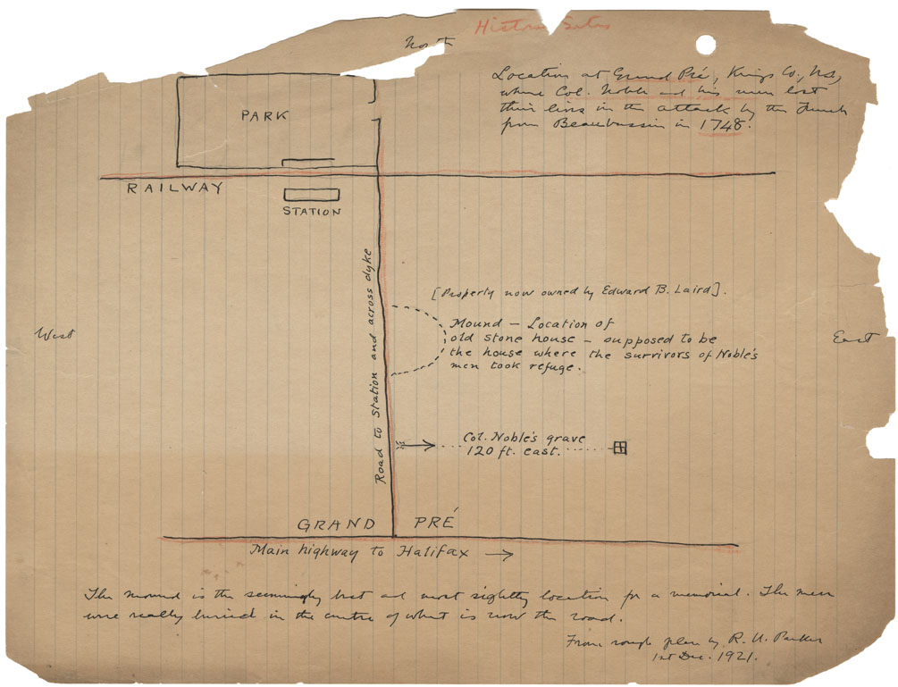
Location at Grand Pre, Kings County NS where Col Noble and his men lost their lives in an attack by the French from Beaubassin in 1748
Date: 1 December 1921
Reference: Nova Scotia Archives Map Collection: F/239 - 1921
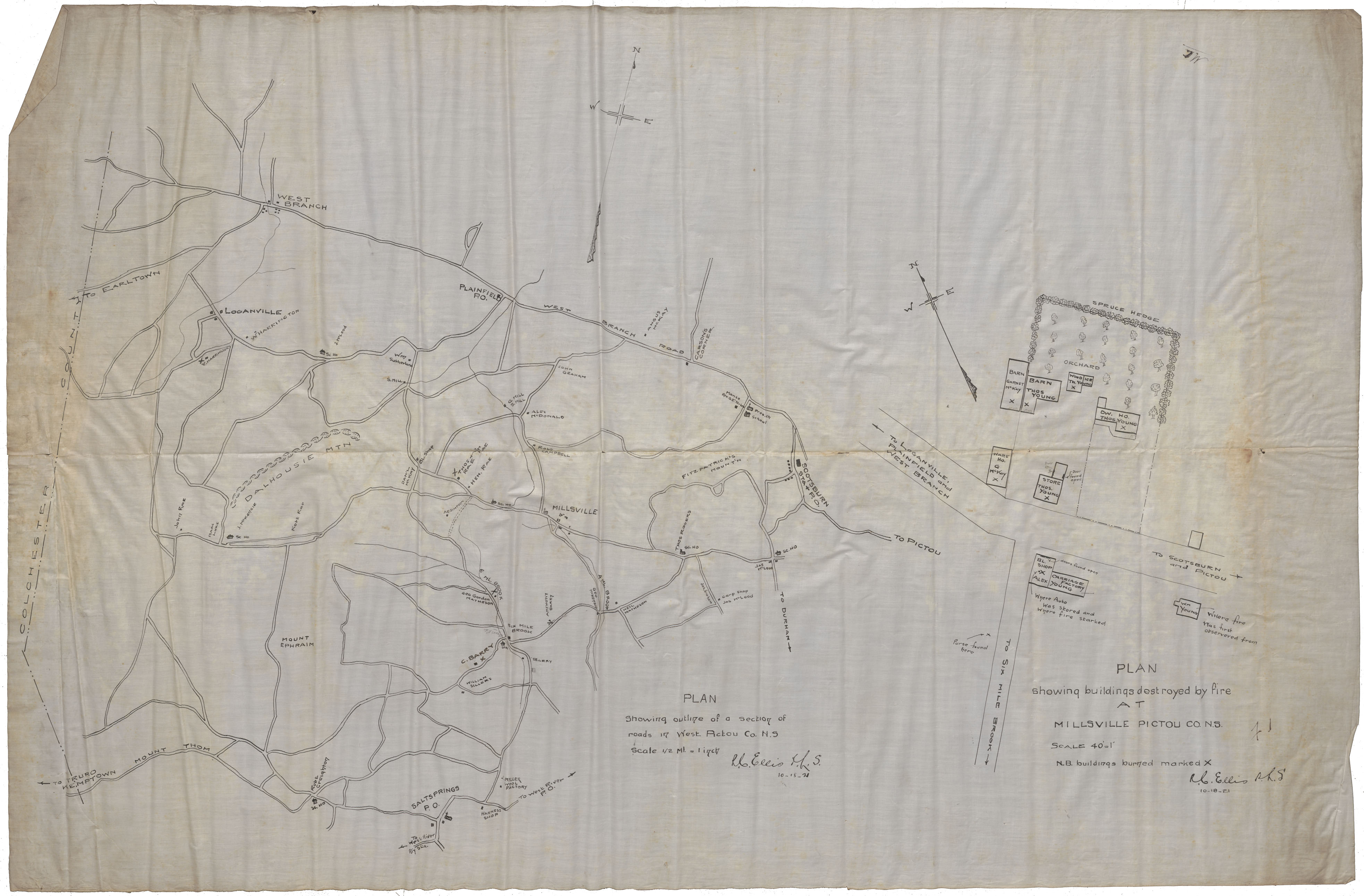
Plan showing buildings destroyed by fire at Millsville Pictou County, N.S.
Date: 10 October 1921
Reference: Nova Scotia Archives Map Collection: F/239 - 1921
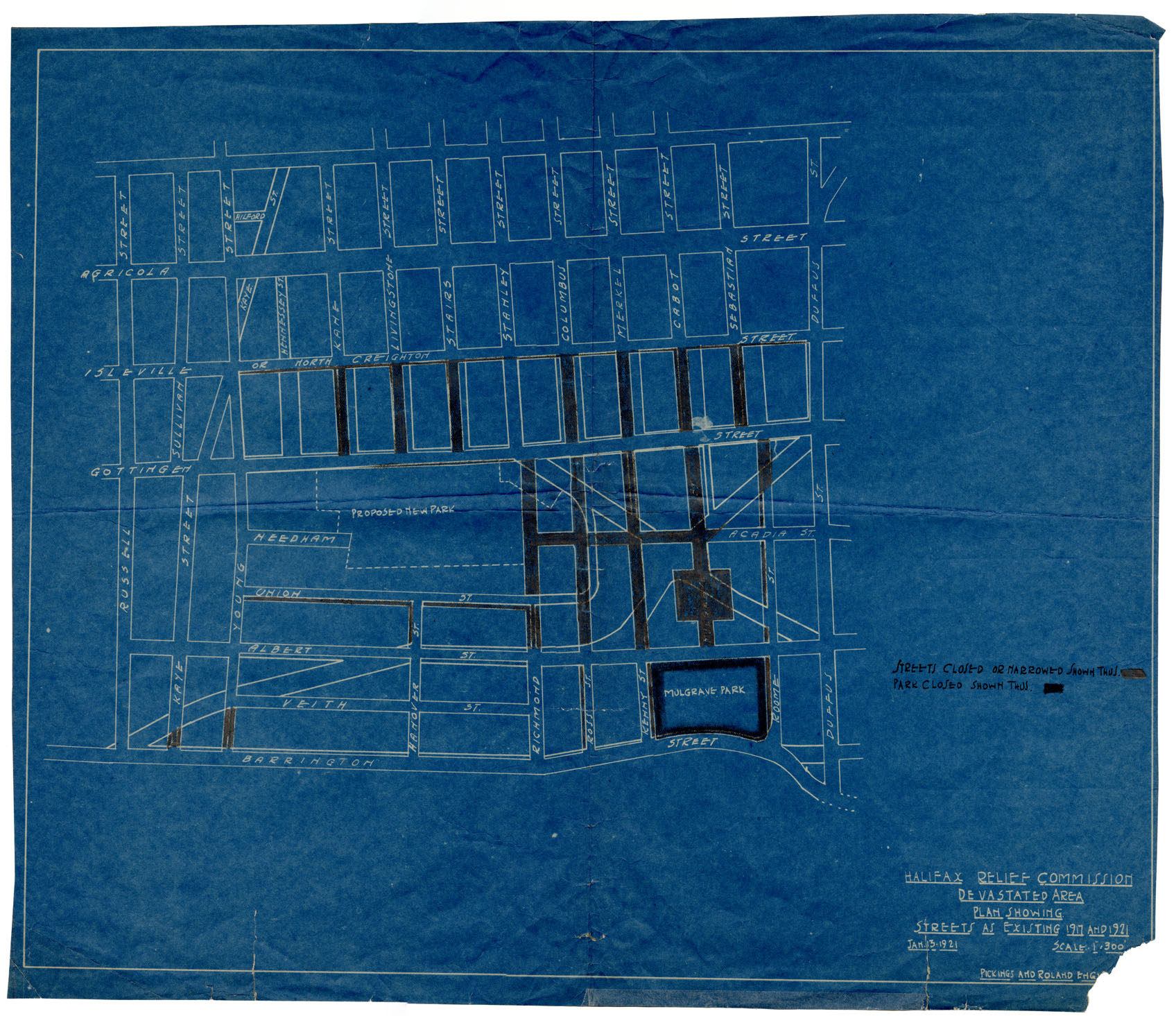
Halifax Relief Commisssion Devastated Area: Plan Showing
Date: 13 January 1921
Reference: Nova Scotia Archives Map Collection: F/240 - 1921
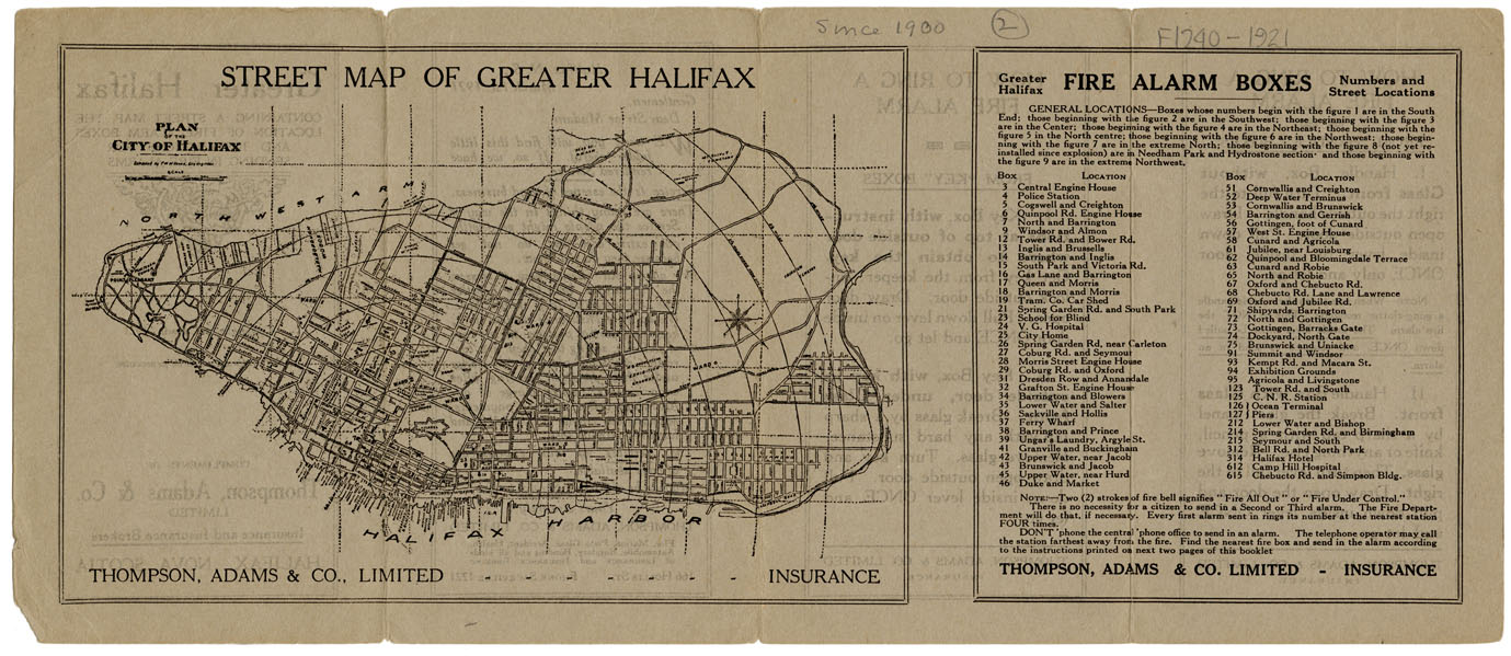
Street map of Greater Halifax
Date: 1921
Reference: Nova Scotia Archives Map Collection: F/240 - 1921
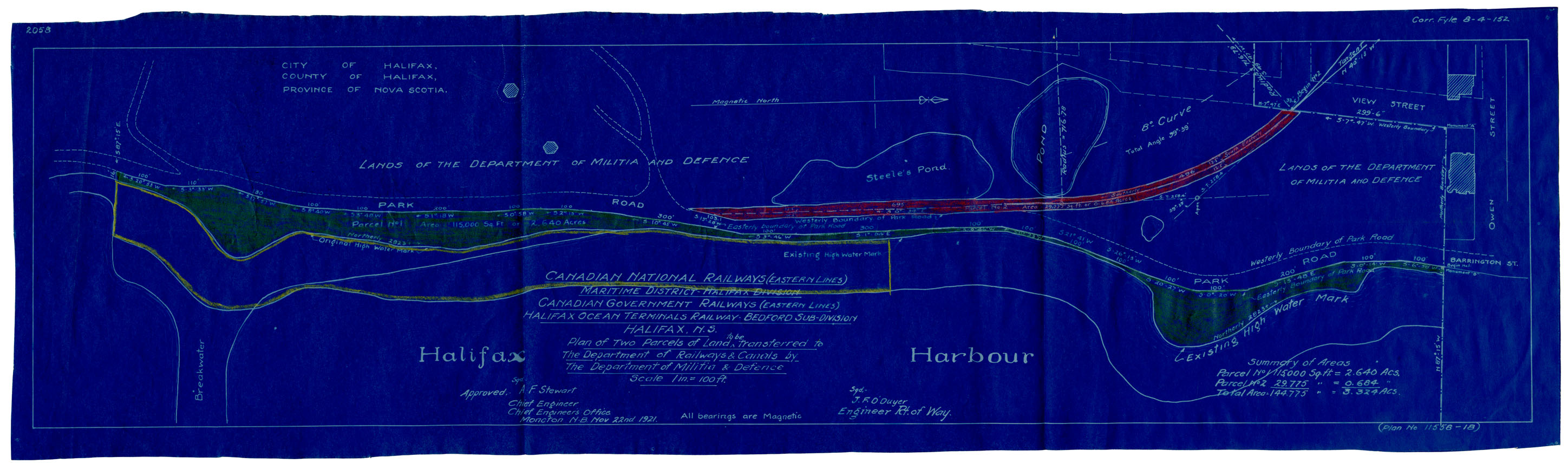
Plan of Three Parcels of Land to be Expropriated..in the City of Halifax for the Canadian National Rys
Date: 22 November 1921
Reference: Nova Scotia Archives Map Collection: F/240 - 1921
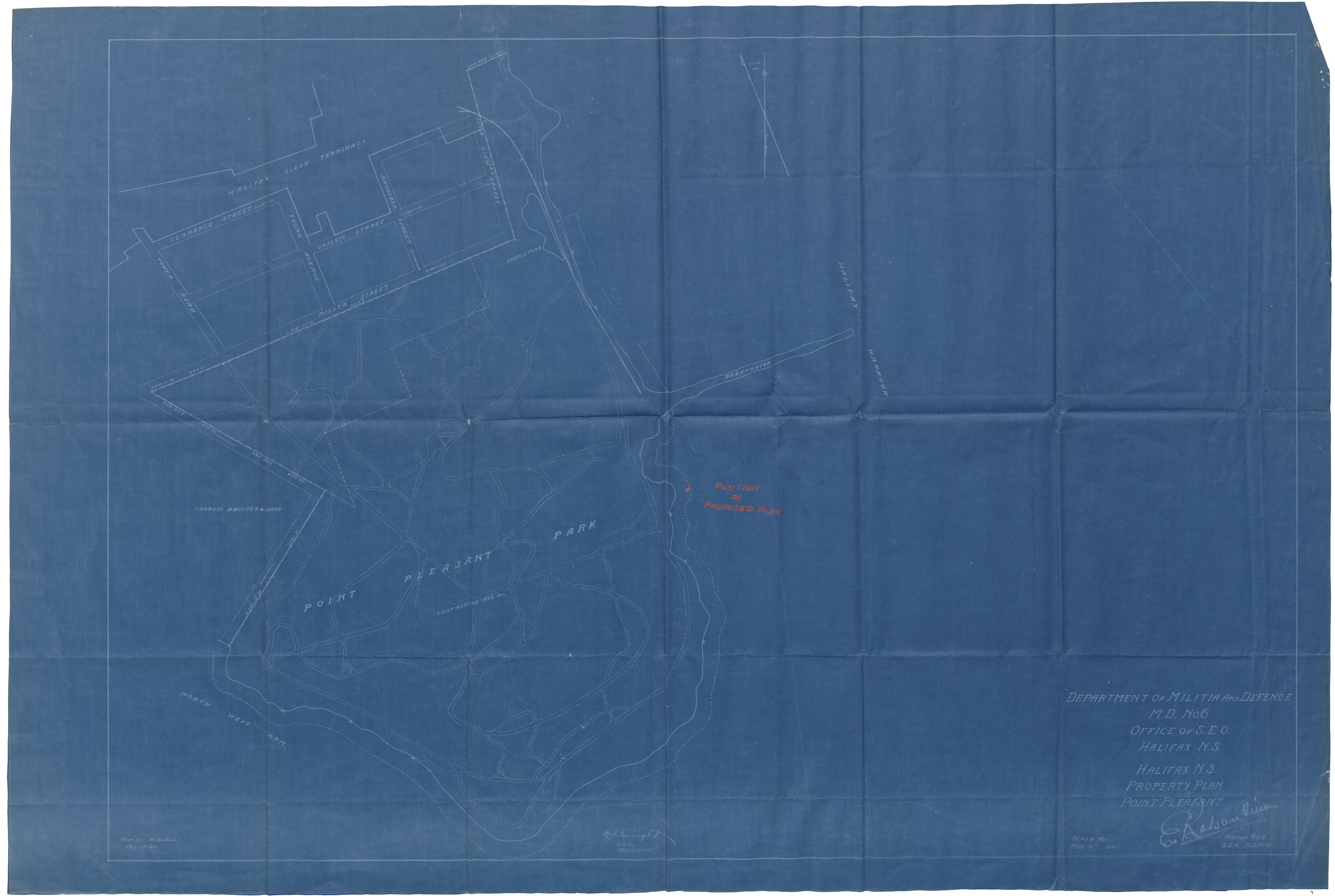
Dept of Militia & Defense M.D.6 Office of S.E.O., Halifax, N.S. Property Plan Point Pleasant
Date: 15 August 1921
Reference: Nova Scotia Archives Map Collection: F/240 - 1921
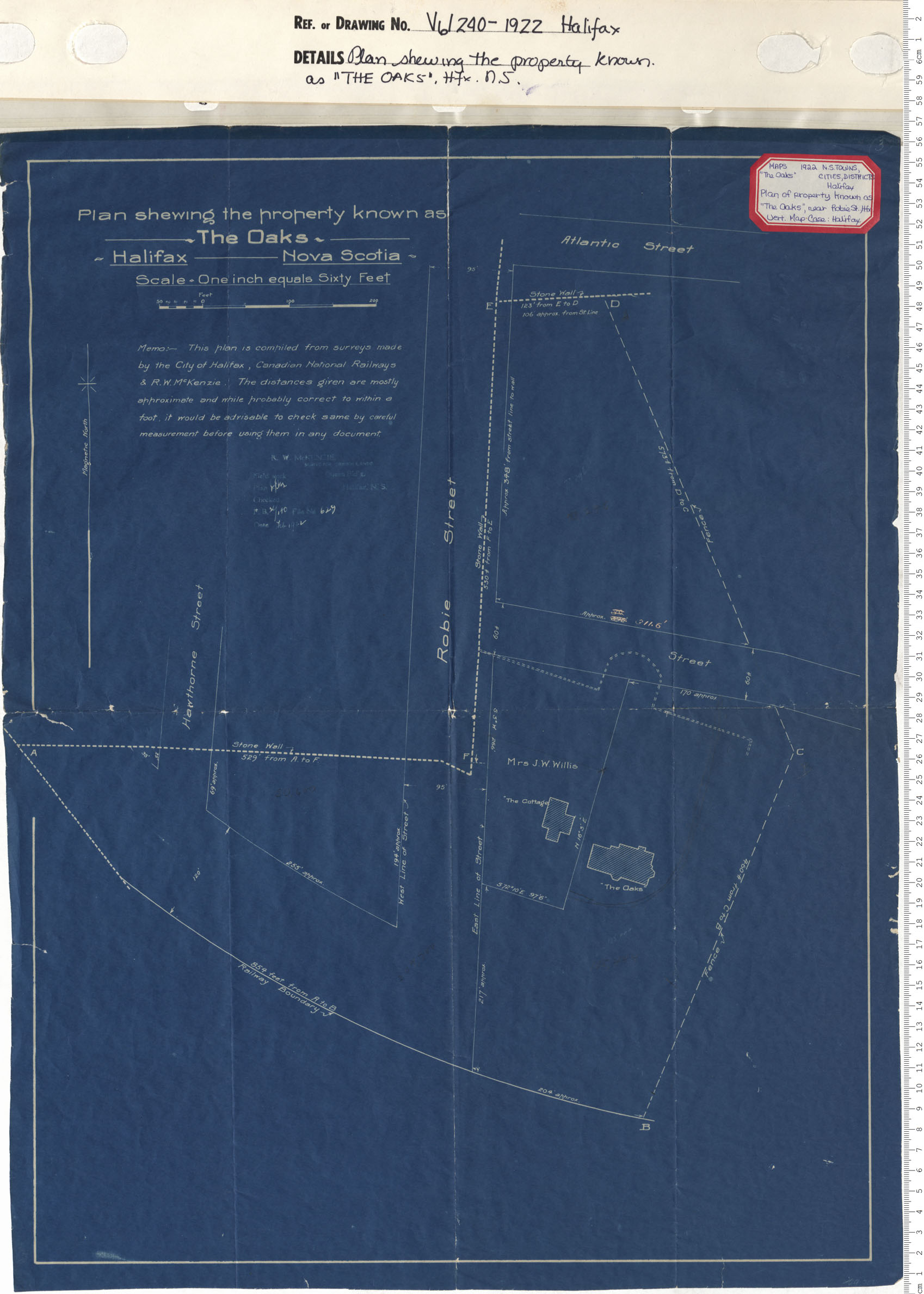
A plan Shewing the Property Known as "The Oaks" Halifax, N.S.
Date: 1922
Reference: Nova Scotia Archives Map Collection: V6 240 Halifax, Nova Scotia
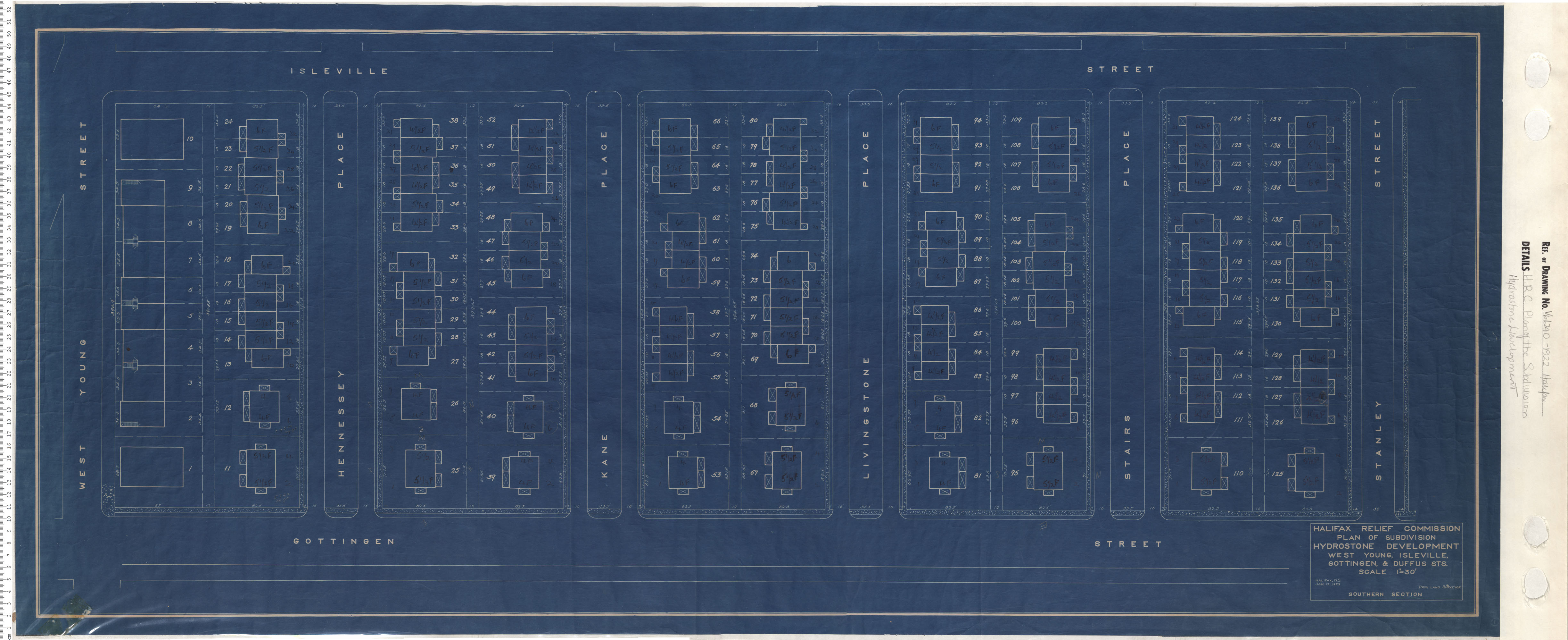
Plan of Subdivision Hydrostone Development West, Young, Isleville, Gottingen and Duffus Streets Southern Section
Date: 1922
Reference: Nova Scotia Archives Map Collection: V6 240 Halifax, Nova Scotia
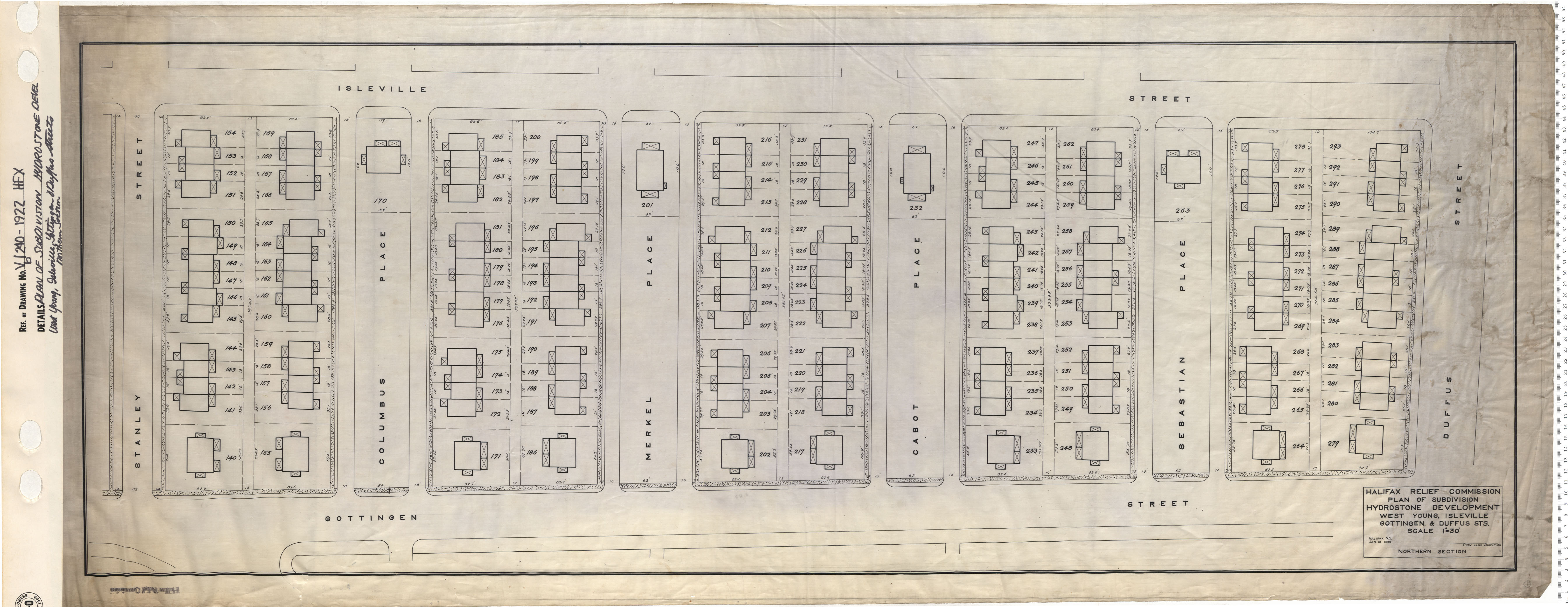
Plan of Subdivision Hydrostone Development West, Young, Isleville, Gottingen and Duffus Streets Northern Section
Date: 1922
Reference: Nova Scotia Archives Map Collection: V6 240 Halifax, Nova Scotia
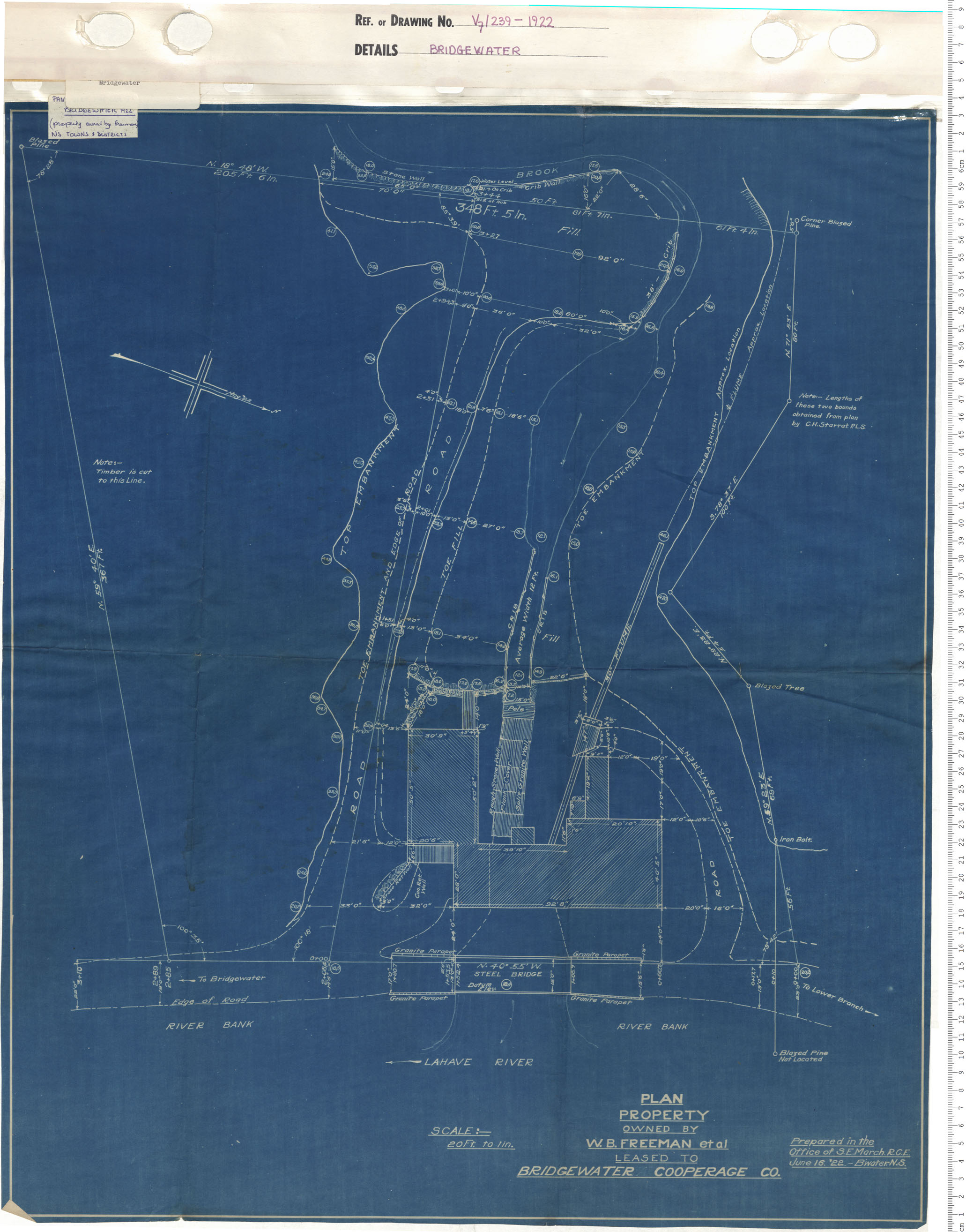
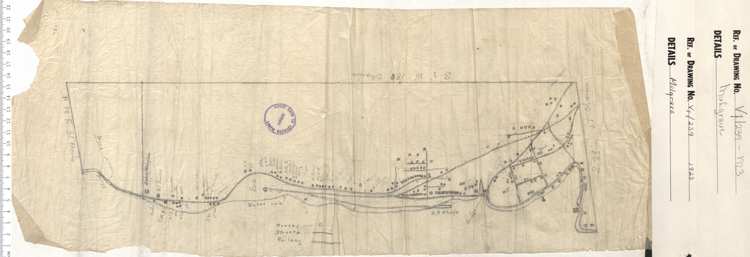
Plan property owned by W.B. Freeman et al leased to Bridgewater Cooperage Company
Date: 1922
Reference: Nova Scotia Archives Map Collection: V7 239 Bridgewater, Nova Scotia
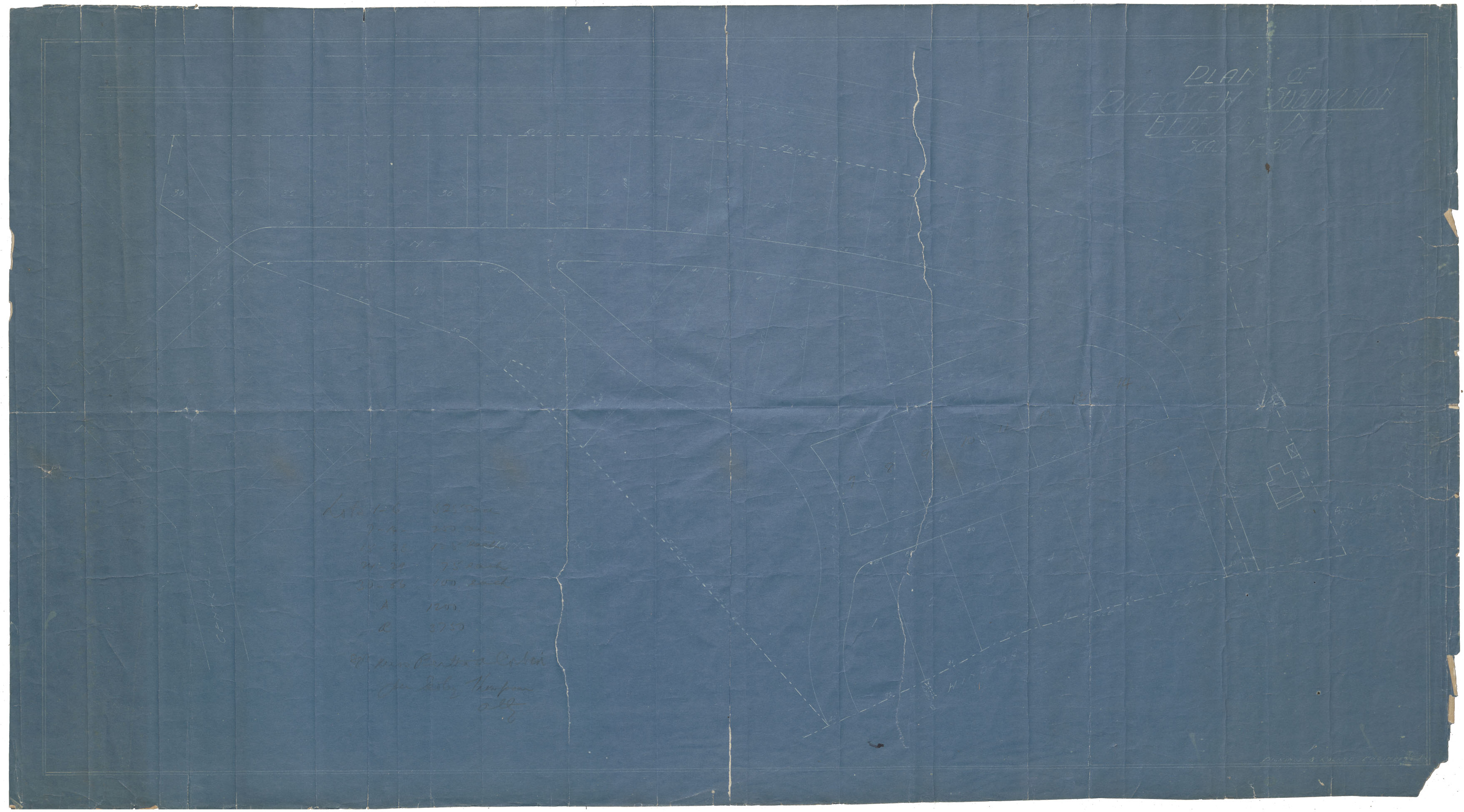
Plan of Riverview Subdivision Bedford Nova Scotia
Date: 1922
Reference: Nova Scotia Archives Map Collection: F/239 - 1922
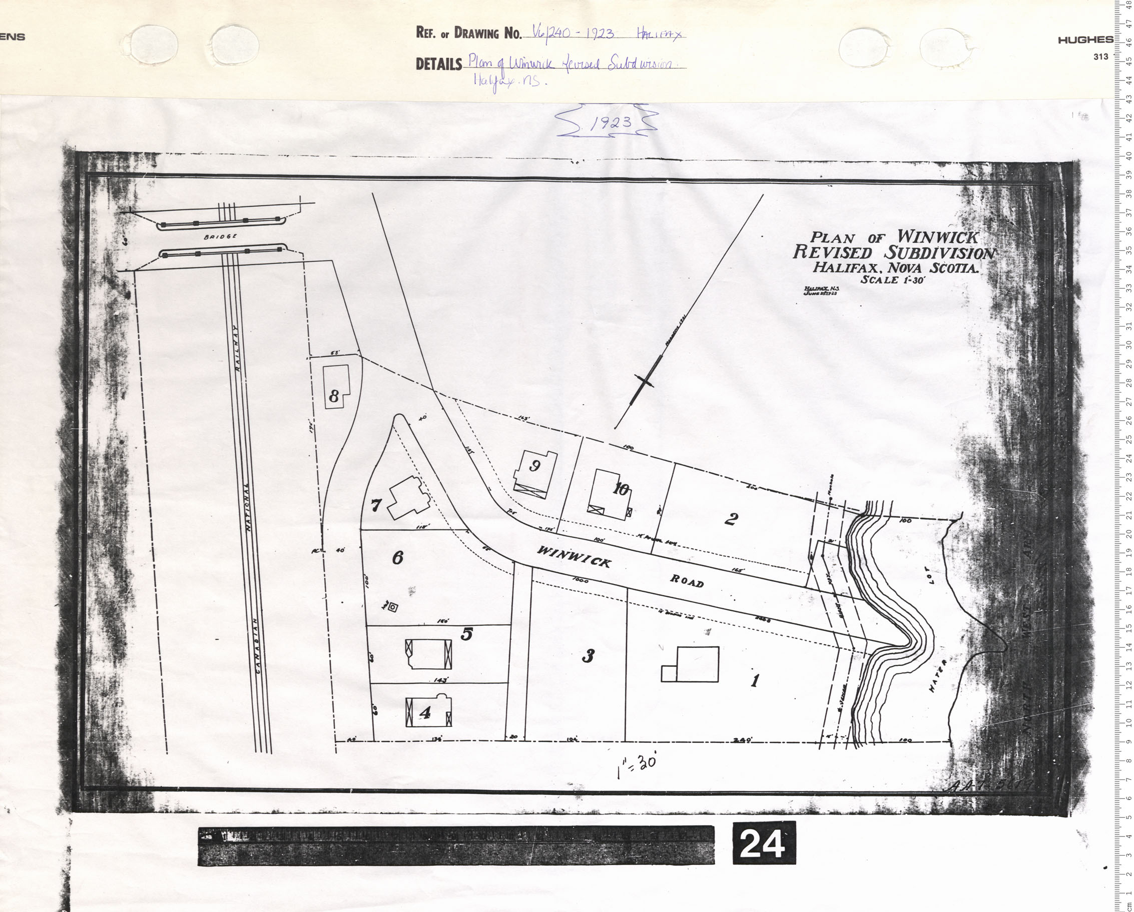
Plan of Winwick Revised Subdivision, Halifax, N.S.
Date: 1923
Reference: Nova Scotia Archives Map Collection: V6 240 Halifax, Nova Scotia