Nova Scotia Archives
Search
Results 1 to 48 of 53 from your search: maps
Note: if what you see below isn't quite what you're looking for, or if you're looking for results from different areas of our website, try our Additional Search Tools or Google
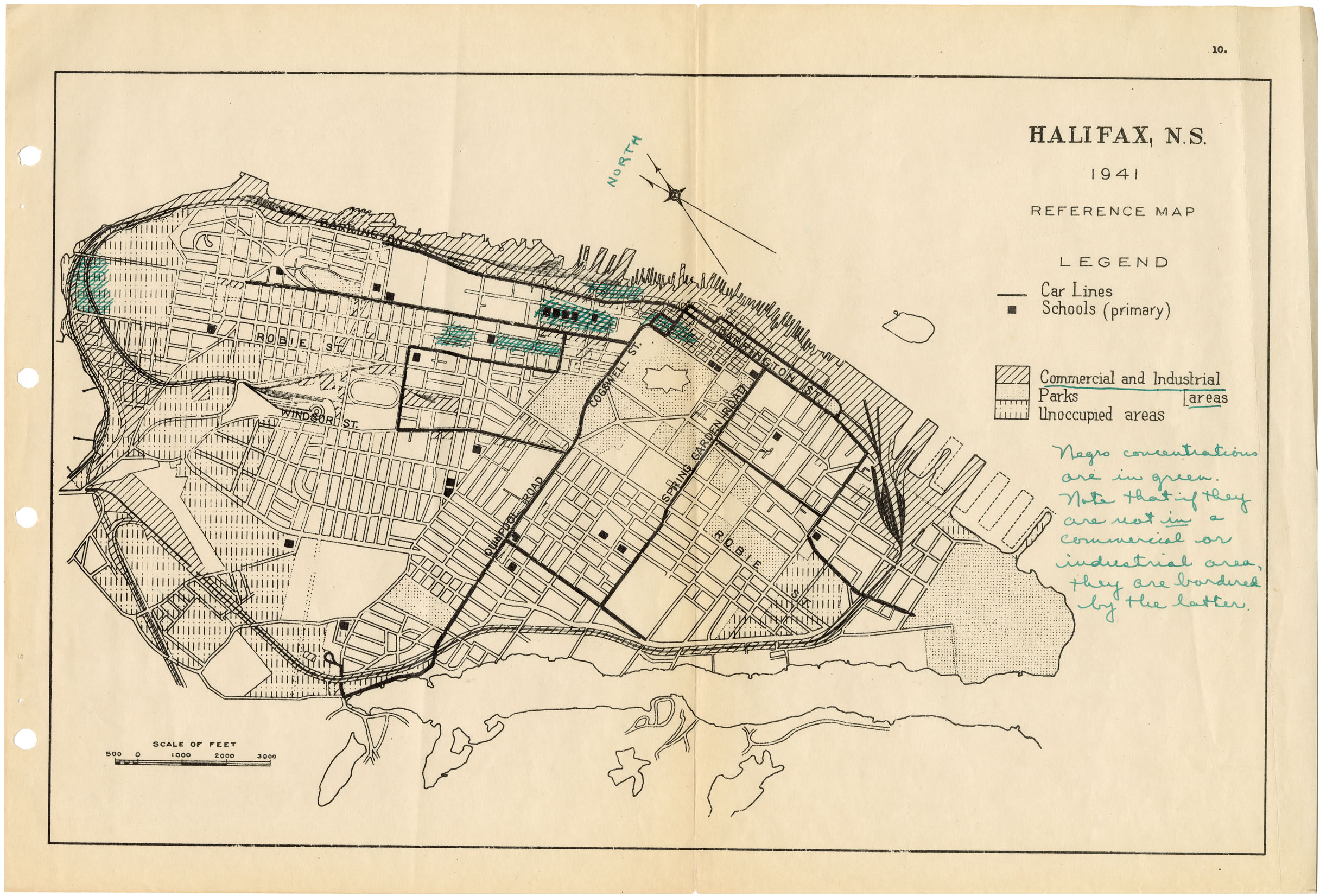
Page 33 - Reference maps of Halifax showing Negro concentrations in relation to other factors
african-heritage : 201912105
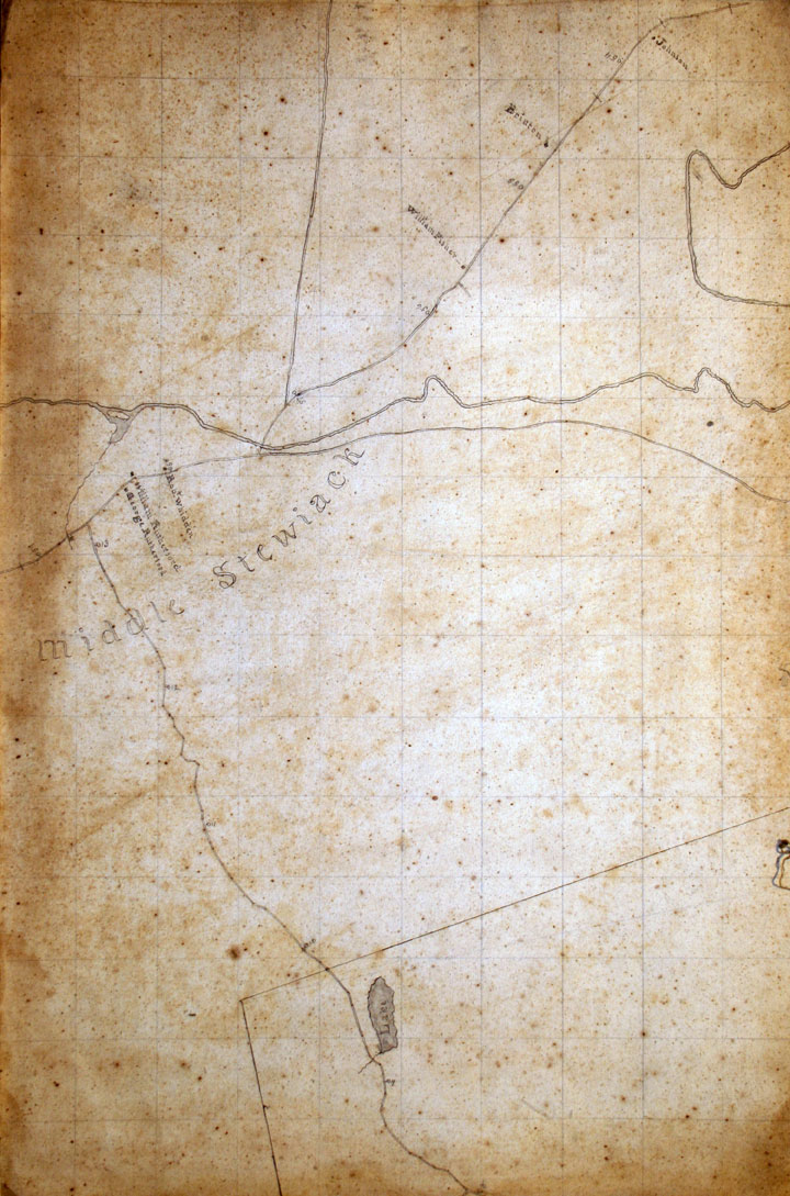
Middle Stewiacke, Colchester County
builtheritage : 200804577
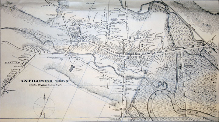
Antigonish Town inset of Topographical Township Map of Antigonish County, Nova Scotia
builtheritage : 200804594
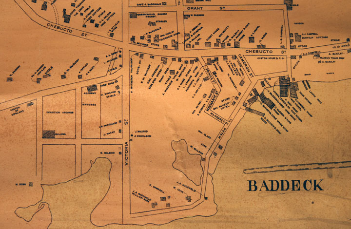
Baddeck inset of Topographical Township Map of Victoria County, Nova Scotia
builtheritage : 200804595
Province of Nova Scotia (Island of Cape Breton)
builtheritage : 200804573
builtheritage : 200804576
builtheritage : 200804574
builtheritage : 200804575
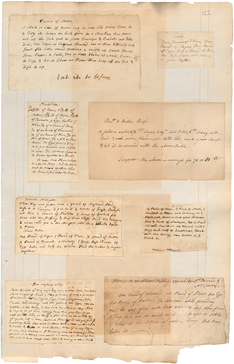
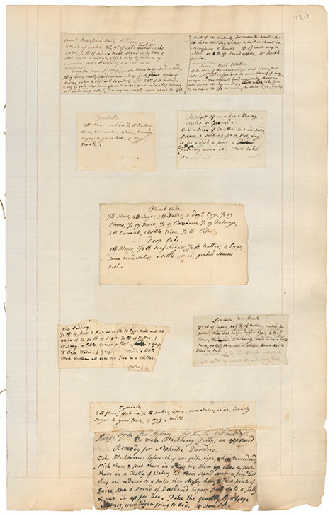
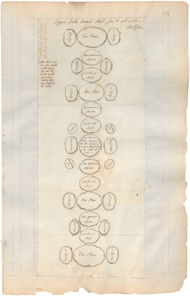
Diagram of arrangement of food on the Supper Table, Queens Ball, Halifax
cooking : 201313675
Air Raid Precautions Sector maps, part of the Richmond district of Halifax
eastcoastport : 200906805
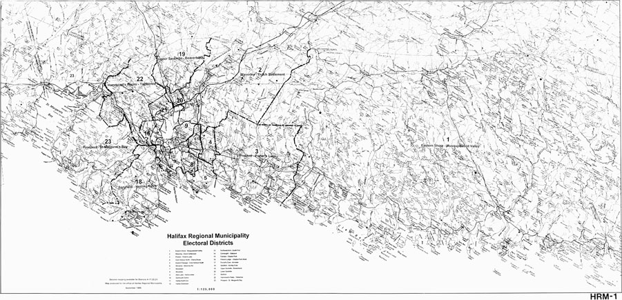
Halifax Regional Municipality Electoral District Map. September 1995
halifax : 199900013


A Plan of Halifax Maps: Halifax: c1749
maps : 202013488

Town of Halifax in Nova Scotia Maps: Halifax: 1755
maps : 202013499

Annapolis Townships Annapolis County Maps
maps : 201602266

PANS Vert Mss File: Maps: Dartmouth Watering Place c. 1800 (2 maps)
maps : 202012304

Maps: Colchester County-land grant to Jason Forsyth
maps : 201602224

A plan of part of the Township of Amherst Maps: Amherst: 1818
maps : 202012145

Land Grants: Maps: Shubenacadie/Grand lake Area, c.1840
maps : 202012121


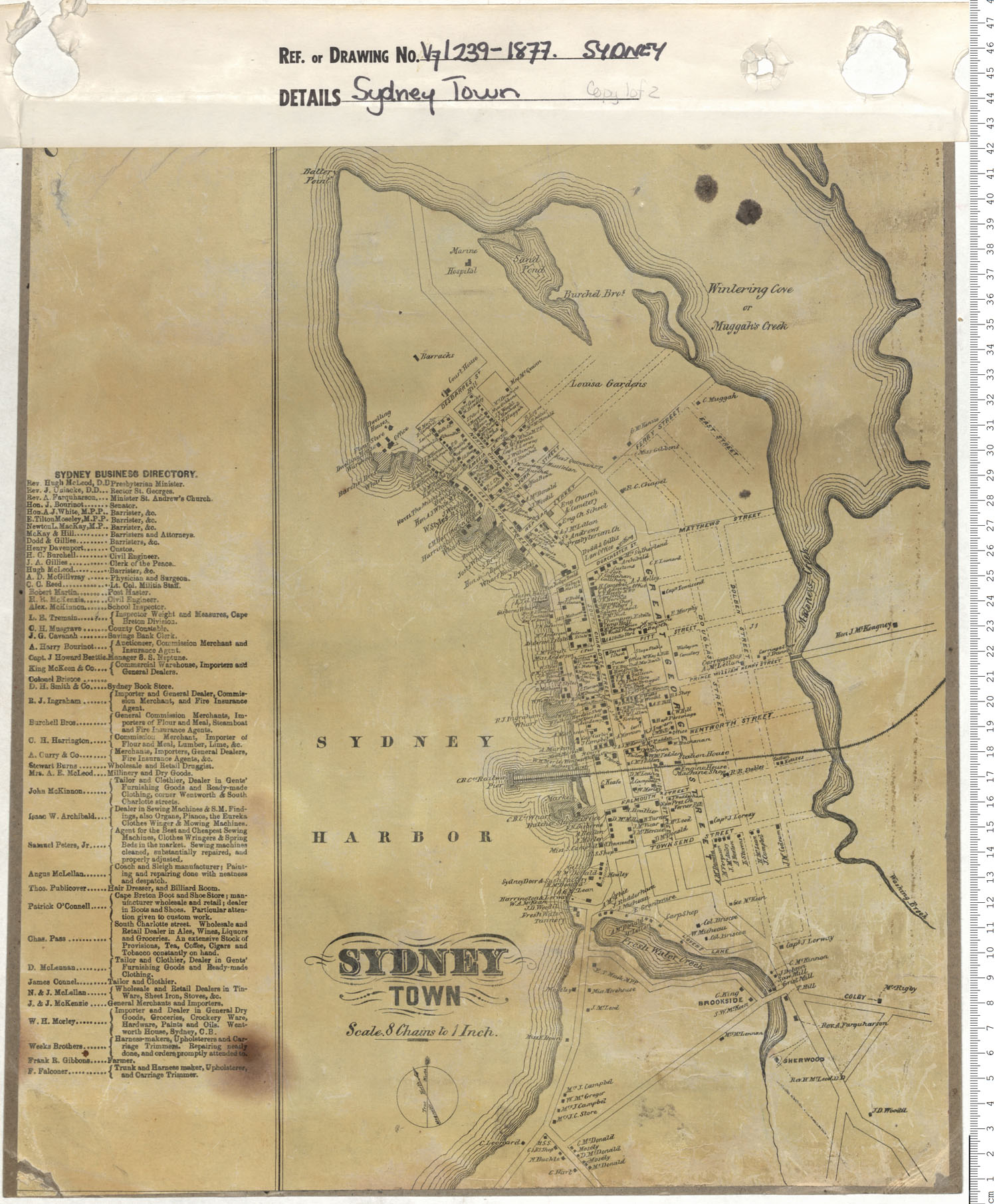
Maps: Halifax, circa 1860 The Bower Property
maps : 202013582

PANS Vert Mss File: Maps: Chimney Corner, C.B., c.1880
maps : 202012270

PANS Vert Mss File: Maps: Dartmouth: Admiralty Property, c.1880
maps : 202012331

Maps: Halifax, circa 1880 Streets: Bower Road
maps : 202013593

Maps: Halifax, N.D., circa 1900 Streets: Francklin Street
maps : 202013643

maps : 202011922

PANS: Maps: Ship Harbour, Halifax County
maps : 202011959


Maps: Halifax County 1898 Armdale School Boundaries
maps : 201602247

Maps: Halifax, circa 1910 The Oaks Property
maps : 202013648

Maps: Part 2 Mines Report 1940
maps : 201520245


Sable Island Maps 1767 to 1959
maps : 202015045

Kejimkujik National Park (4 maps) - Information Master Planning
maps : 202013987

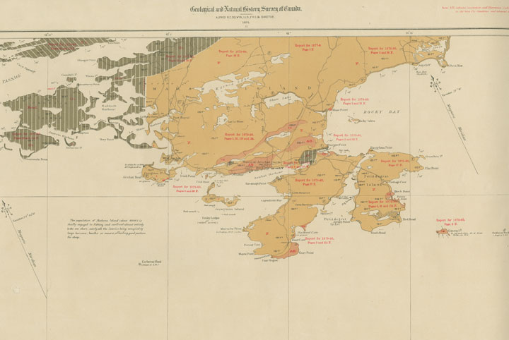
Folio of Geological Maps of N.S.
maps : 201520326


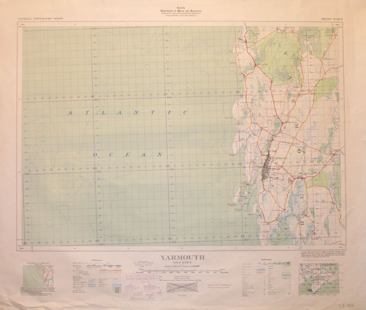
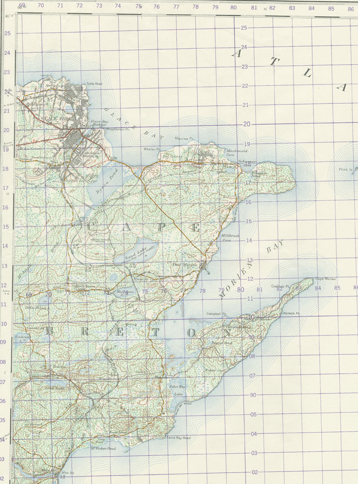
Sydney Glace Bay North Sydney & Sydney Mines 1980
maps : 202012852


Additional Search Tools
Need more results? The Search box in the top right corner looks for digitized content only and does not full-text search our website.
- To search our Nova Scotia Births, Marriages, and Deaths click the Nova Scotia Genealogy button below.
- To search descriptions in the archival holdings catalogue, click the Archival Holdings button below.
- To search items in the library holdings catalogue, click the Library Holdings button below.
- To Google search all our websites click the Google button below
Images Nova Scotia Genealogy Archival Holdings Library Holdings Google Site Search