Nova Scotia Archives
Historical Maps of Nova Scotia
Results 166 to 180 of 296 from your search: V7
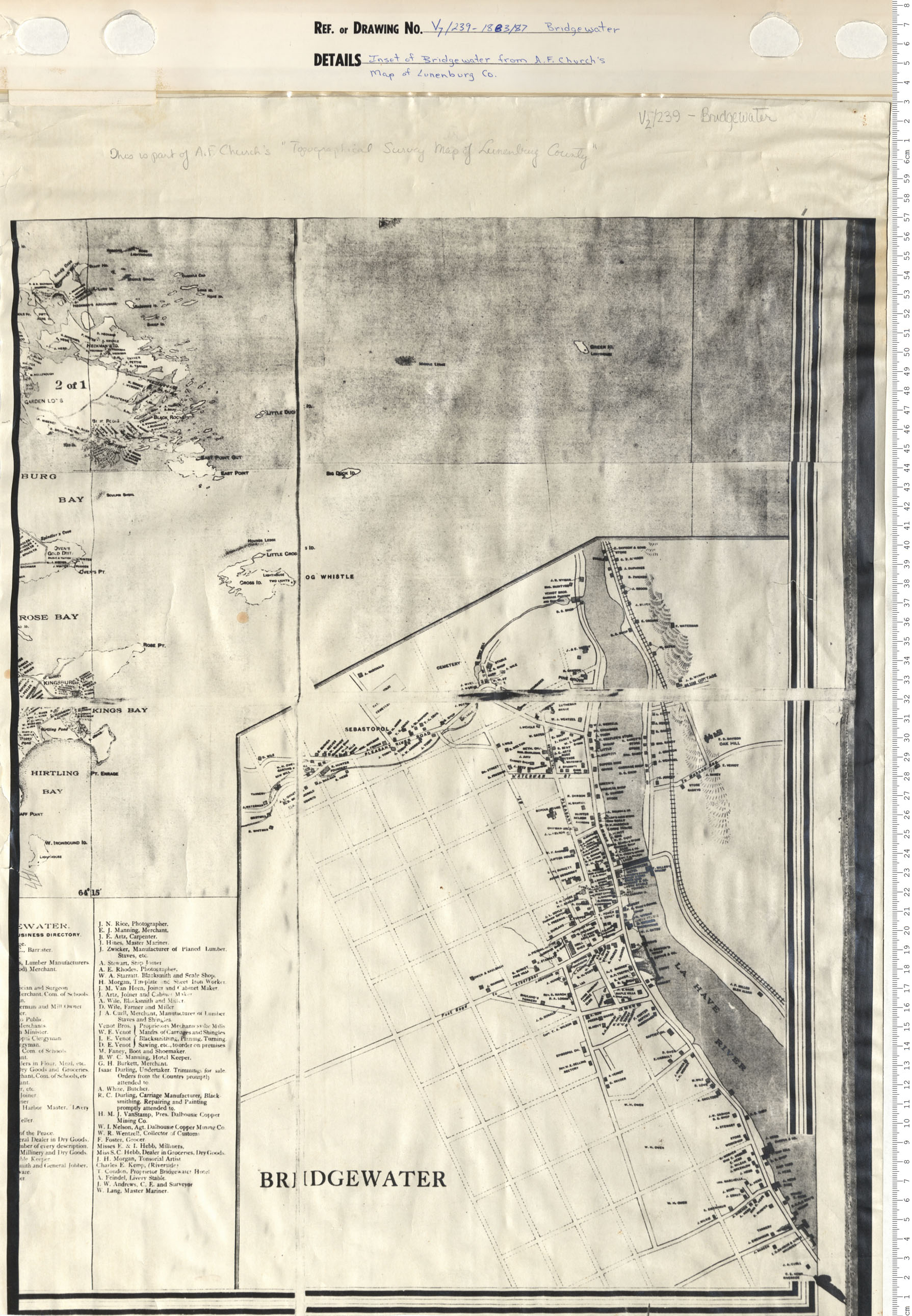
Inset of Bridgewater from A.F. Church's Map of Lunenburg County
Date: 1883/1887
Reference: Nova Scotia Archives Map Collection: V7 239 Bridgewater, Nova Scotia
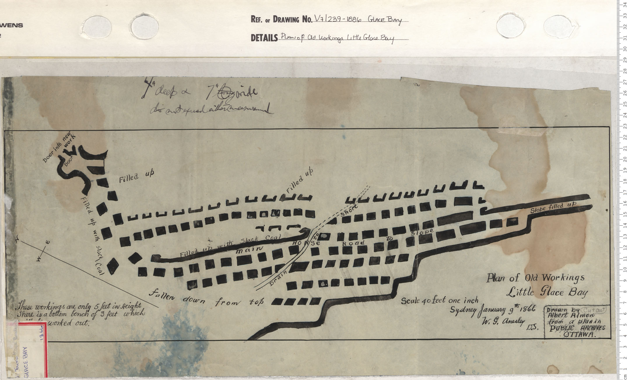
Plan of Old Workings Little Glace Bay
Date: 1886
Reference: Nova Scotia Archives Map Collection: V7 239 Glace Bay, Nova Scotia
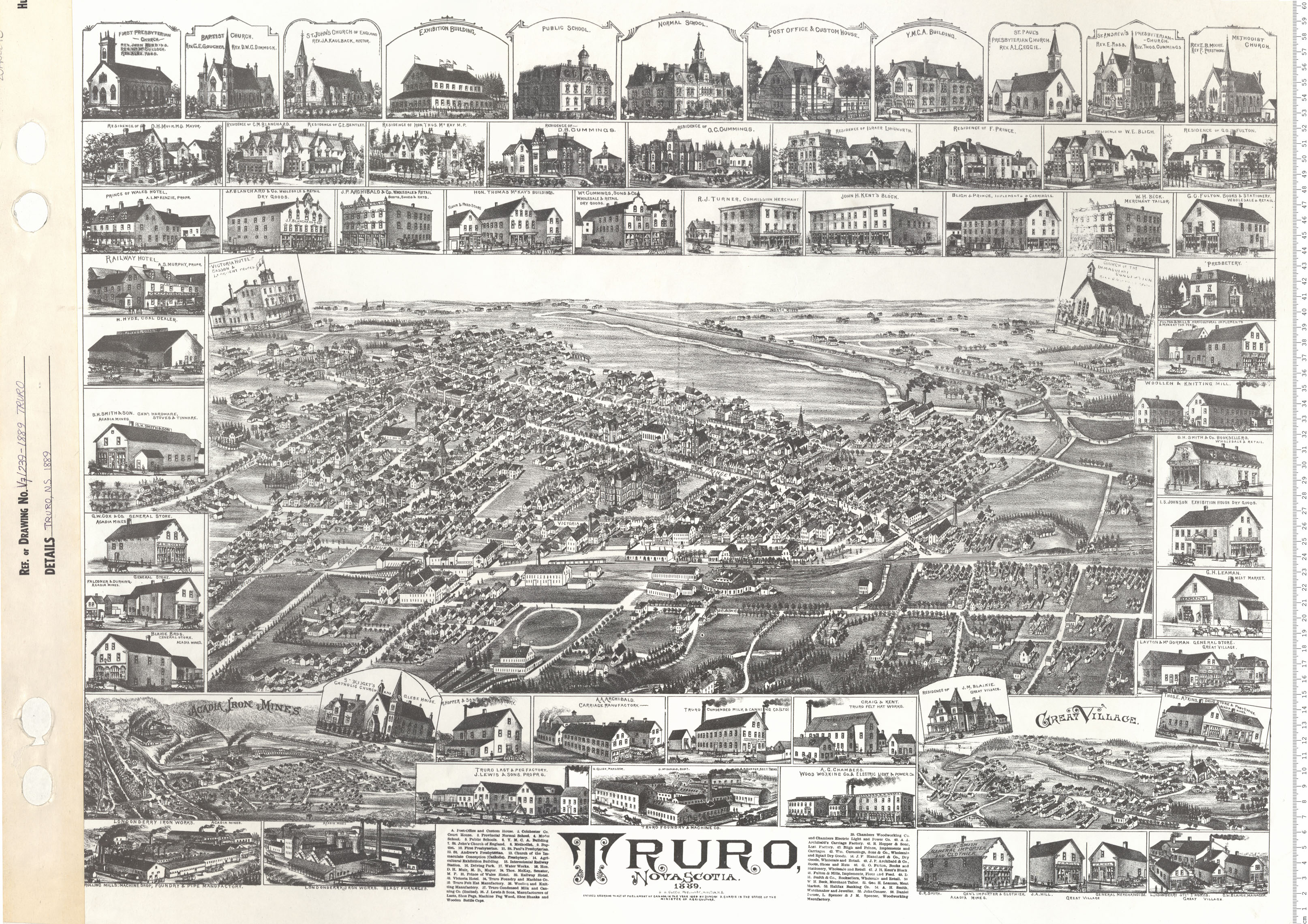
Truro, N.S. Birds Eye View
Date: 1889
Reference: Nova Scotia Archives Map Collection: V7 239 Truro, Nova Scotia
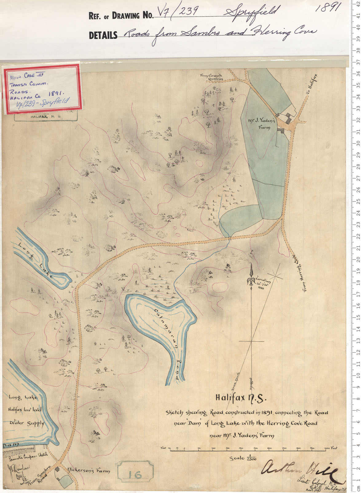
Roads from Sambro and Herring Cove
Date: 1891
Reference: Nova Scotia Archives Map Collection: V7 239 Spryfield, Nova Scotia
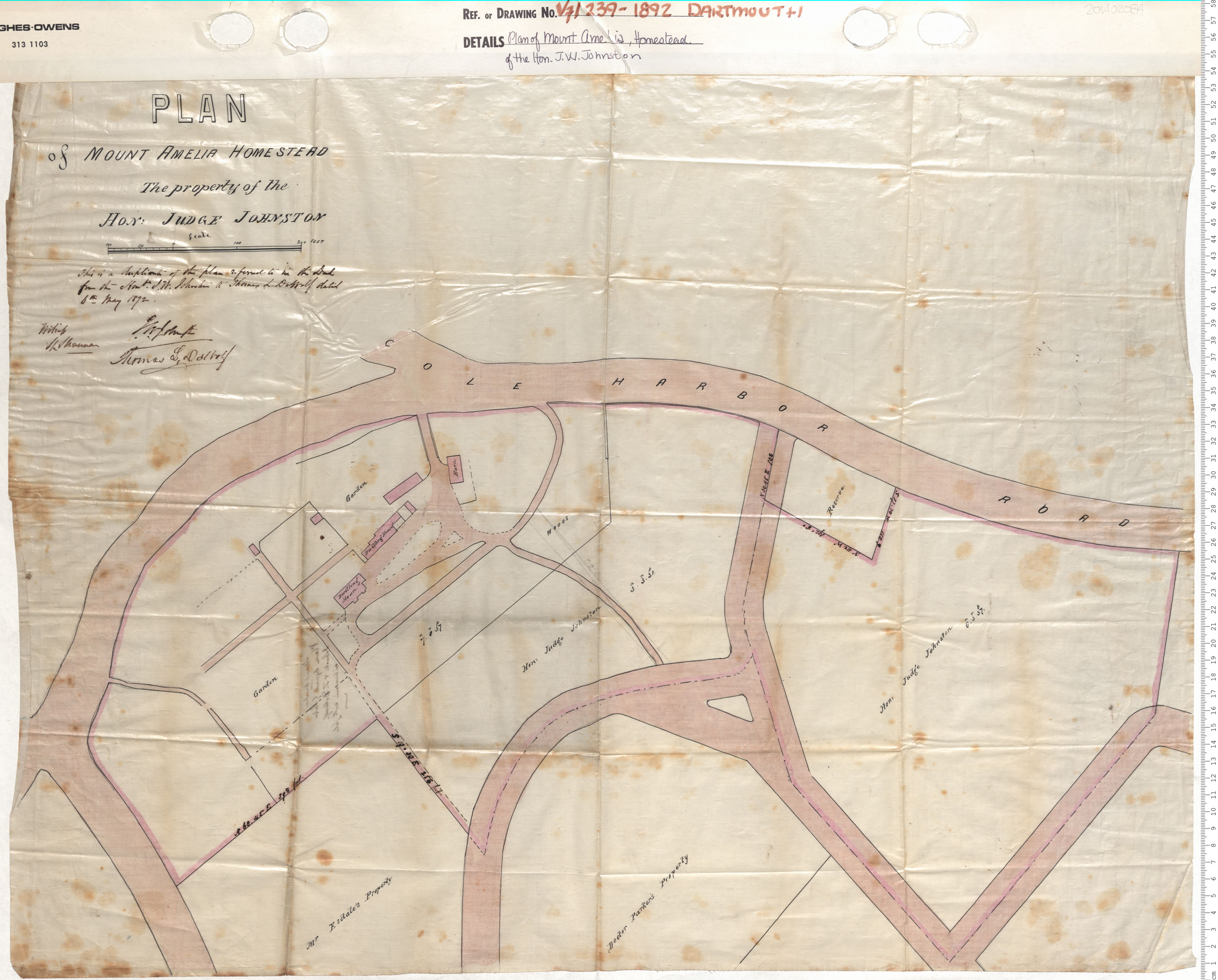
Plan of Mount Amelia Homestead of the Hon. J.W. Johnston
Date: 1892
Reference: Nova Scotia Archives Map Collection: V7 239 Dartmouth, Nova Scotia
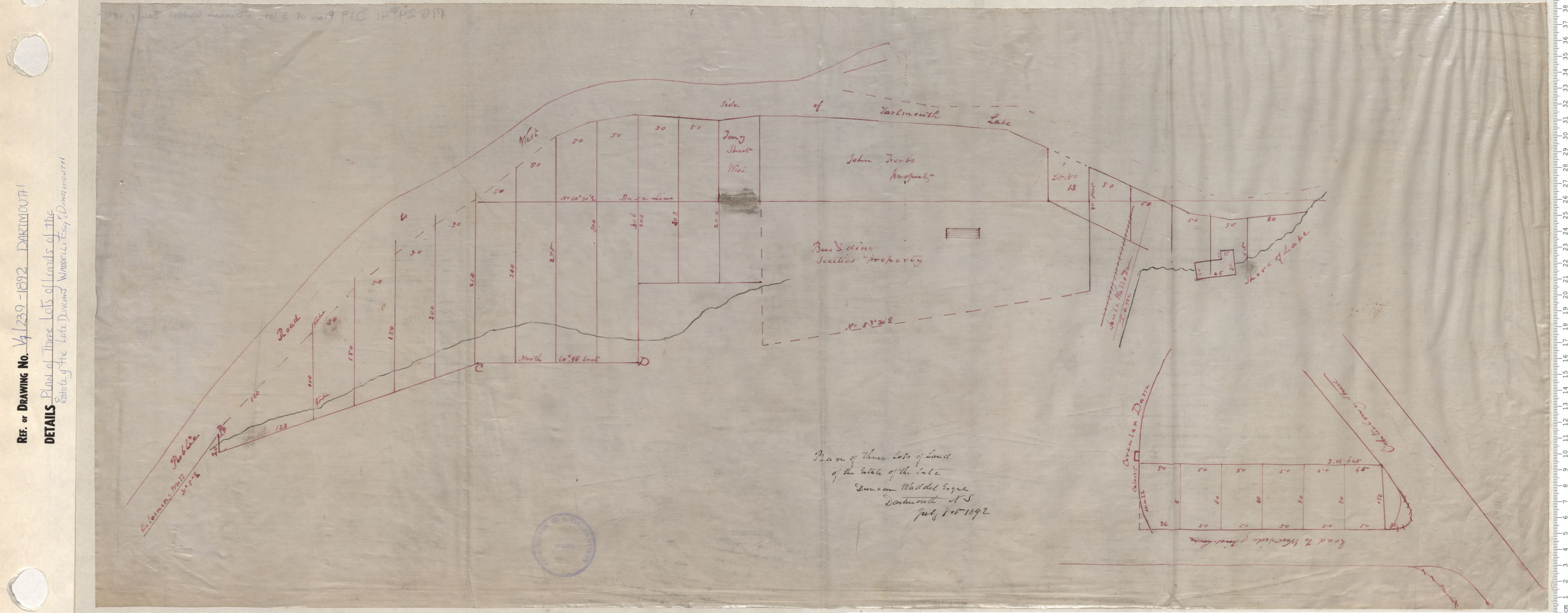
Plan of Three Lots of Lands of the Estate of the Late Duncan Waddell, Esq., Dartmouth
Date: 1892
Reference: Nova Scotia Archives Map Collection: V7 239 Dartmouth, Nova Scotia
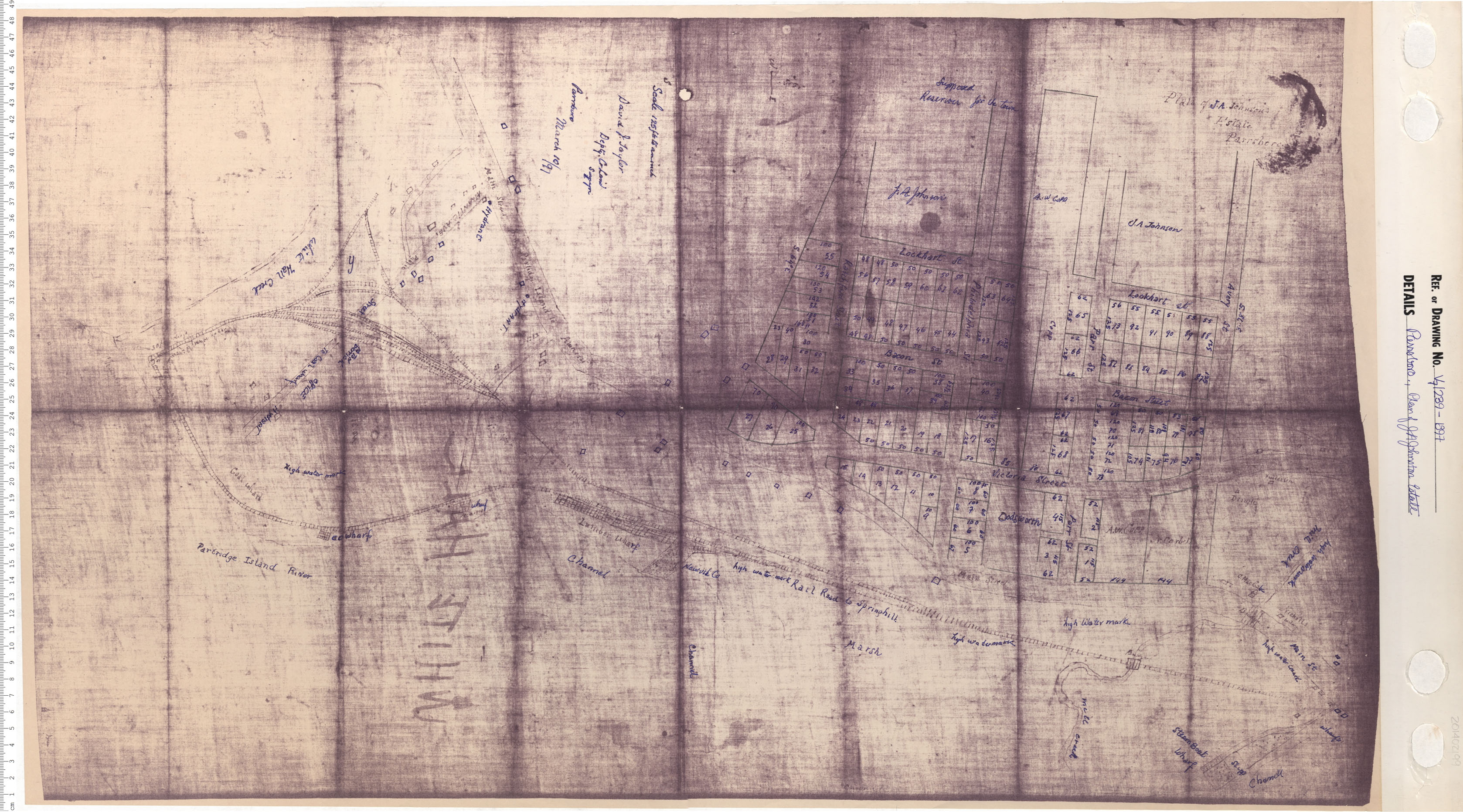
Parrsboro, Plan of J.A. Johnston Estate
Date: 1897
Reference: Nova Scotia Archives Map Collection: V7 239 Parrsboro, Nova Scotia
Plan of Lands and lands covered with Water Required for Proposed Blast Furnaces
Date: 1899
Reference: Nova Scotia Archives Map Collection: V7 239 Sydney, Nova Scotia
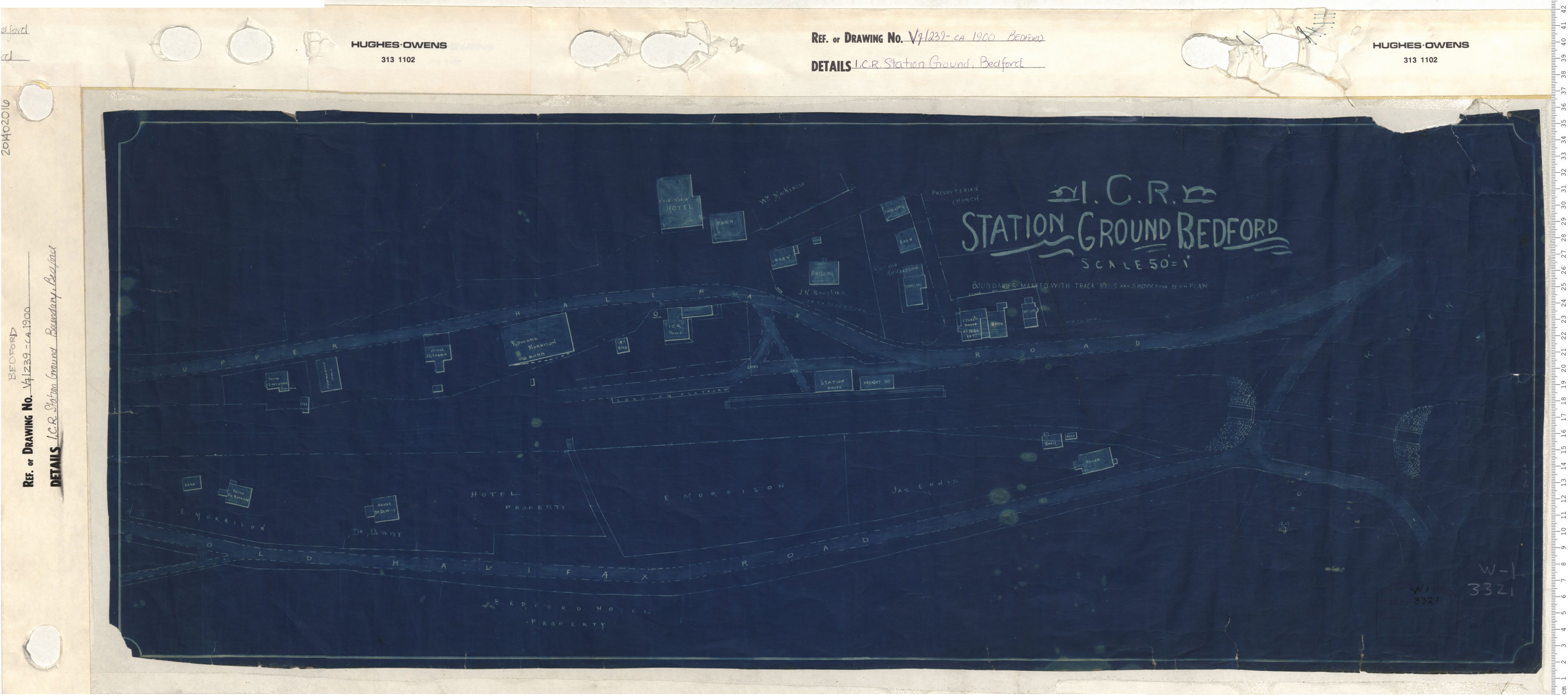
I.C.R. Station Ground, Bedford
Date: 1900
Reference: Nova Scotia Archives Map Collection: V7 239 Bedford, Nova Scotia
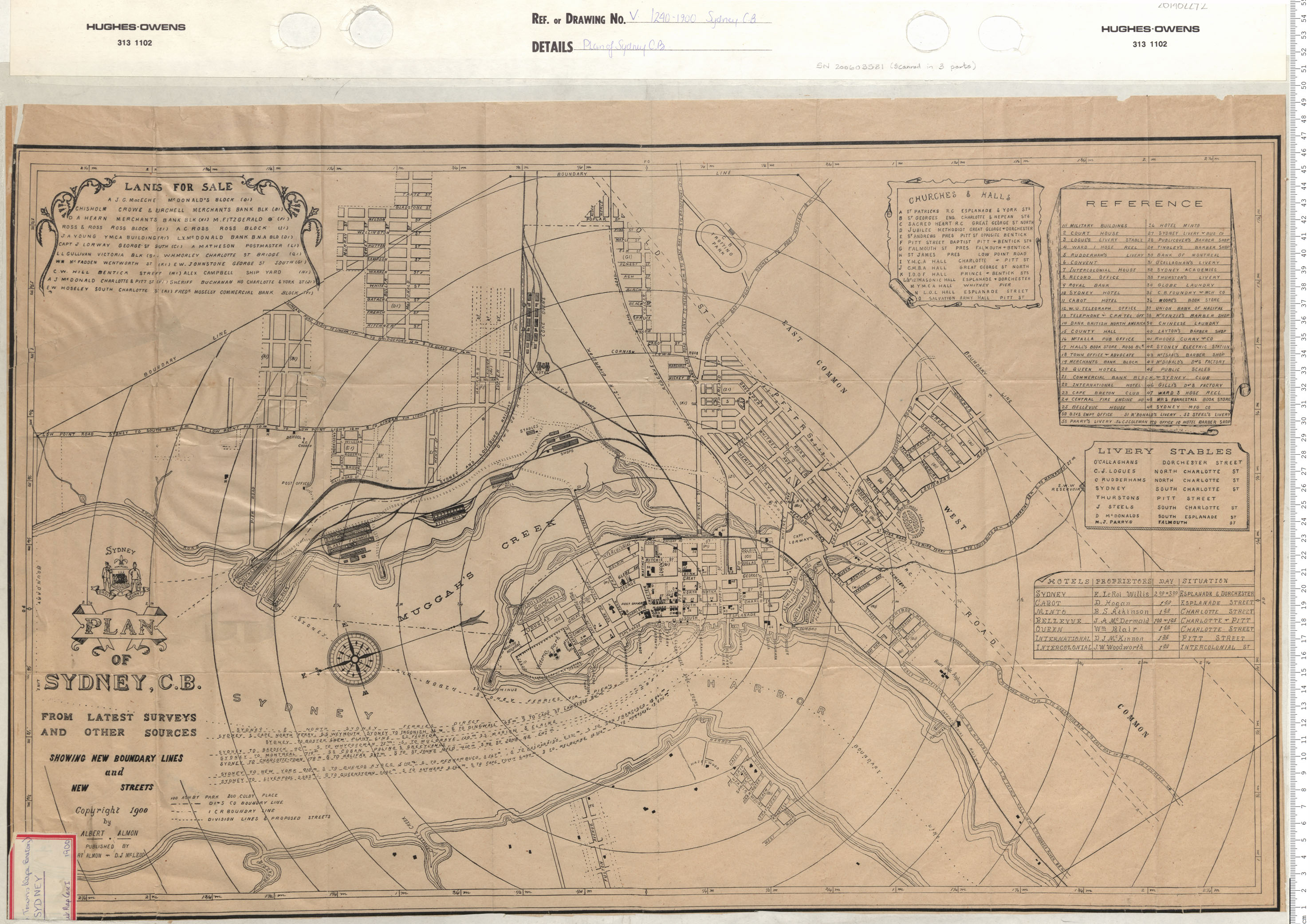
Plan of Sydney, Cape Breton
Date: 1900
Reference: Nova Scotia Archives Map Collection: V7 240 Sydney, Nova Scotia
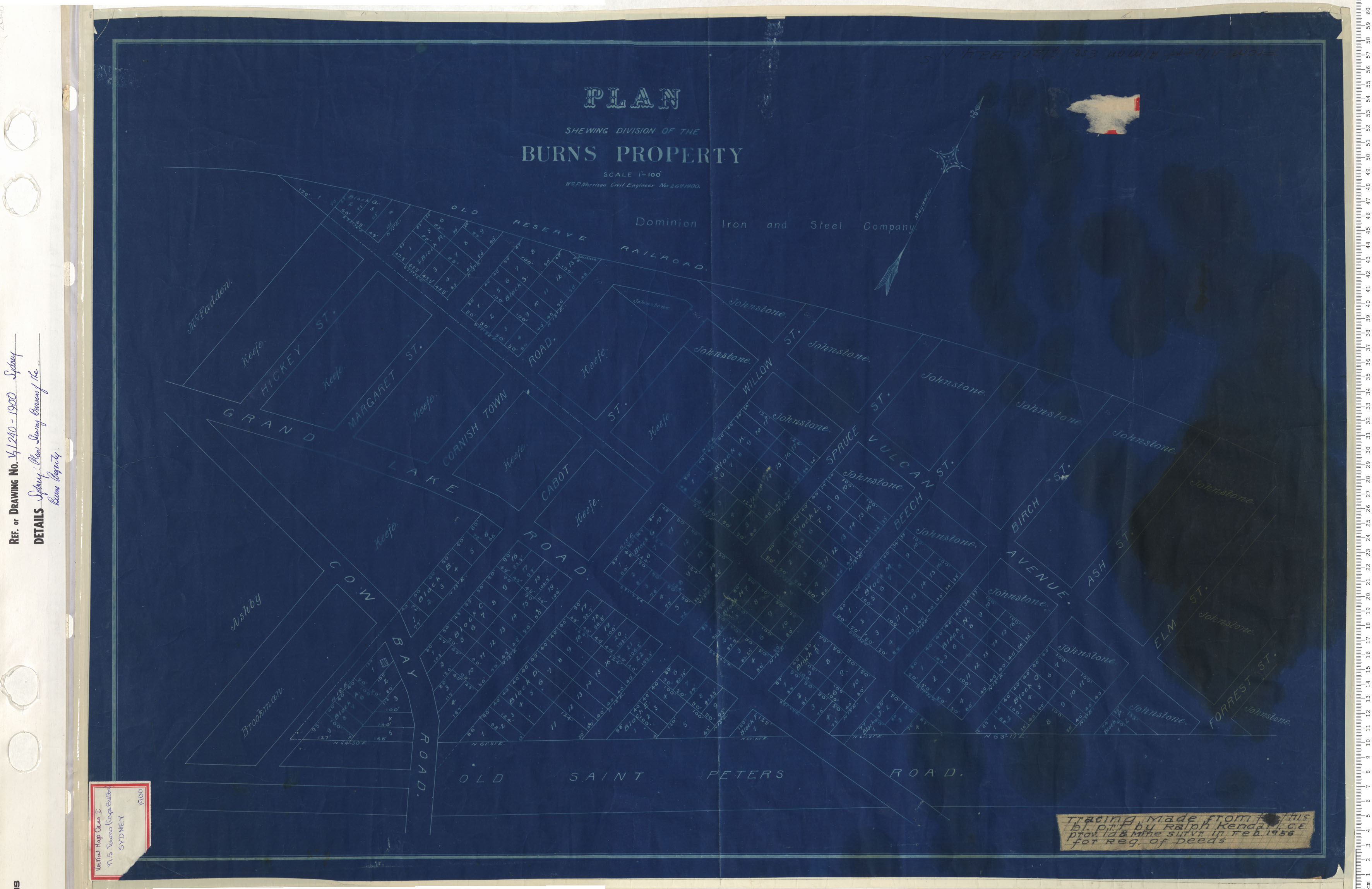
Sydney: Plan Shewing Division of the Burns Property
Date: 1900
Reference: Nova Scotia Archives Map Collection: V7 240 Sydney, Nova Scotia
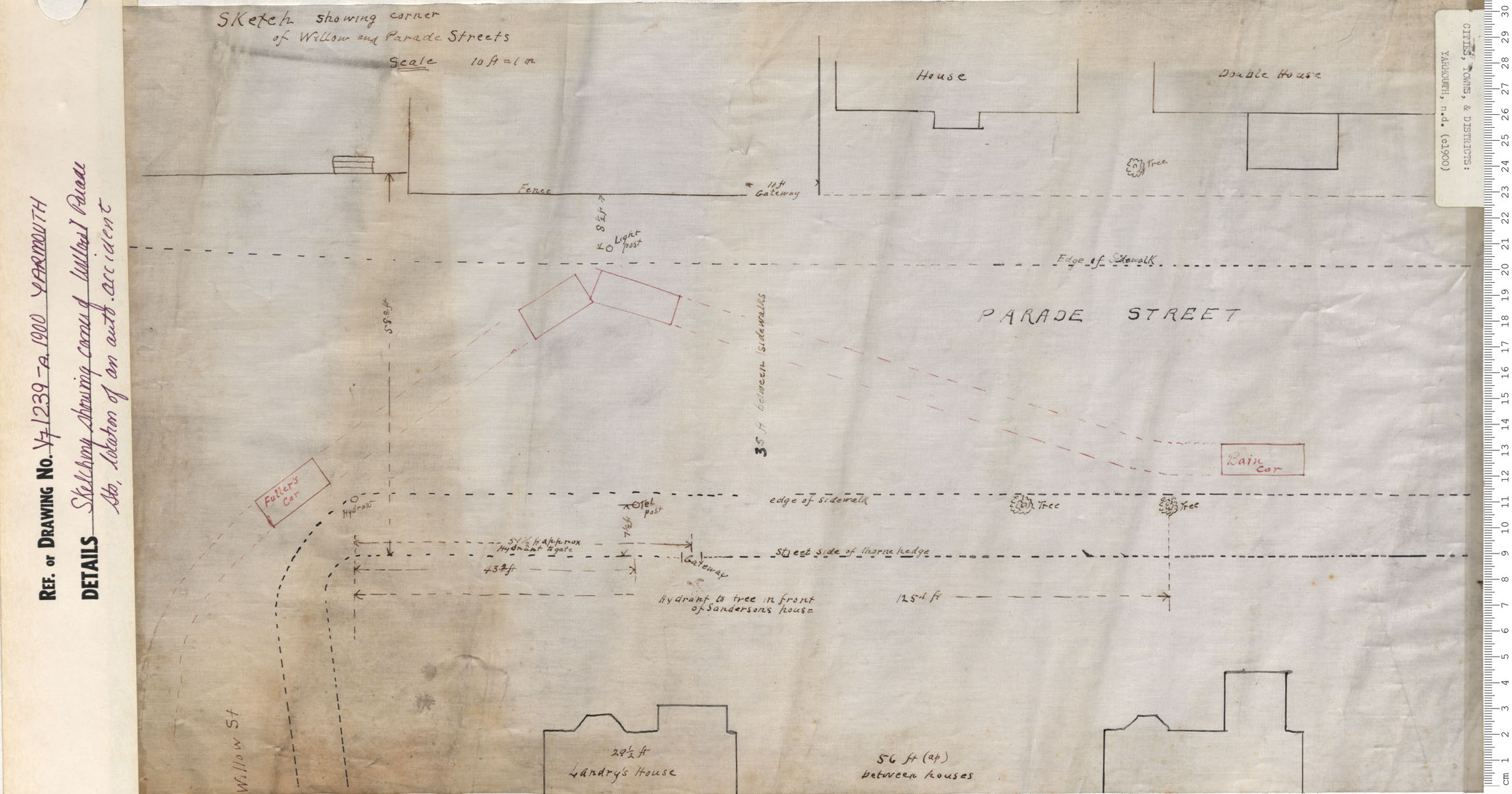
Sketching Showing corner of Willow and Parade Sts. Location of auto accident
Date: 1900
Reference: Nova Scotia Archives Map Collection: V7 239 Yarmouth, Nova Scotia
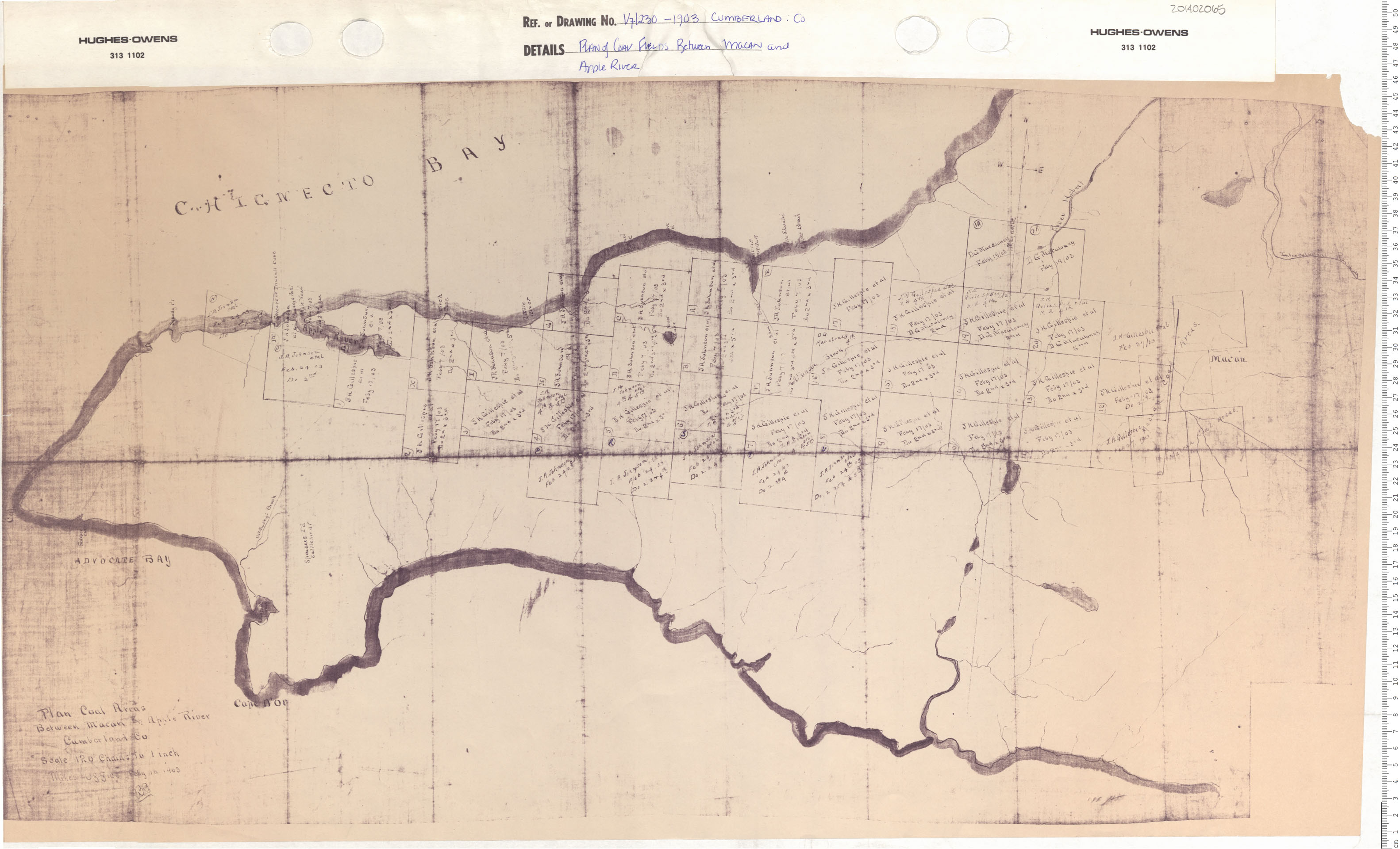
Plan of Coal Fields Between Macan and Apple River
Date: 1903
Reference: Nova Scotia Archives Map Collection: V7 230 Cumberland County, Nova Scotia
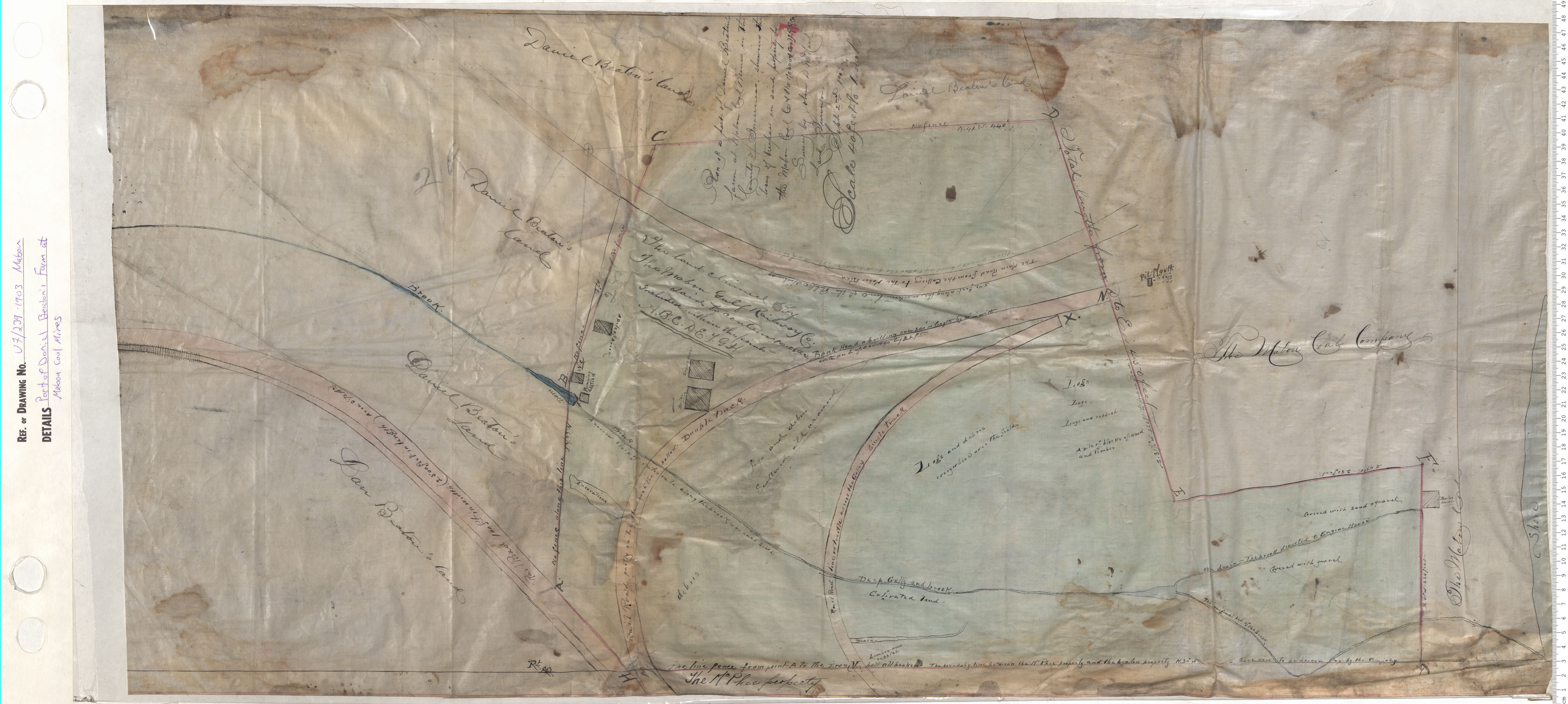
Part of Daniel Beaton's Farm at Mabou Coal Mines
Date: 1903
Reference: Nova Scotia Archives Map Collection: V7 239 Mabou, Nova Scotia
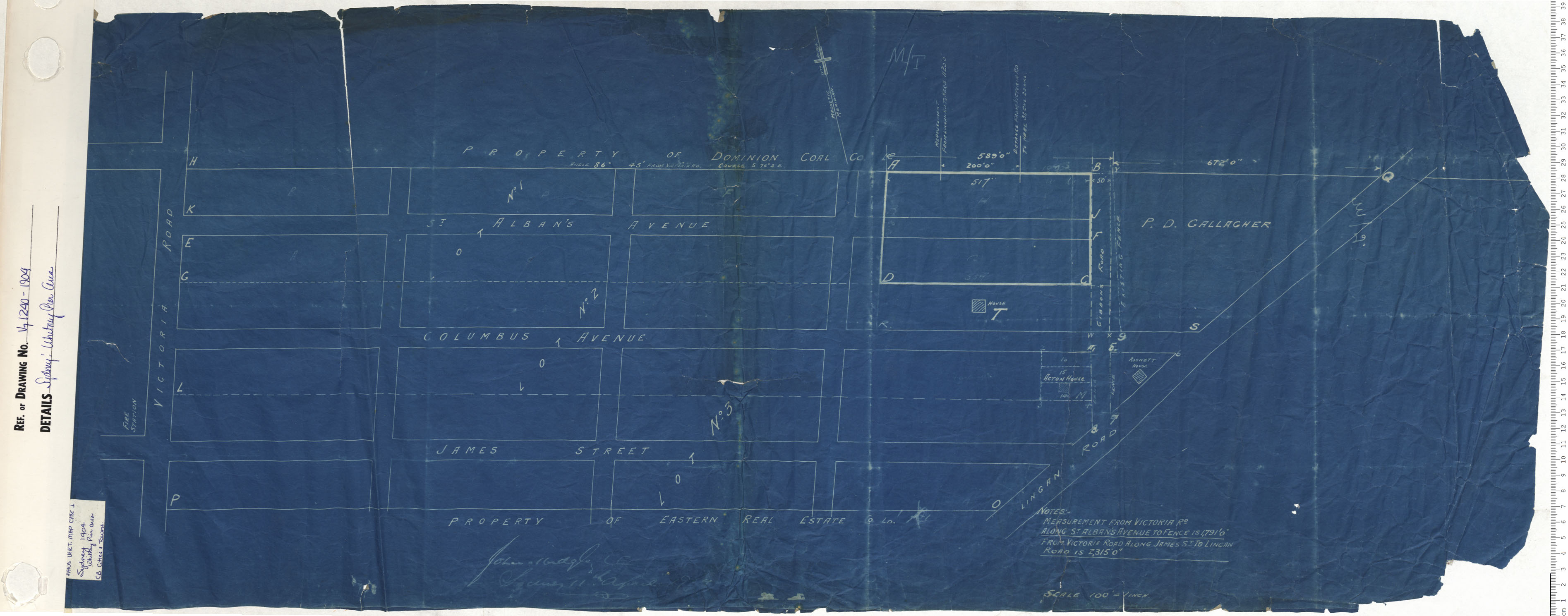
Whitney Pier Area
Date: 1904
Reference: Nova Scotia Archives Map Collection: V7 240 Sydney, Nova Scotia