Nova Scotia Archives
Historical Maps of Nova Scotia
Results 91 to 105 of 296 from your search: V7
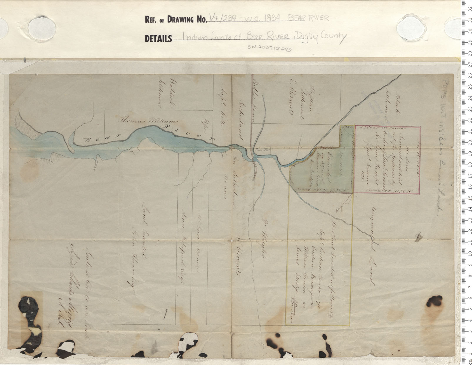
Indian Lands at Bear River, Digby County
Date: 1834
Reference: Nova Scotia Archives Map Collection: V7 239 Bear River, Nova Scotia
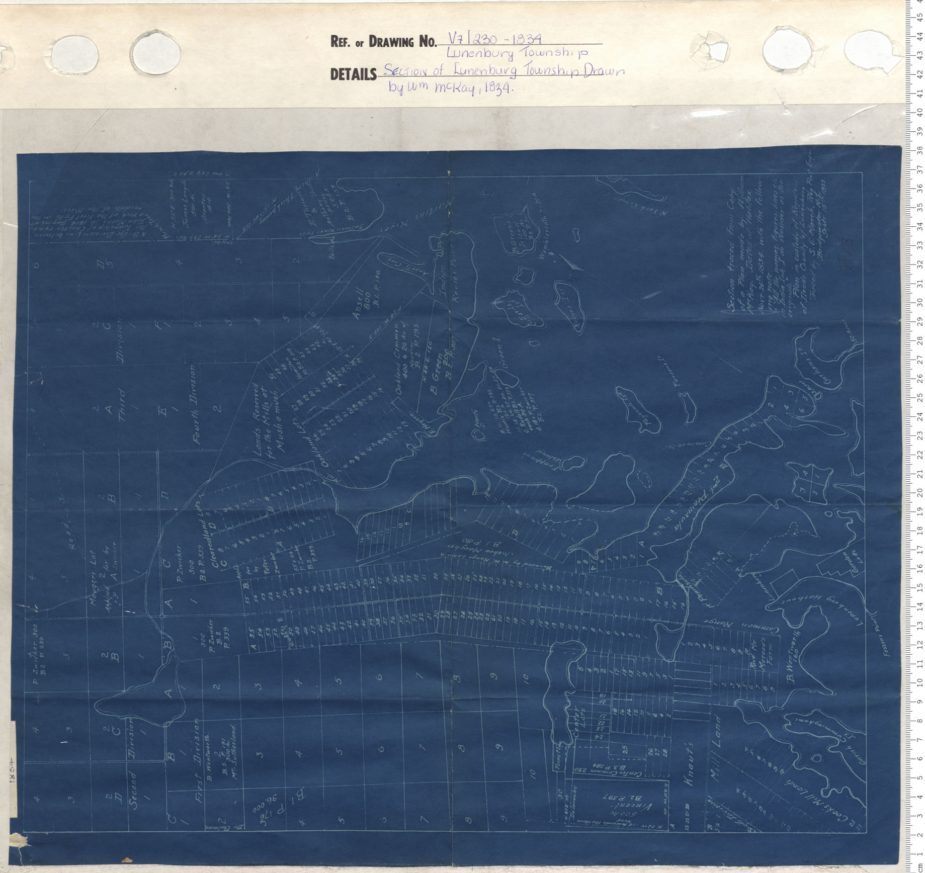
Section of Lunenburg Township Drawn by W.M. McKay, 1834
Date: 1834
Reference: Nova Scotia Archives Map Collection: V7 230 Lunenburg Township, Nova Scotia
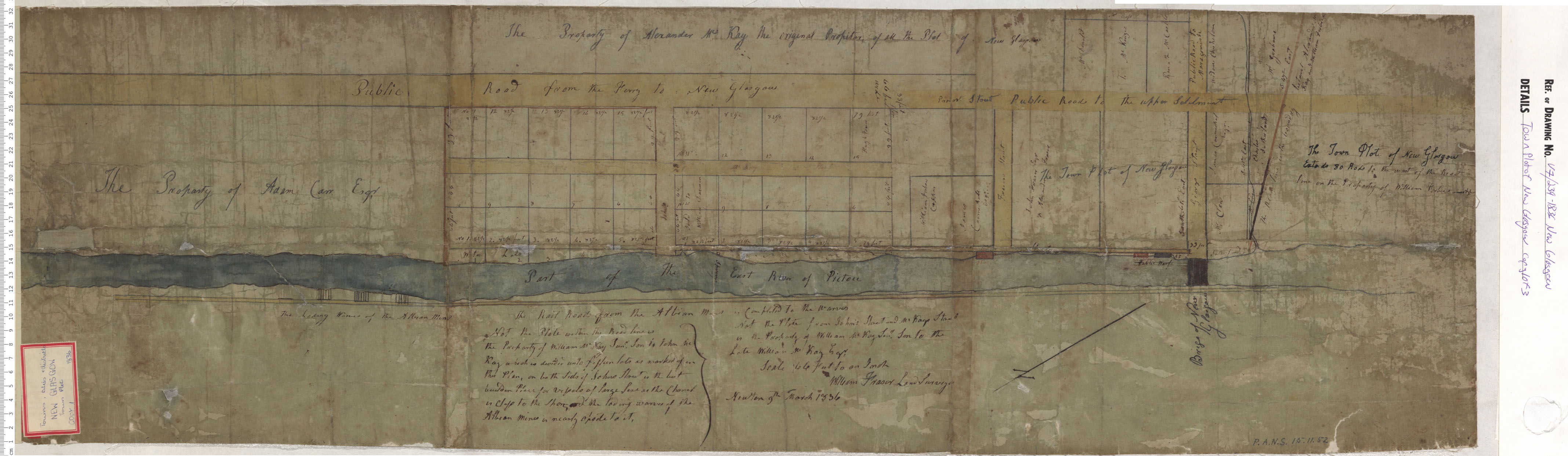
Town Plot of New Glasgow
Date: 1836
Reference: Nova Scotia Archives Map Collection: V7 239 New Glasgow, Nova Scotia
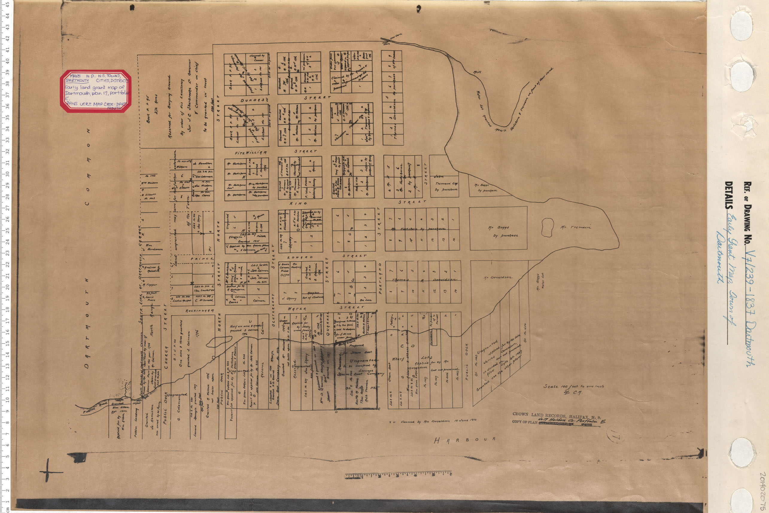
Early Grant Map. Town of Dartmouth
Date: 1837
Reference: Nova Scotia Archives Map Collection: V7 239 Dartmouth, Nova Scotia
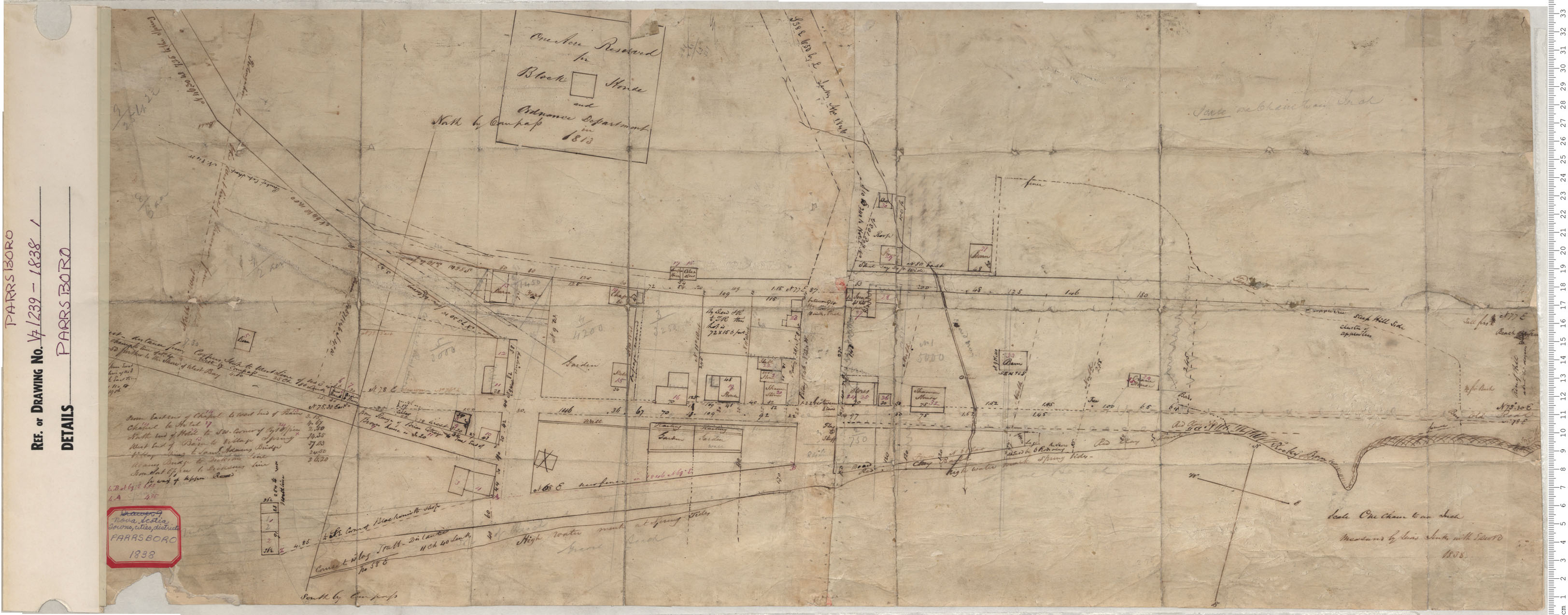
Partridge Island, Parrsboro
Date: 1838
Reference: Nova Scotia Archives Map Collection: V7 239 Partridge Island, Parrsboro, Nova Scotia
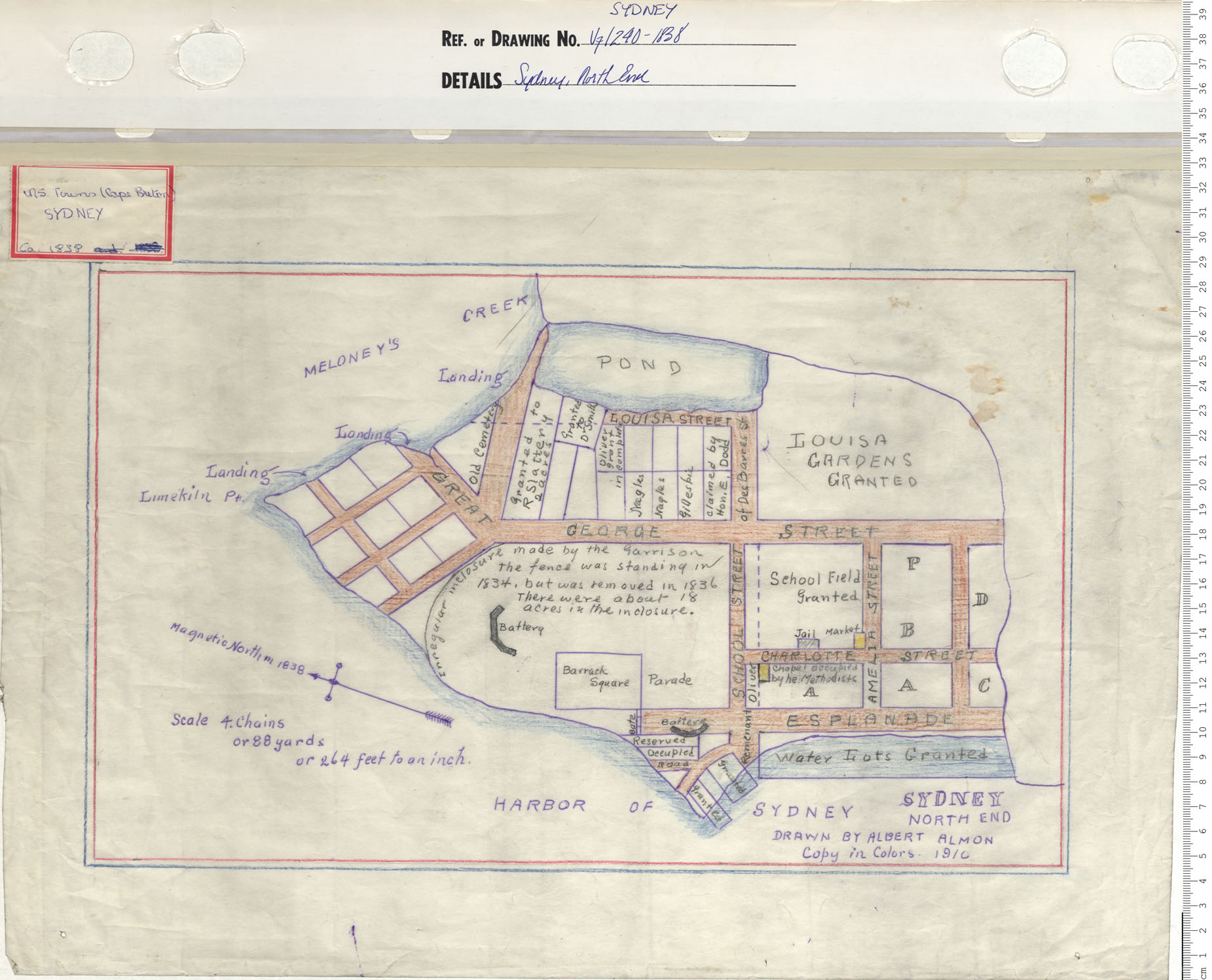
Sydney, North End
Date: 1838
Reference: Nova Scotia Archives Map Collection: V7 240 Sydney, Nova Scotia
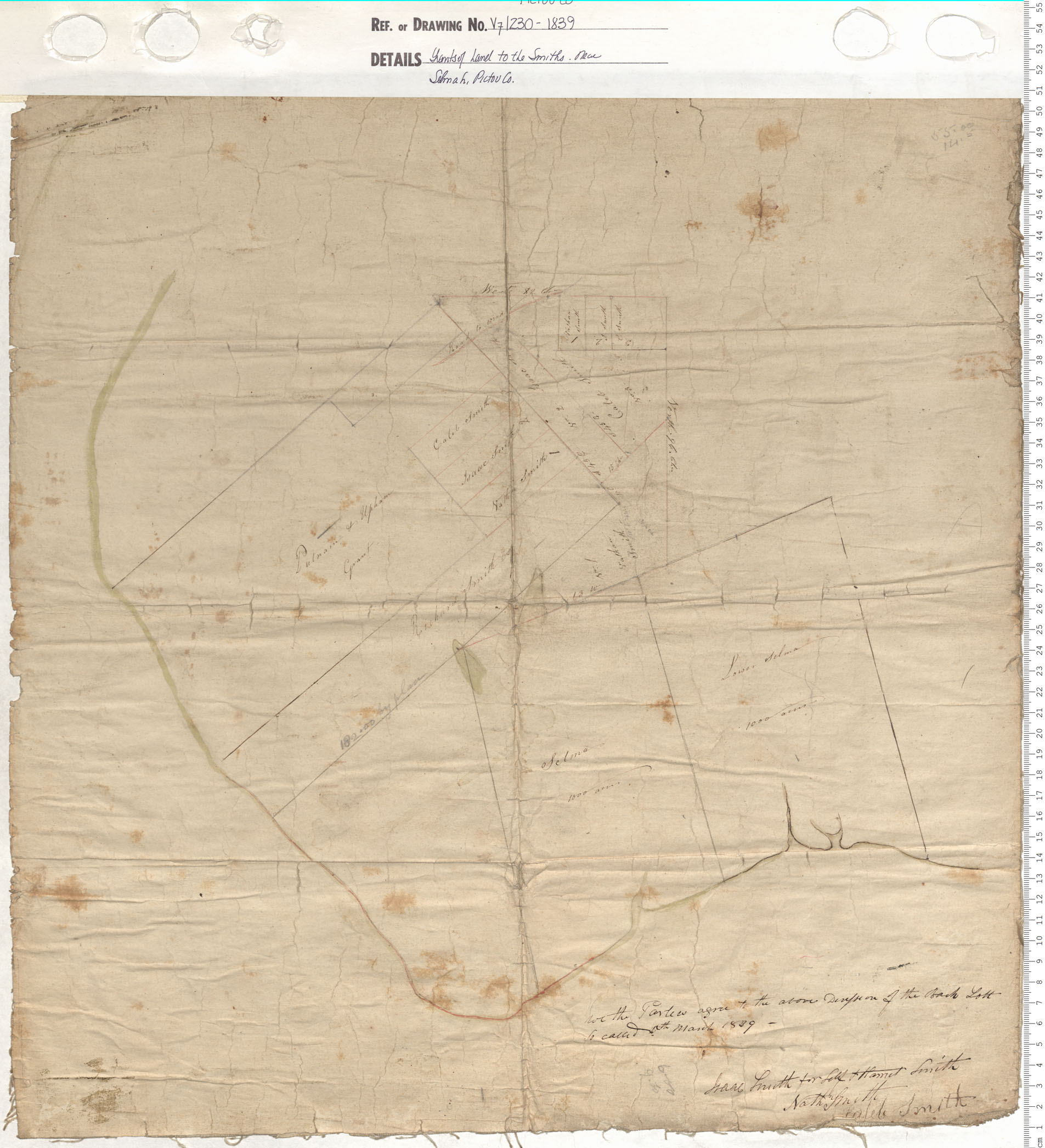
Grants of Land to the Smiths near Selma, Hants County
Date: 1839
Reference: Nova Scotia Archives Map Collection: V7 230 Hants County, Nova Scotia
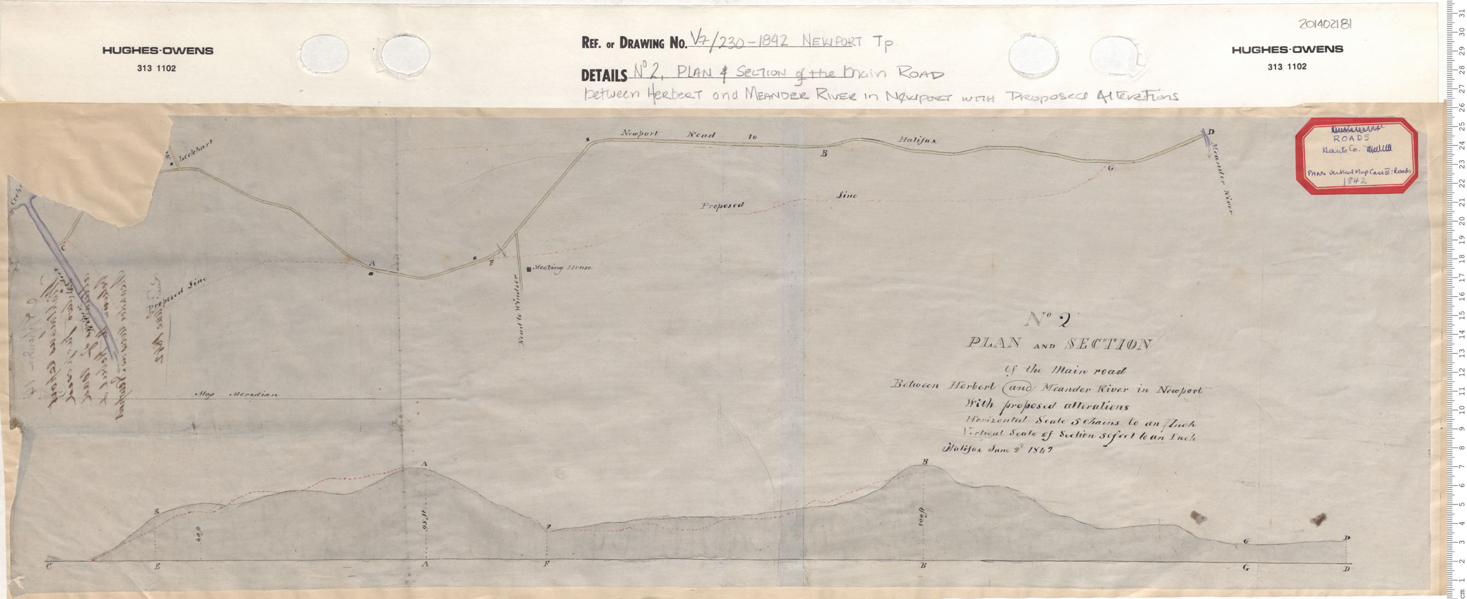
No. 2 Plan & Section of the Main Road between Herbert and Meander River in Newport with Proposed alterations
Date: 1842
Reference: Nova Scotia Archives Map Collection: V7 230 Newport, Nova Scotia
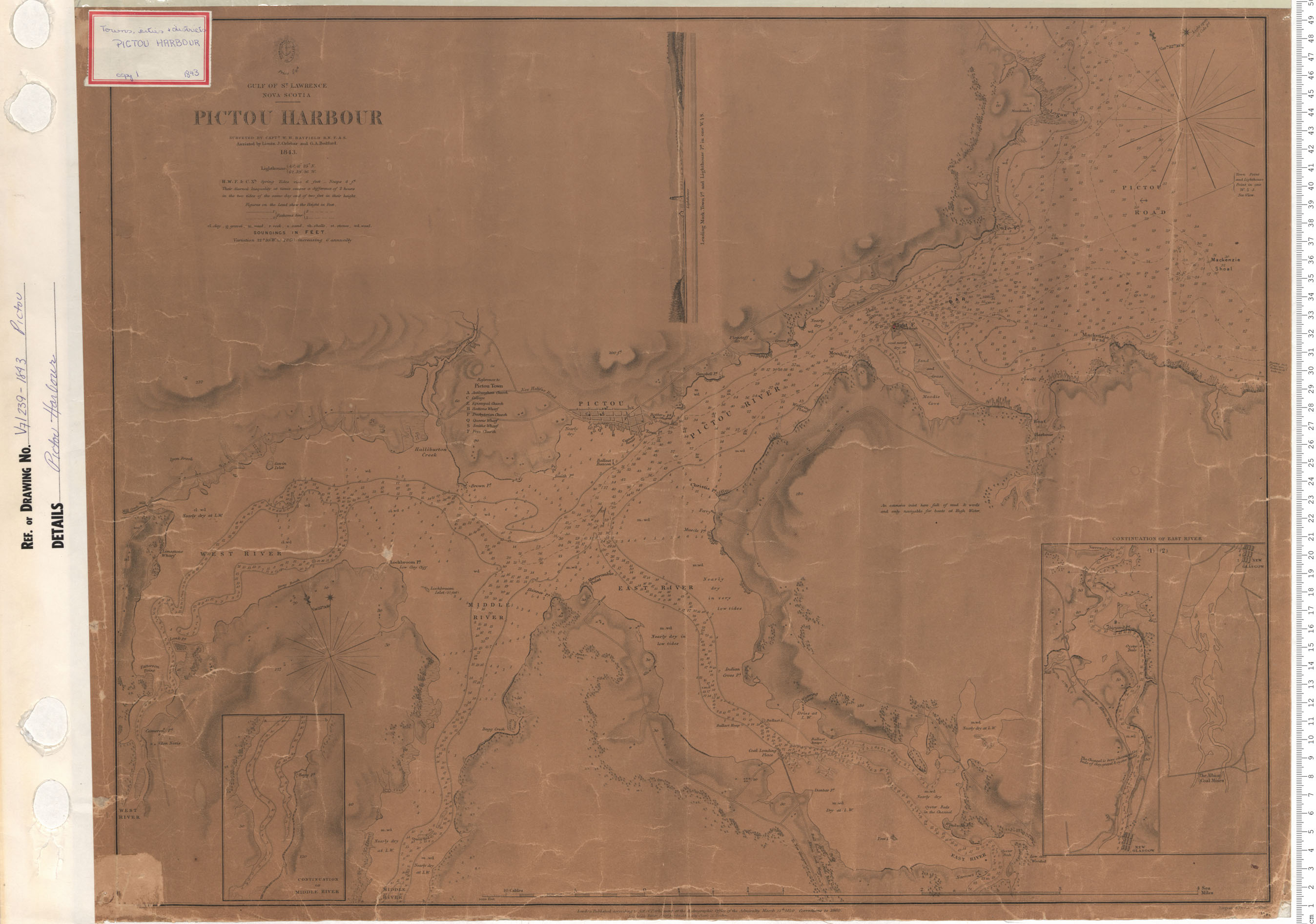
Pictou Harbour
Date: 1843
Reference: Nova Scotia Archives Map Collection: V7 239 Pictou, Nova Scotia
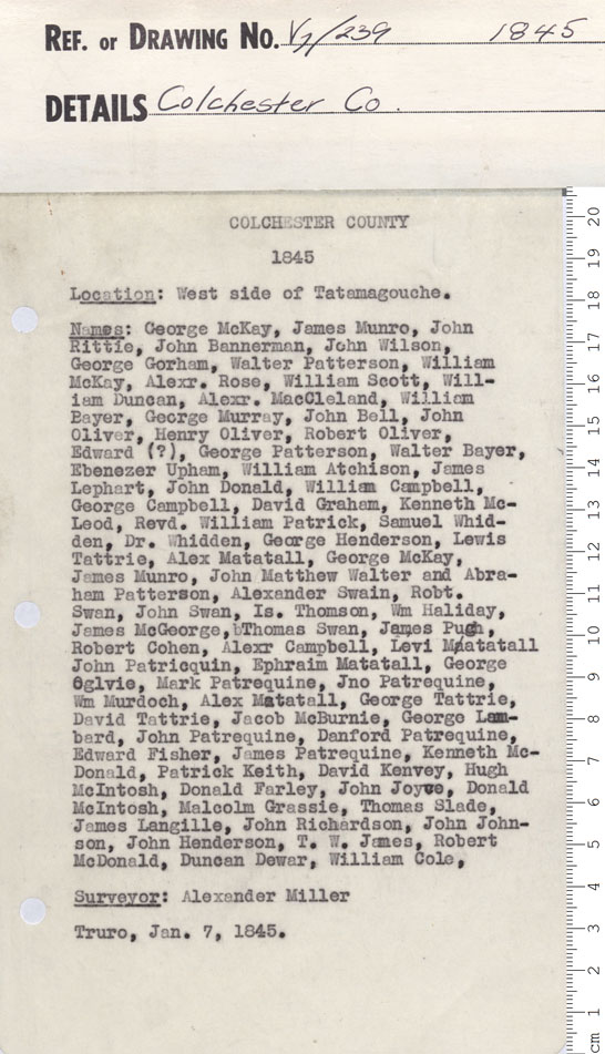
"A plan of the west side of Tatamagouche on a scale of..."
Date: 1845
Reference: Nova Scotia Archives Map Collection: V7 239 Colchester County, Nova Scotia
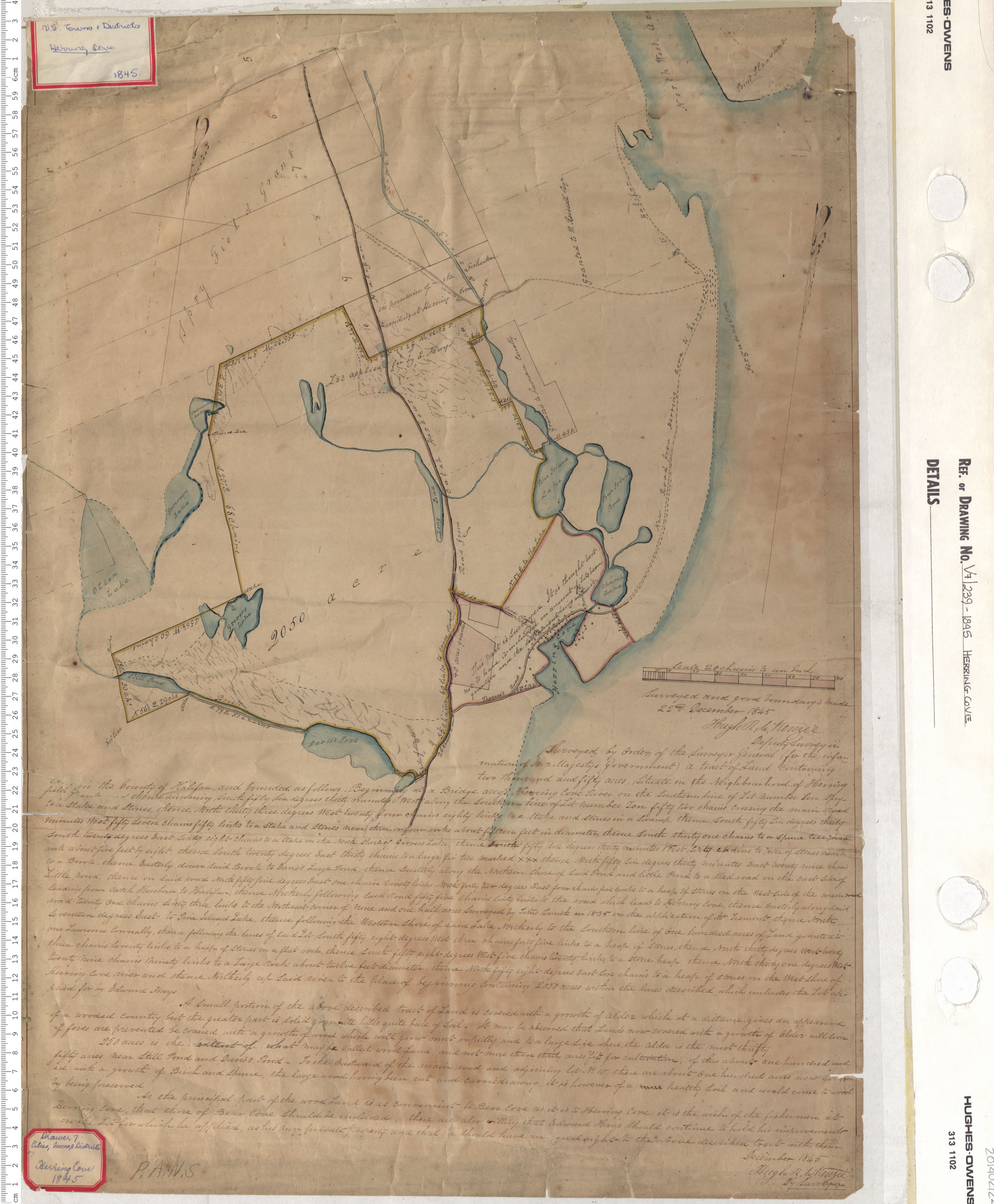
Herring Cove
Date: 1845
Reference: Nova Scotia Archives Map Collection: V7 239 Herring Cove, Nova Scotia
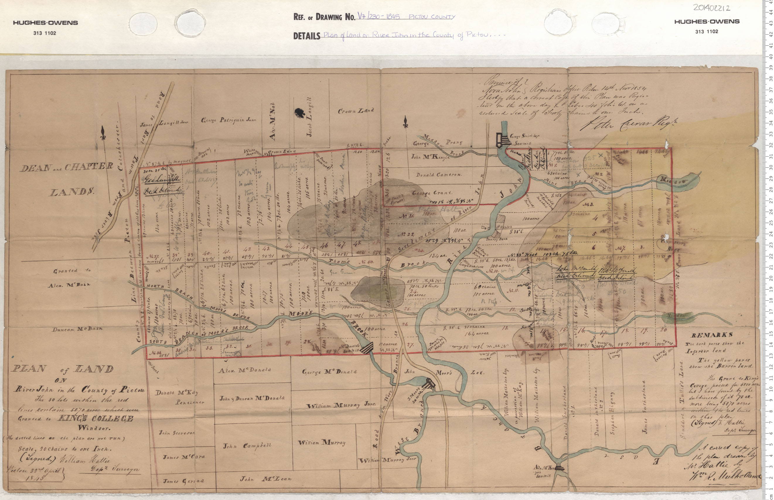
Plan of the Landon River John in the County of Pictou
Date: 1845
Reference: Nova Scotia Archives Map Collection: V7 230 Pictou County, Nova Scotia
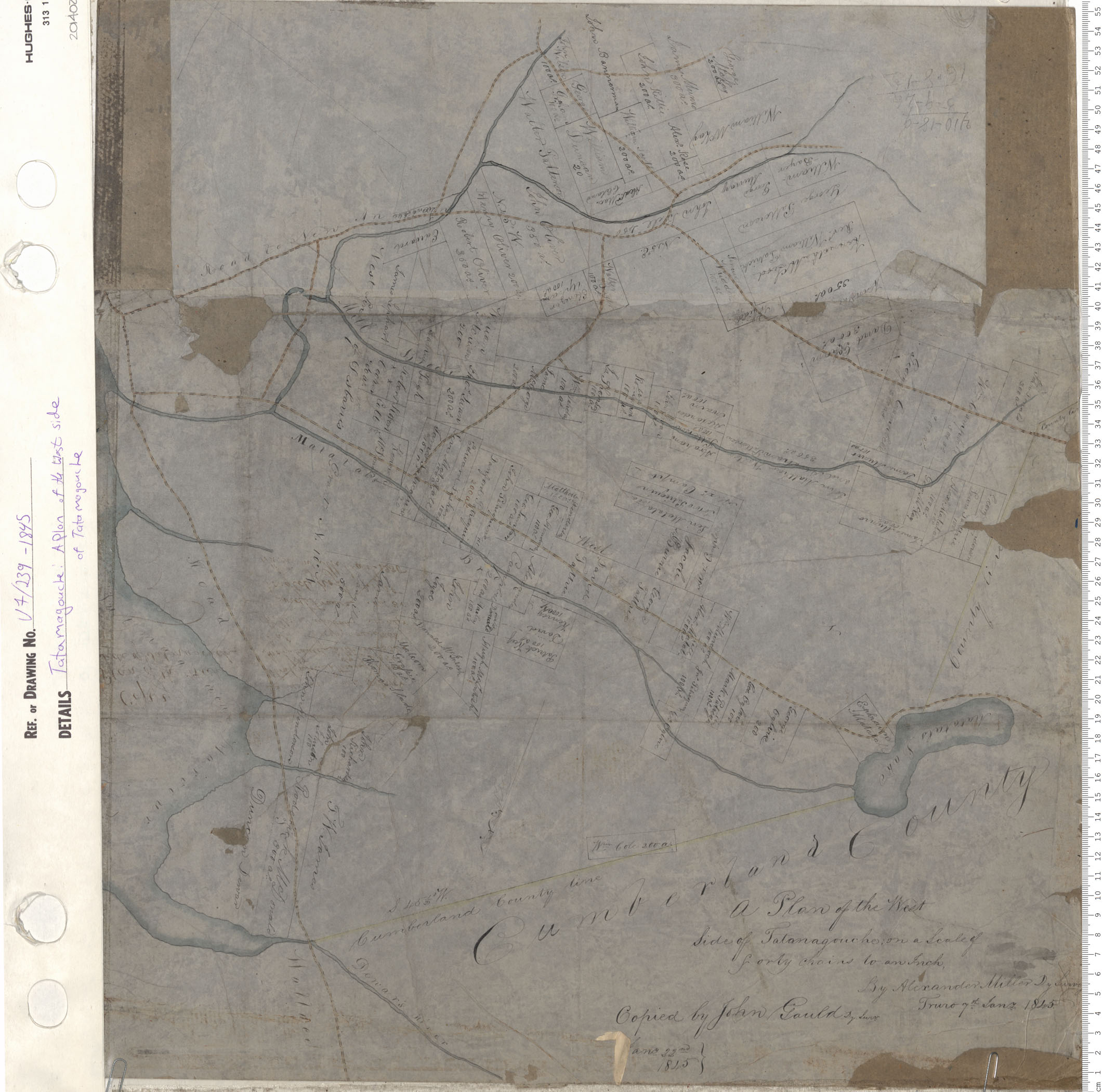
A Plan of the west side of Tatamagouche
Date: 1845
Reference: Nova Scotia Archives Map Collection: V7 239 Tatamagouche, Nova Scotia
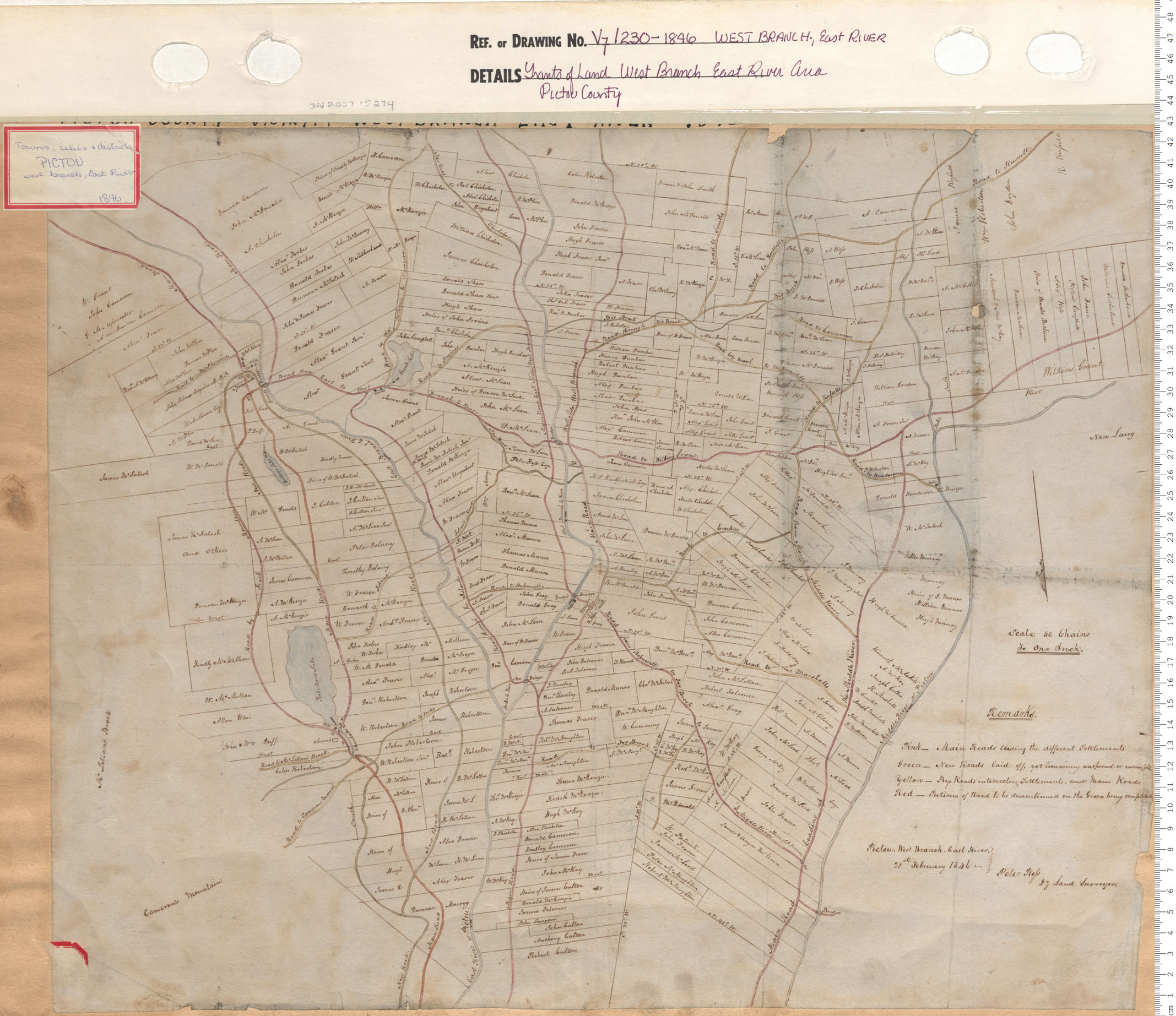
Grant of West Branch East River Area Pictou County
Date: 1846
Reference: Nova Scotia Archives Map Collection: V7 230 West Branch, East River, Nova Scotia