Nova Scotia Archives
Historical Maps of Nova Scotia
Results 106 to 120 of 296 from your search: V7
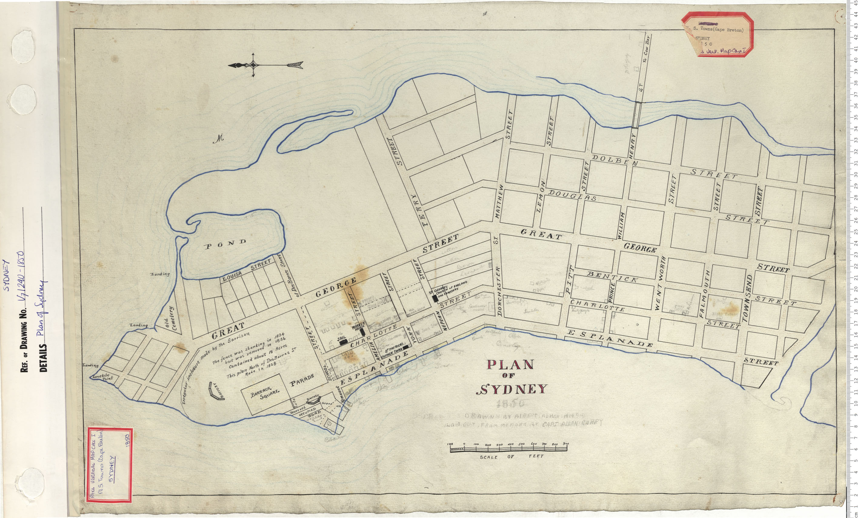
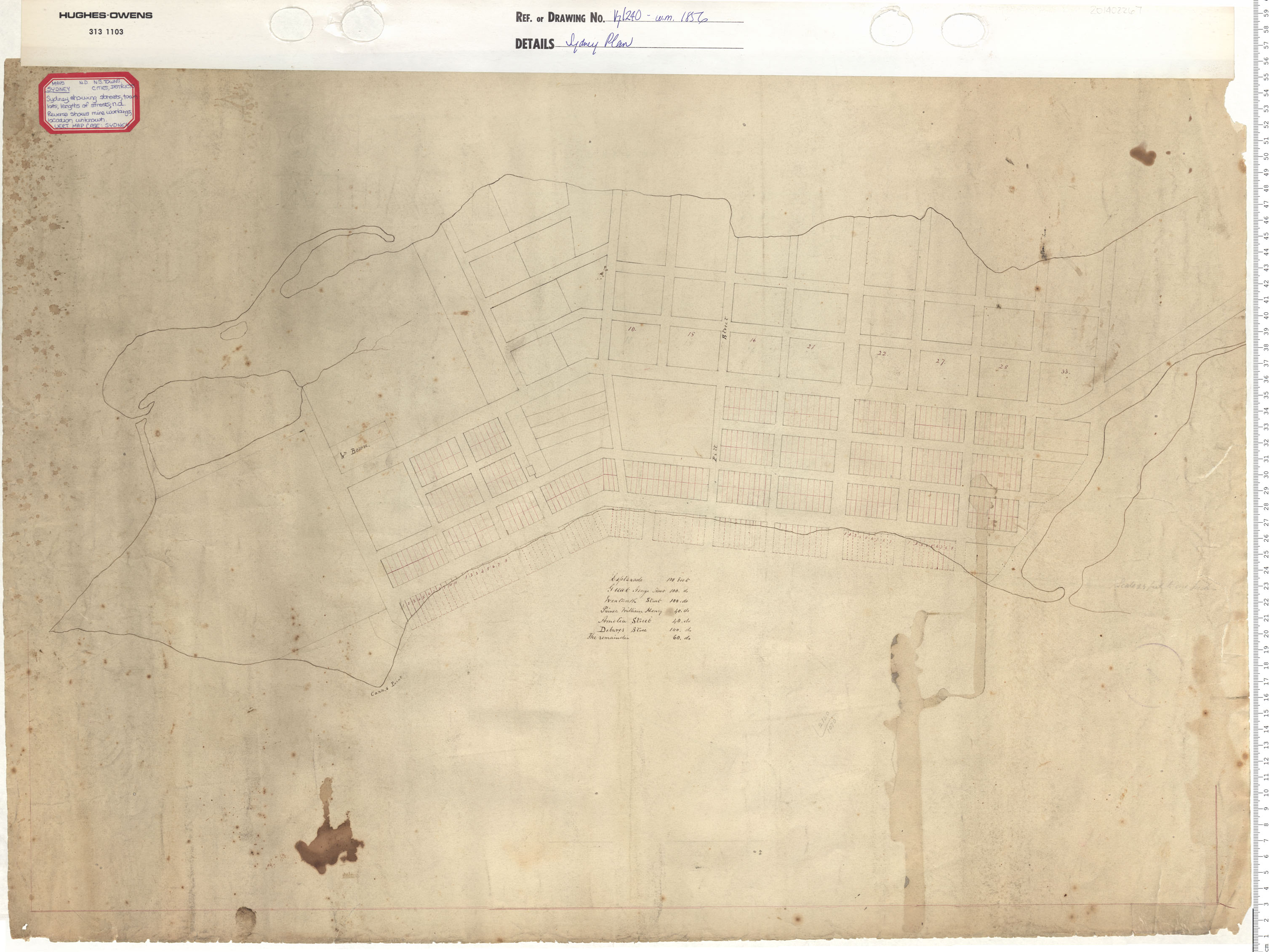
Plan of Sydney
Date: 1850
Reference: Nova Scotia Archives Map Collection: V7 240 Sydney, Nova Scotia
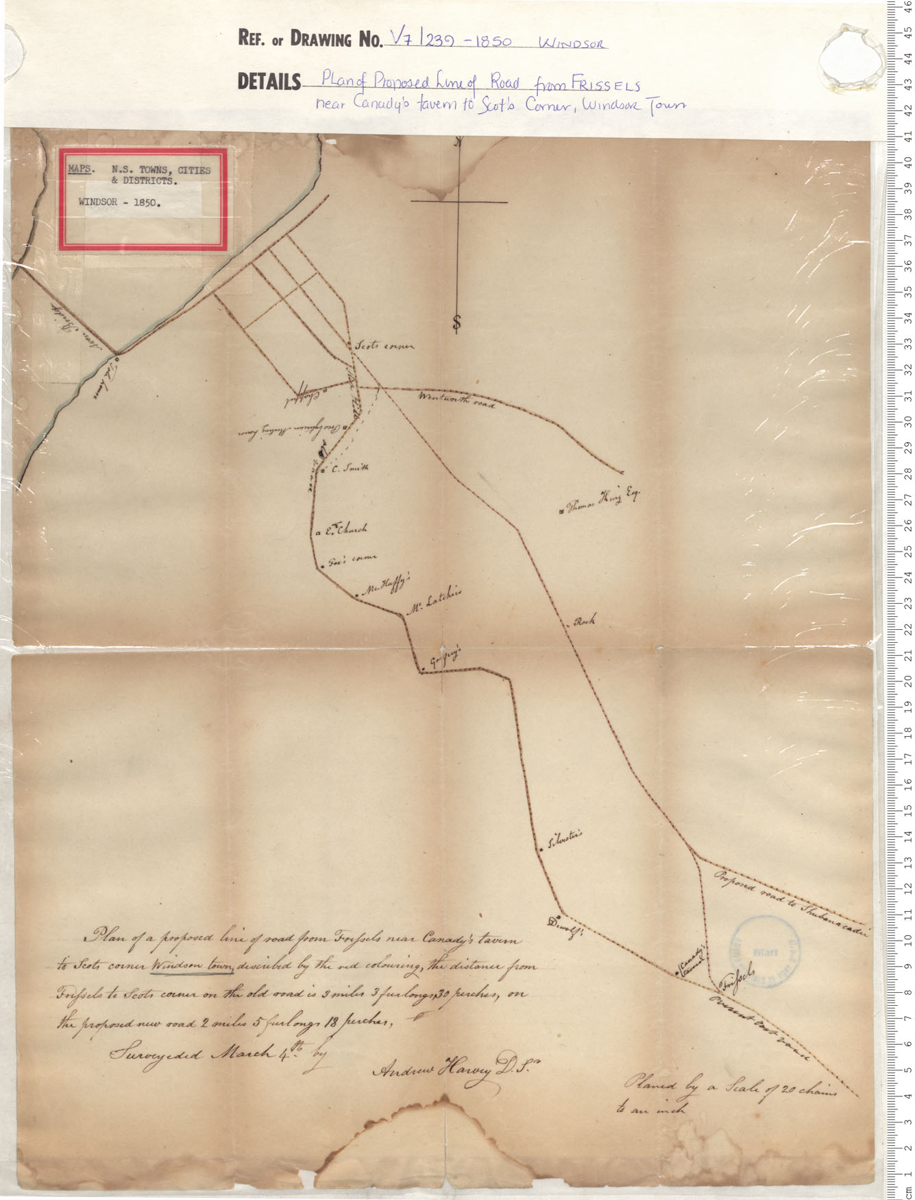
Plan of Proposed Line of Road From Frissels near Canady's tavern to Scot's Corner, Windsor Town
Date: 1850
Reference: Nova Scotia Archives Map Collection: V7 239 Windsor, Nova Scotia
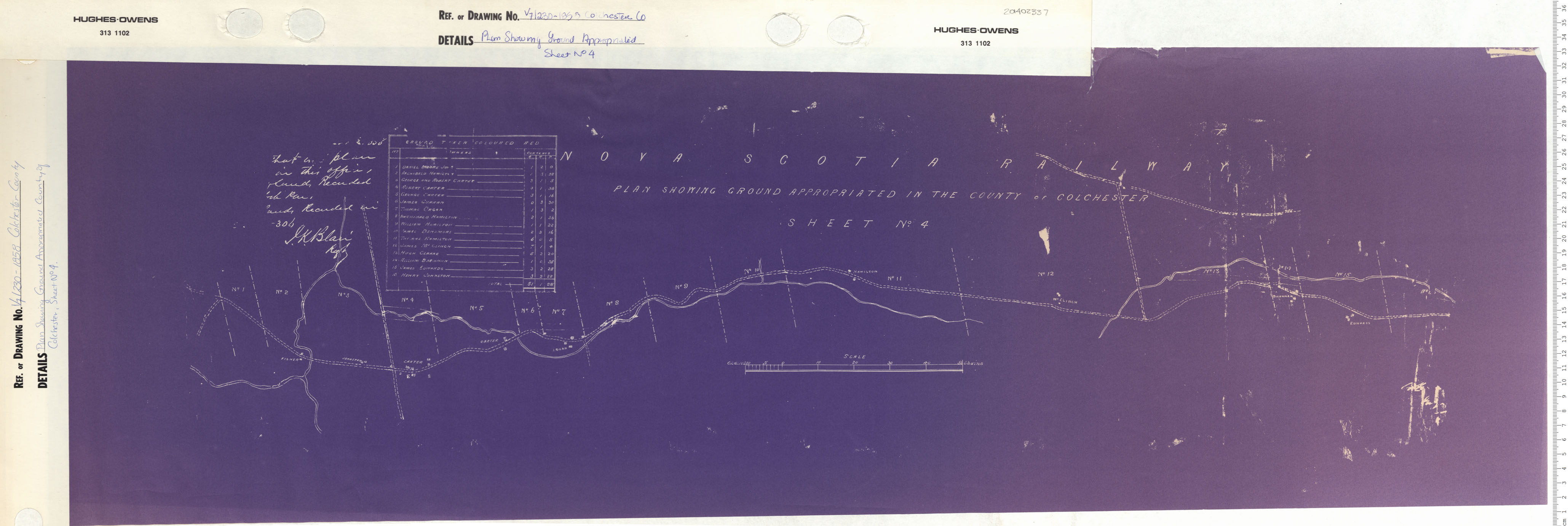
Plan Showing Ground Appropriated in the County of Colchester Sheet No. 4
Date: 1853
Reference: Nova Scotia Archives Map Collection: V7 230 Colchester County, Nova Scotia
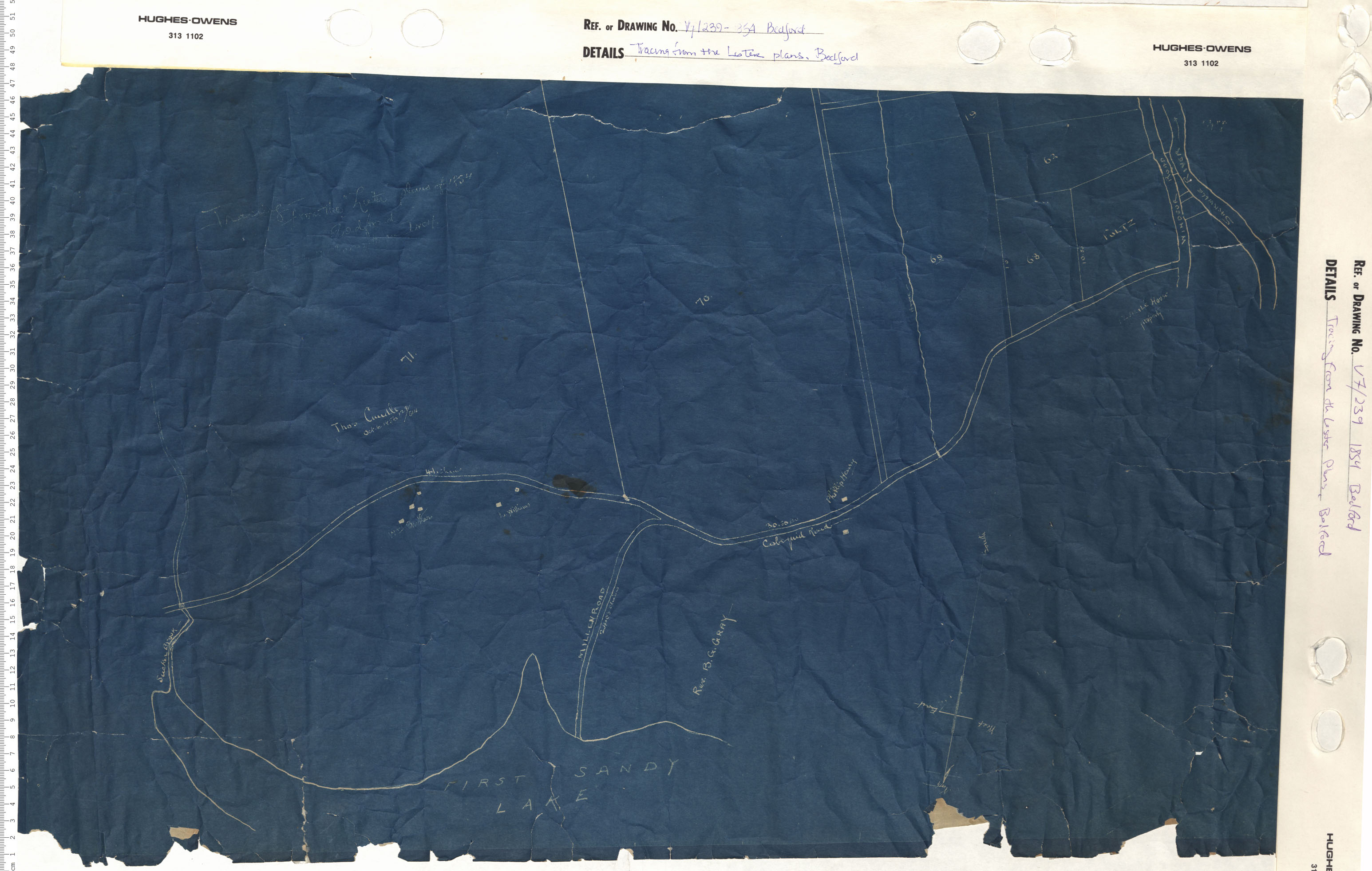
Tracing from the "Lister" plans, Bedford
Date: 1854
Reference: Nova Scotia Archives Map Collection: V7 239 Bedford, Nova Scotia
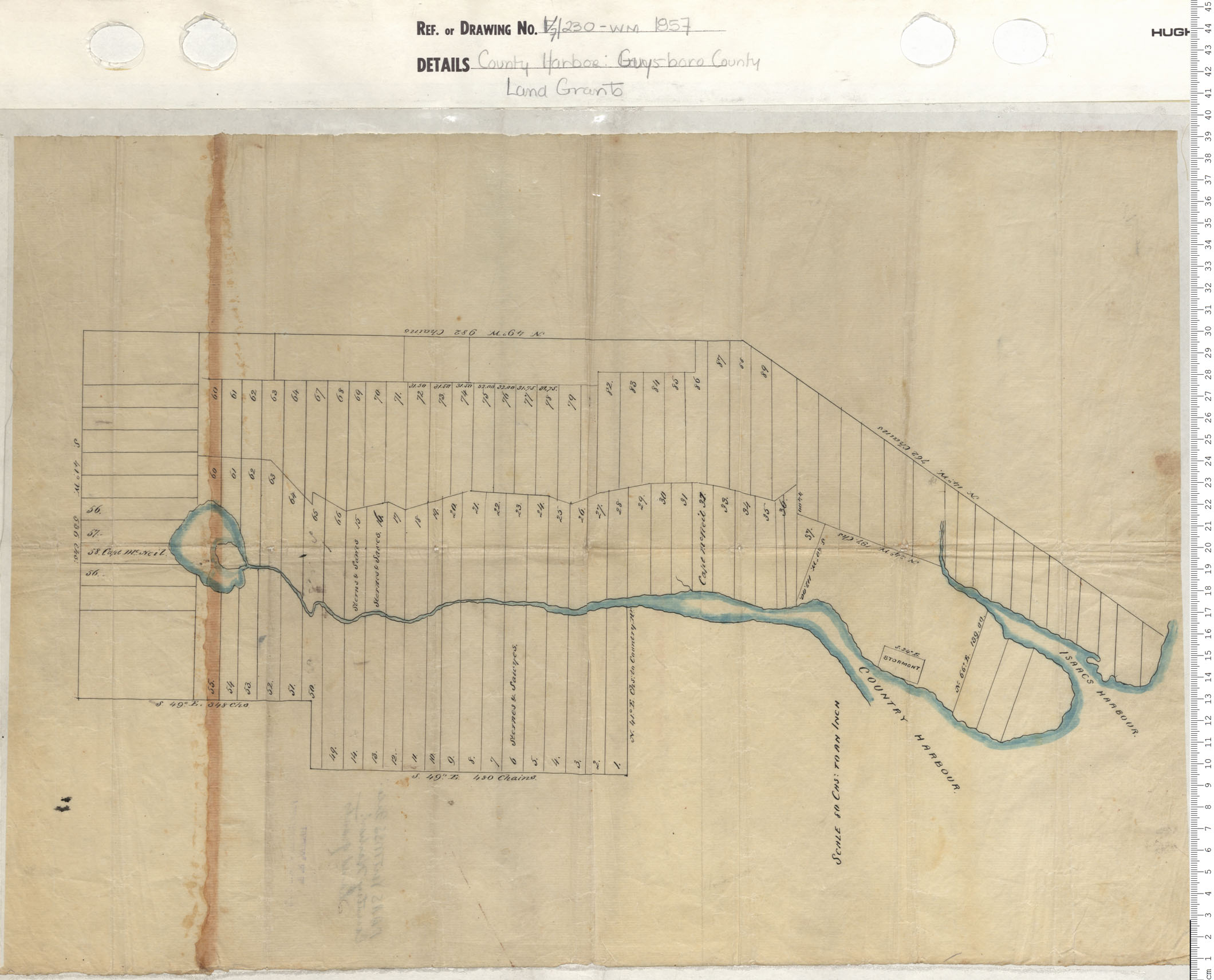
County harbour, Guysborough County, Land Grants
Date: 1857
Reference: Nova Scotia Archives Map Collection: V7 230 County Harbour, Nova Scotia
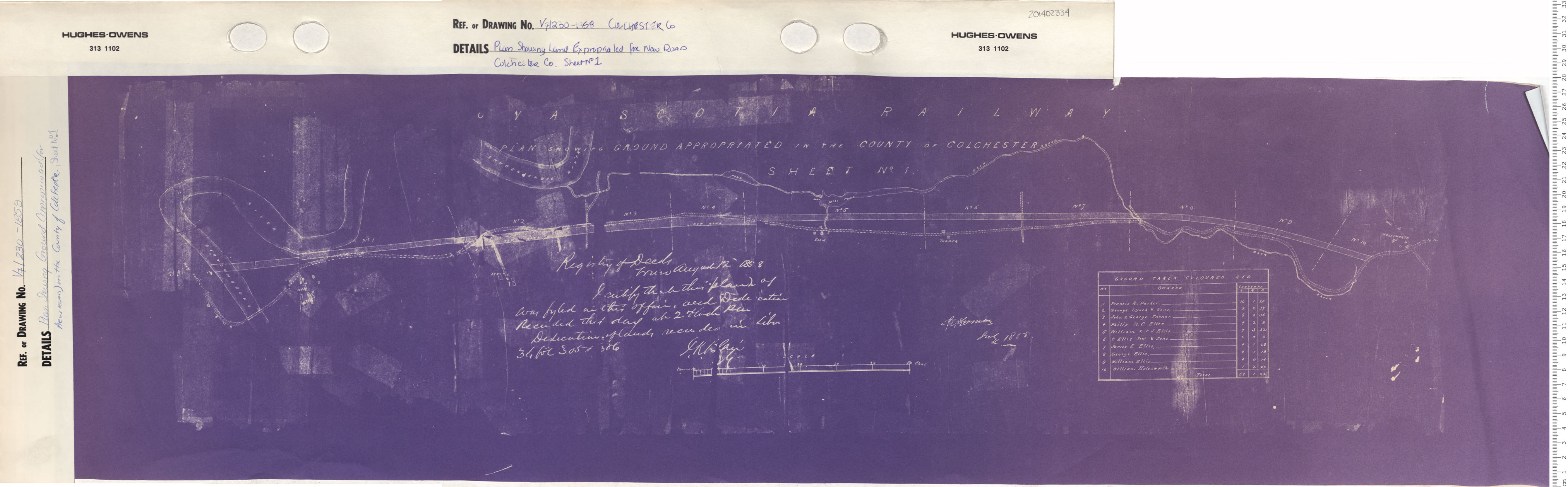
Plan Showing Land Expropriated for New Road Colchester County, Sheet No. 1
Date: 1858
Reference: Nova Scotia Archives Map Collection: V7 230 Colchester County, Nova Scotia
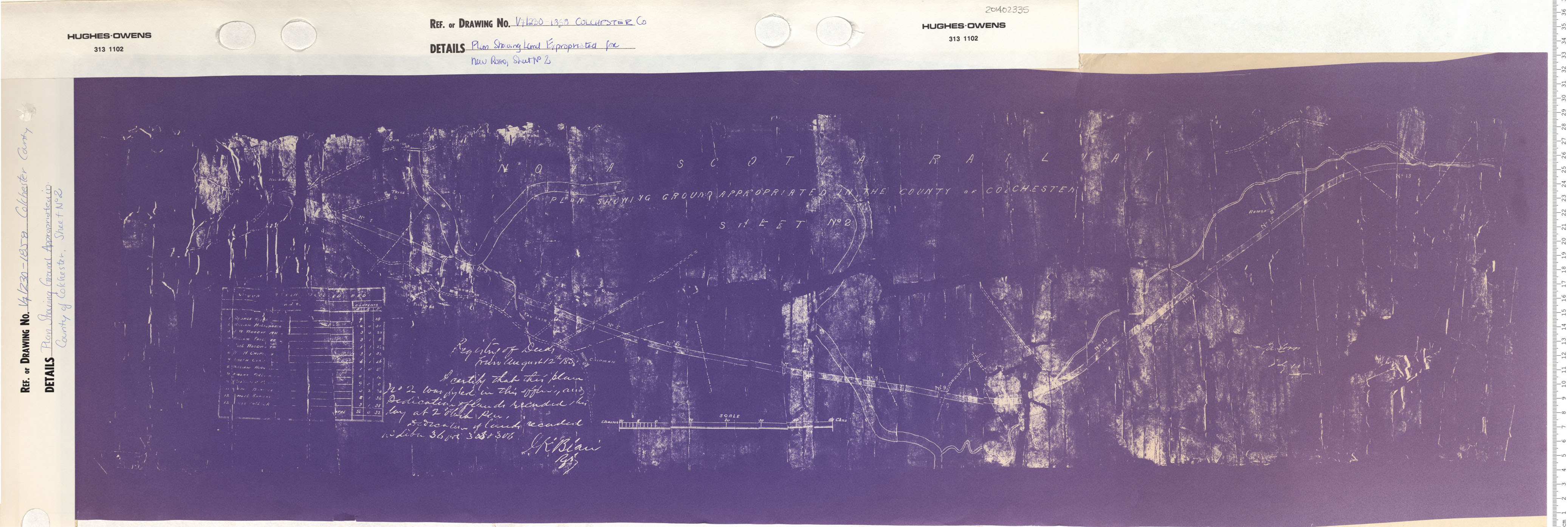
Plan Showing Land Expropriated for New Road Colchester County, Sheet No. 2
Date: 1858
Reference: Nova Scotia Archives Map Collection: V7 230 Colchester County, Nova Scotia
Plan Showing Land Expropriated for New Road Colchester County, Sheet No. 3
Date: 1858
Reference: Nova Scotia Archives Map Collection: V7 230 Colchester County, Nova Scotia
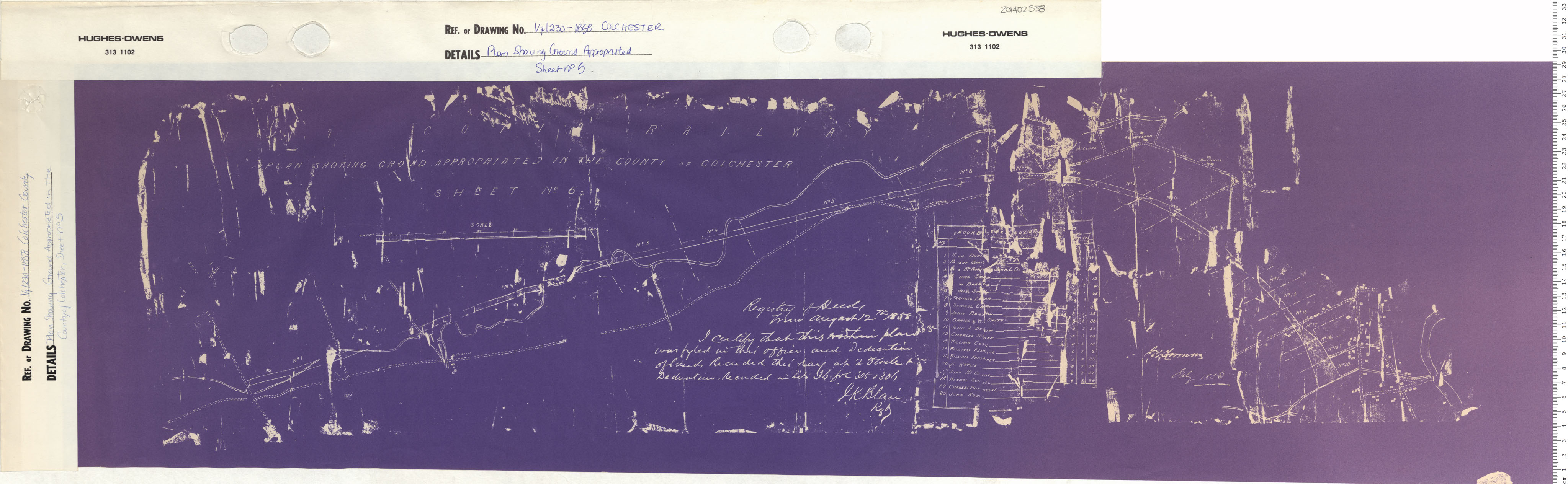
Plan Showing Land Expropriated for New Road Colchester County, Sheet No. 4
Date: 1858
Reference: Nova Scotia Archives Map Collection: V7 230 Colchester County, Nova Scotia
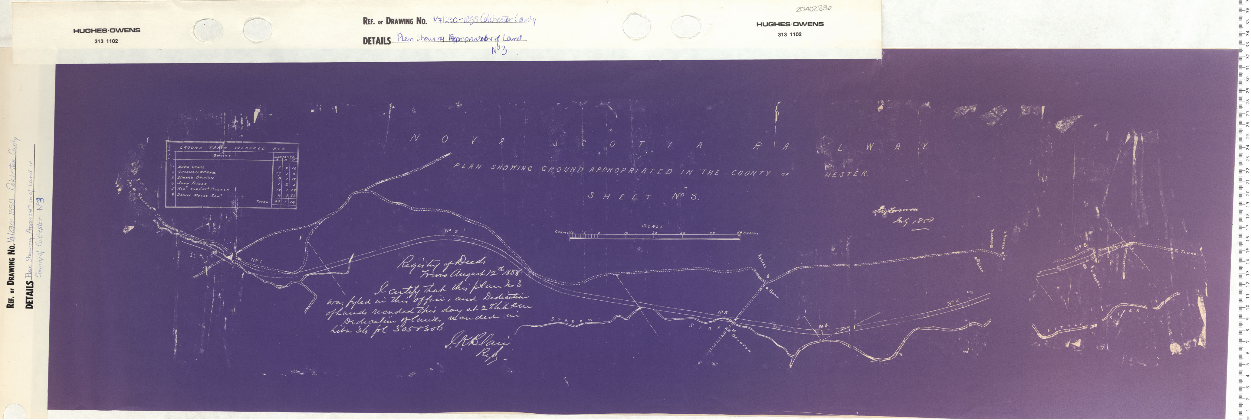
Plan Showing Land Expropriated for New Road Colchester County, Sheet No. 5
Date: 1858
Reference: Nova Scotia Archives Map Collection: V7 230 Colchester, Nova Scotia
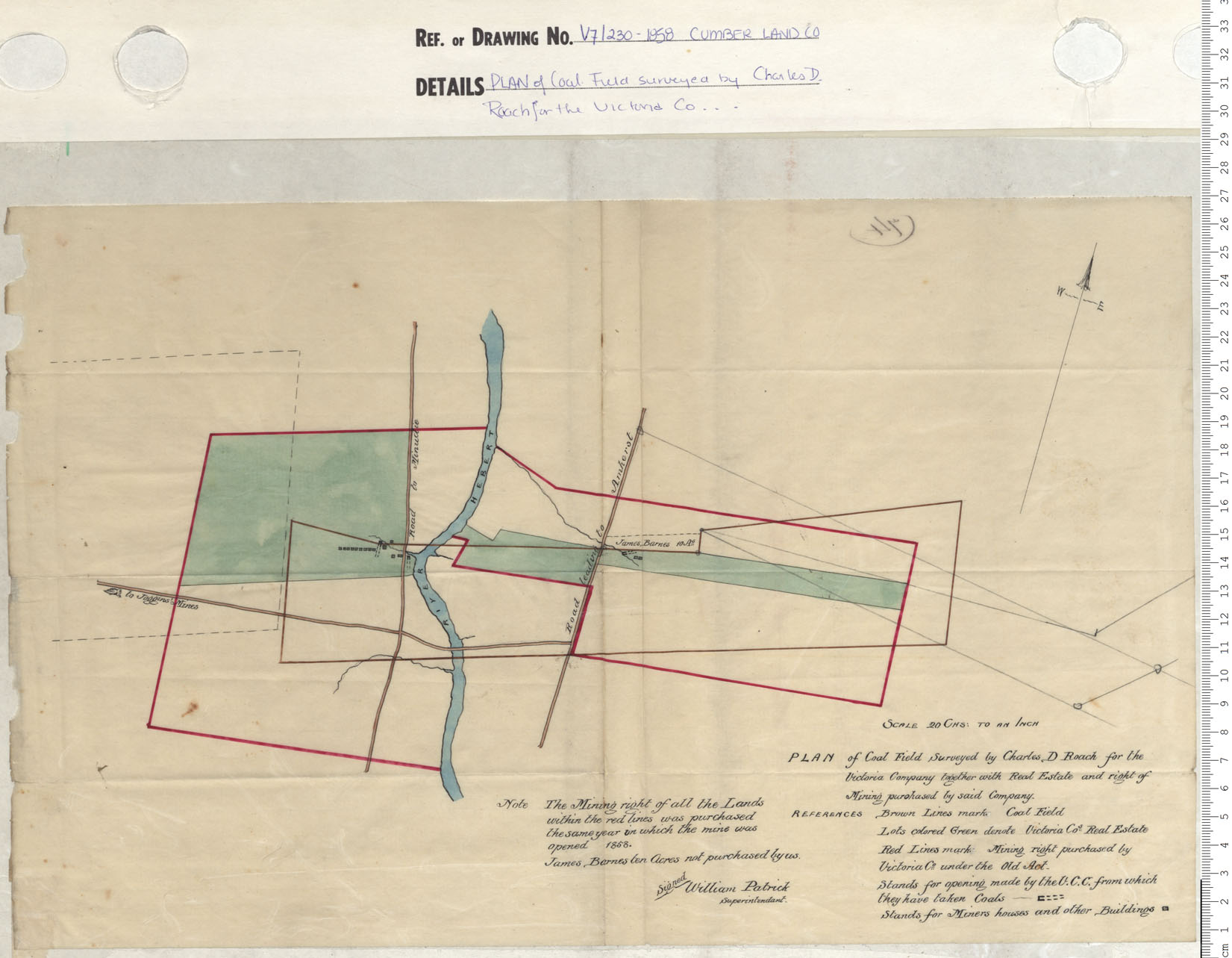
Plan of coal field Surveyed by Charles D. Roach for the Victoria Company
Date: 1858
Reference: Nova Scotia Archives Map Collection: V7 230 Cumberland County, Nova Scotia
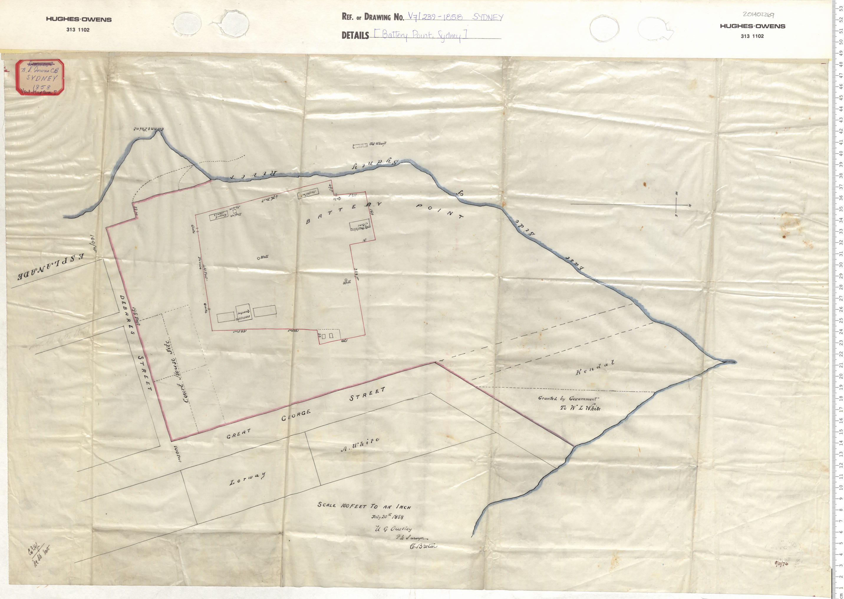
Battery Point Sydney
Date: 1858
Reference: Nova Scotia Archives Map Collection: V7 239 Sydney, Nova Scotia
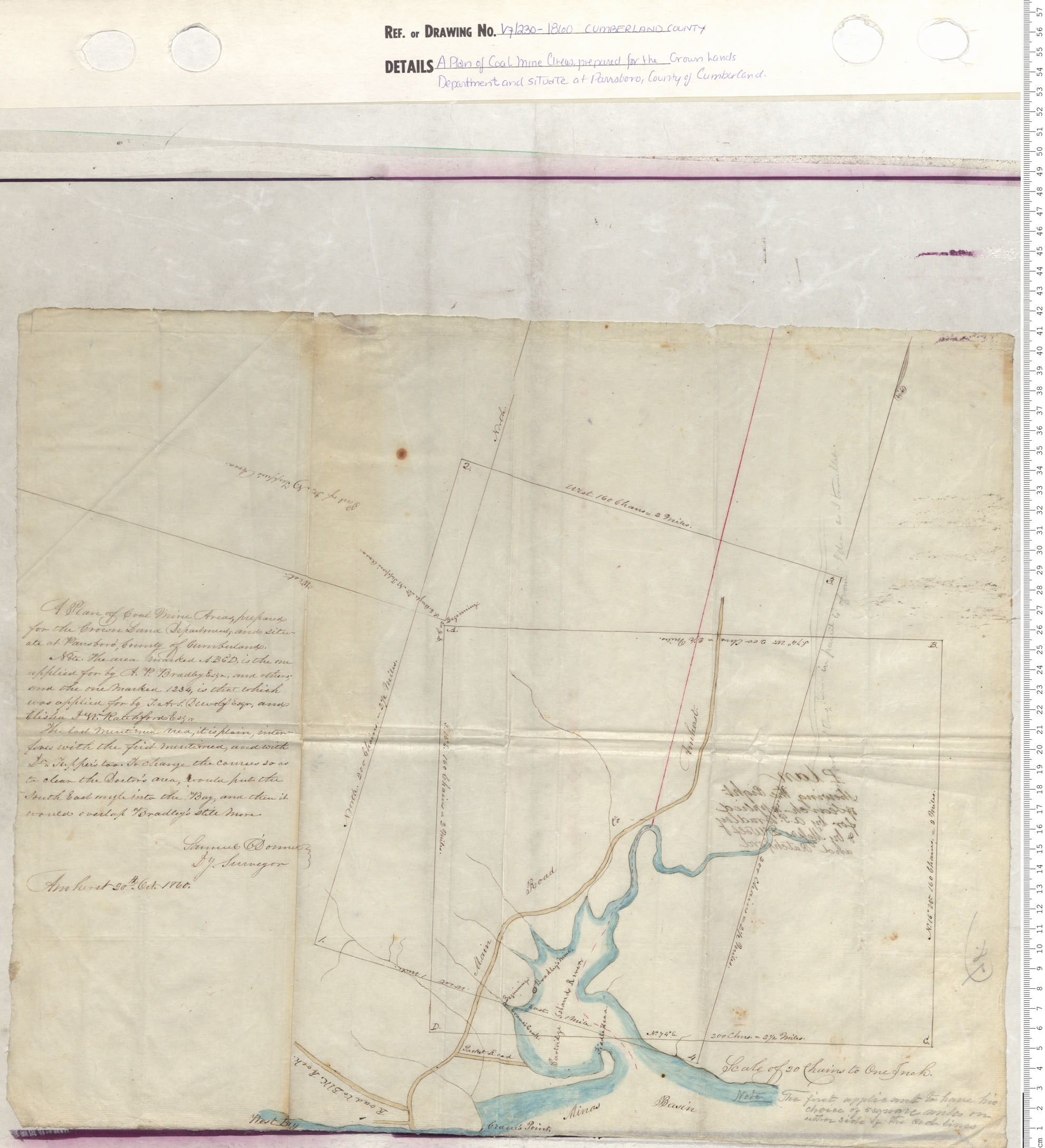
A Plan of Coal Mine Areas Prepared for the Crown Lands Department and situate at Parrsboro, County of Cumberland
Date: 1860
Reference: Nova Scotia Archives Map Collection: V7 230 Cumberland County, Nova Scotia
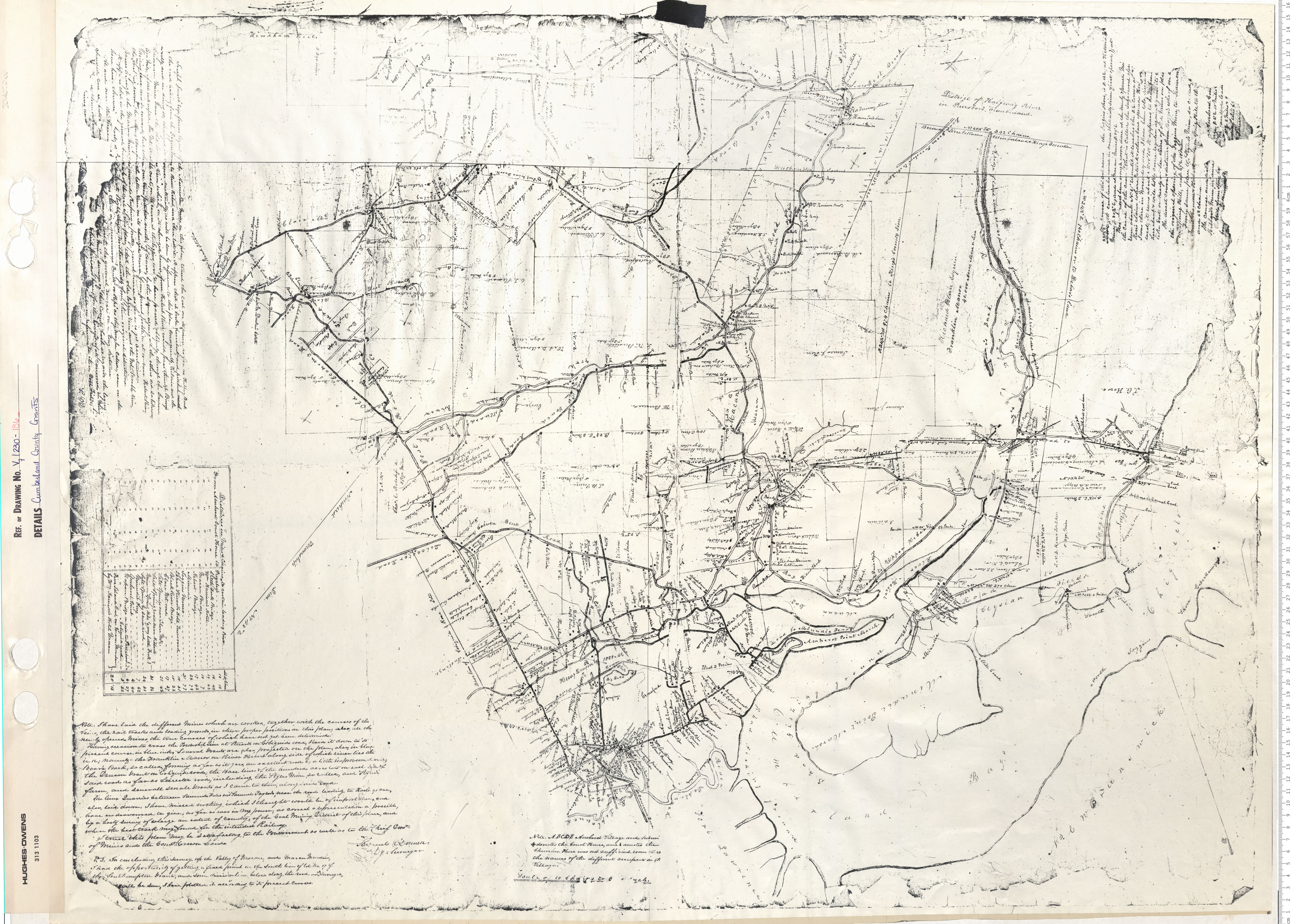
Cumberland County Grants
Date: 1860
Reference: Nova Scotia Archives Map Collection: V7 230 Cumberland County, Nova Scotia