Nova Scotia Archives
Historical Maps of Nova Scotia
Results 496 to 510 of 905 from your search: 1800
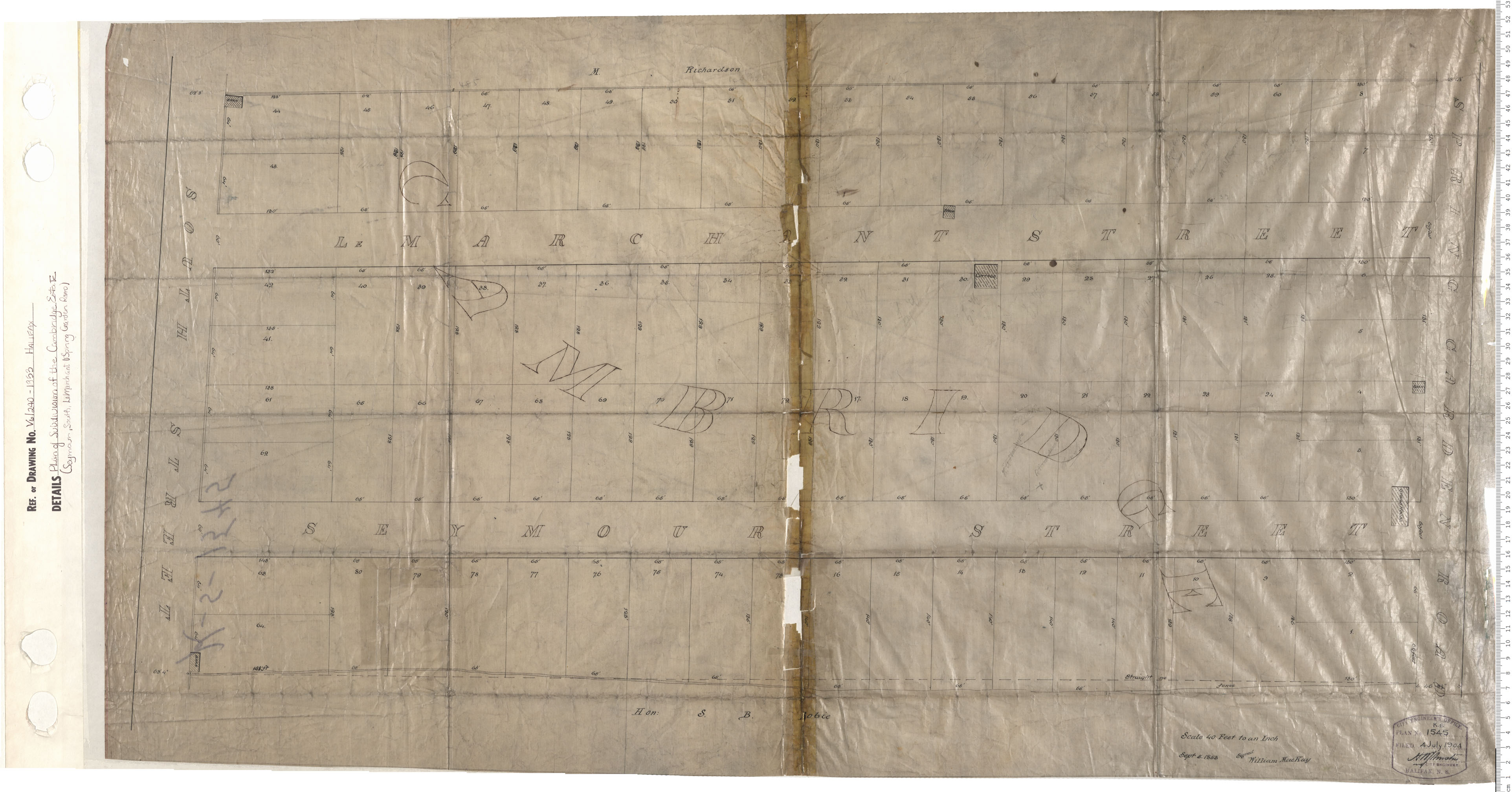
Plan of Subdivision of the Cambridge Estate (Seymour, South, LeMerchant & Spring Garden Rd.)
Date: 1853
Reference: Nova Scotia Archives Map Collection: V6 240 Halifax, Nova Scotia
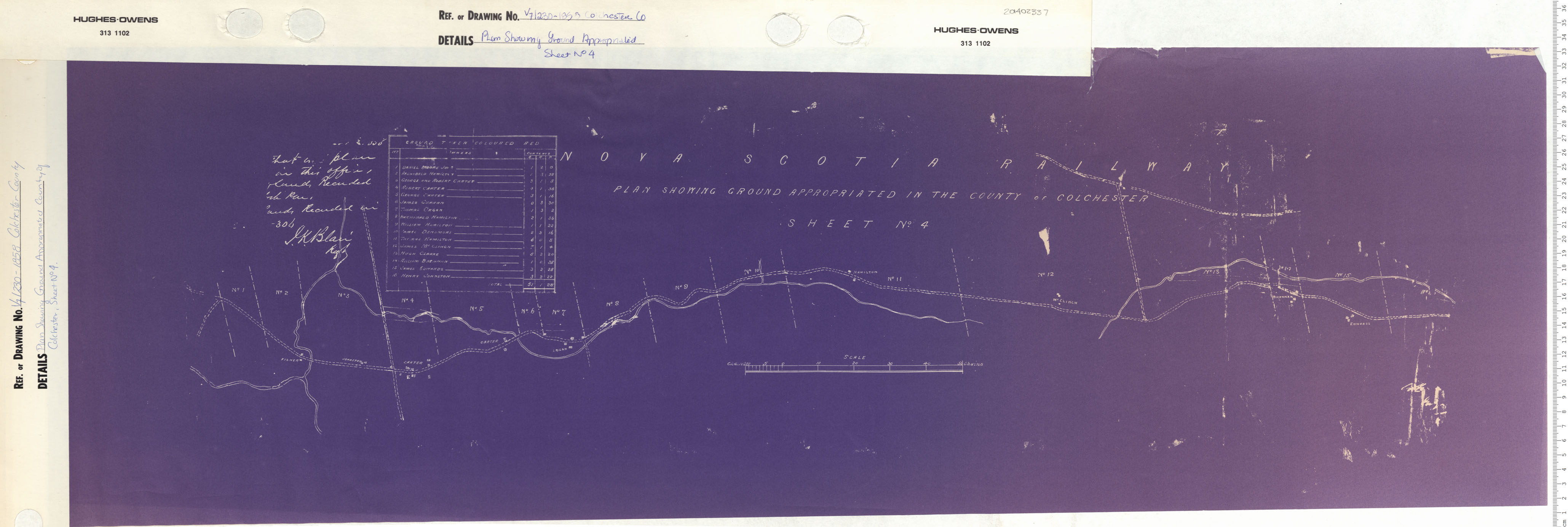
Plan Showing Ground Appropriated in the County of Colchester Sheet No. 4
Date: 1853
Reference: Nova Scotia Archives Map Collection: V7 230 Colchester County, Nova Scotia
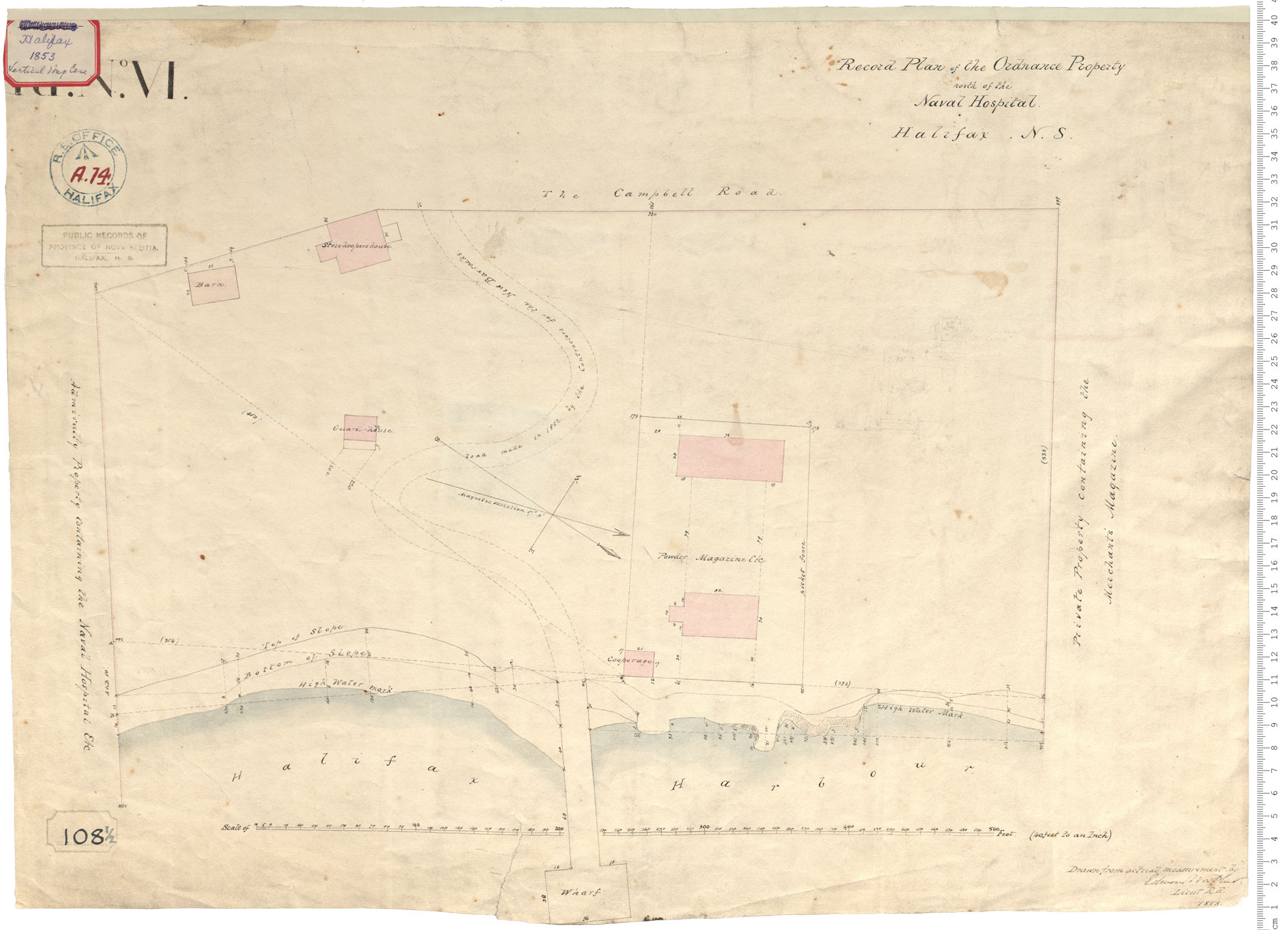
Ordnance Property north of Naval Hospital
Date: 1853
Reference: Nova Scotia Archives Royal Engineers Maps and Plans A.14
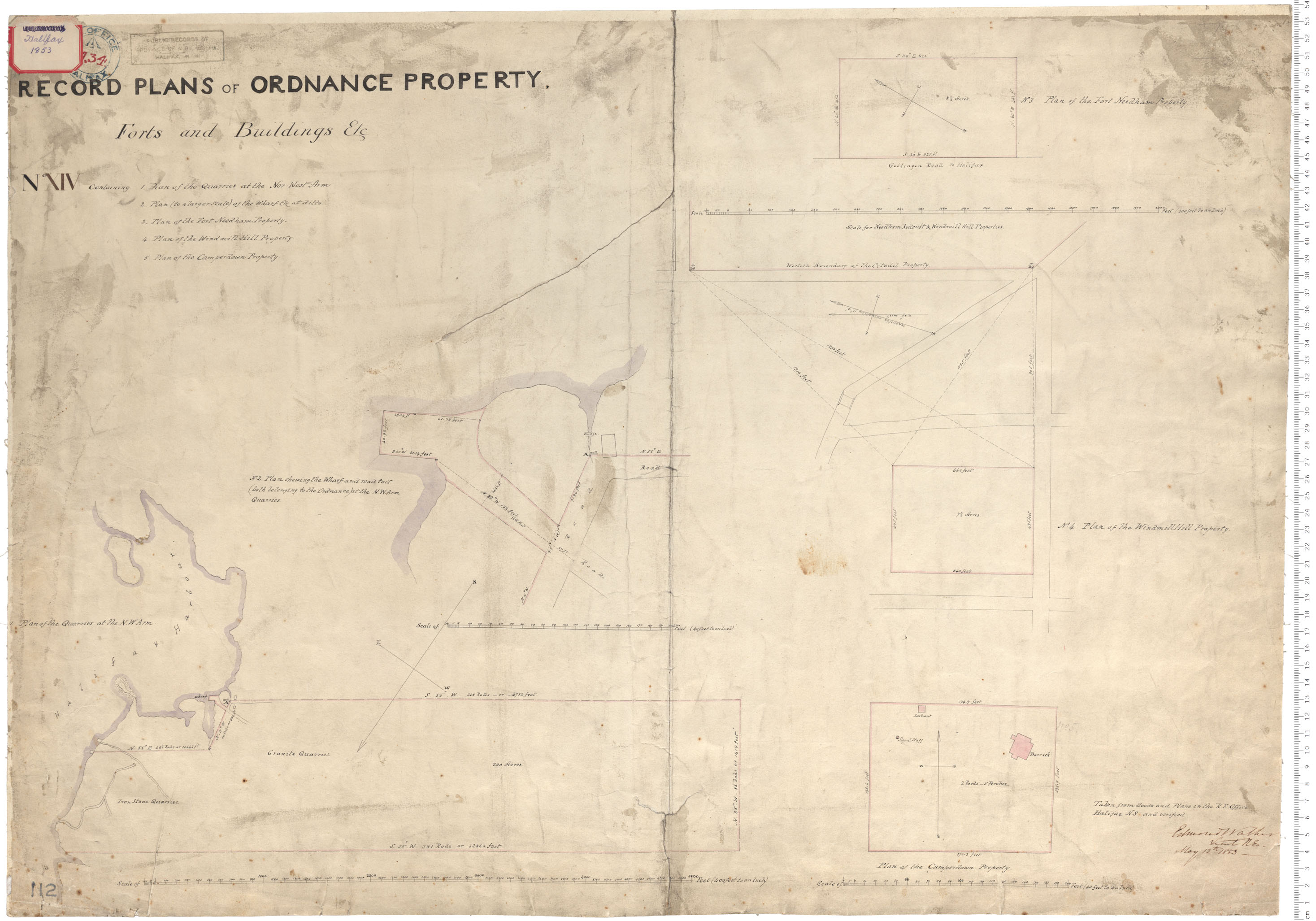
Record plans of Ordnance Property
Date: 12 May 1853
Reference: Nova Scotia Archives Royal Engineers Maps and Plans A.34
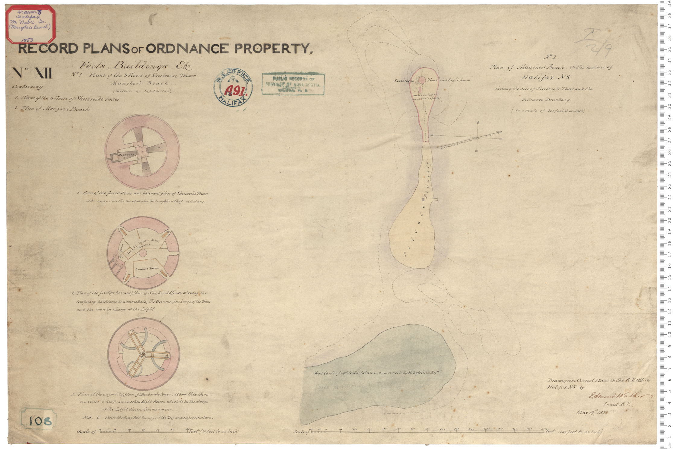
McNab's Island - Maugher's Beach
Date: 19 May 1853
Reference: Nova Scotia Archives Royal Engineers Maps and Plans A.91
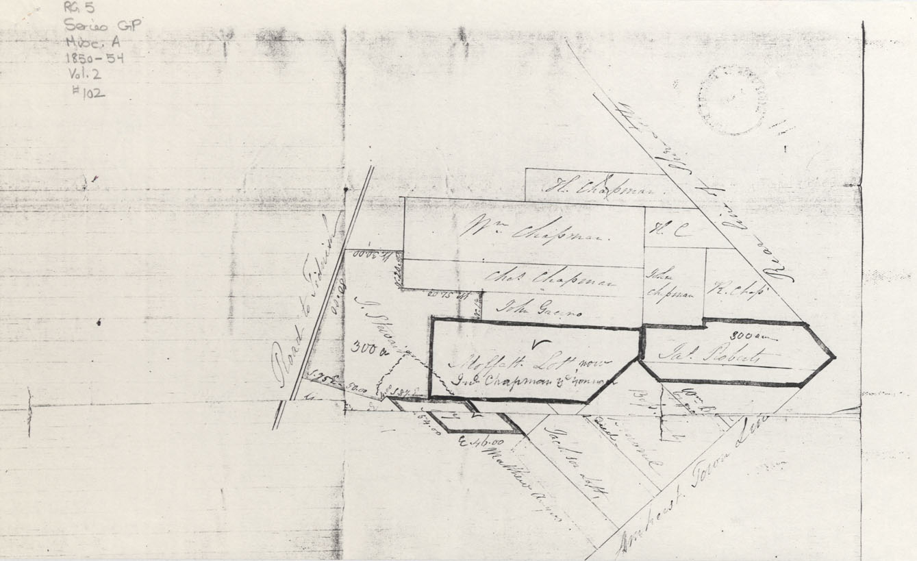
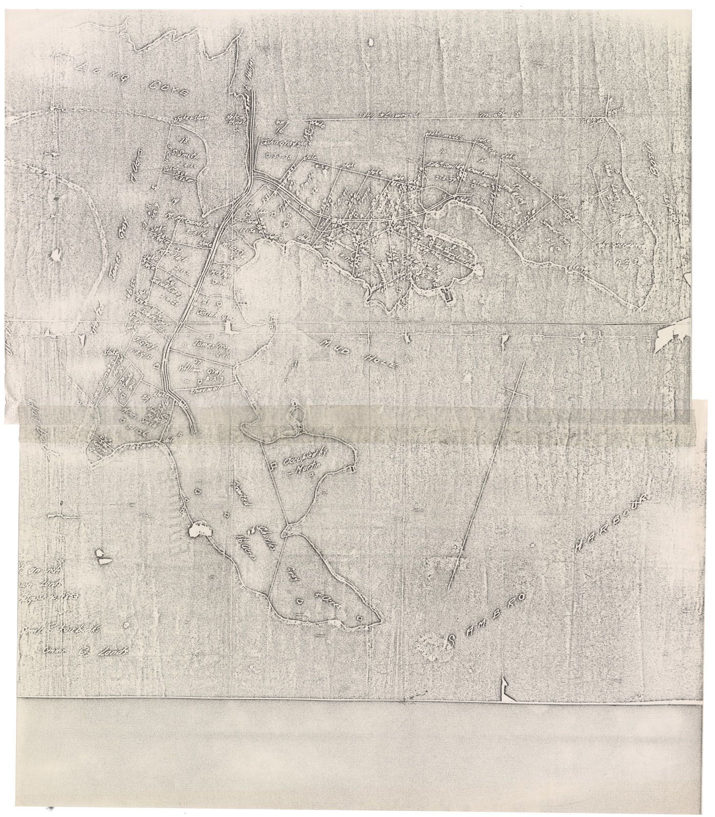
Cumberland County Lots of Land in or near Amherst Town Line
Date: 1853
Reference: Nova Scotia Archives Map Collection: F/220 - 1853
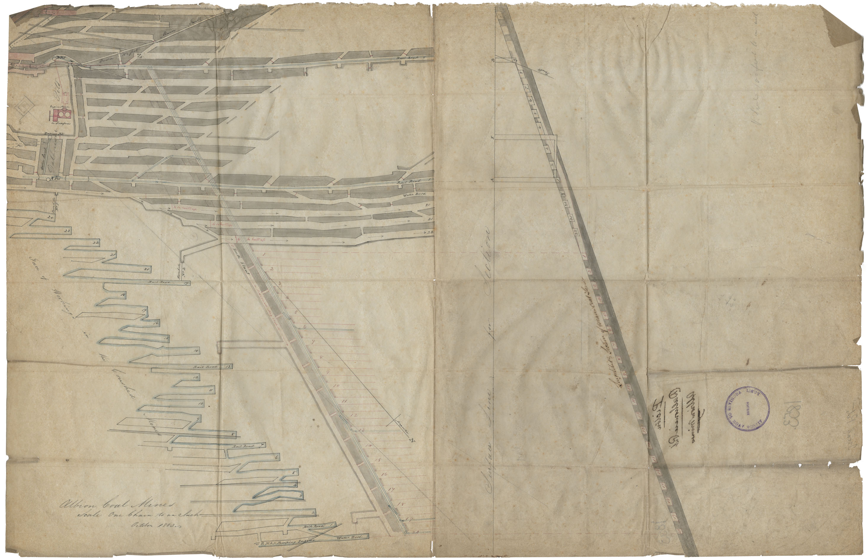
Albion Coal Mines, Dalhousie Pit
Date: October 1853
Reference: Nova Scotia Archives Map Collection: F/239 - 1853
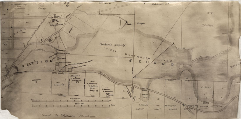
Dartmouth, Property along the 1st Dartmouth Lake
Date: 1853
Reference: Nova Scotia Archives Map Collection: F/239 - 1853

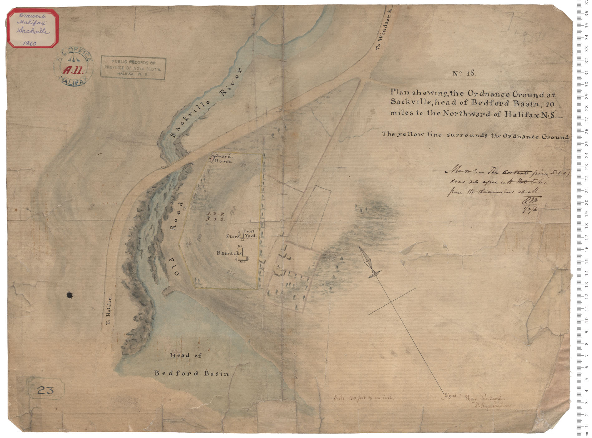
Halifax County Sackville River and Old Windsor Road, Property of Nicholas Vass w.m.1853
Date: 1853
Reference: Nova Scotia Archives Map Collection: F/239 - 1853
Map: Crown lands: Samuel P. Fairbanks
Date: 10 August 1853
Reference: Nova Scotia Archives Map Collection: F/239 - 1853
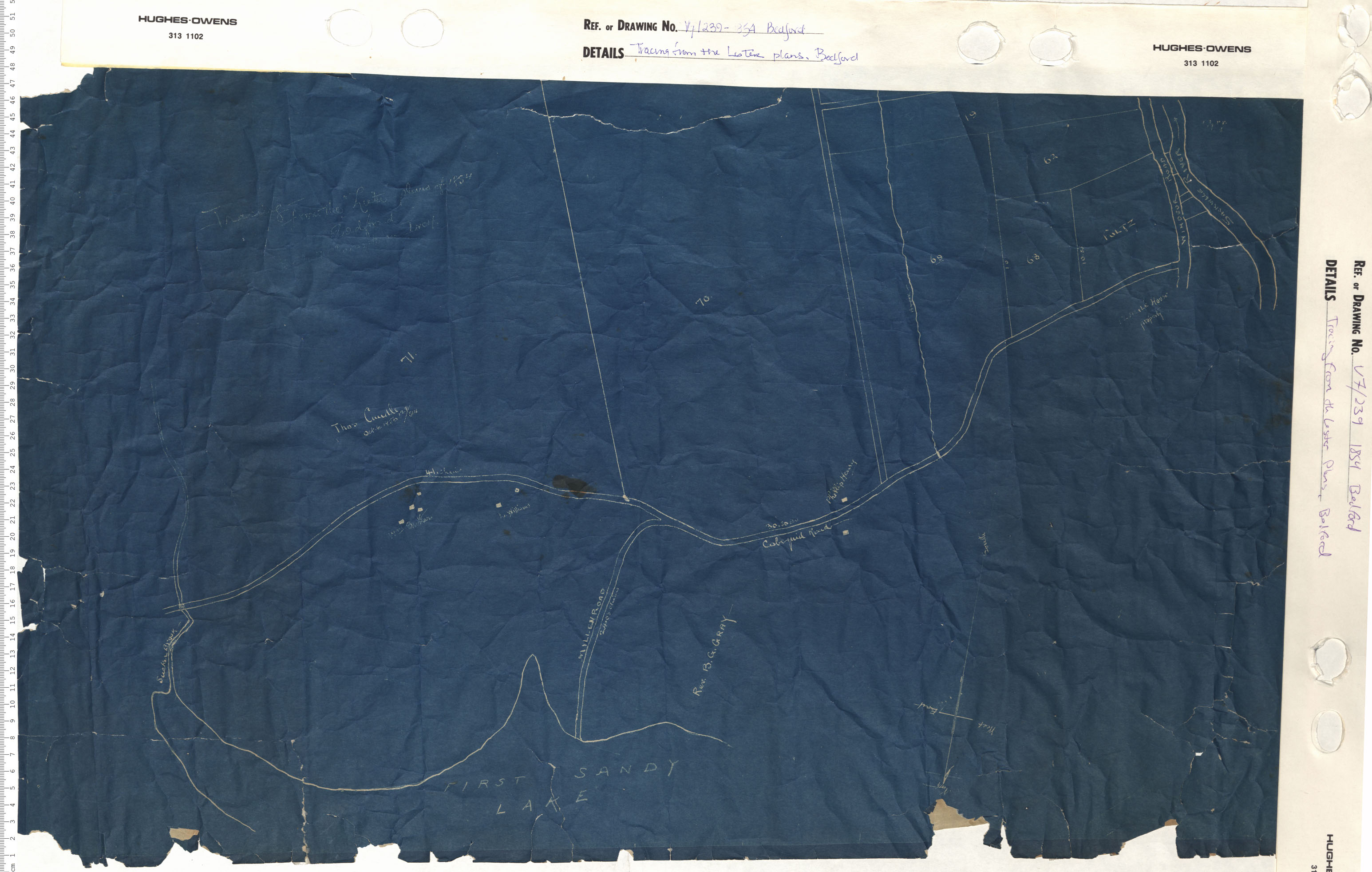
Tracing from the "Lister" plans, Bedford
Date: 1854
Reference: Nova Scotia Archives Map Collection: V7 239 Bedford, Nova Scotia
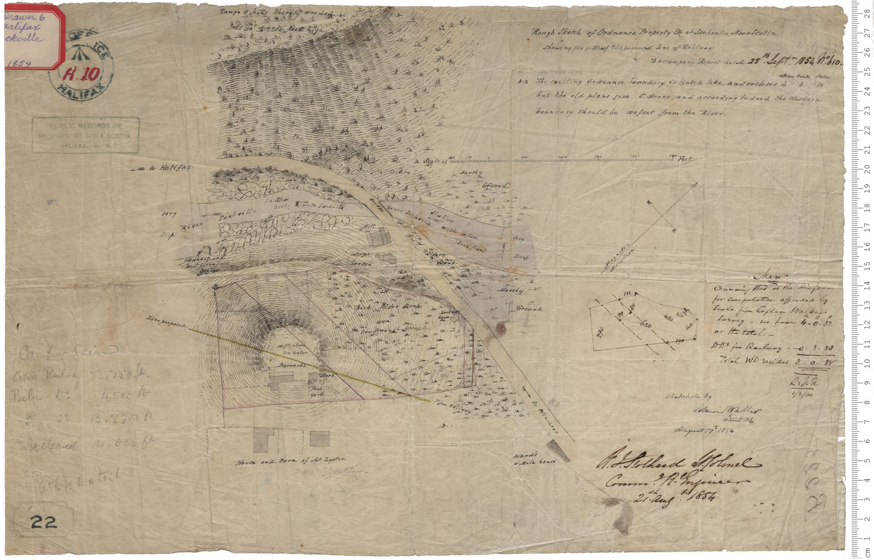
Ordnance Property
Date: 19 August 1854
Reference: Nova Scotia Archives Royal Engineers Maps and Plans A.10

Fort Clarence - Survey by War Department
Date:
Reference: Nova Scotia Archives Royal Engineers Maps and Plans L.04
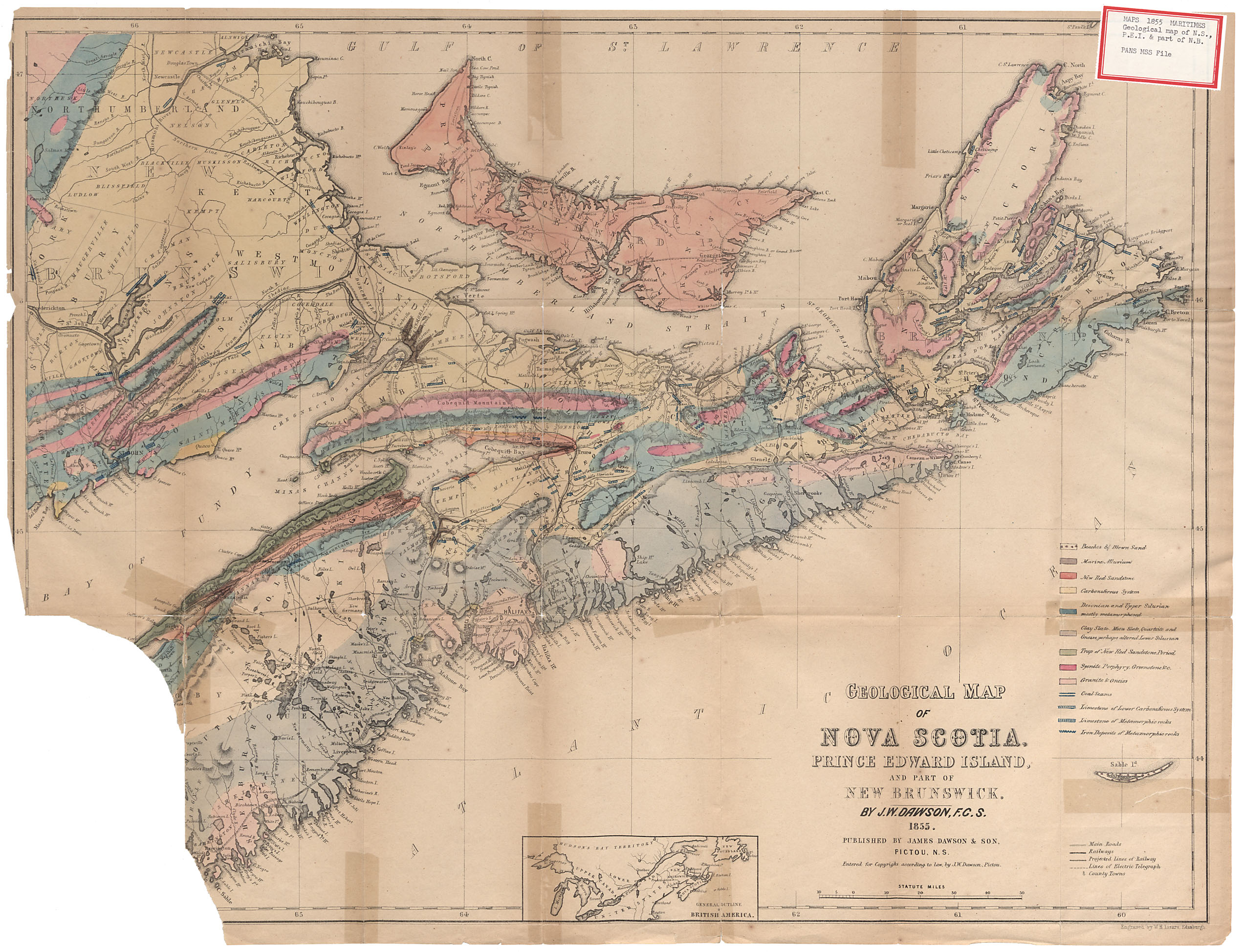
Geological Map of Nova Scotia, Prince Edward Island and Part of New Brunswick By J.W.Dawson F.S.C. 1855
Date: 1855
Reference: Nova Scotia Archives Map Collection: F/200 - 1855