Nova Scotia Archives
Historical Maps of Nova Scotia
Results 1111 to 1125 of 2074 from your search:

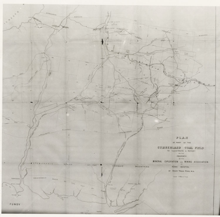
Plan of part of the Cumberland Coal Field to illustrate report on property…by Henry Y. Hind
Date:
Reference: Nova Scotia Archives Map Collection: F/230
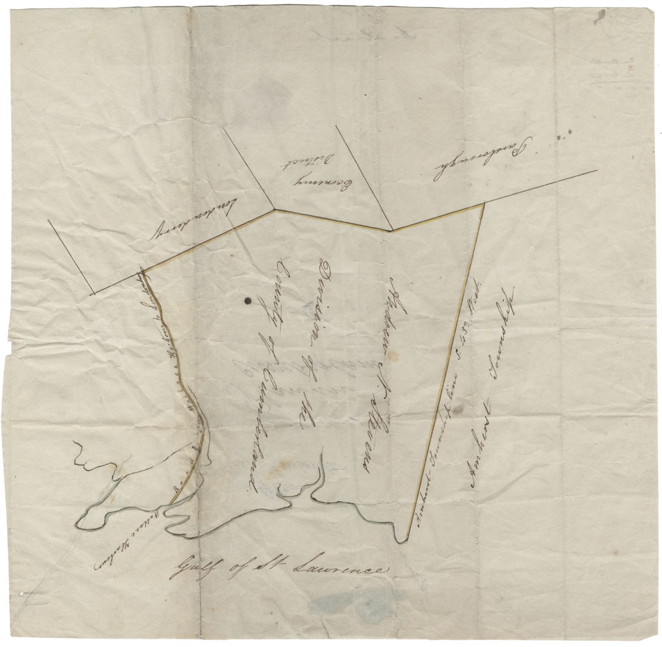
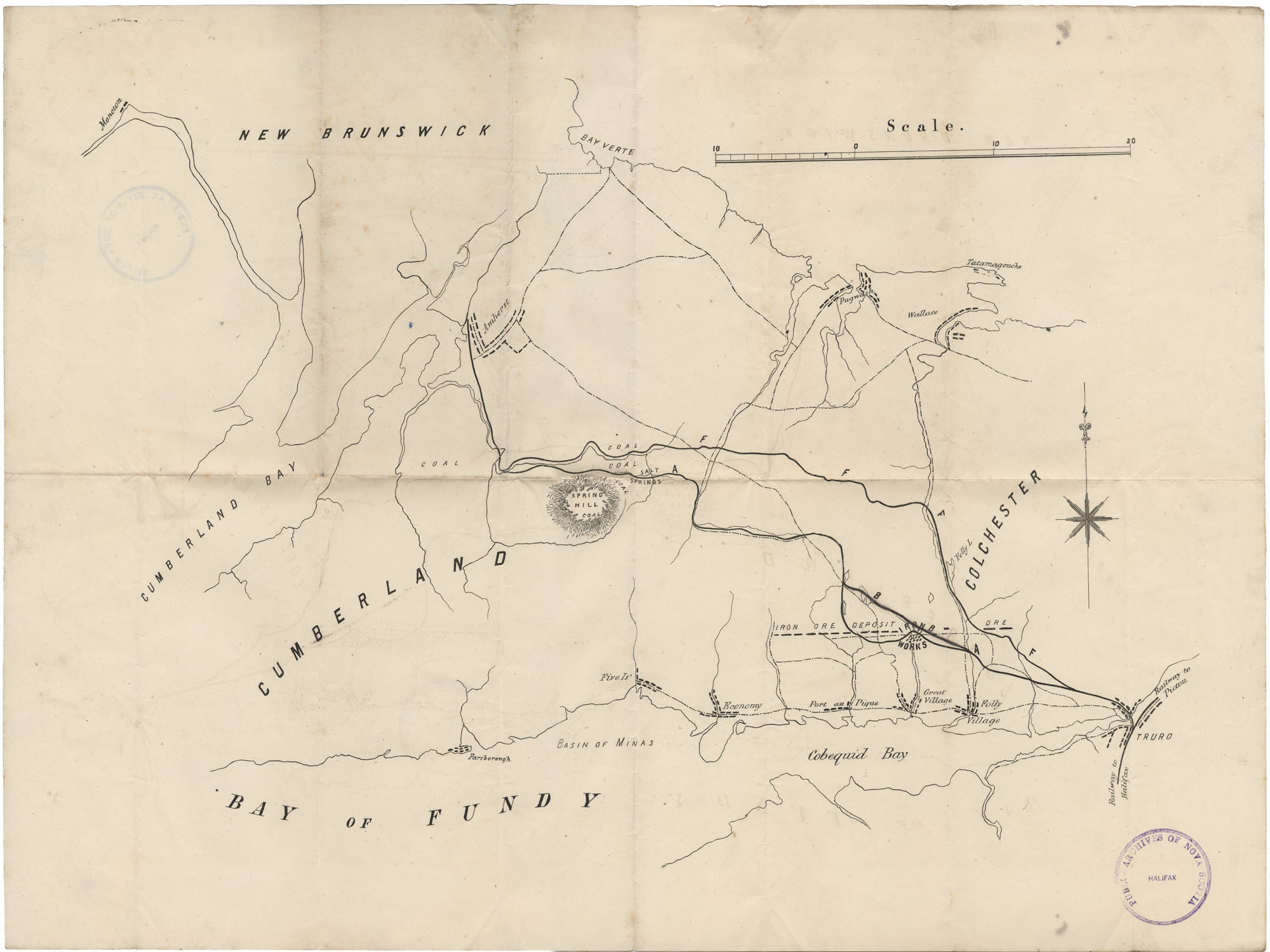
Cumberland County Wallace Harbour, Road from Wallace harbour to Londonderry, Londonderry, Economy District, Parsbourgh, Amherst Township and Gulf of St.Lawrence
Date:
Reference: Nova Scotia Archives Map Collection: F/230
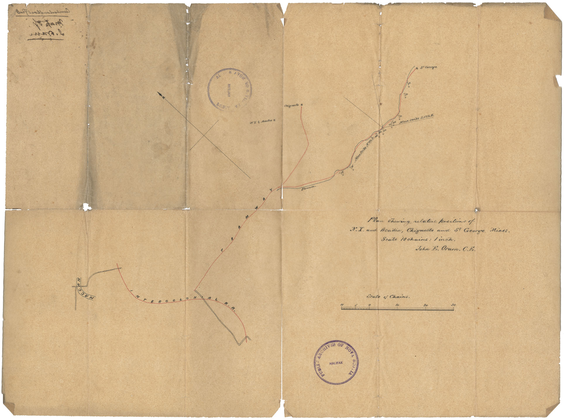
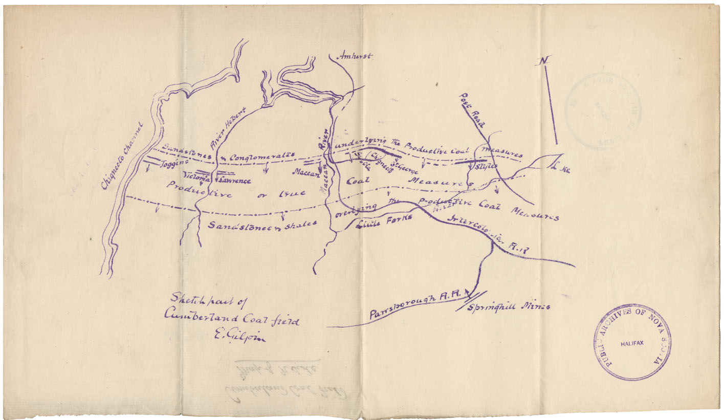
Plan showing relative positions of N.Y. Acadia, Chegnecto & St.George Mines, Cumb. Co
Date:
Reference: Nova Scotia Archives Map Collection: F/230
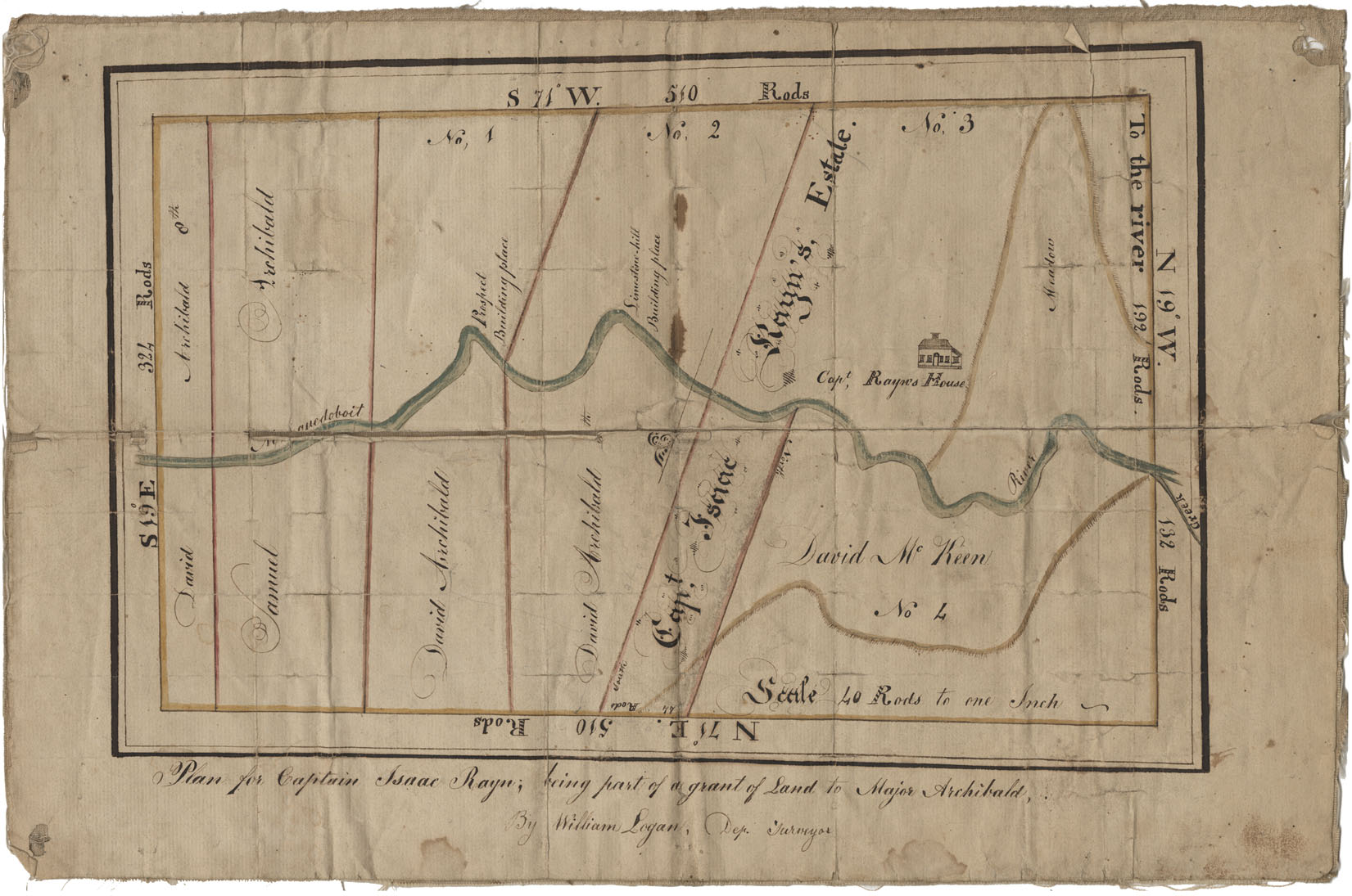
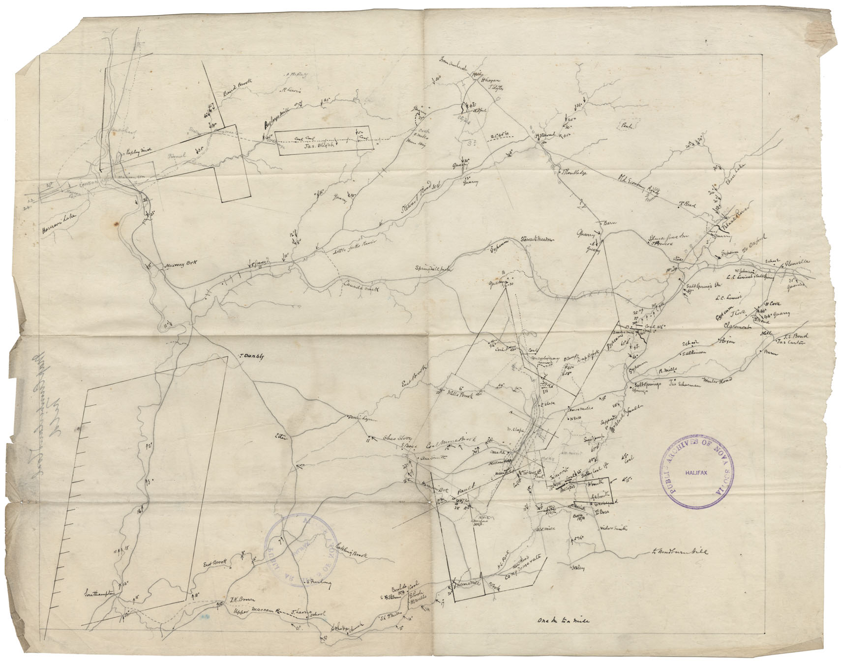
Plan for Captain Isaac Ryan: being part of a grant of land to Major Archibald
Date:
Reference: Nova Scotia Archives Map Collection: F/230
PANS: Maps: Ship Harbour, Halifax County
Date:
Reference: Nova Scotia Archives Map Collection: F/230
Sackville, Halifax County-Plan showing land owners in the Sackville area
Date:
Reference: Nova Scotia Archives Map Collection: F/230
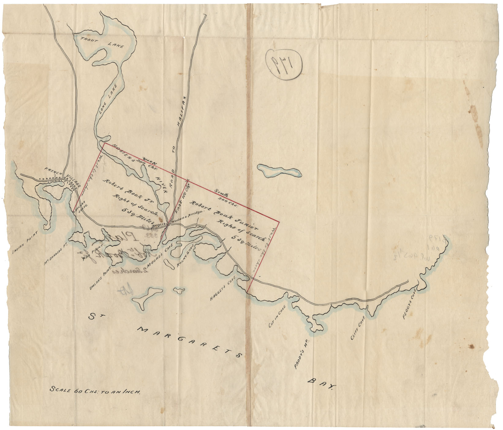
Plan Robert Boak, Jr.2 Rights to search St.Margaret's Bay
Date:
Reference: Nova Scotia Archives Map Collection: F/230
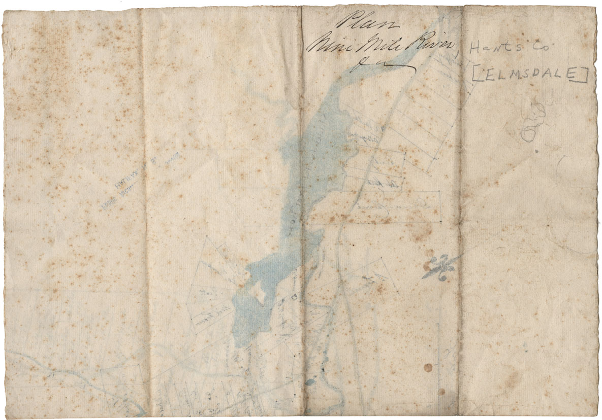
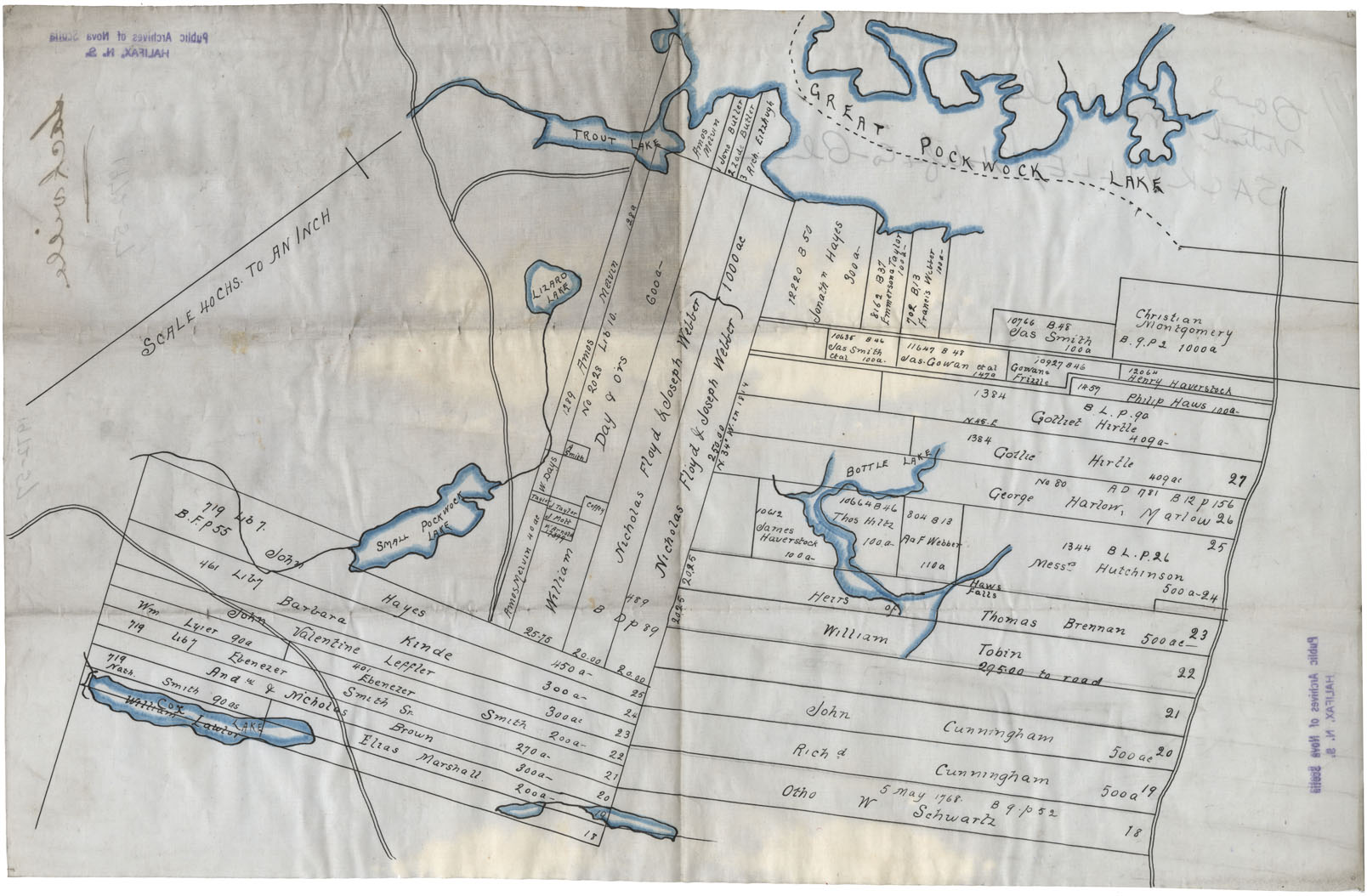
Nine Mile River, Hants County-undated Land Grants
Date:
Reference: Nova Scotia Archives Map Collection: F/230