Nova Scotia Archives
Historical Maps of Nova Scotia
Results 1081 to 1095 of 2074 from your search:
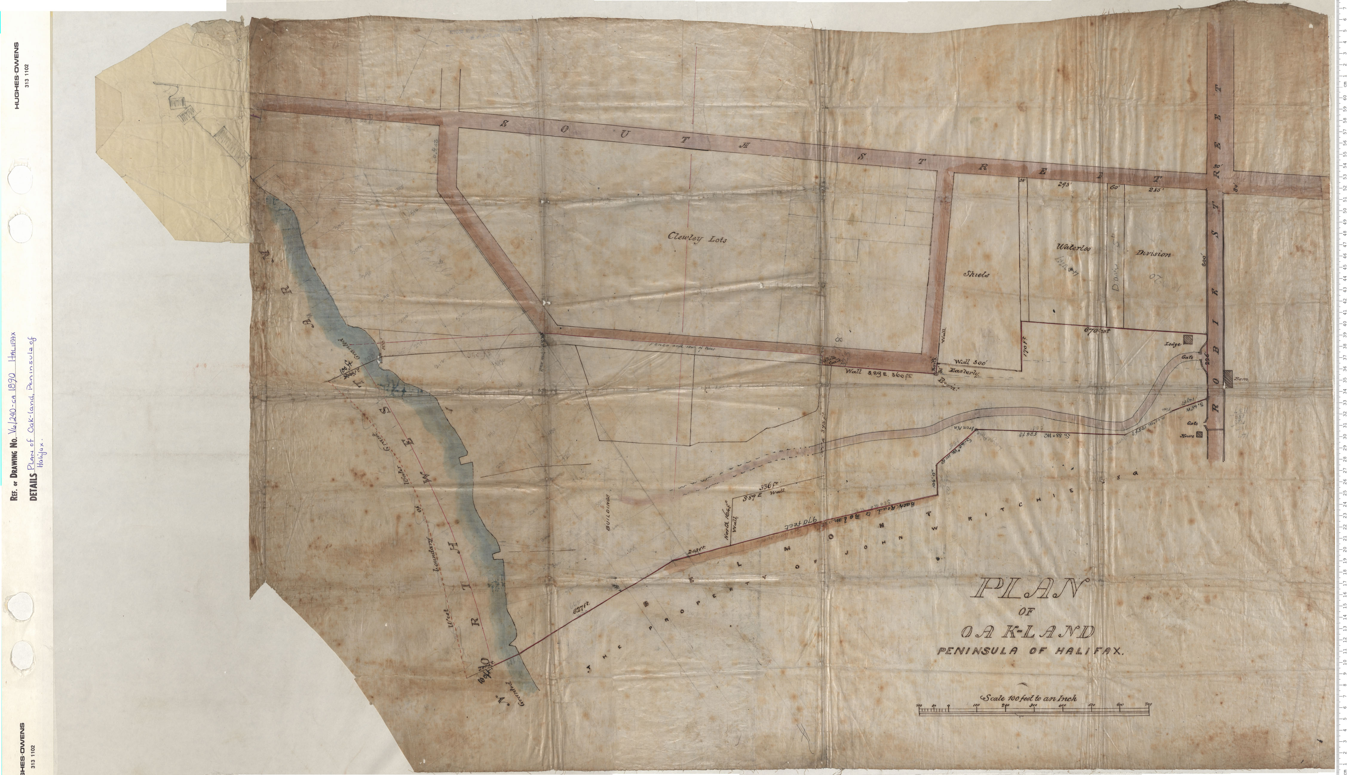
Plan of Oakland Peninsula of Halifax
Date: 1890
Reference: Nova Scotia Archives Map Collection: V6 240 Halifax, Nova Scotia
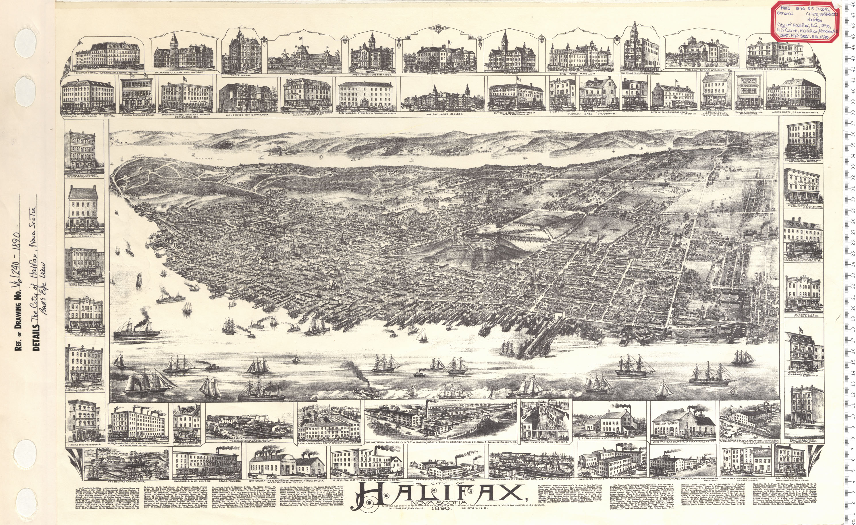
The City of Halifax Bird's Eye View
Date: 1890
Reference: Nova Scotia Archives Map Collection: V6 240 Halifax, Nova Scotia
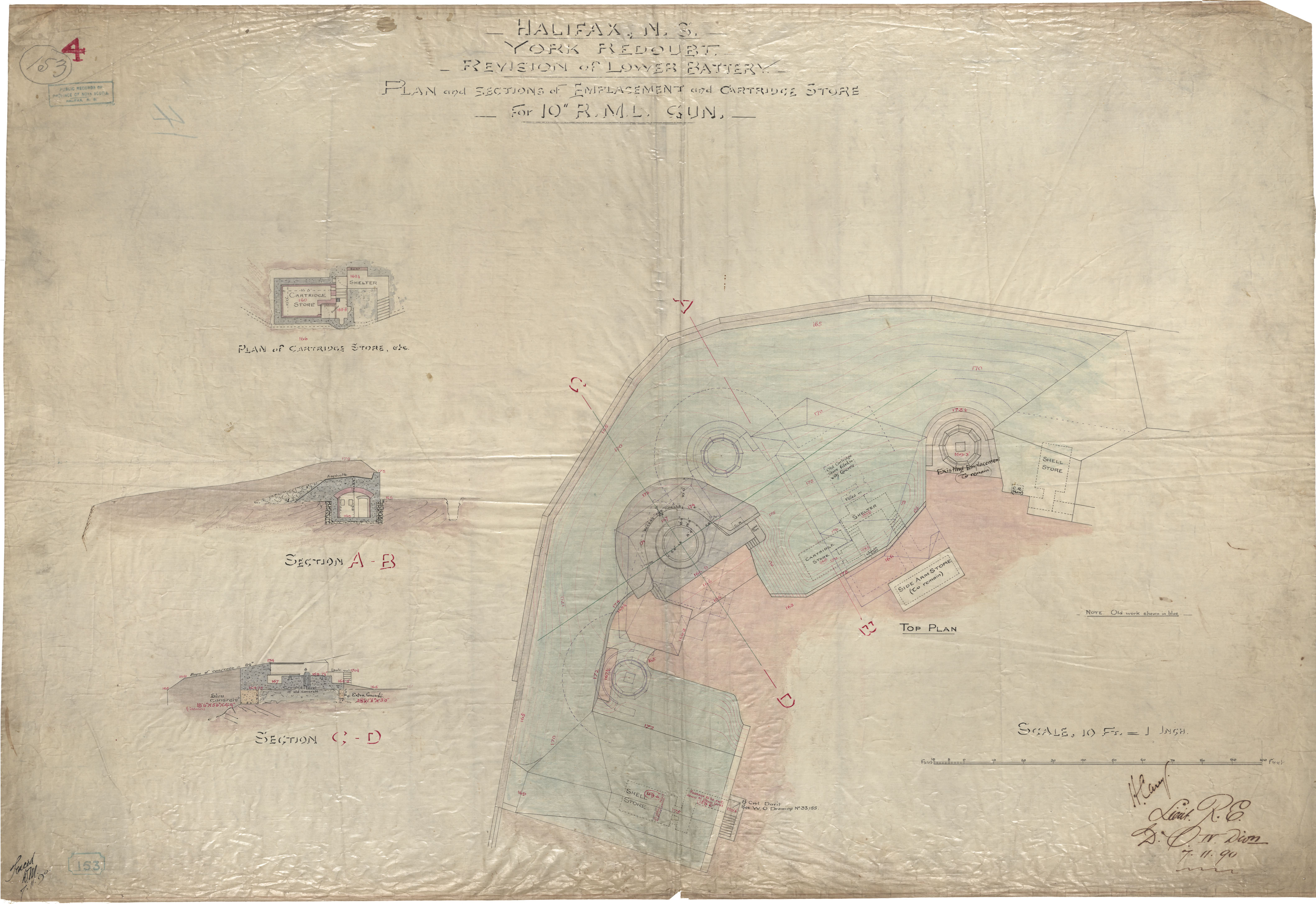
Halifax, ns, York Redoubt, Revision of Lower Battery, Plan and Sctions of Emplacements and Cartridge Store , for 10" RML Gun
Date: 7 November 1890
Reference: Nova Scotia Archives Royal Engineers Maps and Plans
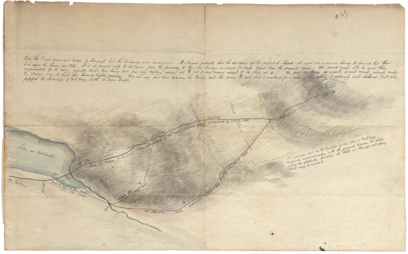
Road from Hartlands Lake to Fenerty's Hill on Road to Halifax
Date:
Reference: Nova Scotia Archives Map Collection: F/209
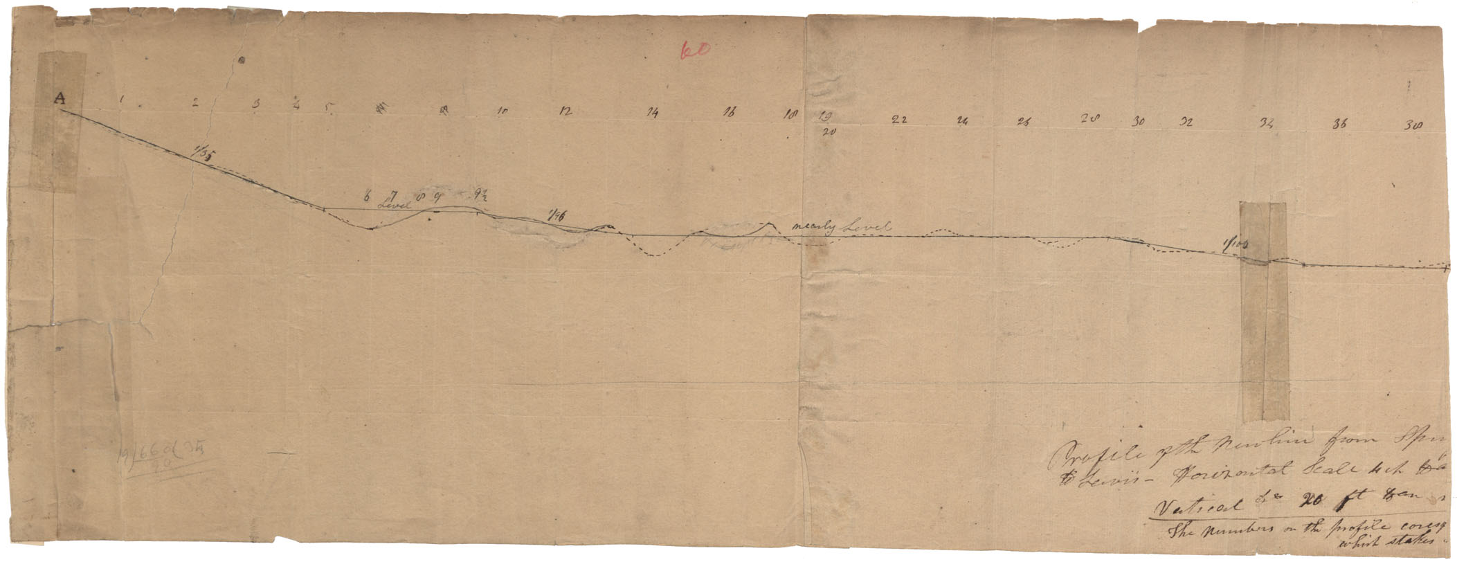
Profile of the New Line from Springfield to Lewis
Date:
Reference: Nova Scotia Archives Map Collection: F/209
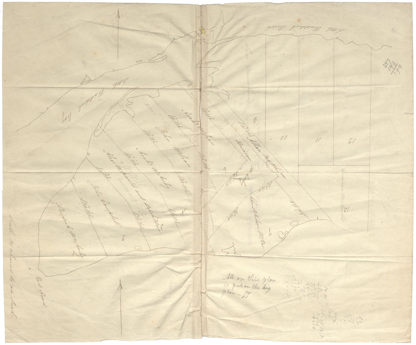
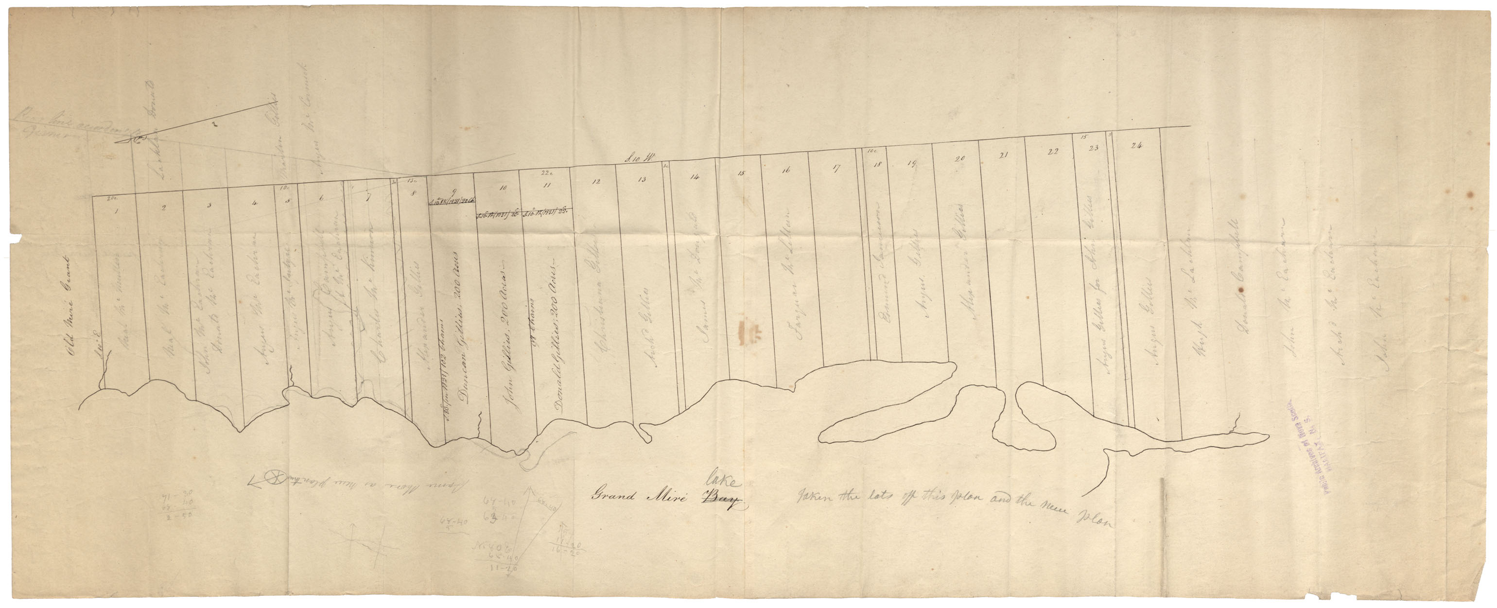
Cape Breton Sketch of Red Head Lots, Little Baddeck Bay undated
Date:
Reference: Nova Scotia Archives Map Collection: F/210
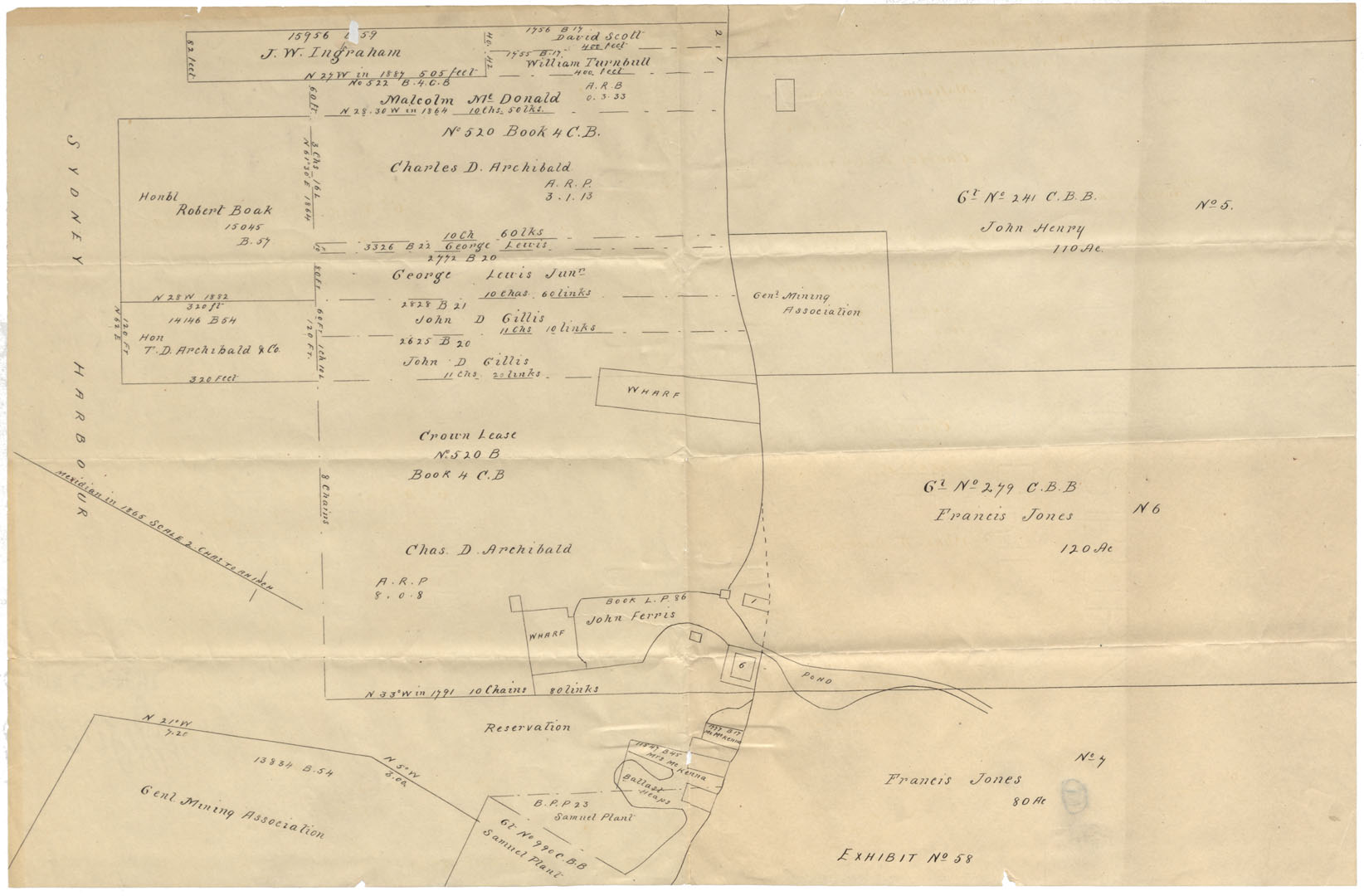
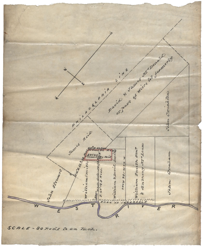
Halifax County, Cape Breton Plan of Grants at N.W.A. undated
Date:
Reference: Nova Scotia Archives Map Collection: F/210
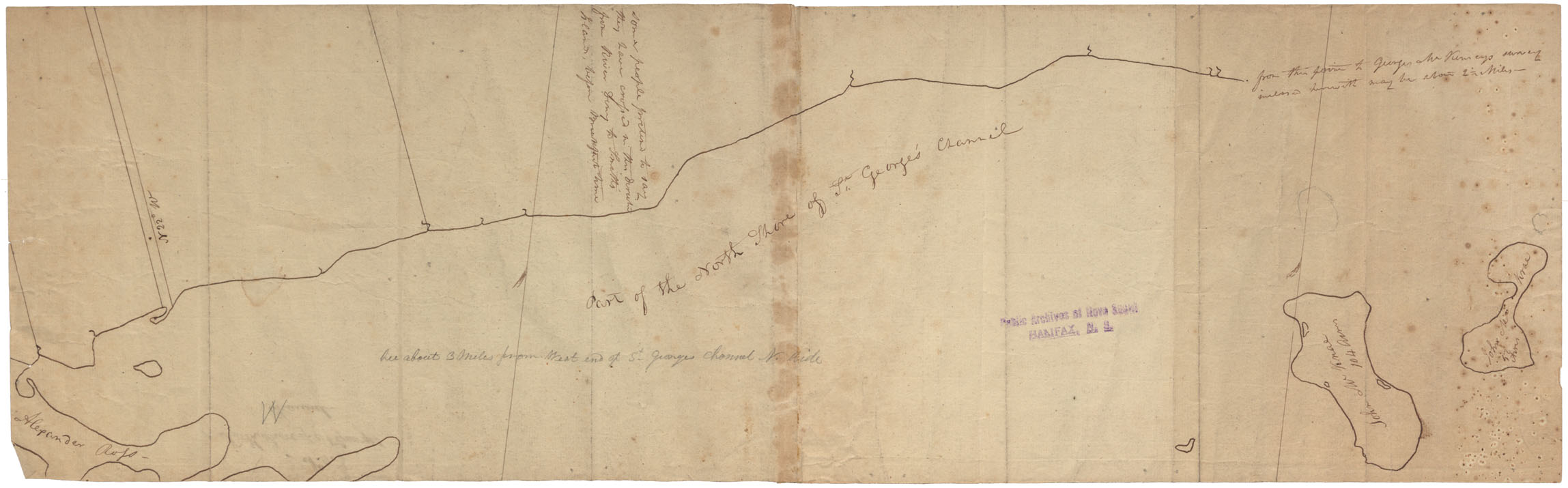
Cape Breton North Shore of St.George's Channel No.9
Date:
Reference: Nova Scotia Archives Map Collection: F/210
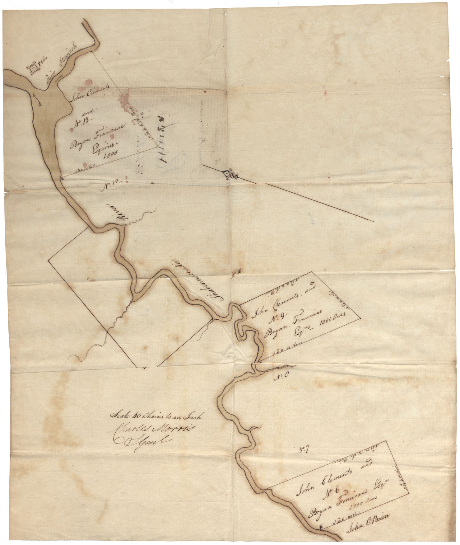
Lands on Shubenacadie River Colchester side of Shubenacadie R., south of Slewiacke River, undated
Date:
Reference: Nova Scotia Archives Map Collection: F/210
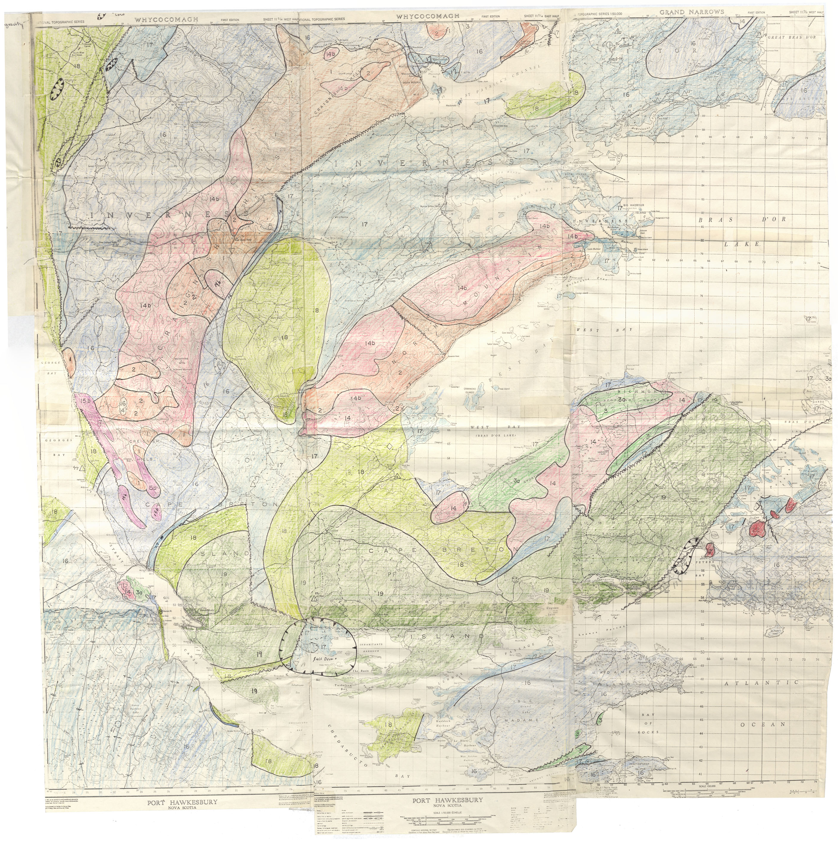
Geological Survey map Cape Breton County
Date:
Reference: Nova Scotia Archives Map Collection: F/220
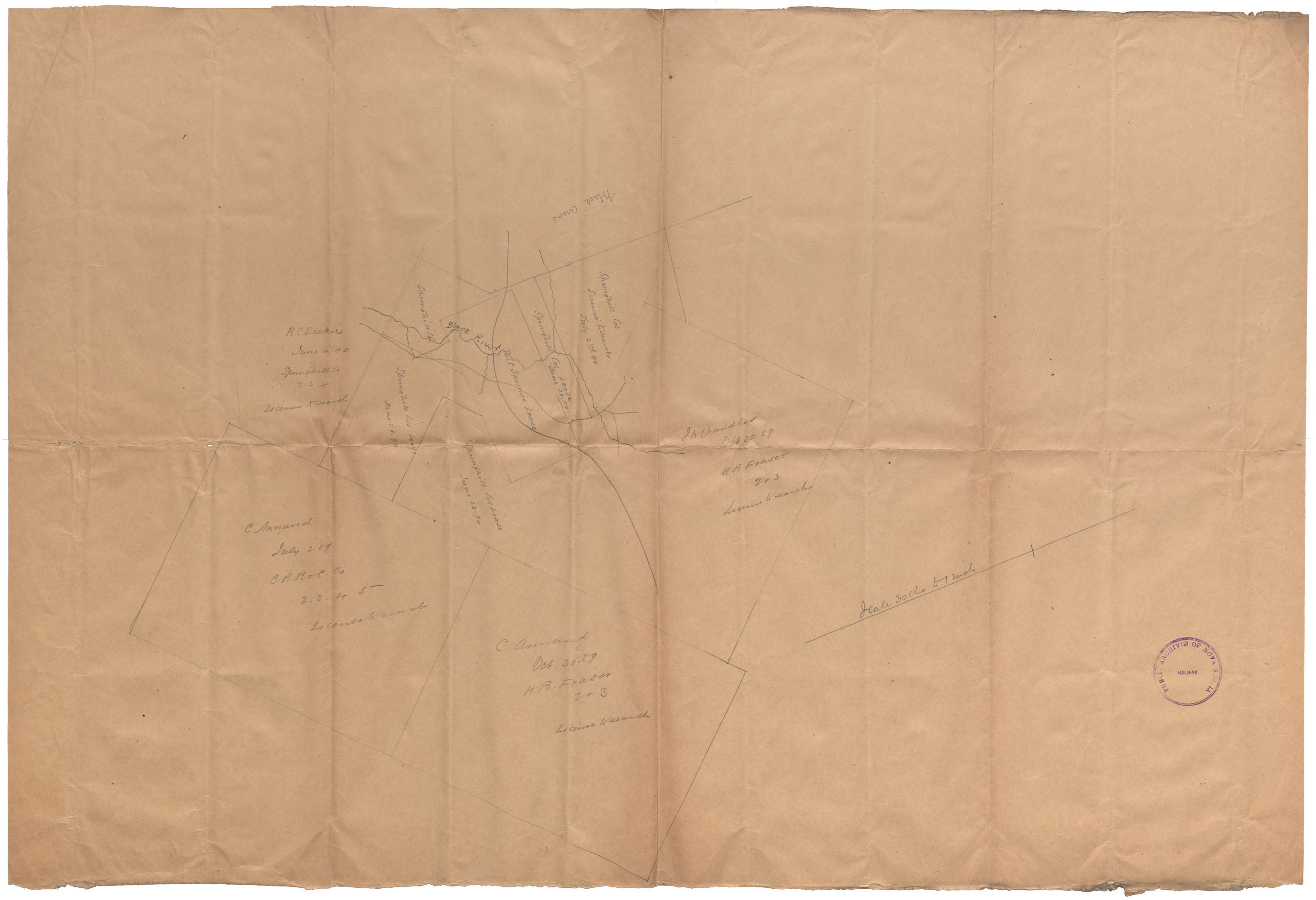
Lease Salt Springs Cumberland County
Date: 1890
Reference: Nova Scotia Archives Map Collection: F/220 - 1890