Nova Scotia Archives
Historical Maps of Nova Scotia
Results 391 to 405 of 905 from your search: 1800
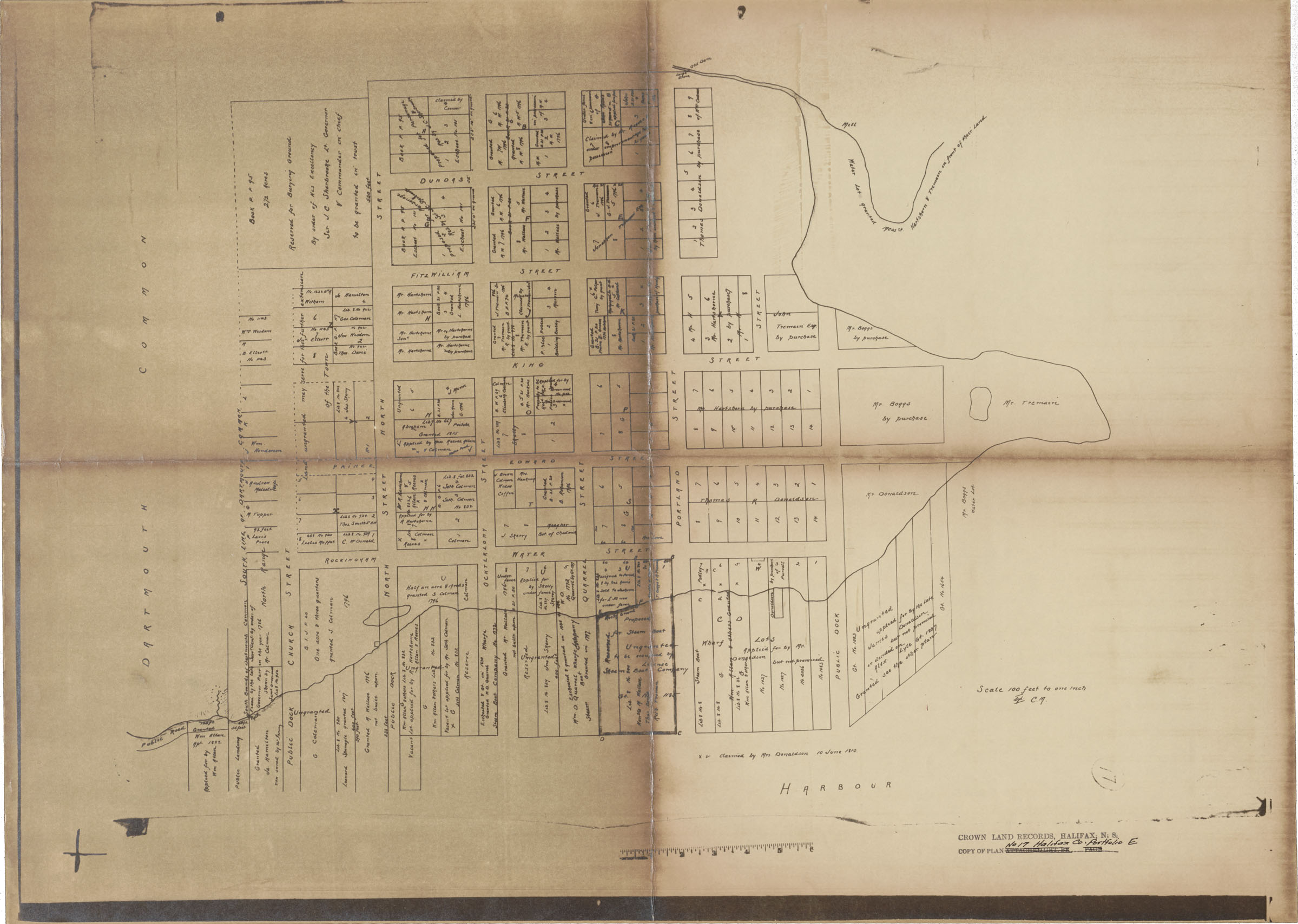
Plan, Town of Dartmouth Central Core-Land Grants
Date: 1838
Reference: Nova Scotia Archives Map Collection: F/239 - 1838
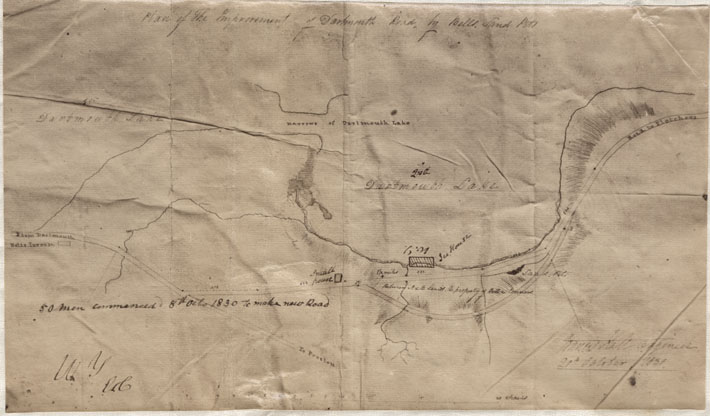
Plan of the Improvement of Dartmouth Road by Bells Sand Pit
Date: 20 October 1838
Reference: Nova Scotia Archives Map Collection: F/239 - 1838
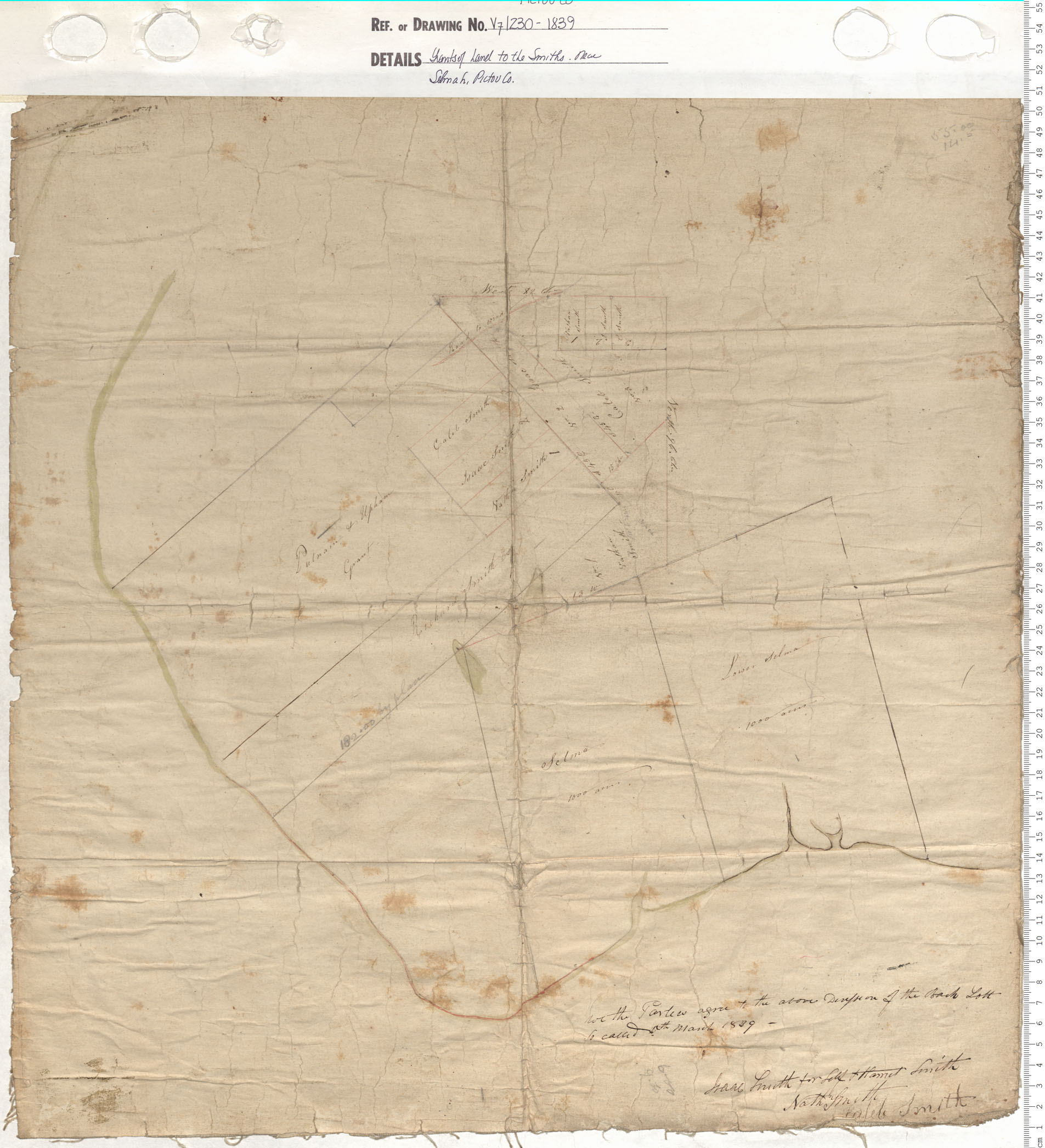
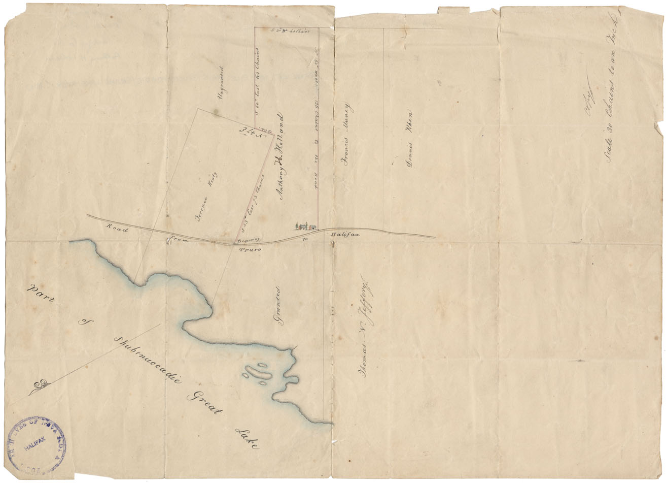
Grants of Land to the Smiths near Selma, Hants County
Date: 1839
Reference: Nova Scotia Archives Map Collection: V7 230 Hants County, Nova Scotia
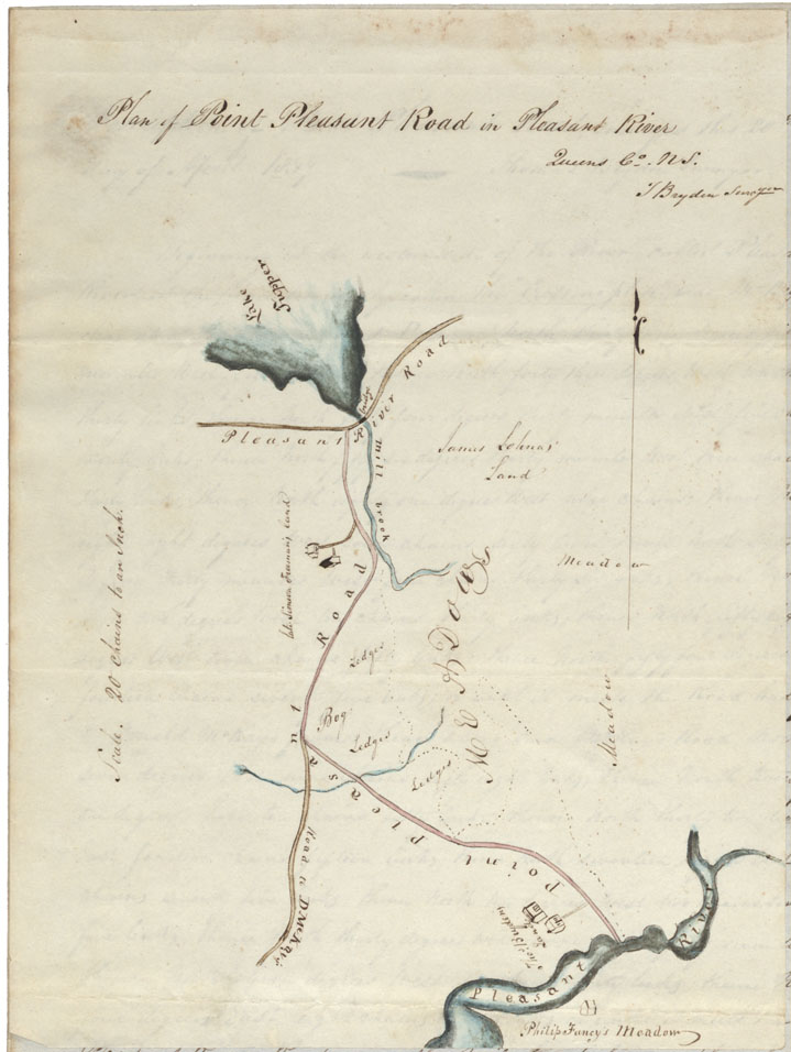
Plan of the Point Pleasant Road in Pleasant River, Queen's County
Date: 1839
Reference: Nova Scotia Archives Map Collection: F/209 - 1839
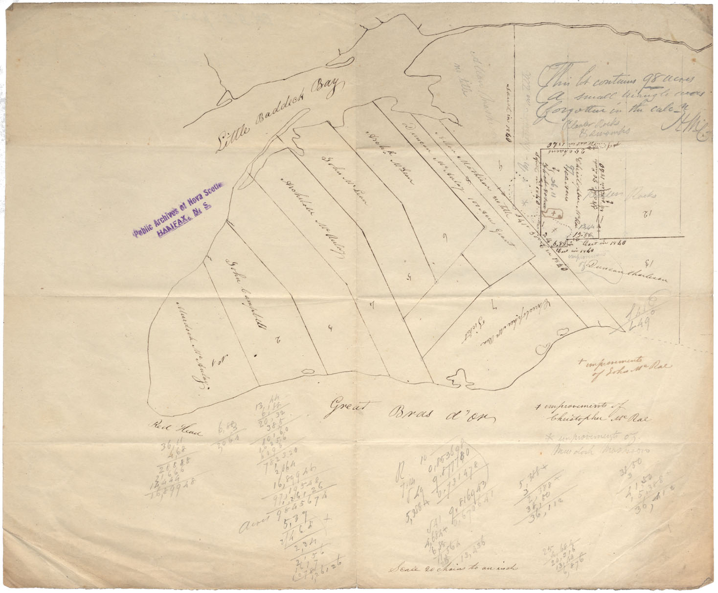
Cape Breton Great Bras d'Or, Red Head & Little Braddock Bay C. 1840
Date: 1840
Reference: Nova Scotia Archives Map Collection: F/210 - 1840
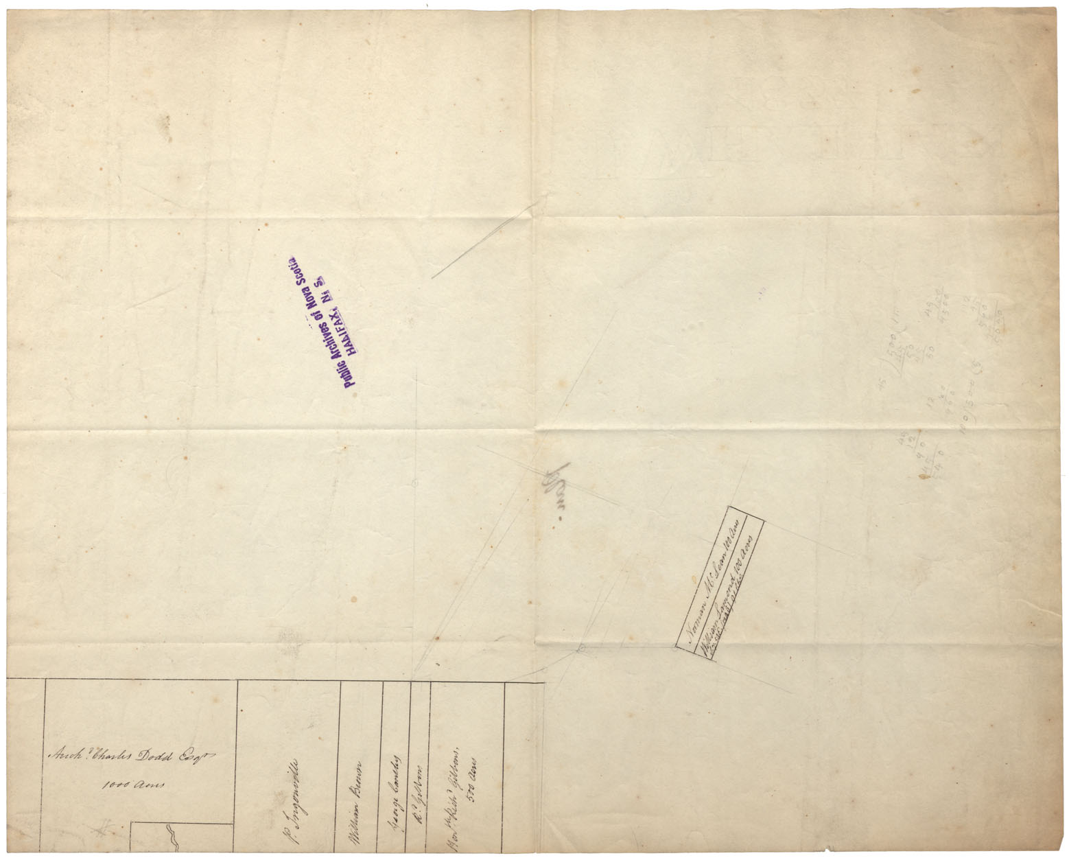
Land Grants: Maps: Shubenacadie/Grand lake Area, c.1840
Date: 1840
Reference: Nova Scotia Archives Map Collection: F/230 - 1840
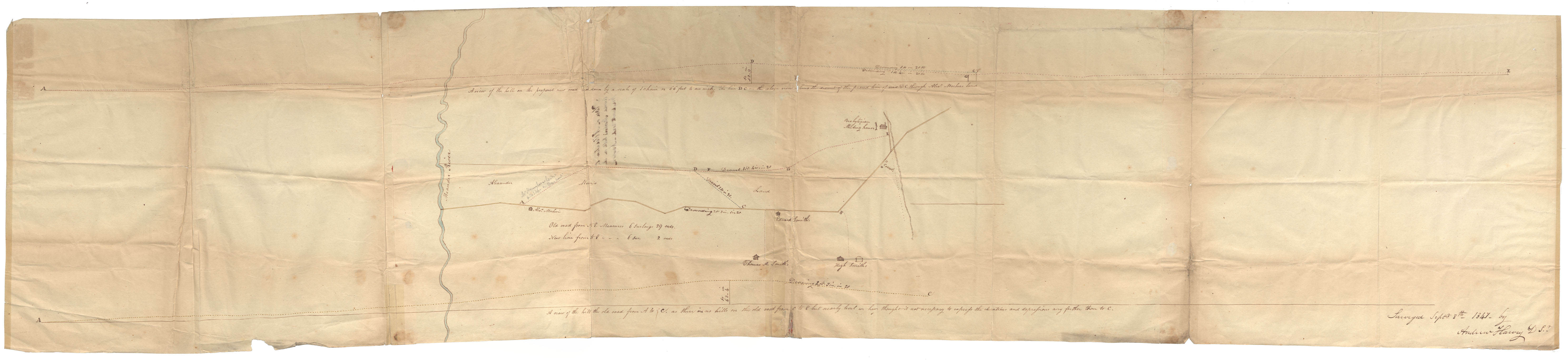
Plan of Alteration to Avoid Mosher's Hill on the Wenckworth Road, Newport, Hants County
Date: 8 September 1841
Reference: Nova Scotia Archives Map Collection: F/209 - 1841
Cape Breton Baddeck River undated c.1841
Date: 1841
Reference: Nova Scotia Archives Map Collection: F/210 - 1841
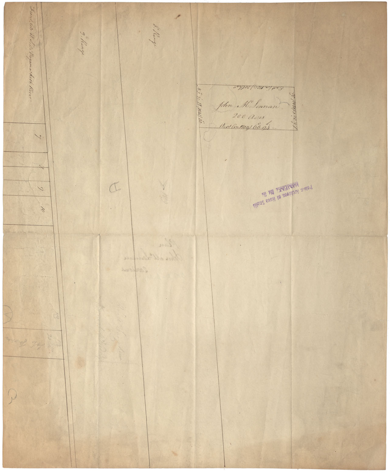
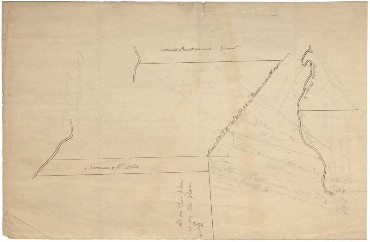
Cape Breton Grant John McLennan near front lots west side Wagamakook River c.1841
Date: 1841
Reference: Nova Scotia Archives Map Collection: F/210 - 1841
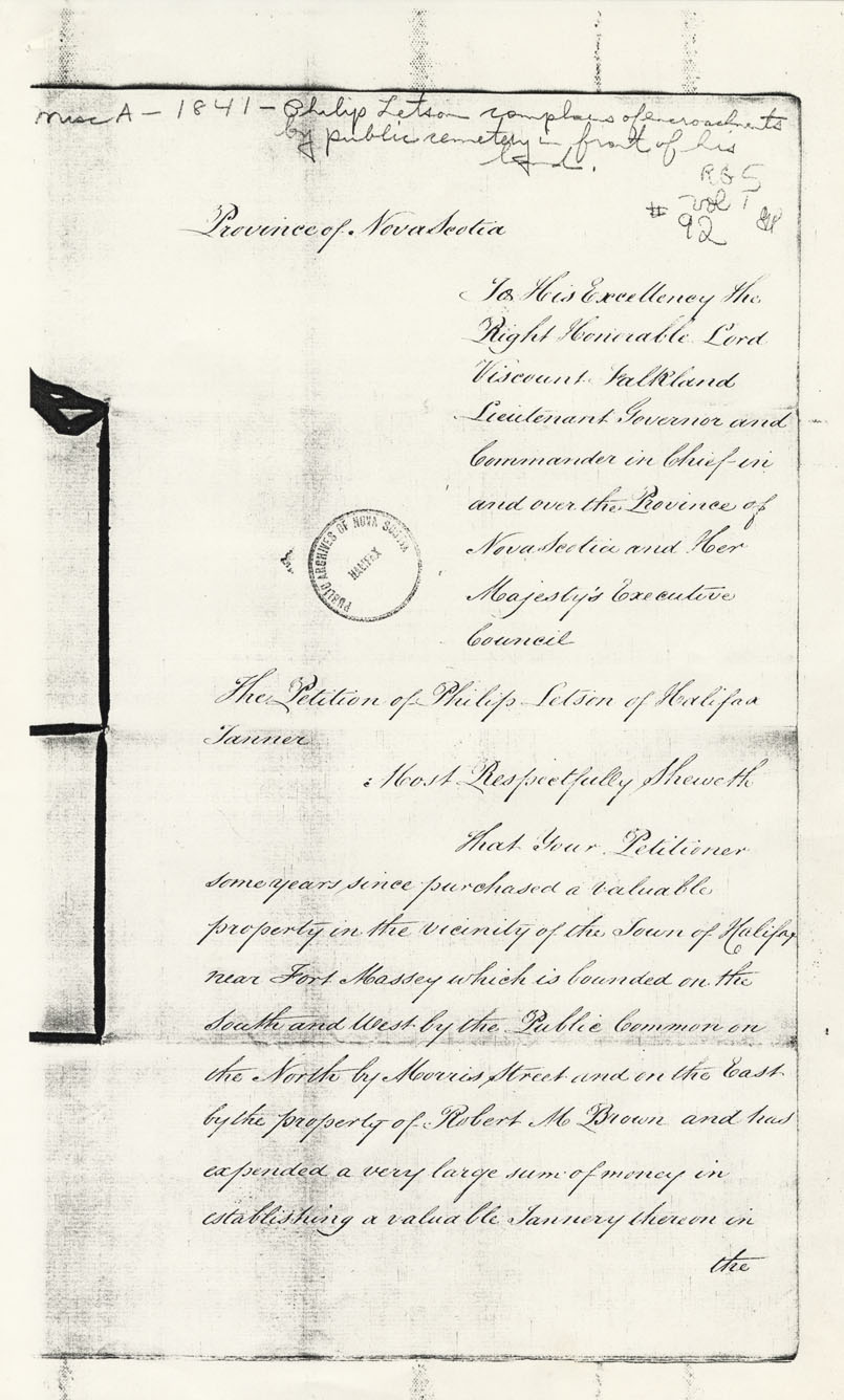
Plan of land of Philip Letson and Encroachment of Land
Date: 1841
Reference: Nova Scotia Archives Map Collection: F/240 - 1841
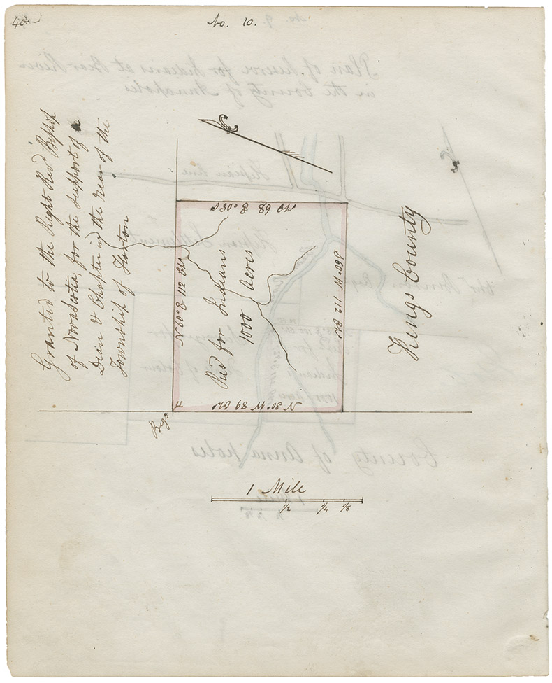
"Map of part of the Indian Lands in Nova Scotia, 1842" – Kings County
Date: 1842
Reference: Nova Scotia Archives Map Collection: F/202 - Nova Scotia 1842; RG 1 v. 432 p. 28; microfilm no. 14011
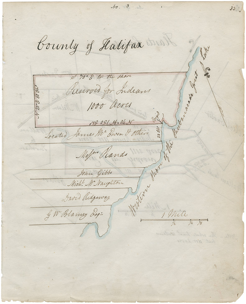
"Map of part of the Indian Lands in Nova Scotia, 1842" – Halifax County, west side Shubenacadie Lake
Date: 1842
Reference: Nova Scotia Archives Map Collection: F/202 - Nova Scotia 1842; RG 1 v. 432 p. 33; microfilm no. 14011.
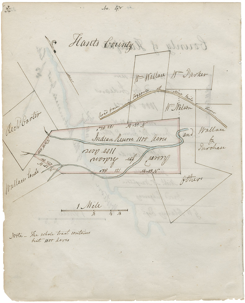
"Map of part of the Indian Lands in Nova Scotia, 1842" – Hants County
Date: 1842
Reference: Nova Scotia Archives Map Collection: F/202 - Nova Scotia 1842; RG 1 v. 432 p. 34; microfilm no. 14011
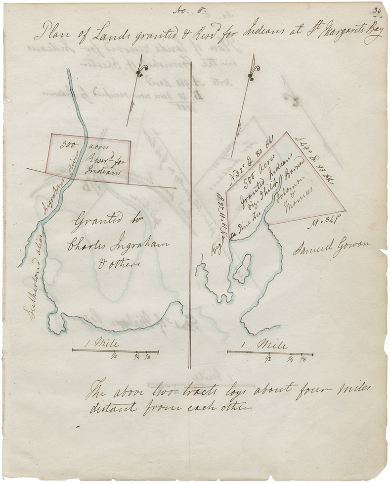
"Map of part of the Indian Lands in Nova Scotia, 1842" – Halifax County, St. Margaret's Bay
Date: 1842
Reference: Nova Scotia Archives Map Collection: F/202 - Nova Scotia 1842; RG 1 v. 432 p. 35; microfilm no. 14011