
Nova Scotia Archives
Historical Maps of Nova Scotia
"Map of part of the Indian Lands in Nova Scotia, 1842" – Kings County
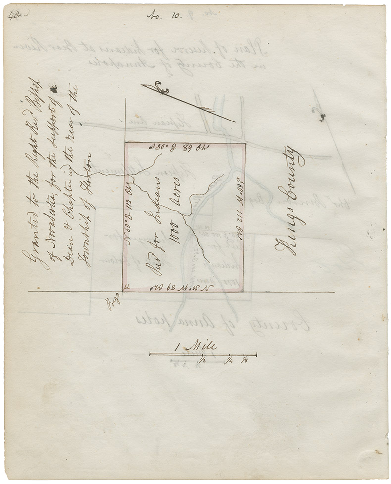
Indian Commissioner Joseph Howe's first "Report on Indian Affairs" [see Journals of the House of Assembly, 25 January 1843, Appendix 1, p. 3] states that Howe had received plans of Mi'kmaq Reserves in Nova Scotia from the Surveyor General and copied them into his note book [RG 1 v. 432 p. 28]. Original map comprises nine individual plans on one sheet; each plan is signed by John Spry Morris, Surveyor General, May 20, 1842. Howe's note book copies are embedded in narrative descriptions of
Date: 1842
Reference: Nova Scotia Archives Map Collection: F/202 - Nova Scotia 1842; RG 1 v. 432 p. 28; microfilm no. 14011