Nova Scotia Archives
Historical Maps of Nova Scotia
Results 526 to 540 of 827 from your search: 1900
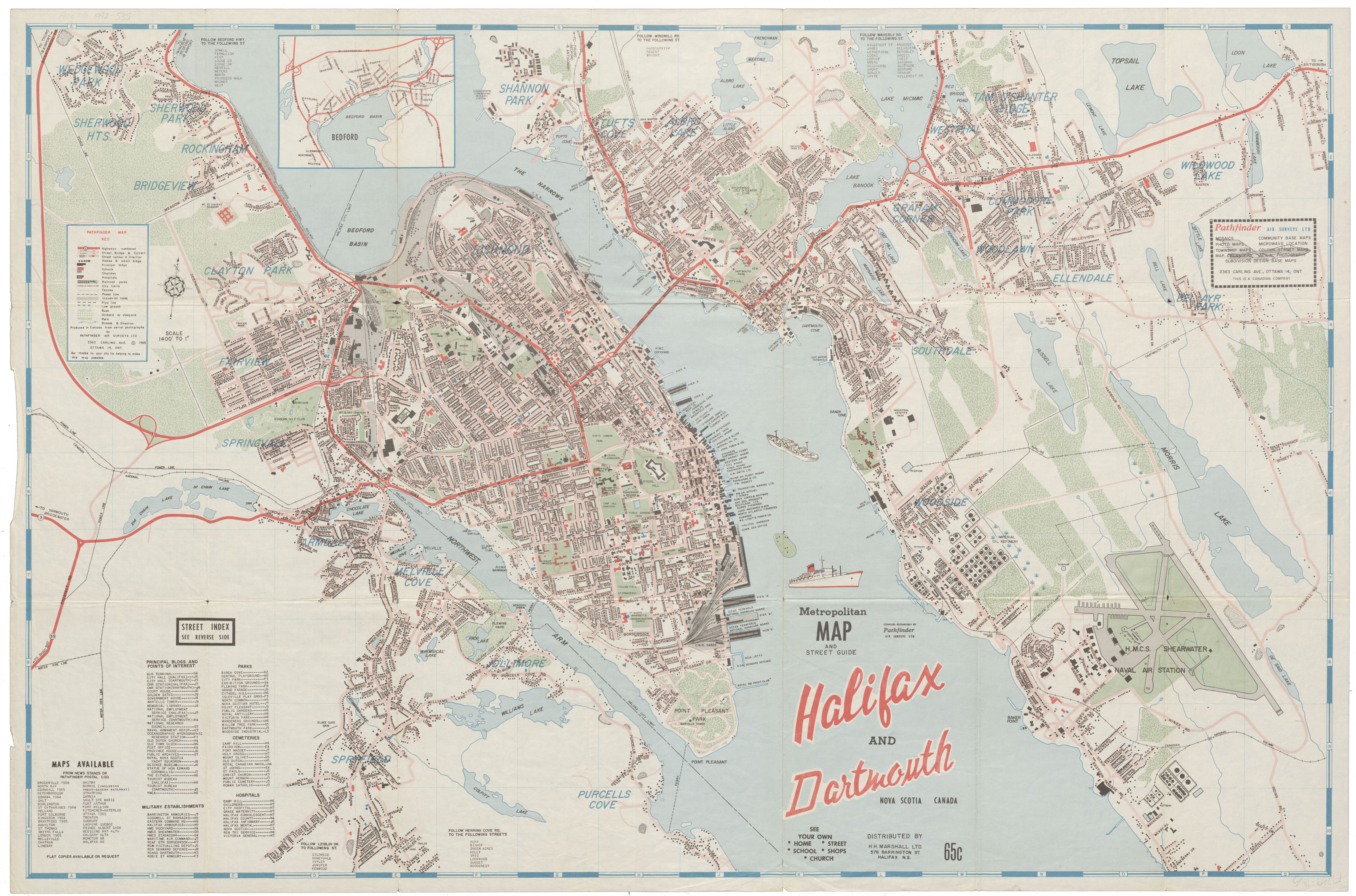
Metropolitan Map and Street Guide Halifax and Dartmouth N.S., Canada
Date: 1965
Reference: Nova Scotia Archives Map Collection: F/239 - 1965
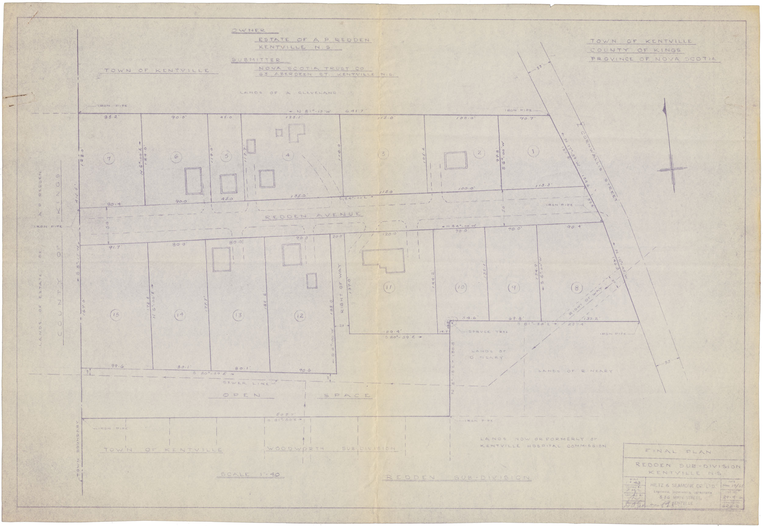
Town of Kentville Redden Sub-division Kentville, N.S.
Date: 19 May 1965
Reference: Nova Scotia Archives Map Collection: F/239 - 1964
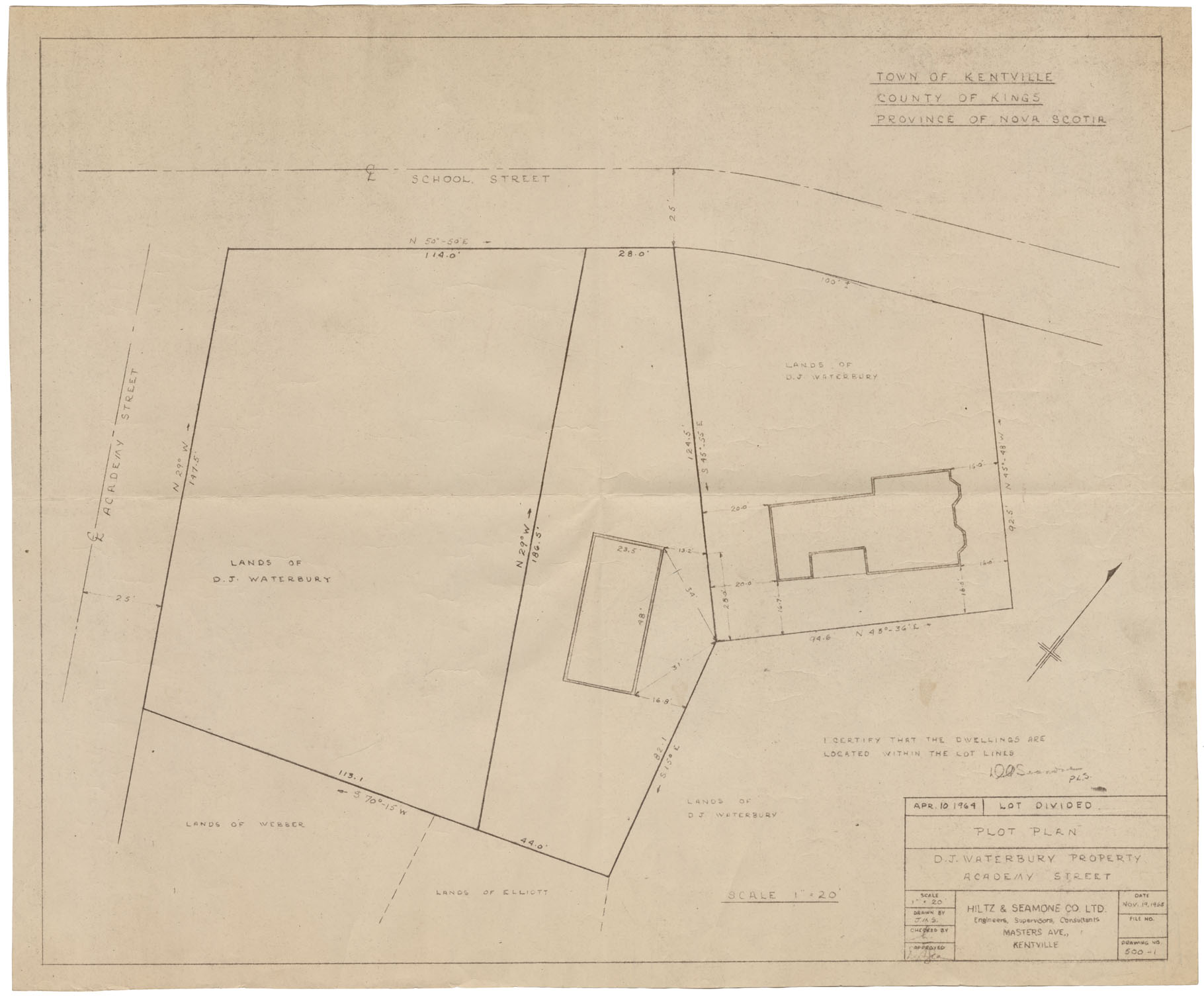
Town of Kentville Plot Plan-D.J.Waterbury Property Academy Street
Date: 19 November 1965
Reference: Nova Scotia Archives Map Collection: F/239 - 1965
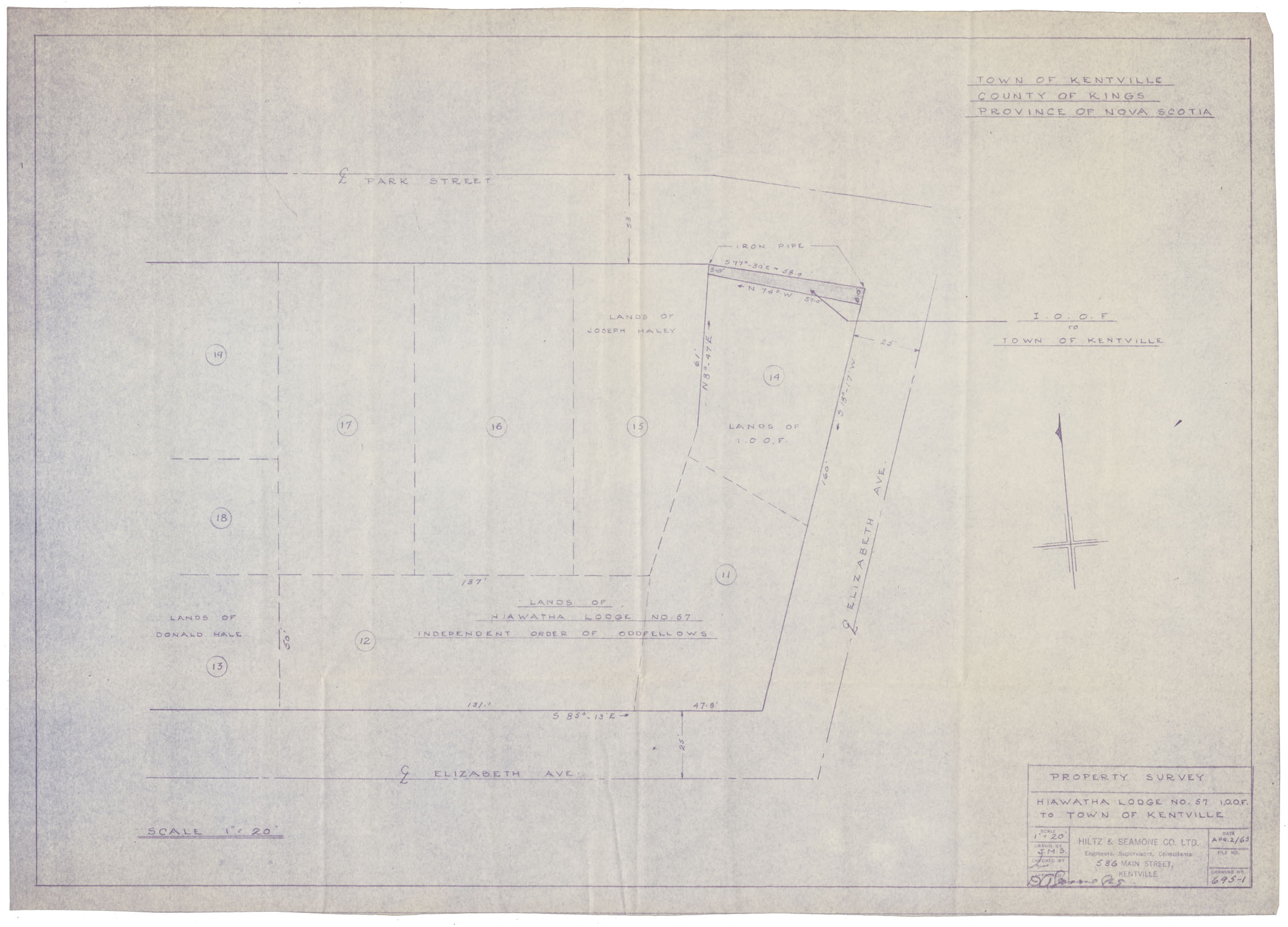
Town of Kentville Property Survey: Hiawatha Lodge No 57
Date: 2 April 1965
Reference: Nova Scotia Archives Map Collection: F/239 - 1965
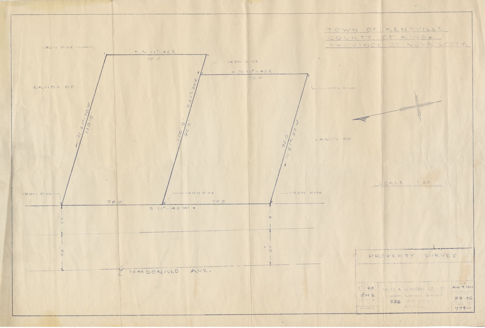
Town of Kentville Property Survey-MacDonald Ave
Date: 9 August 1965
Reference: Nova Scotia Archives Map Collection: F/239 - 1965
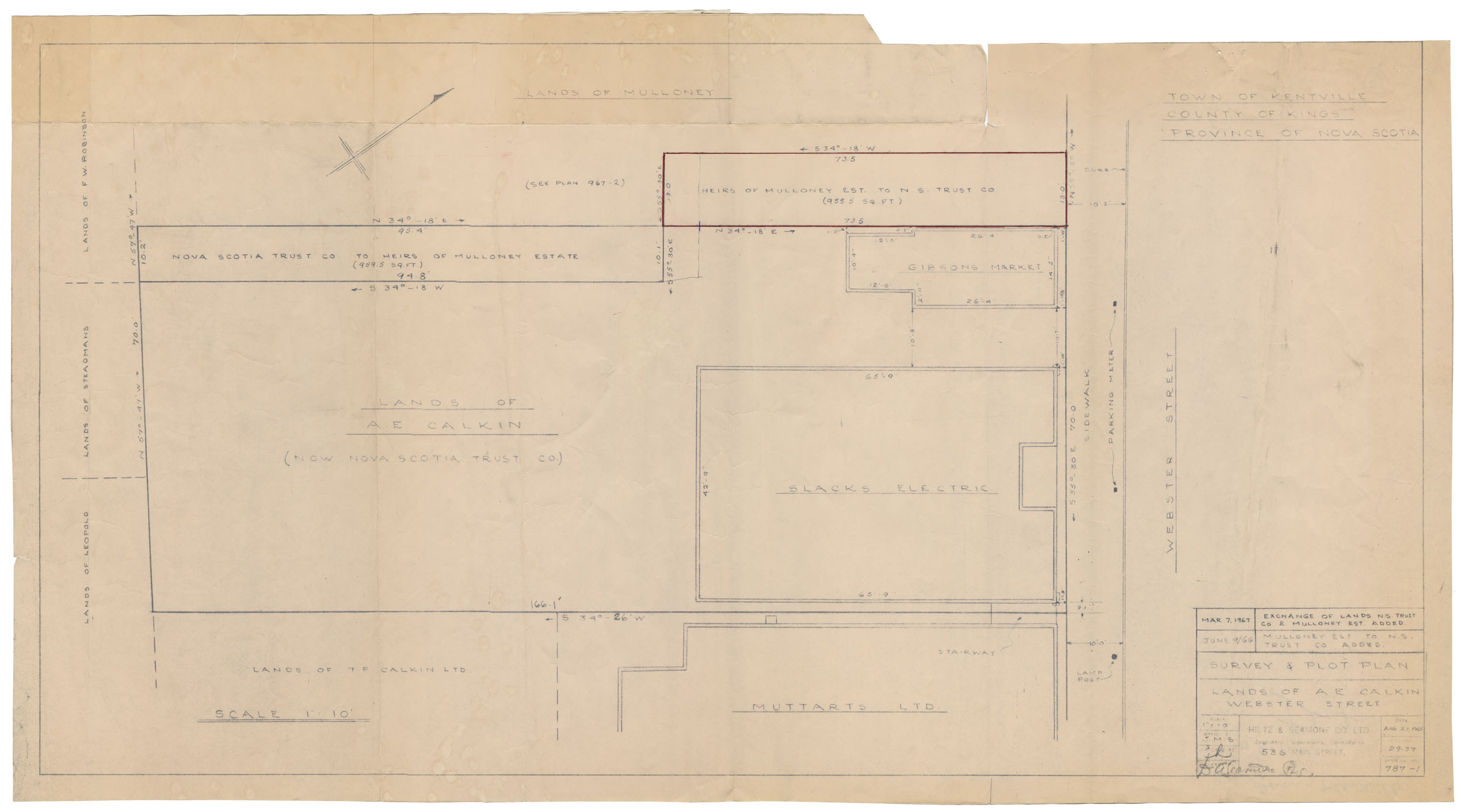
Town of Kentville Survey & Plot Plan-Webster Street Lands of A.E.Calkin
Date: 23 August 1965
Reference: Nova Scotia Archives Map Collection: F/239 - 1965
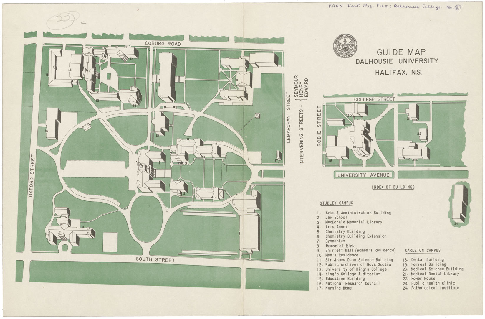
Guide map, Dalhousie University Halifax, N.S. with Index of Buildings including King's College
Date: 1965
Reference: Nova Scotia Archives Map Collection: F/240 - 1965
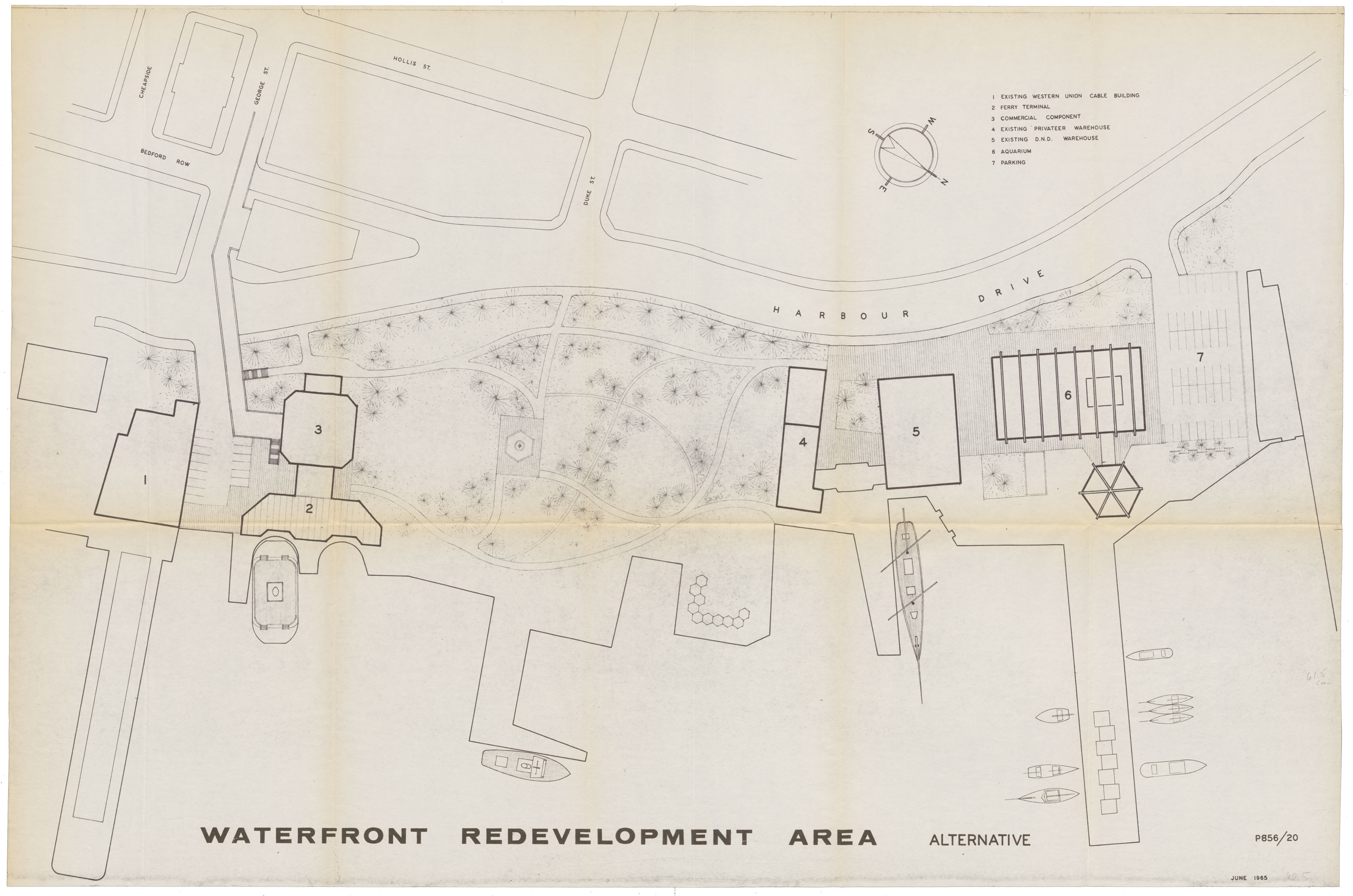
Proposed: Waterfront Redevelopment Aerial View June 1965
Date: June 1965
Reference: Nova Scotia Archives Map Collection: F/240 - 1965
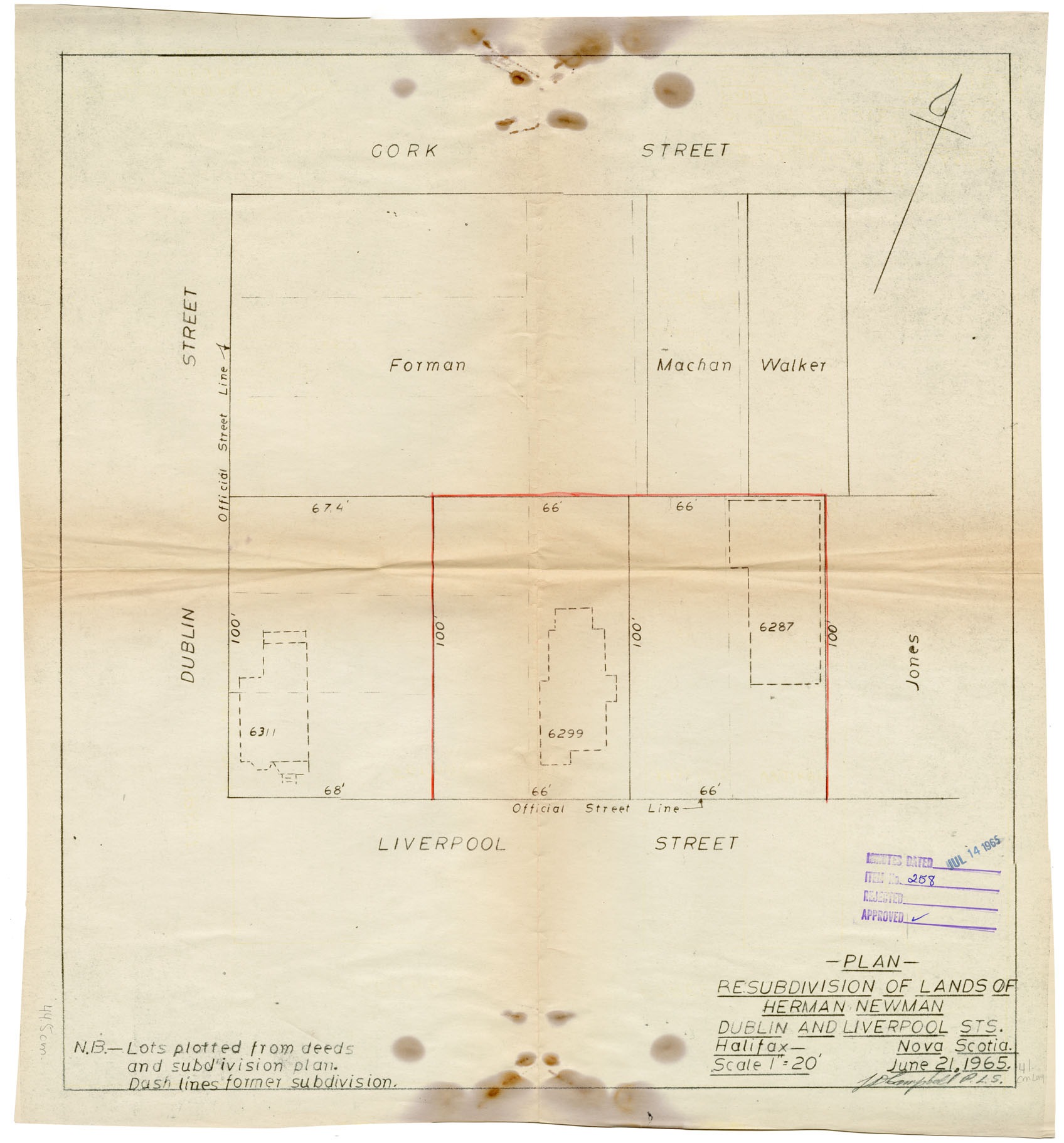
Plan Resubdivision of Lands of Herman Newman Dublin and Liverpool Streets, Halifax, Nova Scotia
Date: 21 June 1965
Reference: Nova Scotia Archives Map Collection: F/240 - 1965
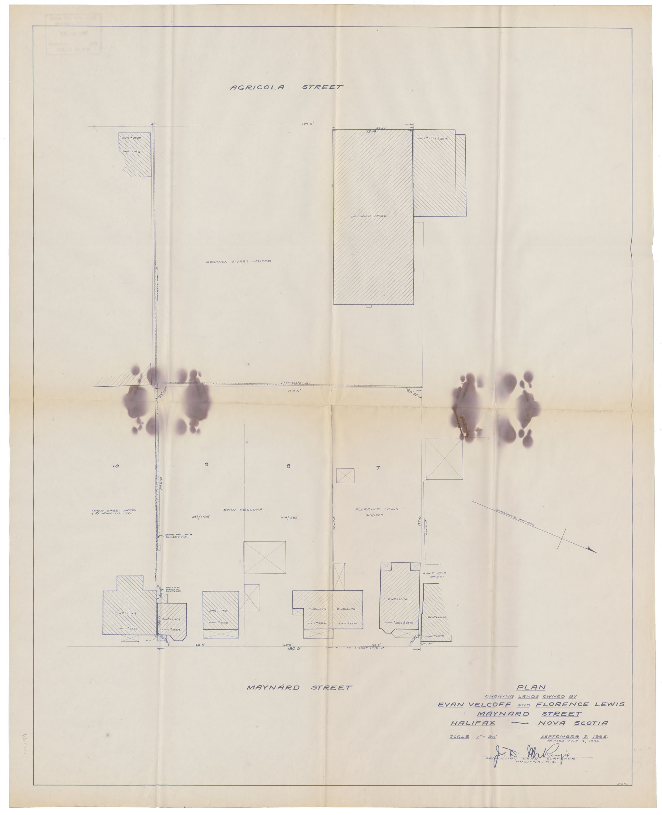
Plan of Lands owned by Evan Velcoff & Florence Lewis, Maynard St, Halifax
Date: 3 September 1965
Reference: Nova Scotia Archives Map Collection: F/240 - 1965
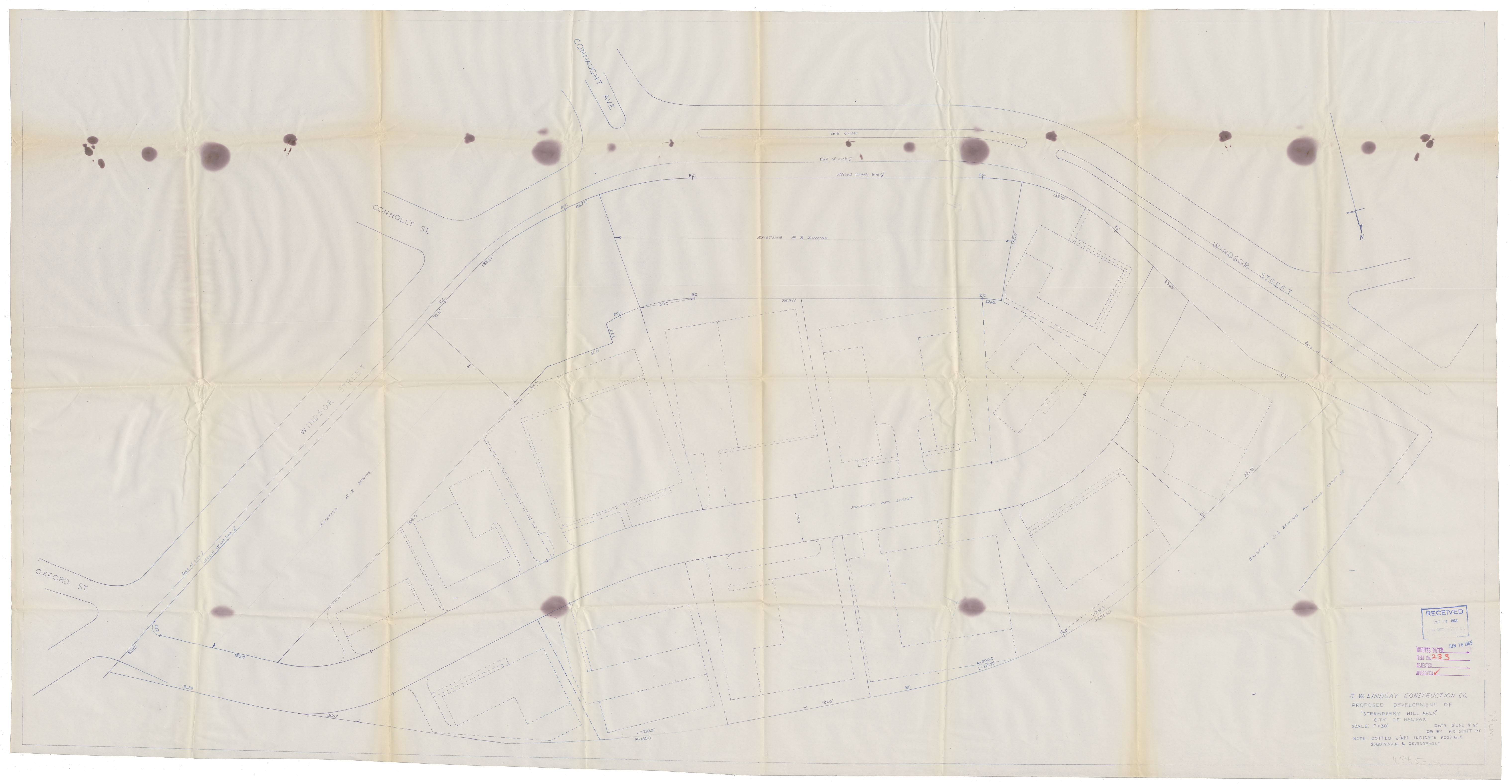
Proposed Development of "Strawberry Hill Area" City of Halifax
Date: 15 June 1965
Reference: Nova Scotia Archives Map Collection: F/240 - 1965
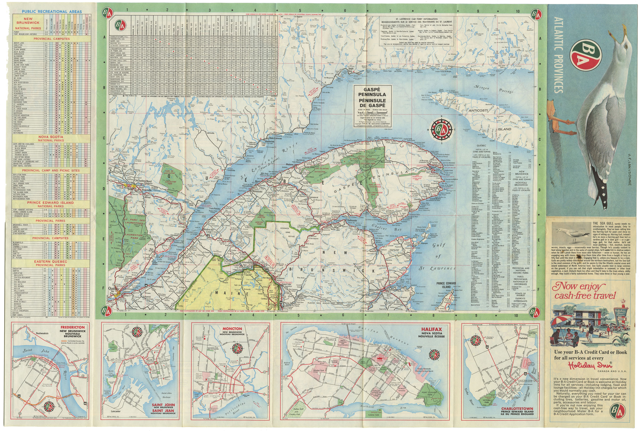
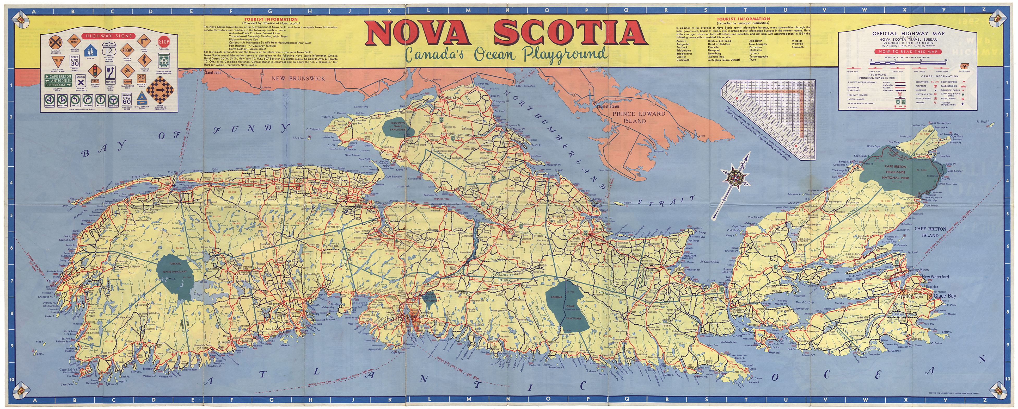
Nova Scotia Highway map 1966-67
Date: 1966
Reference: Nova Scotia Archives Map Collection: F/202 - 1966/1967
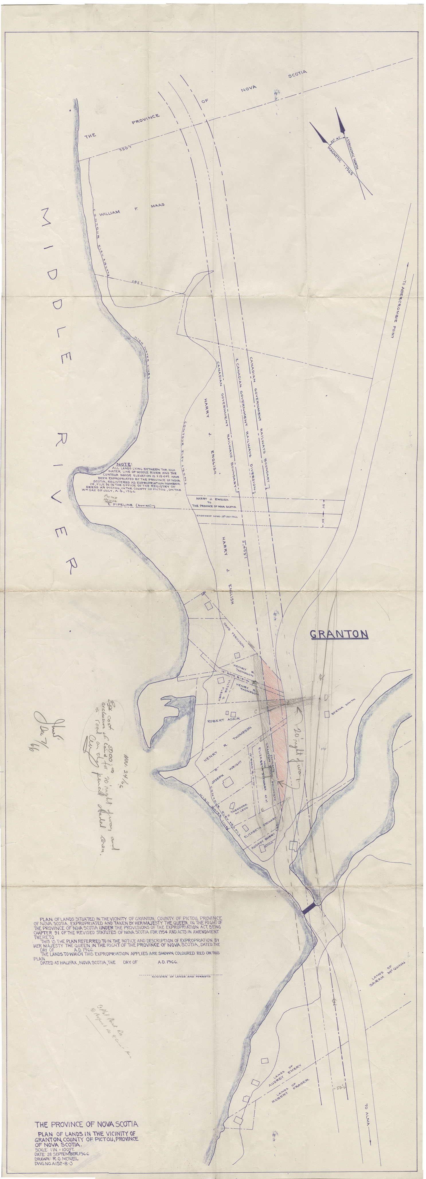
Plan of Lands situated in the Vicinity of Granton, Pictou County
Date: 28 September 1966
Reference: Nova Scotia Archives Map Collection: F/239 - 1966
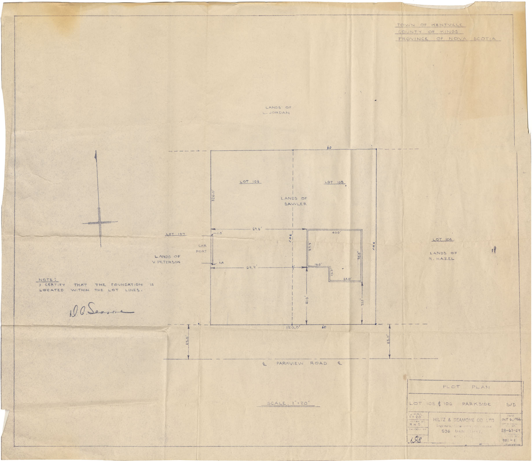
Town of Kentville Plot Plan Lot 105 & 106 Parkside
Date: 6 October 1966
Reference: Nova Scotia Archives Map Collection: F/239 - 1966