Nova Scotia Archives
Historical Maps of Nova Scotia
Results 406 to 420 of 827 from your search: 1900
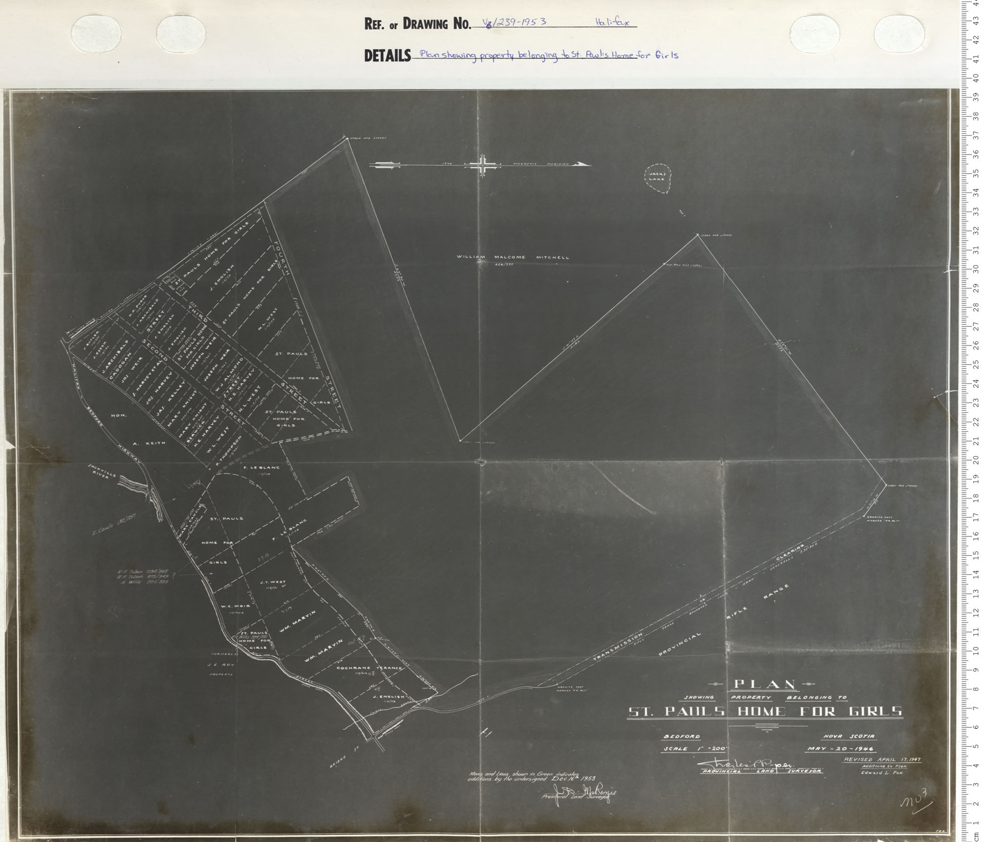
Plan Showing Property belonging to St Paul's Home for Girls
Date: 1953
Reference: Nova Scotia Archives Map Collection: V6 239 Halifax, Nova Scotia
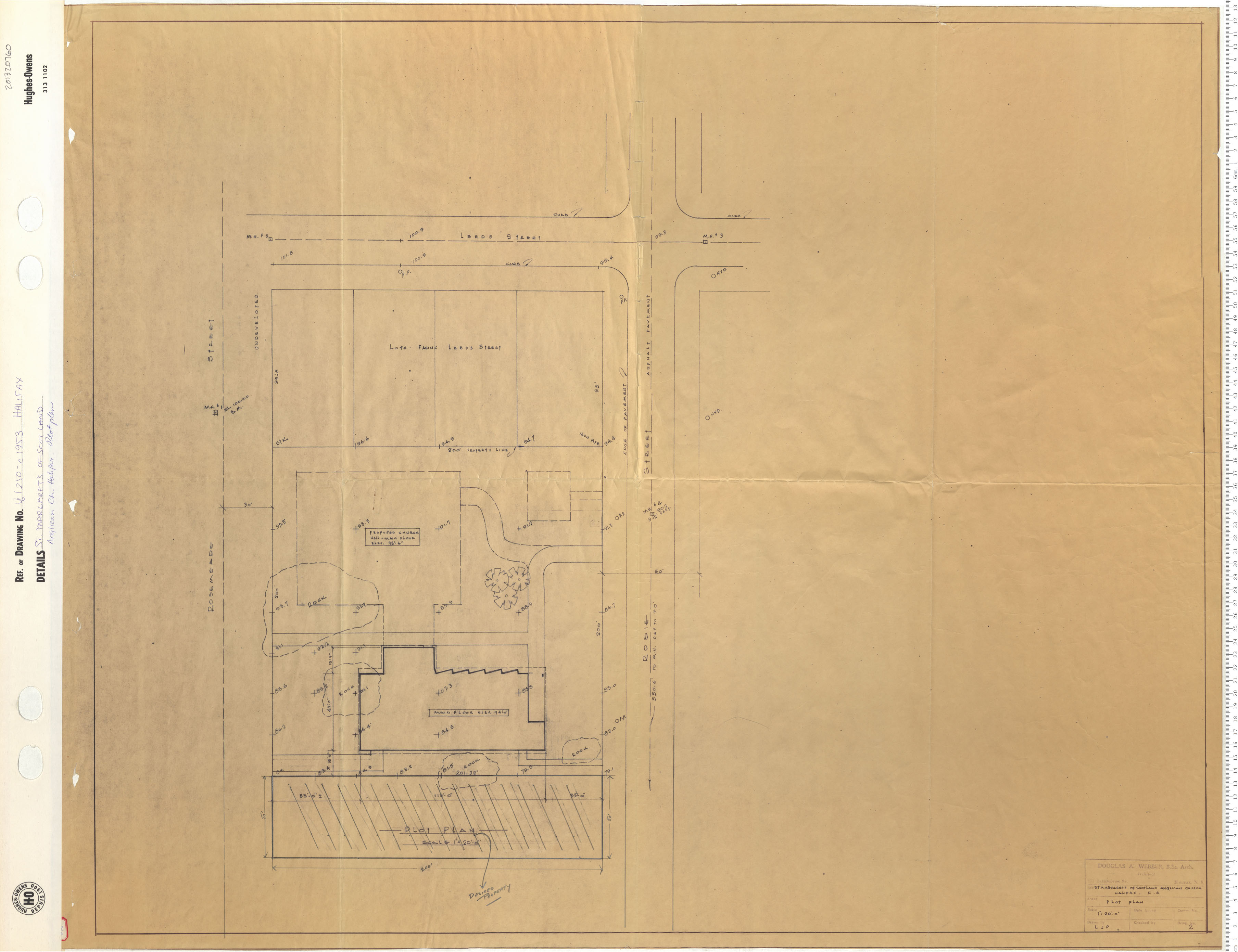
Saint Margret's of Scotland Anglican Church Halifax Plot Plan
Date: 1953
Reference: Nova Scotia Archives Map Collection: V6 250 Halifax, Nova Scotia
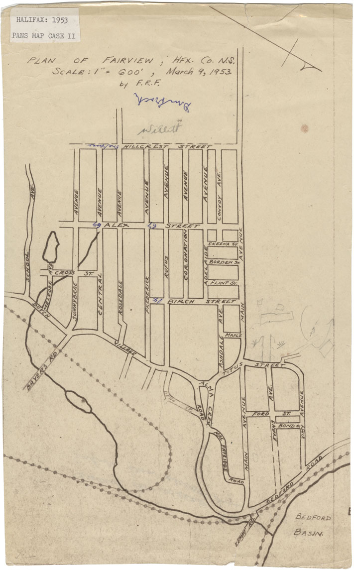
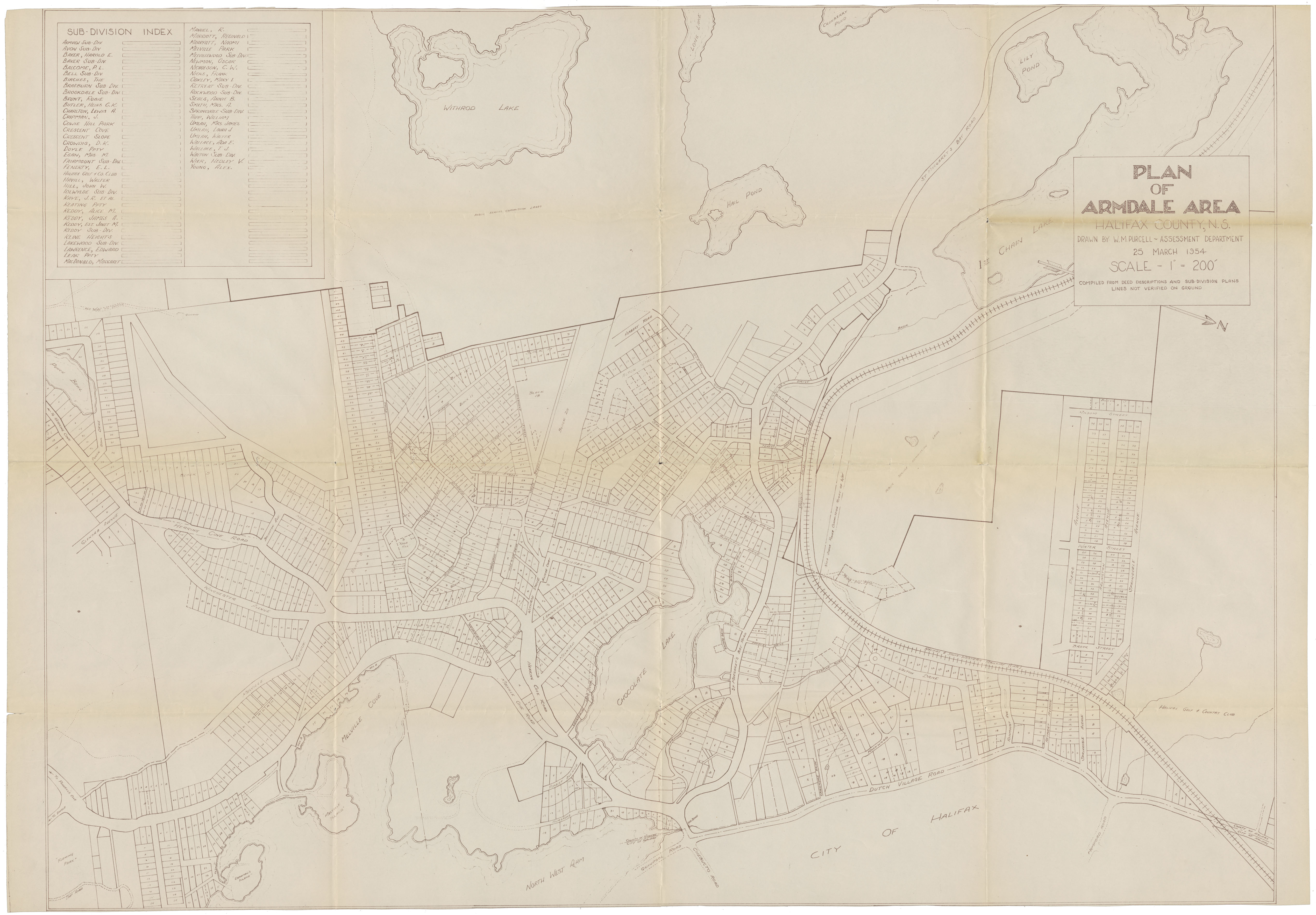
Plan of Fairview, Halifax County, N.S.
Date: 9 March 1953
Reference: Nova Scotia Archives Map Collection: F/239 - 1953
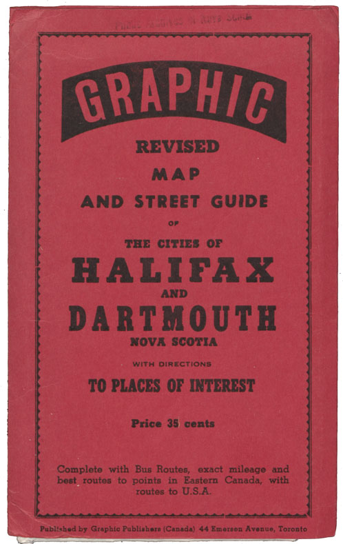
Graphic Revised map and Street Guide of the Cities of Halifax and Dartmouth, N.S. with Directions to Places of Interest
Date: 1953
Reference: Nova Scotia Archives Map Collection: F/239 - 1953
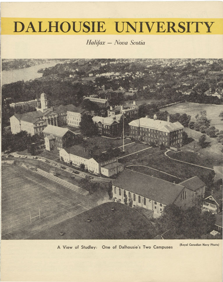
Ground Plan of Dalhousie University
Date: 1953
Reference: Nova Scotia Archives Map Collection: F/240 - 1953
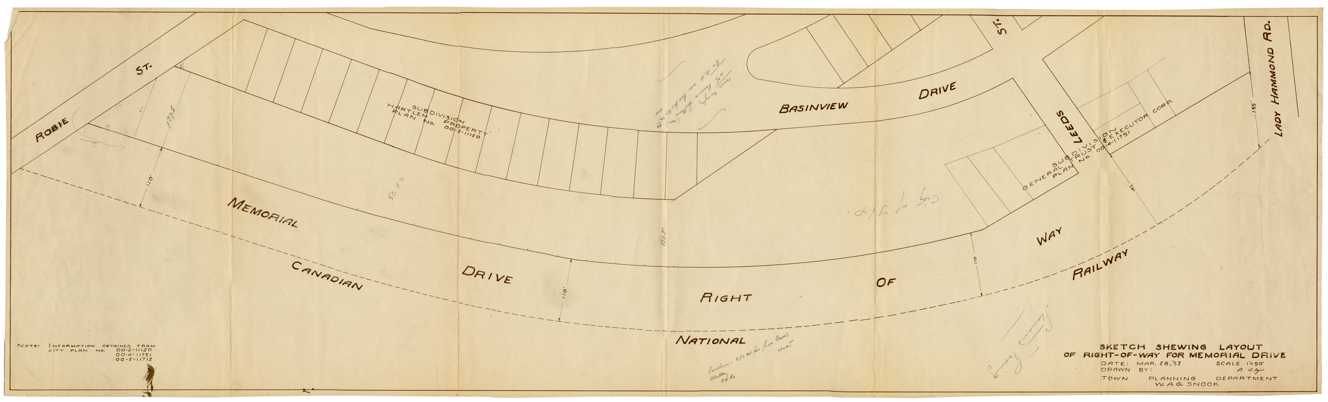
Sketch showing layout of right of way for Memorial Drive
Date: 28 March 1953
Reference: Nova Scotia Archives Map Collection: F/240 - 1953
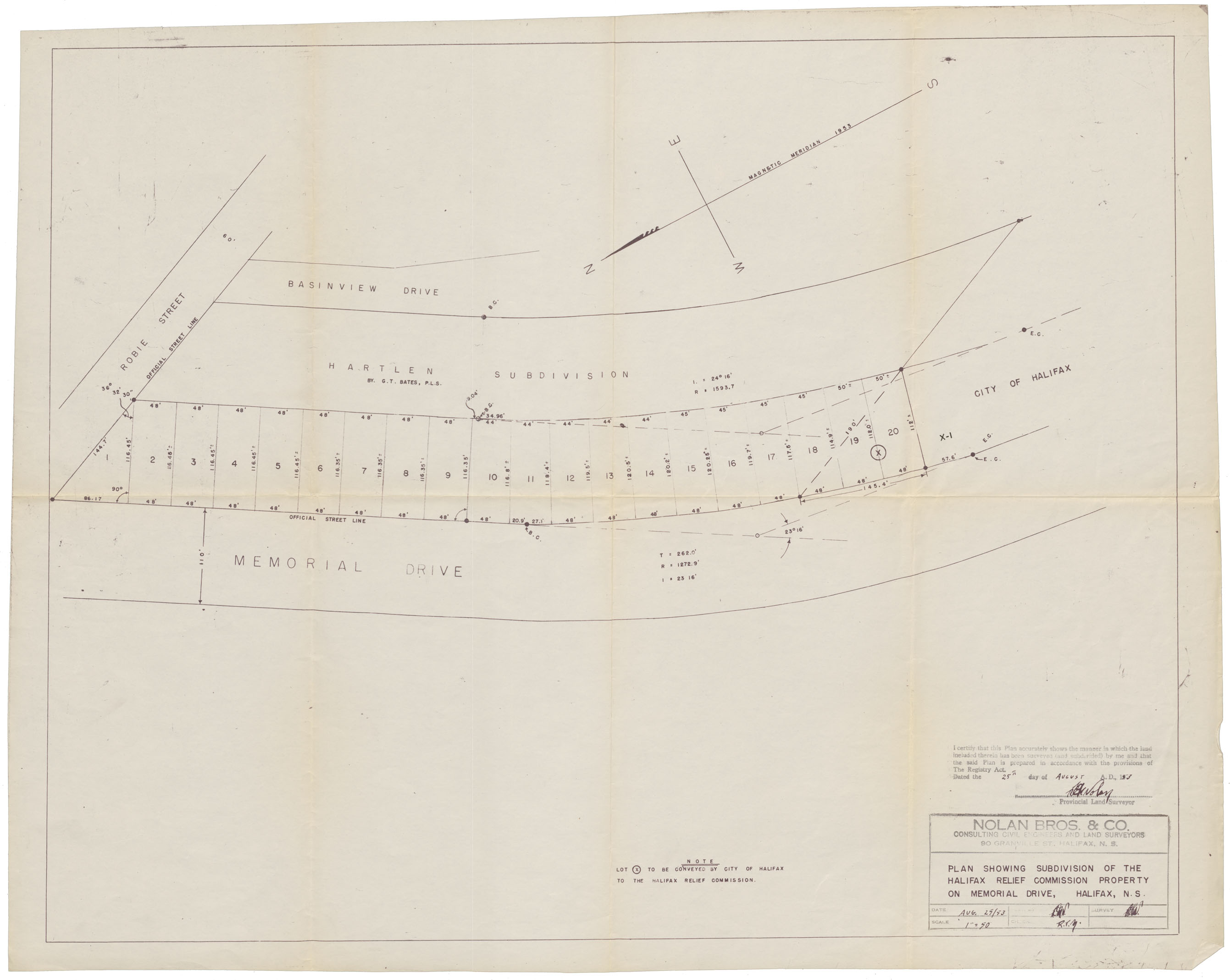
Plan showing Subdivision of the Halifax Relief Commission Property on memorial Drive, Halifax, N.S.
Date: 25 November 1953
Reference: Nova Scotia Archives Map Collection: F/240 - 1953
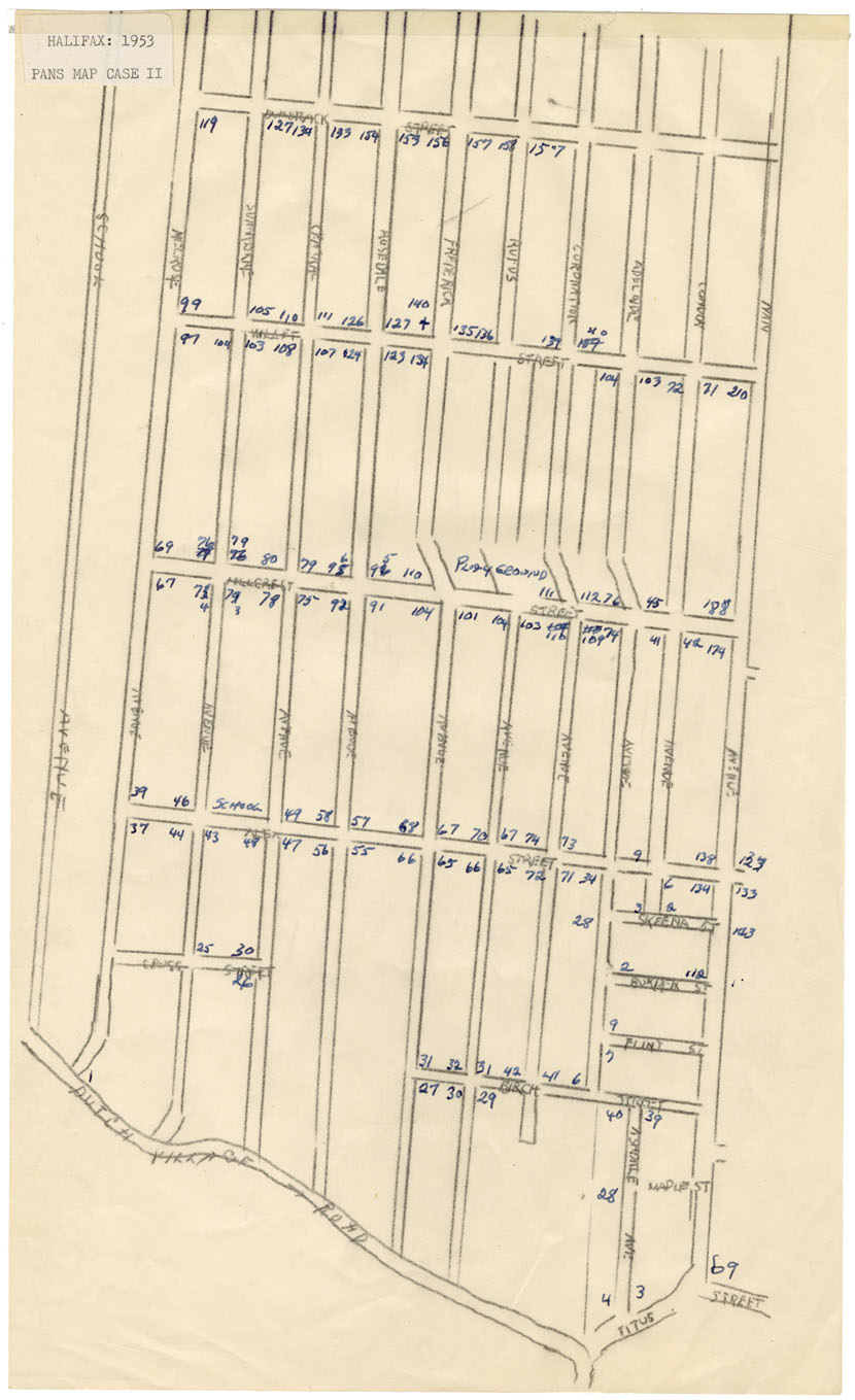
Area bounded by Dutch Village Road, Dunrack, School Avenue and NAN(?)
Date: 1953
Reference: Nova Scotia Archives Map Collection: F/240 - 1953
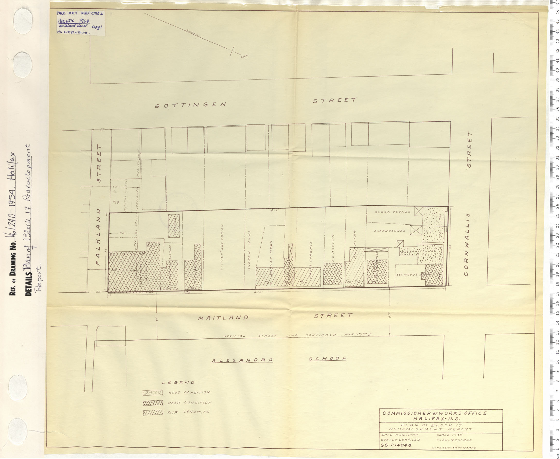
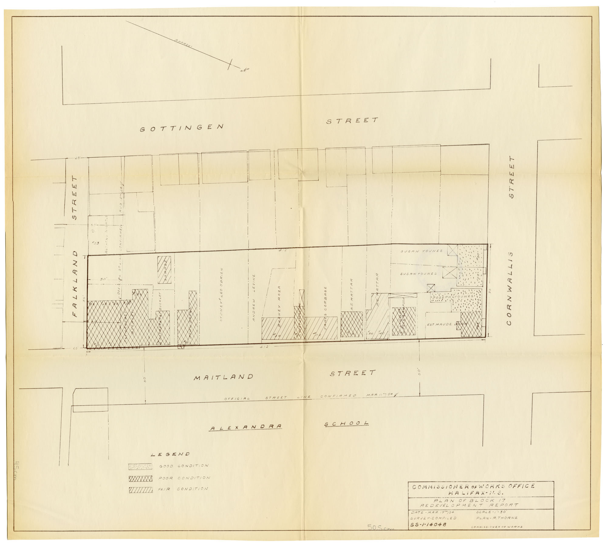
Plan of Block 17 Redevelopment Report
Date: 1954
Reference: Nova Scotia Archives Map Collection: V6 240 Halifax, Nova Scotia
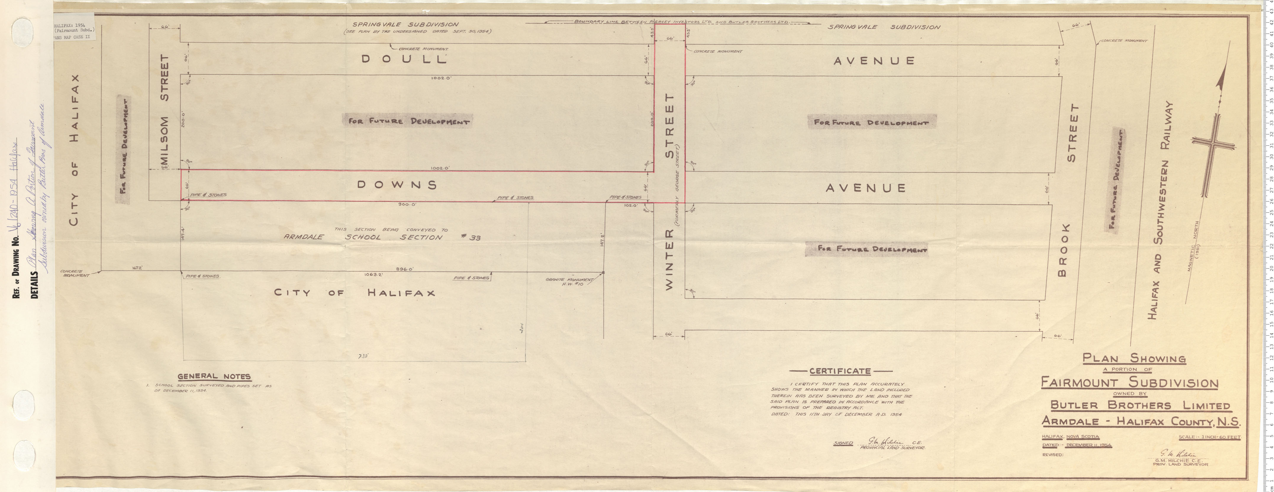
Plan Showing a Portion of fairmount Subdivision owned by Butler brothers of Armdale
Date: 1954
Reference: Nova Scotia Archives Map Collection: V6 240 Halifax, Nova Scotia
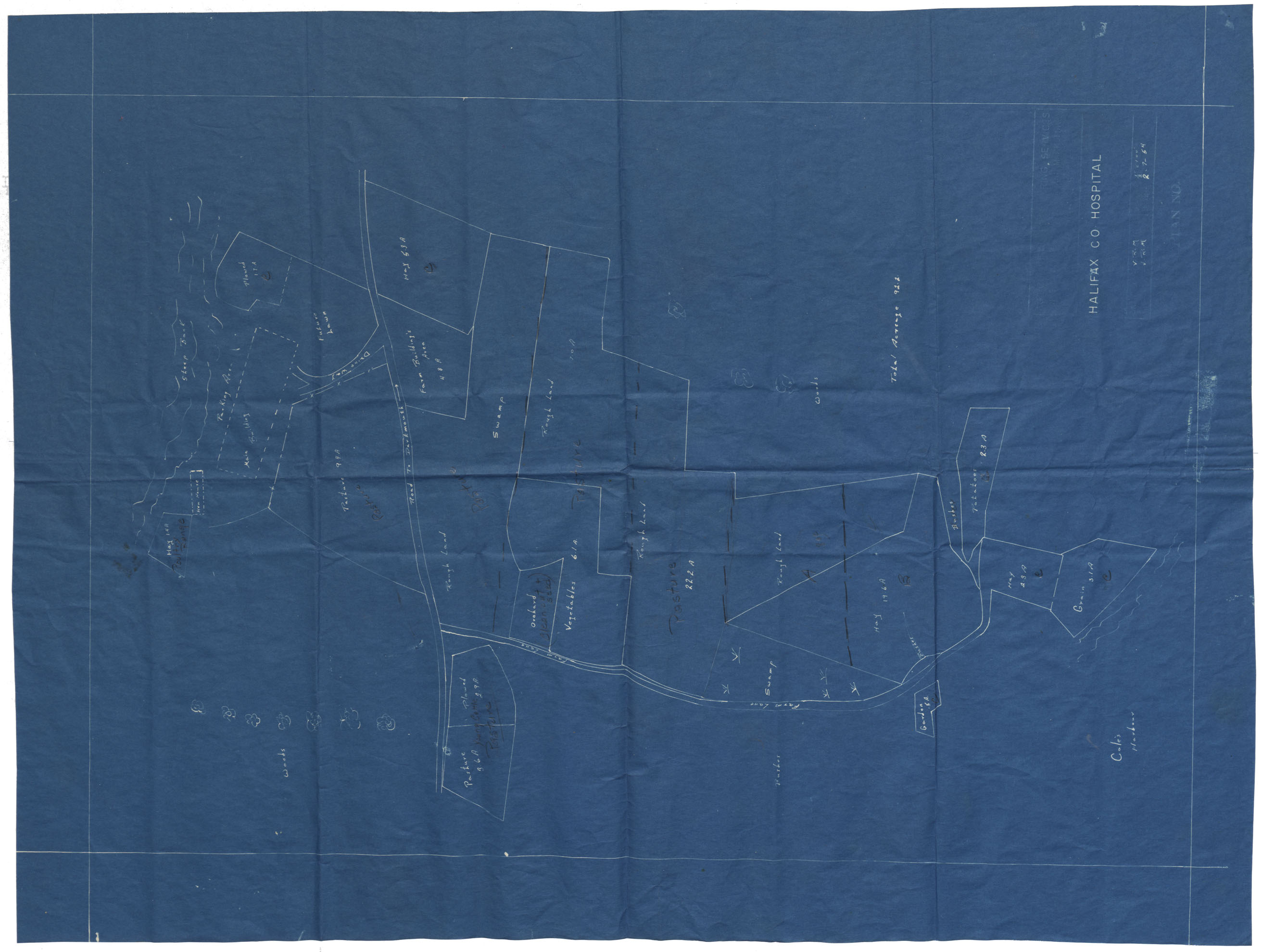
Halifax County Farm Hospital plan
Date: 1954
Reference: Nova Scotia Archives Map Collection: F/220 - 1954
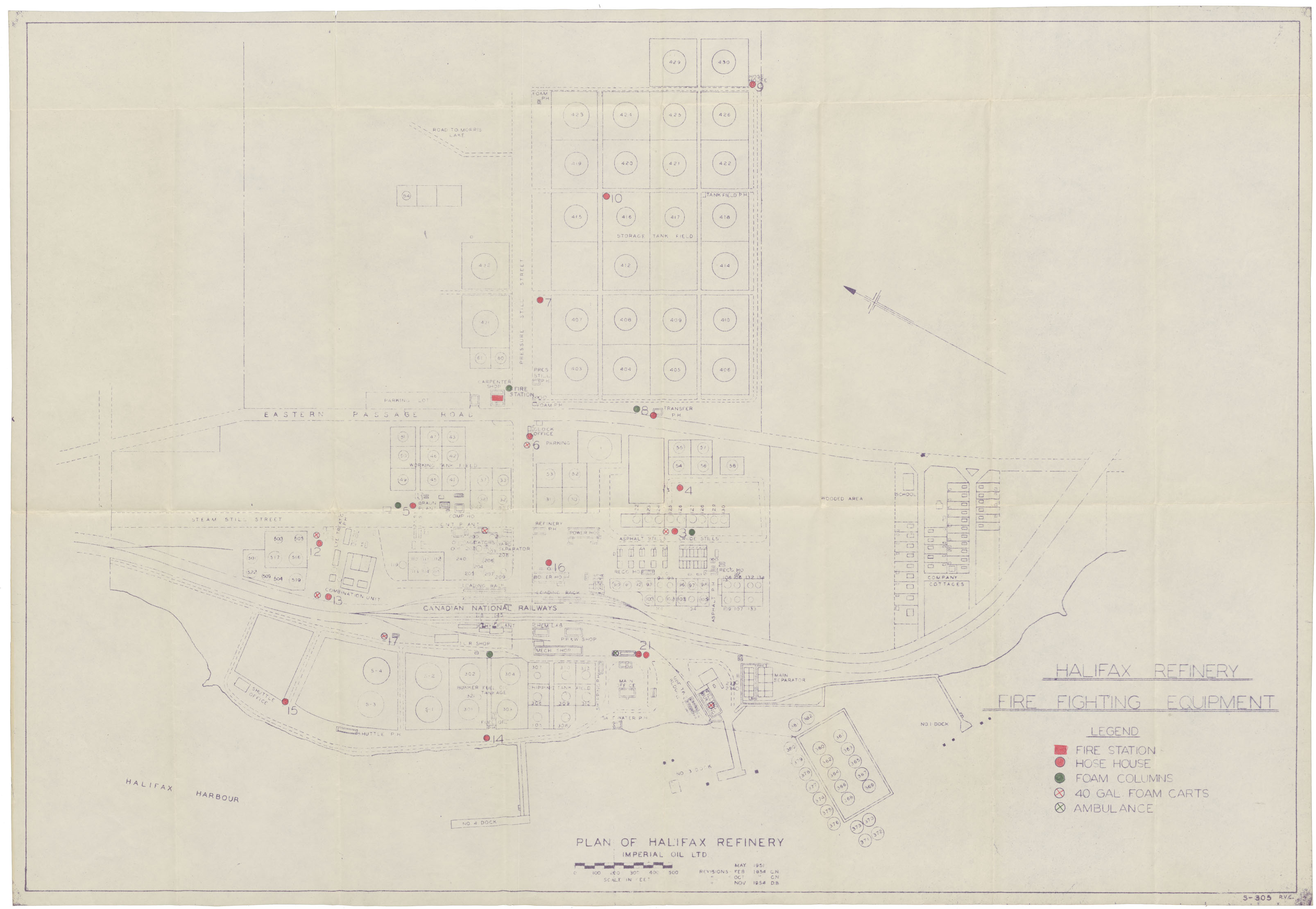
Plan of Halifax Refinery Imperial Oil Ltd
Date: November 1954
Reference: Nova Scotia Archives Map Collection: F/240 - 1954
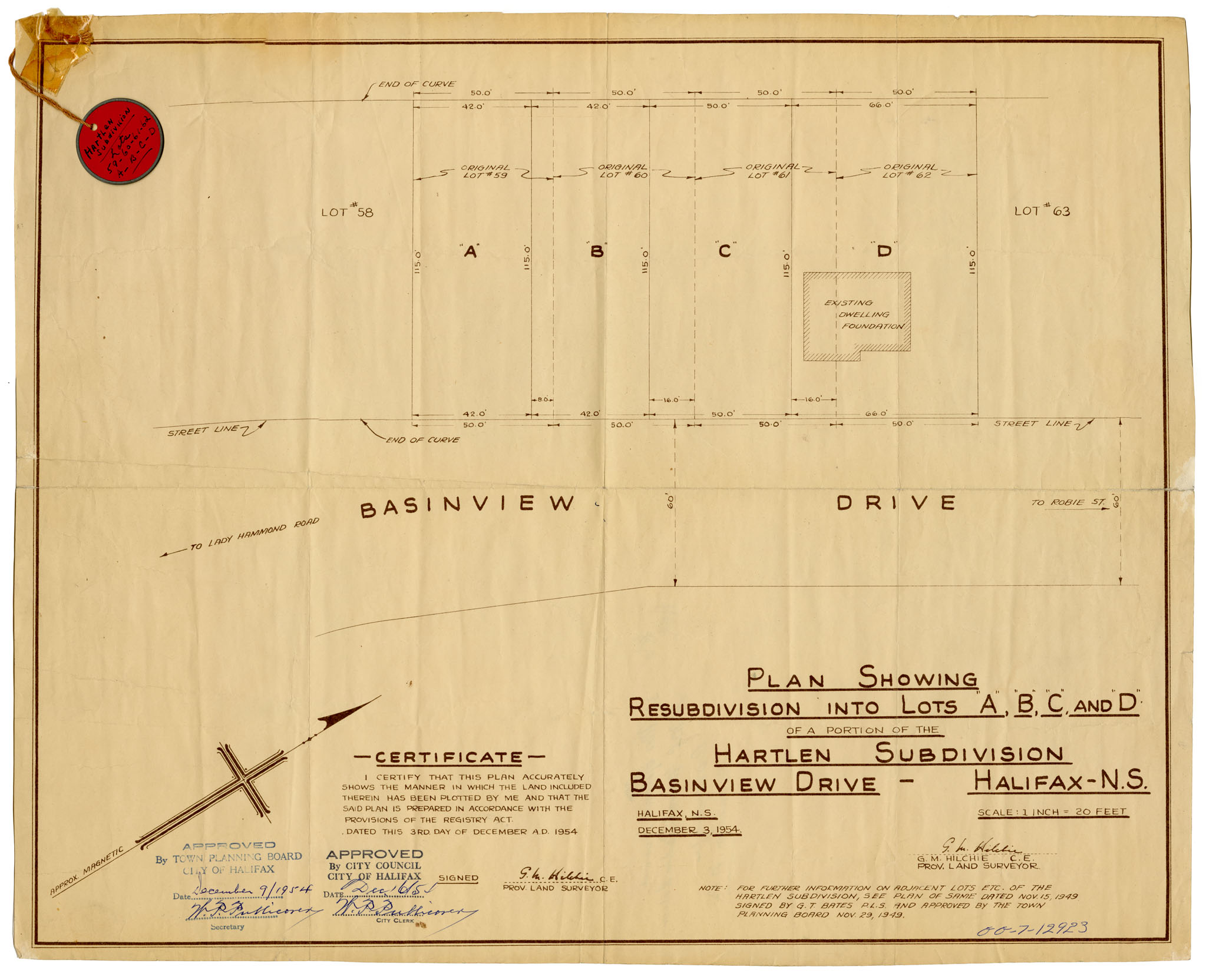
Plan showing subdivisions into lots "A", "B", "C", "D" of a Portion of the Hortlen Subdivision, Basinview Drive, Halifax Dec 3
Date: 3 December 1954
Reference: Nova Scotia Archives Map Collection: F/240 - 1954