Nova Scotia Archives
Historical Maps of Nova Scotia
Results 241 to 255 of 905 from your search: 1800
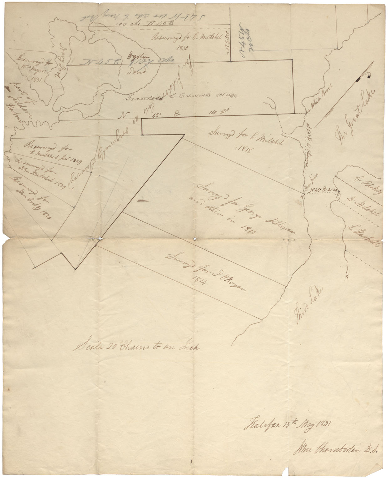
Halifax county Jeddore and Ship Harbour Lakes 1831
Date: 1831
Reference: Nova Scotia Archives Map Collection: F/210 - 1831
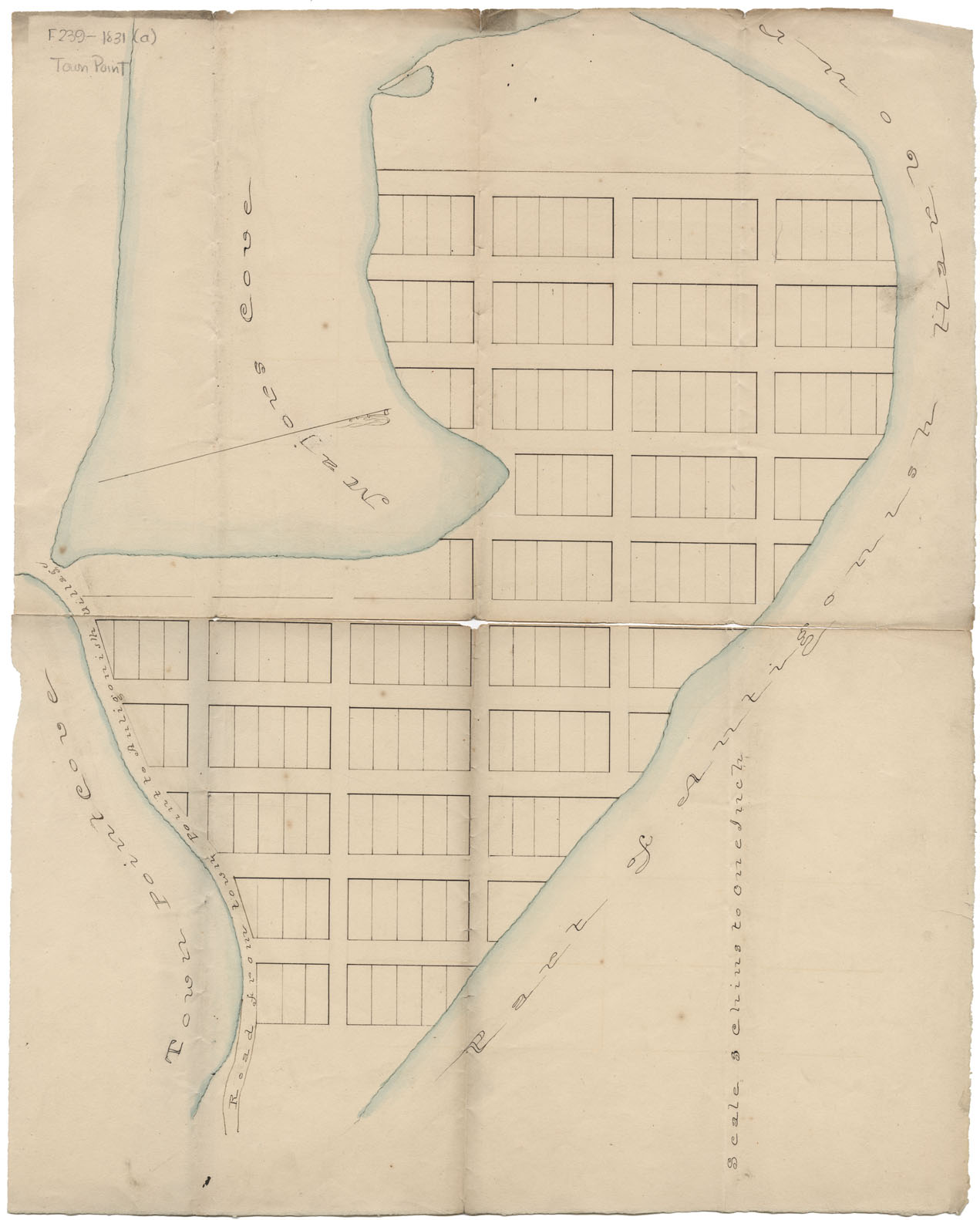
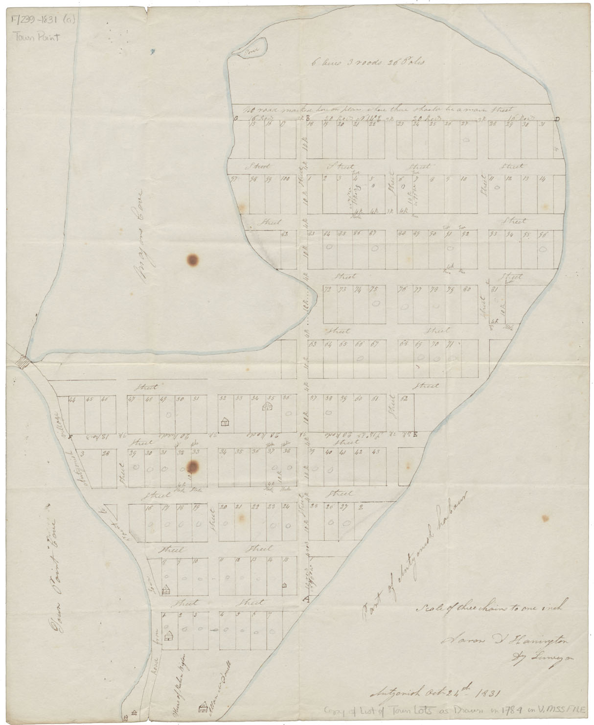
Plan of Town (3 copies of same)
Date: 24 October 1831
Reference: Nova Scotia Archives Map Collection: F/239 - 1831
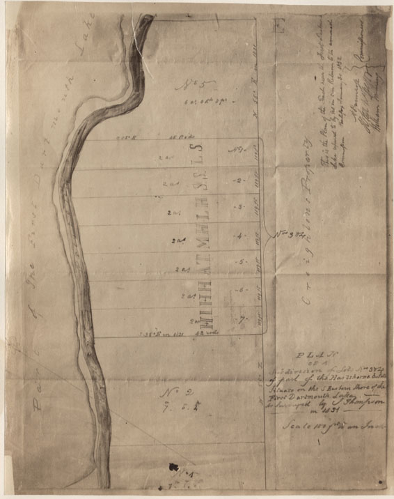
Plan of a Subdivision of Lots Nos 3&4 of part of the Hartshorne Estate situate on the S.Eastern Shore of the Lot Dartmouth Lake as surveyed by J.Thompson in 1831
Date: 1831
Reference: Nova Scotia Archives Map Collection: F/239 - 1831
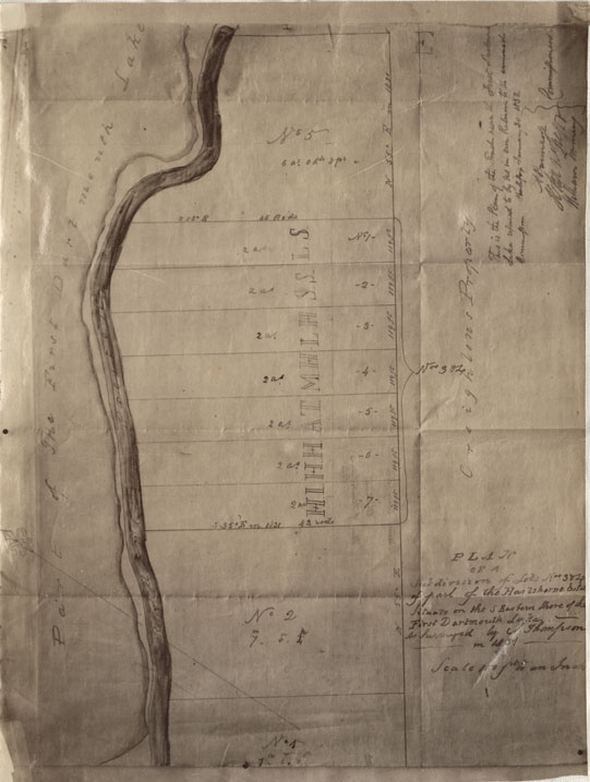
Plan of a Subdivision of Lots Nos3&4 of part of the Hartshorne Estate situate on the S.Eastern Shore of the First Dartmouth Lake
Date: 1831
Reference: Nova Scotia Archives Map Collection: F/239 - 1831
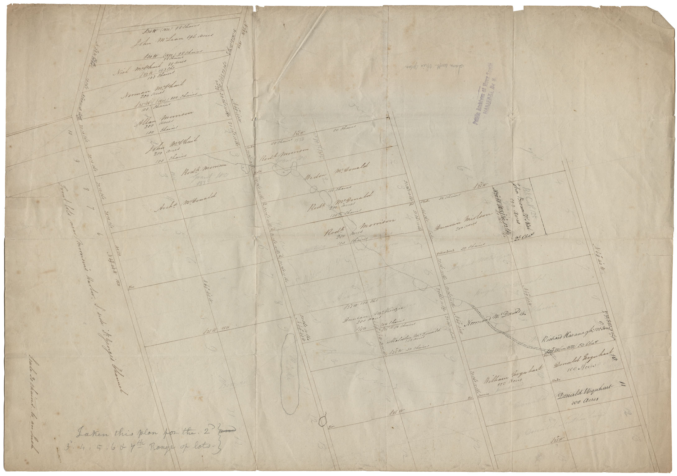
Cape Breton Front lots westward Morrison's Harbour. South side of St.George's Channel c1831
Date: 1831
Reference: Nova Scotia Archives Map Collection: F/239 - 1831
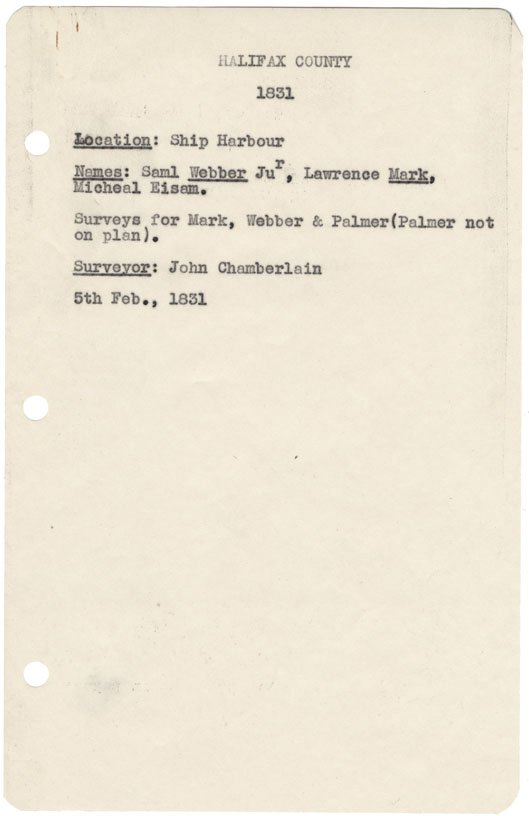
Halifax County Ship Harbour, 1831
Date: 5 February 1831
Reference: Nova Scotia Archives Map Collection: F/239 - 1831
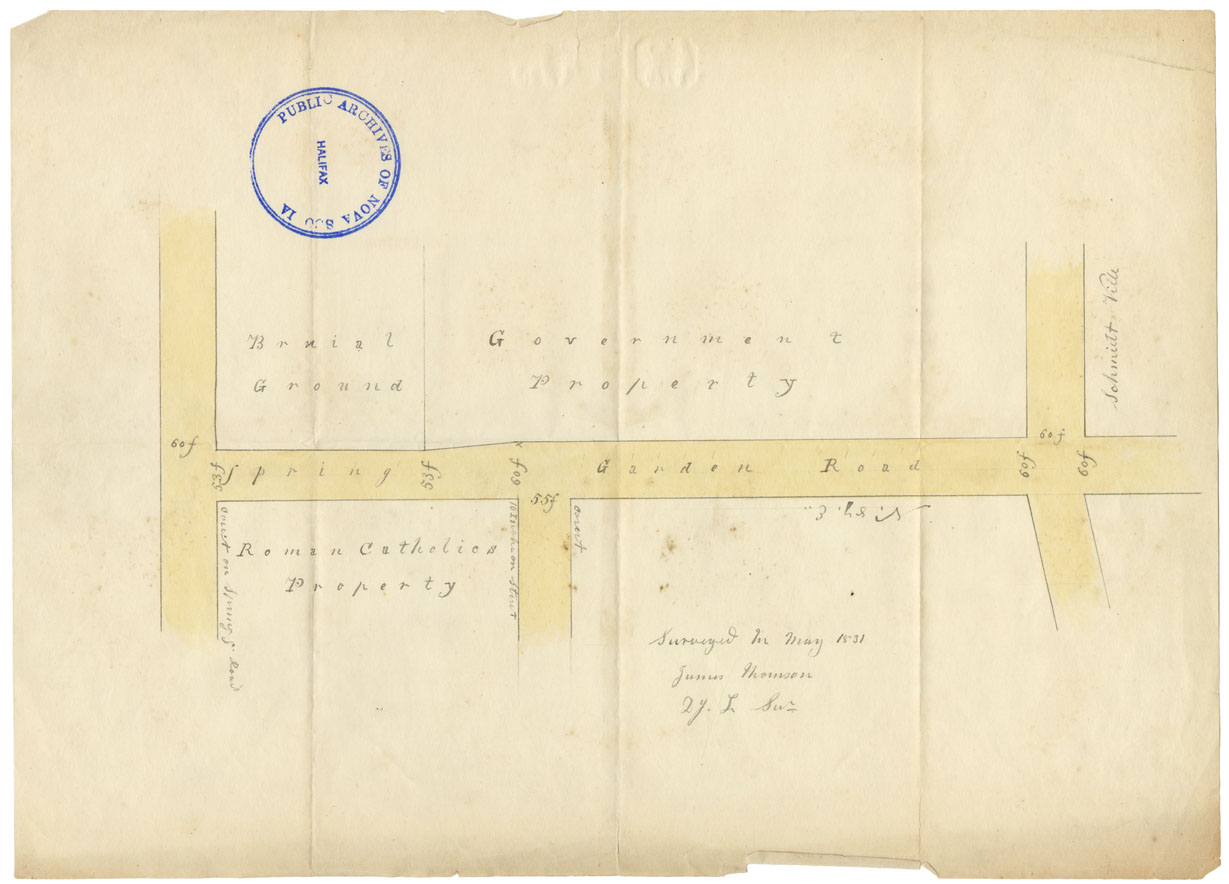
Spring Garden Road from Barrington to Queen Street
Date: May 1831
Reference: Nova Scotia Archives Map Collection: F/240 - 1831
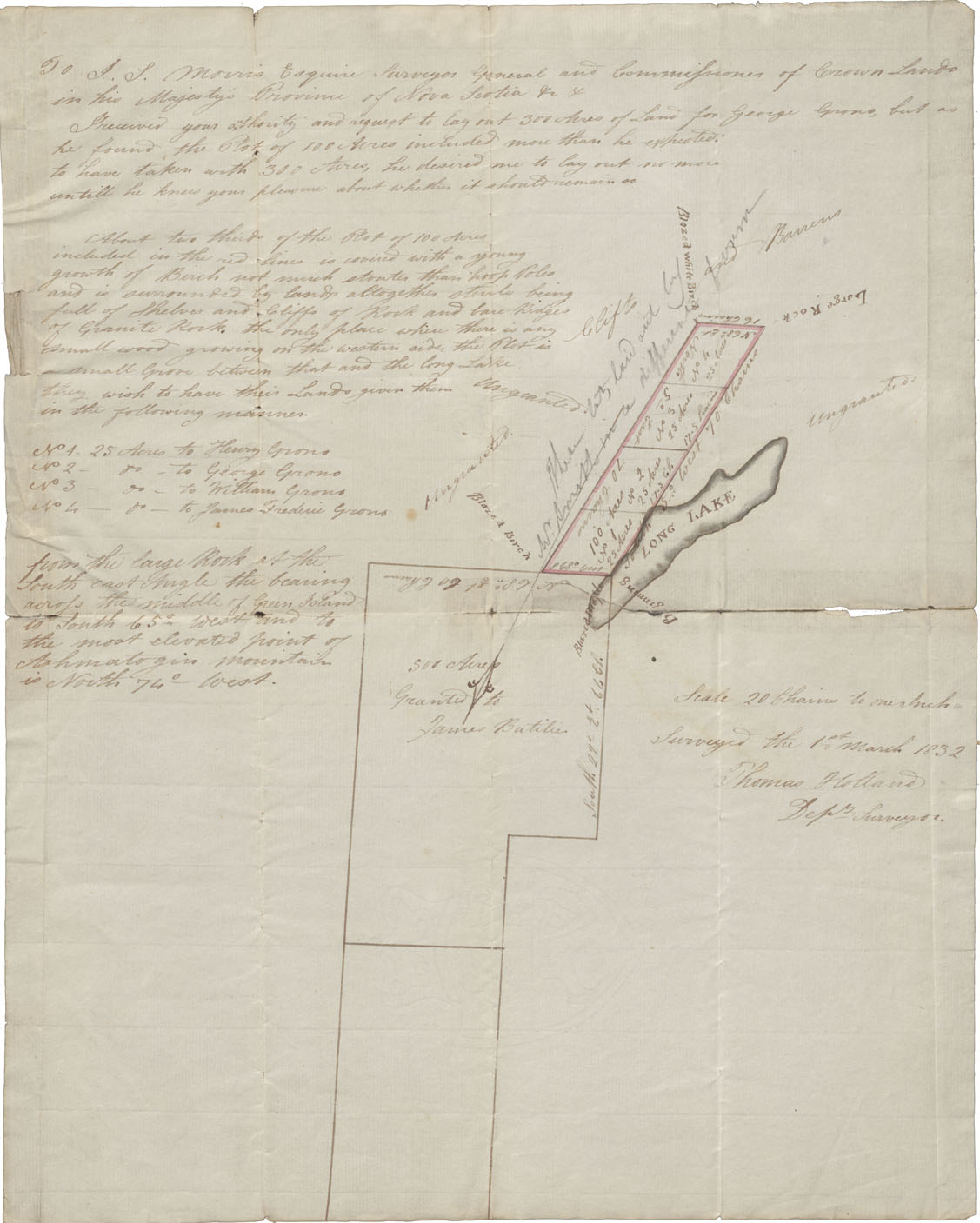
Lunenburg County Vicinity of Long Lake, Green Island and "Ashmatogin Mountain" 1832
Date: 1 March 1832
Reference: Nova Scotia Archives Map Collection: F/230 - 1832
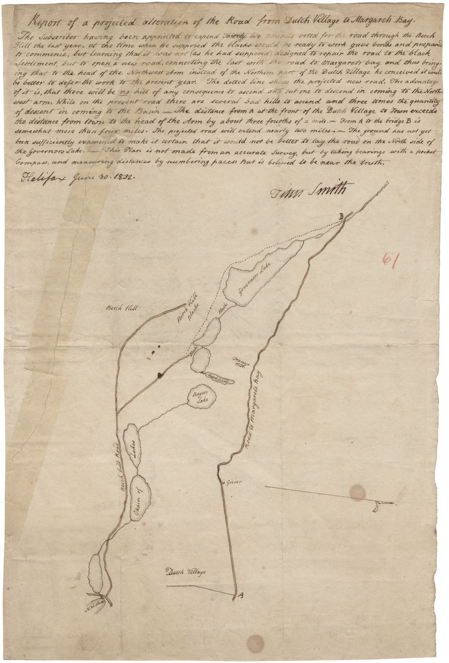
Proposed New Road to St Margaret Bay
Date: 30 June 1832
Reference: Nova Scotia Archives Map Collection: F/239 - 1832
Halifax County Eastern Passage, 1832
Date: April 1832
Reference: Nova Scotia Archives Map Collection: F/239 - 1832
Lunenburg County Plan of Western Shore of St Margarets bay, 1832
Date: 10 November 1832
Reference: Nova Scotia Archives Map Collection: F/240 - 1832
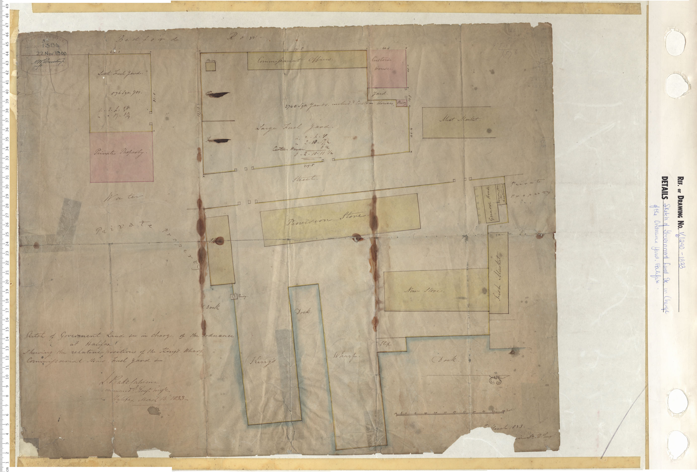
Sketch of Government Land etc. in charge of the Ordnance Yard, Halifax
Date: 1833
Reference: Nova Scotia Archives Map Collection: V6 240 Halifax, Nova Scotia
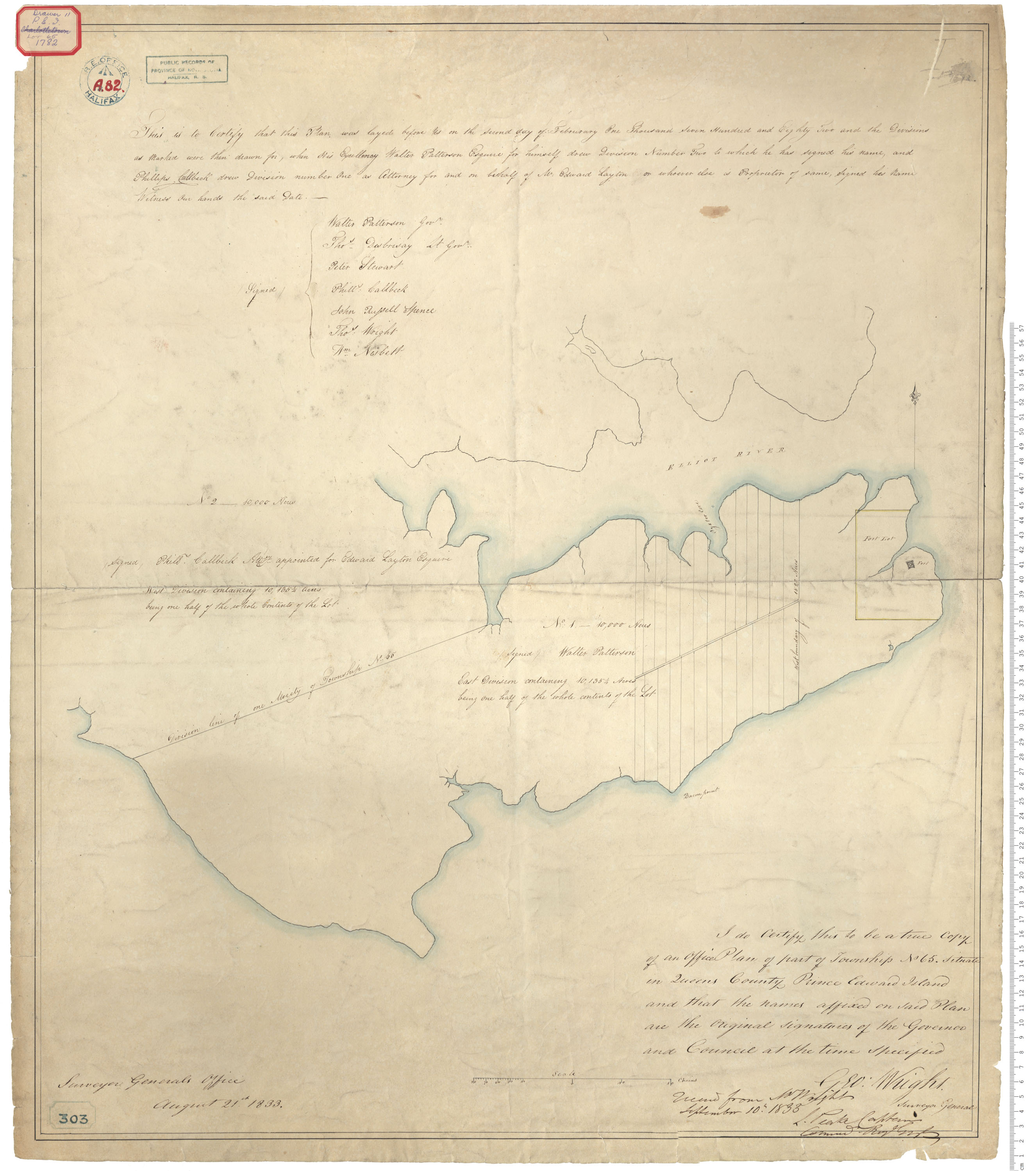
Township No. 65, Queen's County
Date: 10 September 1833
Reference: Nova Scotia Archives Royal Engineers Maps and Plans A.82
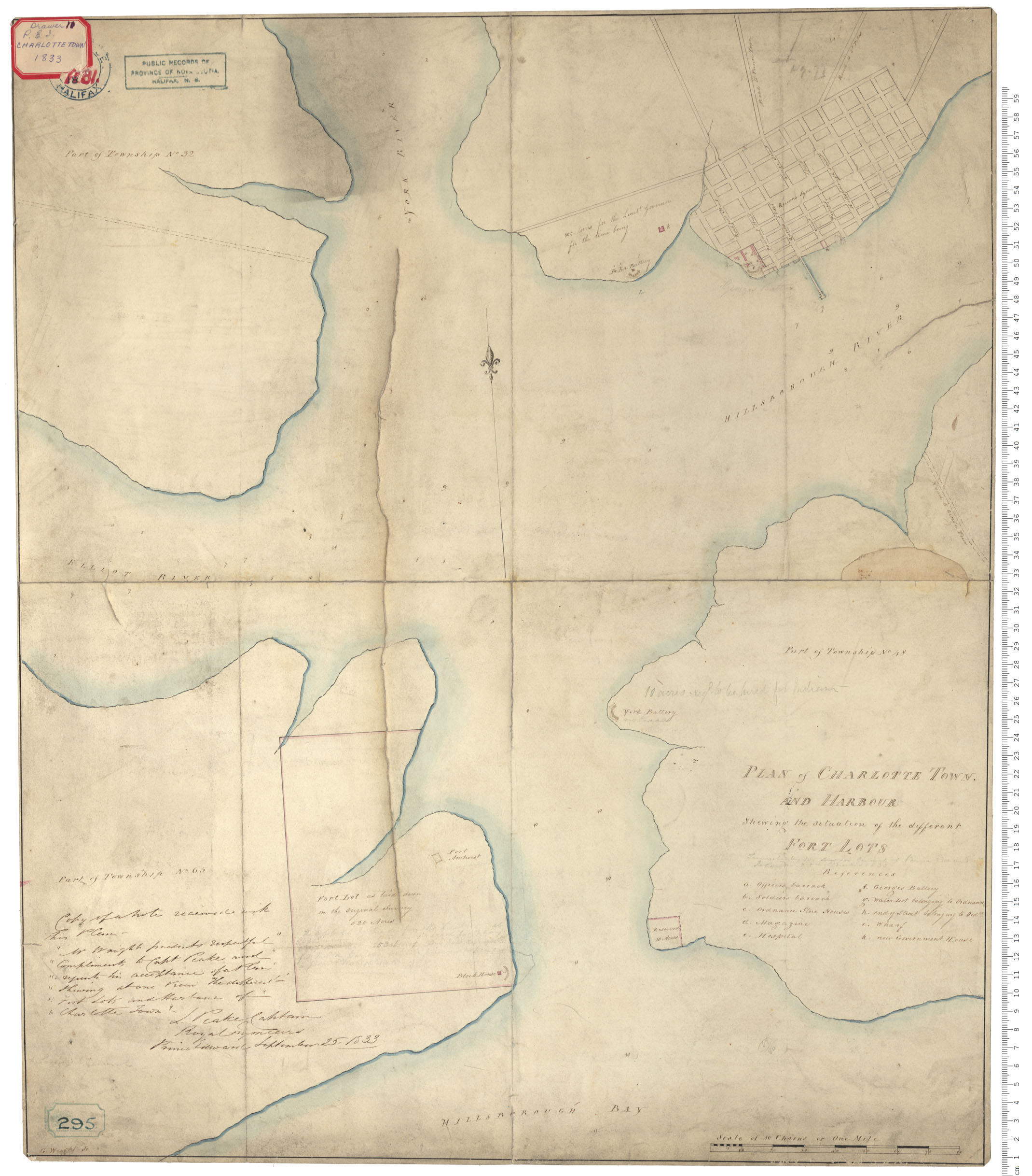
Fort Lot
Date: 25 September 1833
Reference: Nova Scotia Archives Royal Engineers Maps and Plans A.81