Nova Scotia Archives
Built Heritage Resource Guide
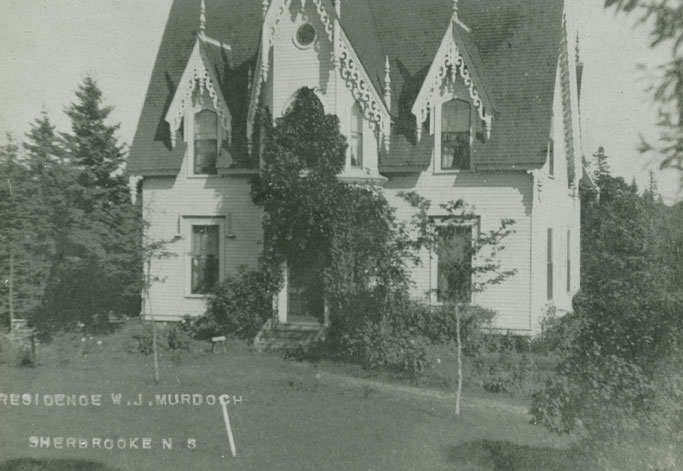
Residence of W.J. Murdoch, Sherbrooke, NS
Reference: Nova Scotia Archives Photo Collection: Places: Sherbrooke: Houses: Murdoch, W.J.
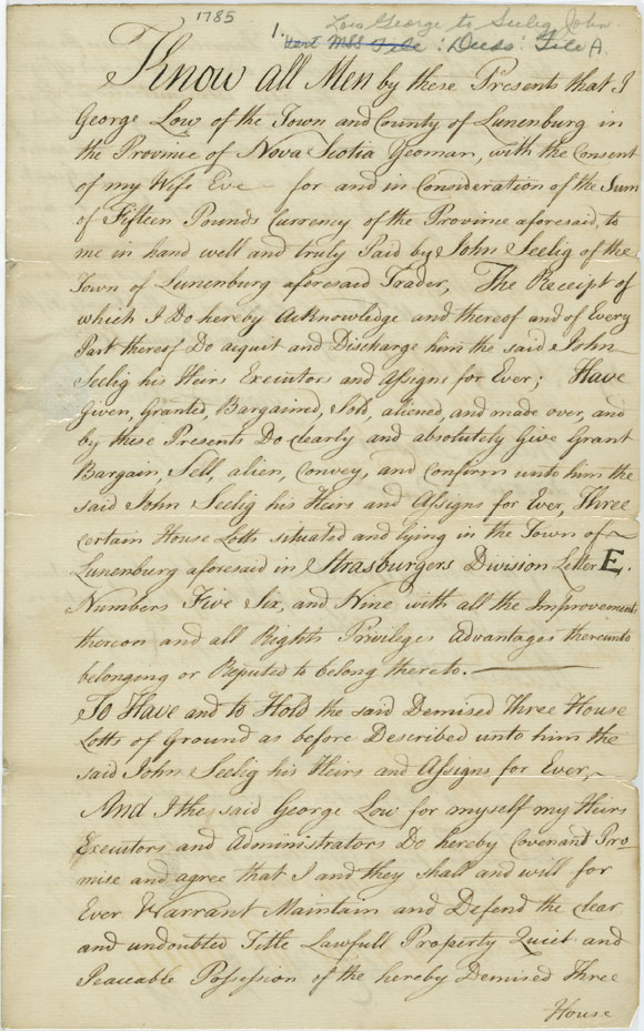
Deed Between George and Eva Low and John Seelig, Lunenburg
Date: 1785
Reference: Deeds, Bills of Sale, Legal DocumentsNova Scotia Archives MG 10 vol. 20 K-P no. 160a
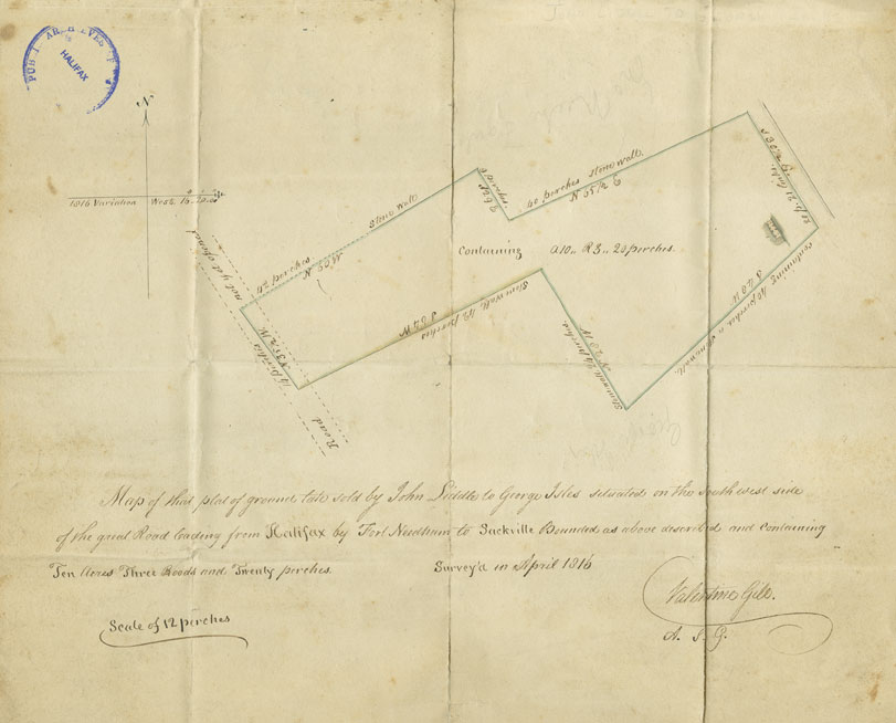
"Map of That Plat of Ground Late Sold by John Liddle to George Isles..."
Date: April 1816
Artist: Valentine Gill
Reference: Deeds, Bills of Sale, Legal DocumentsNova Scotia Archives MG 10 vol. 20 K-P no. 149
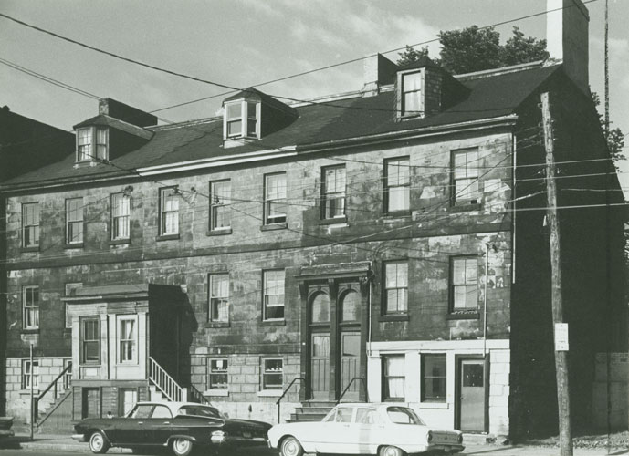
Pryor Terrace,1346-1352 Hollis Street, Halifax, NS
Date: ca. 1967
Photographer: M.E.B. Martin
Reference: Heritage Trust of Nova ScotiaNova Scotia Archives accession no. 1982-560 no. 13
"Map of the First Division of the Roads Leading from Halifax to Truro and Windsor"
Date: ca. 1823?
Reference: Nova Scotia Archives Map Collection: R.E.O. Y7
Topic: Map Collection
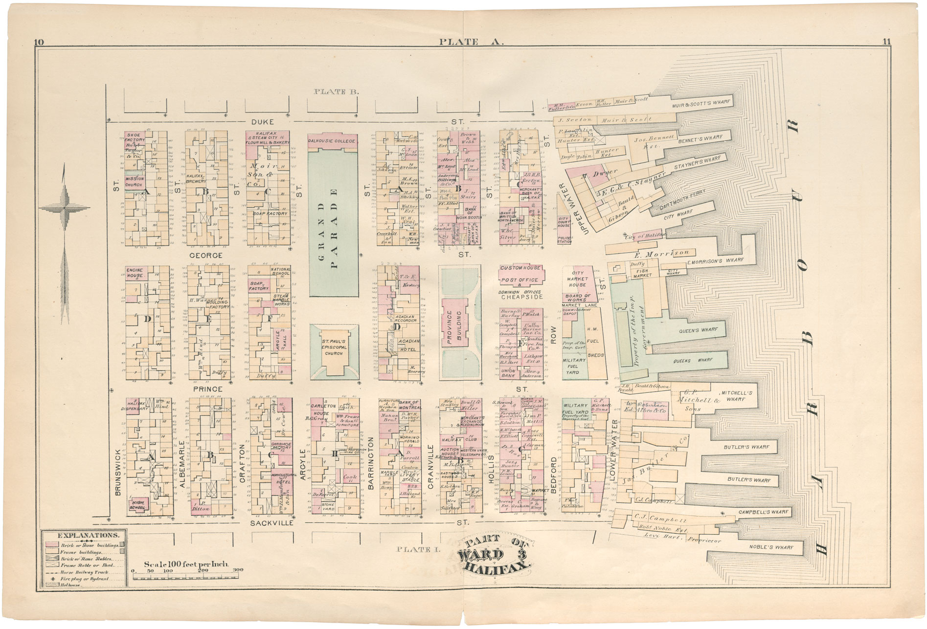
"Plate A" in City Atlas of Halifax, Nova Scotia
Date: 1878
Reference: Nova Scotia Archives microfilm no. 9697
Topic: Map Collection
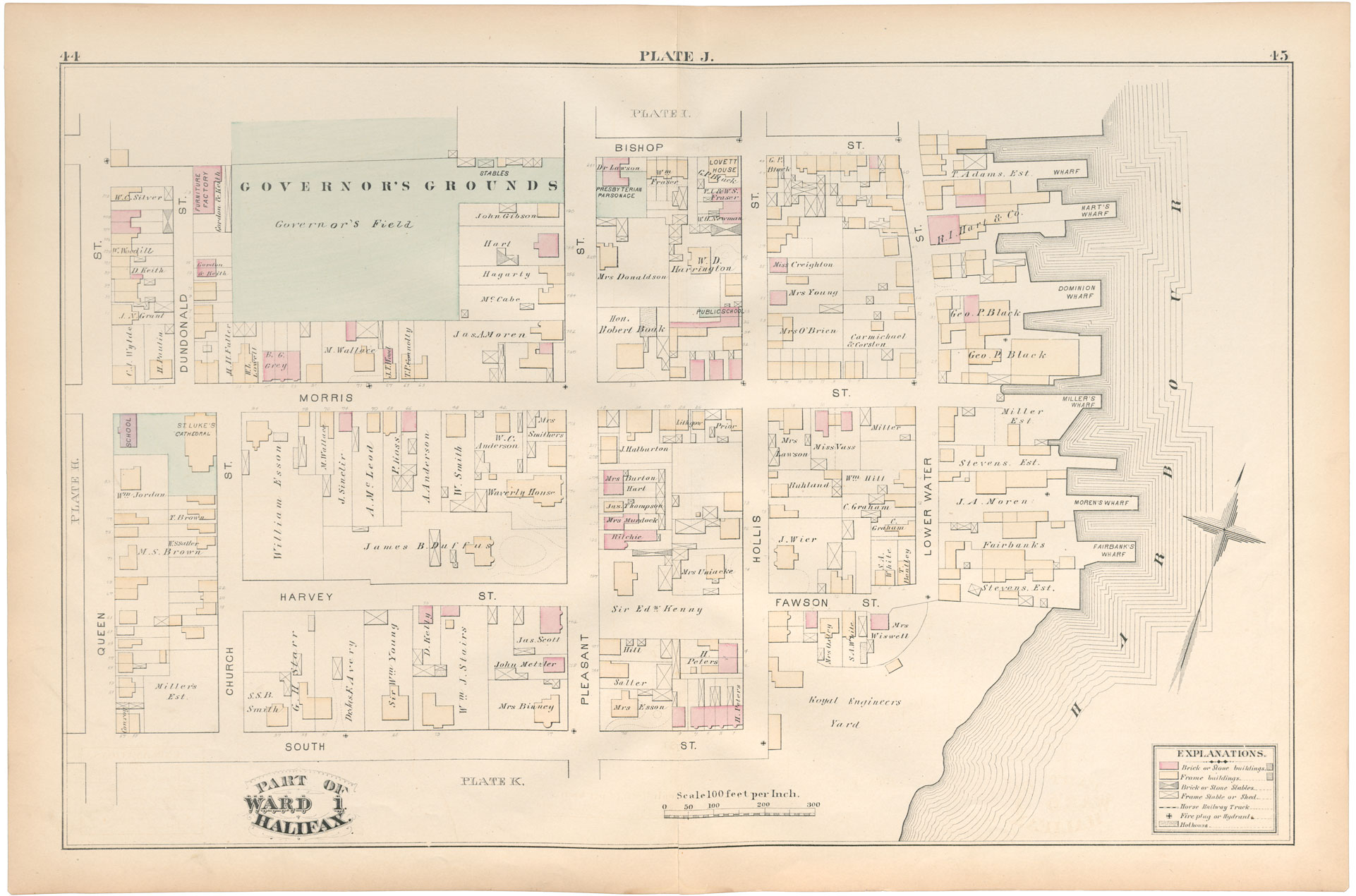
"Plate J" in City Atlas of Halifax, Nova Scotia
Date: 1878
Reference: Nova Scotia Archives microfilm no. 9697
Topic: Map Collection
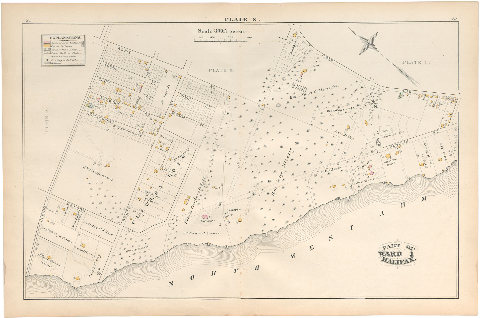
"Plate N" in City Atlas of Halifax, Nova Scotia
Date: 1878
Reference: Nova Scotia Archives microfilm no. 9697
Topic: Map Collection
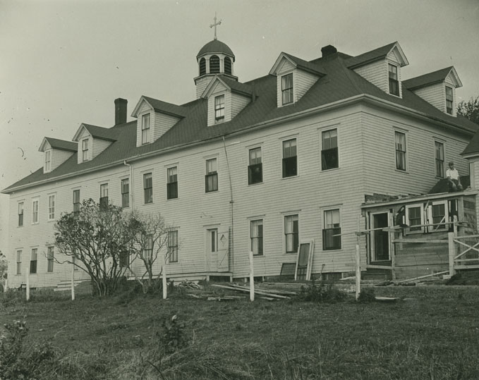
Our Lady of Assumption Convent, Arichat
Date: 1953
Photographer: E.G.L. Wetmore
Reference: Nova Scotia Archives Photo Collection: Places: Cape Breton: Arichat: Convent: Our Lady of Assumption Convent
Topic: Map Collection
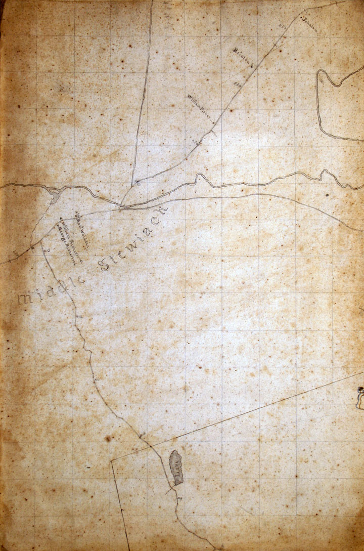
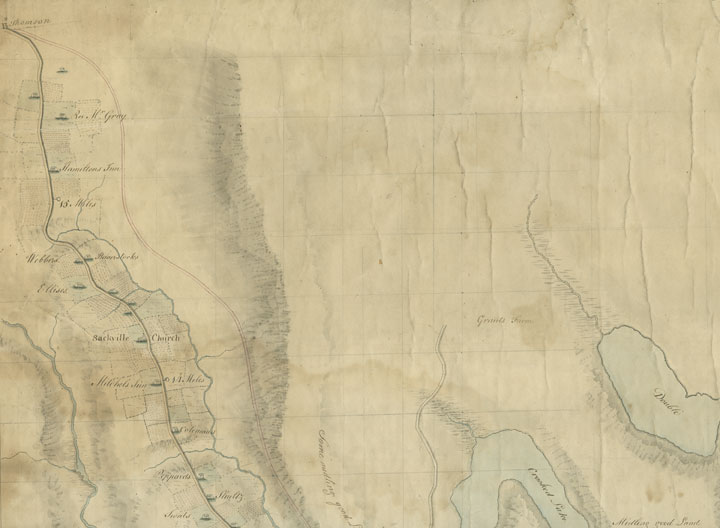
Middle Stewiacke, Colchester County
Date: 1834
Reference: Nova Scotia Archives Map Collection: Great Map, No. O91
Topic: William Mackay's 'Great Map'
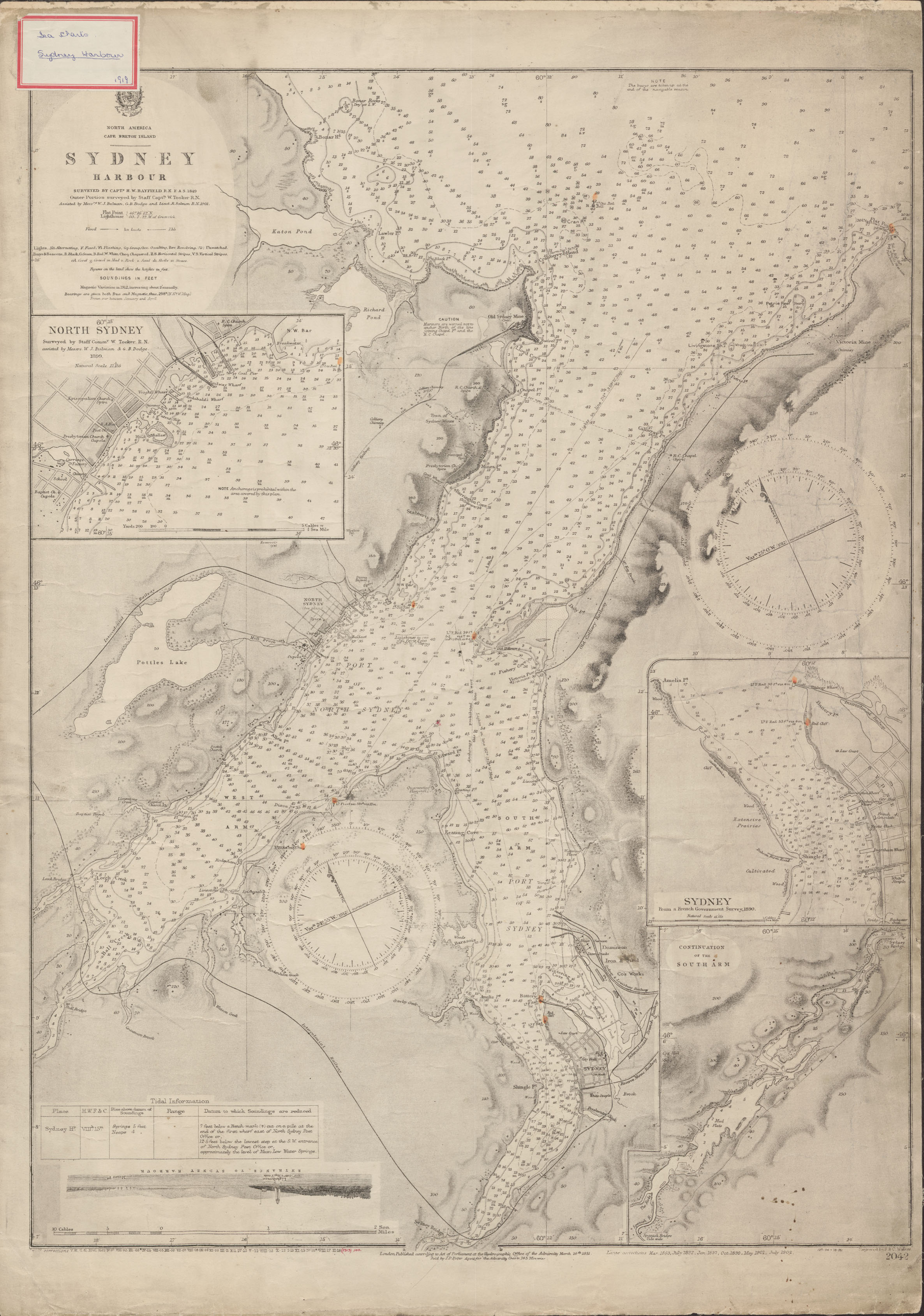
"North America Cape Breton Island Sydney Harbour", surveyed by Captain H.W. Bayfield
Date: 1849, with corrections to 1902
Reference: Nova Scotia Archives Map Collection: Great Britain Hydrographic Office, Chart No. 2042
Topic: Nautical Charts
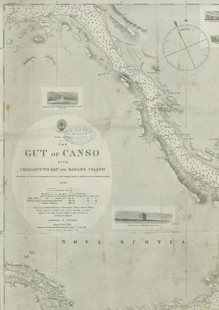
"Nova Scotia Gut of Canso with Chedabucto Bay and Madame Island"
Date: 1850
Reference: Nova Scotia Archives Map Collection: Great Britain Hydrographic Office, Chart No. 2342
Topic: Nautical Charts
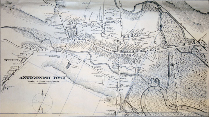
"Antigonish Town" inset of Topographical Township Map of Antigonish County, Nova Scotia
Date: 1878
Reference: Nova Scotia Archives Map Collection: A.F. Church Maps
Topic: A.F. Church Co. Maps
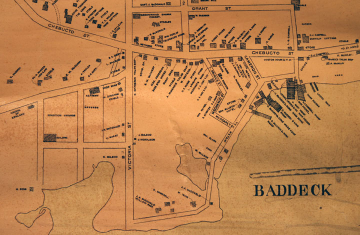
"Baddeck" inset of Topographical Township Map of Victoria County, Nova Scotia
Date: 1887
Reference: Nova Scotia Archives Map Collection: A.F. Church Maps
Topic: A.F. Church Co. Maps
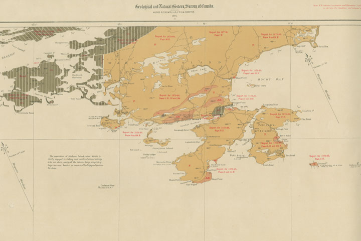
"Province of Nova Scotia (Island of Cape Breton)"
Date: 1884
Reference: Nova Scotia Archives Map Collection: Geological SurveyMaps, Cape Breton, No. 23 (O/S G3421 C51 F64 1884 No. 23)
Topic: Geological Survey Maps