Nova Scotia Archives
Historical Maps of Nova Scotia
Results 916 to 930 of 2074 from your search:
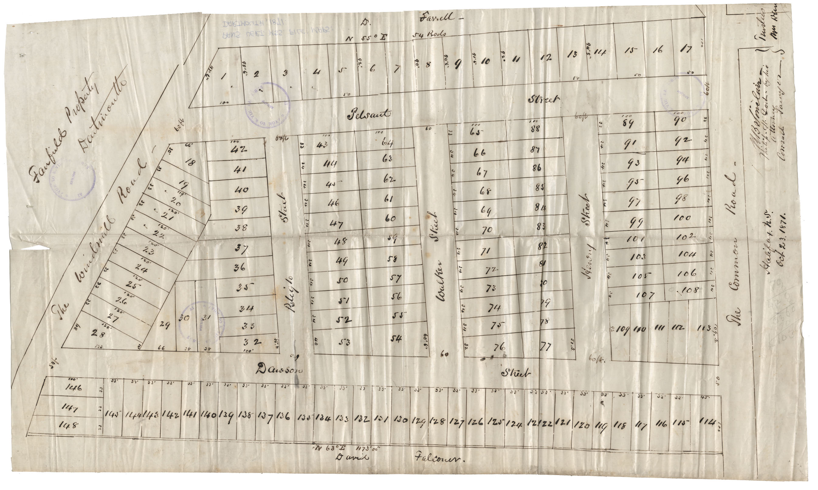
Maps: Dartmouth, 1871: Area bounded on West by the Windmill Rd, on East by Common Rd, on North by D.Fanell property, on South by David Falconer (Fairfield property)
Date: 23 October 1871
Reference: Nova Scotia Archives Map Collection: F/239 - 1871
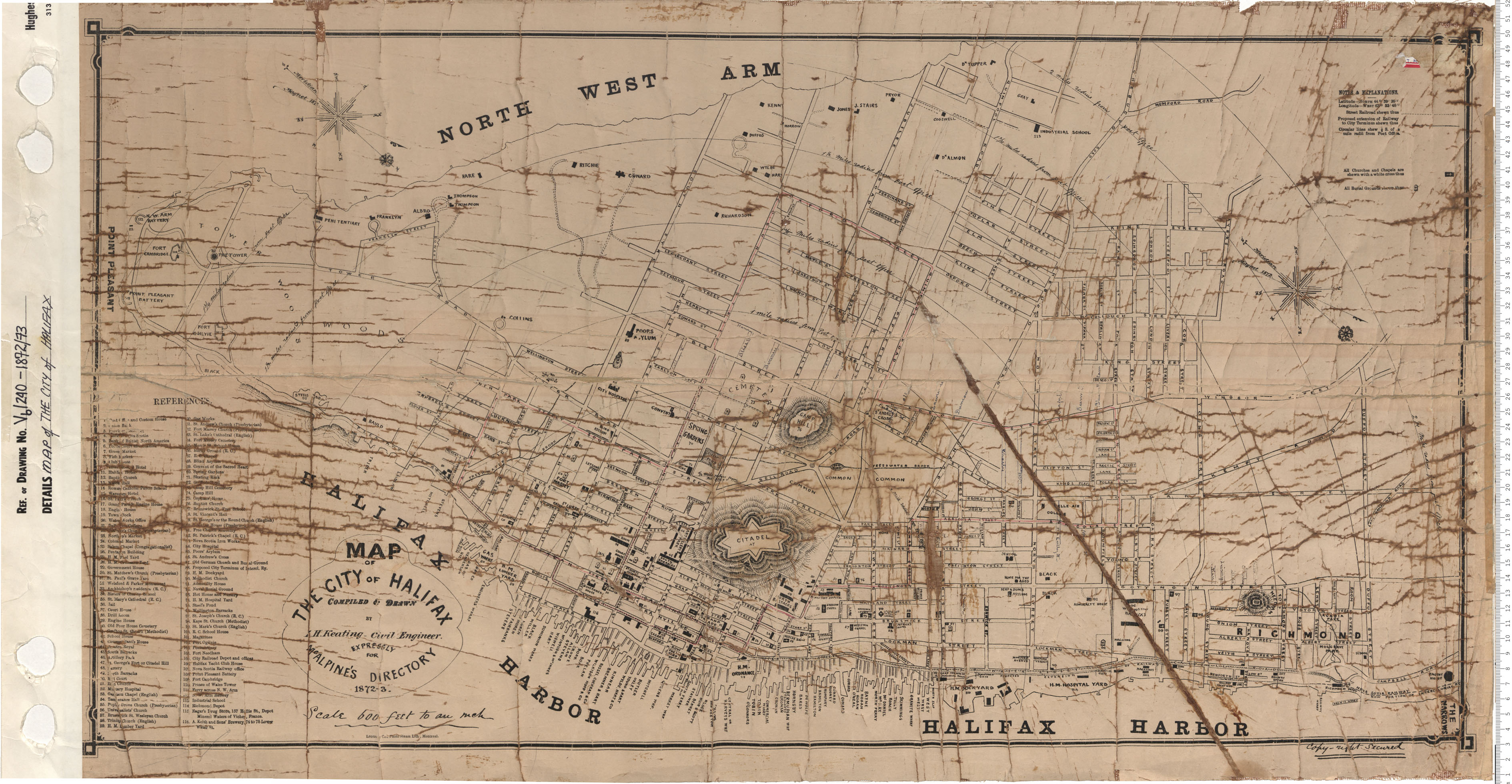
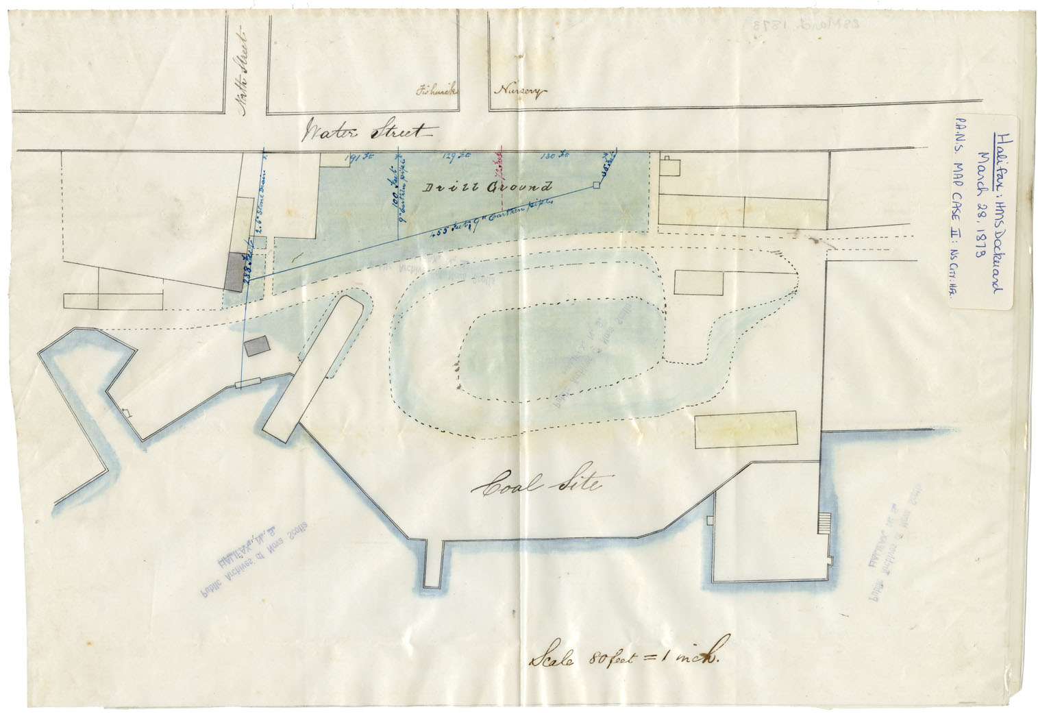
Map of the City of Halifax
Date: 1872/73
Reference: Nova Scotia Archives Map Collection: V6 240 Halifax, Nova Scotia
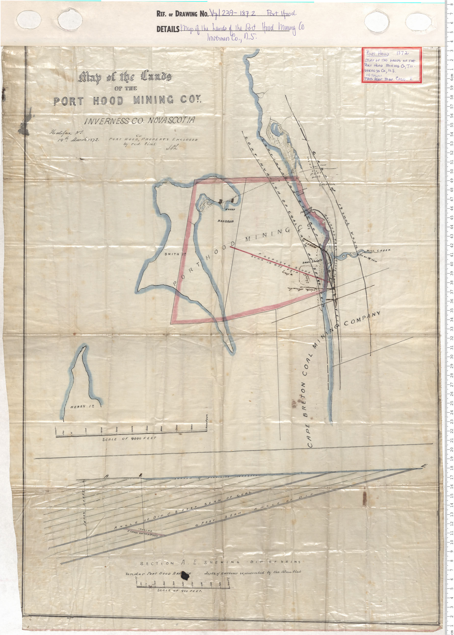
Map of the lands of Port Hood Mining Company, Inverness County
Date: 1872
Reference: Nova Scotia Archives Map Collection: V7 239 Port Hood, Nova Scotia
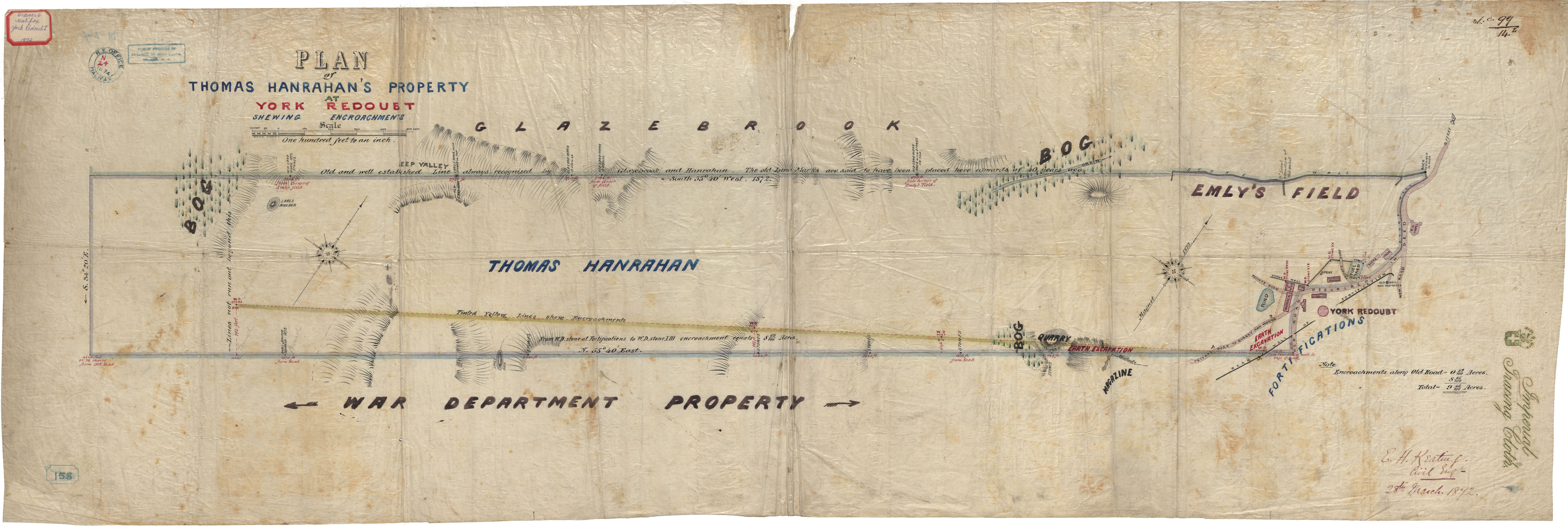
Thomas Hanrahan's Property
Date: 28 March 1872
Reference: Nova Scotia Archives Royal Engineers Maps and Plans N.24
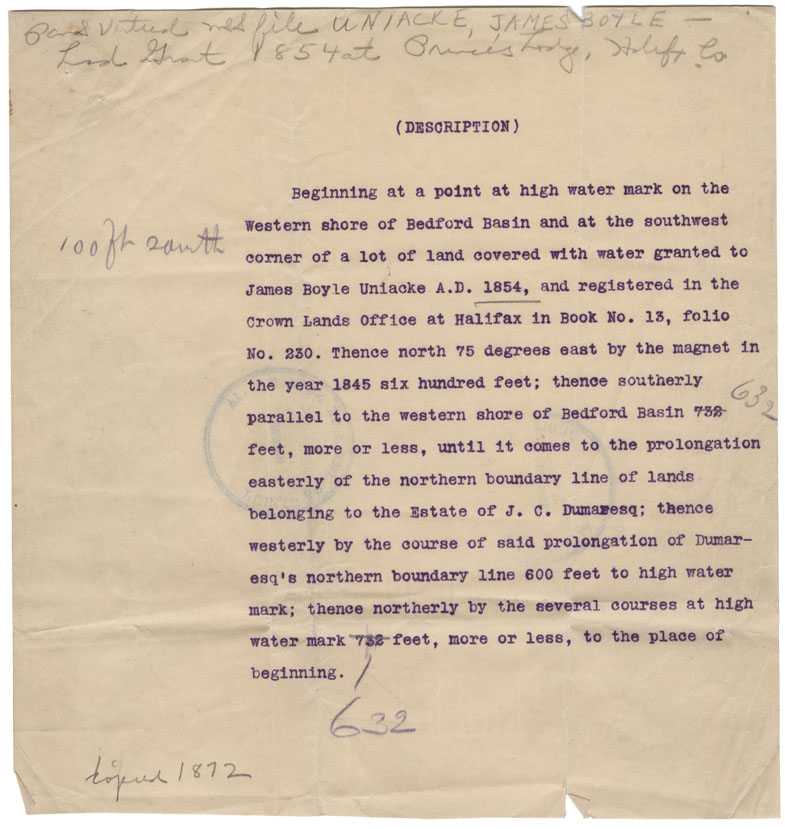
Property of J.B. Uniacke at Bedford
Date: 10 February 1872
Reference: Nova Scotia Archives Map Collection: F/239 - 1872
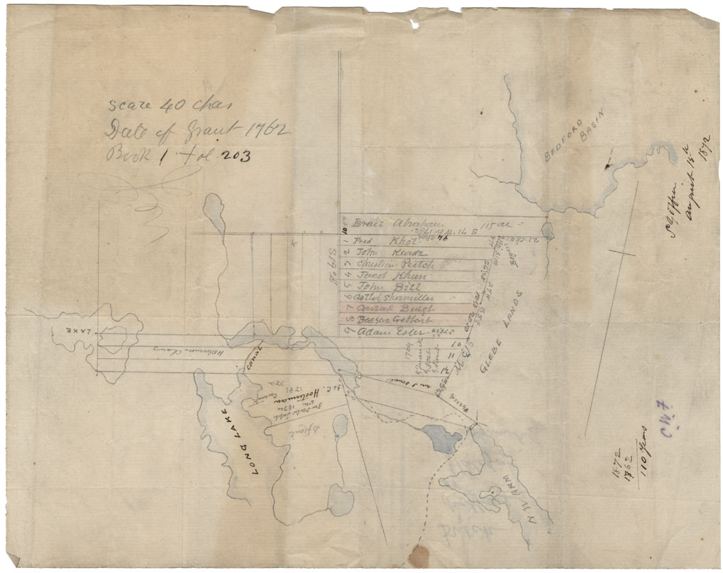
Grants: Dutch Village: Dutch Village Area, 1872
Date: 1872
Reference: Nova Scotia Archives Map Collection: F/239 - 1872
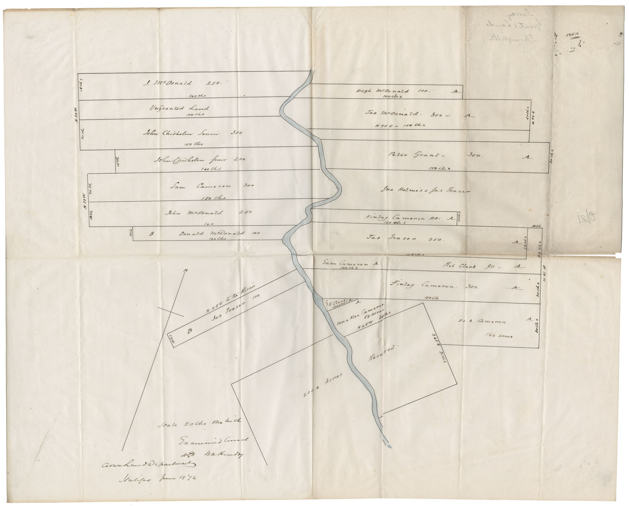
Survey of Granted Lands Springville
Date: 19 June 1872
Reference: Nova Scotia Archives Map Collection: F/239 - 1872
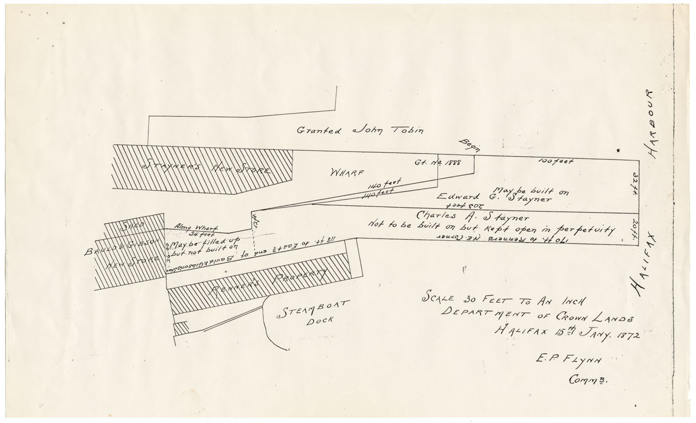
Steamboat Dock Area
Date: 15 January 1872
Reference: Nova Scotia Archives Map Collection: F/240 - 1872
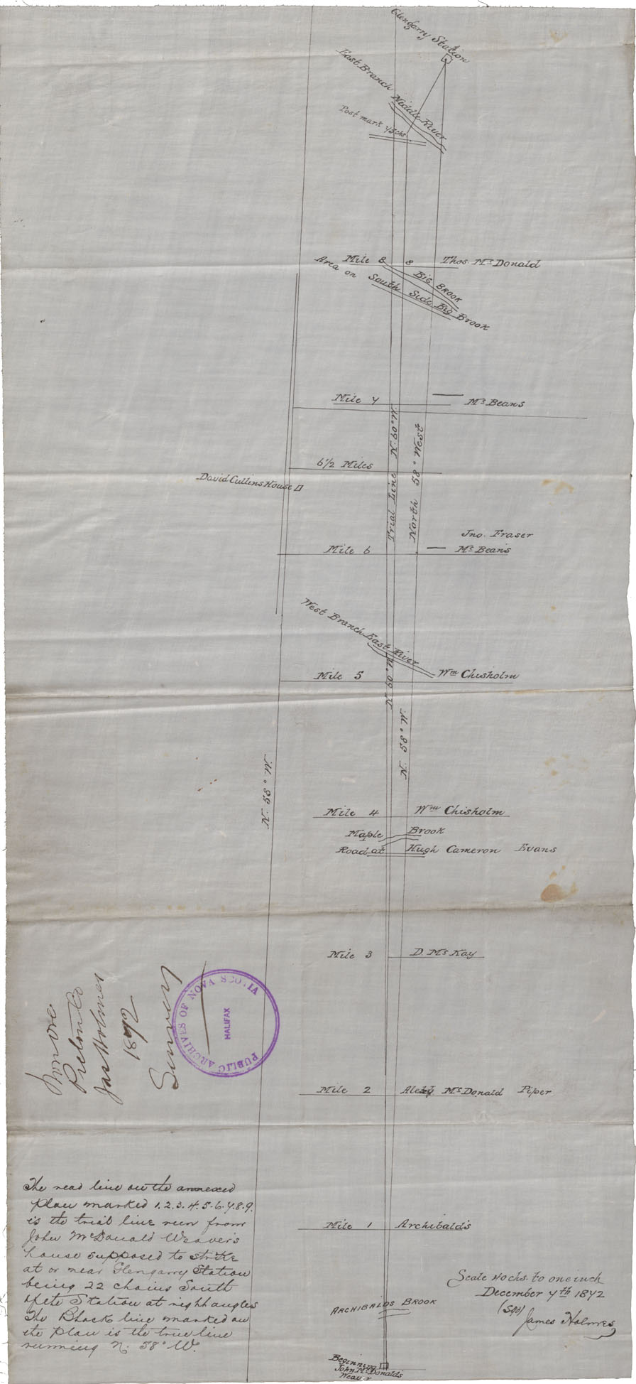
Colchester County From Londonderry township Westward to Moose River, 1873
Date: 14 June 1873
Reference: Nova Scotia Archives Map Collection: F/230 - 1873

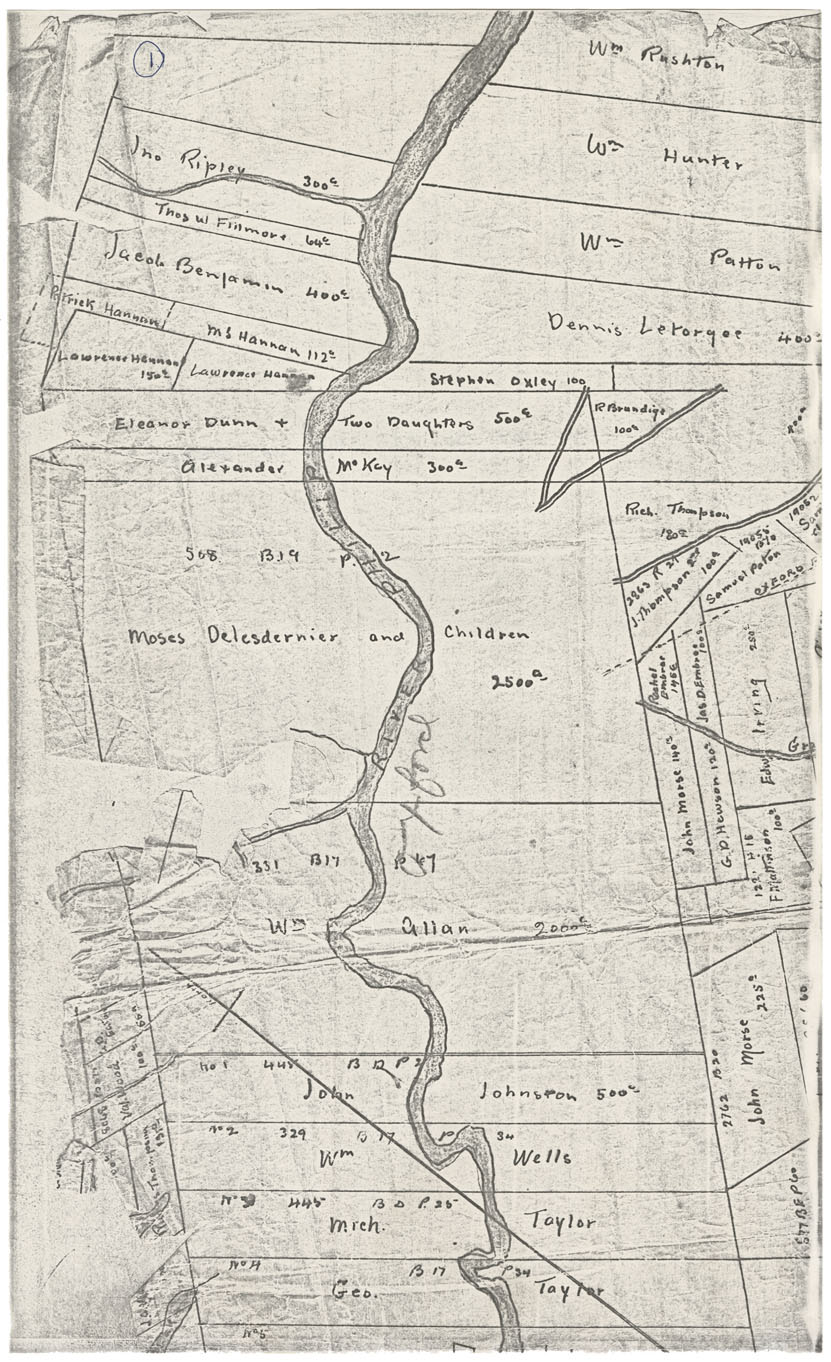
Sketch grants vicinity Eight Mile & Ten Mile Lakes, Queens County
Date: 1873
Reference: Nova Scotia Archives Map Collection: F/230 - 1873
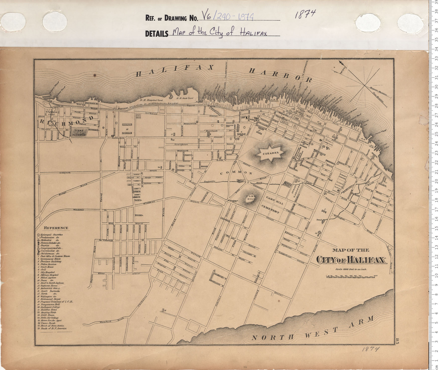
Map of the City of Halifax
Date: 1874
Reference: Nova Scotia Archives Map Collection: V6 240 Halifax, Nova Scotia
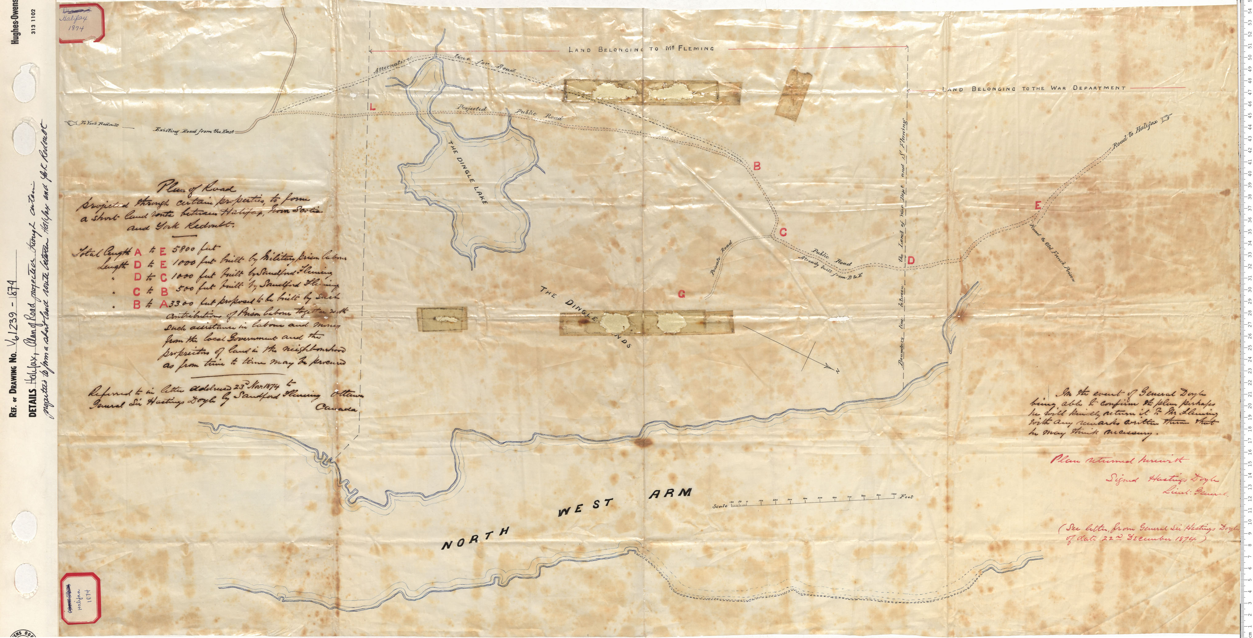
Plan of Road projected through certain properties to form short land route between Halifax, Nova Scotia and York Redoubt
Date: 1874
Reference: Nova Scotia Archives Map Collection: V6 239 Halifax, Nova Scotia