Nova Scotia Archives
Historical Maps of Nova Scotia
Results 1516 to 1530 of 2074 from your search:
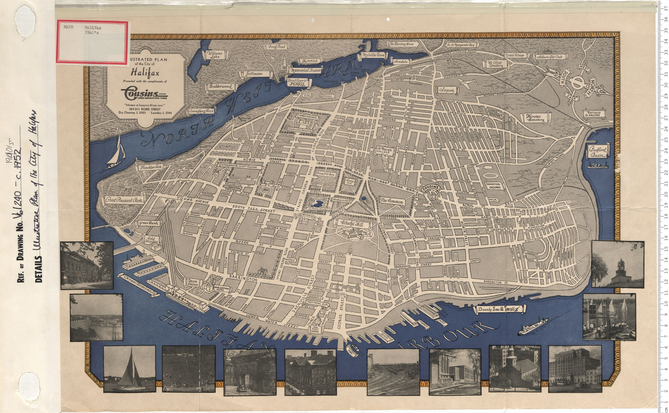
Illustrated Plan of the City of Halifax, N.S.
Date: 1940
Reference: Nova Scotia Archives Map Collection: V6 240 Halifax, Nova Scotia

Maps: Part 2 Mines Report 1940
Date: 1940
Reference: Nova Scotia Archives Map Collection: F/202 - 1940
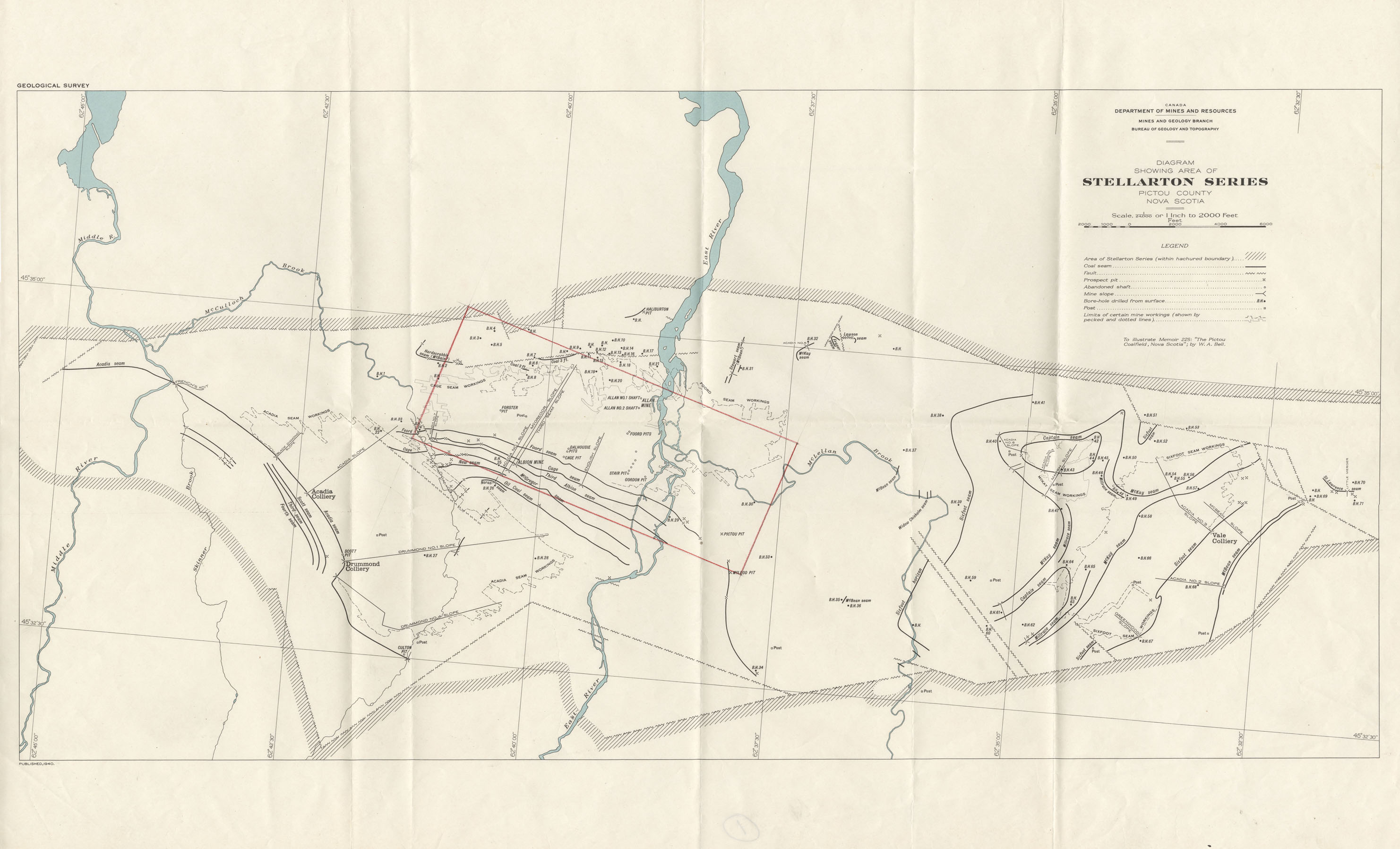
Diagram showing area of Stellarton series Pictou County NS
Date: 1940
Reference: Nova Scotia Archives Map Collection: F/230 - 1940
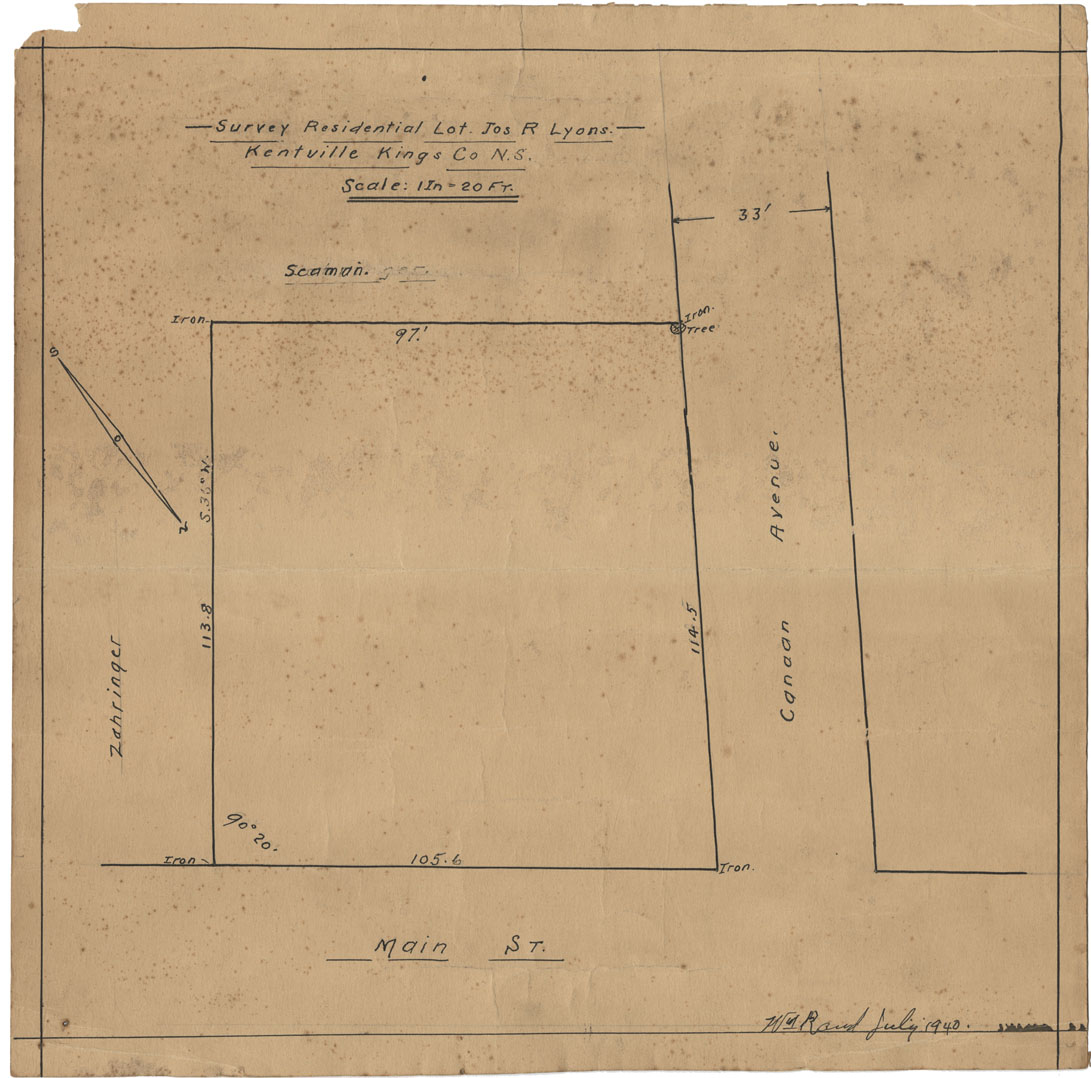
Survey Residential Lot Joshua R.Lyons, Kentville Kings County NS
Date: July 1940
Reference: Nova Scotia Archives Map Collection: F/239 - 1940
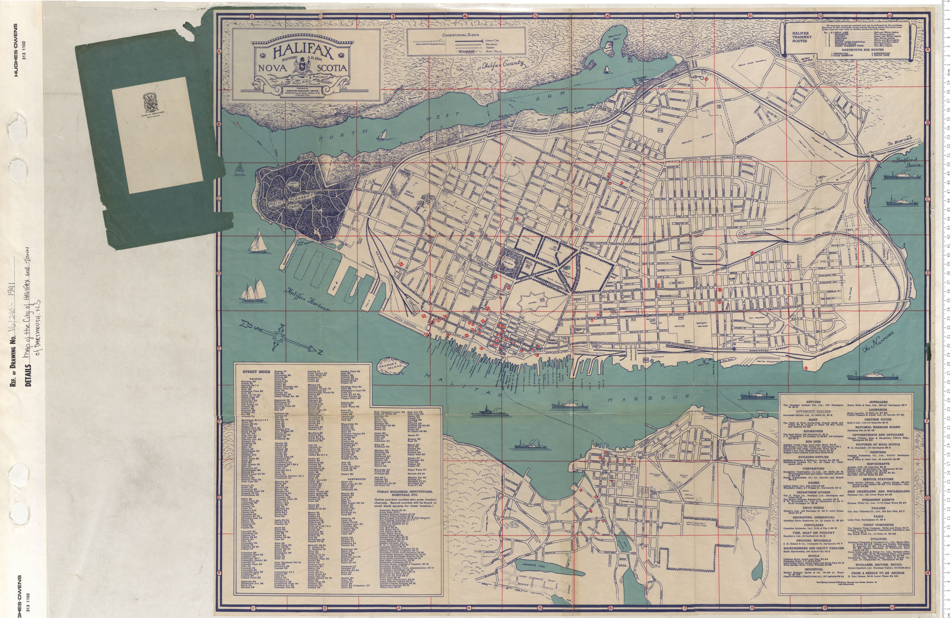
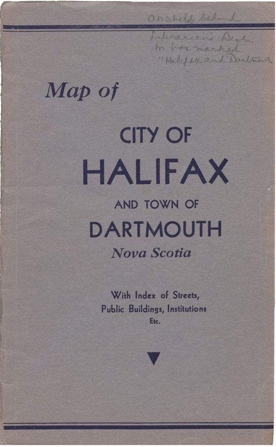
Map of the City Halifax and town of Dartmouth
Date: 1941
Reference: Nova Scotia Archives Map Collection: V6 240 Halifax, Nova Scotia
Map of the City of halifax and Town of Dartmouth, N.S.
Date: 1941
Reference: Nova Scotia Archives Map Collection: F/239 - 1941
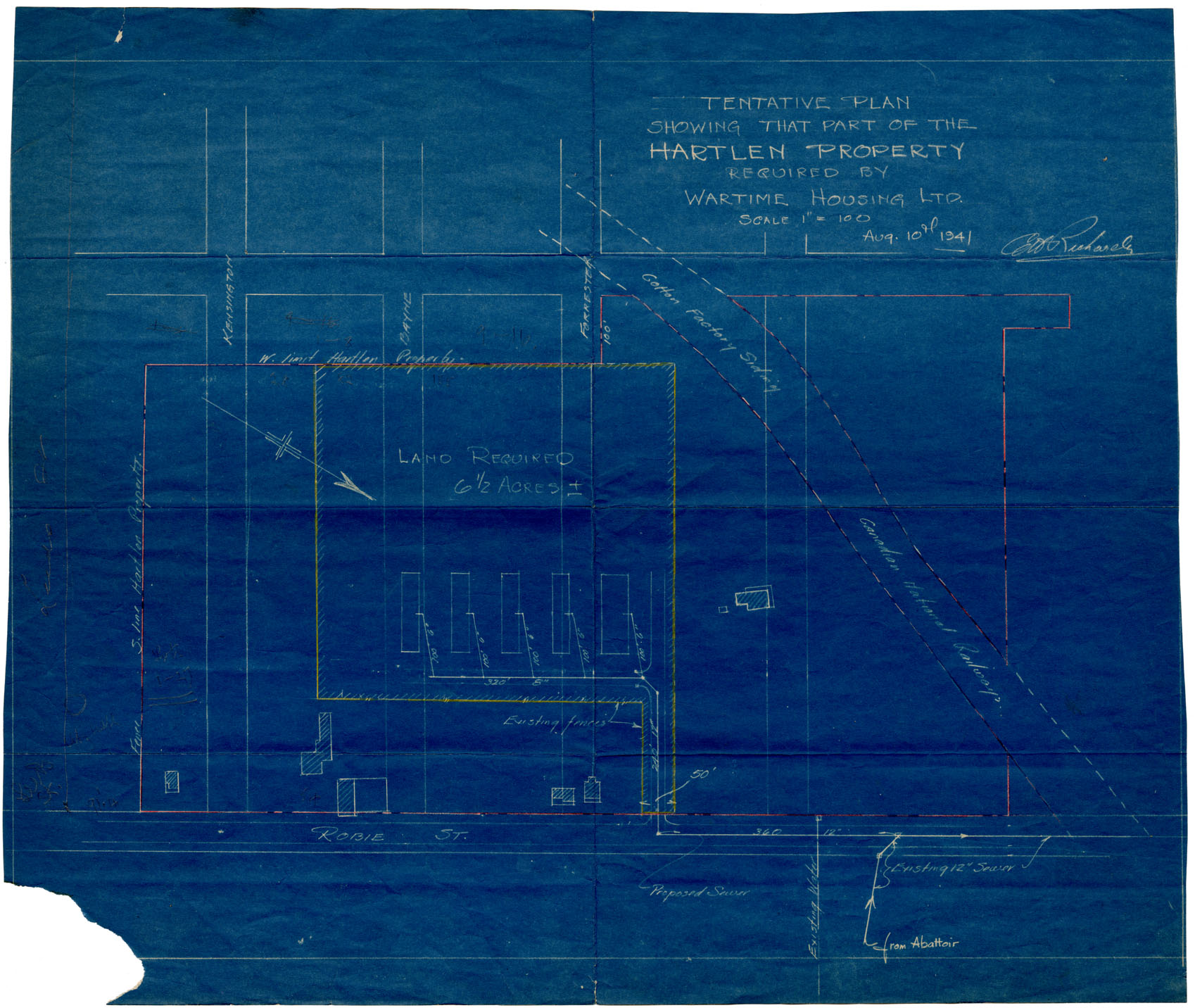
Tentative Plan showing that Part of the Hartlen Property required by the Wartime Housing Ltd
Date: 10 August 1941
Reference: Nova Scotia Archives Map Collection: F/240 - 1941
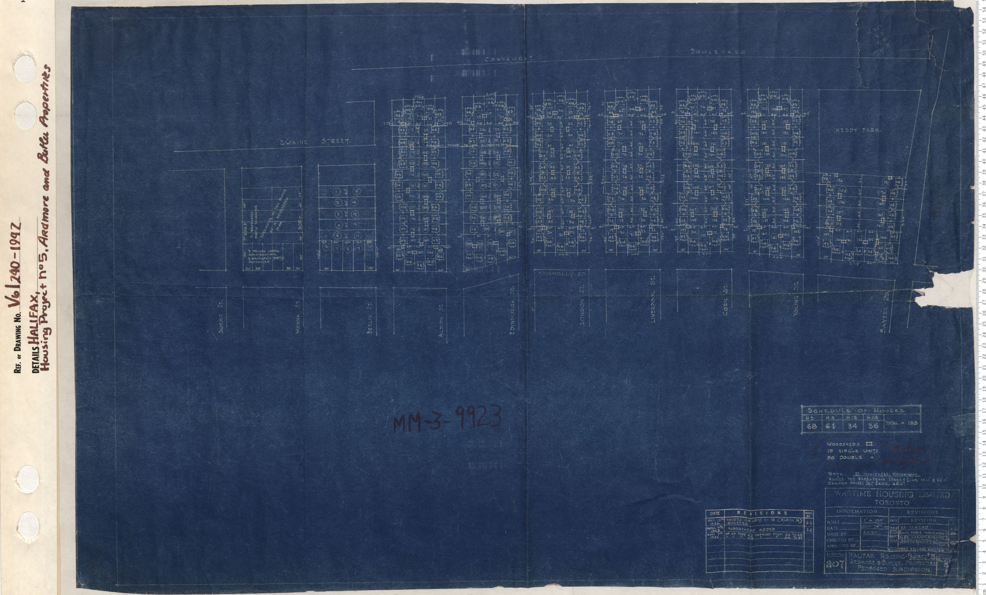
Housing Project No. 5 Ardmore and butler properties
Date: 1942
Reference: Nova Scotia Archives Map Collection: V6 240 Halifax, Nova Scotia
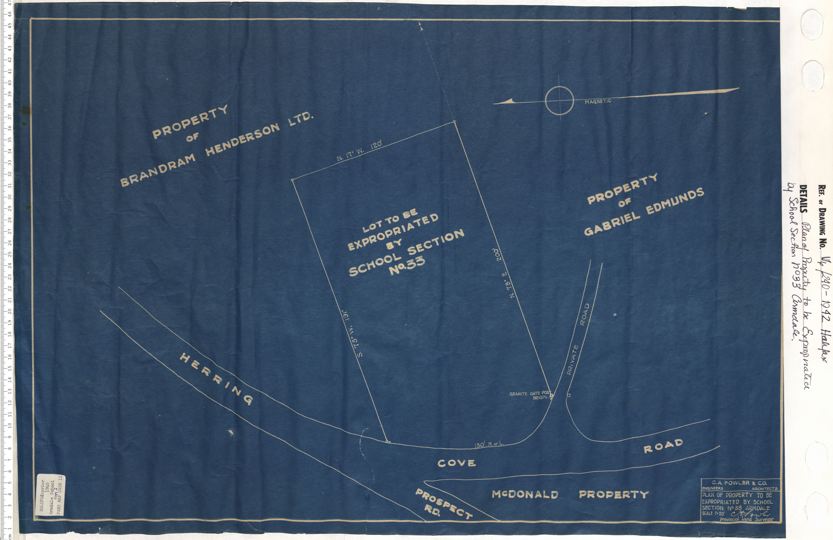
Plan of the Property to be Expropriated by School Section No 33 Armdale
Date: 1942
Reference: Nova Scotia Archives Map Collection: V6 240 Halifax, Nova Scotia
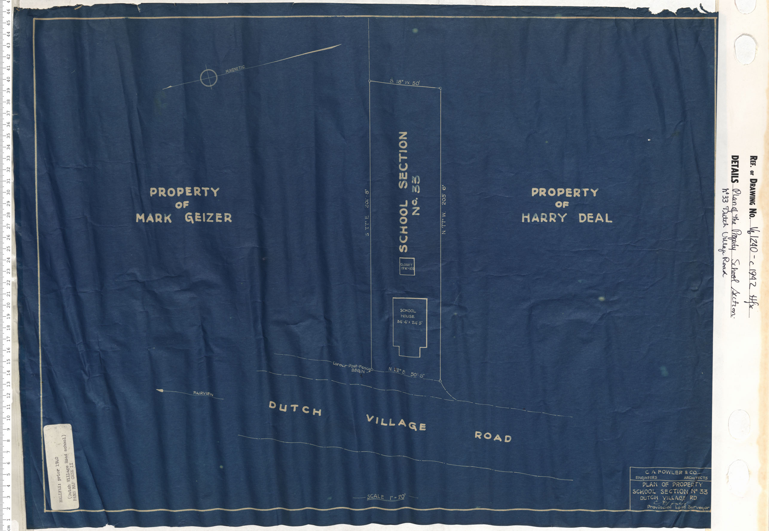
Plan of the property School Section No. 33 Dutchvillage Road
Date: 1942
Reference: Nova Scotia Archives Map Collection: V6 240 Halifax, Nova Scotia
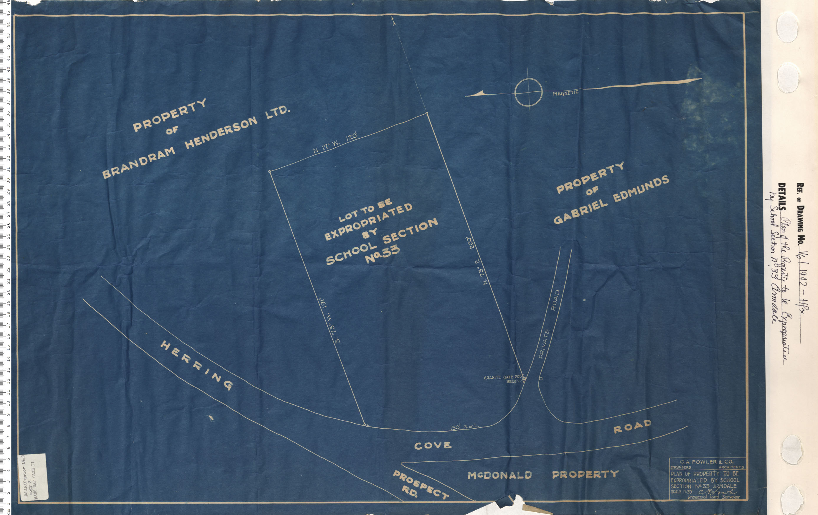
Plan of the Property to be Expropriated by School Section No 33 Armdale
Date: 1942
Reference: Nova Scotia Archives Map Collection: V6 Halifax, Nova Scotia
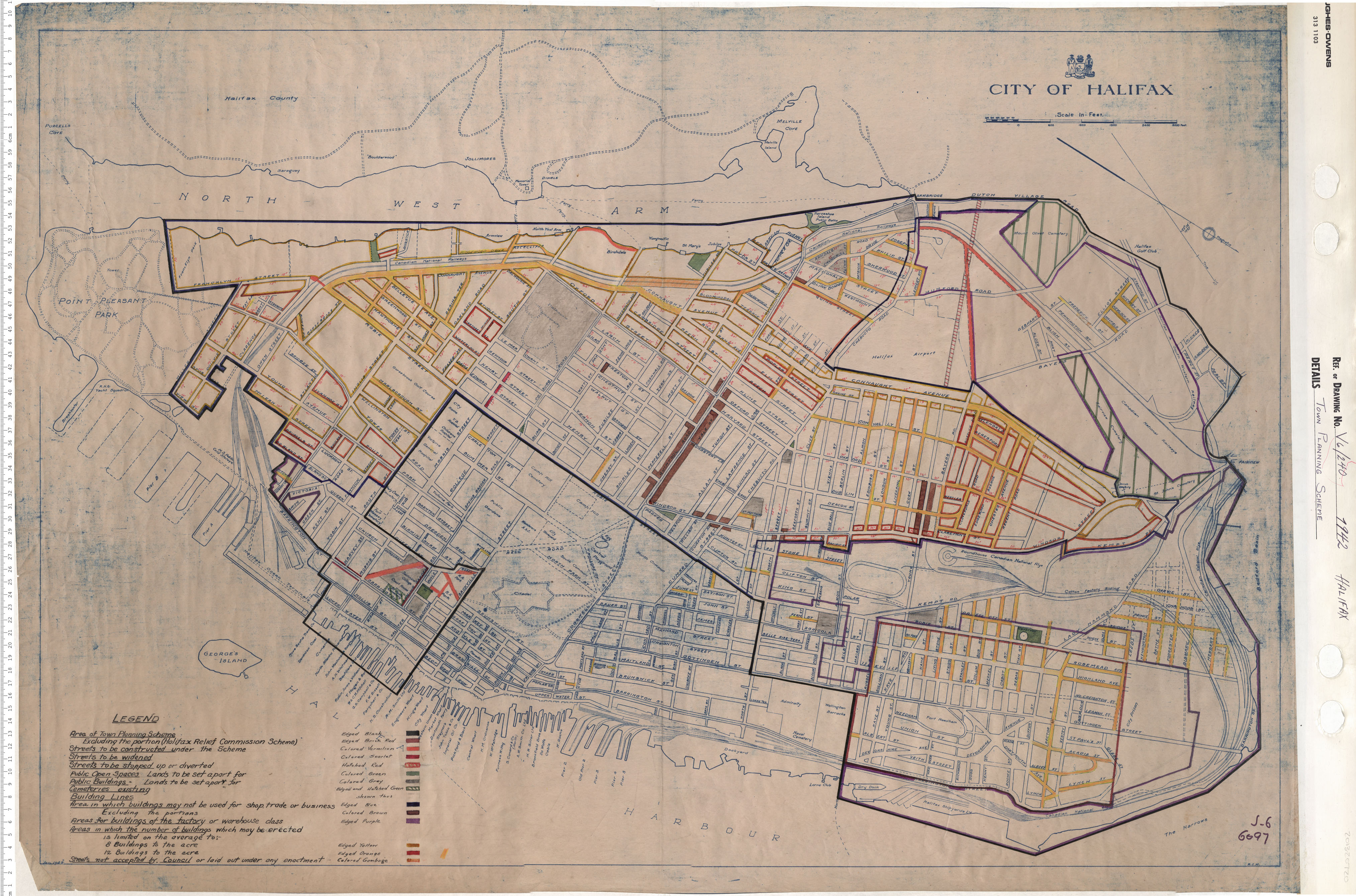
Town Planning scheme
Date: 1942
Reference: Nova Scotia Archives Map Collection: V6 240 Halifax, Nova Scotia
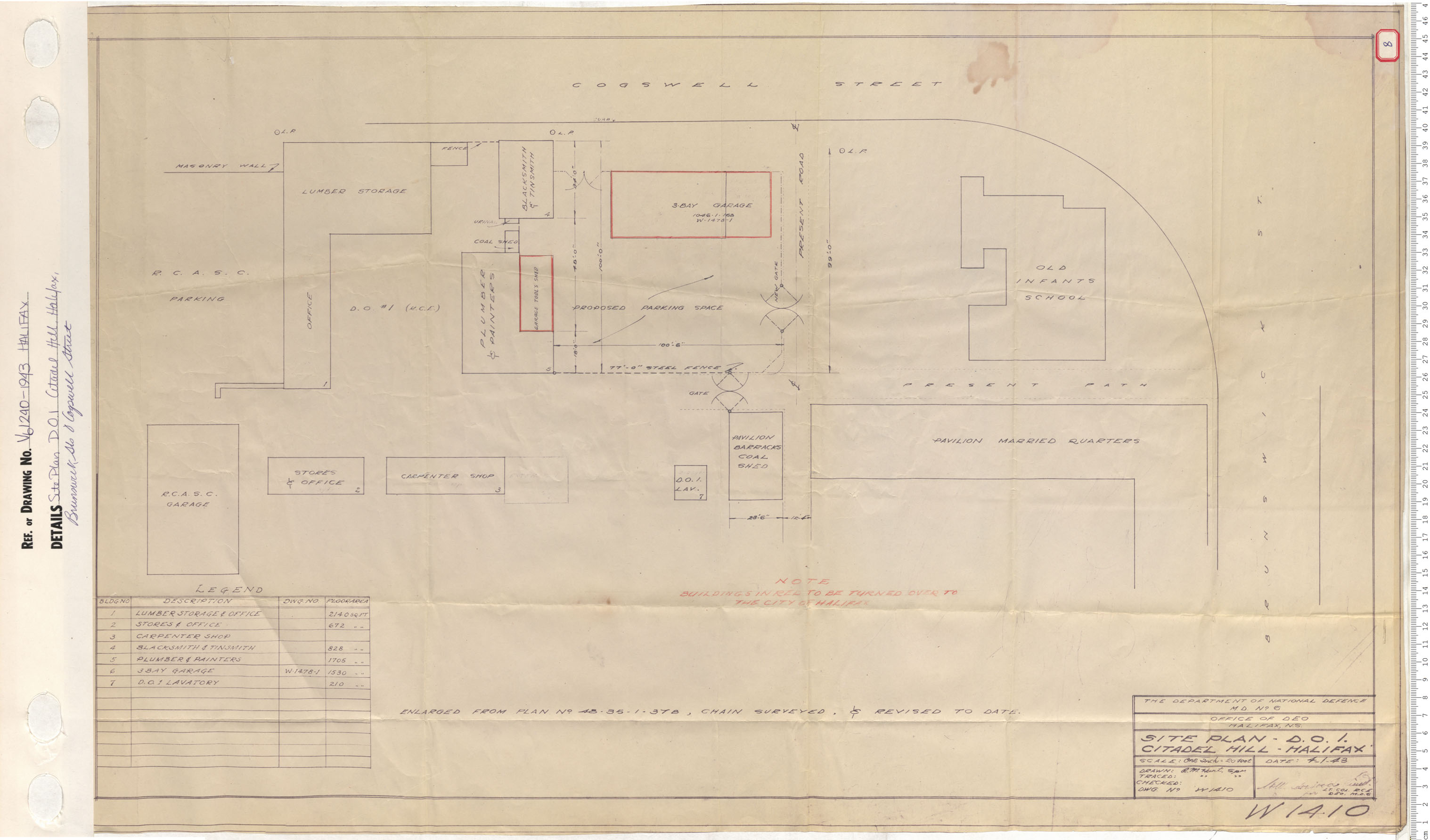
Site Plan DOI Citadel Hill, Halifax, Brunswick Street and Cogswell Street
Date: 1943
Reference: Nova Scotia Archives Map Collection: V6 240 Halifax, Nova Scotia
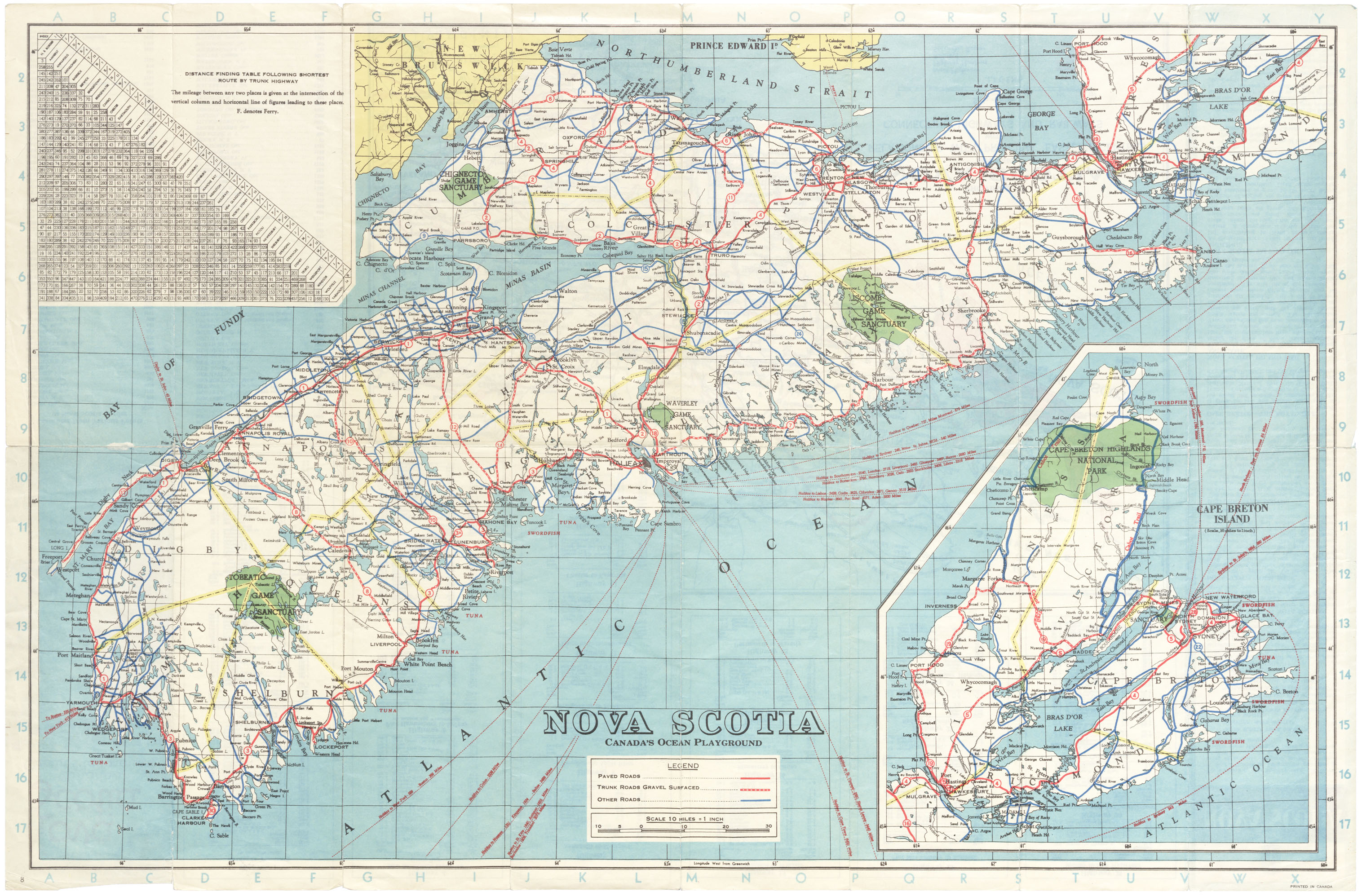
Official Highway Map, Province of Nova Scotia, Canada’s Ocean Playground
Date: 1944
Reference: Nova Scotia Archives Nova Scotia ca. 1944, 3.5.14
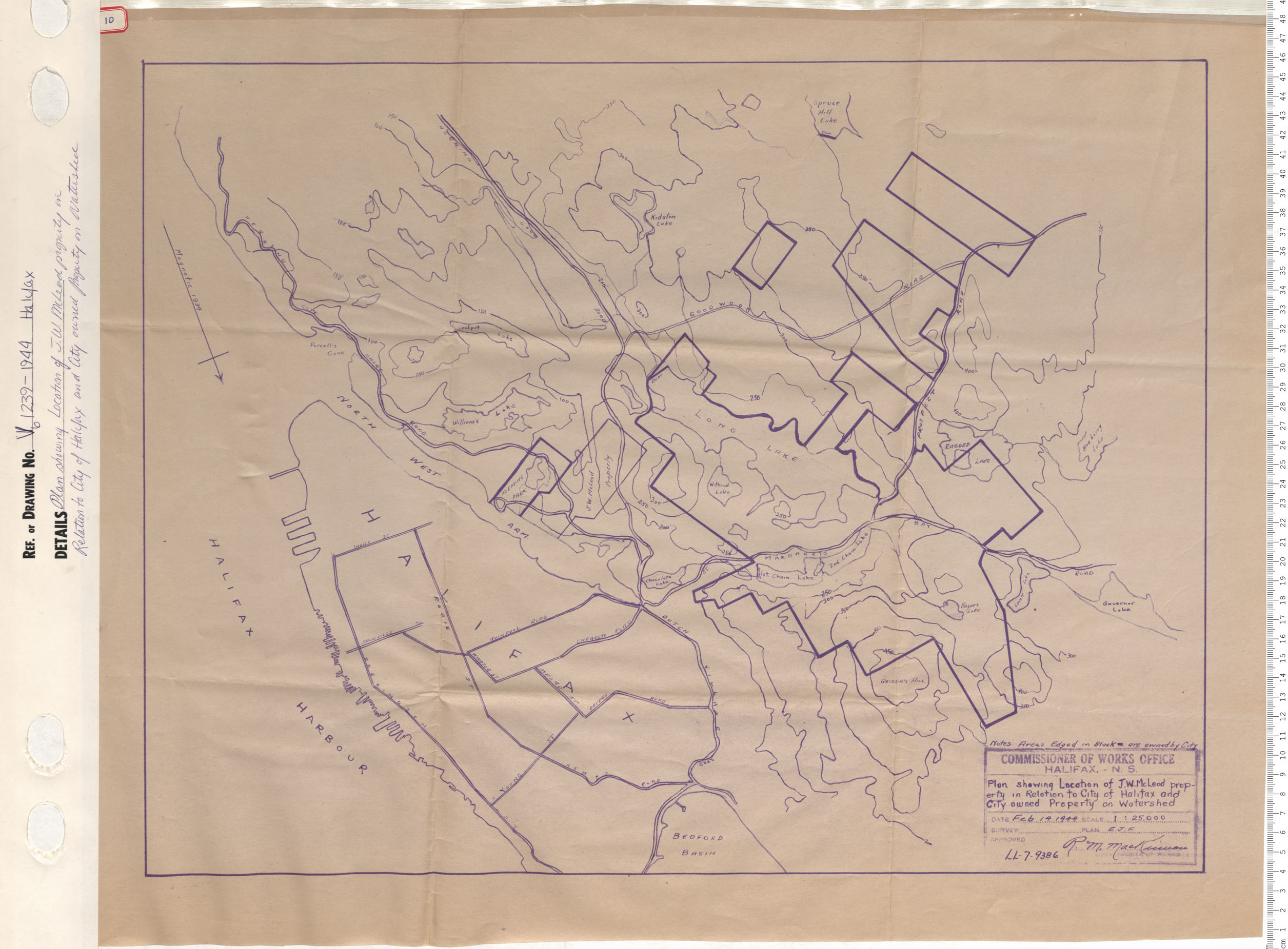
Plan showing Location of J.W. McLeod property in Relationto city of Halifax and City owned Property on Watershed
Date: 1944
Reference: Nova Scotia Archives Map Collection: V6 239 Halifax, Nova Scotia