Nova Scotia Archives
Historical Maps of Nova Scotia
Results 376 to 390 of 663 from your search: Halifax
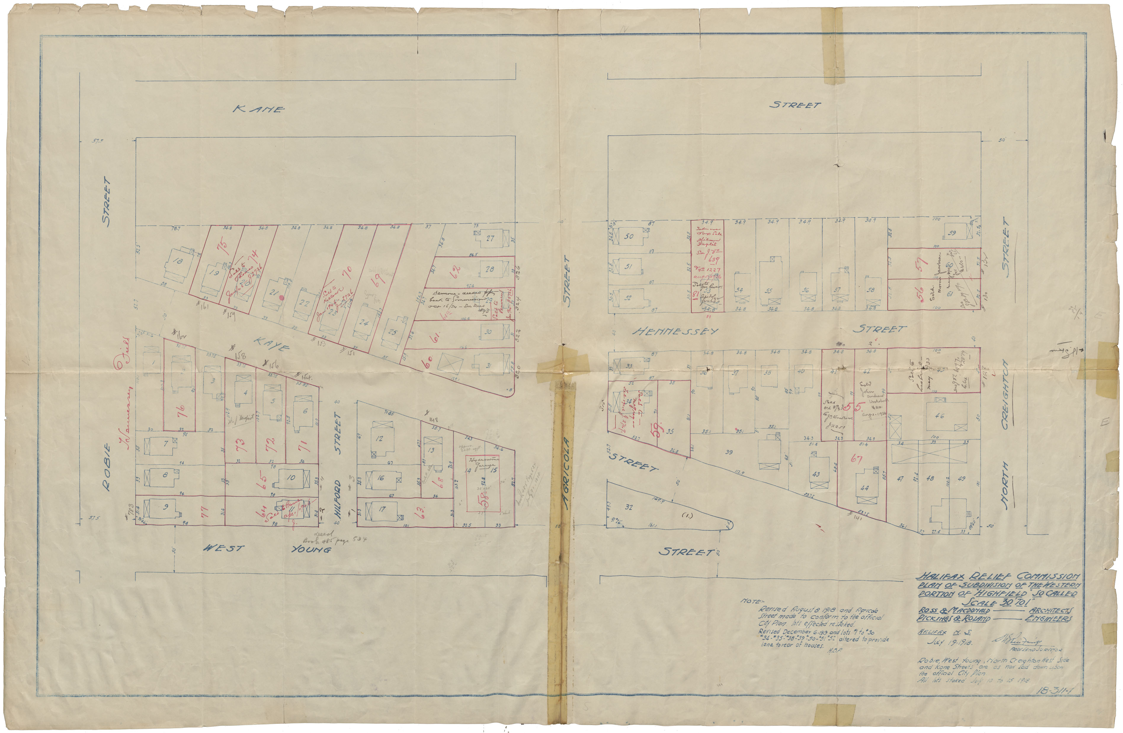
Halifax Relief Commission Plan of Subdivision of the Western Portion of "Highfield" so called
Date: 1918
Reference: Nova Scotia Archives Map Collection: F/240 - 1918
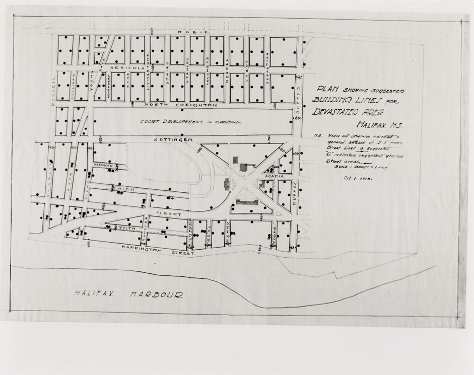
Halifax Re-housing Plan of Devastated Area Indicating Progress Re-housing Undertaken by H.R.C.
Date: 25 October 1918
Reference: Nova Scotia Archives Map Collection: F/240 - 1918
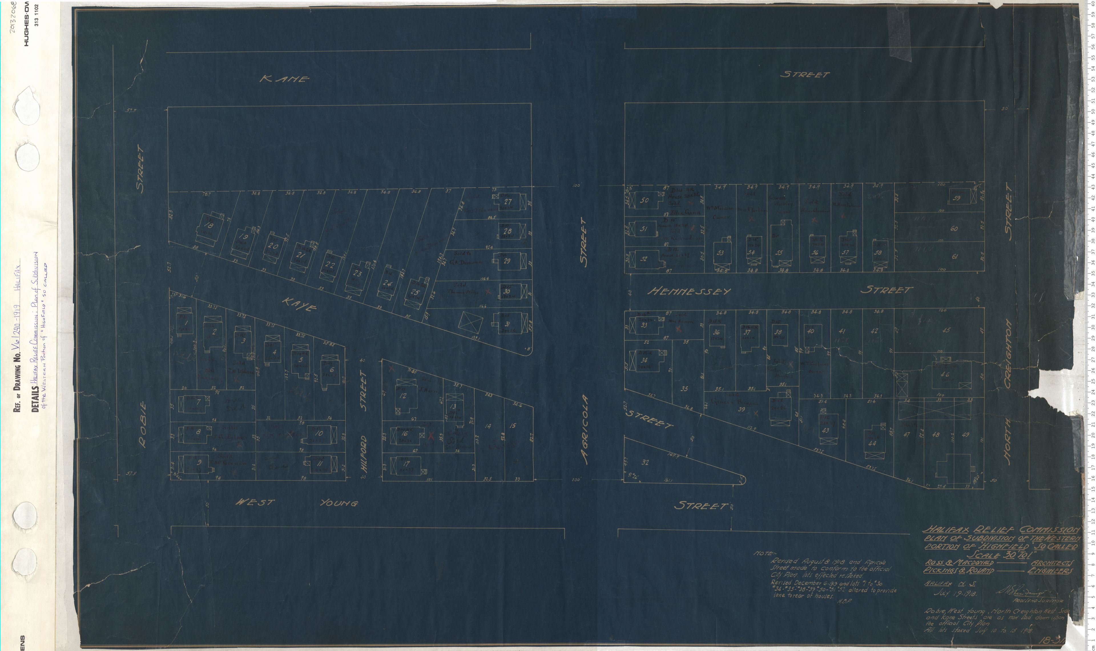
Halifax Relief Commission: Plan of Subdivsion of the Westren Portion of "Highfield" so called
Date: 1919
Reference: Nova Scotia Archives Map Collection: V6 240 Halifax, Nova Scotia
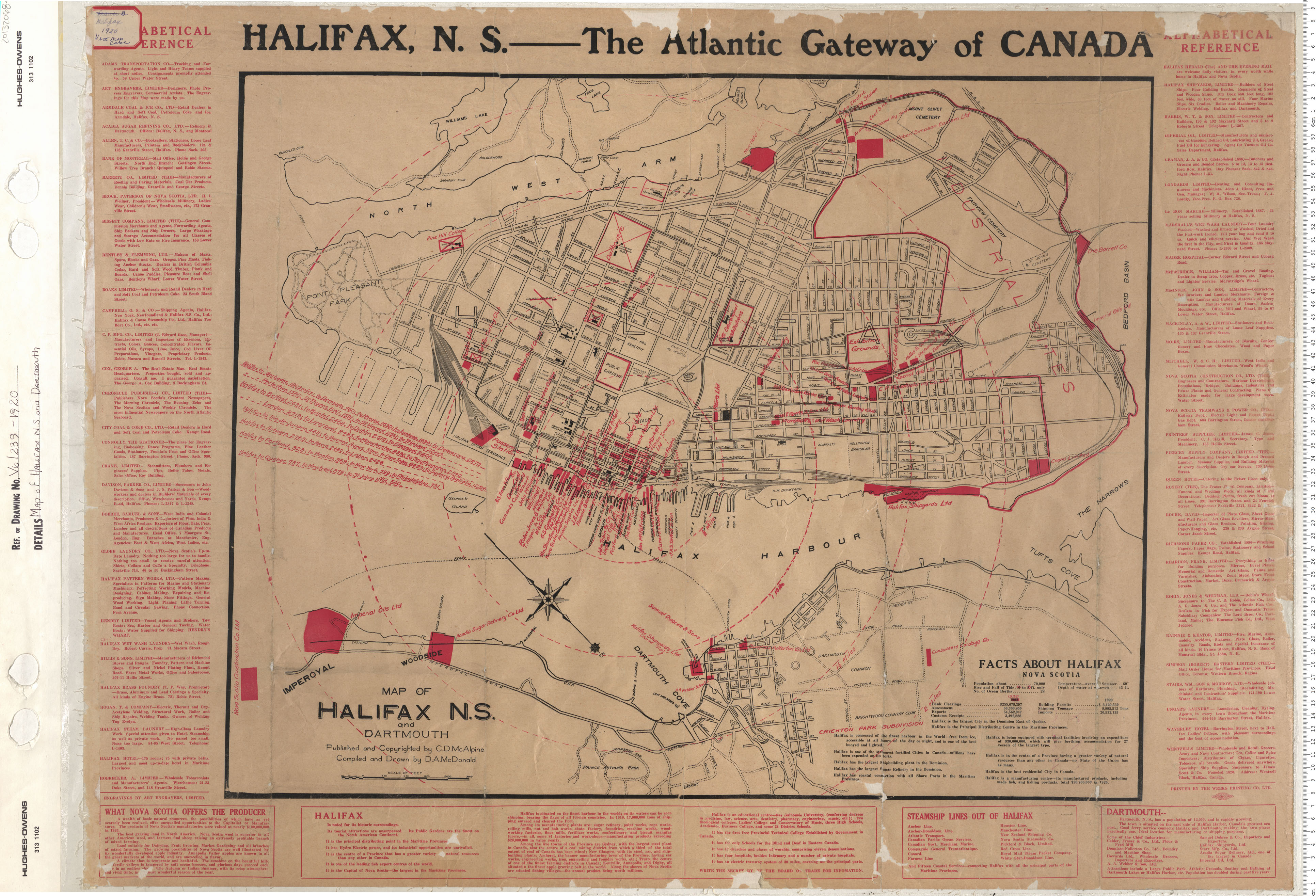
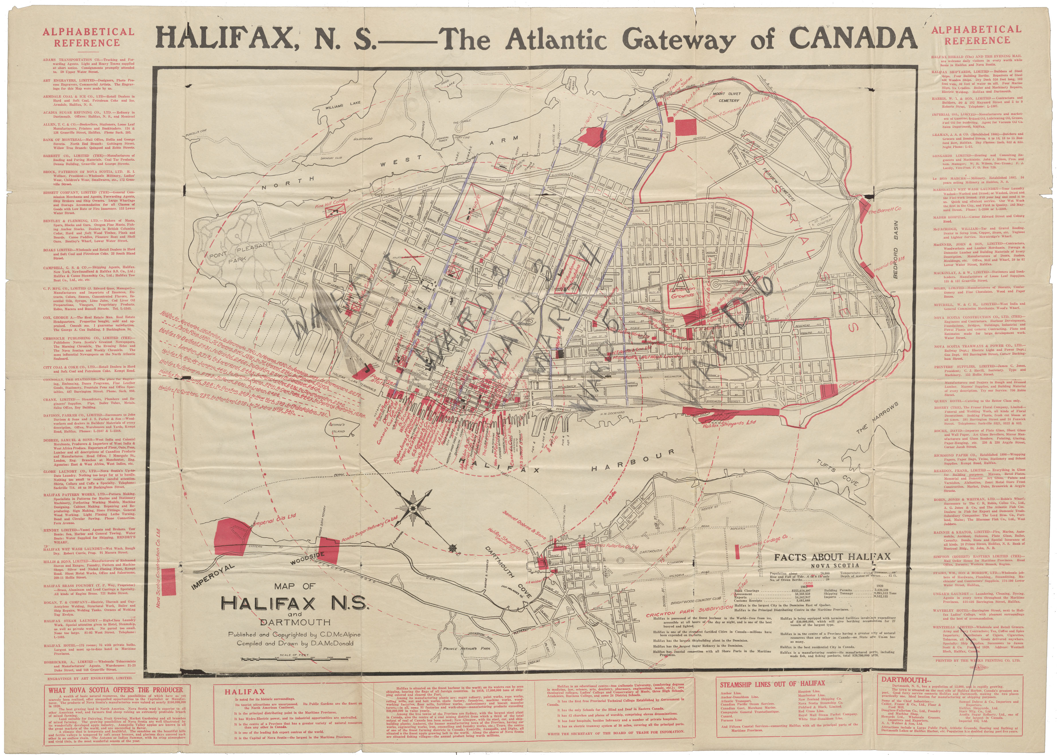
Map of Halifax and Dartmouth
Date: 1920
Reference: Nova Scotia Archives Map Collection: V6 239 Halifax, Nova Scotia
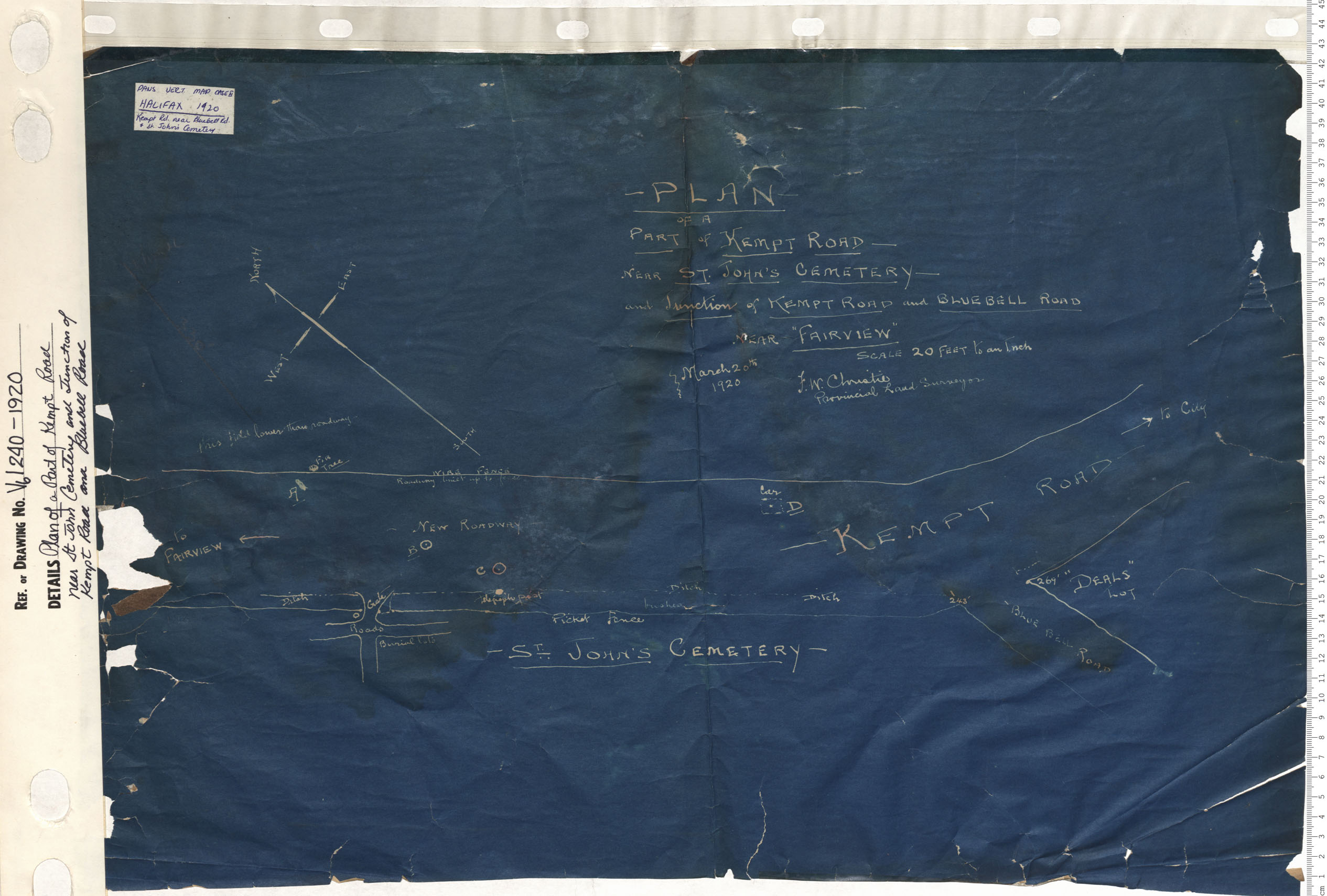
Plan of Part of Kempt Road Near Saint John Cematery and Junction of Kempt Road and Bluebell Road
Date: 1920
Reference: Nova Scotia Archives Map Collection: V6 240 Halifax, Nova Scotia
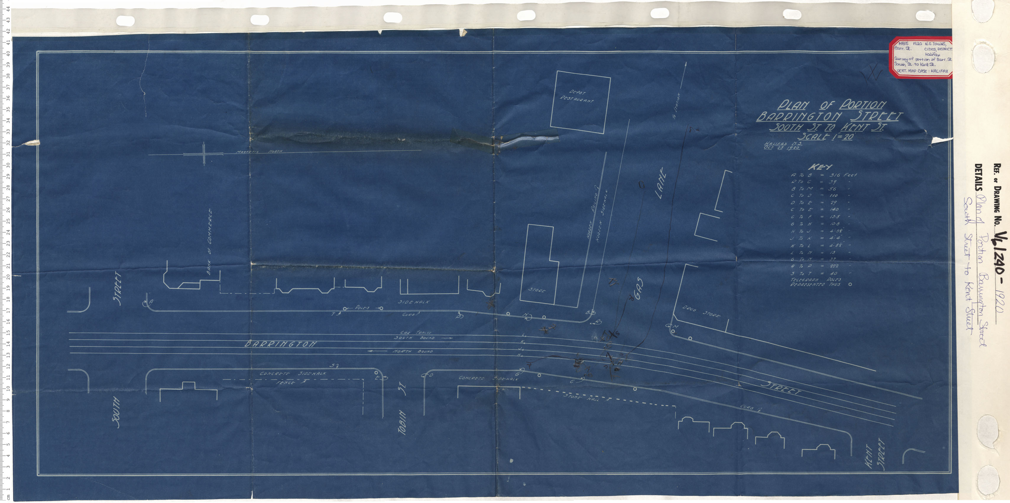
Plan of Portion Barrington Street South Street to Kent Street
Date: 1920
Reference: Nova Scotia Archives Map Collection: V6 240 Halifax, Nova Scotia
Map of Halifax and Dartmouth Gateway of Canada
Date: 1920
Reference: Nova Scotia Archives Map Collection: F/239 - 1920

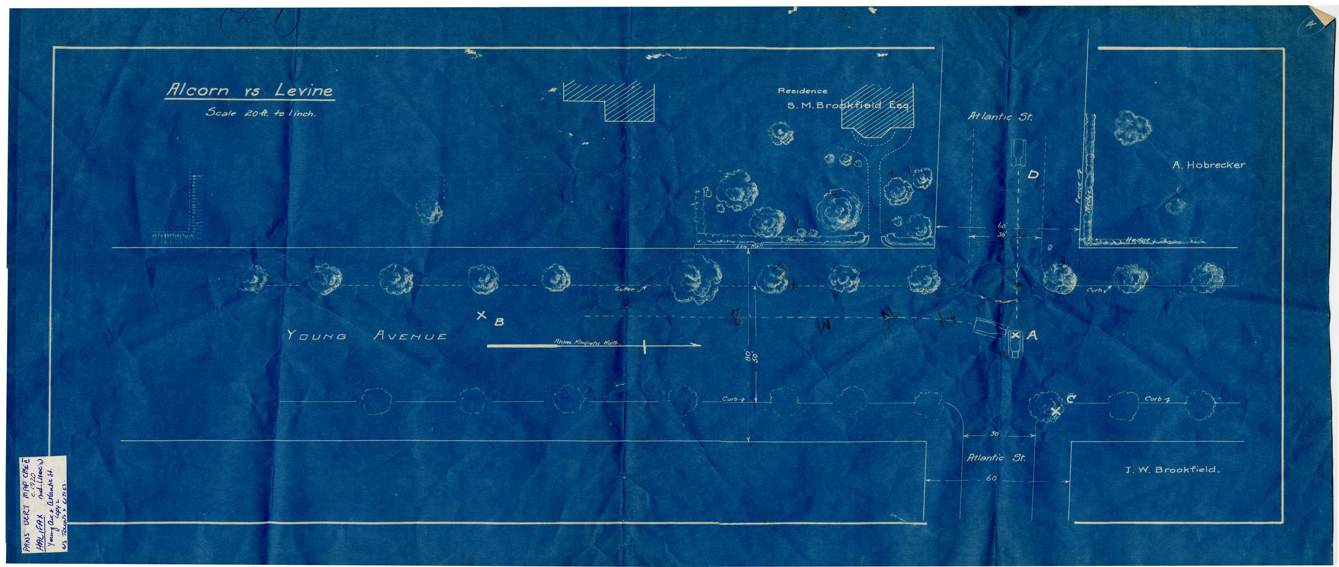
Halifax Sts: Young Ave intersection of Atlantic
Date: 1920
Reference: Nova Scotia Archives Map Collection: F/240 - 1920
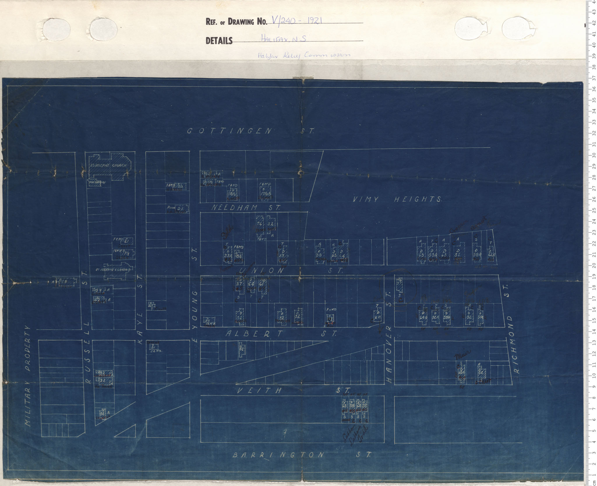
Halifax Relief Commission
Date: 1921
Reference: Nova Scotia Archives Map Collection: V6 240 Halifax, Nova Scotia
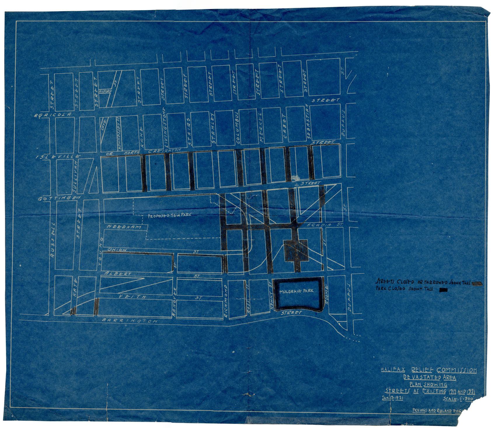
Halifax Relief Commisssion Devastated Area: Plan Showing
Date: 13 January 1921
Reference: Nova Scotia Archives Map Collection: F/240 - 1921
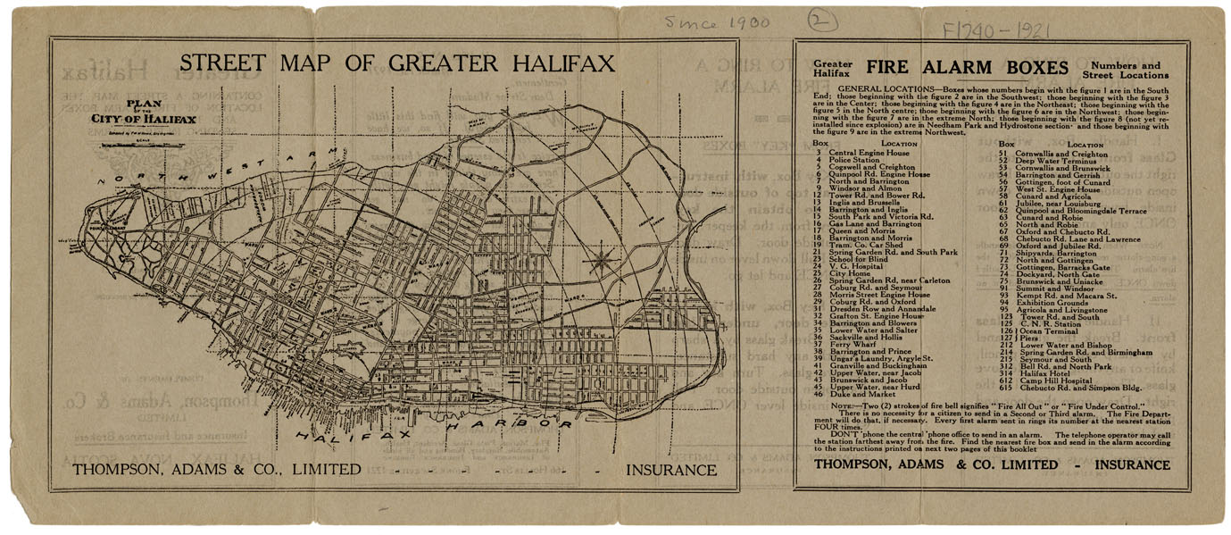
Street map of Greater Halifax
Date: 1921
Reference: Nova Scotia Archives Map Collection: F/240 - 1921
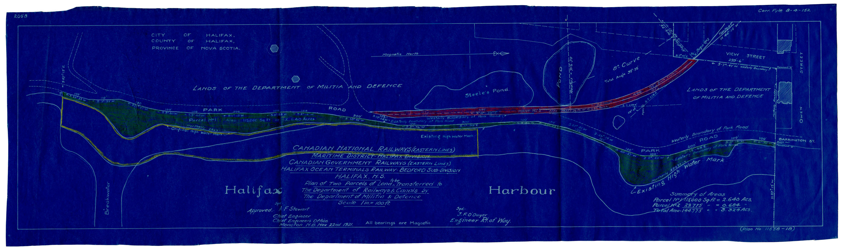
Plan of Three Parcels of Land to be Expropriated..in the City of Halifax for the Canadian National Rys
Date: 22 November 1921
Reference: Nova Scotia Archives Map Collection: F/240 - 1921
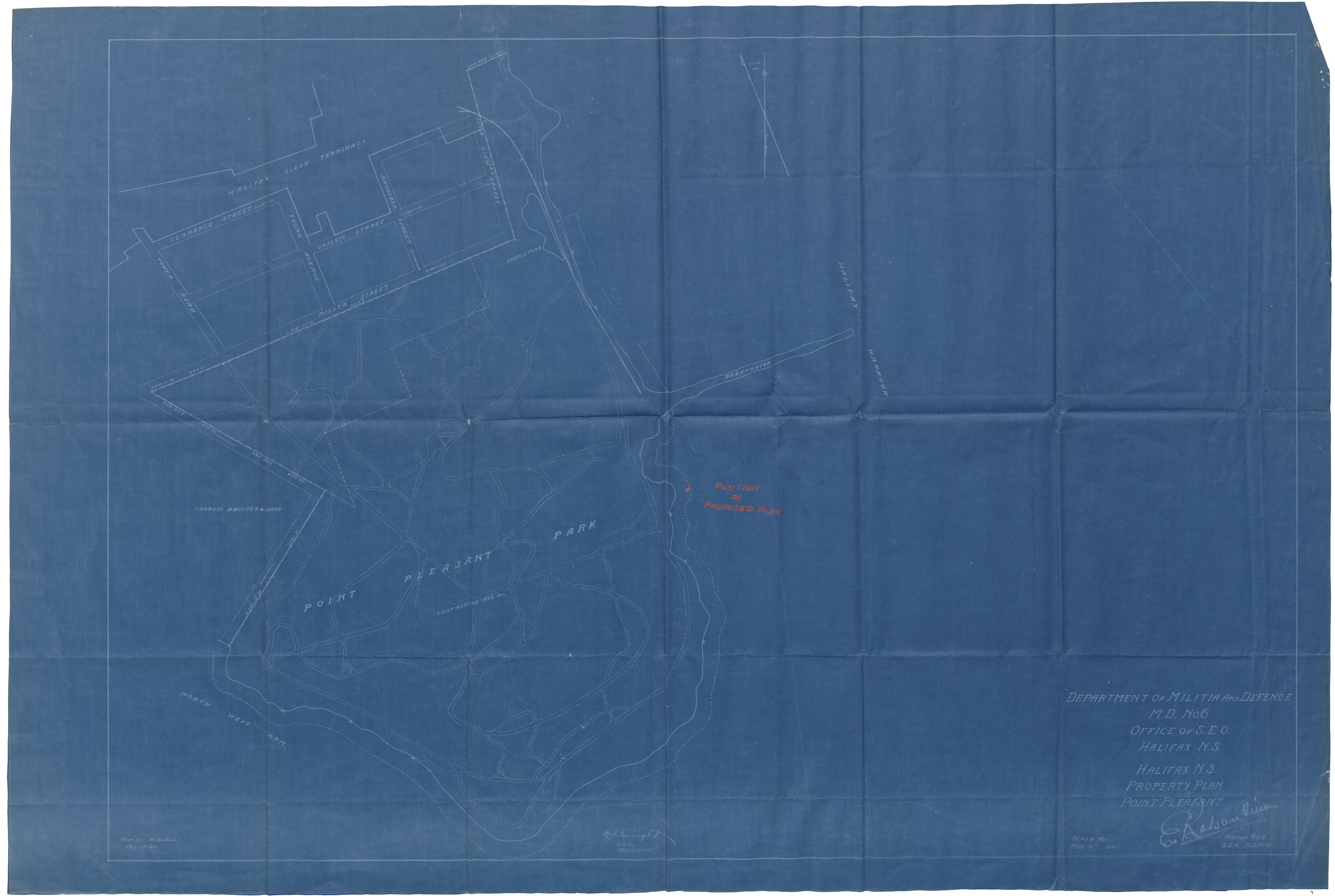
Dept of Militia & Defense M.D.6 Office of S.E.O., Halifax, N.S. Property Plan Point Pleasant
Date: 15 August 1921
Reference: Nova Scotia Archives Map Collection: F/240 - 1921