Nova Scotia Archives
Historical Maps of Nova Scotia
Results 301 to 315 of 827 from your search: 1900
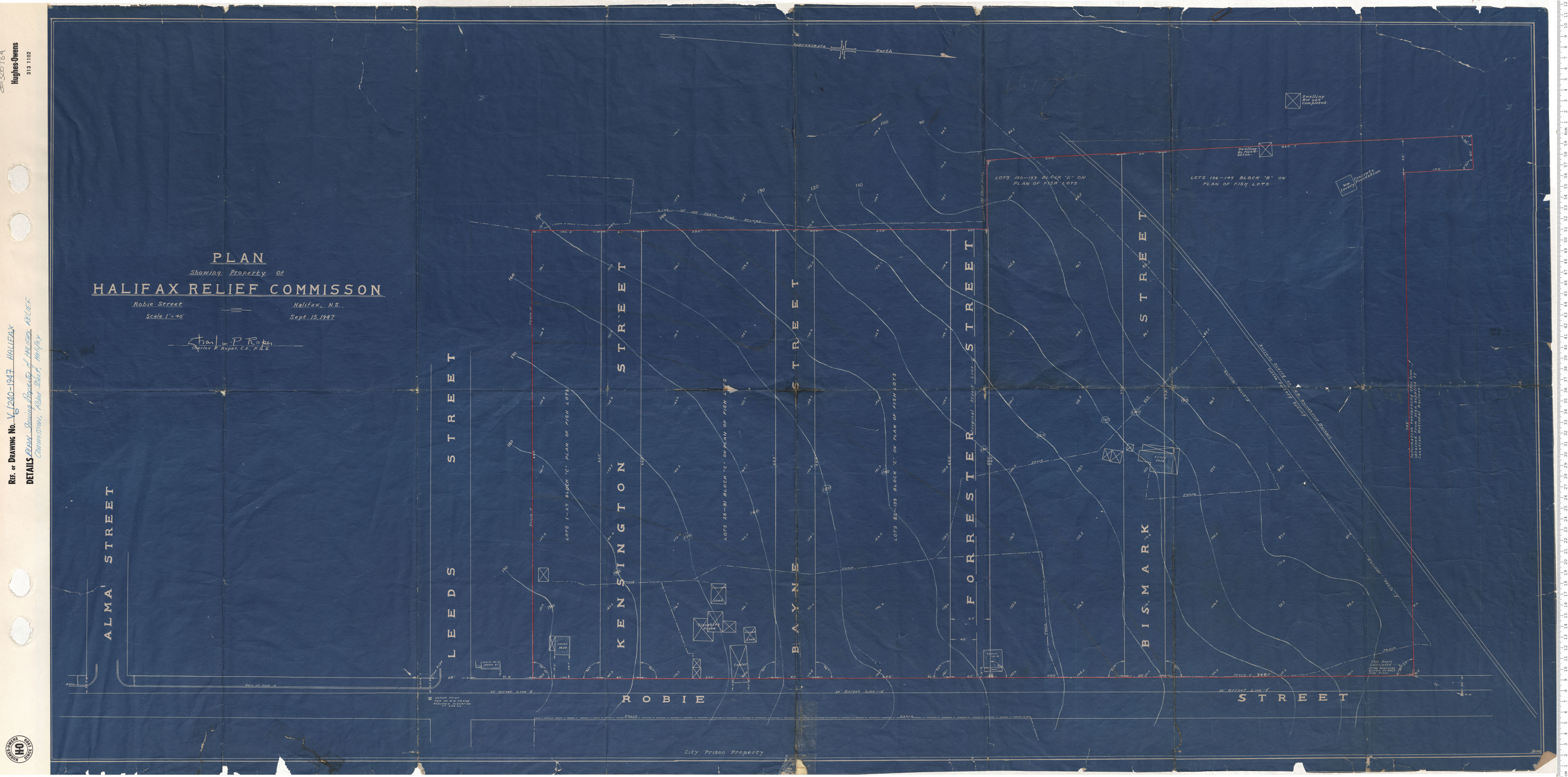
Plan Showing Property of Halifax Relief Commission, Robie Street, Halifax
Date: 1947
Reference: Nova Scotia Archives Map Collection: V6 240 Halifax, Nova Scotia
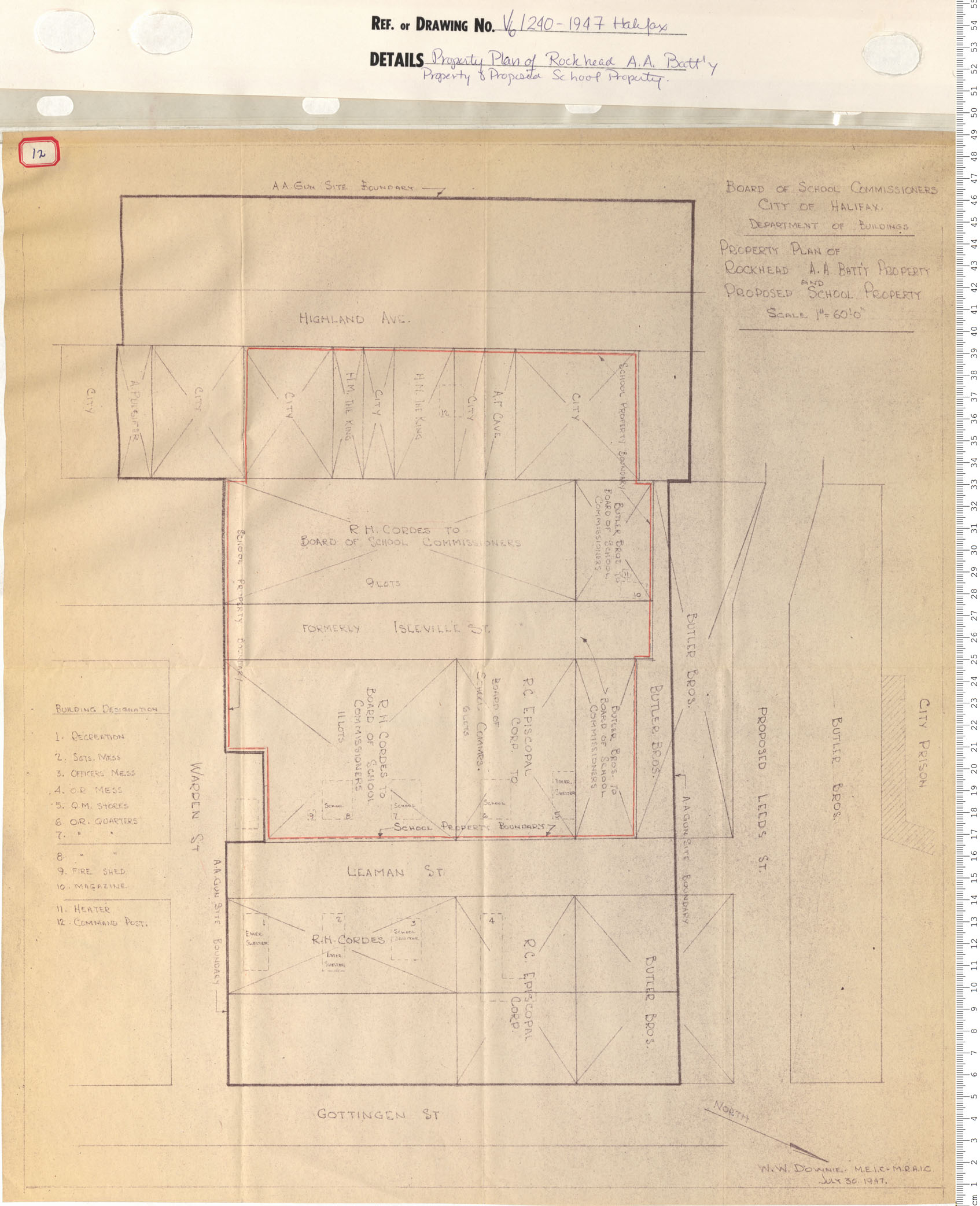
Property Plan of Rockhead A.A. Battery Property And Proposed School Property
Date: 1947
Reference: Nova Scotia Archives Map Collection: V6 240 Halifax, Nova Scotia
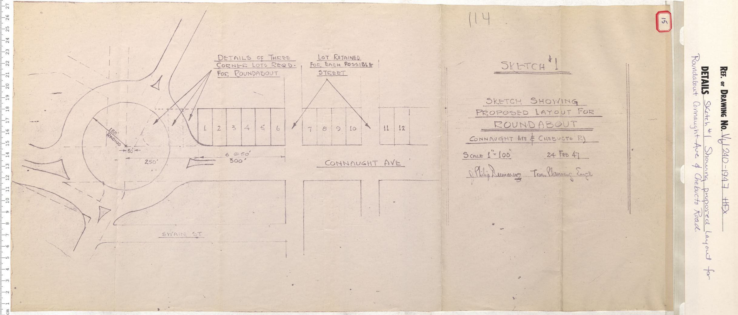
Sketch # 1 Showing proposed layout for Roundabout Connaught Ave. and Chebucto Road
Date: 1947
Reference: Nova Scotia Archives Map Collection: V6 240 Halifax, Nova Scotia
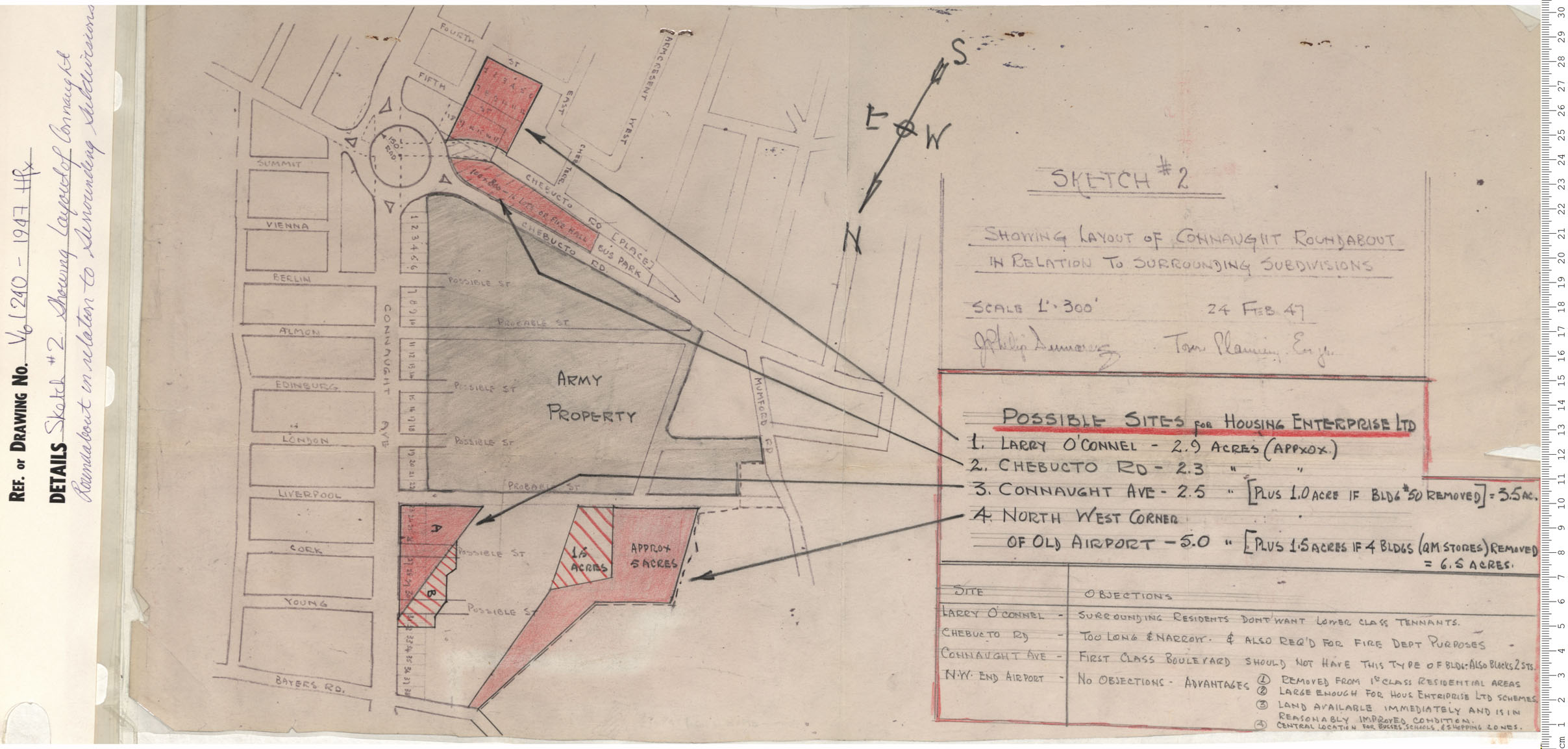
Sketch #2 Showing Layout of Connaught Roundabout in relation to Surrounding Subdivisions
Date: 1947
Reference: Nova Scotia Archives Map Collection: V6 240 Halifax, Nova Scotia
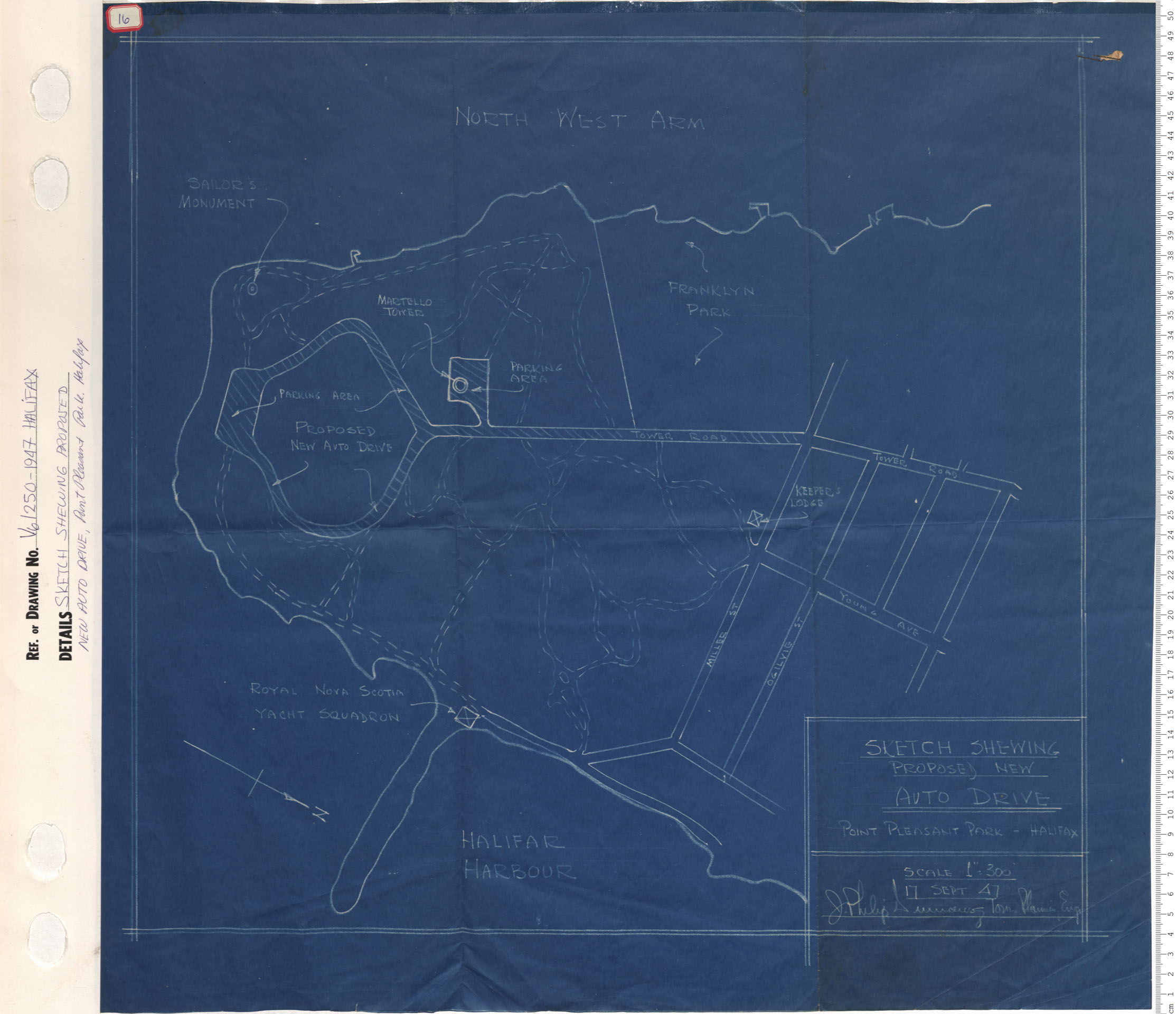
Sketch Shewing Proposed New Auto Drive, Point Pleasant Park, Halifax
Date: 1947
Reference: Nova Scotia Archives Map Collection: V6 250 Halifax, Nova Scotia
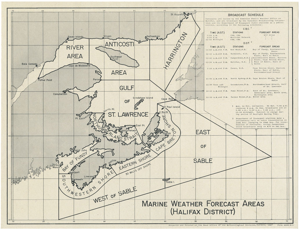
Marine Weather Forecast areas (Halifax District)
Date: 1947
Reference: Nova Scotia Archives Map Collection: F/200 - 1947
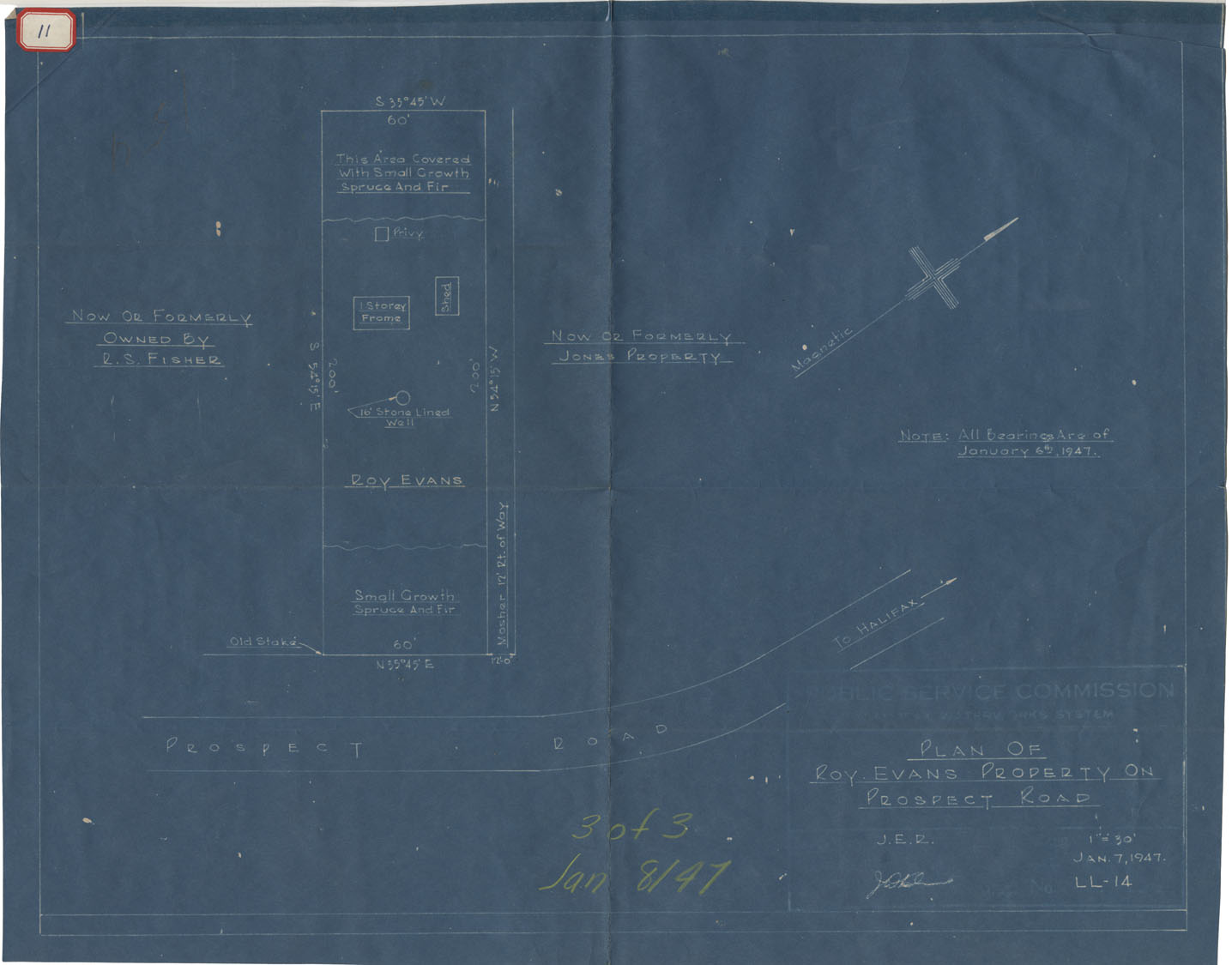
Plan of Roy Evans Property on Prospect Road
Date: 7 January 1947
Reference: Nova Scotia Archives Map Collection: F/239 - 1947
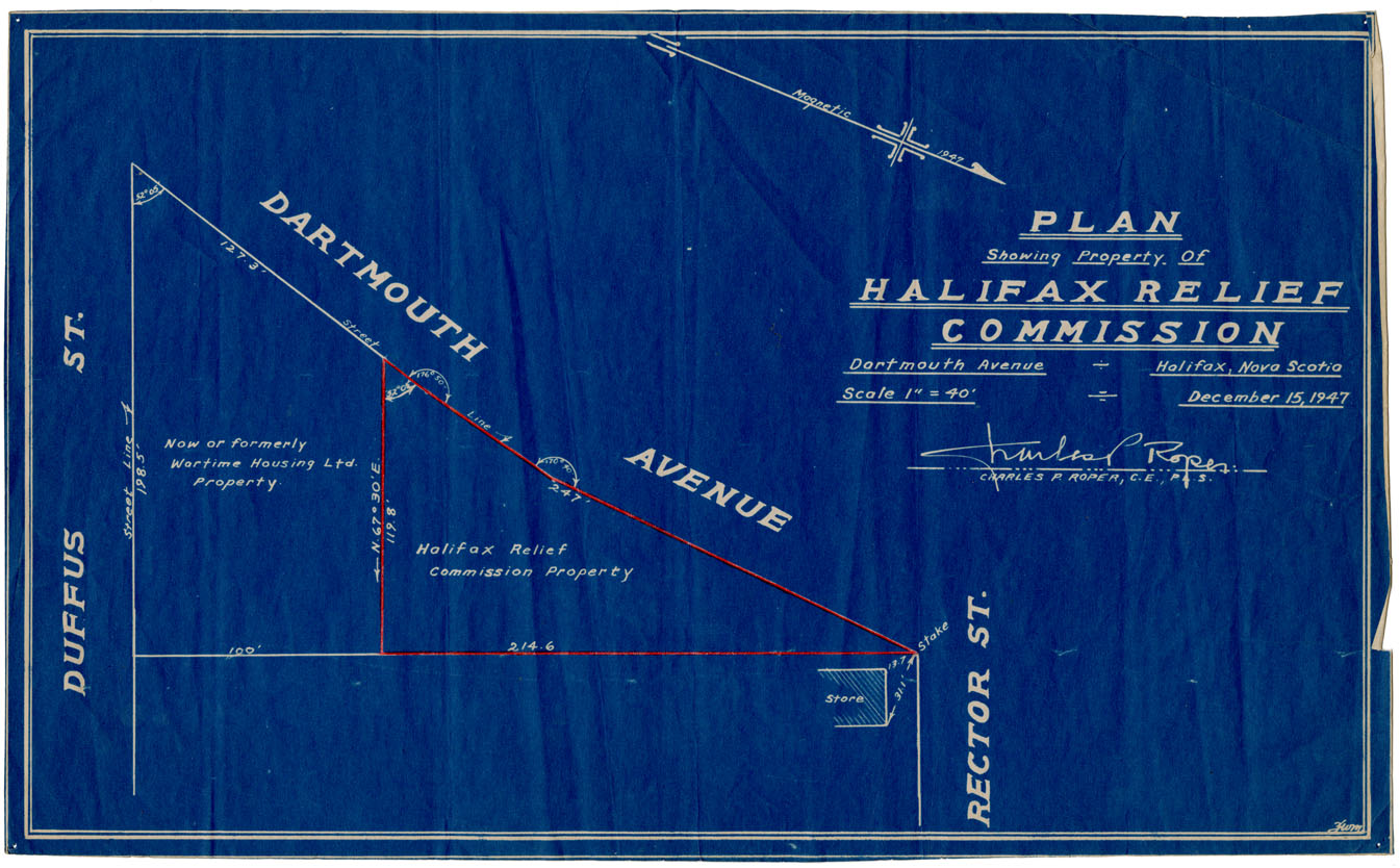
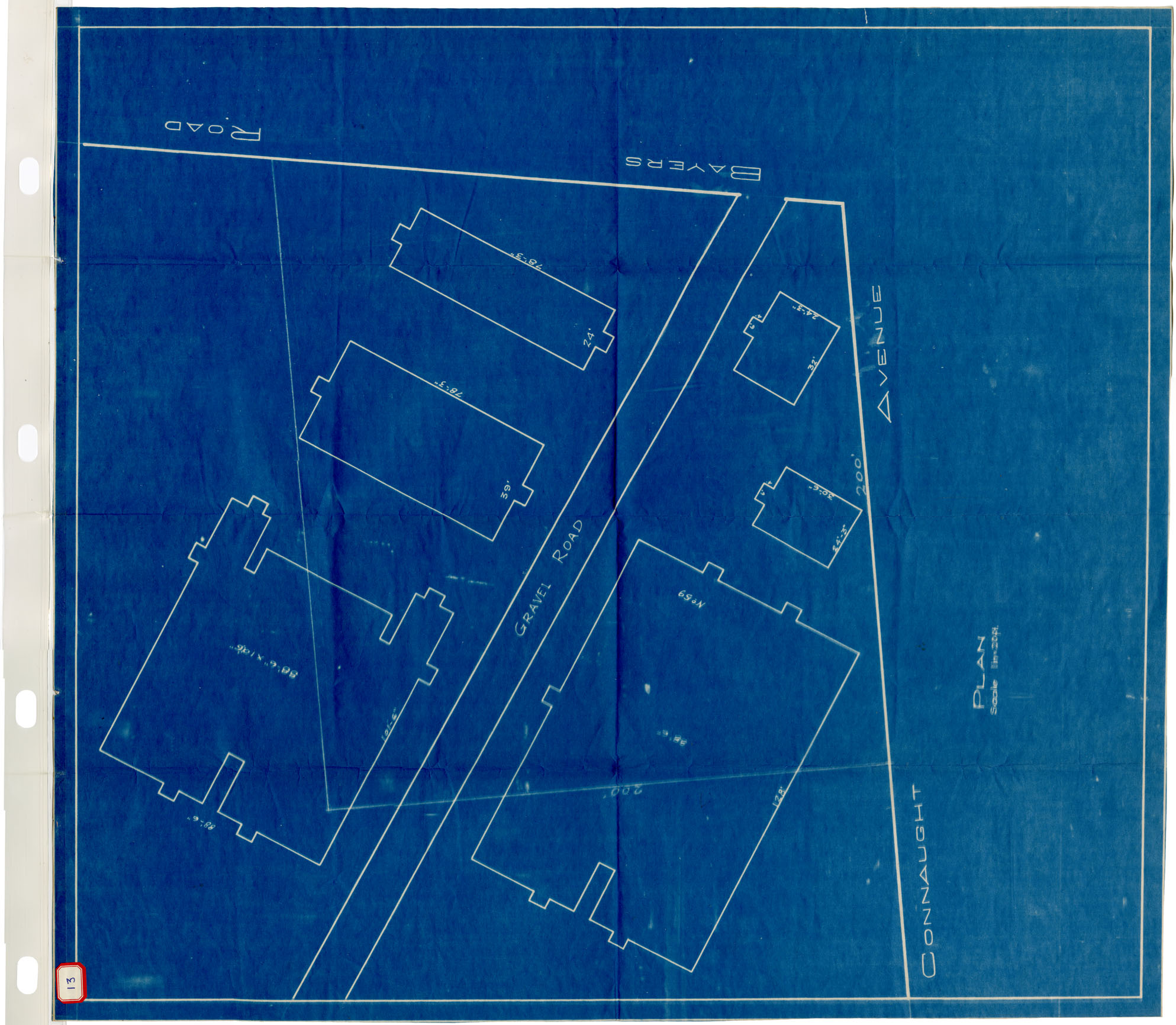
Plan showing Property of Halifax Relief Commission Dartmouth Avenue, Halifax, N.S.
Date: 14 December 1947
Reference: Nova Scotia Archives Map Collection: F/240 - 1947
Halifax: Lot to Erect Christian Mission West End Baptist Church
Date: 1947
Reference: Nova Scotia Archives Map Collection: F/240 - 1947
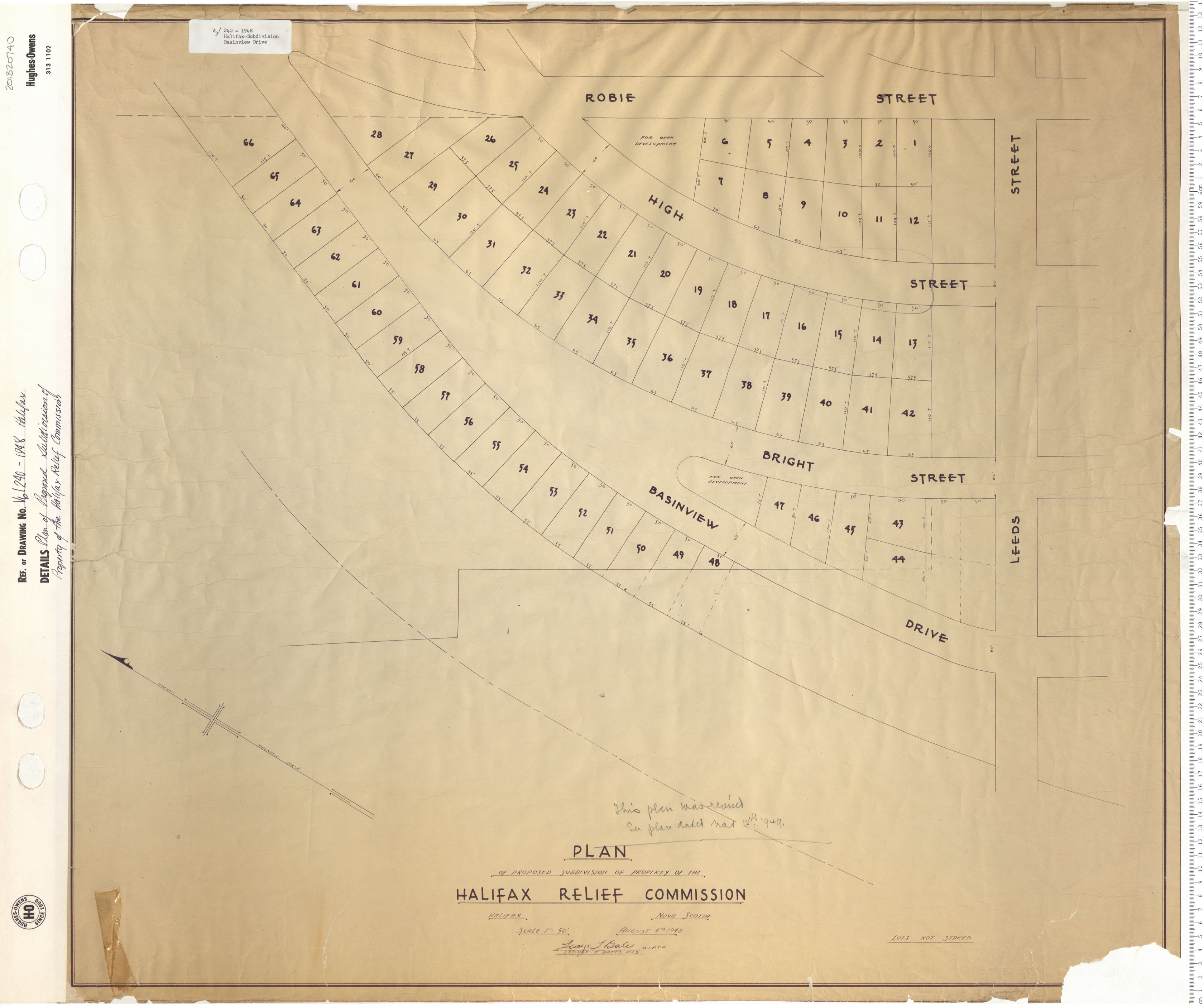
Plan for Porposed Subdivision of Property of the Halifax Relief Commission
Date: 1948
Reference: Nova Scotia Archives Map Collection: V6 240 Halifax, Nova Scotia
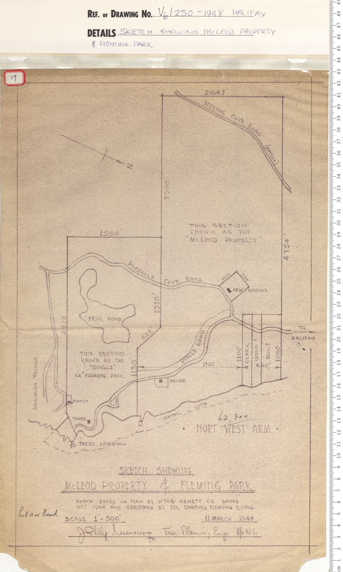
Sketch Shewing McLeod Property and Fleming Park
Date: 1948
Reference: Nova Scotia Archives Map Collection: V6 240 Halifax, Nova Scotia
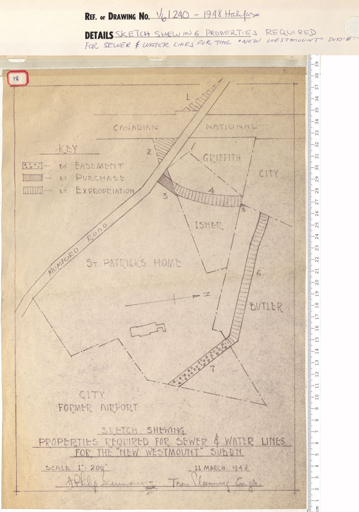
Sketch shewing Properties Required for Sewer and Water lines for the "New Westmount" Subdivision
Date: 1948
Reference: Nova Scotia Archives Map Collection: V6 240 Halifax, Nova Scotia
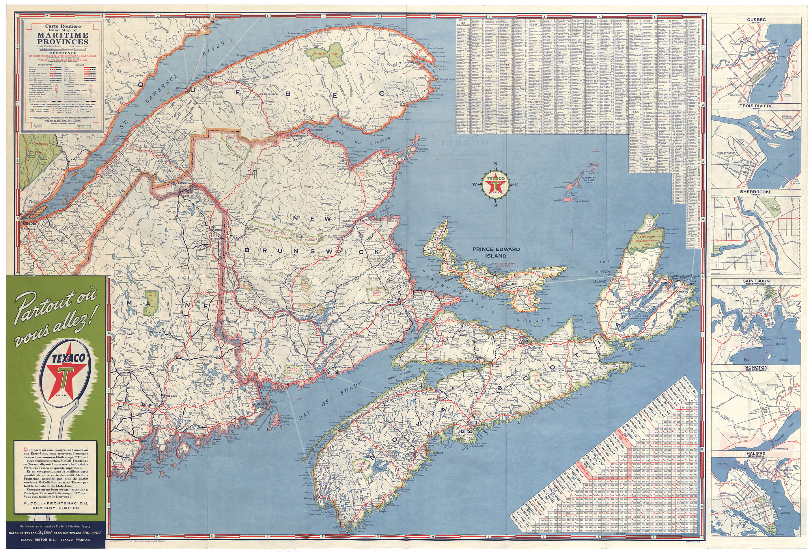
Quebec and the Maritime Provinces
Date: 1948
Reference: Nova Scotia Archives Map Collection: F/200 - 1948
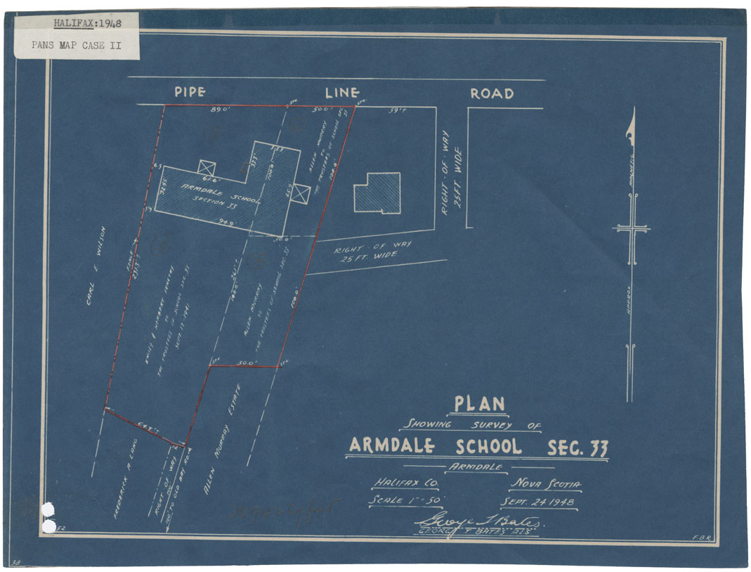
Plan showing survey of Armdale School section 33-Armdale, Halifax Co, NS
Date: 24 September 1948
Reference: Nova Scotia Archives Map Collection: F/239 - 1948
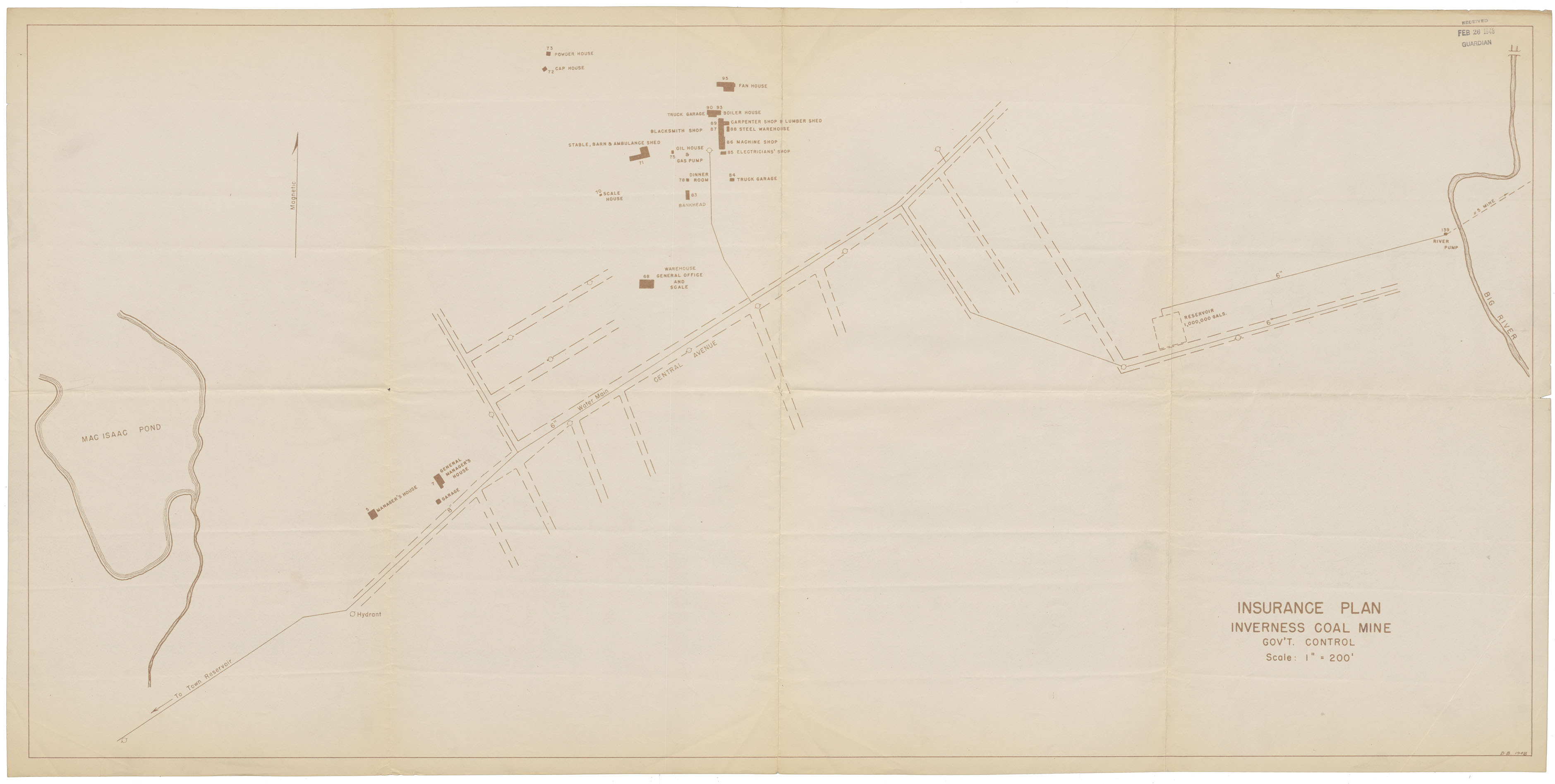
Insurance Plan-Inverness Coal Mine
Date: 1948
Reference: Nova Scotia Archives Map Collection: F/239 - 1948