Nova Scotia Archives
Historical Maps of Nova Scotia
Results 811 to 825 of 905 from your search: 1800
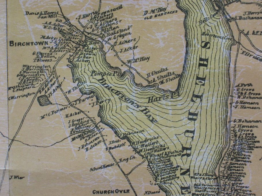
Map detail showing Birchtown
Date: 1882
Reference: Topographical Township Map of Shelburne County, Nova Scotia Nova Scotia Archives Map Collection
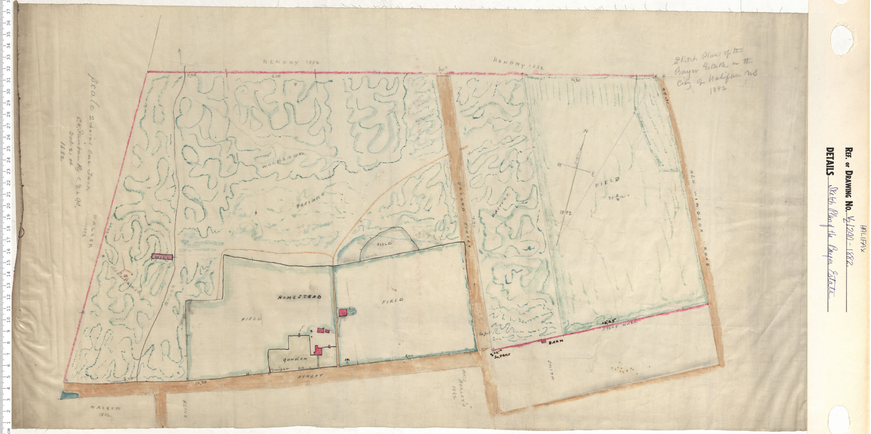
Sketch Plan of the Bayers Estate
Date: 1882
Reference: Nova Scotia Archives Map Collection: V6 240 Halifax, Nova Scotia
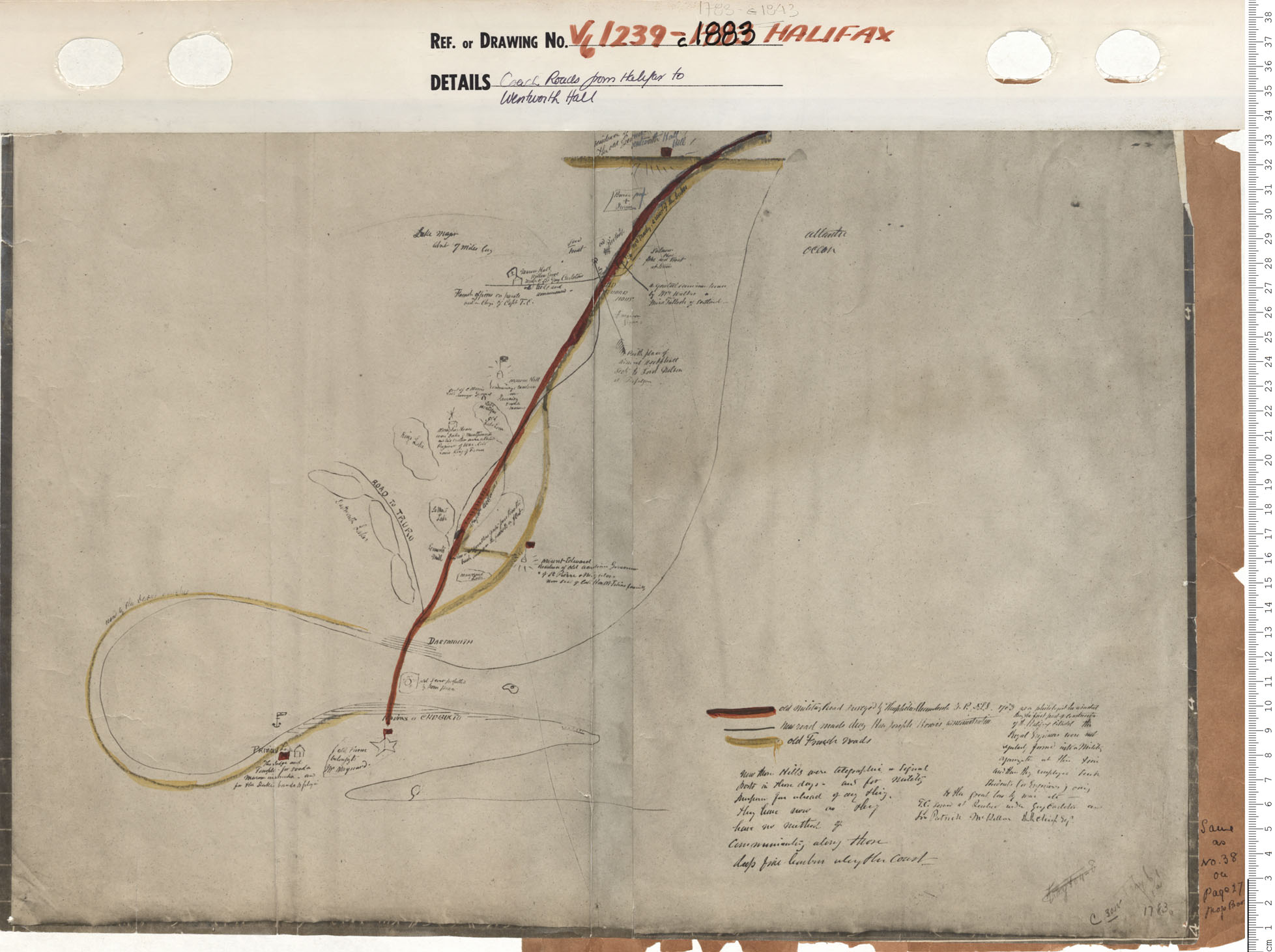
Coach Roads from Halifax to Wentworth Hall
Date: 1883
Reference: Nova Scotia Archives Map Collection: V6 239 Halifax, Nova Scotia
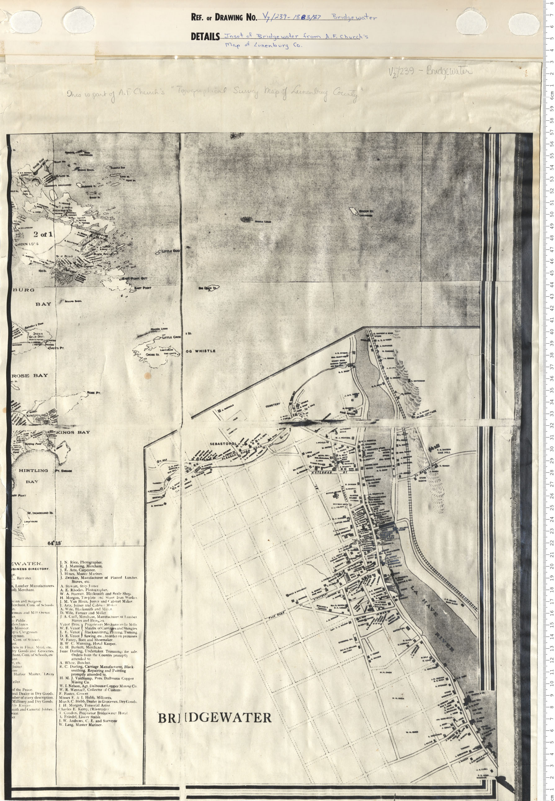
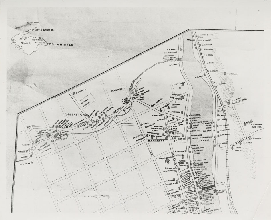
Inset of Bridgewater from A.F. Church's Map of Lunenburg County
Date: 1883/1887
Reference: Nova Scotia Archives Map Collection: V7 239 Bridgewater, Nova Scotia
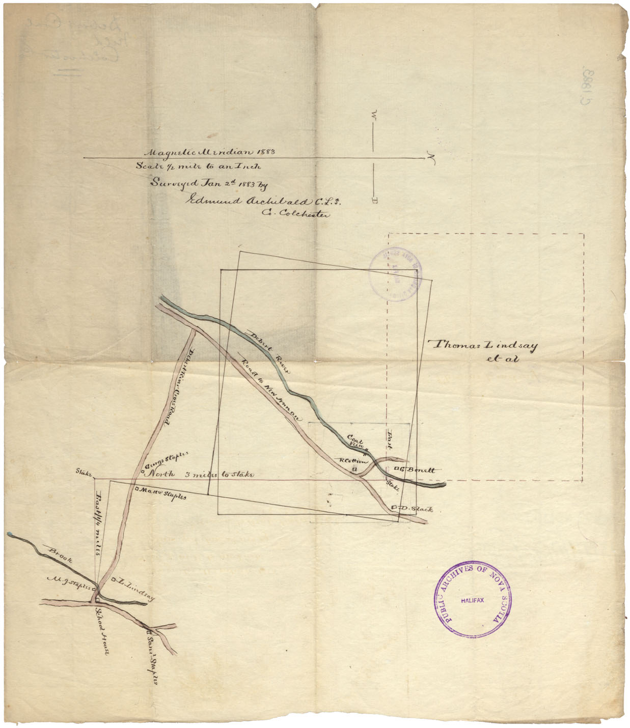
Debert Coal Field, Colchester County
Date: 2 January 1883
Reference: Nova Scotia Archives Map Collection: F/230 - 1883
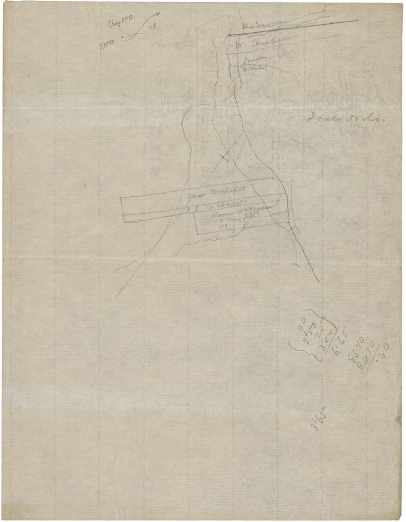
Sketch Watson Area 2 Sumy Brae Pictou Iron
Date: 29 September 1883
Reference: Nova Scotia Archives Map Collection: F/230 - 1883
Town of Bridgewater, photograph
Date: 1883
Reference: Nova Scotia Archives Map Collection: F/239 - 1883/86
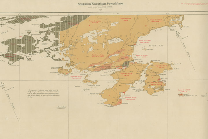
"Province of Nova Scotia (Island of Cape Breton)"
Date: 1884
Reference: Nova Scotia Archives Map Collection: Geological SurveyMaps, Cape Breton, No. 23 (O/S G3421 C51 F64 1884 No. 23)
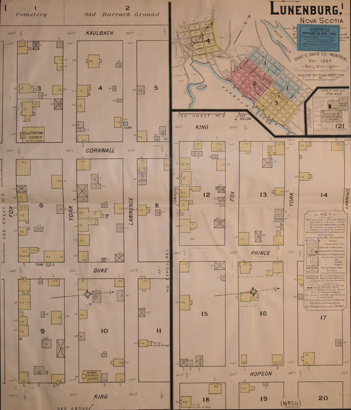
"Insurance Plan of Lunenburg, NS"
Date: Nov. 1884, rev. Oct. 1888
Reference: Nova Scotia Archives Library: O/S G1129 L8 G63 1888
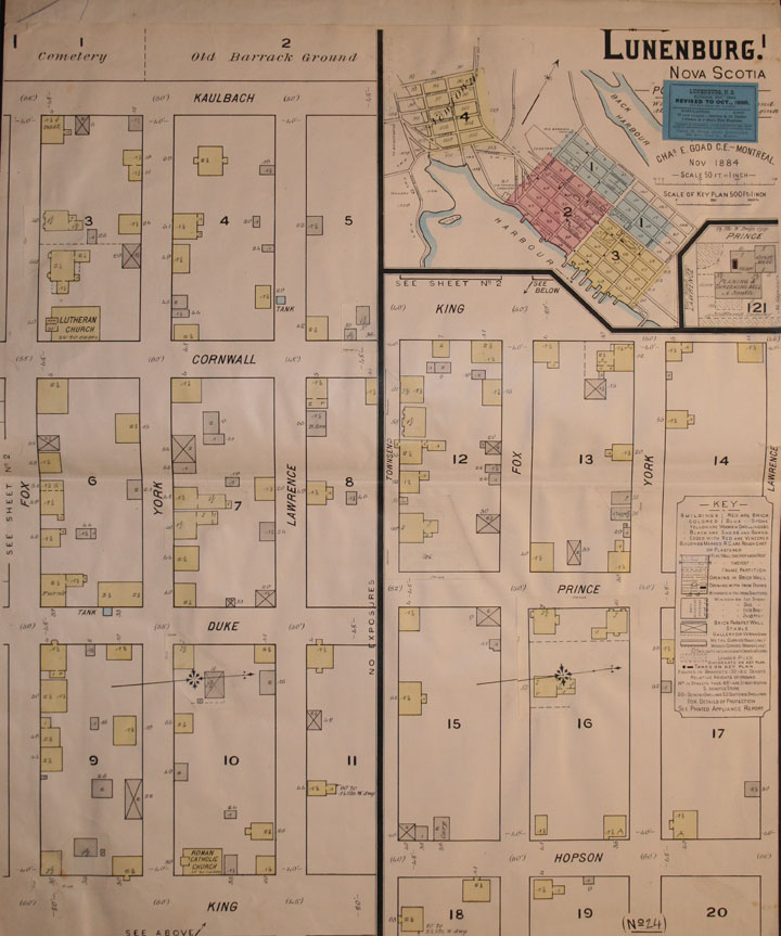
"Insurance Plan of Lunenburg NS"
Date: Nov. 1884, rev. Oct. 1888
Reference: Nova Scotia Archives Library: O/S G1129 L8 G63 1888
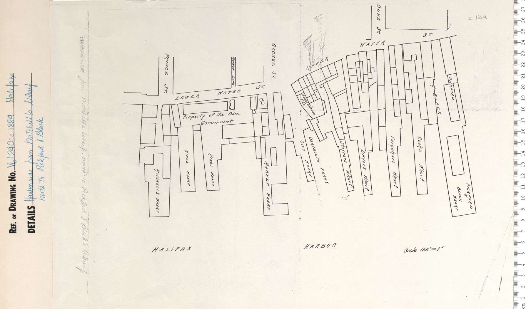
Harborside from Mitchell's Wharf north to Pickford and Black
Date: 1884
Reference: Nova Scotia Archives Map Collection: V6 240 Halifax, Nova Scotia
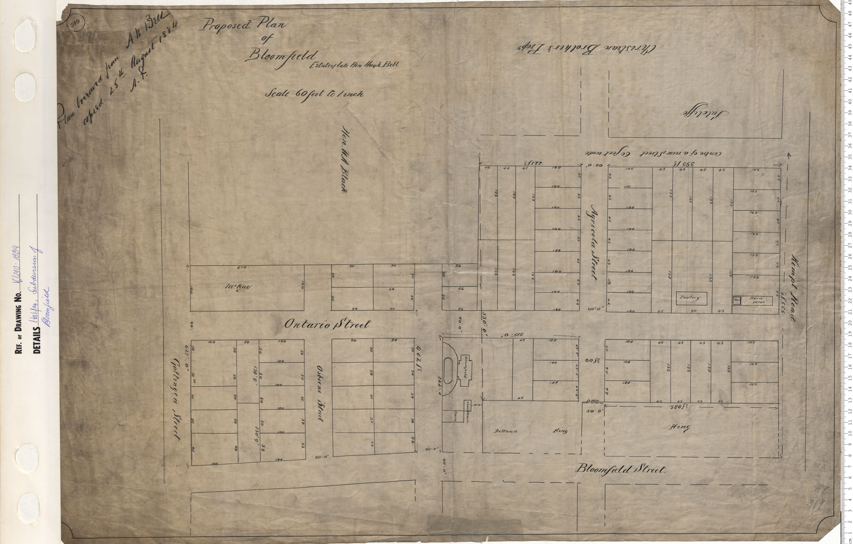
Subdivision of Bloomfield
Date: 1884
Reference: Nova Scotia Archives Map Collection: V6 240 Halifax, Nova Scotia
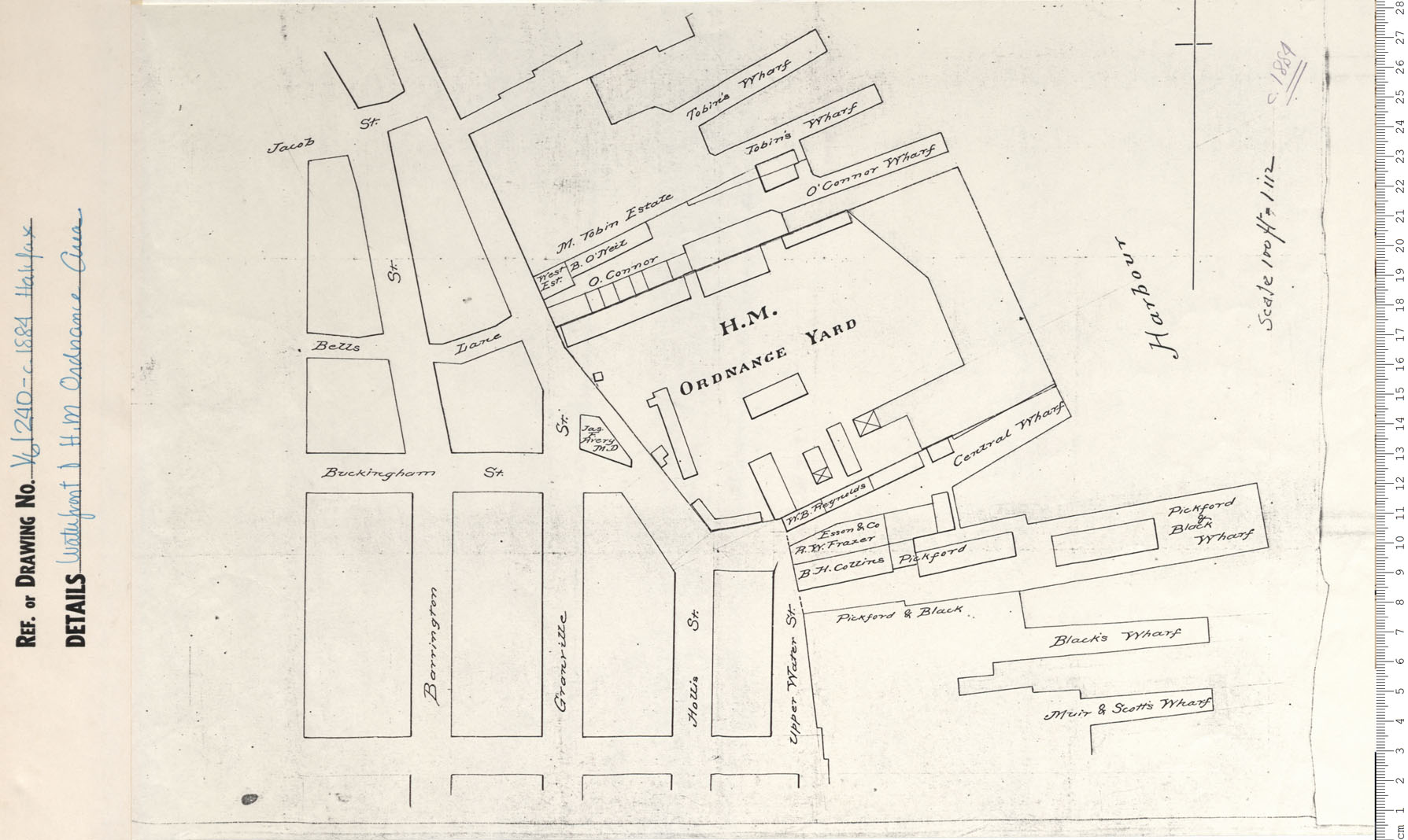
Waterfront and H.M. Ordnance Area
Date: 1884
Reference: Nova Scotia Archives Map Collection: V6 240 Halifax, Nova Scotia
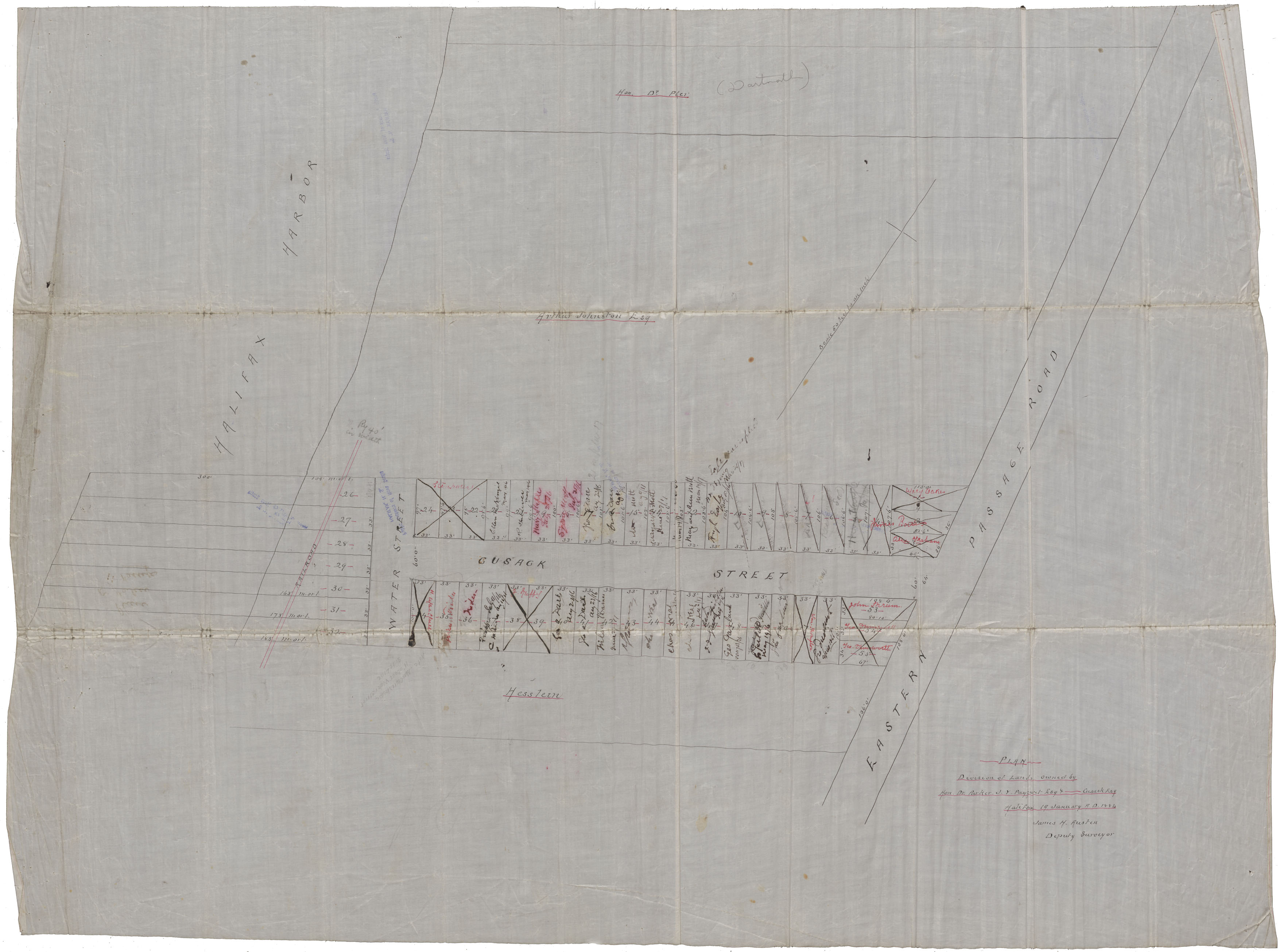
Plan Division of Lands owned by Hon. Dr.Parker/J.Y.Payzant/Cusack Esq.
Date: 19 January 1884
Reference: Nova Scotia Archives Map Collection: F/239 - 1884
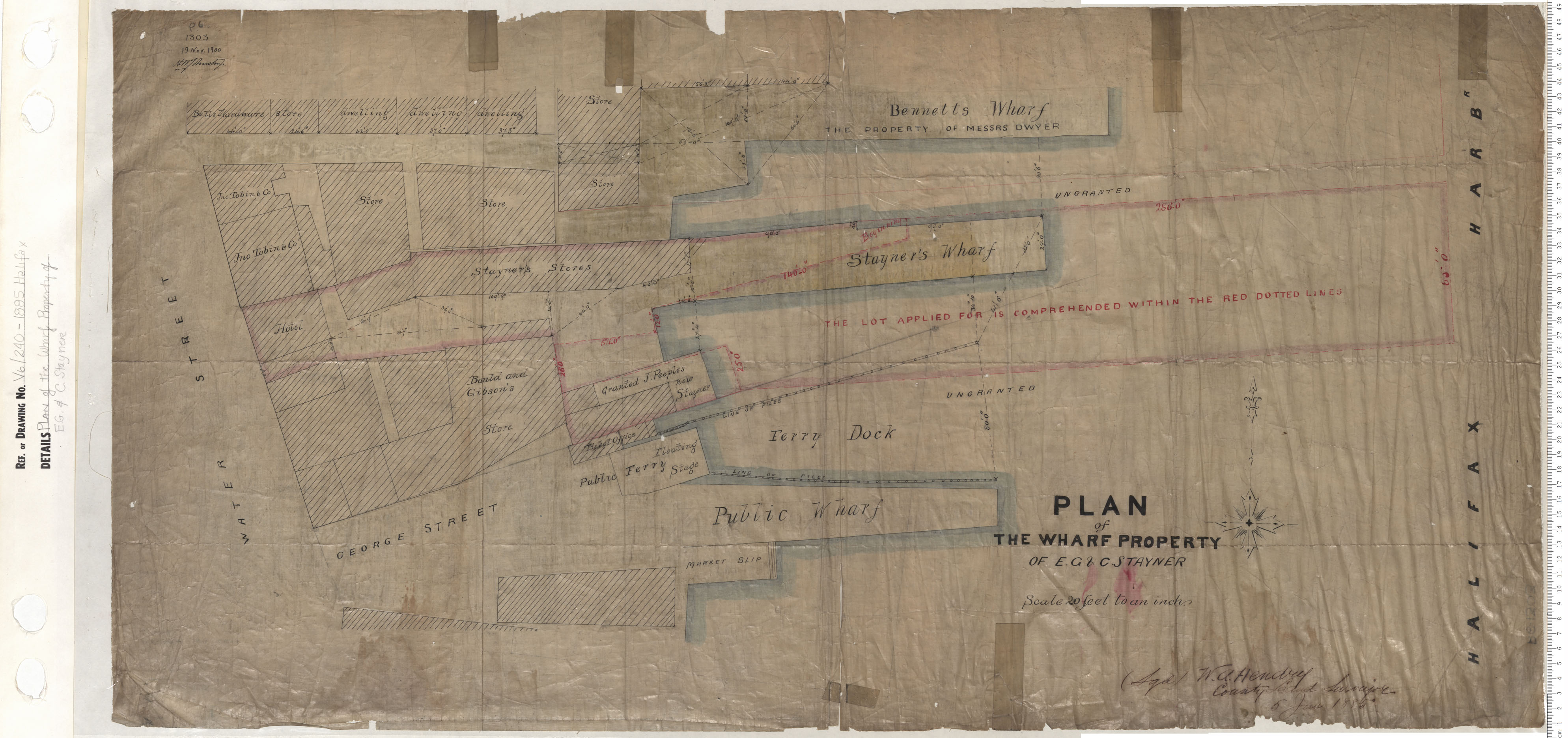
Plan of Wharf Property of E.G. & C. Stayner
Date: 1885
Reference: Nova Scotia Archives Map Collection: V6 240 Halifax, Nova Scotia