Nova Scotia Archives
Historical Maps of Nova Scotia
Results 781 to 795 of 905 from your search: 1800
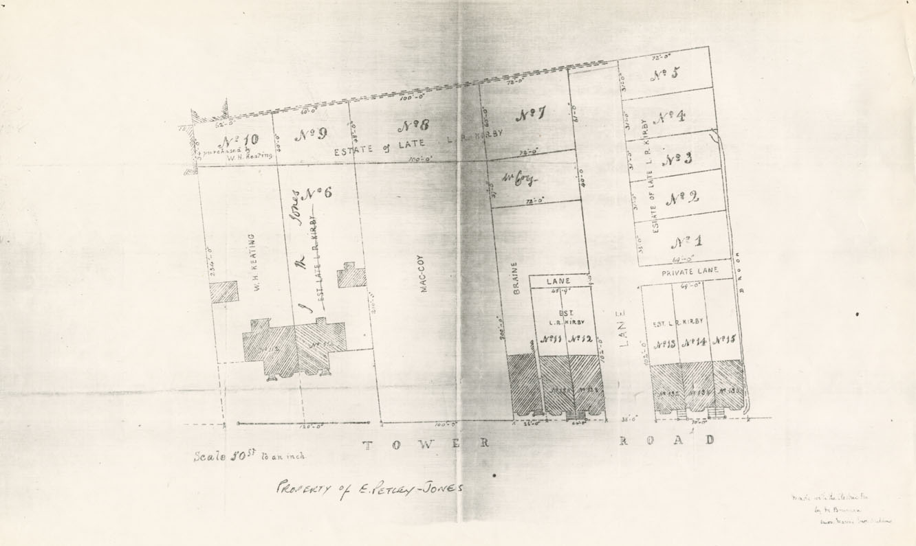
Abstract of the Title and Plan Property owned by Late L.R.Kirby situated in the South Suburbs…Known as Smith's Fields (Tower Rd.)
Date: 1878
Reference: Nova Scotia Archives Map Collection: F/240 - 1878
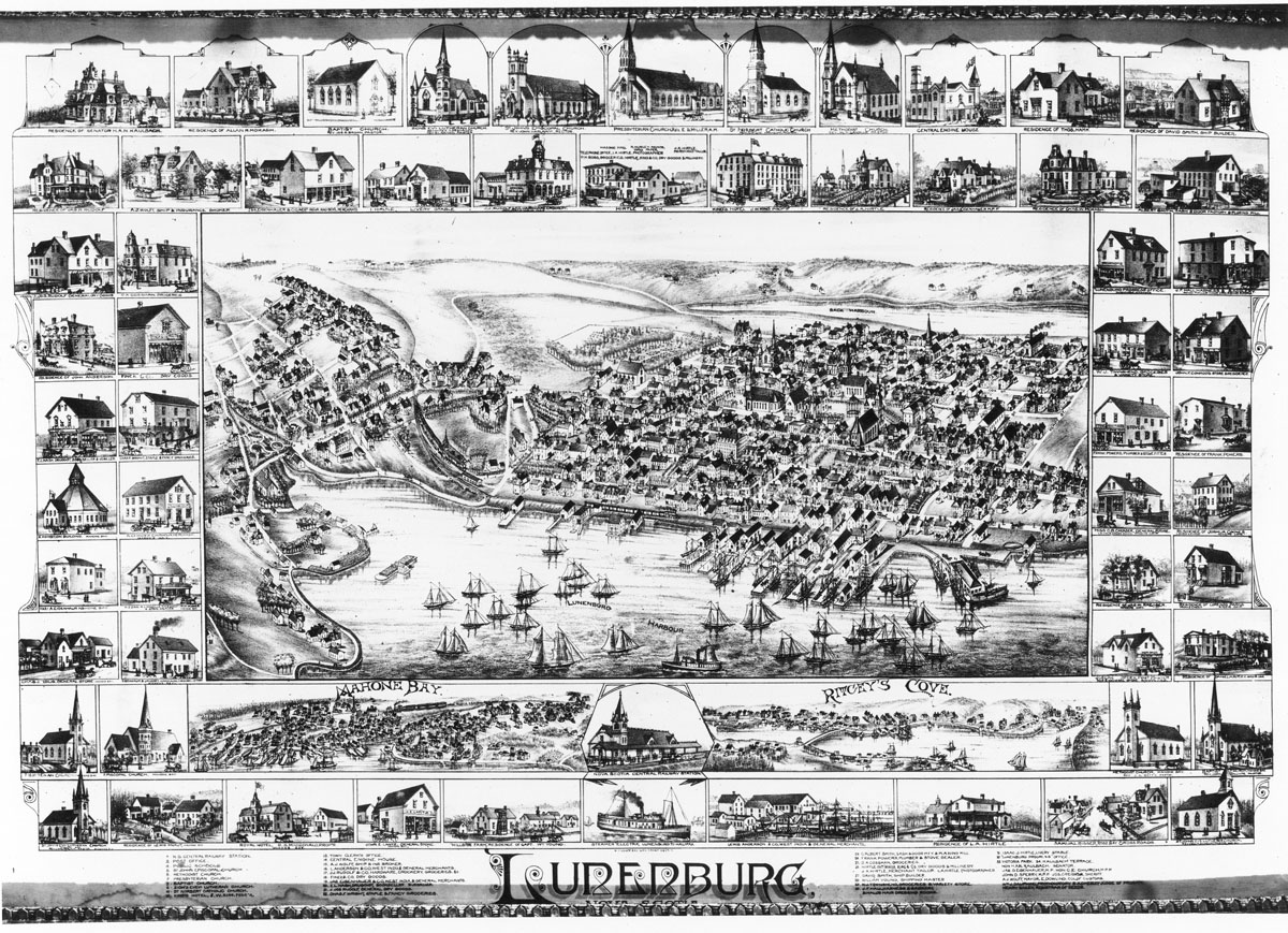
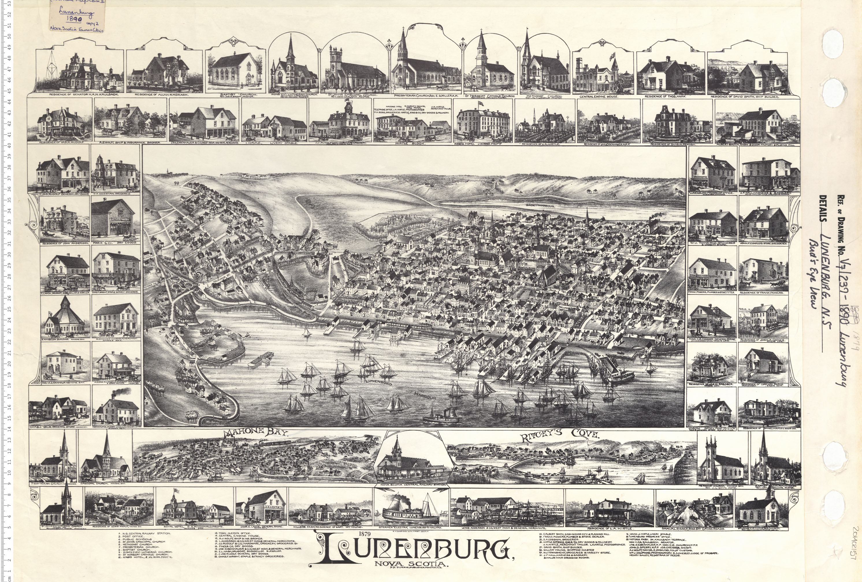
Lunenburg, N.S. Birds Eye View
Date: 1879
Reference: Nova Scotia Archives Map Collection: V7 239 Lunenburg, Nova Scotia
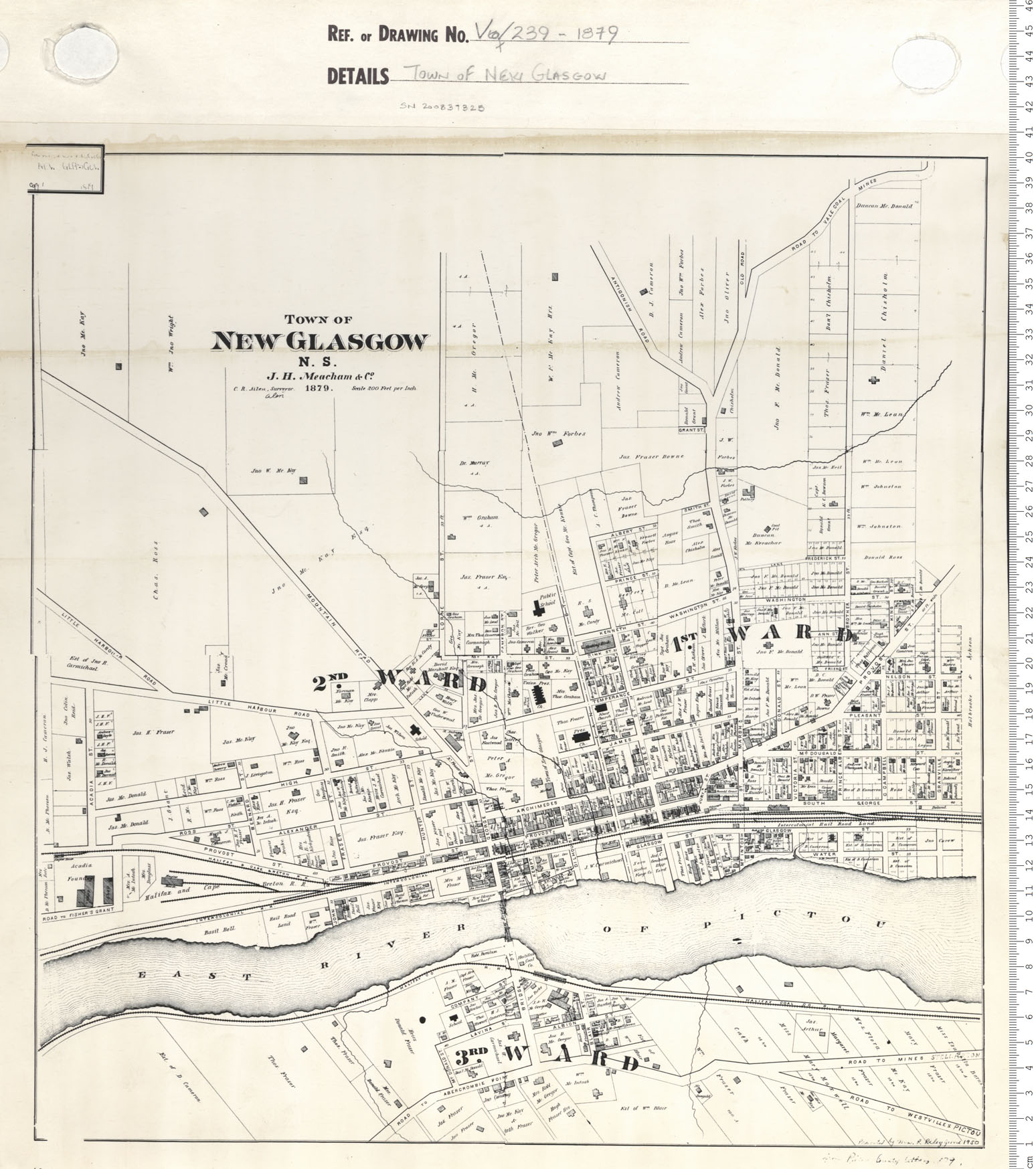
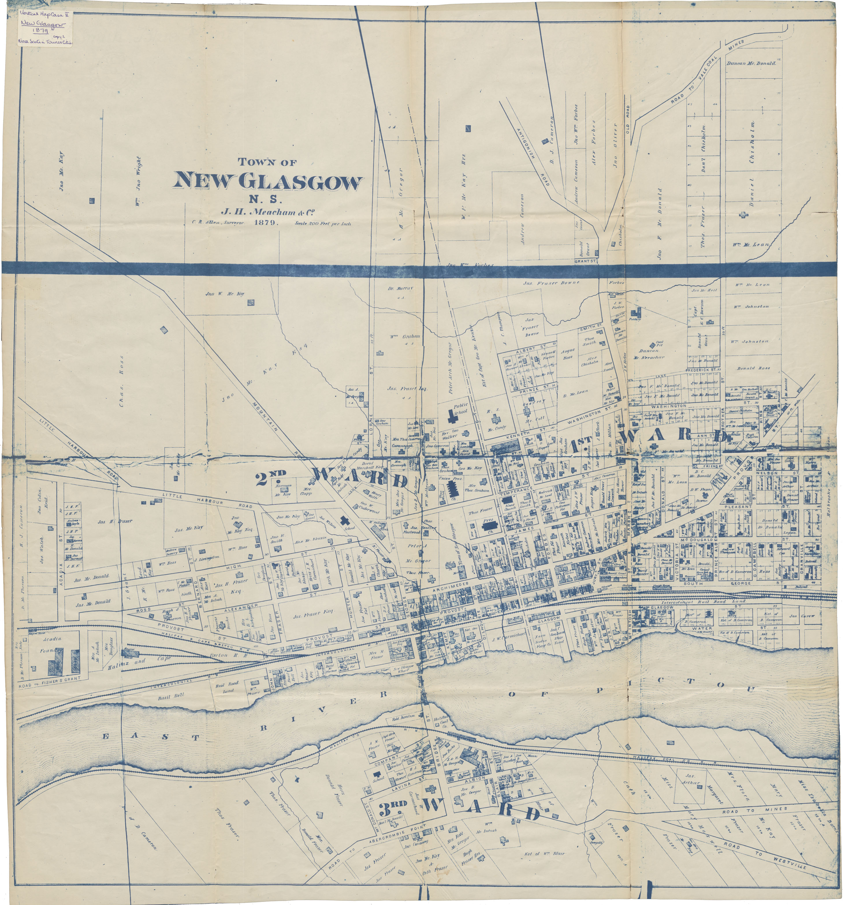
Town of New Glasgow
Date: 1879
Reference: Nova Scotia Archives Map Collection: V7 239 New Glasgow, Nova Scotia
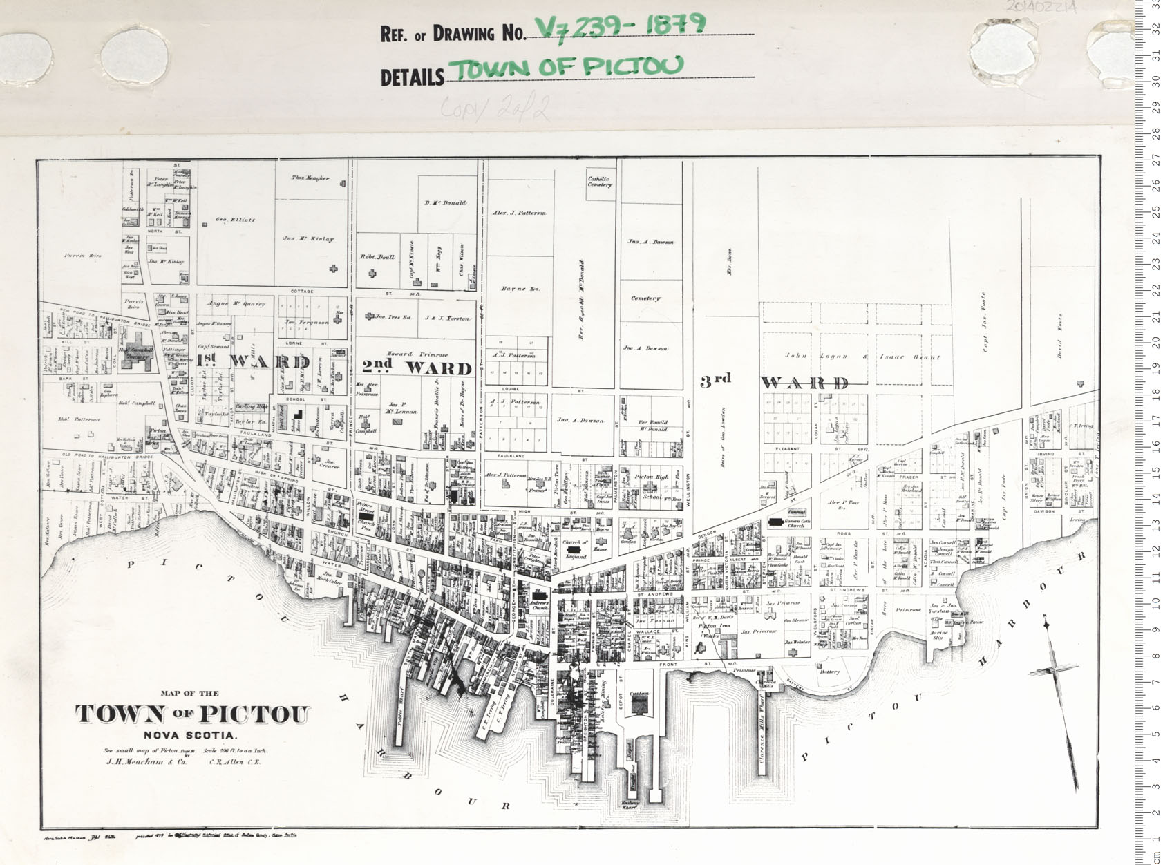
Town of Pictou
Date: 1879
Reference: Nova Scotia Archives Map Collection: V7 239 Pictou, Nova Scotia
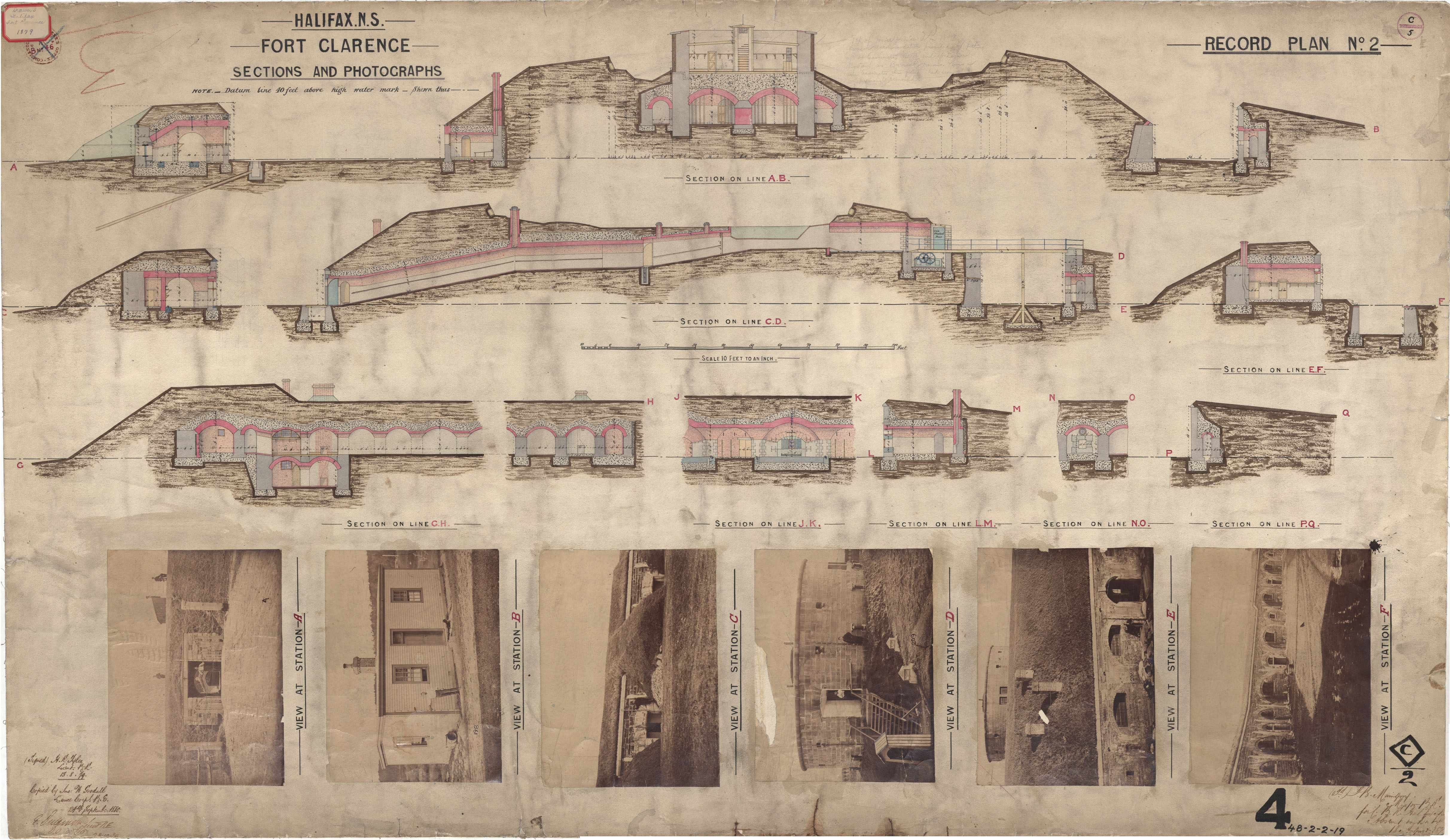
Fort Clarence - Sections and photographs
Date: 13 August 1879
Reference: Nova Scotia Archives Royal Engineers Maps and Plans 48 - 2 - 2 - 19
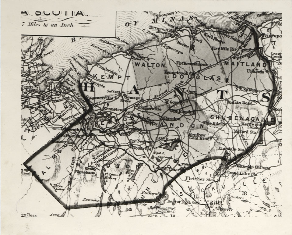
Map (photograph of) Hants County
Date: 1879
Reference: Nova Scotia Archives Map Collection: F/220 - 1879
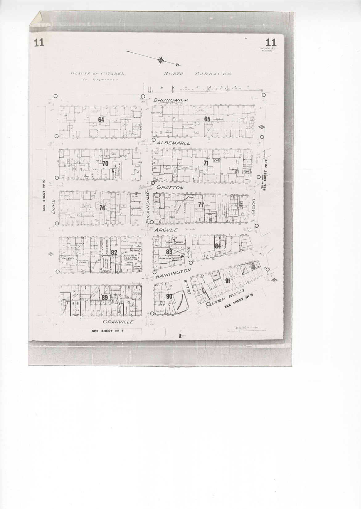
Part of Bird's Eye View of Halifax N.S. 1879
Date: 1879
Reference: Nova Scotia Archives Map Collection: F/240 - 1879
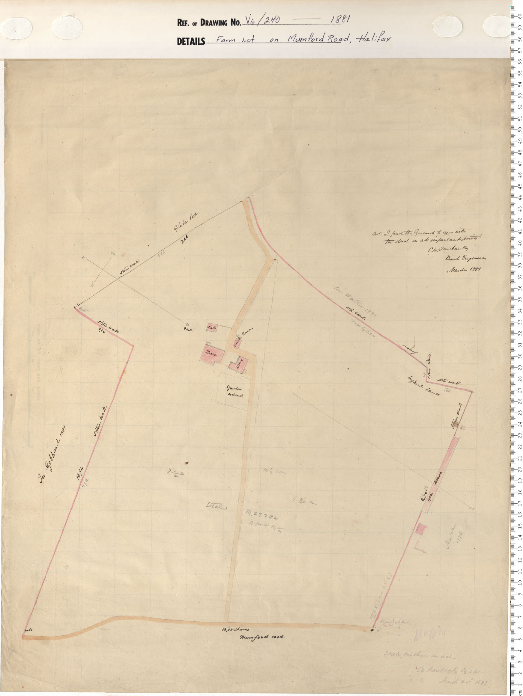
Farm Lot on Mumford Roll, Halifax
Date: 1880
Reference: Nova Scotia Archives Map Collection: V6 240 Halifax, Nova Scotia
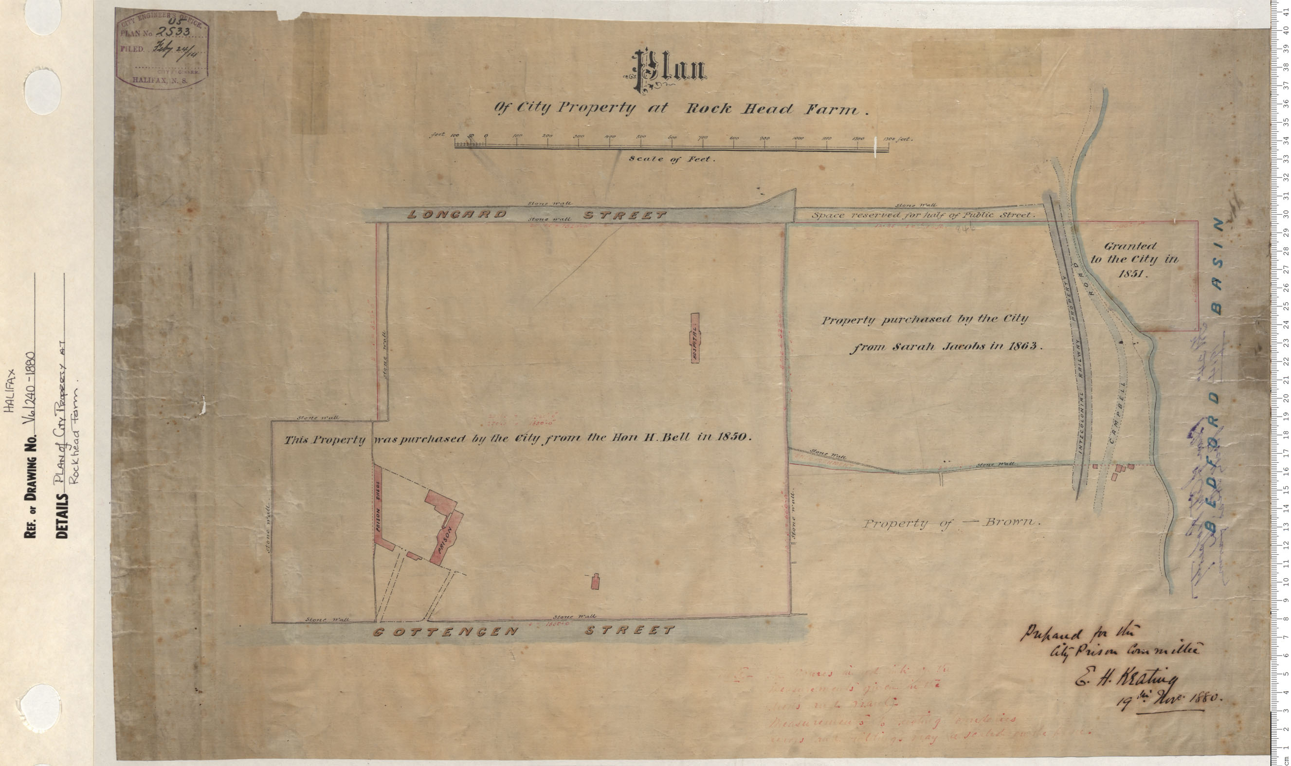
Plan of city Property at Rockhead Farm
Date: 1880
Reference: Nova Scotia Archives Map Collection: V6 240 Halifax, Nova Scotia
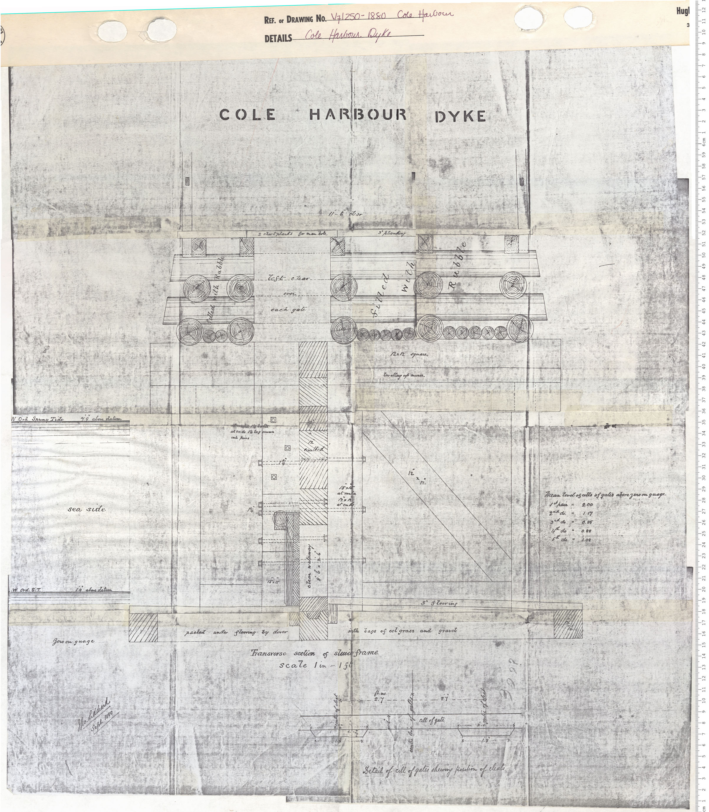
Cole Harbour Dyke
Date: 1880
Reference: Nova Scotia Archives Map Collection: V7 250 Cole Harbour, Nova Scotia
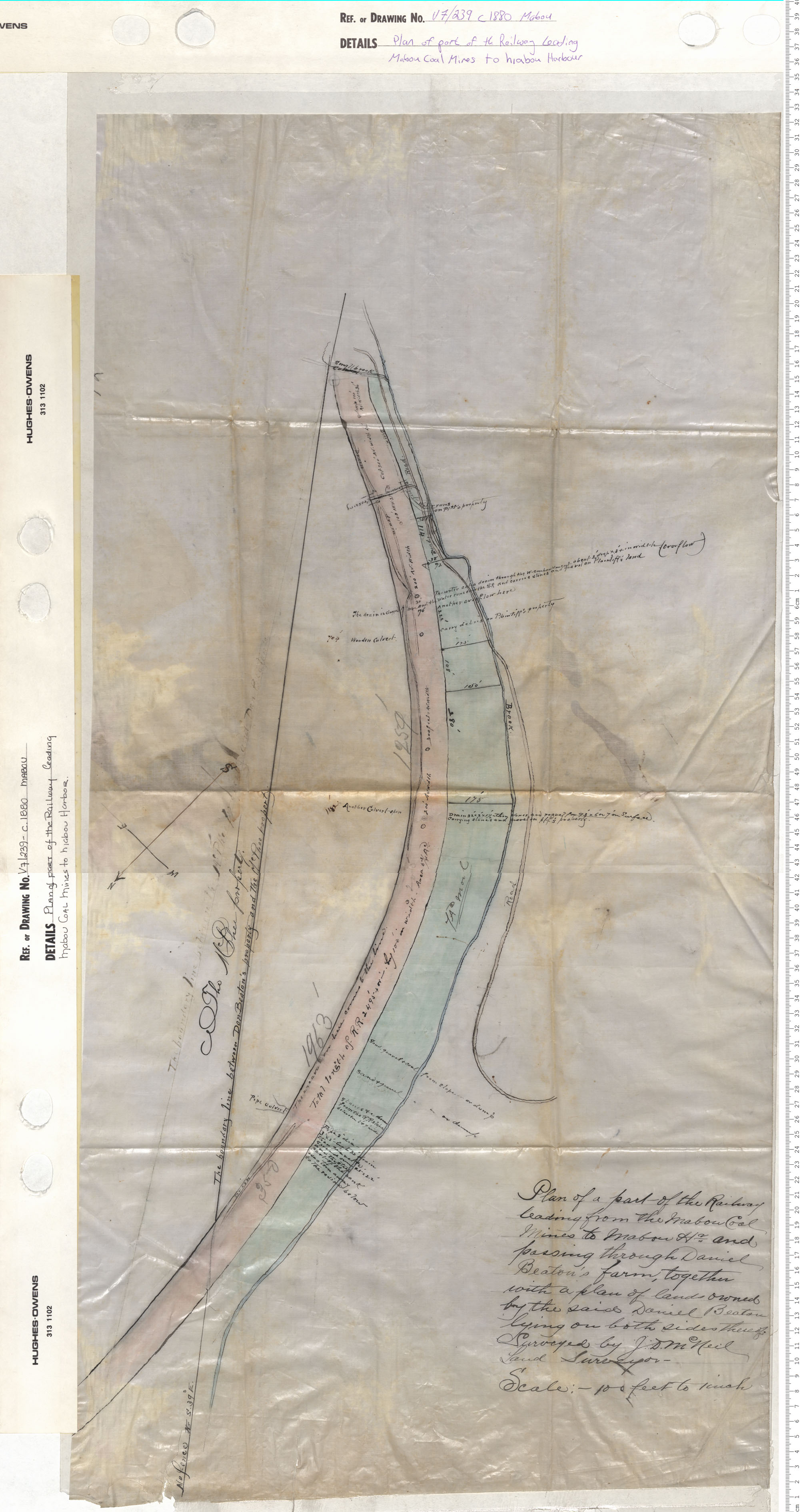
Plan of part of the Railway leading Mabou Coal Mines to Mabou Harbour
Date: 1880
Reference: Nova Scotia Archives Map Collection: V7 239 Mabou, Nova Scotia
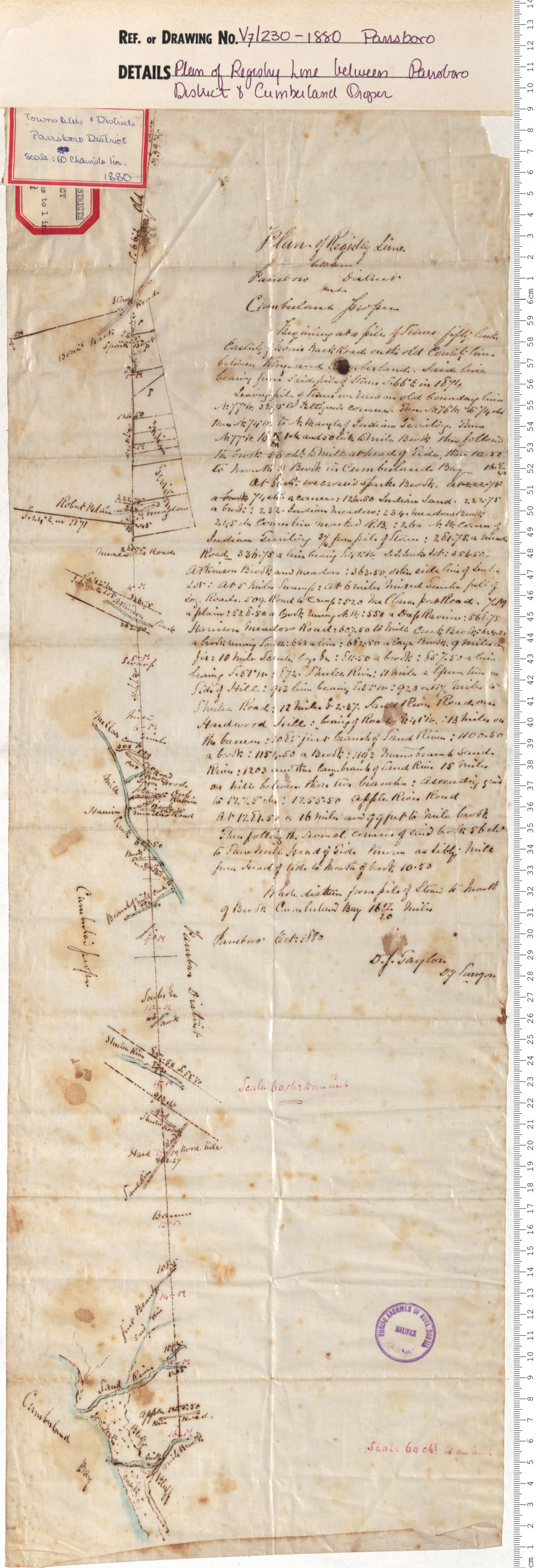
Plan of Registry Line between Parrsboro & Cumberland Proper
Date: 1880
Reference: Nova Scotia Archives Map Collection: V7 230 Parrsboro, Nova Scotia
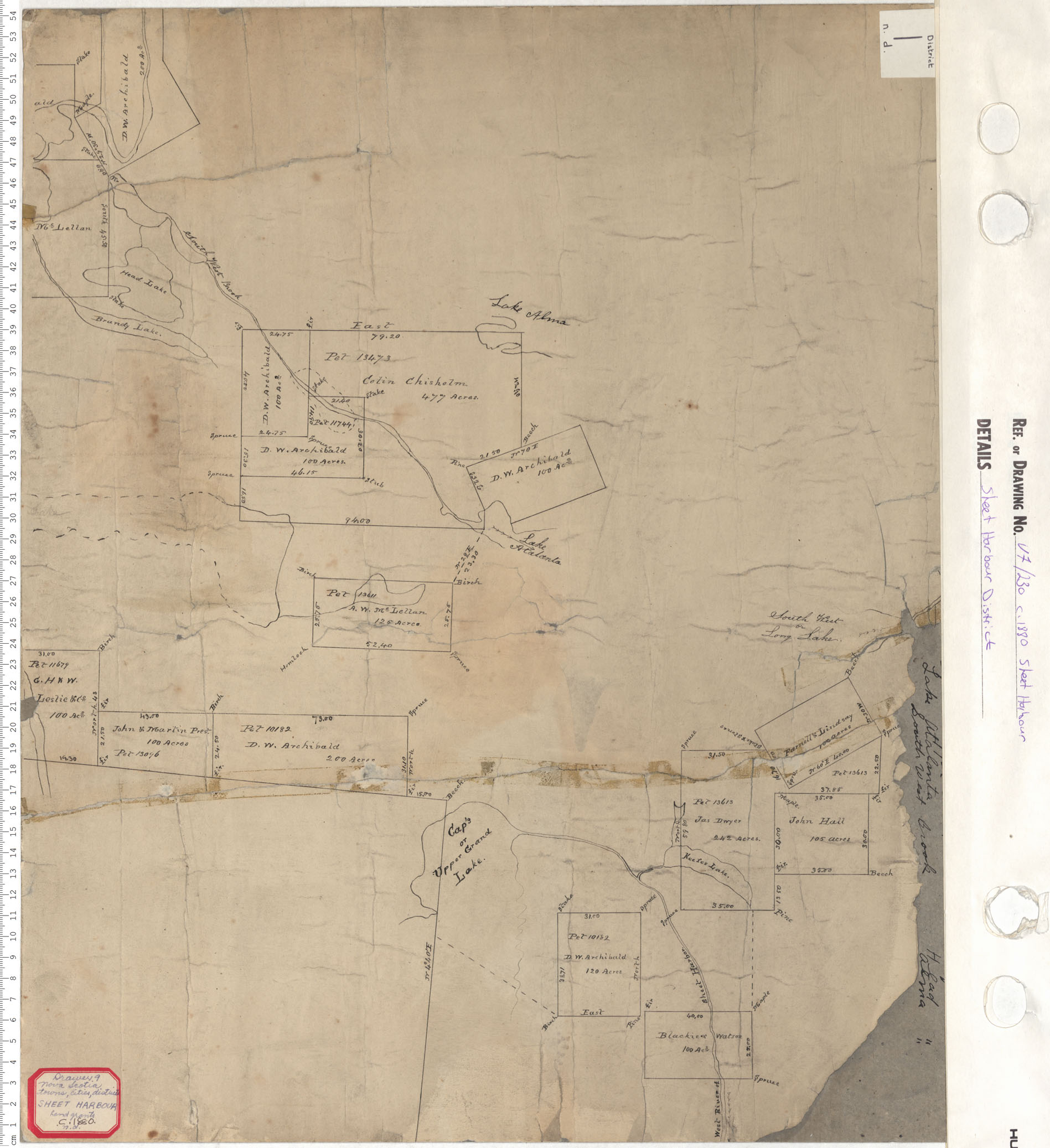
Sheet Harbour District
Date: 1880
Reference: Nova Scotia Archives Map Collection: V7 230 Sheet Harbour, Nova Scotia