Nova Scotia Archives
Historical Maps of Nova Scotia
Results 76 to 90 of 905 from your search: 1800
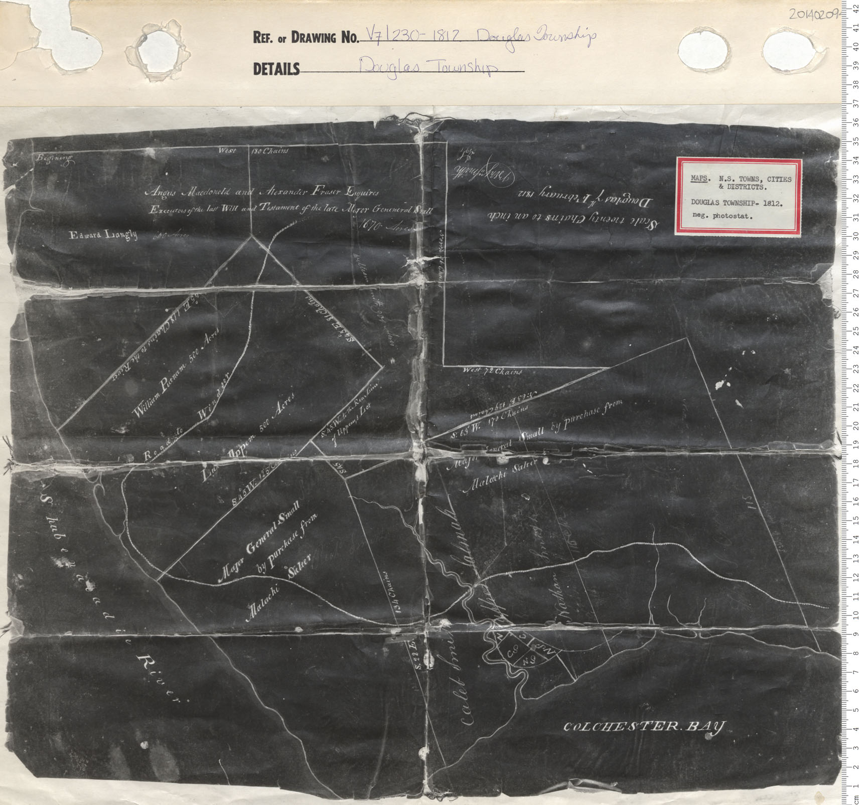
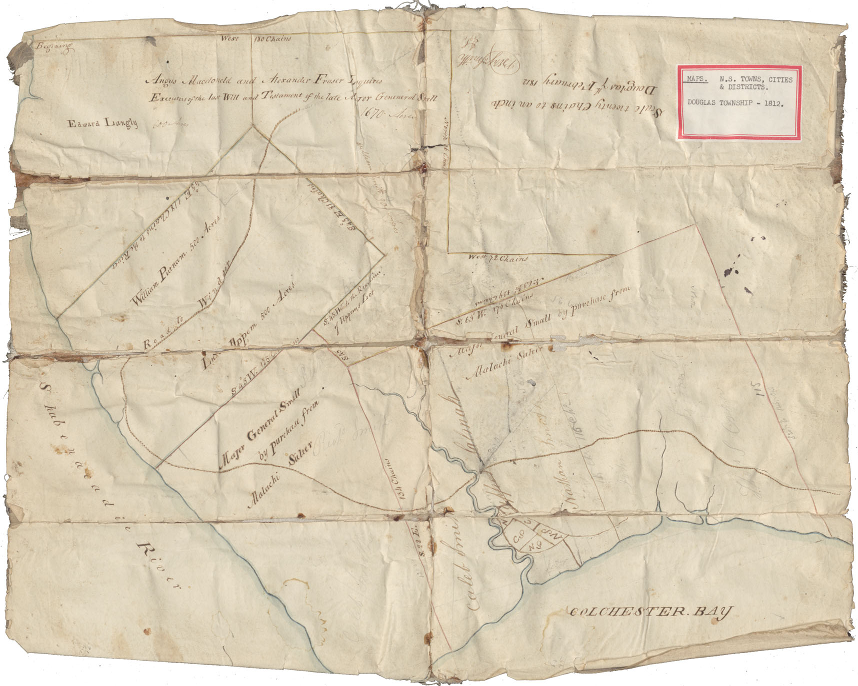
Douglas Township
Date: 1812
Reference: Nova Scotia Archives Map Collection: V7 230 Douglas Township, Nova Scotia
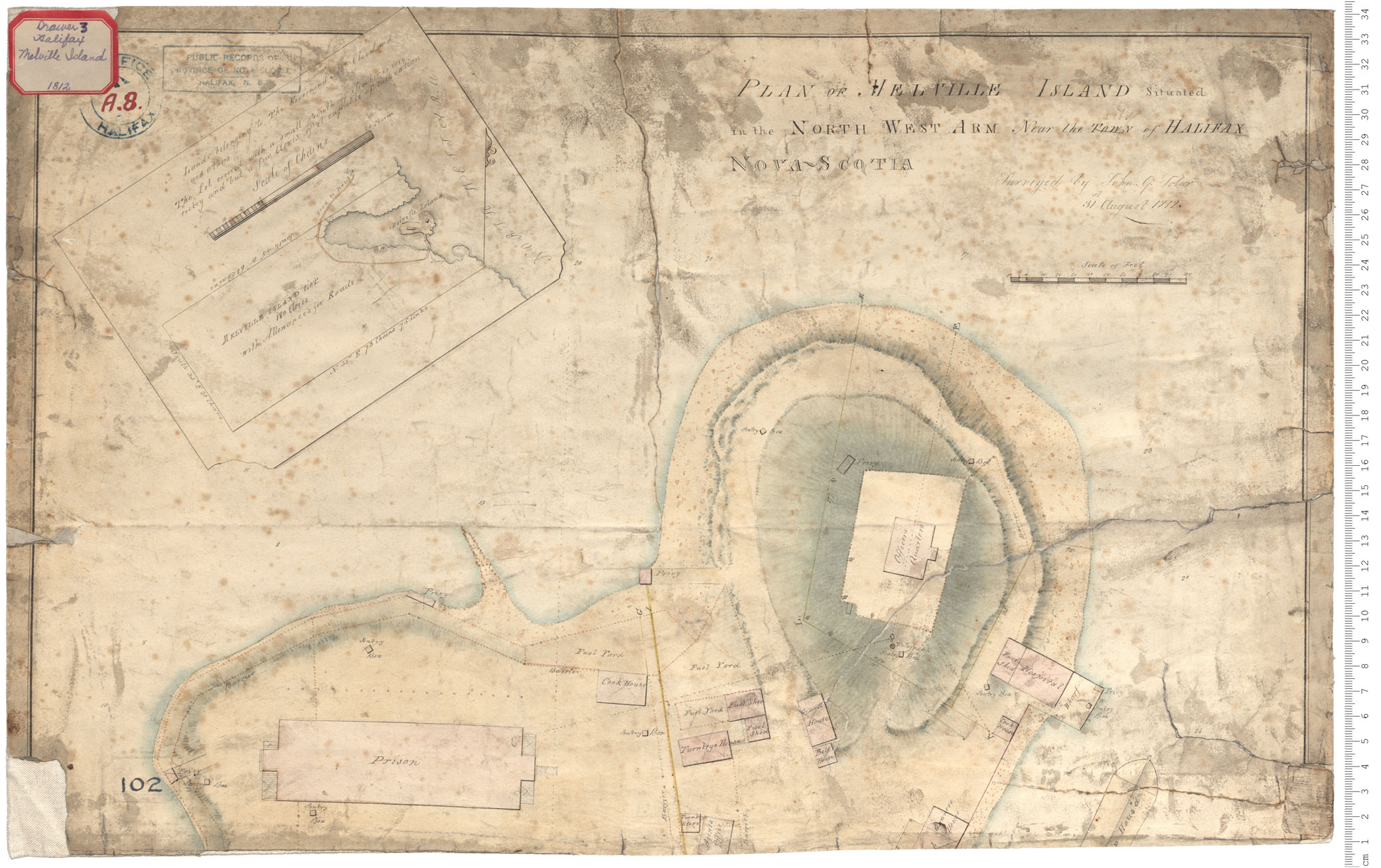
Melville Island - property
Date: 31 August 1812
Reference: Nova Scotia Archives Royal Engineers Maps and Plans A.08
Plan of part of Windsor Road Lots between Piggots and Montgomerys, Lake Pigot is near the South Boundary Rawdan Township
Date: 1812
Reference: Nova Scotia Archives Map Collection: F/209 - 1812
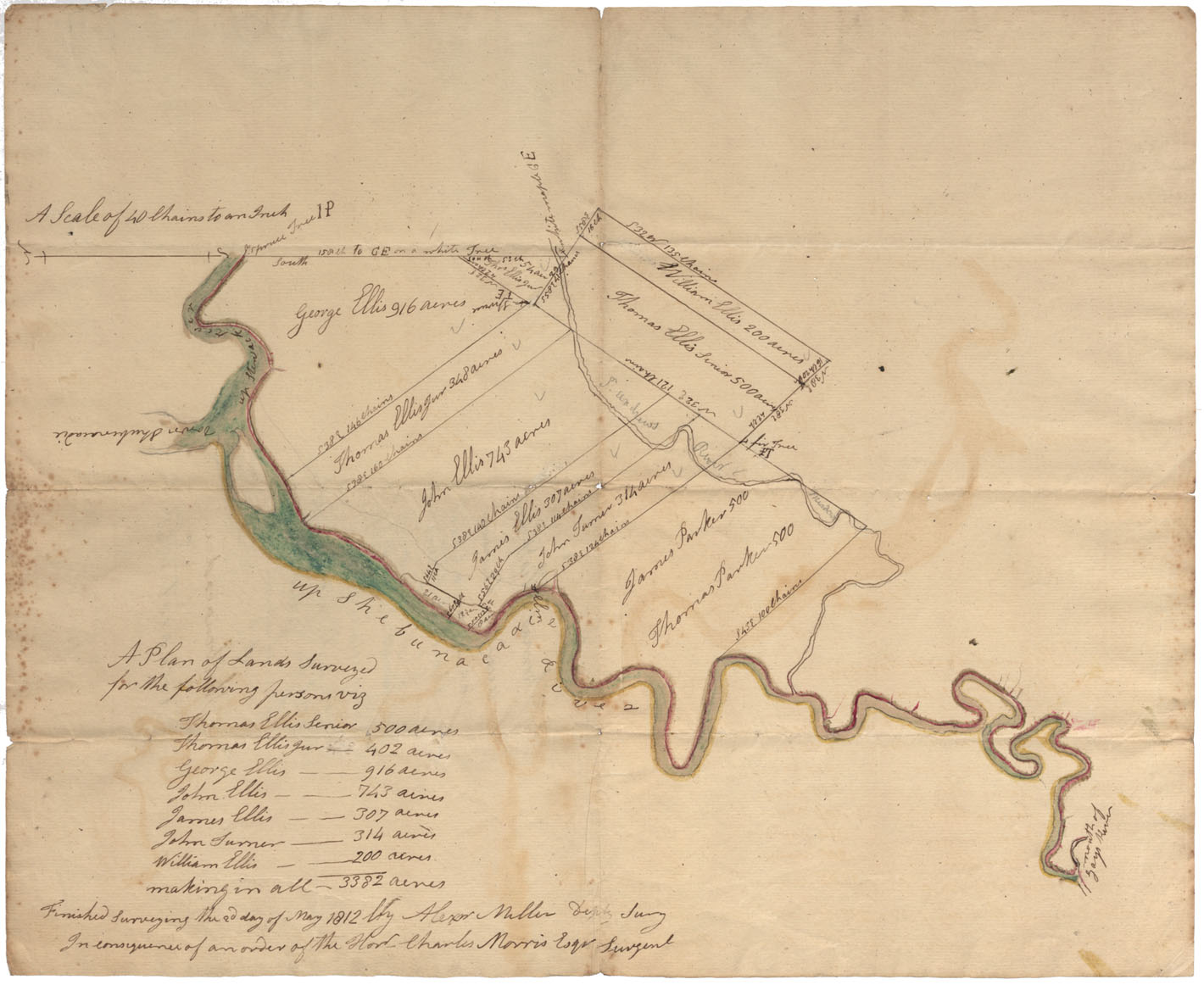
Lands on Shubenacadie River Lots on Upper Shubenacadie river, between Upper Stewiacke River & St. Andrew's River, 1812
Date: 2 May 1812
Reference: Nova Scotia Archives Map Collection: F/210 - 1812
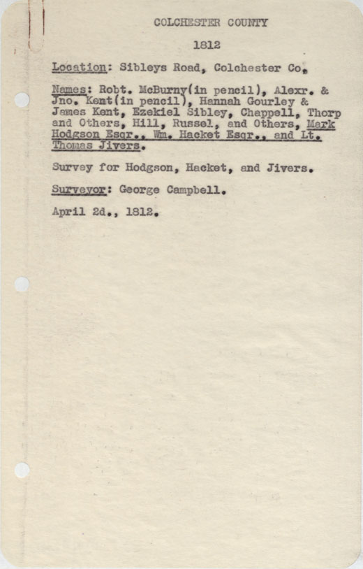
Colchester County Sibley's road, Col County
Date: 2 April 1812
Reference: Nova Scotia Archives Map Collection: F/230 - 1812
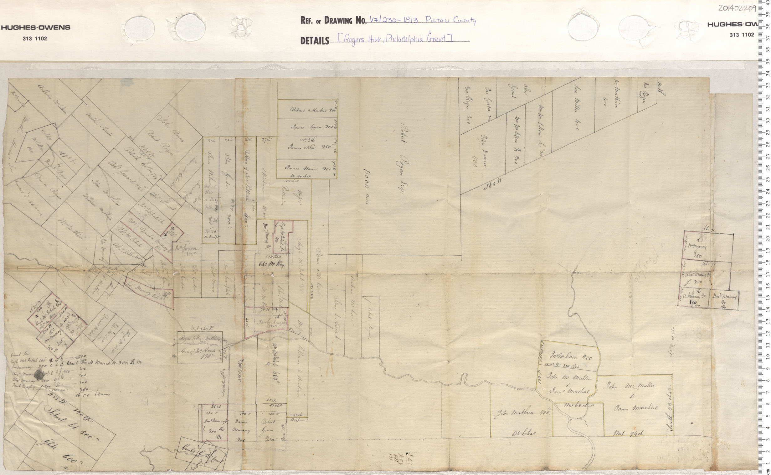
Rogers Hill, Philadelphia Grant
Date: 1813
Reference: Nova Scotia Archives Map Collection: V7 230 Pictou County, Nova Scotia
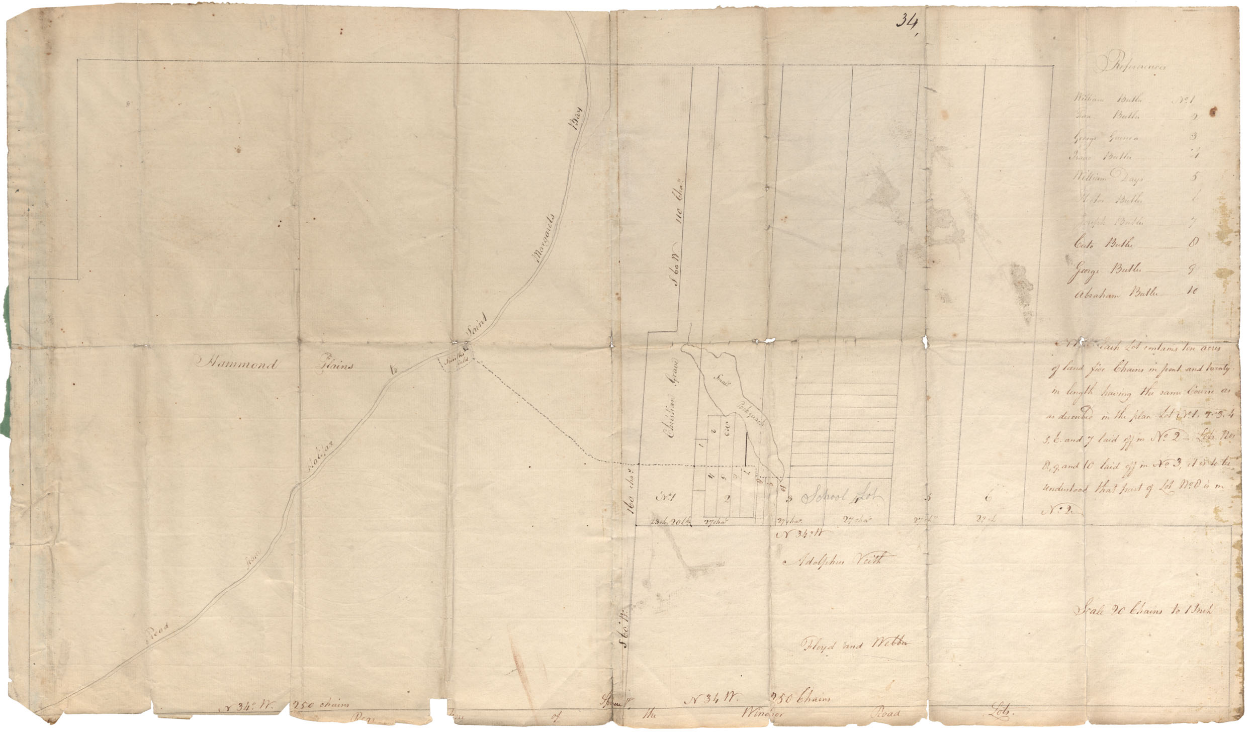
License to Blacks, Hammonds Plains
Date: 1813
Reference: Nova Scotia Archives RG 1 volume 419 number 34 in Map Collection: African Nova Scotians
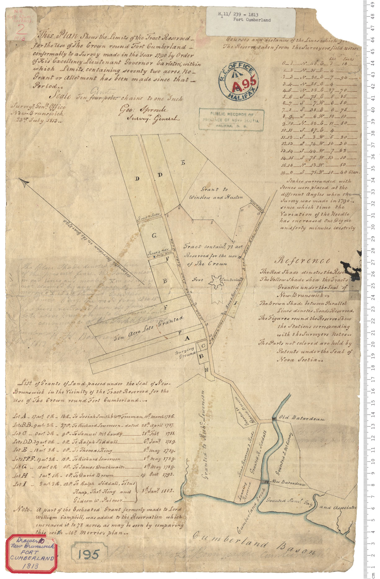
Fort Cumberland
Date: 23 July 1813
Reference: Nova Scotia Archives Royal Engineers Maps and Plans A.95
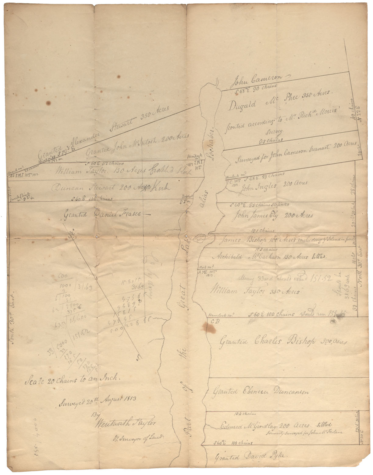
Antigonish County Lands bordering on "the Great Lake" alias Lochabee. 1813
Date: 1813
Reference: Nova Scotia Archives Map Collection: F/210 - 1813
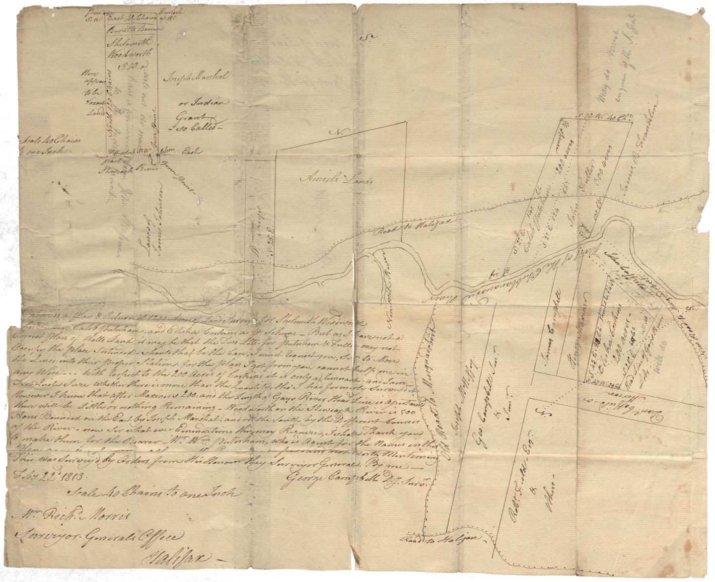
Lands on Shubenacadie River Lands on either side of Shubenacadie River, vicinity of Old Road to Musquodoboit & Nine Mile River, 1813
Date: 22 February 1813
Reference: Nova Scotia Archives Map Collection: F/210 - 1813
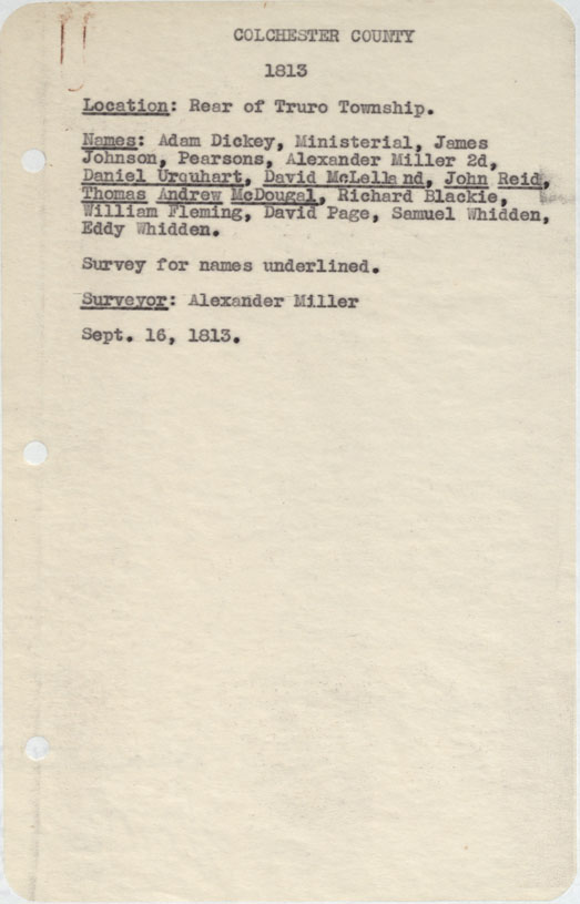
Colchester County Rear of Truro Township 1813
Date: 16 September 1813
Reference: Nova Scotia Archives Map Collection: F/230 - 1813
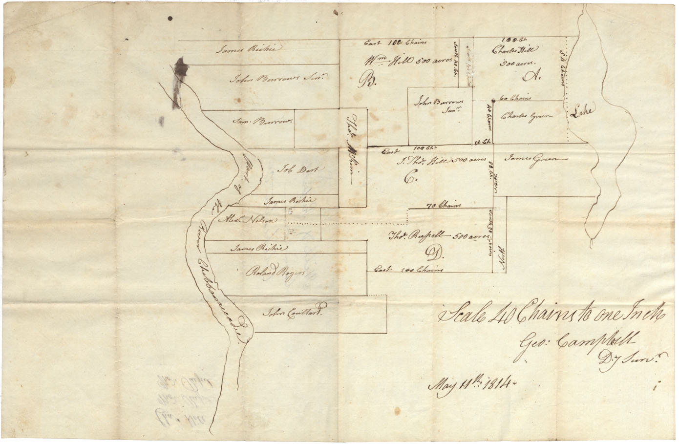
Lands of Shubenacadie River Between Shubenacadie River & a Lake, Colchester County 1814
Date: 11 May 1814
Reference: Nova Scotia Archives Map Collection: F/210 - 1814