Nova Scotia Archives
Mi'kmaw Teaching and Learning Resources
Maps
Archives are a great place to develop and use your skills of investigation. Archives work to preserve materials in their original context. 'Authentic', 'one-of-a-kind', and 'original' are all words used to describe archival materials. This makes them reliable and valid sources of information, or evidence of the past.
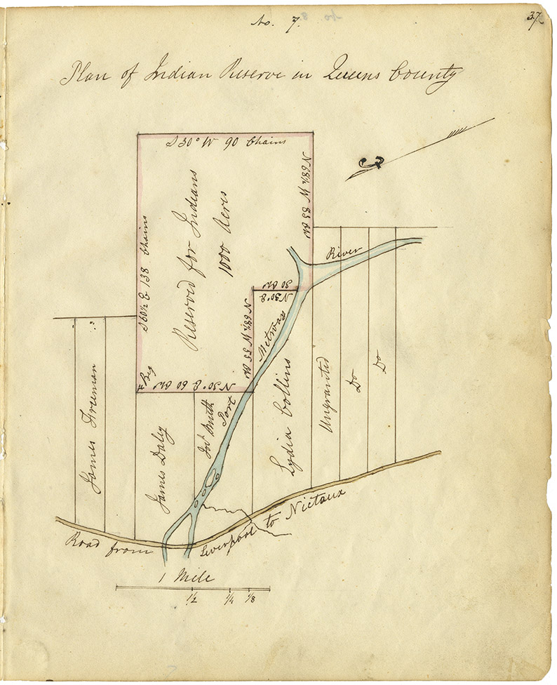
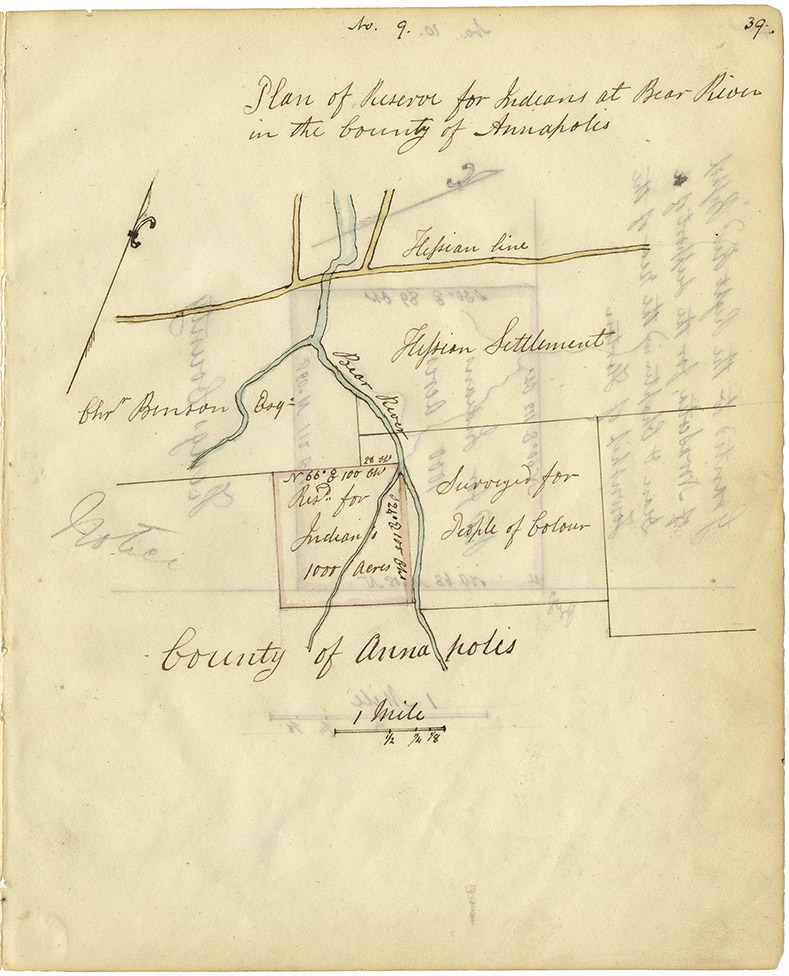
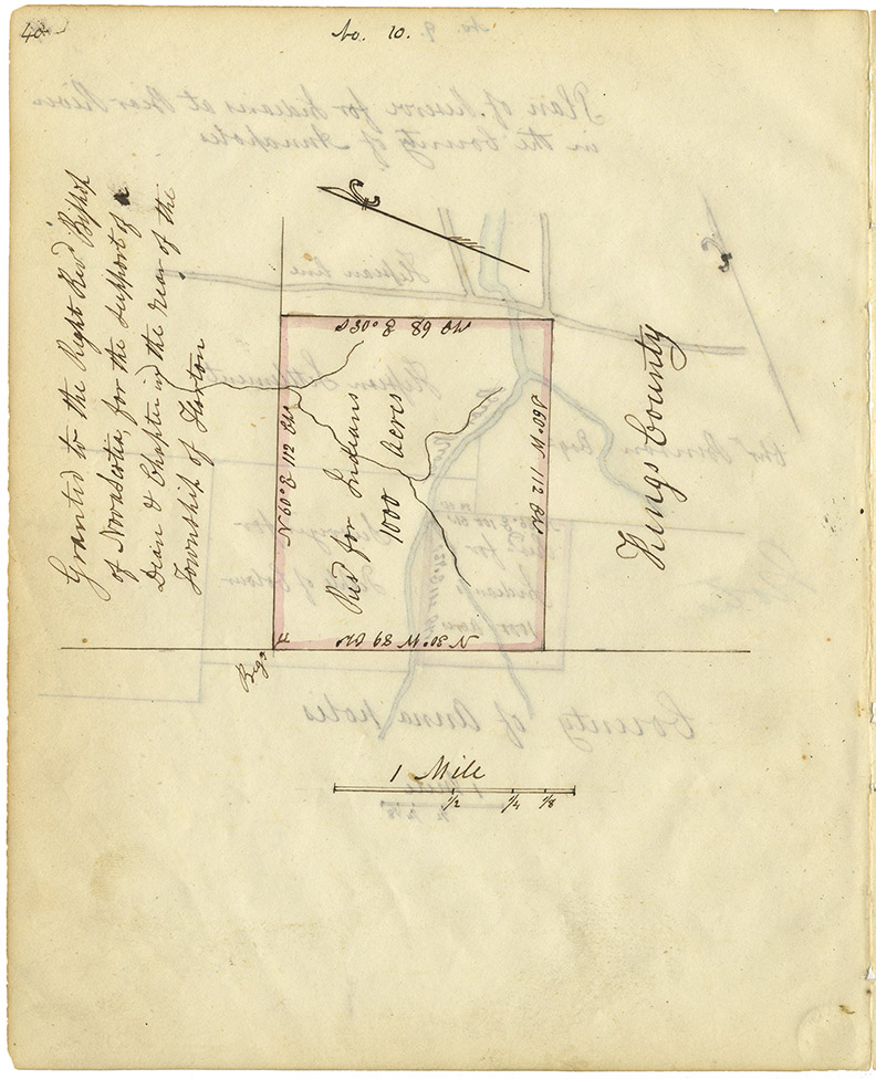
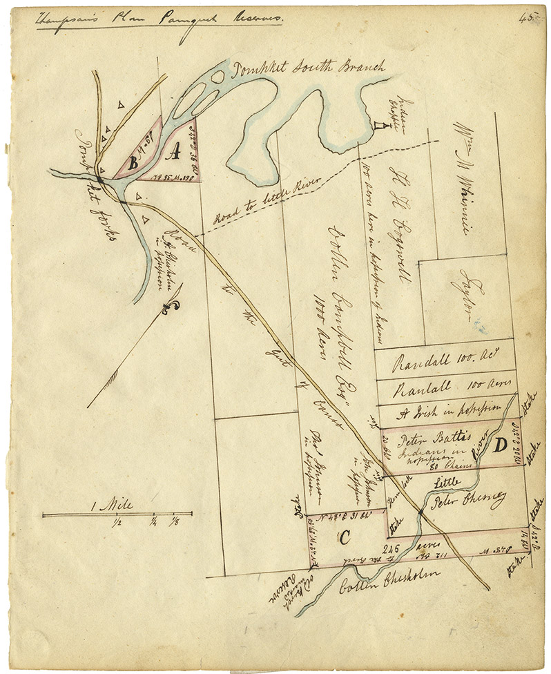
The earliest maps of Mi’kmaq lands were created by European cartographers (map makers) and show the biases of western culture. In the nineteenth century, the government began to ‘reserve’, or set aside, lands for the Mi’kmaq population, as you will see evidence of on some of the maps in this section.
These maps, while not created by the Mi’kmaq, did define Mi’kmaq proprietary rights in Nova Scotia and illustrate geographic areas of settlement (and resettlement) for Mi’kmaq people.
We invite you to explore the maps in this section of the resource, and have provided some questions to consider that may be helpful on your teaching and learning journey.
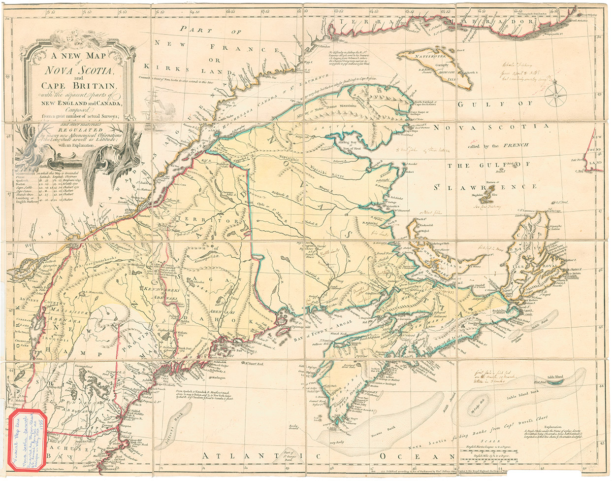
A New Map of Nova Scotia and Cape Britain and the adjacent parts of New England & Canada, 1755
Date: 1755
Publisher: Thomas Jefferys
Reference: Nova Scotia Archives Map Collection Nova Scotia Archives F/200-1755
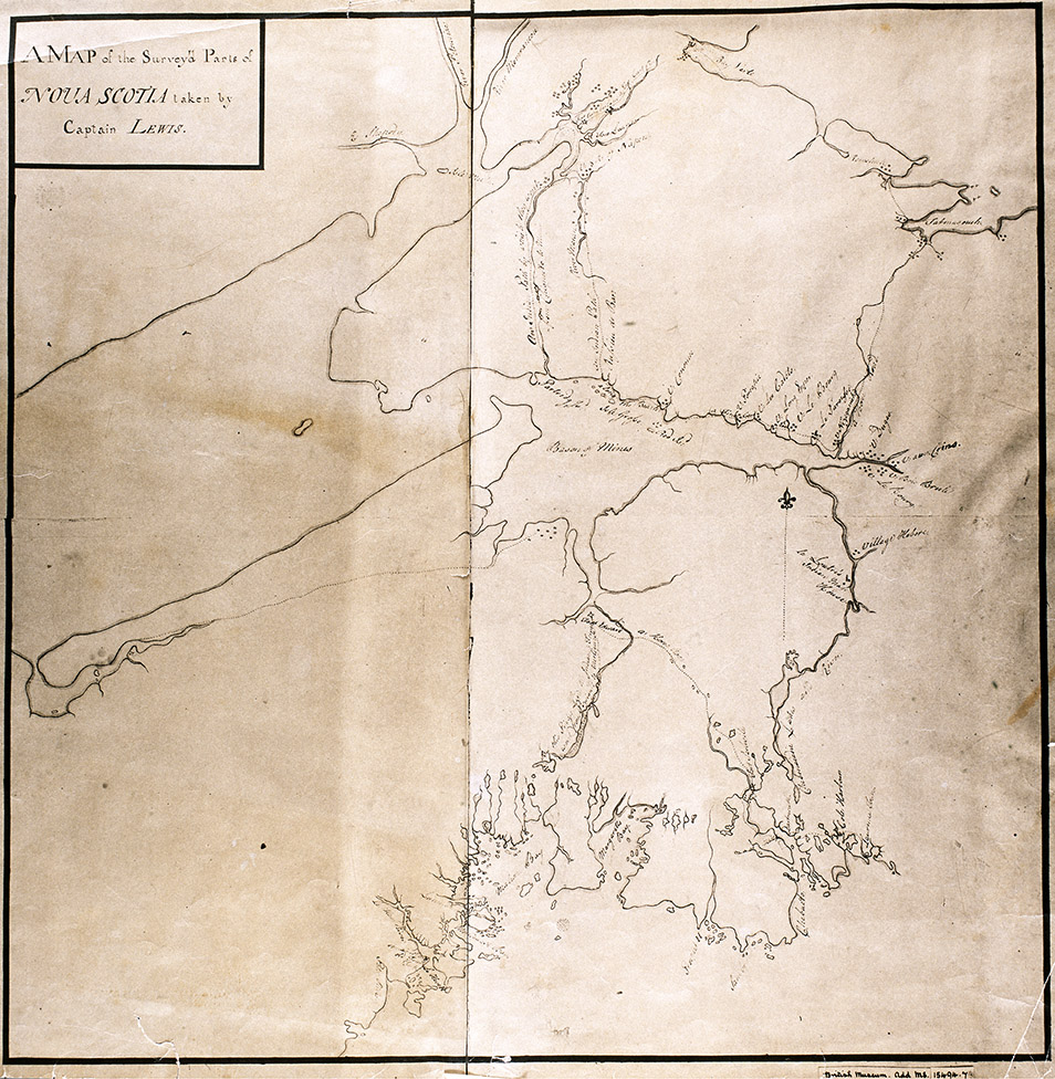
"Map of the surveyed parts of Nova Scotia taken by Captain Lewis, 1755."
Date: 1755
Cartographer: Captain Lewis
Reference: Nova Scotia Archives Map Collection Nova Scotia Archives F/202 - Nova Scotia 1755
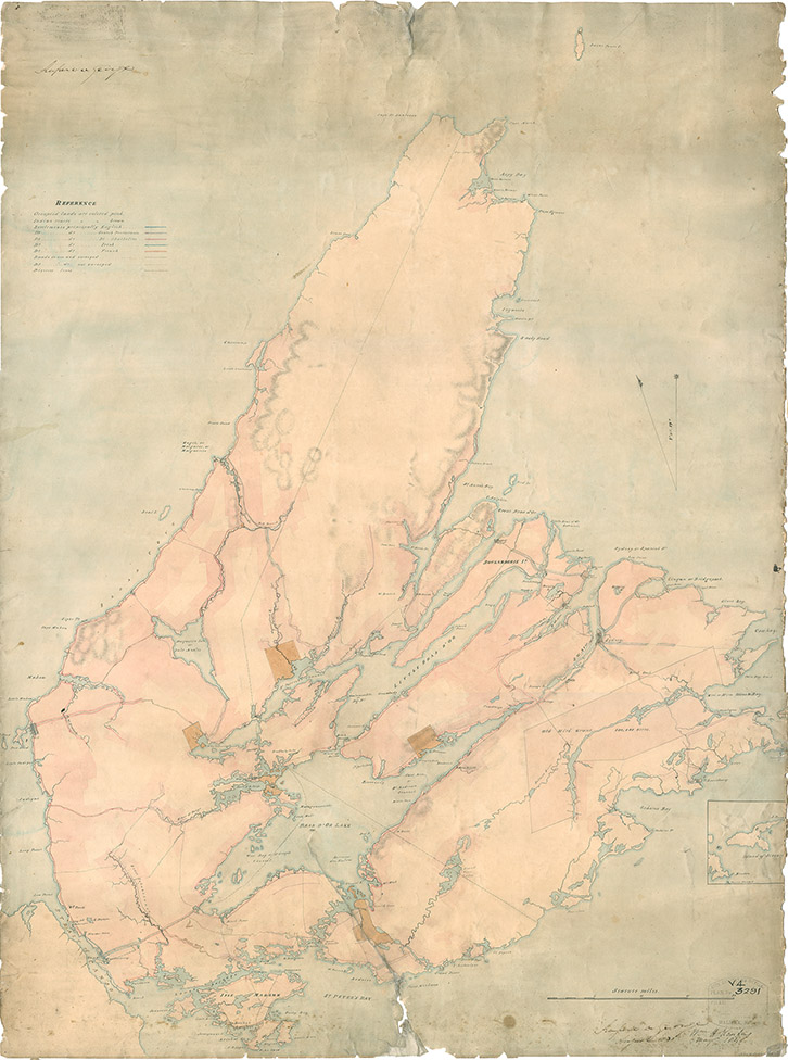
Map of Cape Breton, 1831
Date: 1831
Cartographer: John L. Johnston
Reference: Nova Scotia Archives Map Collection Nova Scotia Archives F/201 - Cape Breton 1831
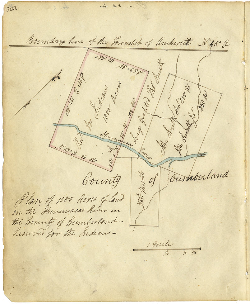
Mi'kmaq reservations in NS counties – Cumberland County
Date: 1842
Reference: Commissioner of Public Records — Indians series Nova Scotia Archives RG 1 Vol. 432 page 32
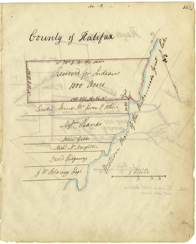
Mi'kmaq reservations in NS counties – Halifax County, west side Shubenacadie Lake
Date: 1842
Reference: Commissioner of Public Records — Indians series Nova Scotia Archives RG 1 Vol. 432 page 33
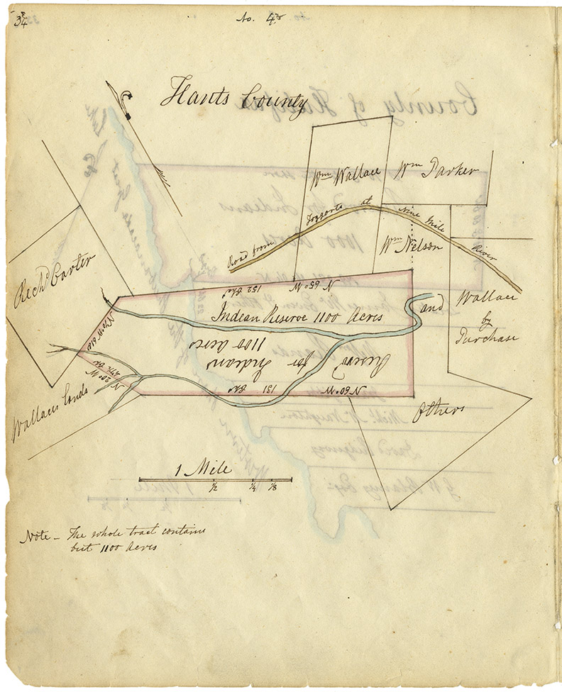
Mi'kmaq reservations in NS counties – Hants County
Date: 1842
Reference: Commissioner of Public Records — Indians series Nova Scotia Archives RG 1 Vol. 432 page 34
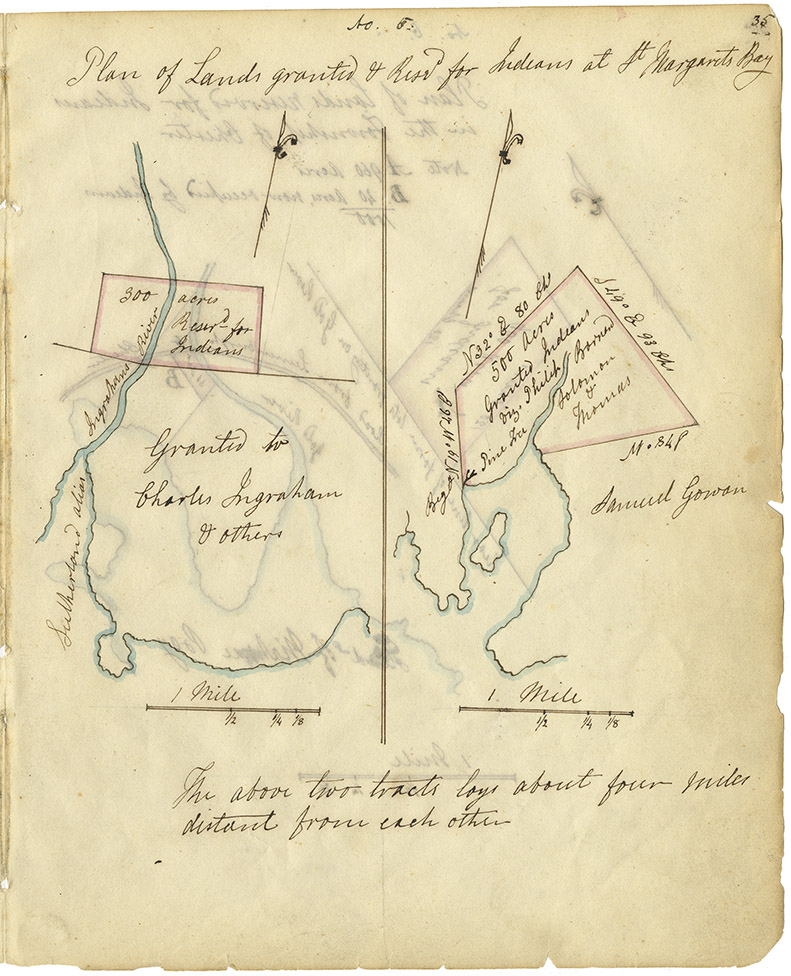
Mi'kmaq reservations in NS counties – Halifax County, St. Margaret's Bay
Date: 1842
Reference: Commissioner of Public Records — Indians series Nova Scotia Archives RG 1 Vol. 432 page 35
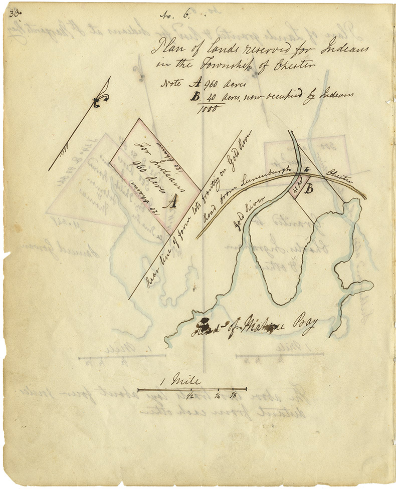
Mi'kmaq reservations in NS counties – Lunenburg County
Date: 1842
Reference: Commissioner of Public Records — Indians series Nova Scotia Archives RG 1 Vol. 432 page 36
Mi'kmaq reservations in NS counties – Queens County
Date: 1842
Reference: Commissioner of Public Records — Indians series Nova Scotia Archives RG 1 Vol. 432 page 37
Mi'kmaq reservations in NS counties – Annapolis County
Date: 1842
Reference: Commissioner of Public Records — Indians series Nova Scotia Archives RG 1 Vol. 432 page 39
Mi'kmaq reservations in NS counties – Kings County
Date: 1842
Reference: Commissioner of Public Records — Indians series Nova Scotia Archives RG 1 Vol. 432 page 40
Mi'kmaq reservations in NS counties – Sydney County
Date: 1842
Reference: Commissioner of Public Records — Indians series Nova Scotia Archives RG 1 Vol. 432 page 45
