Nova Scotia Archives
Mi'kmaw Teaching and Learning Resources
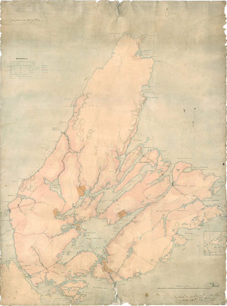
Map of Cape Breton, 1831
Includes First Nations settlements. Drawn by John L. Johnston. Signed "Rupert D. George, August 1831;" and "W.H. Keating, May 1848."
Date: 1831
Cartographer: John L. Johnston
Reference: Nova Scotia Archives Map Collection Nova Scotia Archives F/201 - Cape Breton 1831
Questions to Consider
- When do you think the map was made?
- Can you think of any specific reason(s) why this map was made?
- Who do you think would have used this map?
- Where do you think the map was made?
- What does the map provide information about, or evidence of?
- Do you recognize any place names from the map? How might place names change over time?
- How do you thin the map reflects the attitudes and values of the time when it was created?

