Nova Scotia Archives
Mi'kmaw Teaching and Learning Resources
Mi'kmaq reservations in NS counties – Sydney County
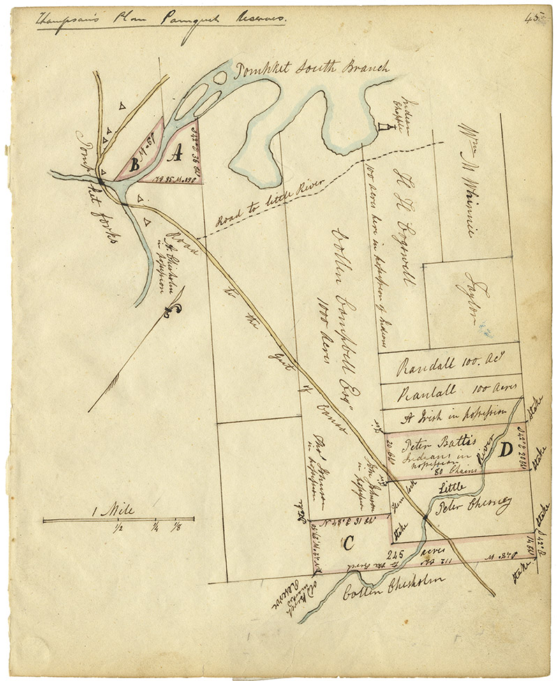
Indian Commissioner Joseph Howe's first "Report on Indian Affairs" [see Journals of the House of Assembly, 25 January 1843, Appendix 1, p. 3] states that Howe had received plans of Mi'kmaq Reserves in Nova Scotia from the Surveyor General and copied them into his note book [RG 1 v. 432]. The original map comprises nine individual plans on one sheet, each signed by John Spry Morris, Surveyor General, 20 May 1842. Howe's copies are embedded in narrative descriptions of his thoughts and encounters as he visited each reservation. An earlier and similar version of the original surveyor General's map may be viewed on microfilm 14011. Sydney County, created in 1784, encompassed basically what is now Antigonish and Guysborough Counties. In 1836, Guysborough County was created out of the southern portion of the original Sydney County, reducing its size. In 1863, the name of the northern portion of Sydney County was changed to Antigonish County.
Date: 1842
Reference: Commissioner of Public Records — Indians series Nova Scotia Archives RG 1 Vol. 432 page 45
Questions to Consider
- When do you think the map was made?
- Can you think of any specific reason(s) why this map was made?
- Who do you think would have used this map?
- Where do you think the map was made?
- What does the map provide information about, or evidence of?
- Do you recognize any place names from the map? How might place names change over time?
- How do you thin the map reflects the attitudes and values of the time when it was created?

