Nova Scotia Archives
African Nova Scotian Teaching and Learning Resources
Maps
Archives are a great place to develop and use your skills of investigation. Archives work to preserve materials in their original context. 'Authentic', 'one-of-a-kind', and 'original' are all words used to describe archival materials. This makes them reliable and valid sources of information, or evidence of the past.
The maps and plans in this section feature areas of African Nova Scotian settlement and land use in Nova Scotia.
We invite you to explore these maps and plans, and have provided some 'questions to consider' that may help in your teaching and learning journey.
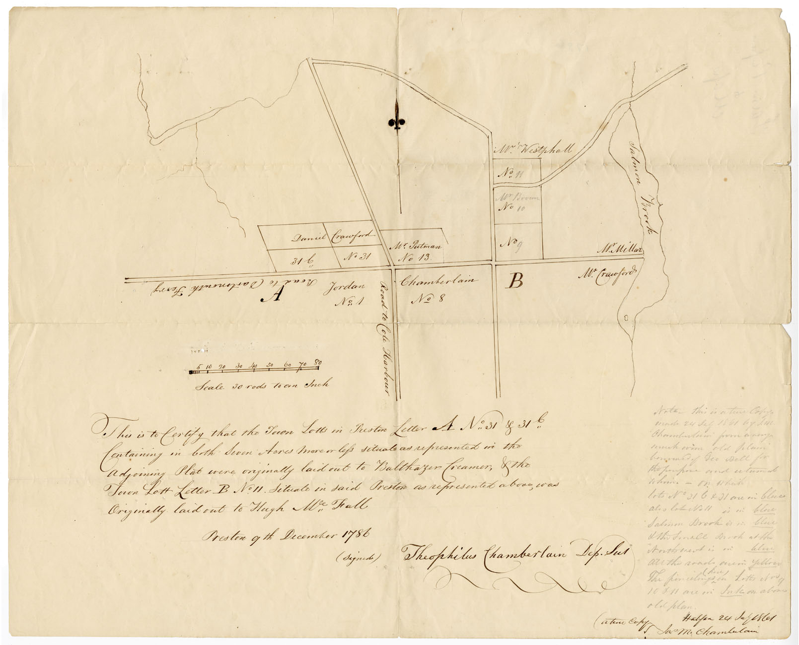
Preston Letter A and Letter B
Date: 9 December 1786
Reference: Nova Scotia Archives Map Collection: F/230 - 1786 African Nova Scotians
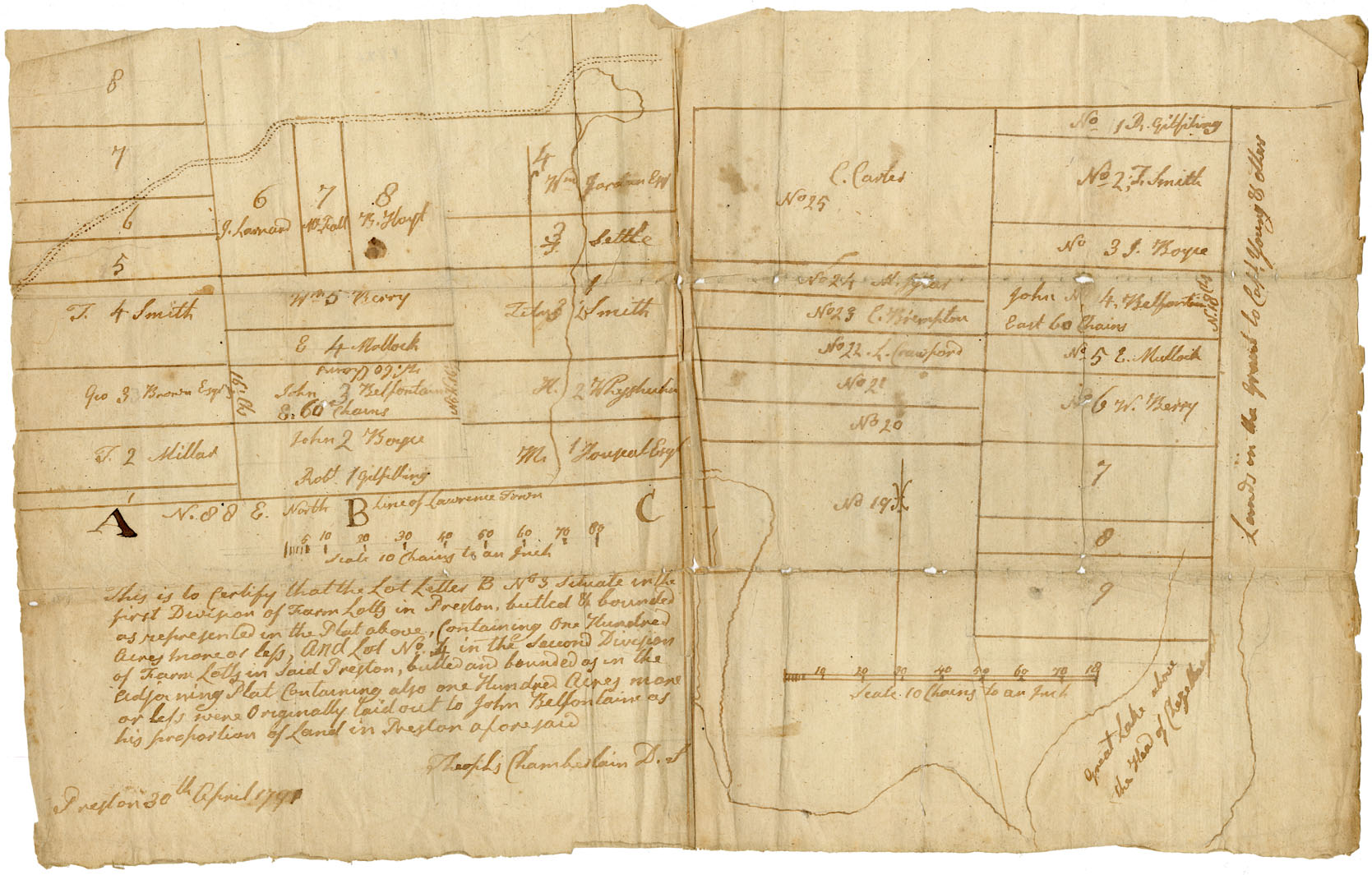
Preston Township
Date: 30 April 1791
Reference: Nova Scotia Archives Map Collection: F/230 - 1791 African Nova Scotians
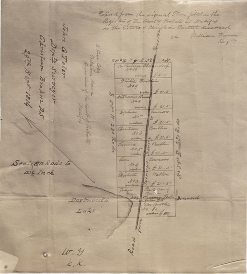
Dartmouth, Property on Road from Dartmouth to Preston
Date: 29 September 1814
Reference: Nova Scotia Archives Map Collection: F/239 - 1814
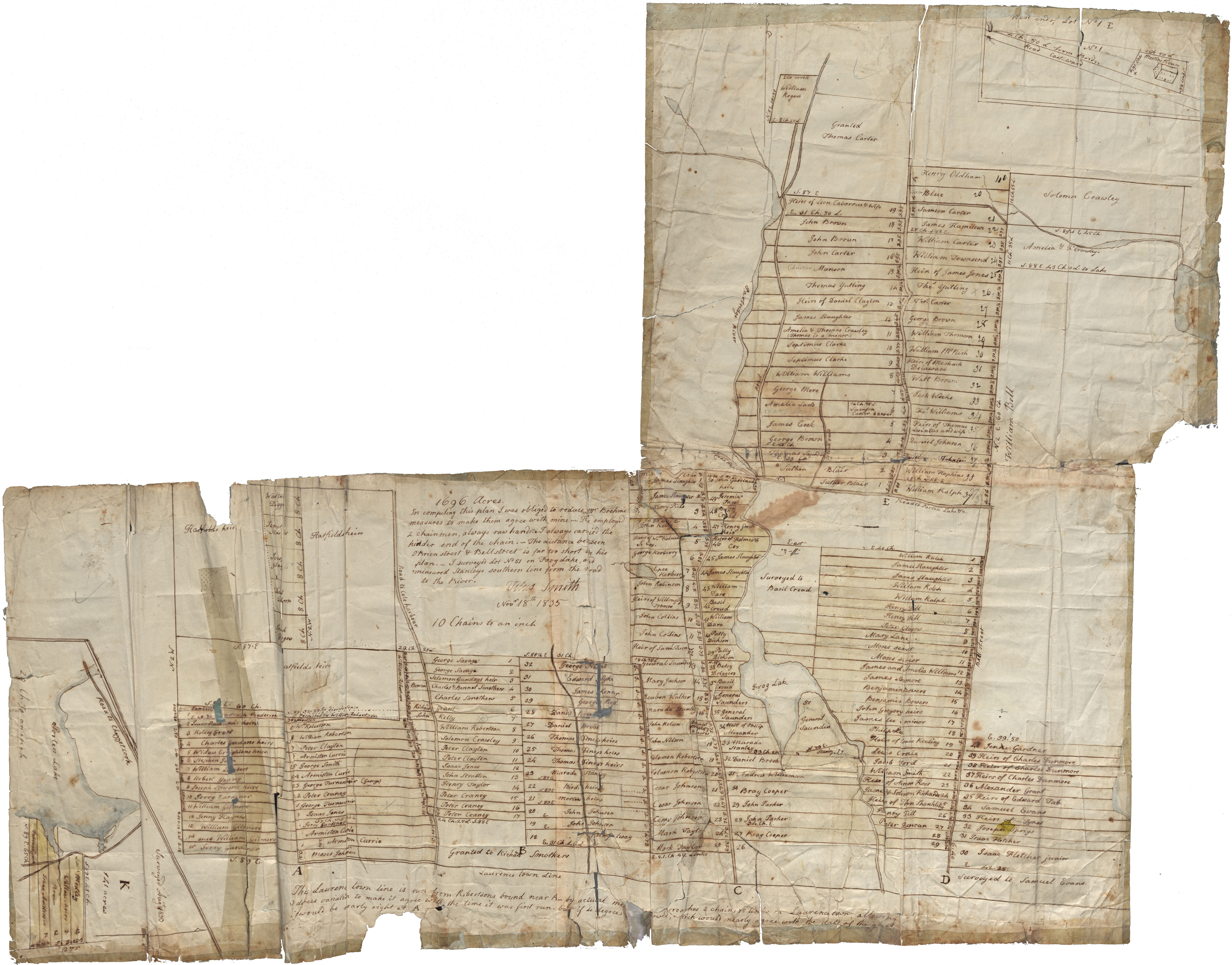
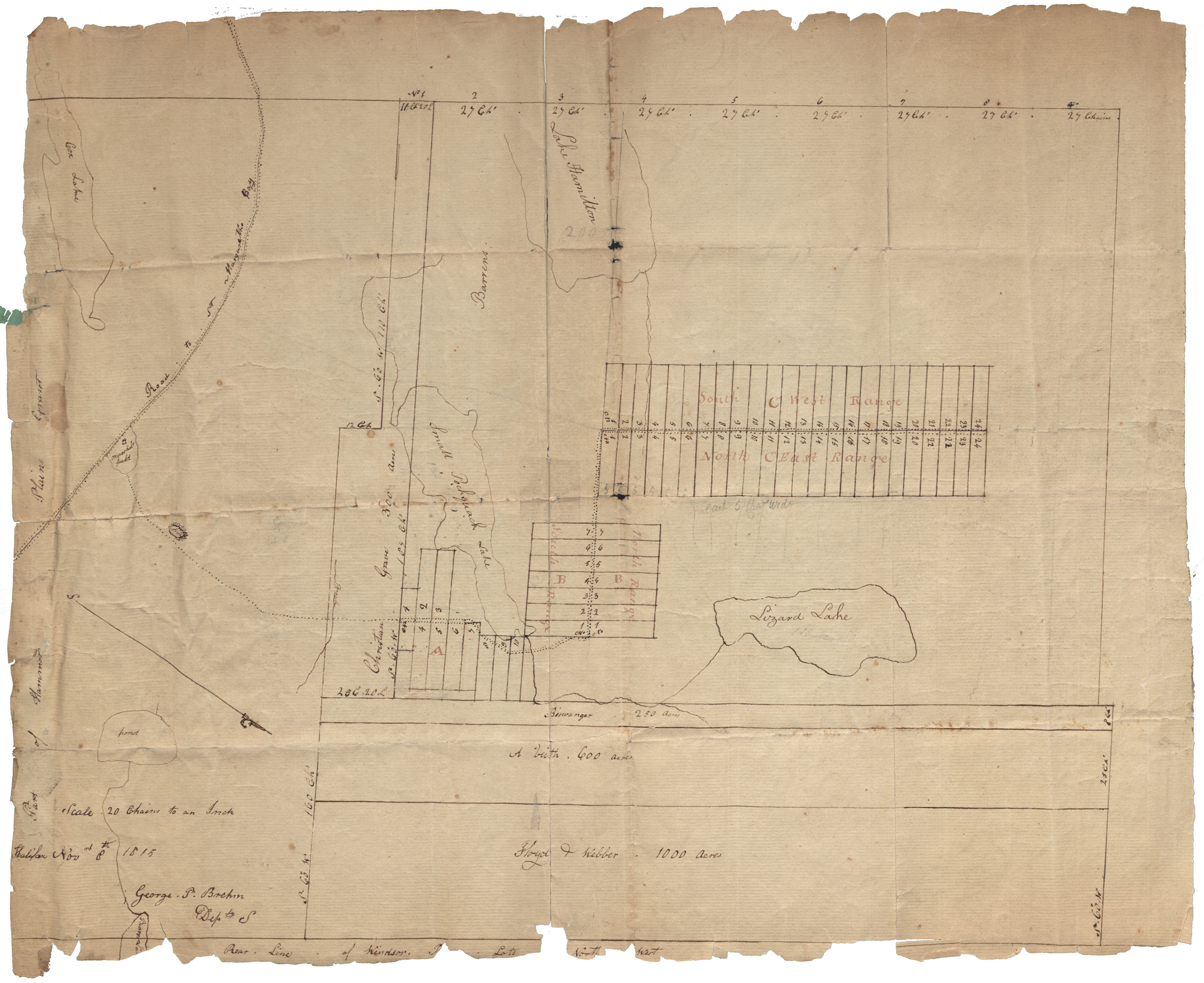
Mr. Titus Smith's plan of the tract of 1696 acres surveyed for Black people at Preston
Date: 18 November 1835
Reference: Commissioner of Public Records Nova Scotia Archives RG 1 volume 419 number 20
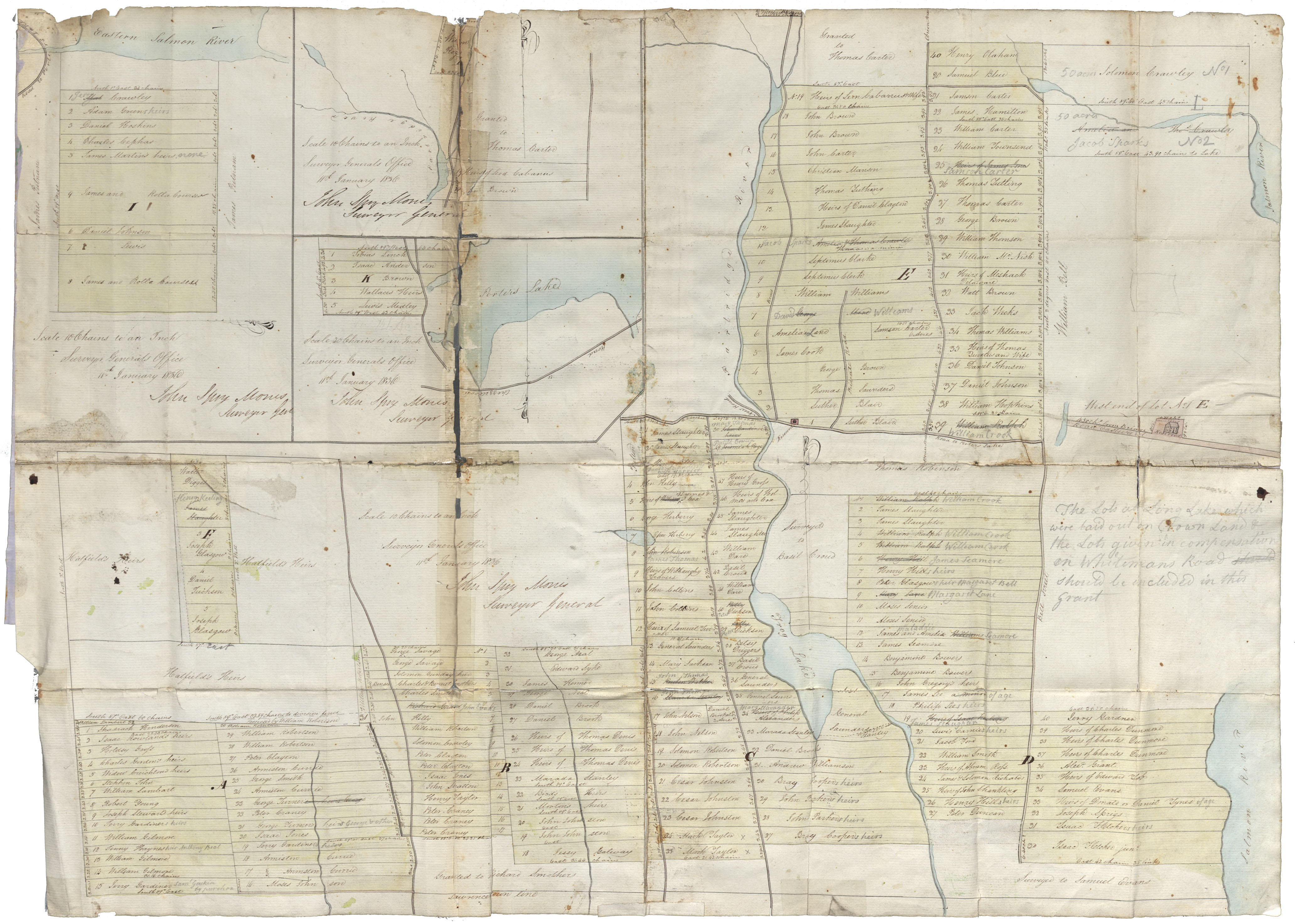
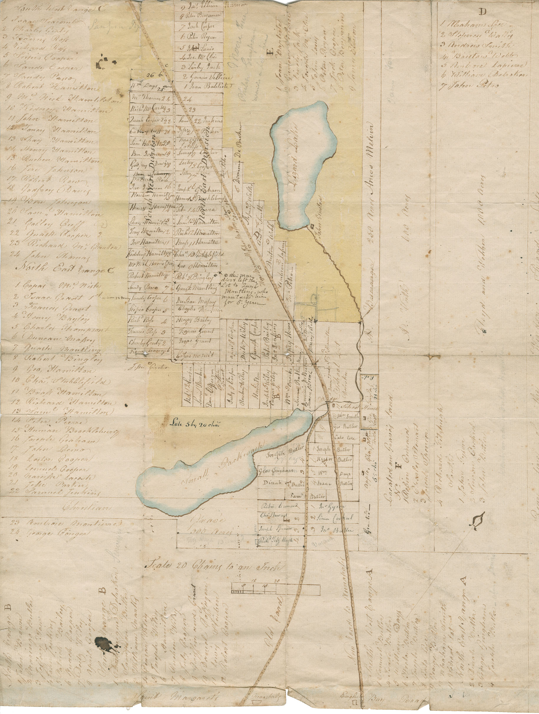
Surveyor General's plan of several tracts of lands occupied by Black people at Preston, attached to a grant thereof from the Crown or intended to be so attached. Certified by Surveyor General, John Spry Morris
Date: 11 January 1836
Reference: Commissioner of Public Records Nova Scotia Archives RG 1 volume 419 number 21
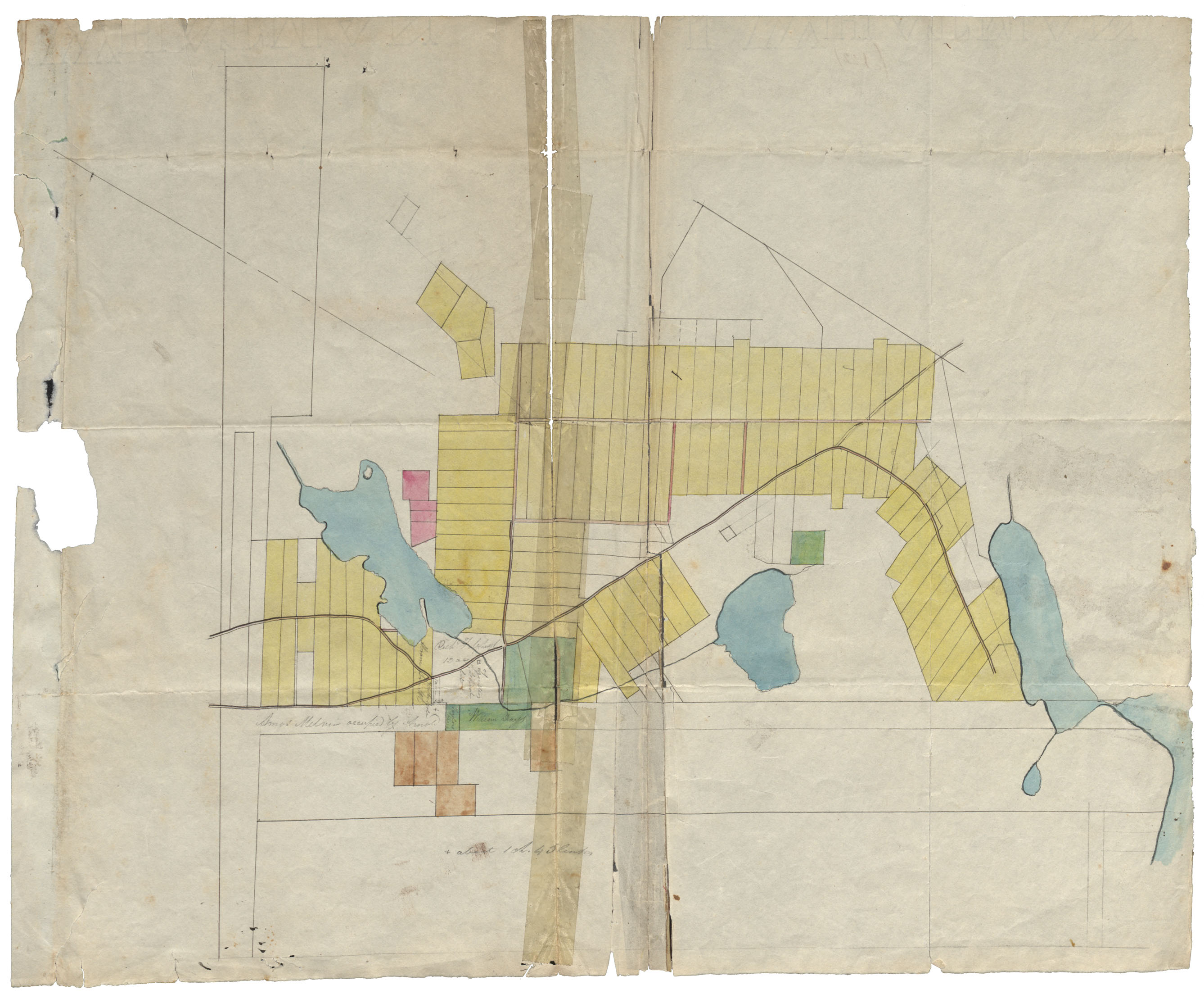
Unfinished sketch of two or three tracts of land. Coloured plan, no date or names. Hammonds Plains
Reference: Commissioner of Public Records Nova Scotia Archives RG 1 volume 419 number 22
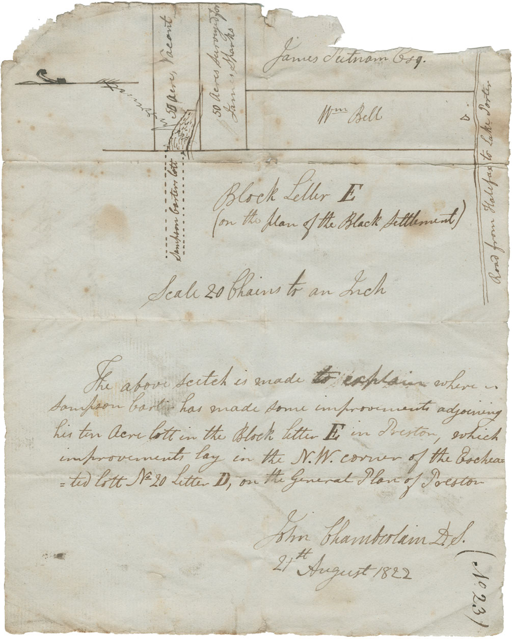
John Chamberlain's sketch of lands in or near to Block Letter E on plan of Black settlement at Preston. Sampson Carter improvements
Date: 21 August 1822
Reference: Commissioner of Public Records Nova Scotia Archives RG 1 volume 419 number 23
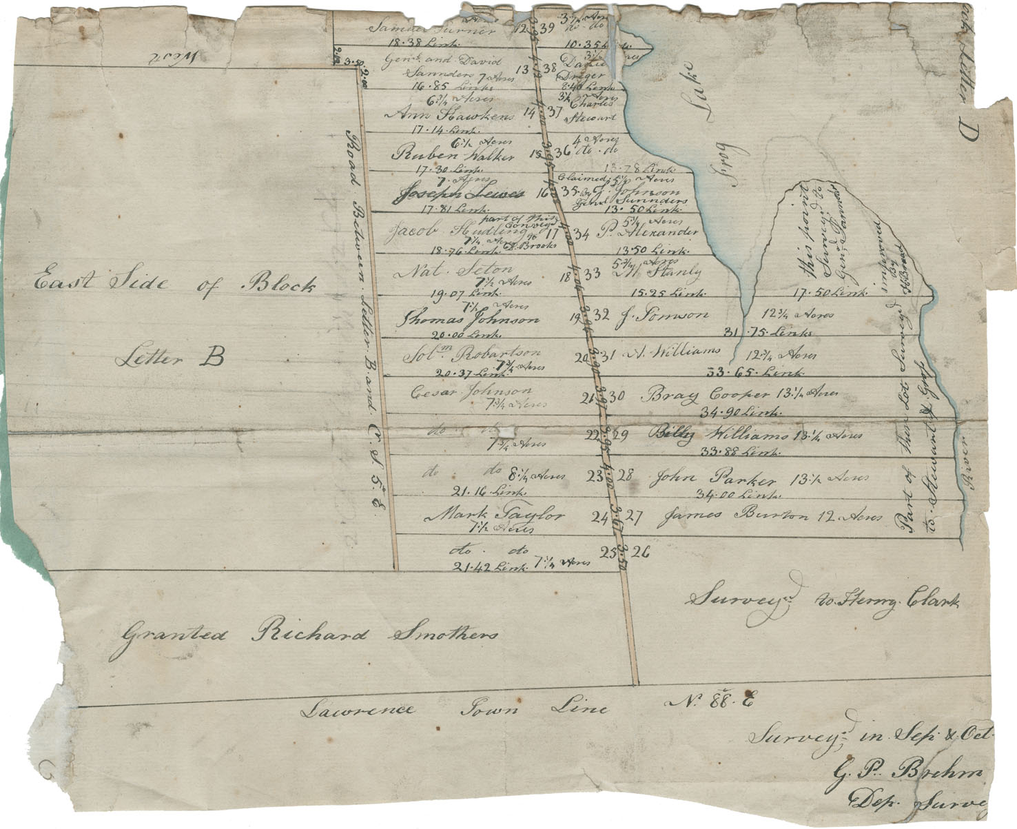
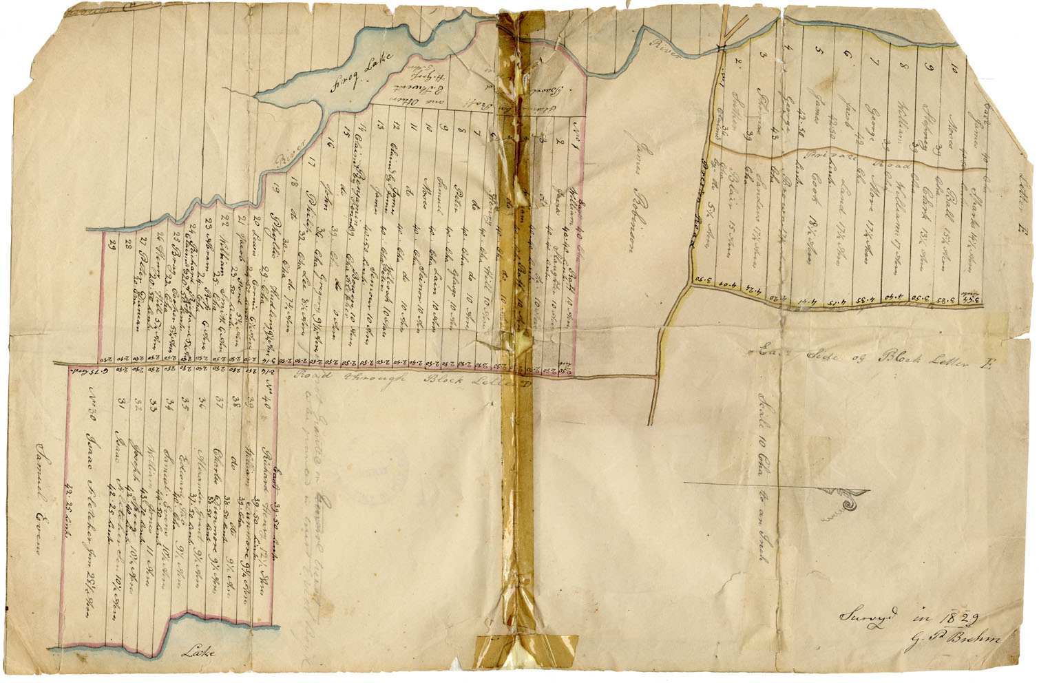
Plan by George P. Brehm of lots occupied by Black people at Preston
Date: September and October 1827
Reference: Commissioner of Public Records Nova Scotia Archives RG 1 volume 419 number 24
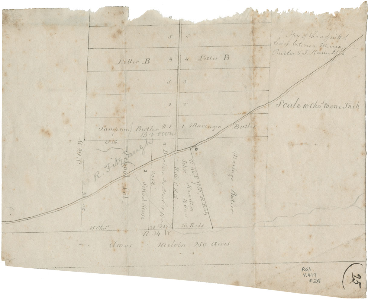
Plan by George Brehm of lines settled between Butler and Hamilton at Hammonds Plains
Date: November 1823
Reference: Commissioner of Public Records Nova Scotia Archives RG 1 volume 419 number 25
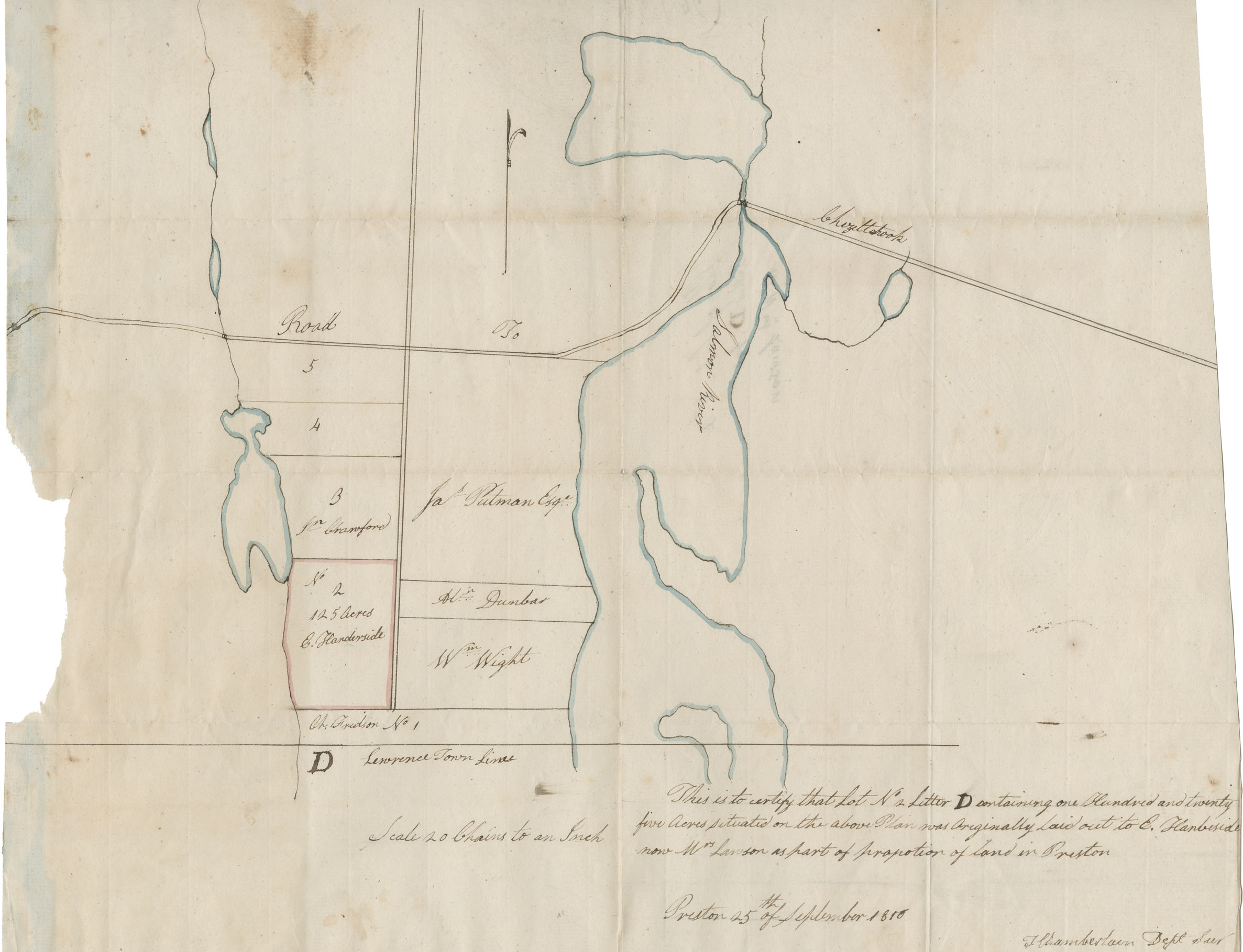
Theophilus Chamberlain's plan. Certain lands in Preston originally laid out to E. Handeside, now owned by W. Lawson
Date: 25 September 1816
Reference: Commissioner of Public Records Nova Scotia Archives RG 1 volume 419 number 26
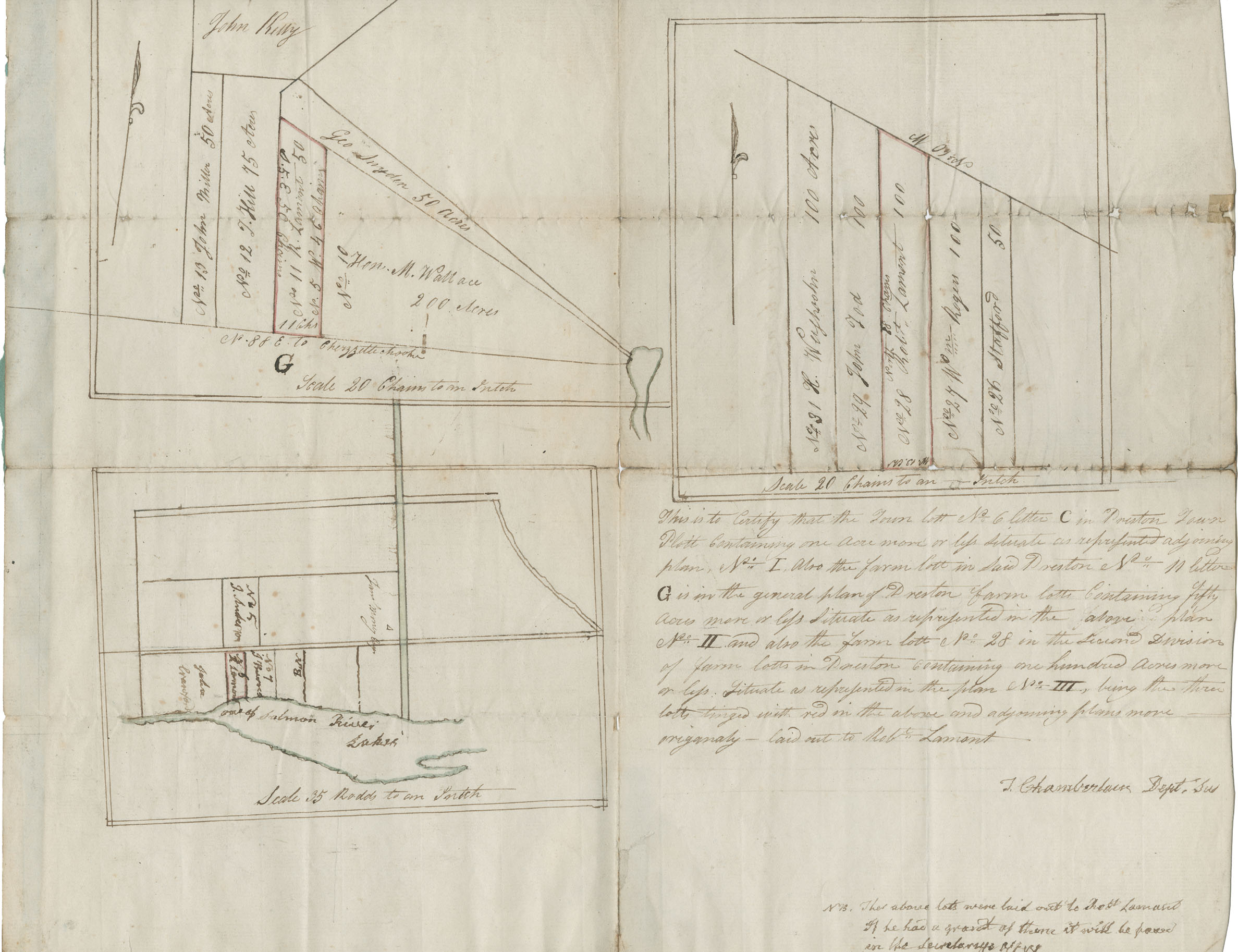
Theophilus Chamberlain's plan of certain lands at Preston originally laid out to Robert Lemont
Reference: Commissioner of Public Records Nova Scotia Archives RG 1 volume 419 number 27
Surveyor General's plan of lands laid out for the Black Refugees at Beech Hill (Beechville), by order of Sir John Coape Sherbrooke, Lieutenant Governor. Certified by Surveyor General
Date: June 1816
Reference: Commissioner of Public Records Nova Scotia Archives RG 1 volume 419 number 28
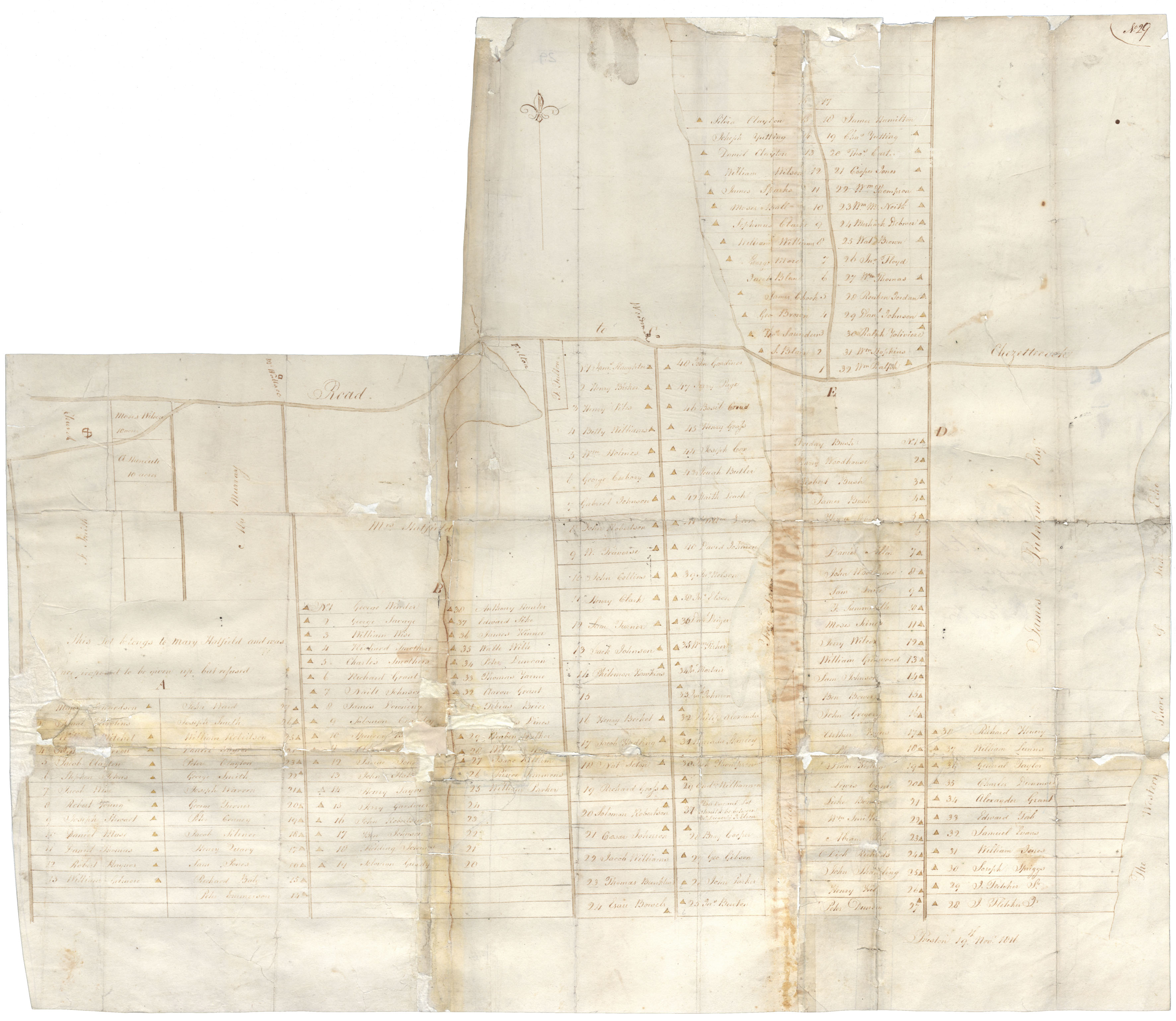
A large sketch plan without signature of Black Refugee lands at Preston, 1816
Reference: Commissioner of Public Records Nova Scotia Archives RG 1 volume 419 number 29
Plan of the Black settlement at Hammonds Plains, with names of settlers, but not signed or authenticated and without date
Reference: Commissioner of Public Records Nova Scotia Archives RG 1 volume 419 number 30
George Brehm's plan of the Black settlement at Hammonds Plains
Date: 8 November 1818
Reference: Commissioner of Public Records Nova Scotia Archives RG 1 volume 419 number 31
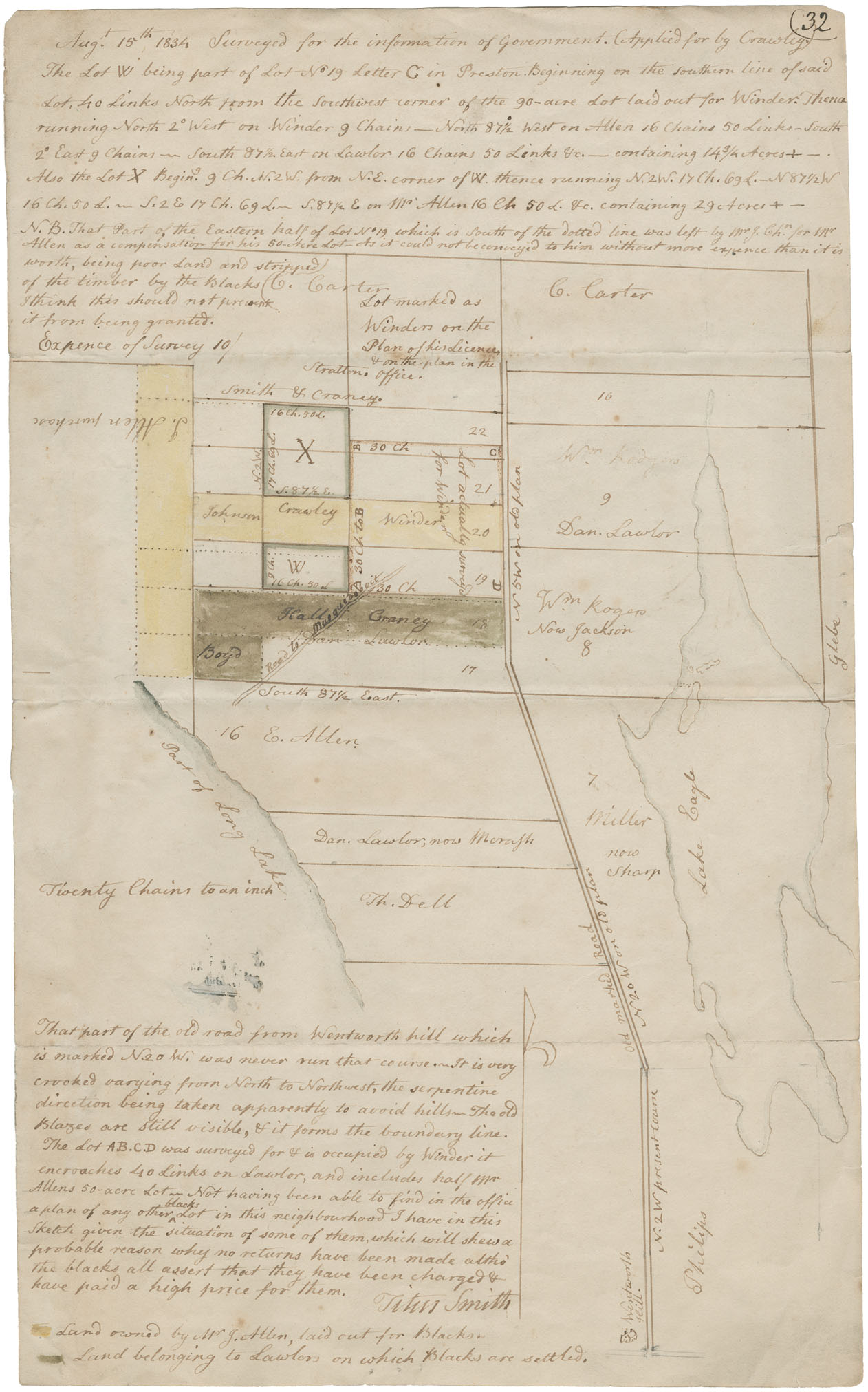
Mr. Titus Smith's plan of lots for Black people near Eagle Lake, Preston. Surveyed 15 August 1834
Reference: Commissioner of Public Records Nova Scotia Archives RG 1 volume 419 number 32
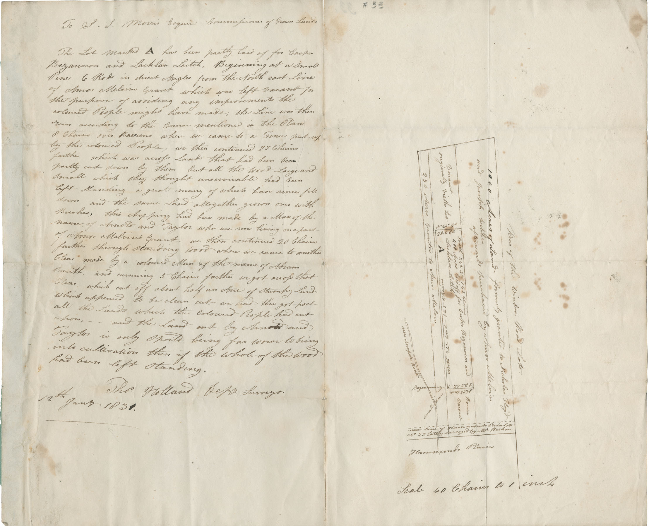
Plan and description by Thomas Holland, Surveyor, of lots at Hammonds Plains
Date: 12 January 1832
Reference: Commissioner of Public Records Nova Scotia Archives RG 1 volume 419 number 33
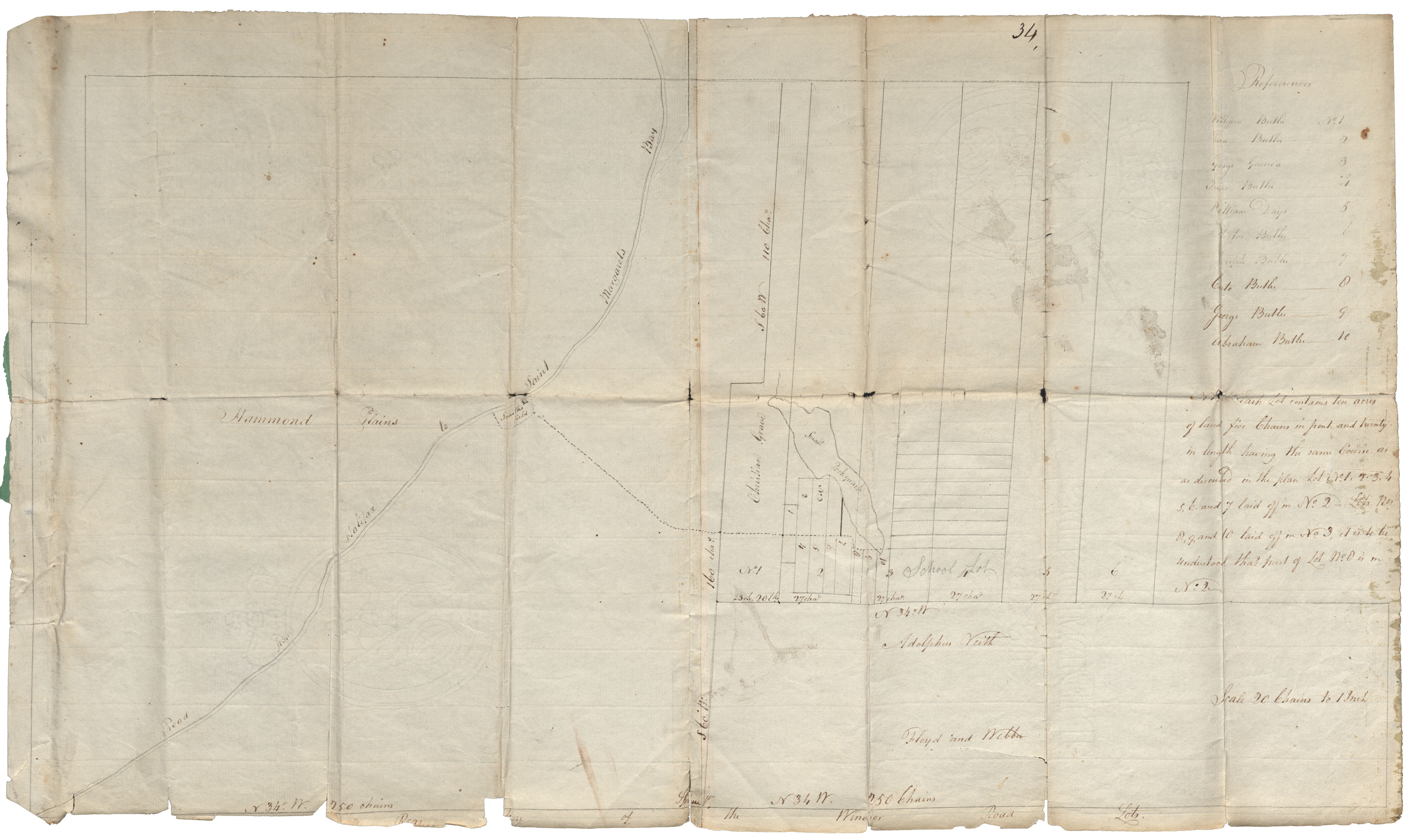
A plan of certain lots at Hammonds Plains in the handwriting of Richard Morris, Surveyor General's clerk, but neither signed nor dated
Reference: Commissioner of Public Records Nova Scotia Archives RG 1 volume 419 number 34
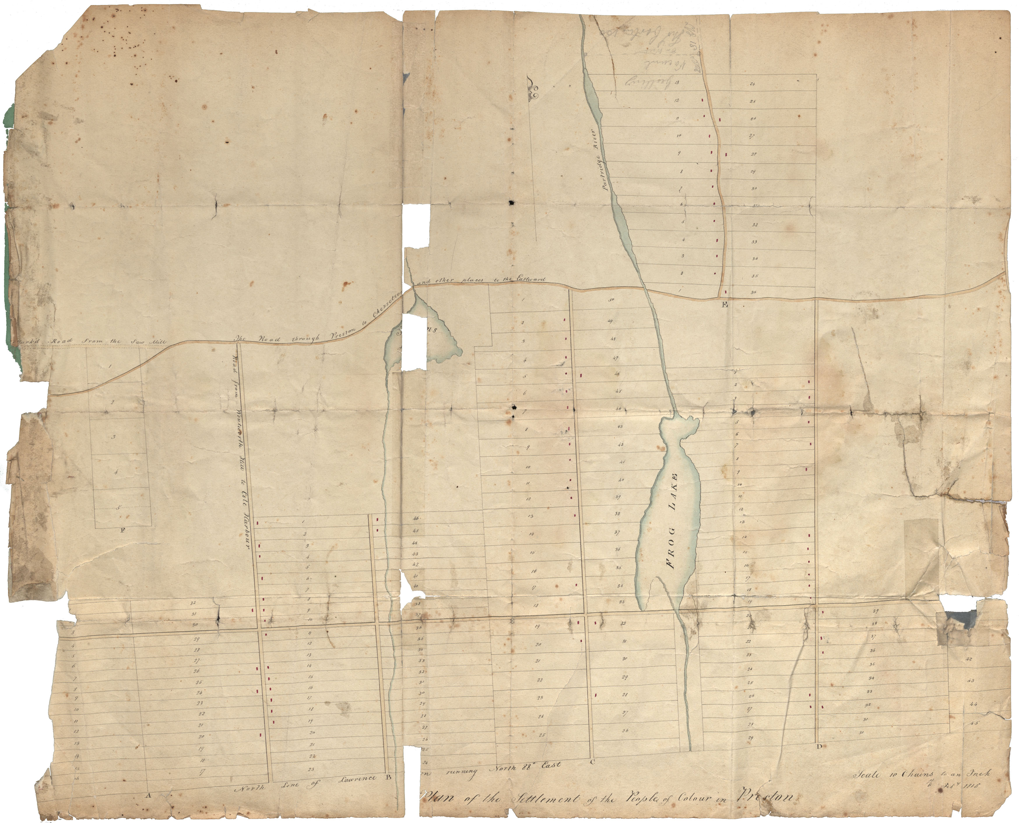
Plan of Black settlement at Preston, showing Frog Lake lots and those at Partridge River, but neither signed or dated
Reference: Commissioner of Public Records Nova Scotia Archives RG 1 volume 419 number 35
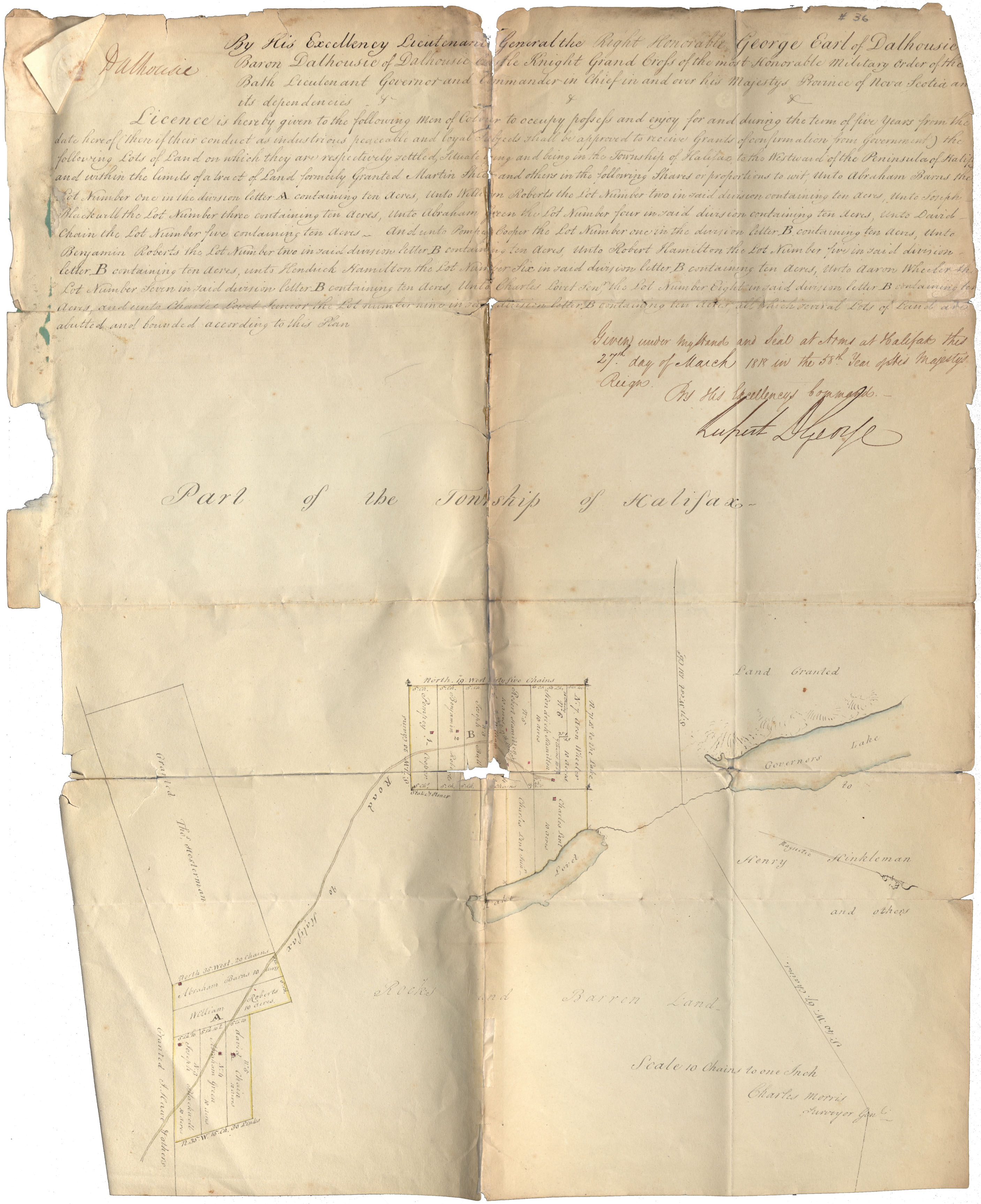
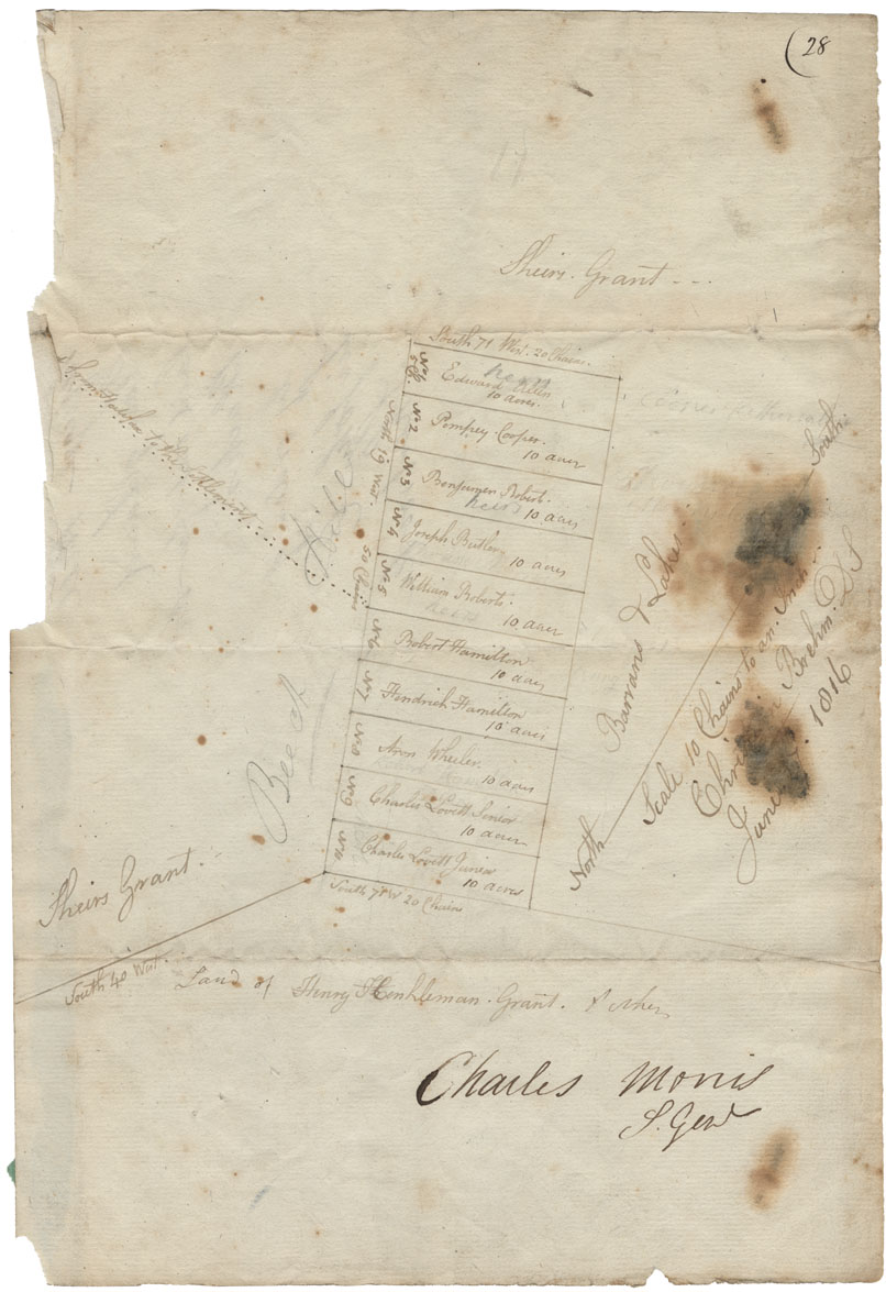
Licence of occupation from Lieutenant Governor Dalhousie for lots at Refugee Hill, Township of Halifax, to Pompey Cooper and others, with plan attached. Given under hand and seal at arms at Halifax
Date: 27 March 1818
Reference: Commissioner of Public Records Nova Scotia Archives RG 1 volume 419 number 36
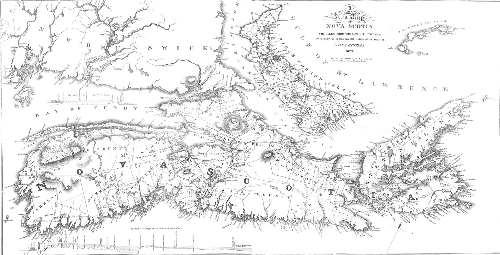
"A New Map of Nova Scotia, compiled...for the Historical & Statistical Account of Nova Scotia"
Date: 1829
Reference: Nova Scotia Archives Map Collection
Plan - Letters D and E at Preston. Surveyed to the Blacks
Date: 1829
Reference: Nova Scotia Archives Map Collection: F/230 - 1829 African Nova Scotians
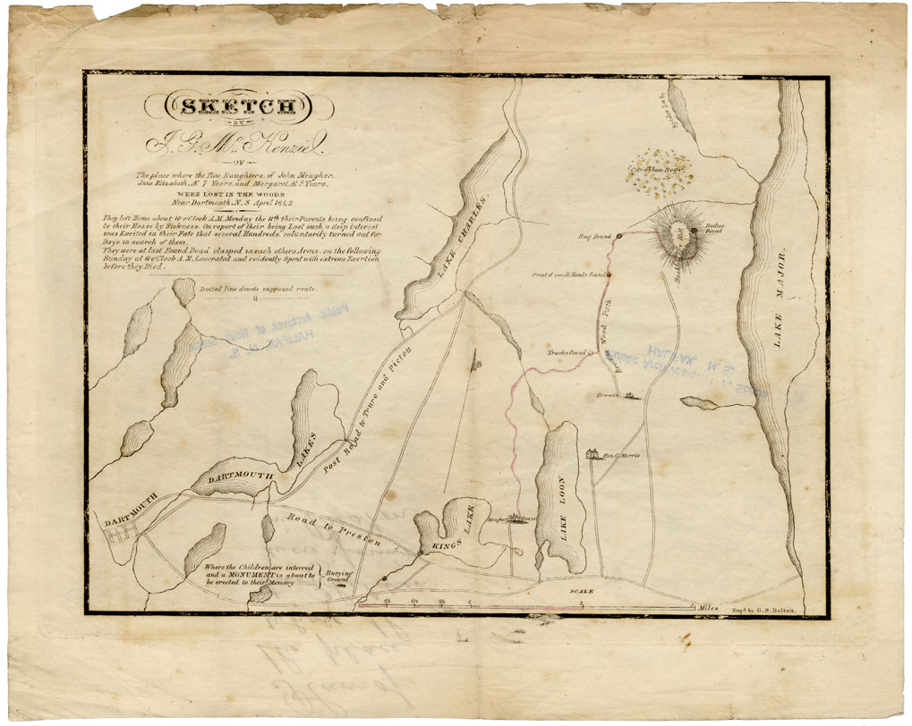
Sketch
Date: April 1842
Reference: Nova Scotia Archives Map Collection: F/230 - 1842 African Nova Scotians
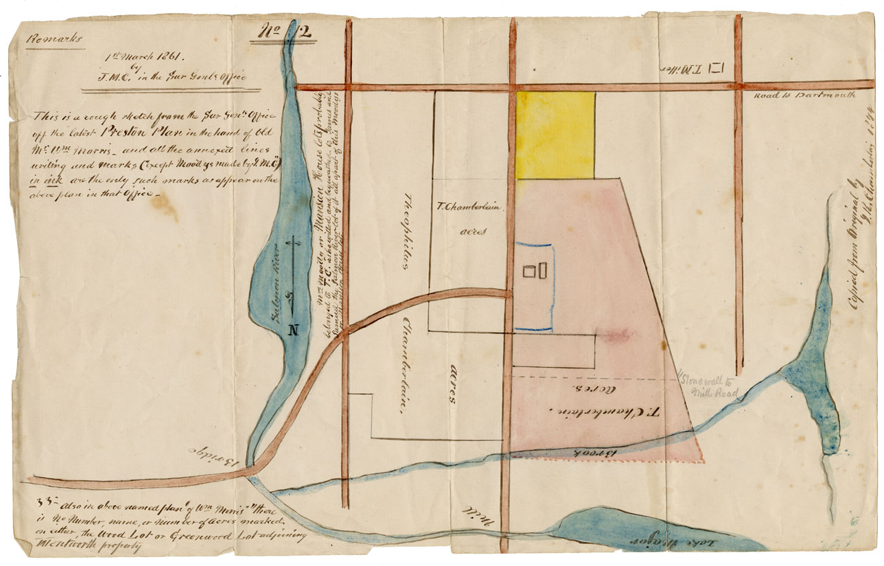
Preston Plan
Date: 1 March 1861
Reference: Nova Scotia Archives Map Collection: F/230 - 1861 African Nova Scotians
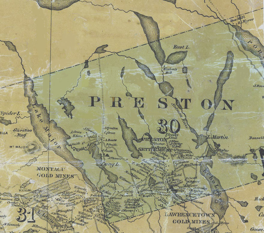
Map detail showing Preston
Date: 1865
Reference: Topographical Township Map of Halifax County, Nova Scotia Nova Scotia Archives Map Collection
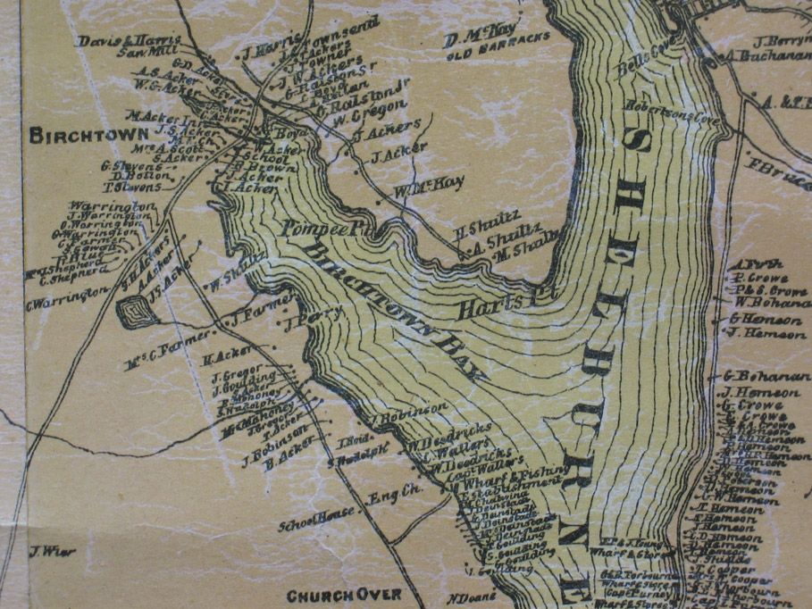
Map detail showing Birchtown
Date: 1882
Reference: Topographical Township Map of Shelburne County, Nova Scotia Nova Scotia Archives Map Collection
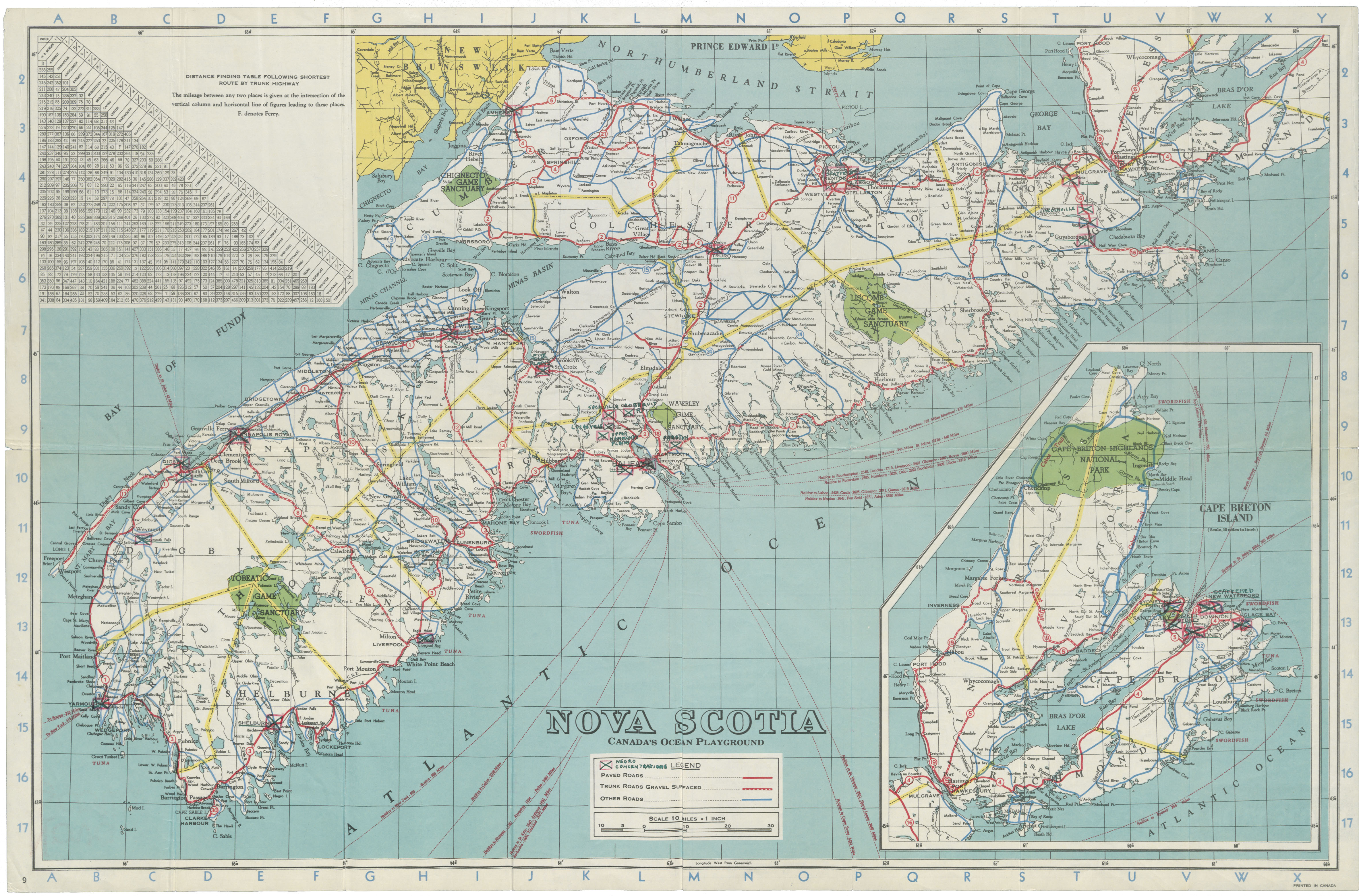
Page 12 - Base map of Nova Scotia
Date: July 1949
Reference: Nova Scotia Archives Library Brookbank 1990-191
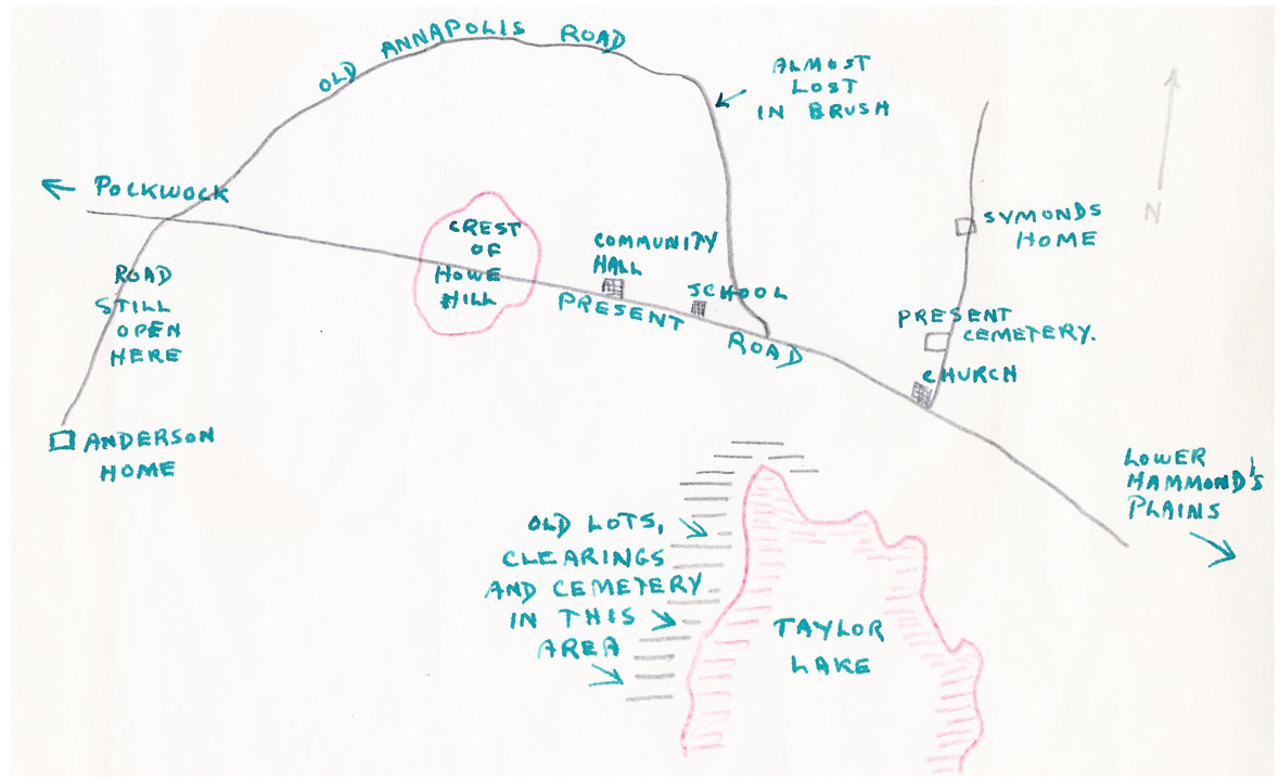
Page 13 - Sketch map of Upper Hammond's Plains
Date: July 1949
Reference: Nova Scotia Archives Library Brookbank 1990-191
Page 30 - Sketch map of Africville
Date: July 1949
Reference: Nova Scotia Archives Library Brookbank 1990-191
Page 32 - Negro concentrations in Halifax (map)
Date: July 1949
Reference: Nova Scotia Archives Library Brookbank 1990-191
Page 33 - Reference maps of Halifax showing Negro concentrations in relation to other factors
Date: July 1949
Reference: Nova Scotia Archives Library Brookbank 1990-191
Appendix - Map No. 1 - Halifax, Preston, Lucasville, and Hammonds Plains
Date: surveyed 1920 reprinted 1946
Reference: Nova Scotia Archives Library Brookbank 1990-191
Appendix - Map No. 2 - Africville, Hammonds Plains, Lucasville, and Preston
Date: Reprinted 1945
Reference: Nova Scotia Archives Library Brookbank 1990-191