Nova Scotia Archives
African Nova Scotian Teaching and Learning Resources
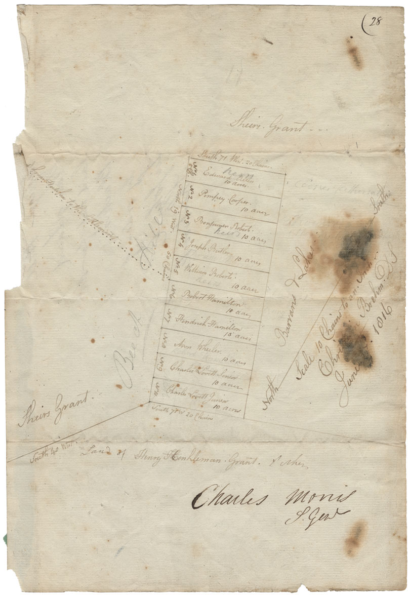
Surveyor General's plan of lands laid out for the Black Refugees at Beech Hill (Beechville), by order of Sir John Coape Sherbrooke, Lieutenant Governor. Certified by Surveyor General
, by order of Sir John Coape Sherbrooke, Lieutenant Governor. Certified by Surveyor General")
Date: June 1816
Reference: Commissioner of Public Records Nova Scotia Archives RG 1 volume 419 number 28
Questions to Consider
- When do you think the map was made?
- Can you think of any specific reason(s) why this map was made?
- Who do you think would have used this map?
- Where do you think the map was made?
- What does the map provide information about, or evidence of?
- Do you recognize any place names from the map? How might place names change over time?
- How do you thin the map reflects the attitudes and values of the time when it was created?