Nova Scotia Archives
African Nova Scotian Teaching and Learning Resources
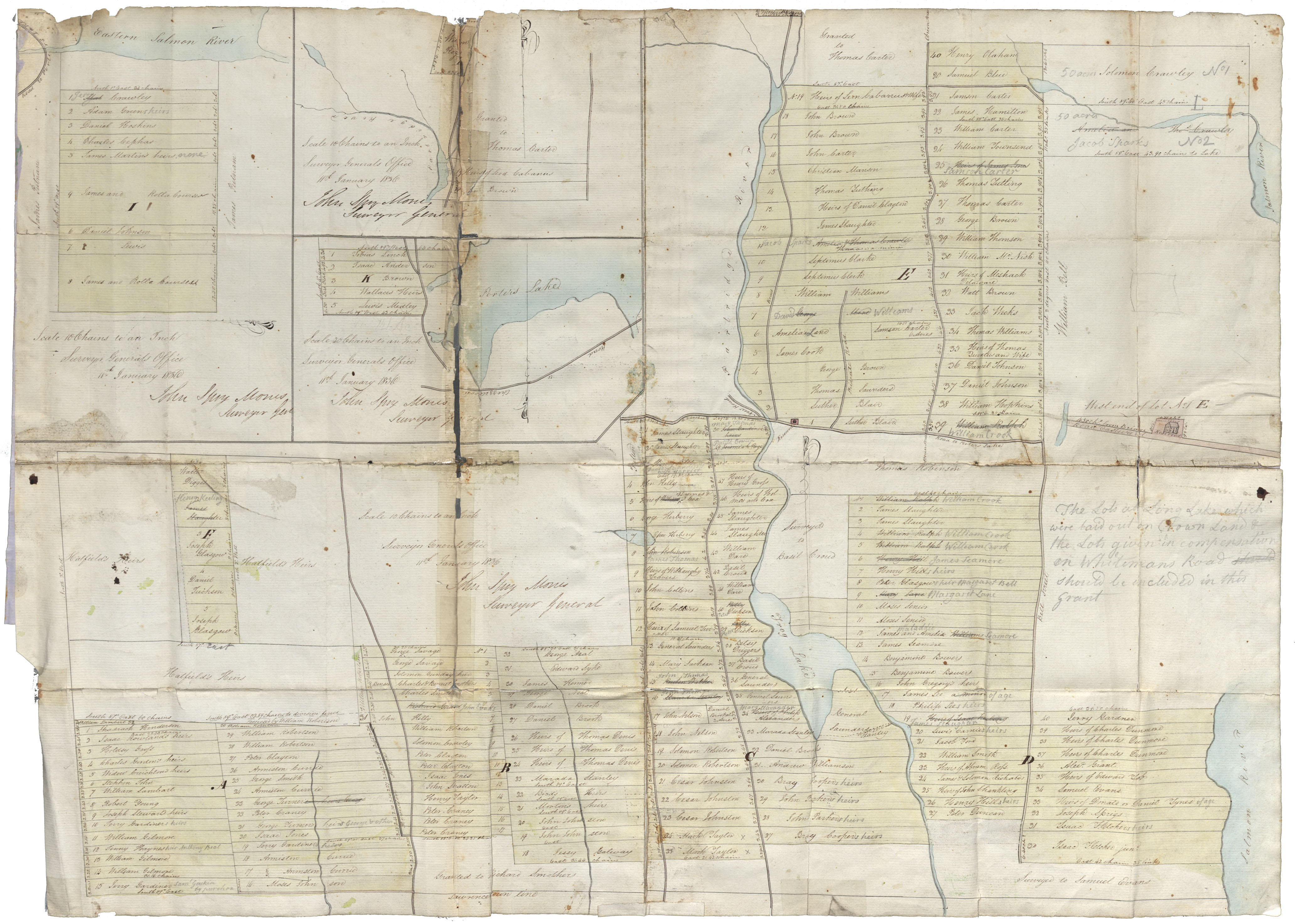
Surveyor General's plan of several tracts of lands occupied by Black people at Preston, attached to a grant thereof from the Crown or intended to be so attached. Certified by Surveyor General, John Spry Morris

Date: 11 January 1836
Reference: Commissioner of Public Records Nova Scotia Archives RG 1 volume 419 number 21
Questions to Consider
- When do you think the map was made?
- Can you think of any specific reason(s) why this map was made?
- Who do you think would have used this map?
- Where do you think the map was made?
- What does the map provide information about, or evidence of?
- Do you recognize any place names from the map? How might place names change over time?
- How do you thin the map reflects the attitudes and values of the time when it was created?