Nova Scotia Archives
African Nova Scotian Teaching and Learning Resources
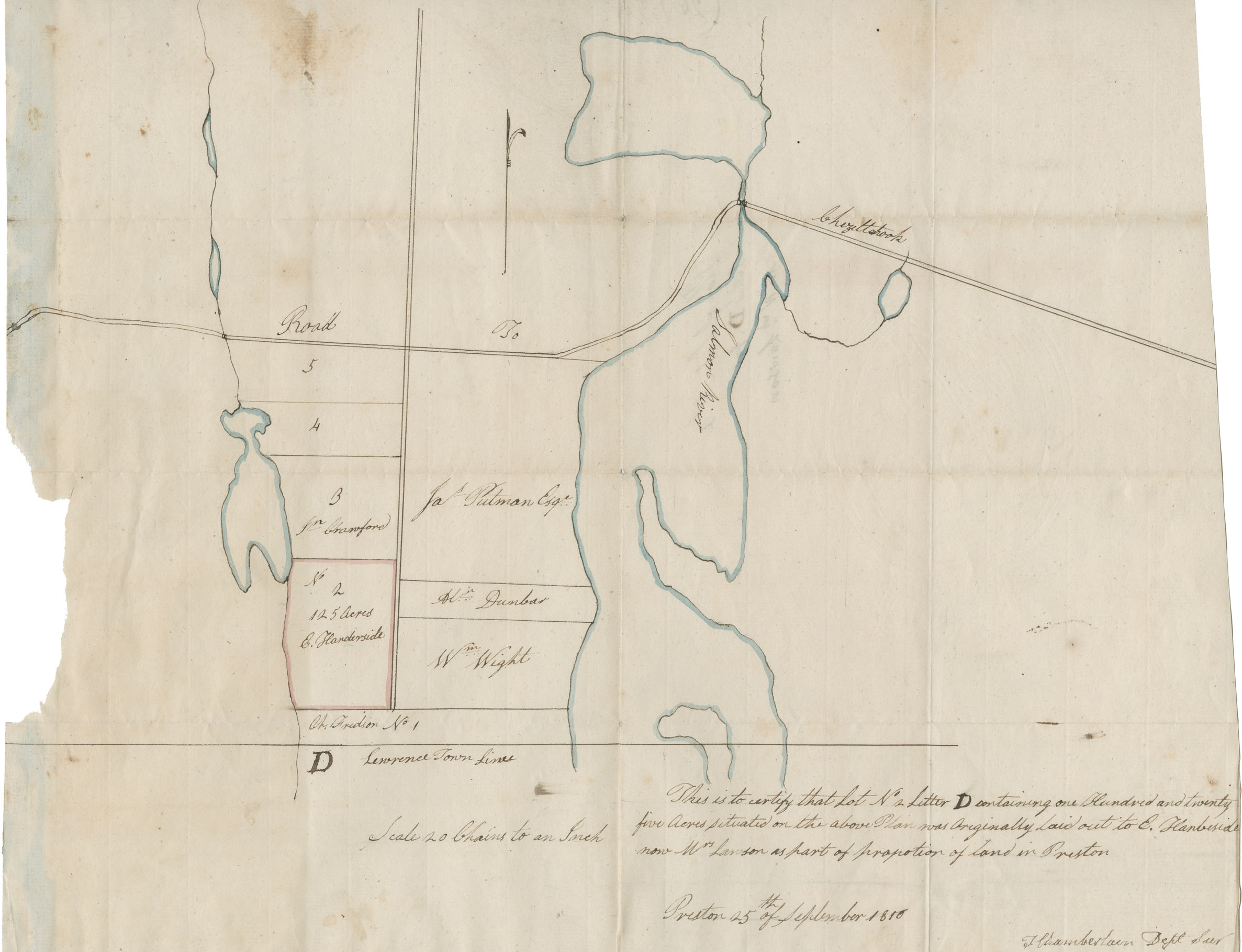
Theophilus Chamberlain's plan. Certain lands in Preston originally laid out to E. Handeside, now owned by W. Lawson

Date: 25 September 1816
Reference: Commissioner of Public Records Nova Scotia Archives RG 1 volume 419 number 26
Questions to Consider
- When do you think the map was made?
- Can you think of any specific reason(s) why this map was made?
- Who do you think would have used this map?
- Where do you think the map was made?
- What does the map provide information about, or evidence of?
- Do you recognize any place names from the map? How might place names change over time?
- How do you thin the map reflects the attitudes and values of the time when it was created?