Nova Scotia Archives
Historical Maps of Nova Scotia
Results 1 to 10 of 10 from your search: Townships
Annapolis Townships Annapolis County Maps
Date: 1759
Reference: Nova Scotia Archives Map Collection: F/230 - 1759

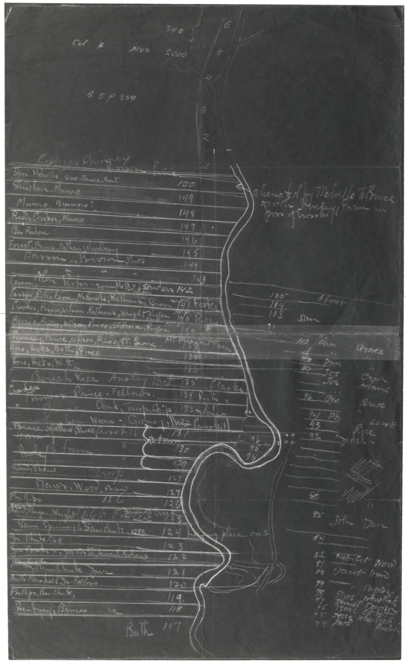
Lunenburg and New Dublin Townships
Date: 1767
Reference: Nova Scotia Archives Map Collection: V7 230 Lunenburg, Nova Scotia
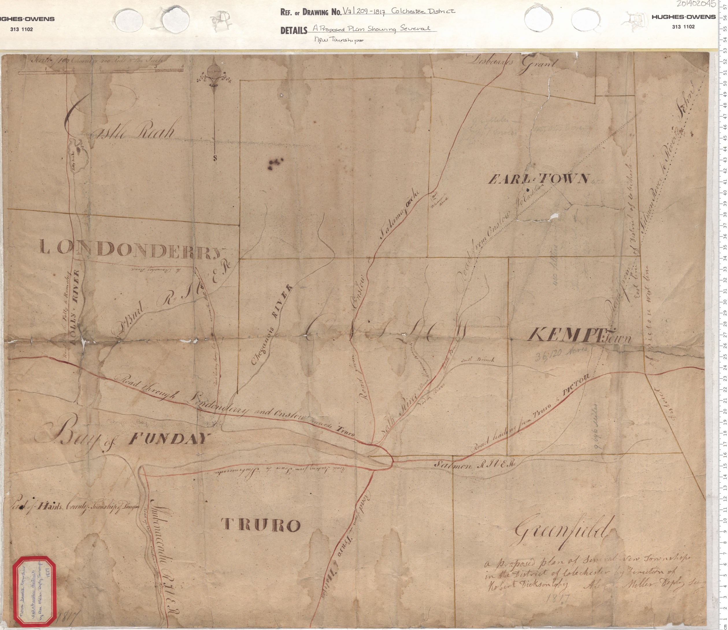
A Proposed Plan Showing Several New Townships
Date: 1817
Reference: Nova Scotia Archives Map Collection: V7 209 Colchester District, Nova Scotia
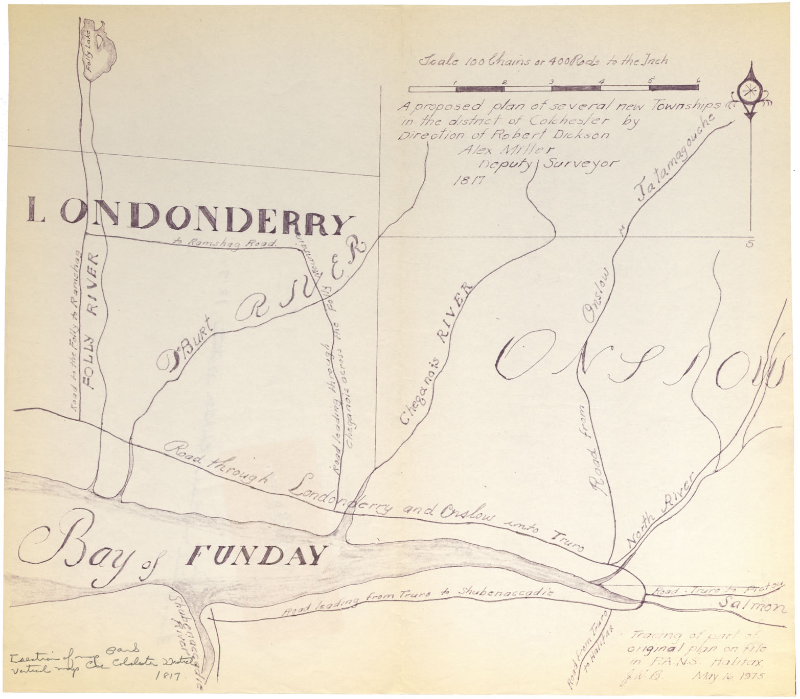
A proposed plan of several new townships in the District of Colchester by direction of Robert Dickson, Alex Miller D.S. 1817
Date: 1817
Reference: Nova Scotia Archives Map Collection: F/230 - 1817
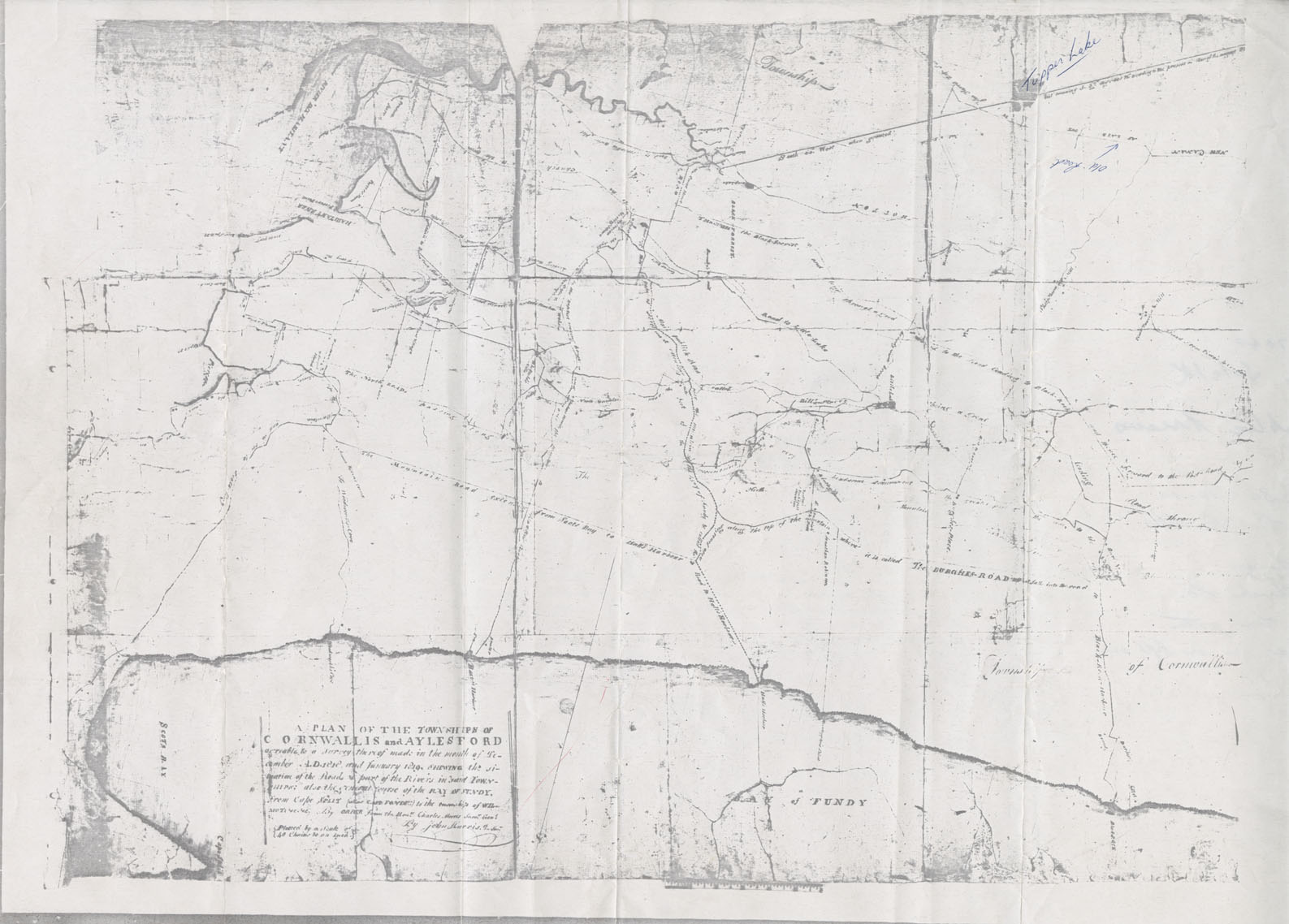
Cornwallis Township A Plan of the Townships of Cornwallis and Aylesford
Date: December 1818
Reference: Nova Scotia Archives Map Collection: F/230 - 1818/19
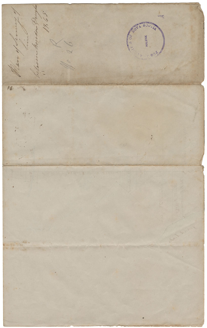
Plan of Survey of line between Rawdon & Douglas Townships
Date: 31 August 1865
Reference: Nova Scotia Archives Map Collection: F/230 - 1865
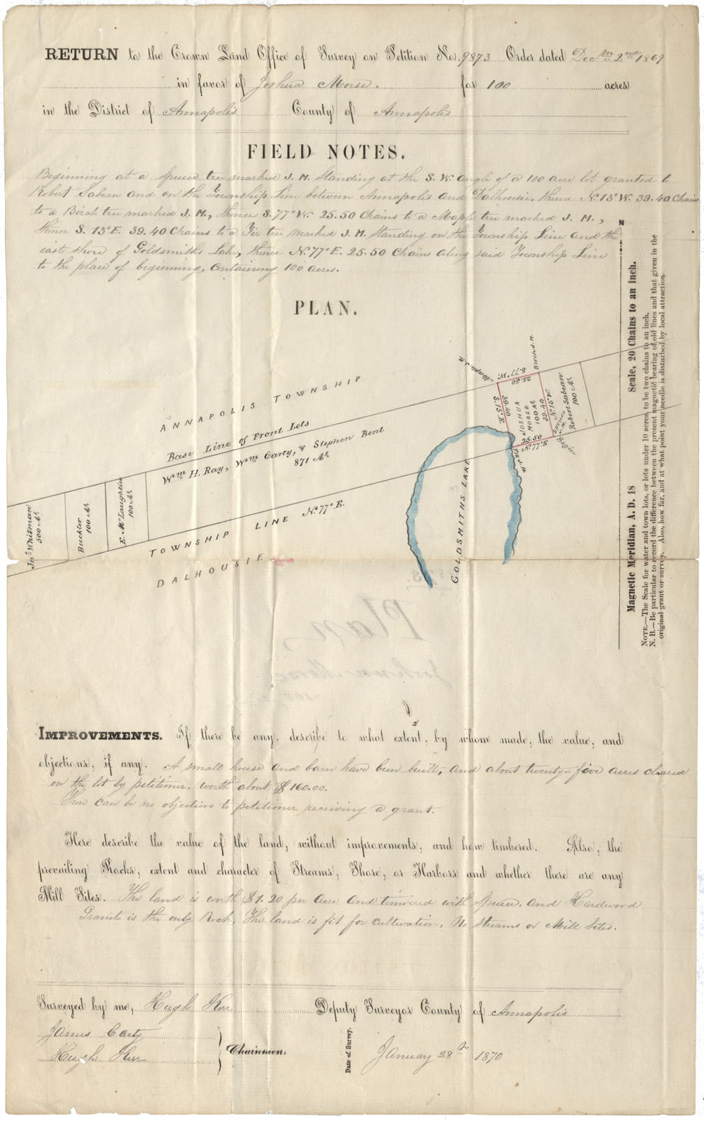
Annapolis County Annapolis & Dalhousie Townships near Goldsmith Lake 1870
Date: 28 January 1870
Reference: Nova Scotia Archives Map Collection: F/230 - 1870
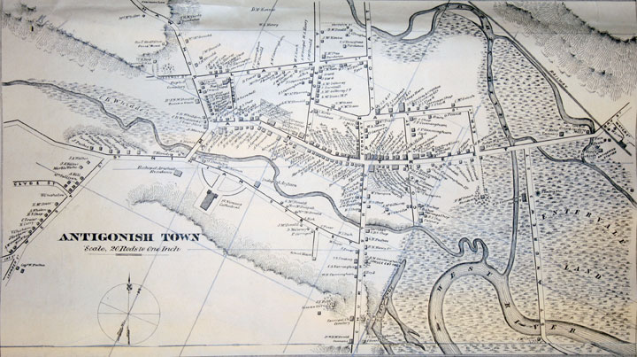
"Antigonish Town" inset of Topographical Township Map of Antigonish County, Nova Scotia
Date: 1878
Reference: Nova Scotia Archives Map Collection: A.F. Church Maps
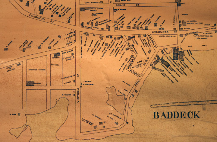
"Baddeck" inset of Topographical Township Map of Victoria County, Nova Scotia
Date: 1887
Reference: Nova Scotia Archives Map Collection: A.F. Church Maps
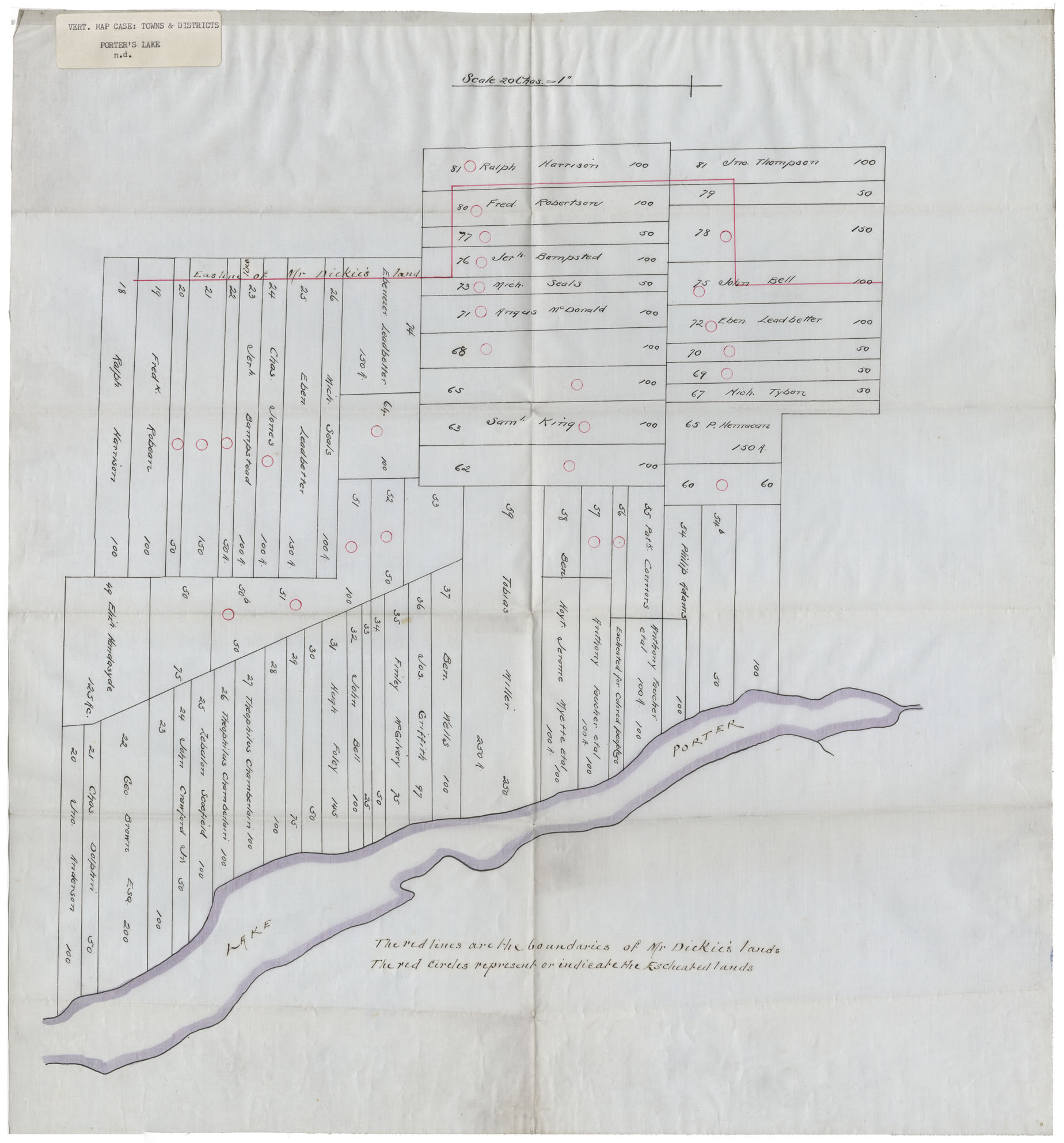
Vert Map Case: Townships & Districts Porter's Lake
Date:
Reference: Nova Scotia Archives Map Collection: F/239