Nova Scotia Archives
Historical Maps of Nova Scotia
Results 286 to 300 of 663 from your search: Halifax
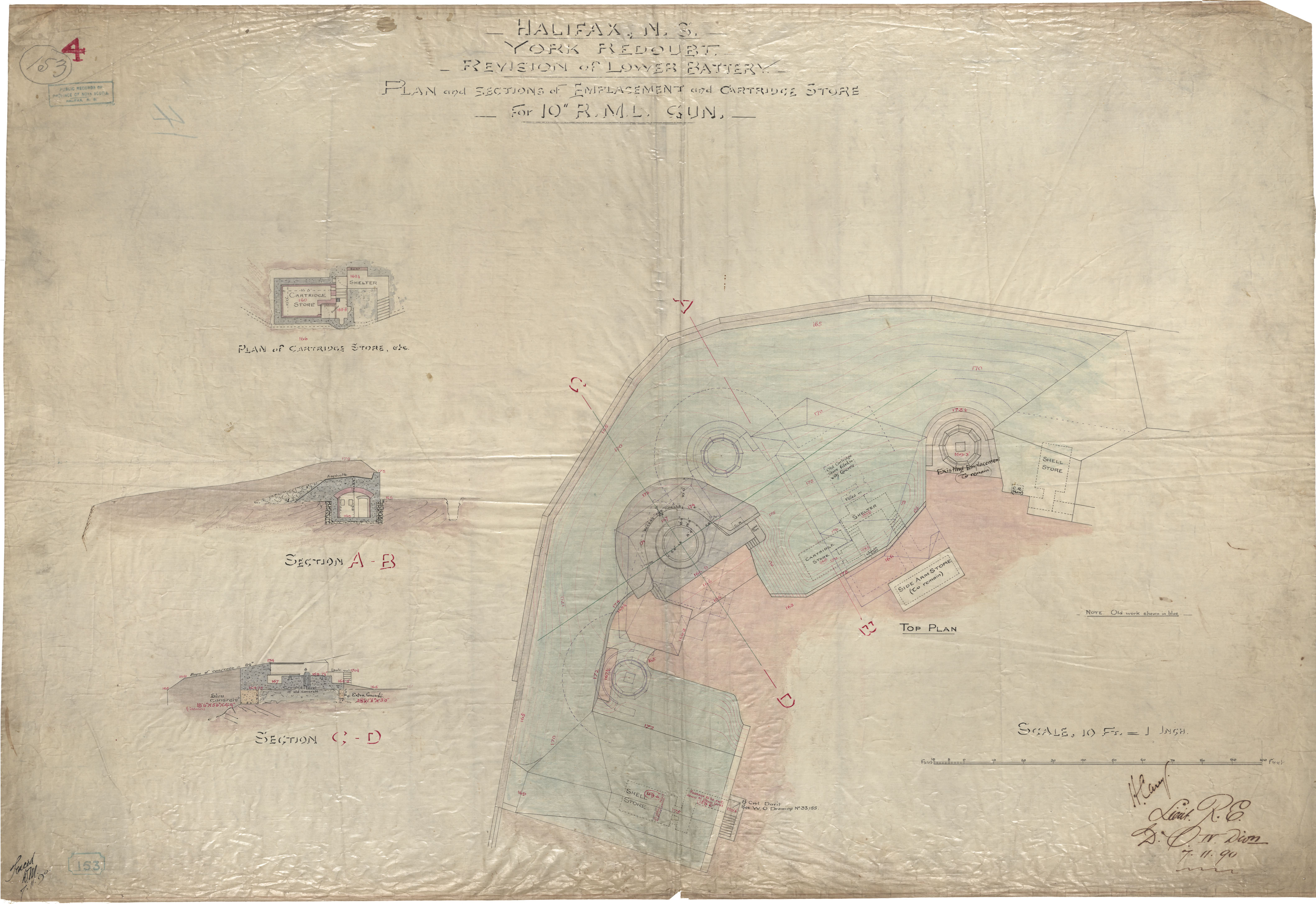
Halifax, ns, York Redoubt, Revision of Lower Battery, Plan and Sctions of Emplacements and Cartridge Store , for 10" RML Gun
Date: 7 November 1890
Reference: Nova Scotia Archives Royal Engineers Maps and Plans
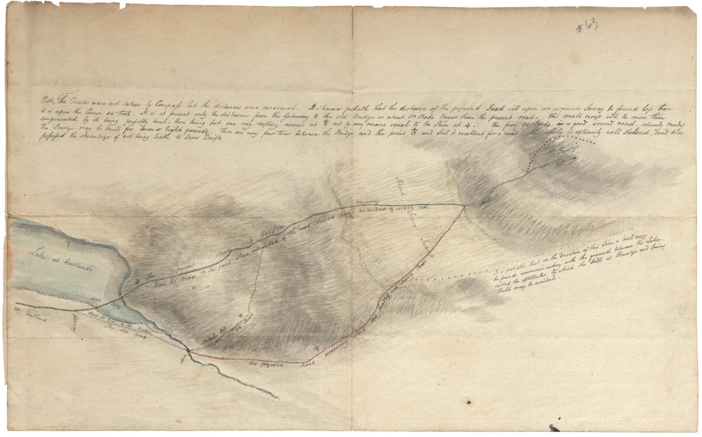
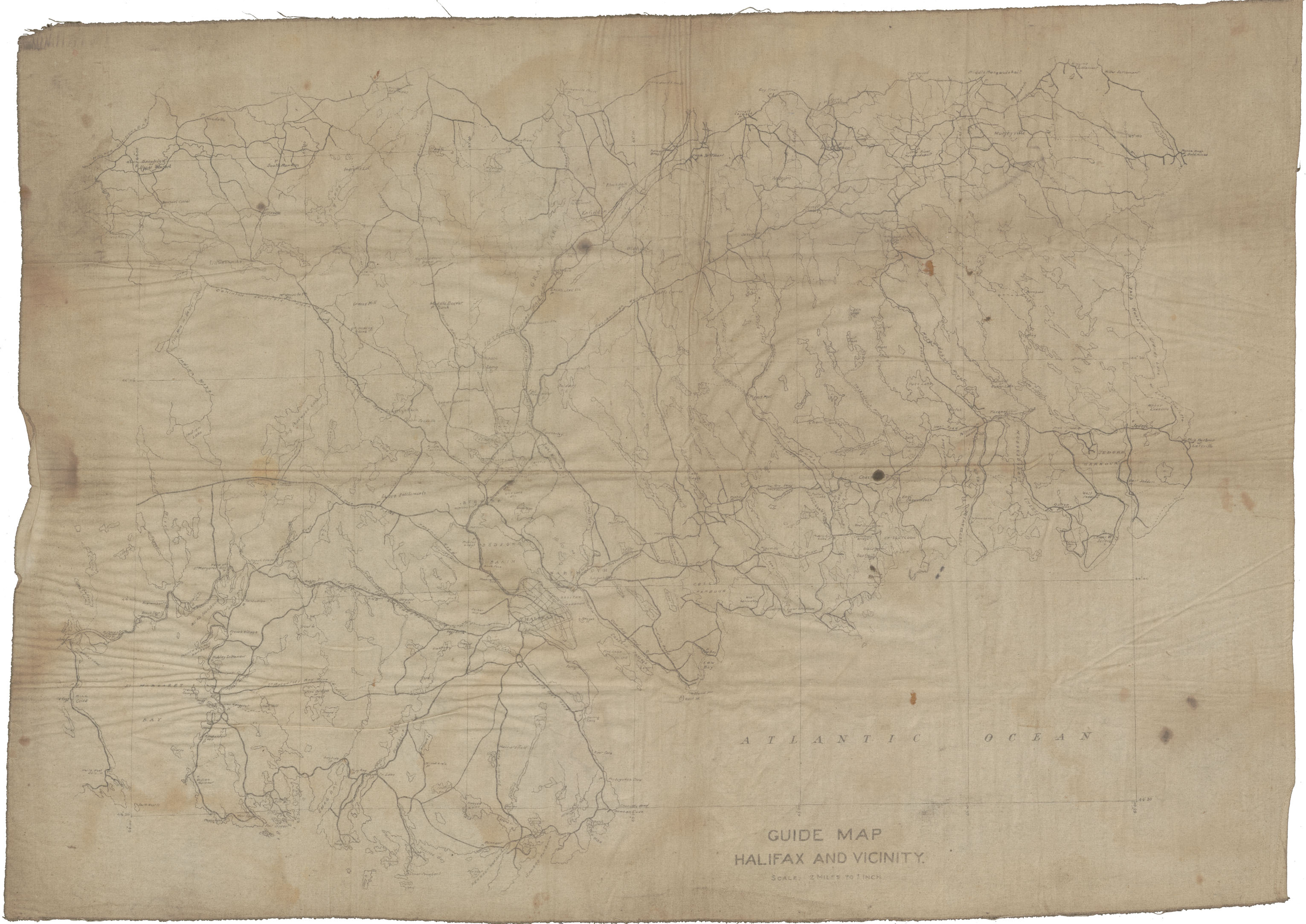
Road from Hartlands Lake to Fenerty's Hill on Road to Halifax
Date:
Reference: Nova Scotia Archives Map Collection: F/209
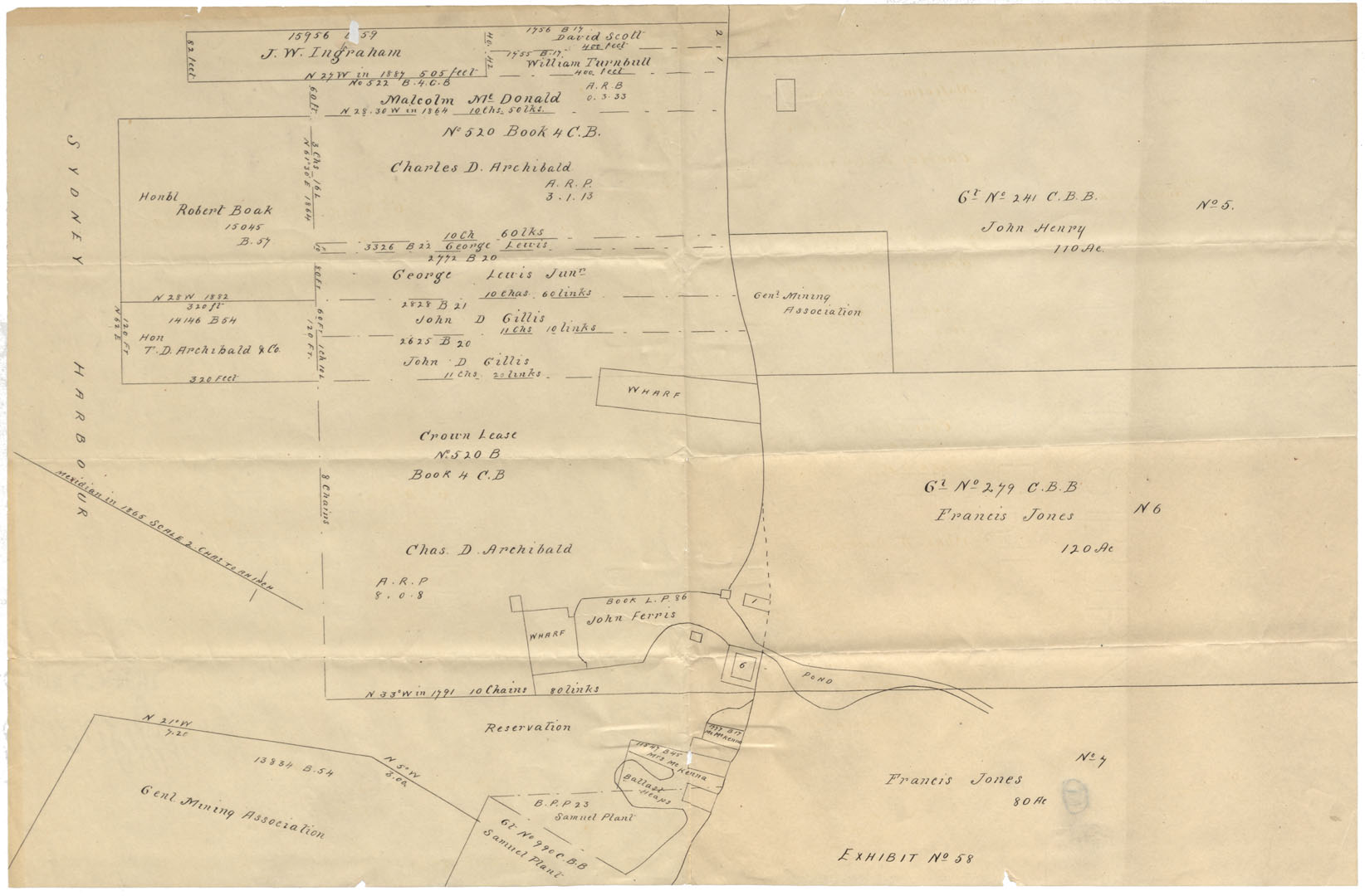
Halifax County, Cape Breton Plan of Grants at N.W.A. undated
Date:
Reference: Nova Scotia Archives Map Collection: F/210
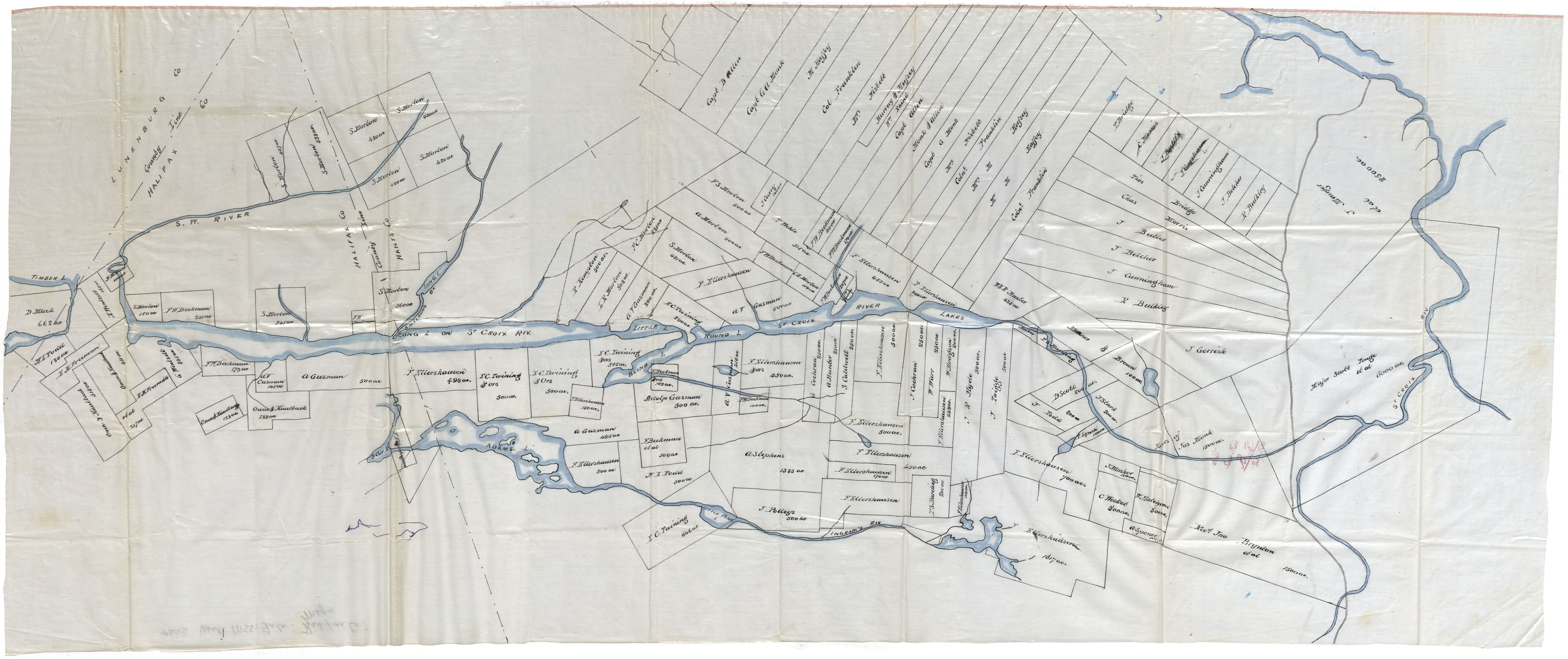
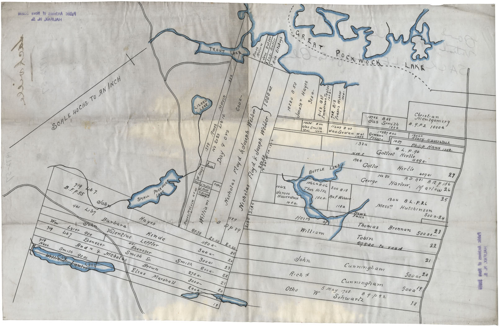
Land Grants in Halifax County along the St. Croix River, bordering Lunenburg County
Date:
Reference: Nova Scotia Archives Map Collection: F/220
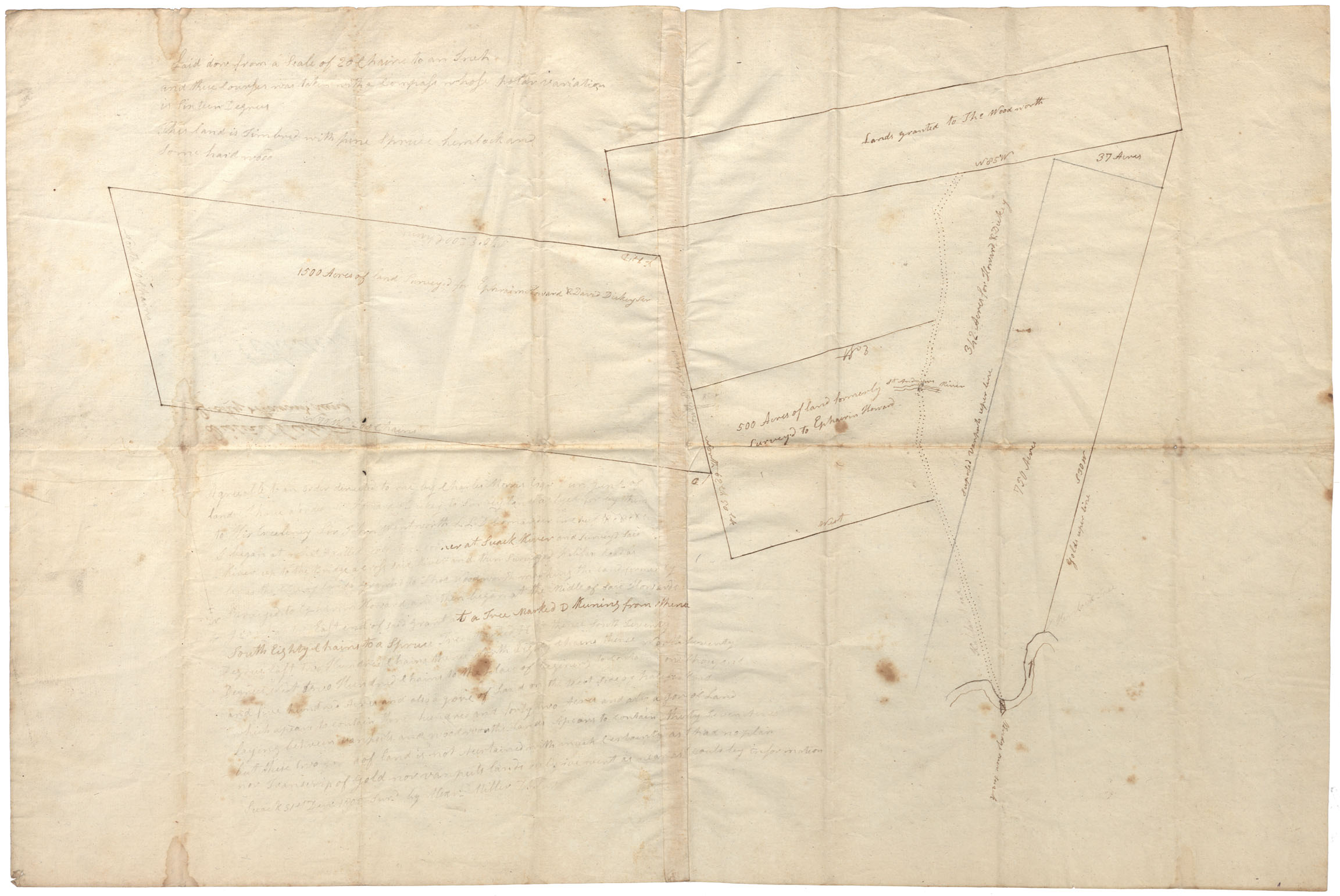
District of Colchester, vicinity of St.Andrew's River and "Bridge over Suack" and Halifax Road
Date:
Reference: Nova Scotia Archives Map Collection: F/230
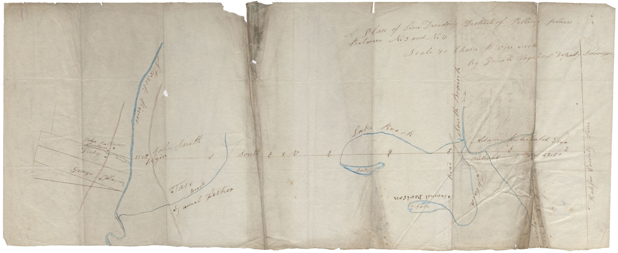
Between Stewiacke River and Halifax county Line
Date:
Reference: Nova Scotia Archives Map Collection: F/230
PANS: Maps: Ship Harbour, Halifax County
Date:
Reference: Nova Scotia Archives Map Collection: F/230
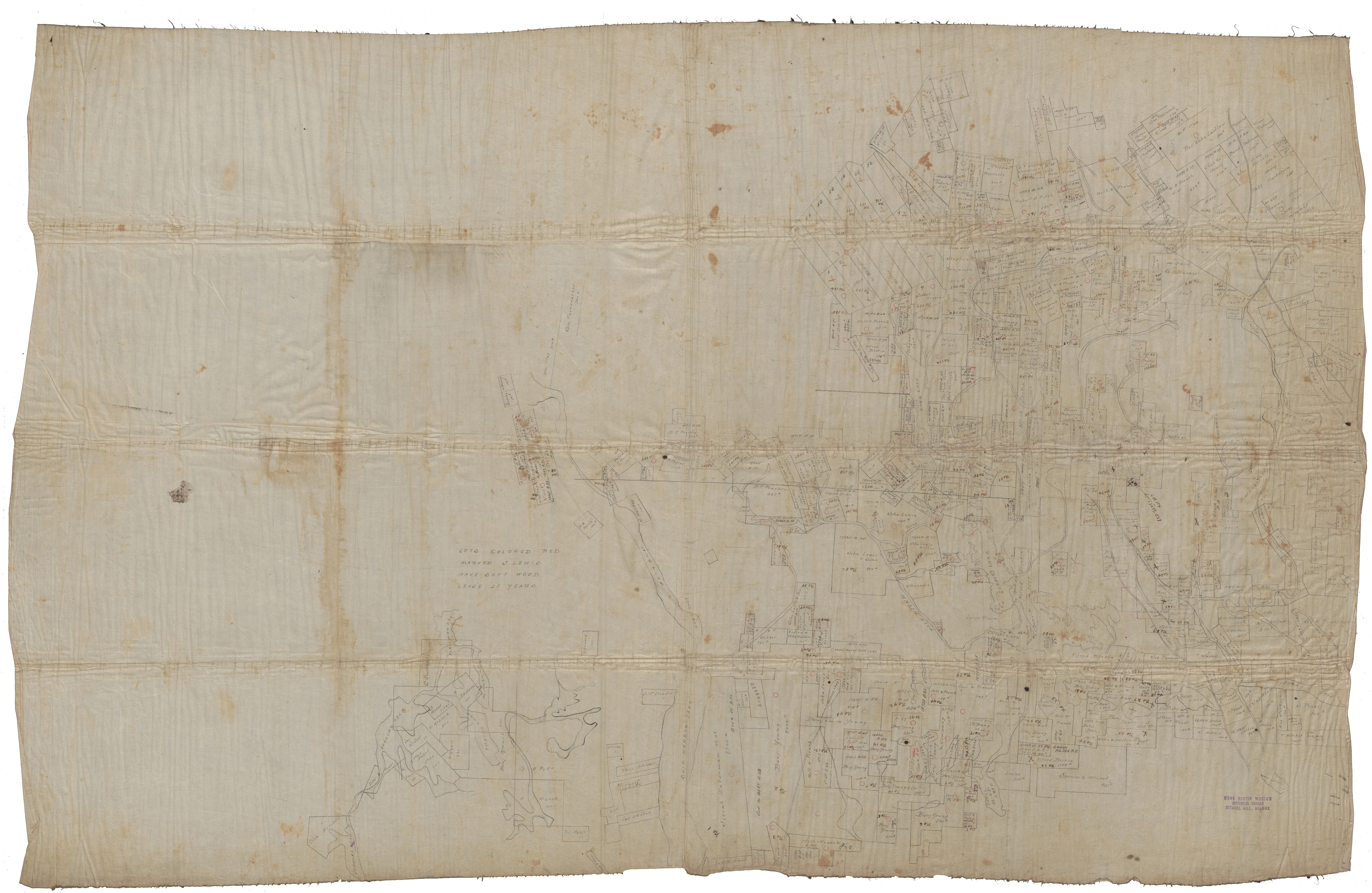
Sackville, Halifax County-Plan showing land owners in the Sackville area
Date:
Reference: Nova Scotia Archives Map Collection: F/230
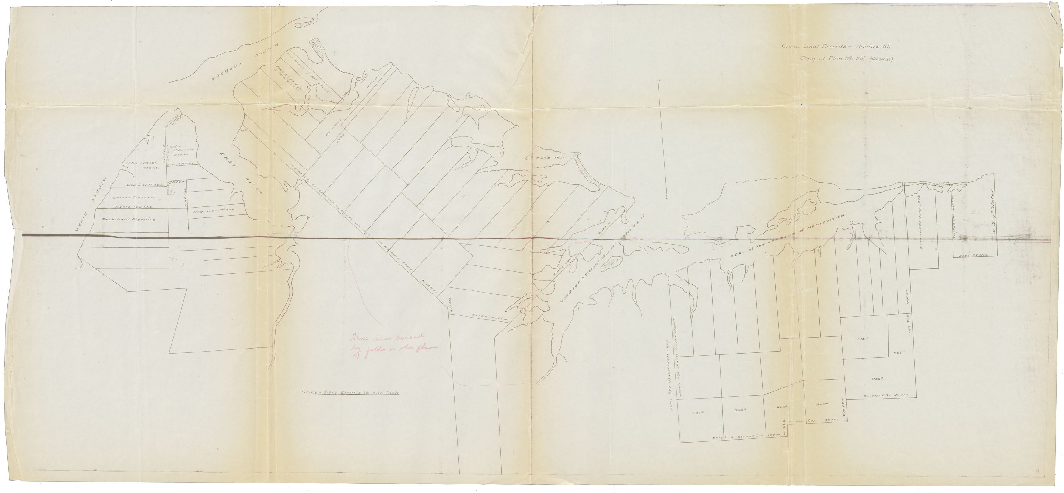
Land Grants: Mergomesh Harbour and Pictou
Date:
Reference: Nova Scotia Archives Map Collection: F/230
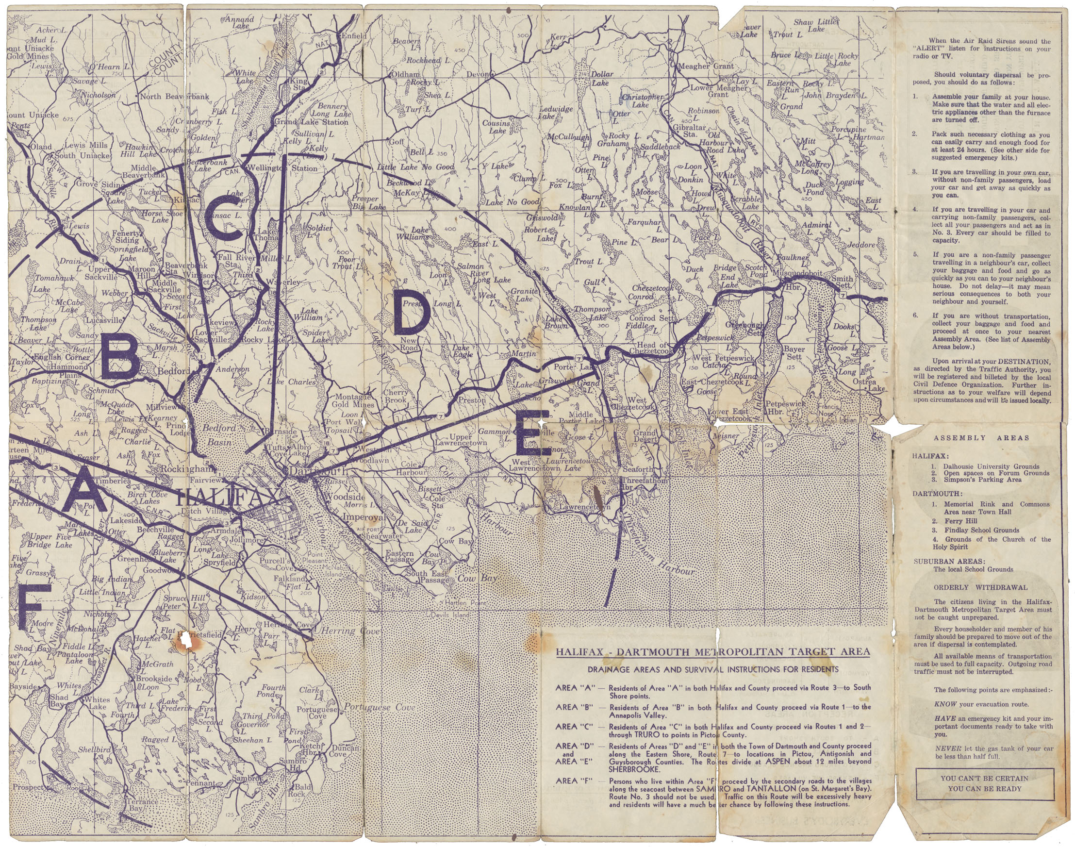
Halifax-Dartmouth Metropolitan Target Area
Date:
Reference: Nova Scotia Archives Map Collection: F/239
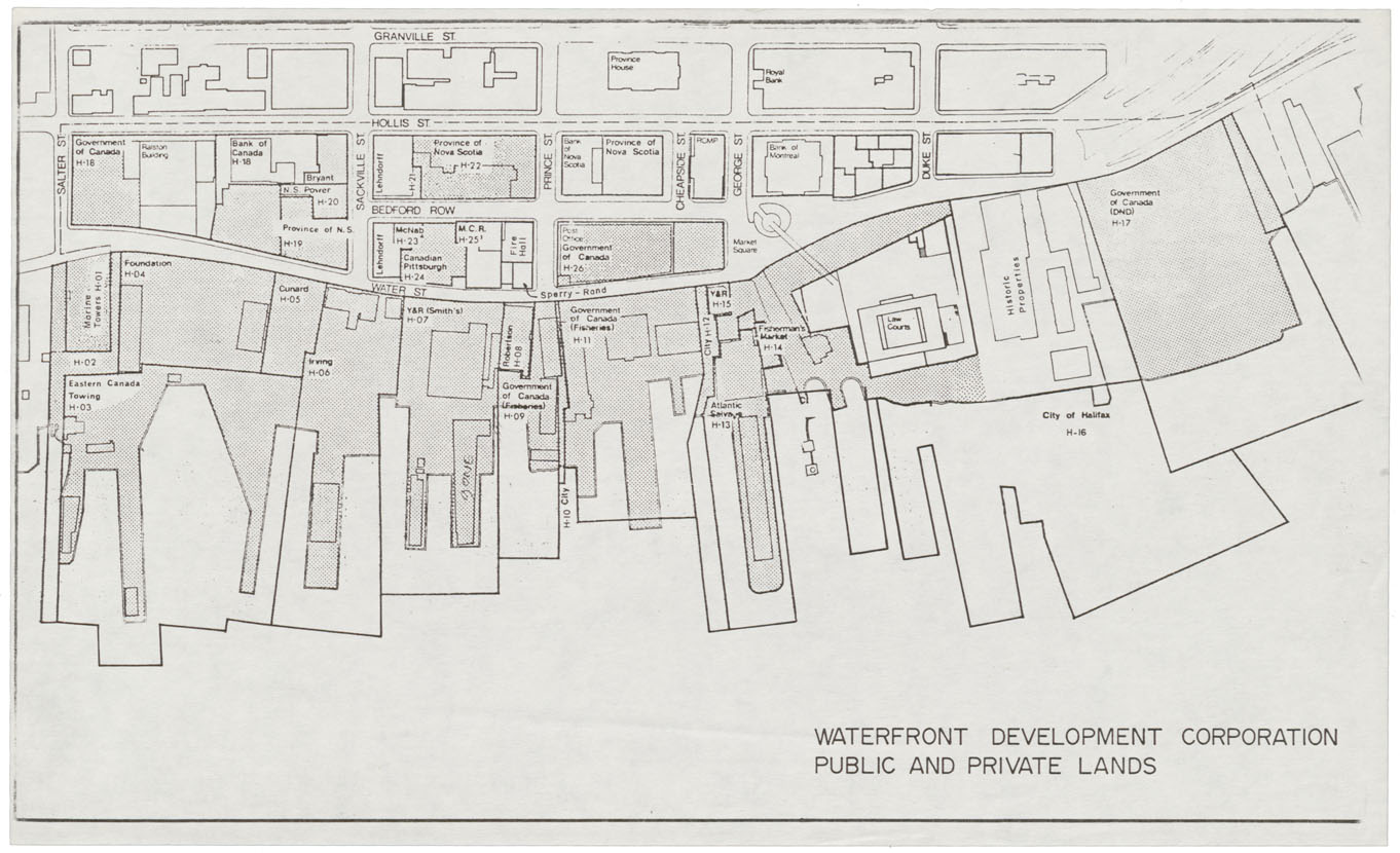
City of Halifax Public & Private Lands Waterfront Development Corporation
Date:
Reference: Nova Scotia Archives Map Collection: F/240
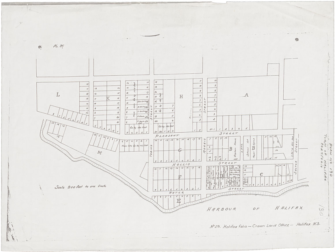
Town of Halifax South Suburbs harbour west to Queen Street north to Salter Street
Date:
Reference: Nova Scotia Archives Map Collection: F/240