Nova Scotia Archives
Historical Maps of Nova Scotia
Results 106 to 120 of 663 from your search: Halifax
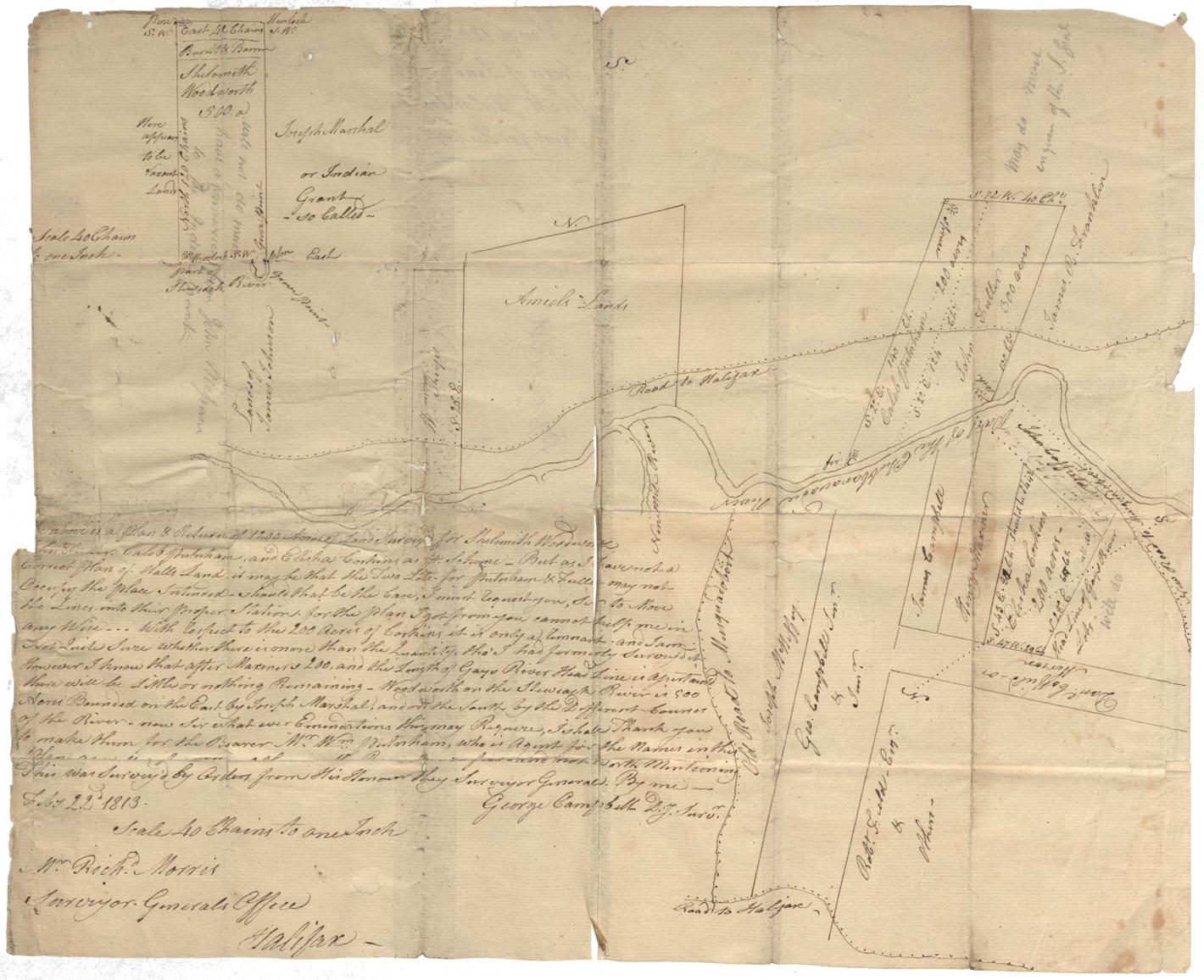
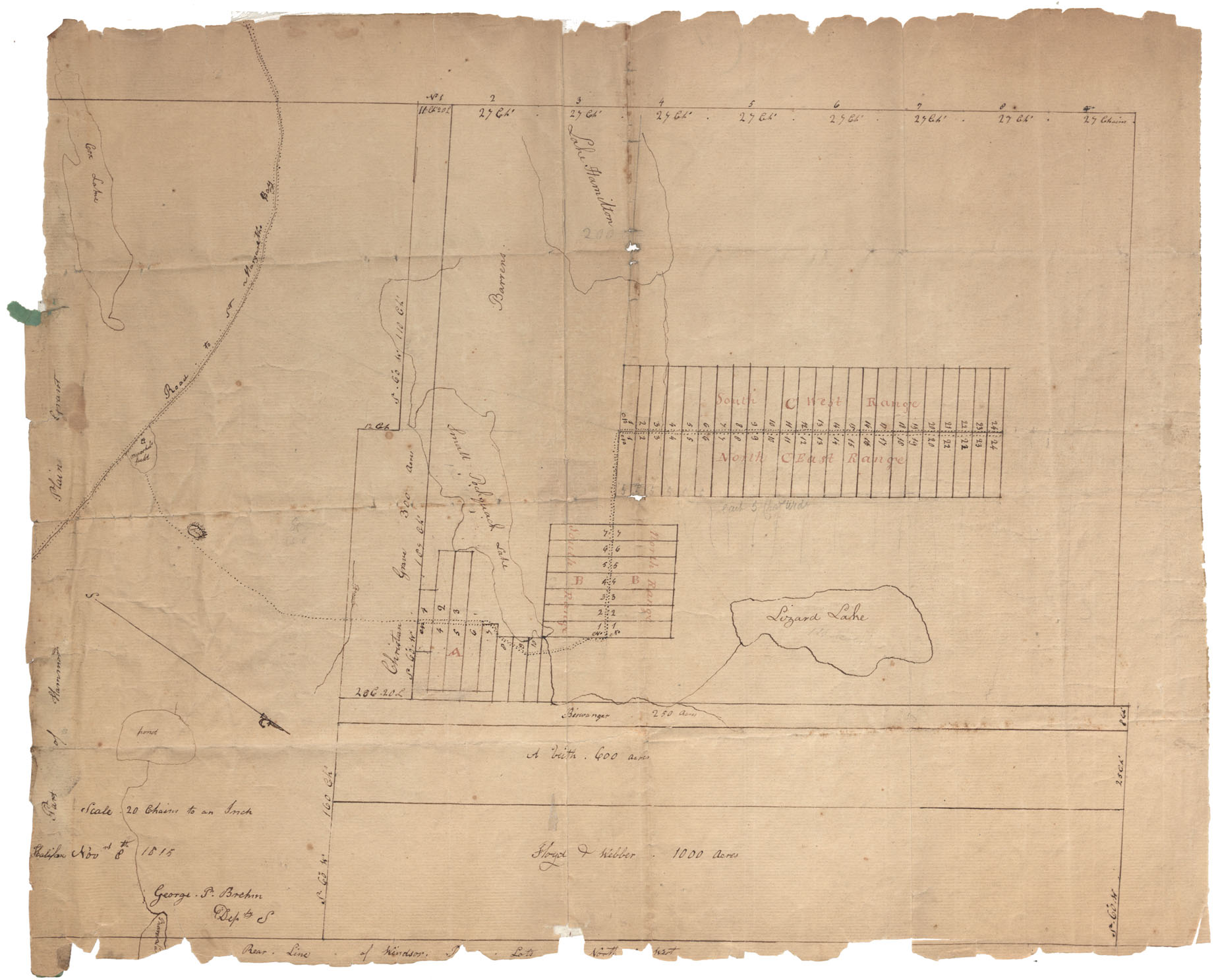
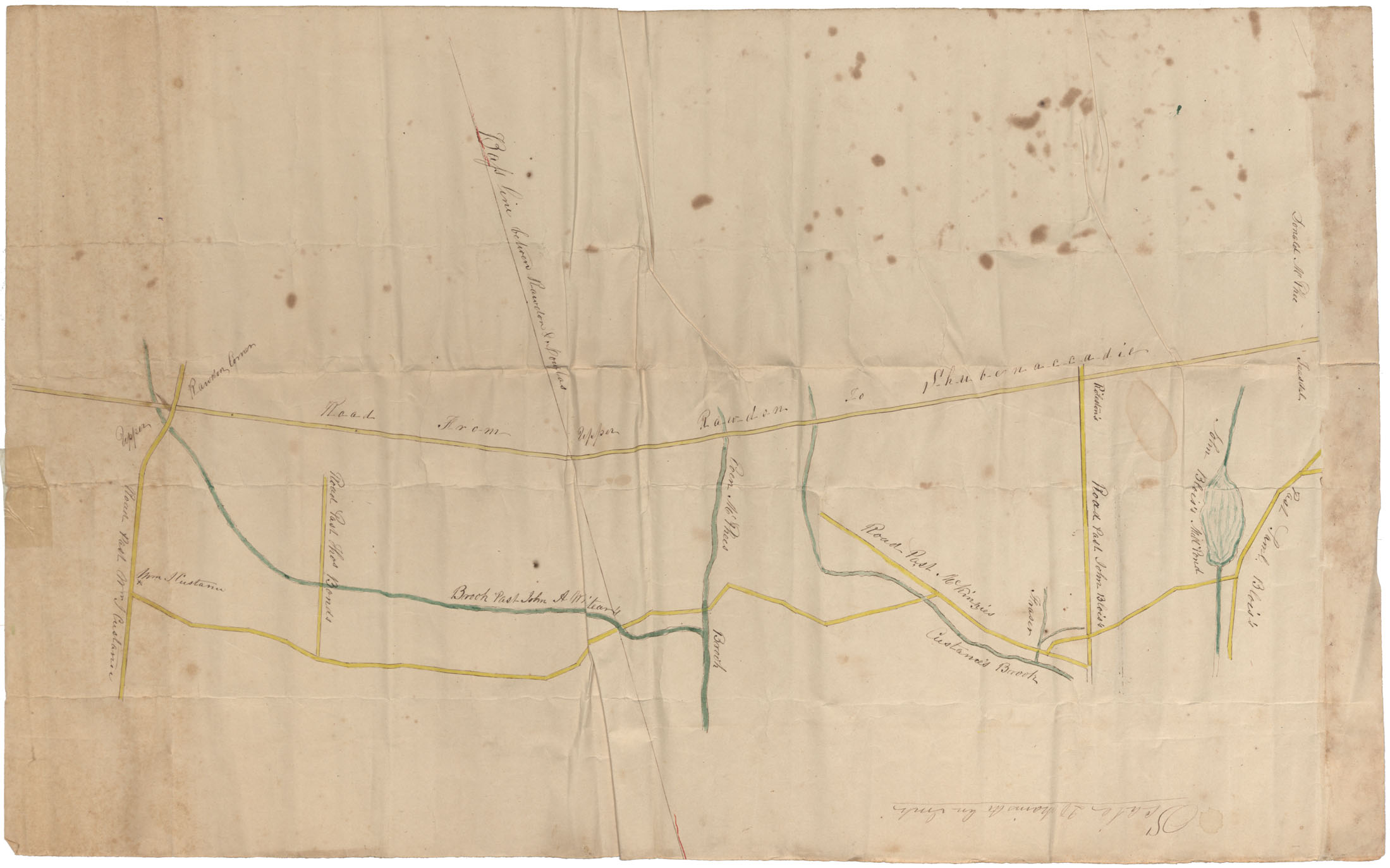
Lands on Shubenacadie River Lands on either side of Shubenacadie River, vicinity of Old Road to Musquodoboit & Nine Mile River, 1813
Date: 22 February 1813
Reference: Nova Scotia Archives Map Collection: F/210 - 1813
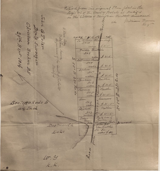
Copied from the original plan filed in the Registry of the Court of probate at Halifax John G Toler Deputy Surveyor
Date: 29 September 1814
Reference: Nova Scotia Archives Map Collection: F/239 - 1814
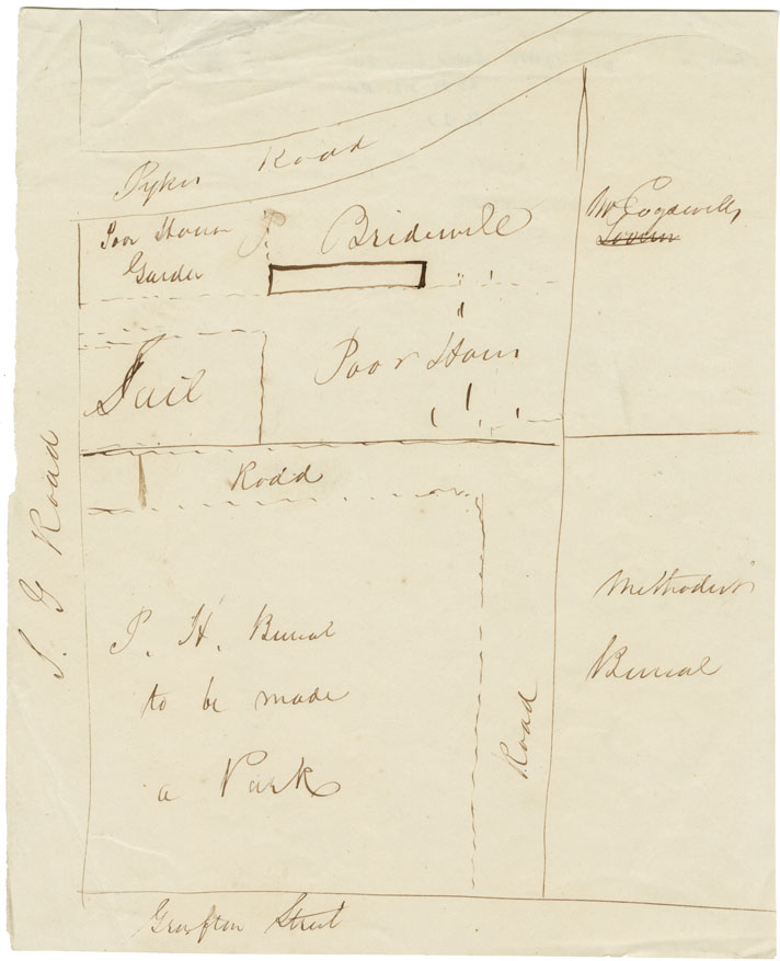
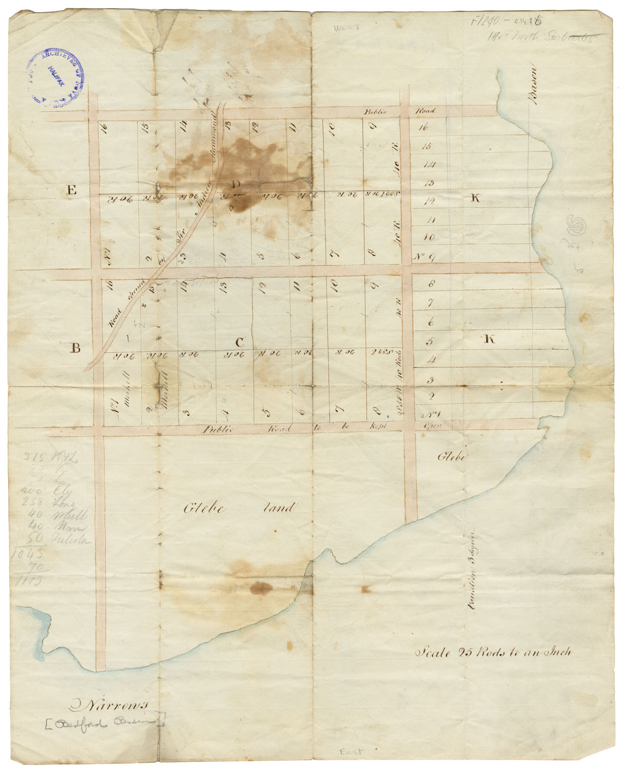
Area in Halifax bounded by Grafton, Spring Garden Road & Queen Street
Date: 1814
Reference: Nova Scotia Archives Map Collection: F/240 - 1814
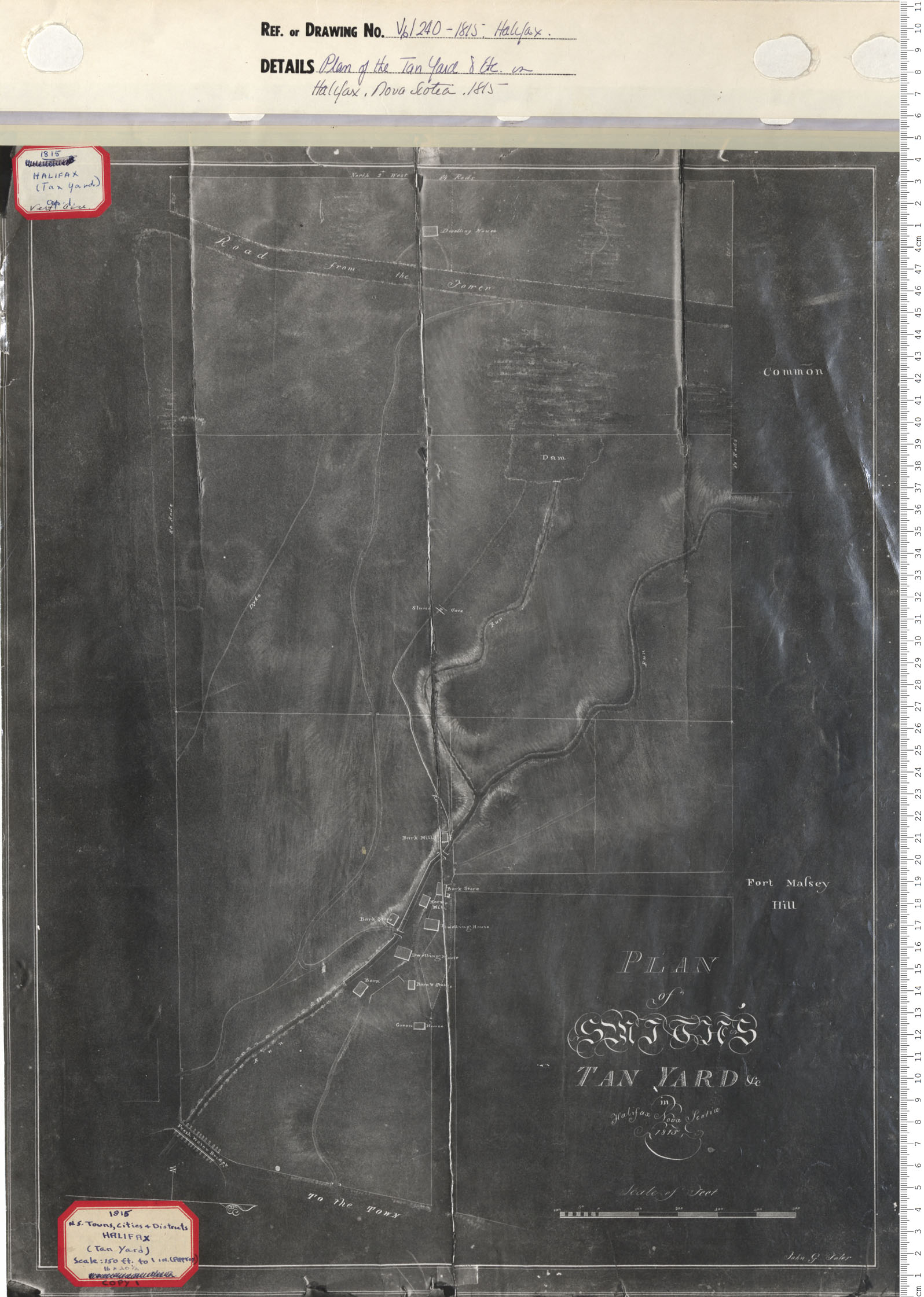
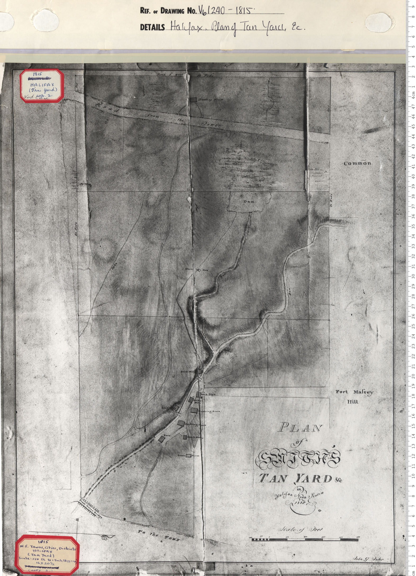
Plan of the Tan Yard & etc. in Halifax, Nova Scotia
Date: 1815
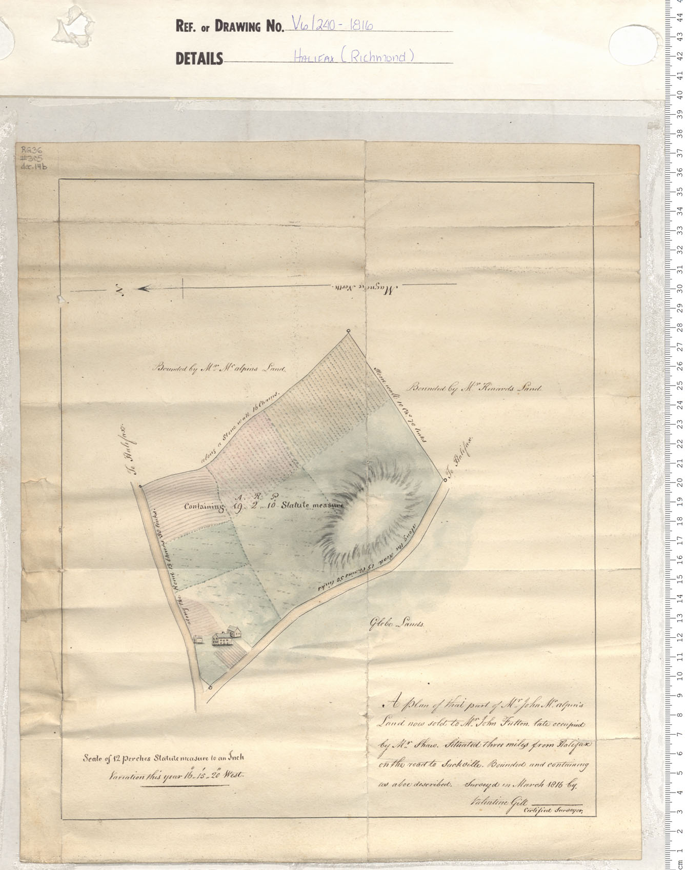
Reference: Nova Scotia Archives Map Collection: V6 240 Halifax, Nova Scotia
Plan of the Tan Yard & etc. in Halifax, Nova Scotia
Date: 1815
Reference: Nova Scotia Archives Map Collection: V6 240 Halifax, Nova Scotia
People of Color, Hammonds Plains, Halifax
Date: 1815
Reference: Nova Scotia Archives RG 1 volume 419 number 31 in Map Collection: African Nova Scotians
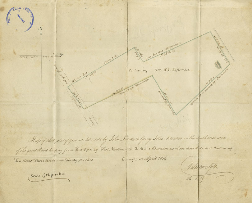
"Map of That Plat of Ground Late Sold by John Liddle to George Isles..."
Date: April 1816
Reference: Deeds, Bills of Sale, Legal Documents Nova Scotia Archives MG 10 vol. 20 K - P no. 149
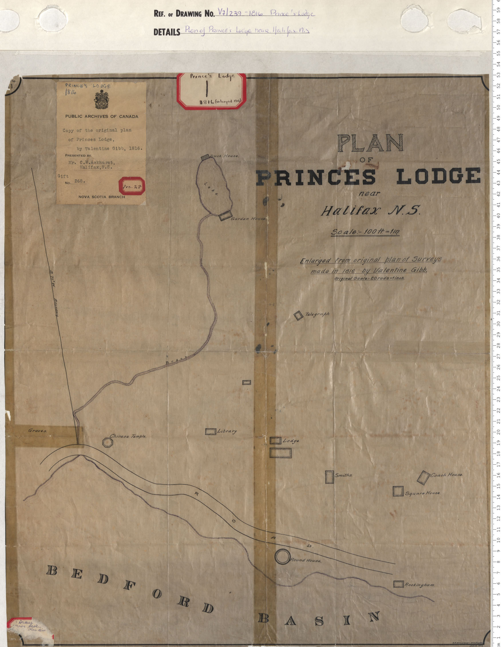
Plan of Prince's Lodge near Halifax N.S.
Date: 1816
Reference: Nova Scotia Archives Map Collection: V7 239 Prince's Lodge, Nova Scotia
Surveys of Roads from Halifax to Windsor; Halifax to Truro
Date: 1817
Reference: Nova Scotia Archives Map Collection: F/209 - 1817
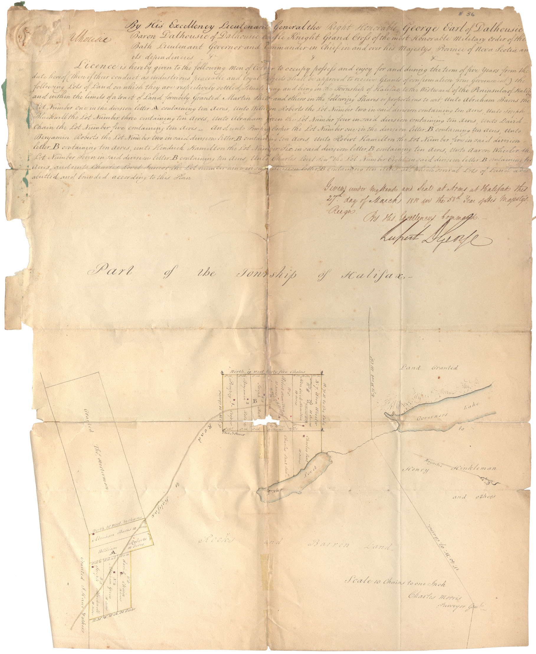
License men of Colour - Pompey Cooper and others, Refugee Hill, Township of Halifax
Date: 1818
Reference: Nova Scotia Archives RG 1 volume 419 number 36 in Map Collection: African Nova Scotians
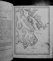
Map of Torrington Hrb by Thomas Durell
Date: 1 May 1818
Reference: Nova Scotia Archives Map Collection: F/239 - 1732
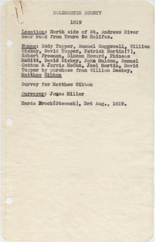
Colchester County North side of St.Andrew's River near road from Truro to halifax 1819
Date: 3 August 1819
Reference: Nova Scotia Archives Map Collection: F/230 - 1819
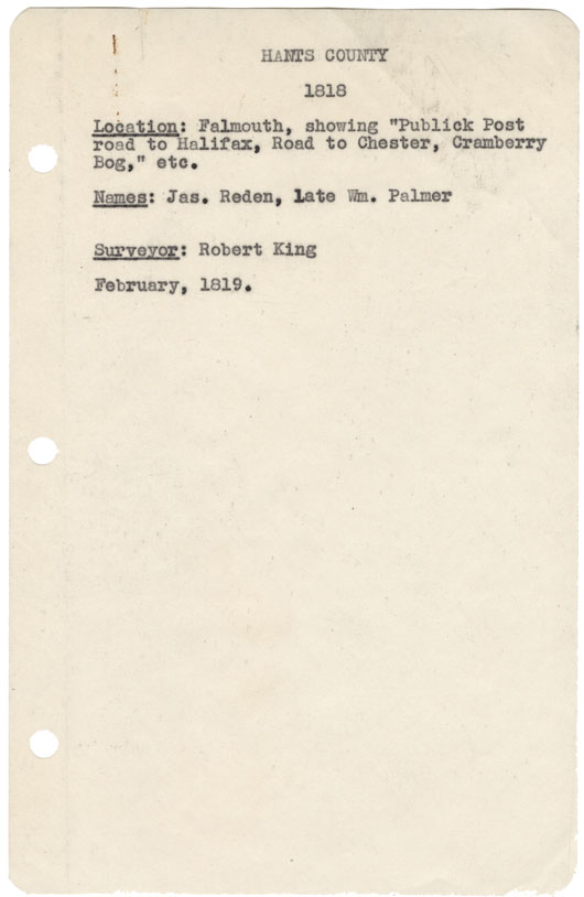
Hants County Falmouth showing "Publick Post Road to halifax, Road to Chester, Cranberry Bog etc 1818
Date: February 1819
Reference: Nova Scotia Archives Map Collection: F/230 - 1818