
Nova Scotia Archives
Historical Maps of Nova Scotia
"Map of That Plat of Ground Late Sold by John Liddle to George Isles..."
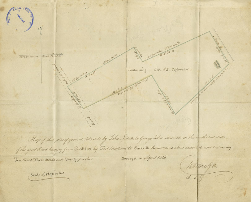
"...situated on the south-west side of the great road leading from Halifax to Fort Needham to Sackville Bounded as above described and containing ten acres three roods and twenty perches.”
Nova Scotia Archives & Records Management has a collection of miscellaneous deeds and plans (MG 10).
A plat is a plan of an area of land. A rood is a quarter of an acre and a square perch is 30 1/4 square yards. A perch is also a measure of length for land equal to 5 ½ yards. Gill’s
Date: April 1816
Cartographer: Valentine Gill
Reference: Deeds, Bills of Sale, Legal Documents Nova Scotia Archives MG 10 vol. 20 K - P no. 149