Nova Scotia Archives
Search
Results 779 to 826 of 1207 from your search: lunenburg
Note: if what you see below isn't quite what you're looking for, or if you're looking for results from different areas of our website, try our Additional Search Tools or Google
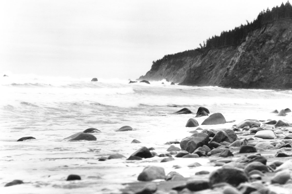
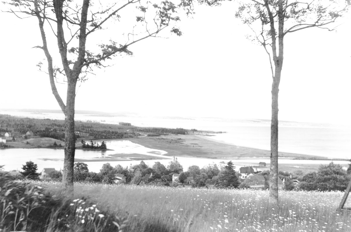
Coastline, Broad Cove, Lunenburg County
macaskill : 200321433
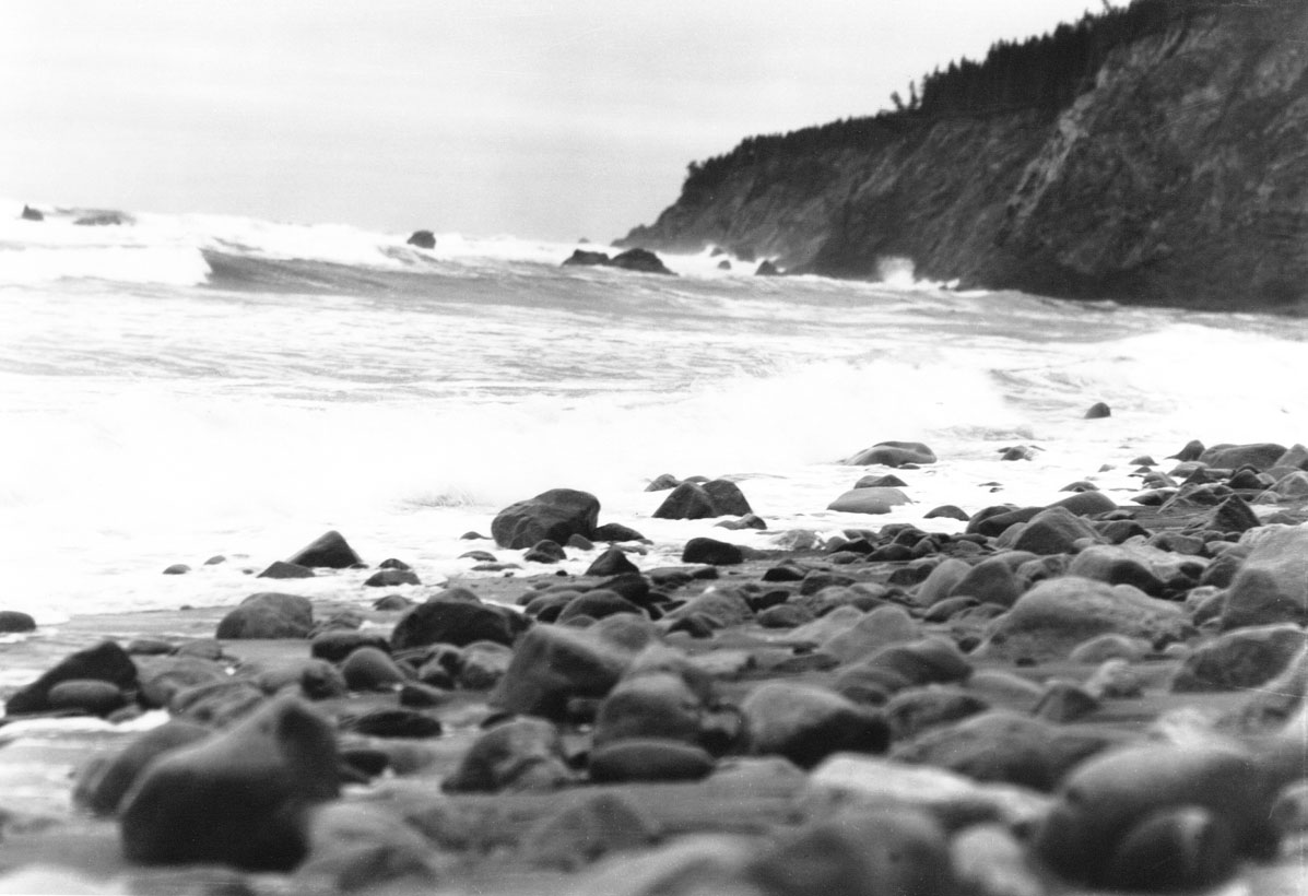
Coastline, Broad Cove, Lunenburg County, NS
macaskill : 200321434
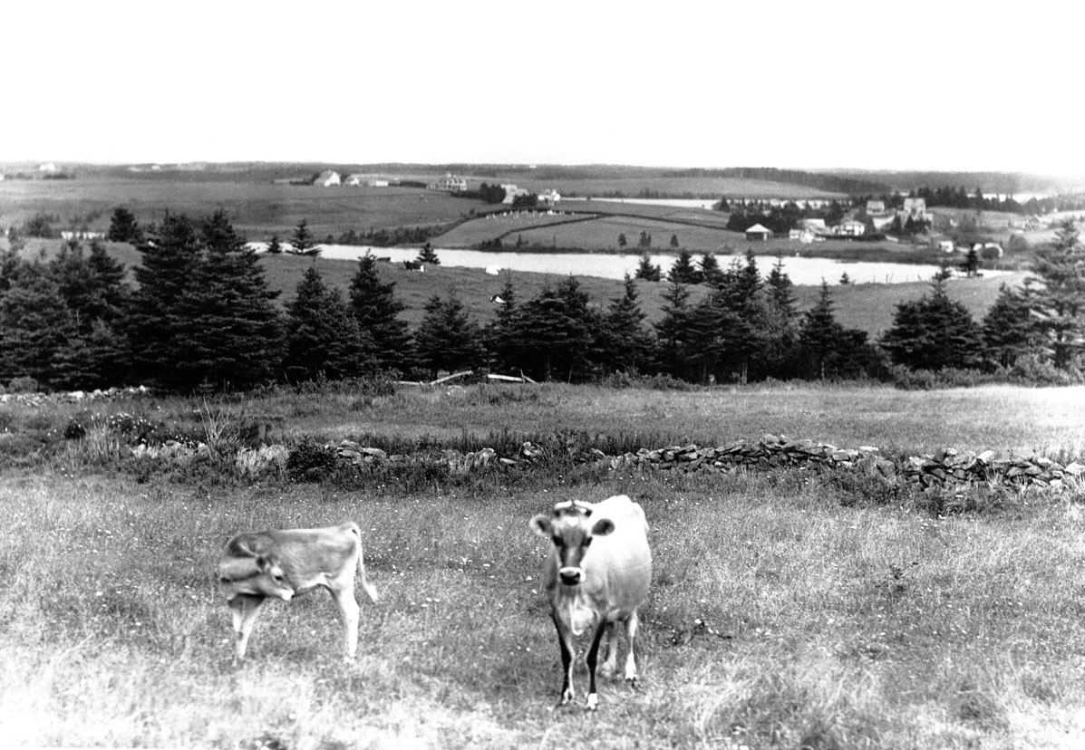
Cattle, lakes near Maitland, Lunenburg County, NS
macaskill : 200321487

Two-masted fishing schooner at anchor, Indian Point, Lunenburg County, NS
macaskill : 200321522
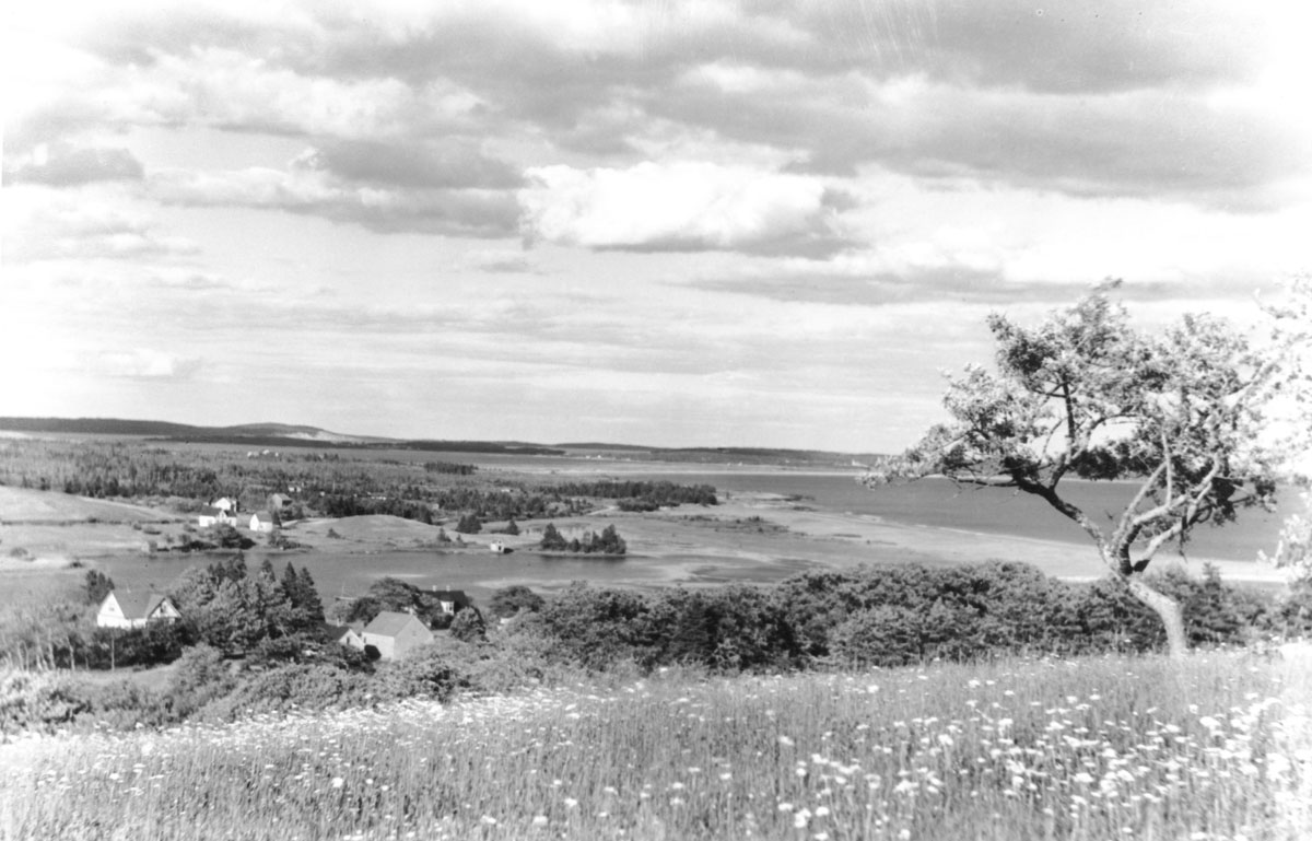
Petite Riviere, Green Bay, Lunenburg County, NS
macaskill : 200311241
Petite Riviere, Green Bay, Lunenburg County, NS
macaskill : 200311242
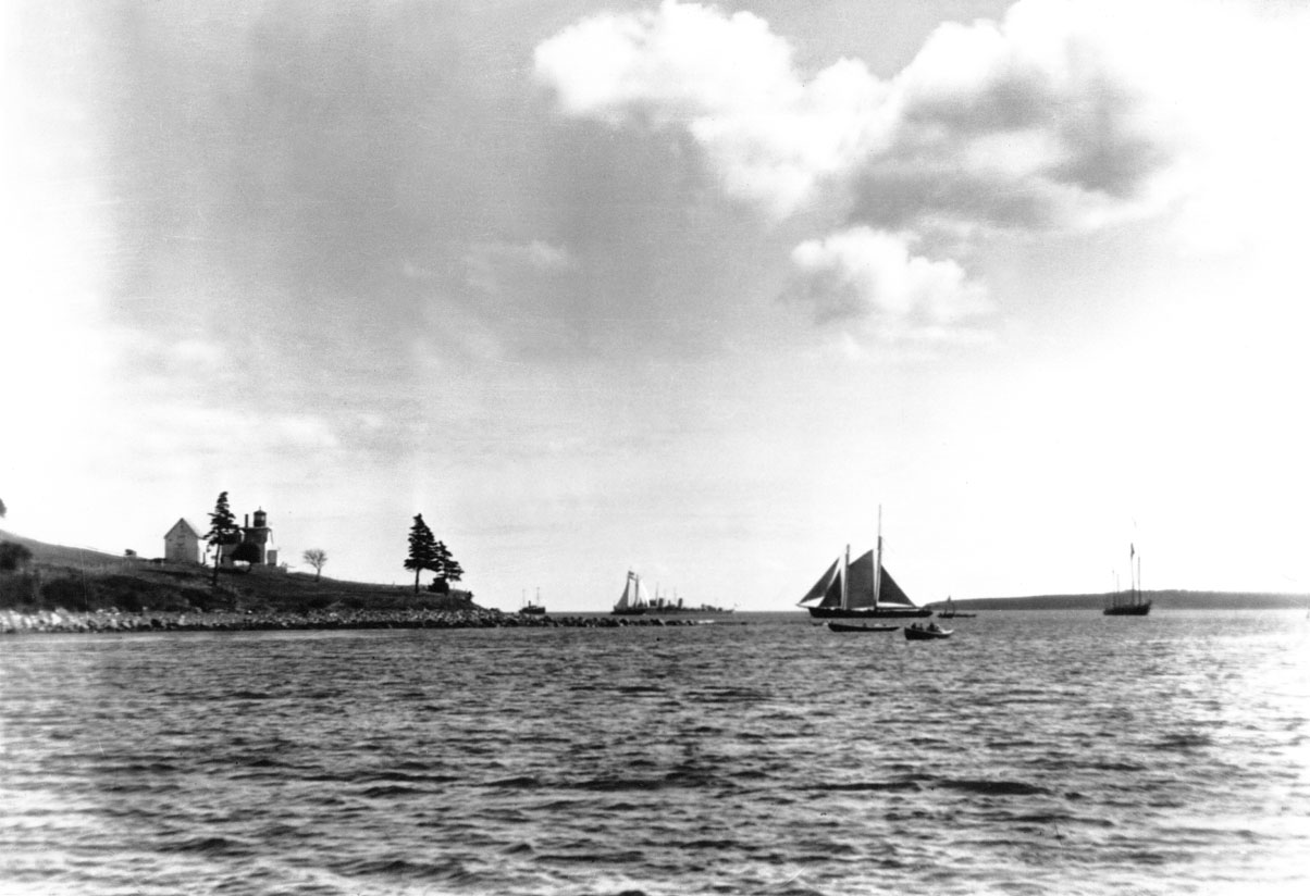
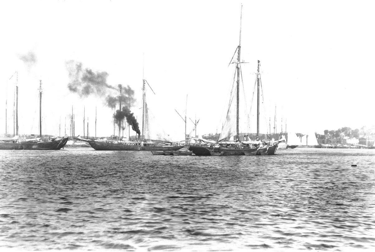
Bay of Fundy trader and other vessels, Lunenburg Harbour
macaskill : 200321633
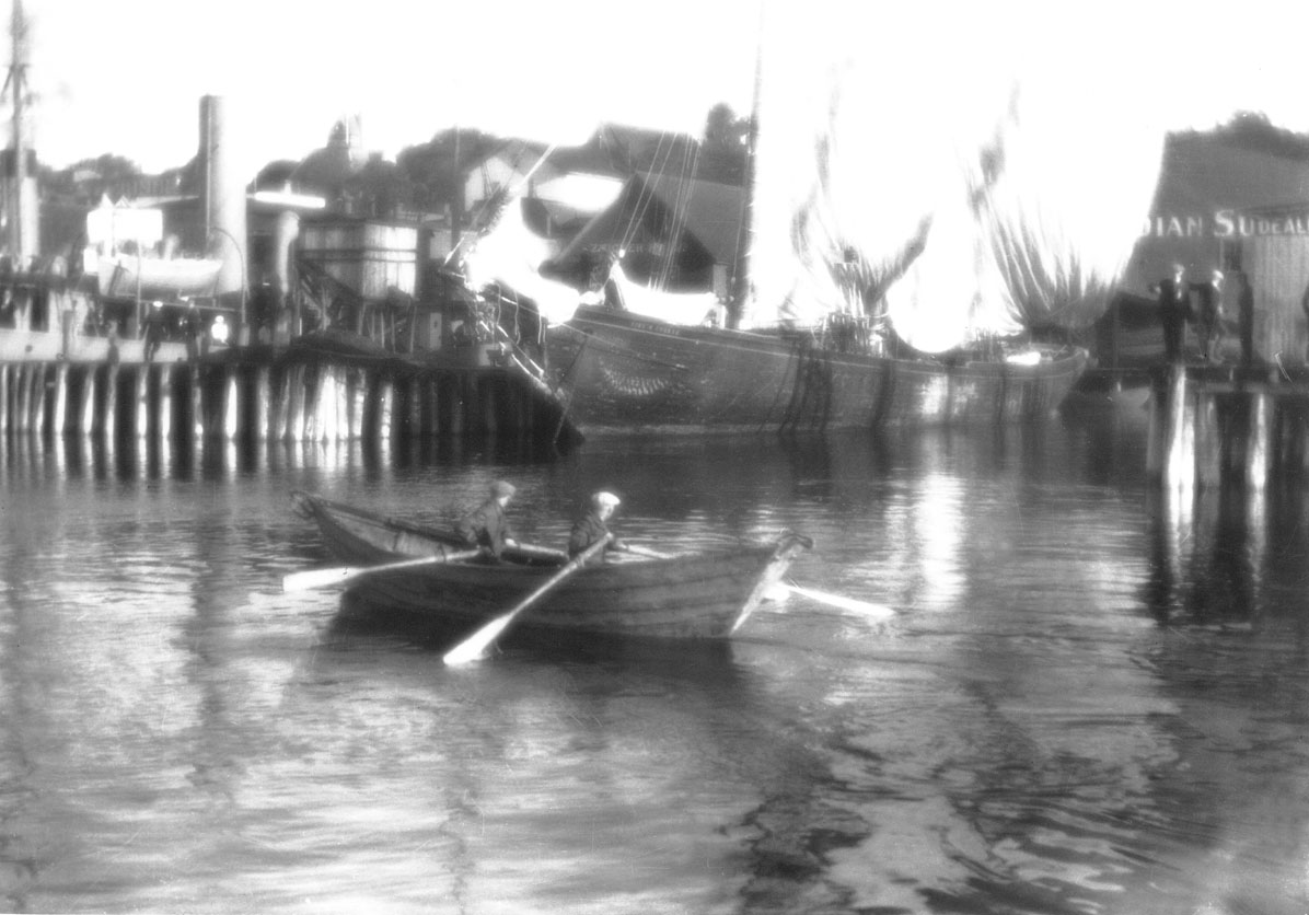
Two-masted fishing schooner anchored, Lunenburg Harbour
macaskill : 200321868
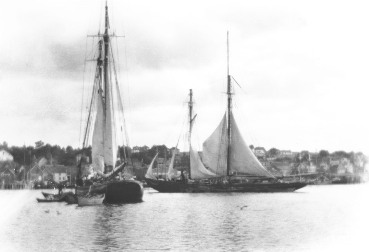
Two-masted and Grand Bank fishing schooners anchored, Lunenburg Harbour
macaskill : 200312066
macaskill : 200321871
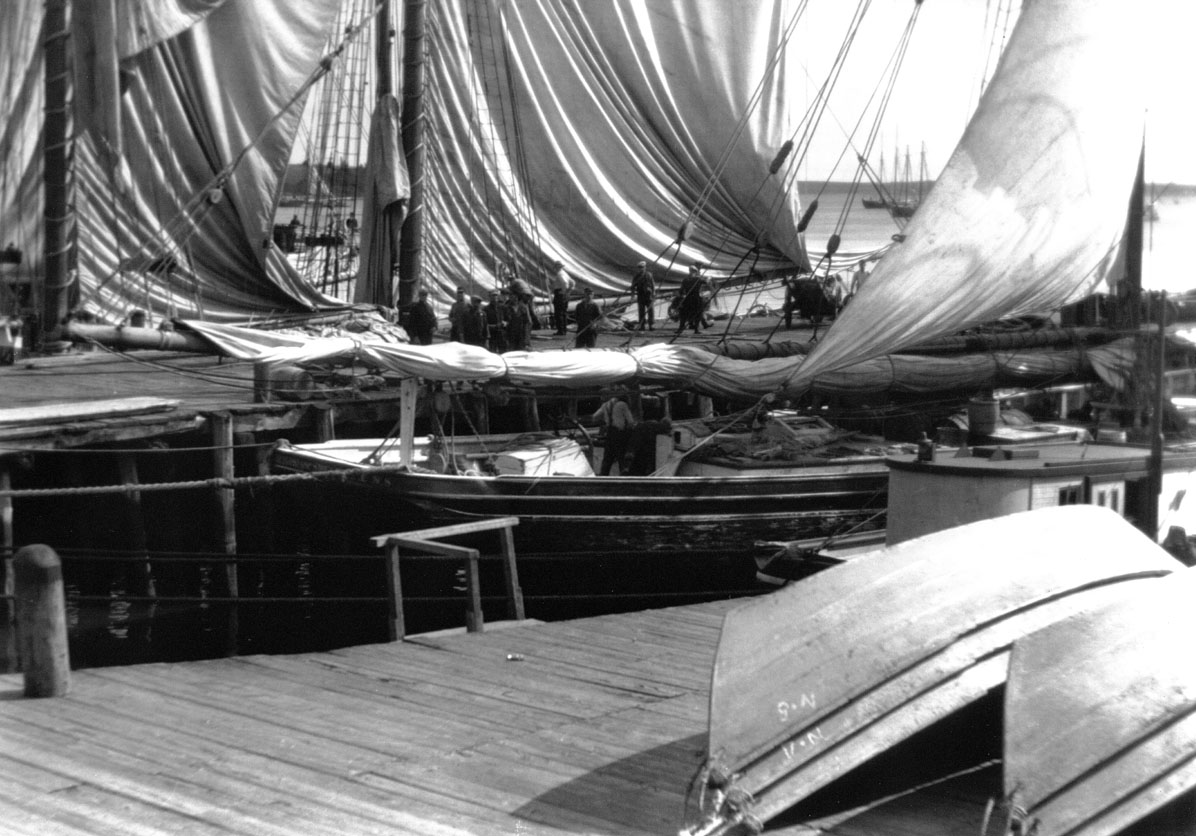
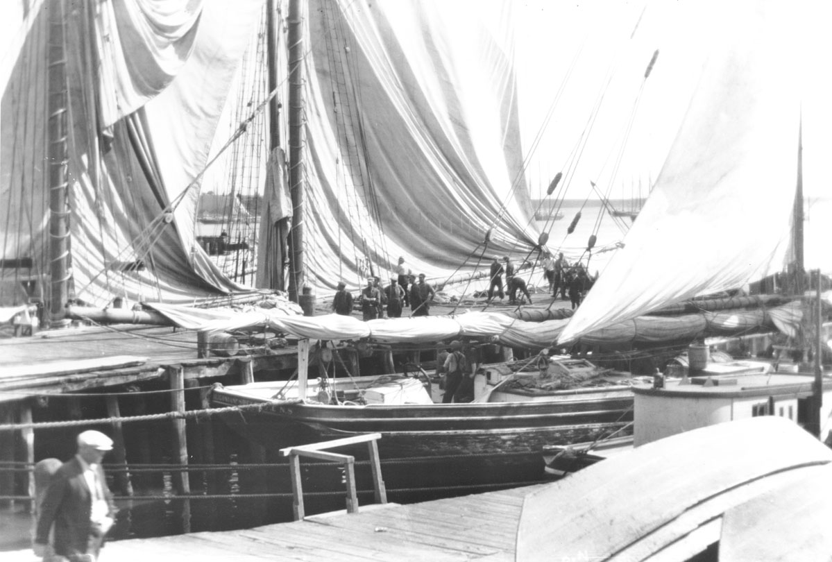
Drying Sails, Zwickers Wharf, Lunenburg, NS
macaskill : 200321873
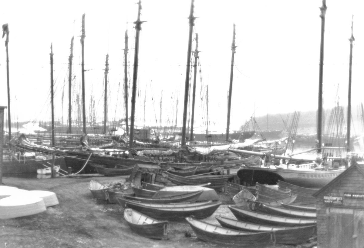
A Forest of Masts / Spars, Lunenburg, NS
macaskill : 200311484
macaskill : 200311486
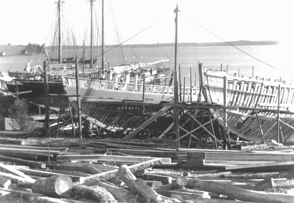
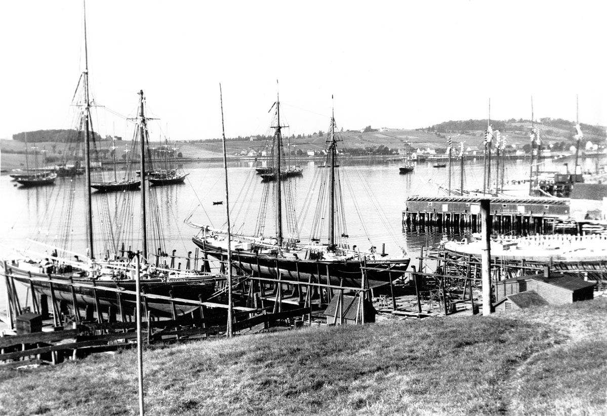
Hulls of fishing schooners being built, Maritime National Fish Co. Ltd, Lunenburg, NS
macaskill : 200311488
Schooners anchored at wharf, Lunenburg, NS
macaskill : 200311491
Tern and two-masted fishing schooners anchored, Lunenburg Harbour
macaskill : 200311492
Two Bay of Fundy traders anchored, Lunenburg Harbour, NS
macaskill : 200311494
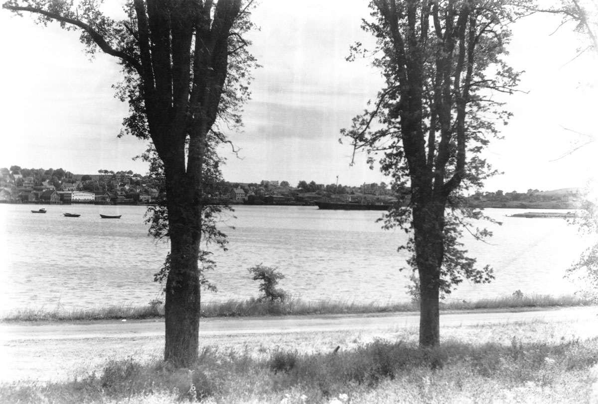
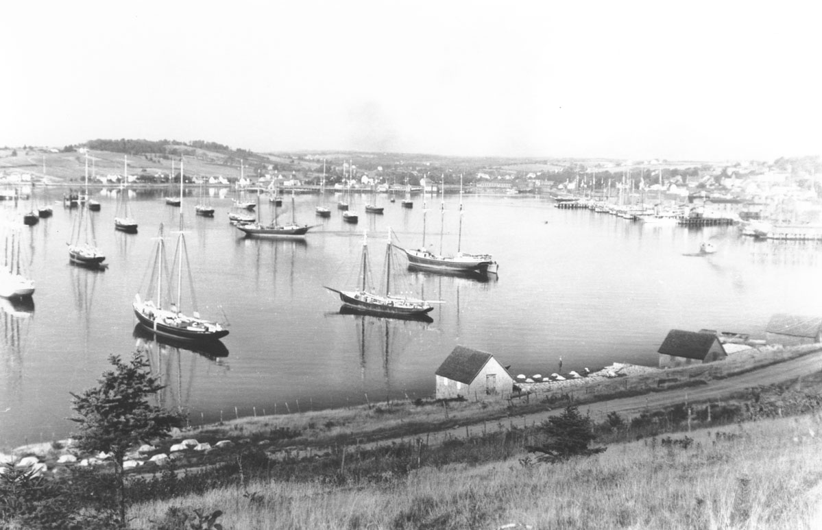
Town of Lunenburg from opposite shore
macaskill : 200330013
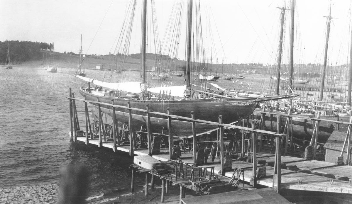
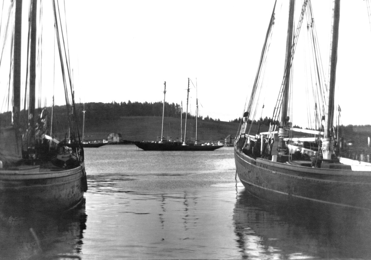
Grand Bank fishing schooner Bluenose in dry dock, Lunenburg Harbour, NS
macaskill : 200311782
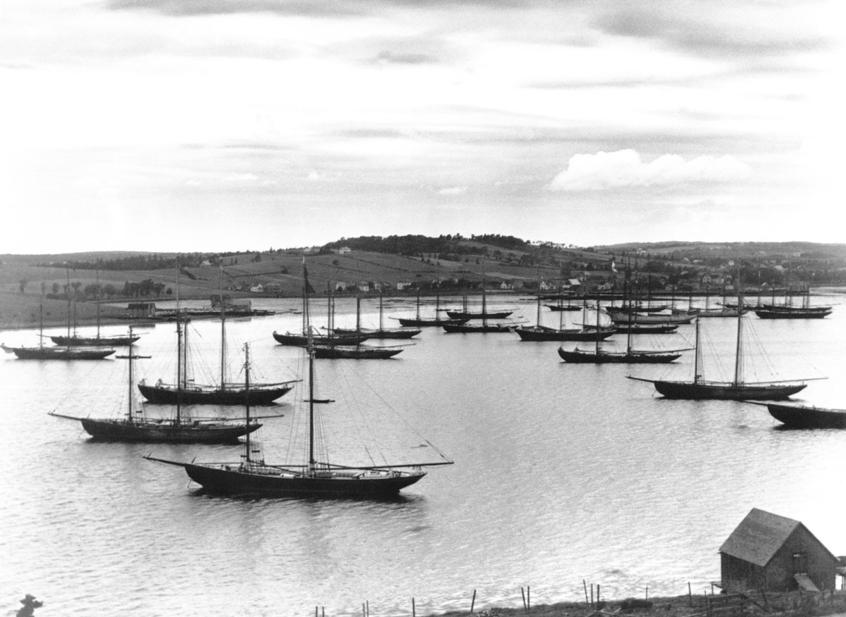
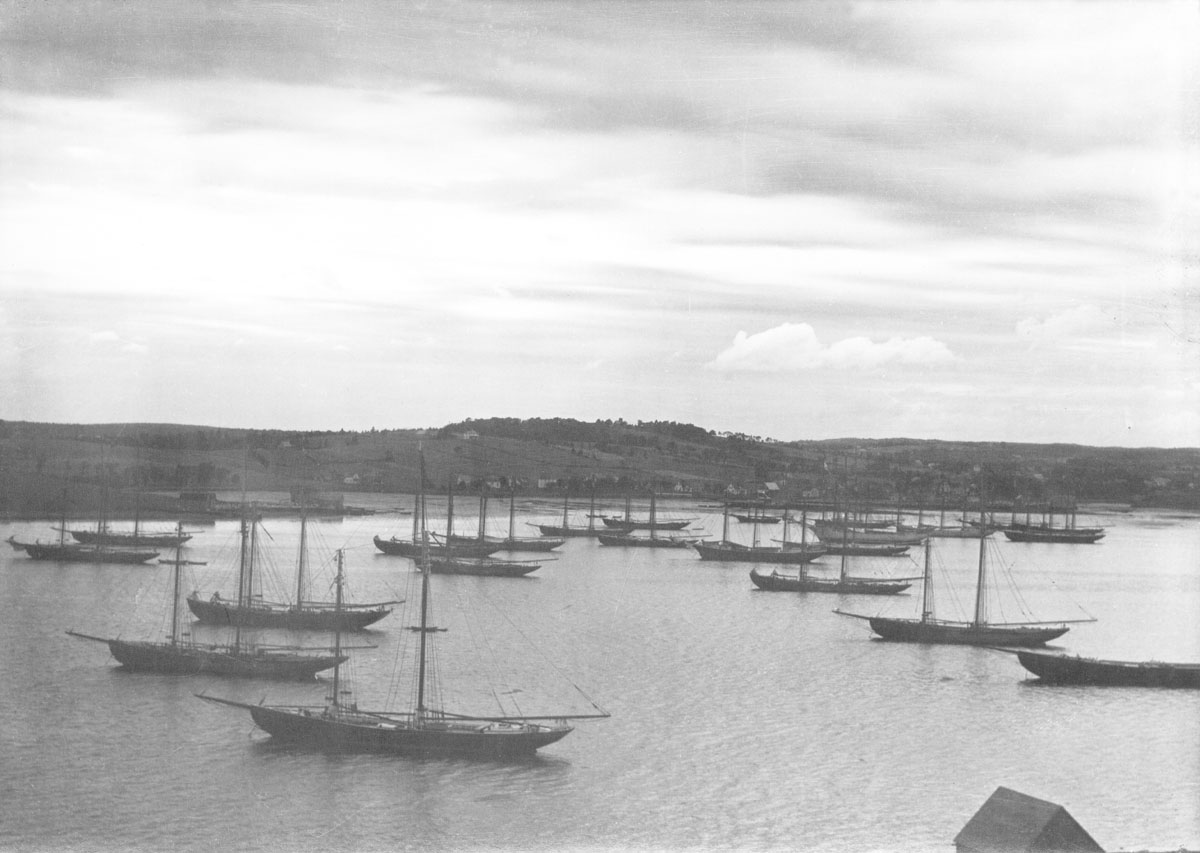
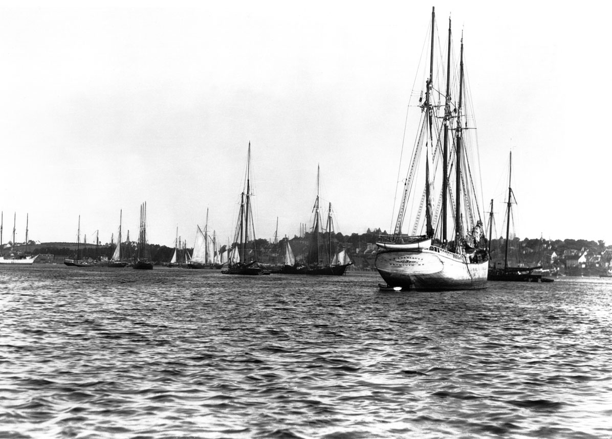
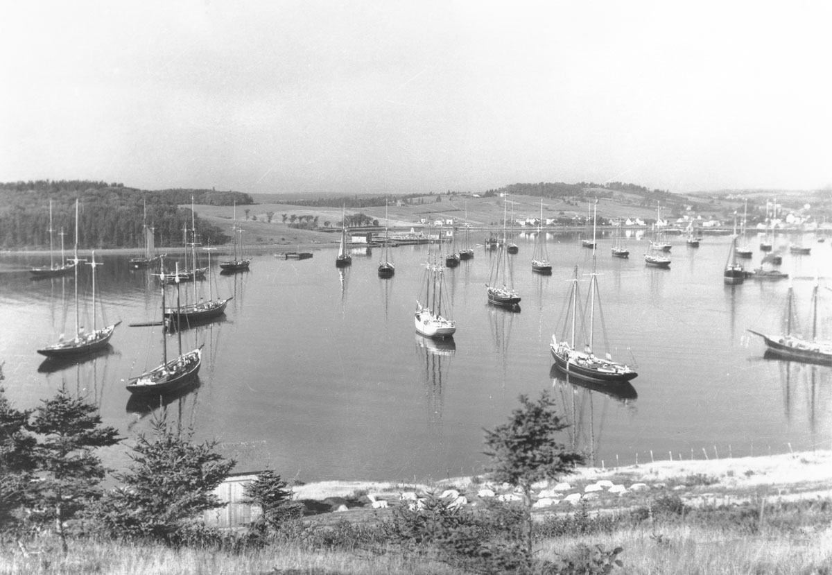
Fleet Home, Lunenburg Harbour, NS
macaskill : 200330253
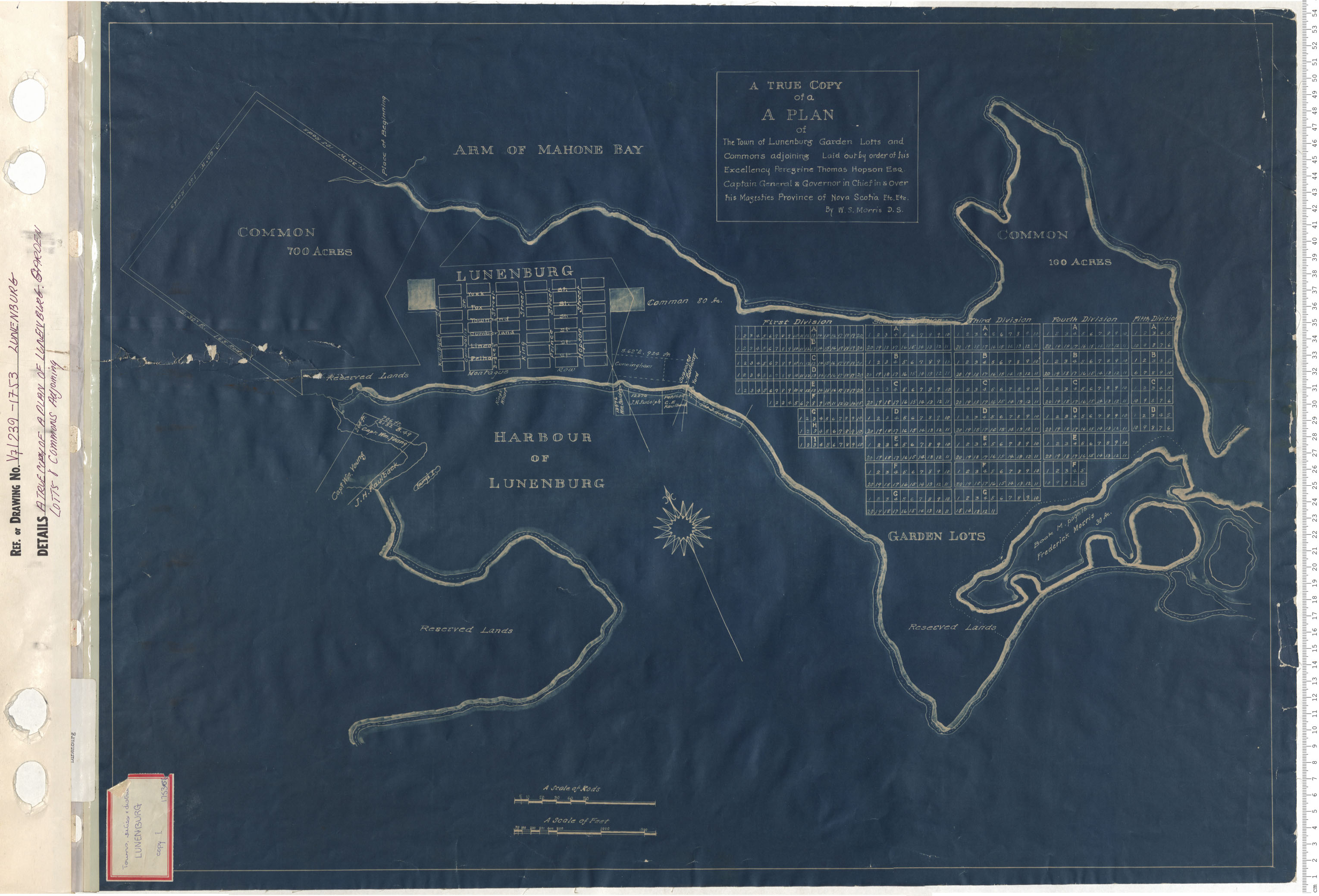
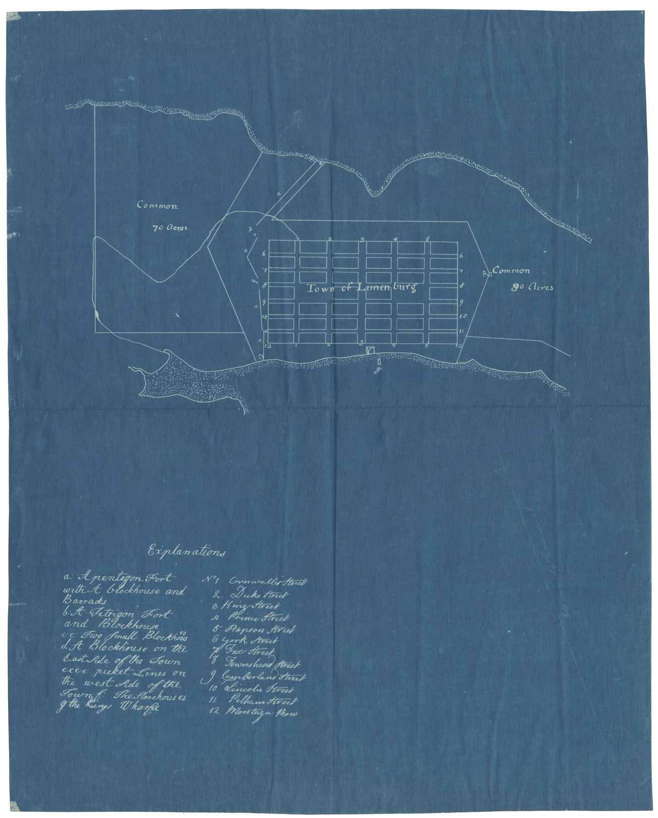
A True Copy of a Plan of Lunenburg Garden Lots and Commons Adjoining
maps : 201402154
maps : 201402147

maps : 201402153
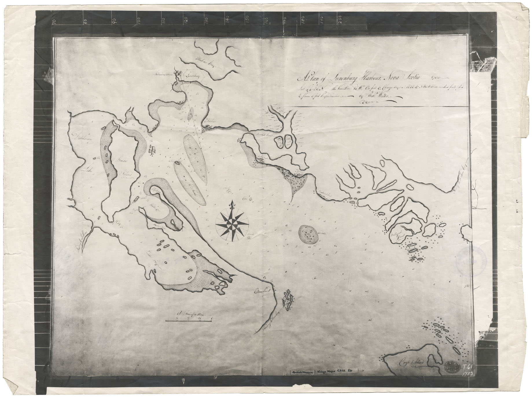
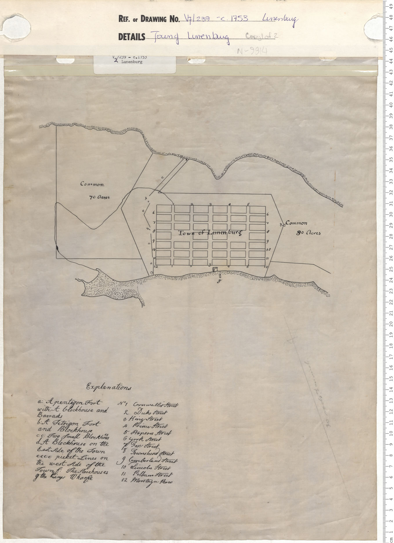
A Plan of Lunenburg Harbour, NS 1753
maps : 202012606
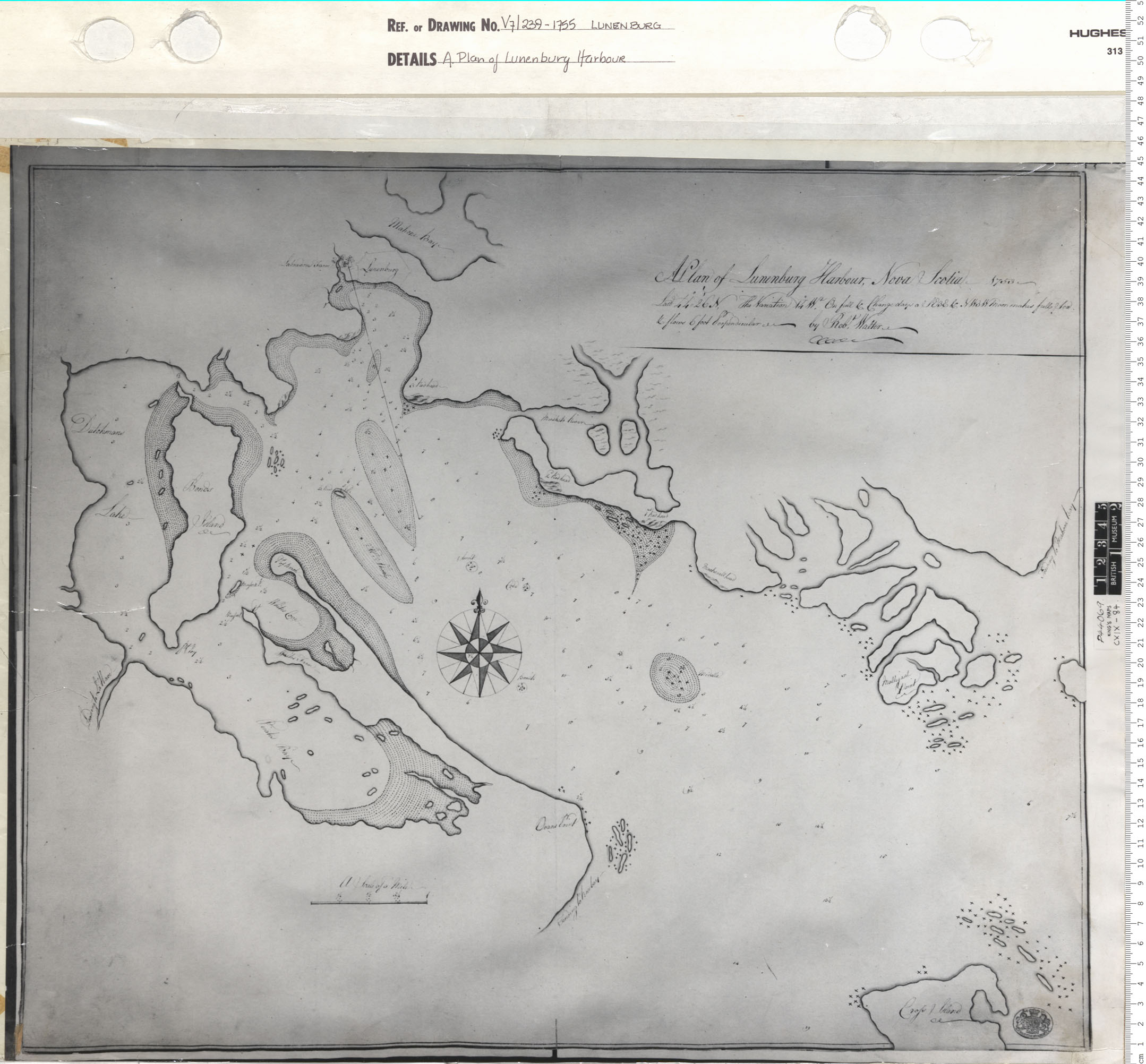
maps : 201402155
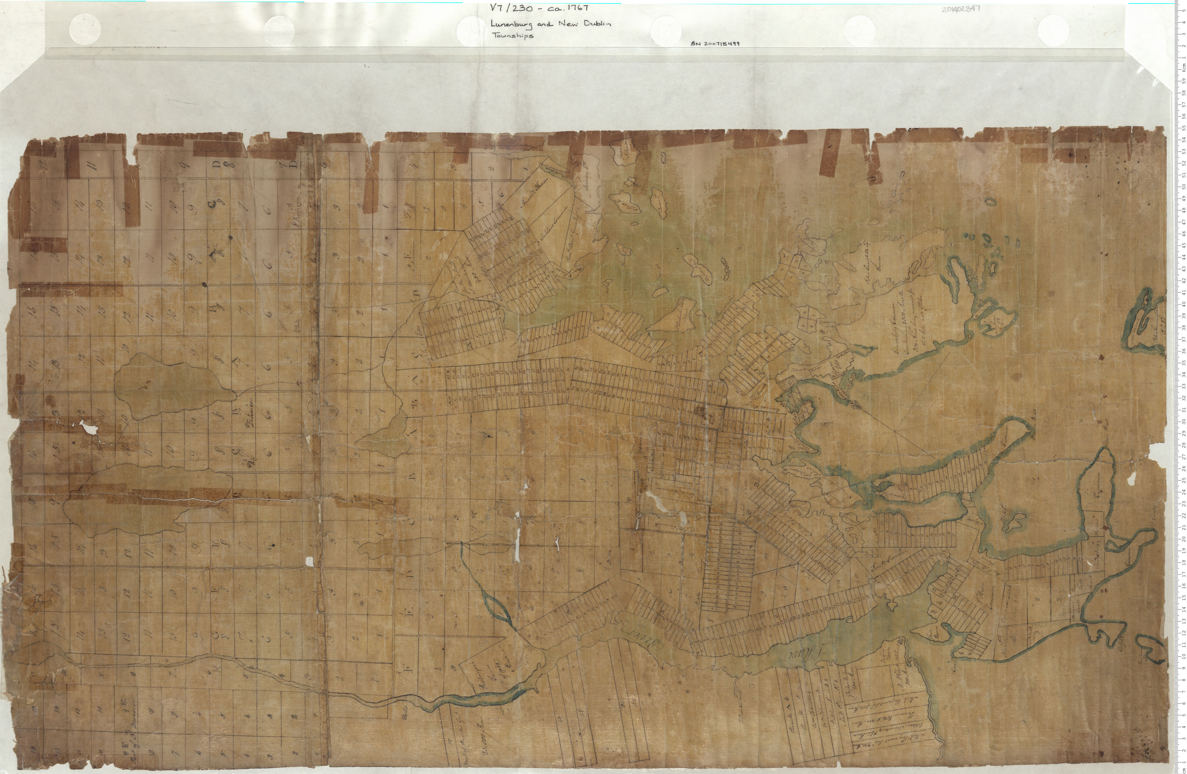
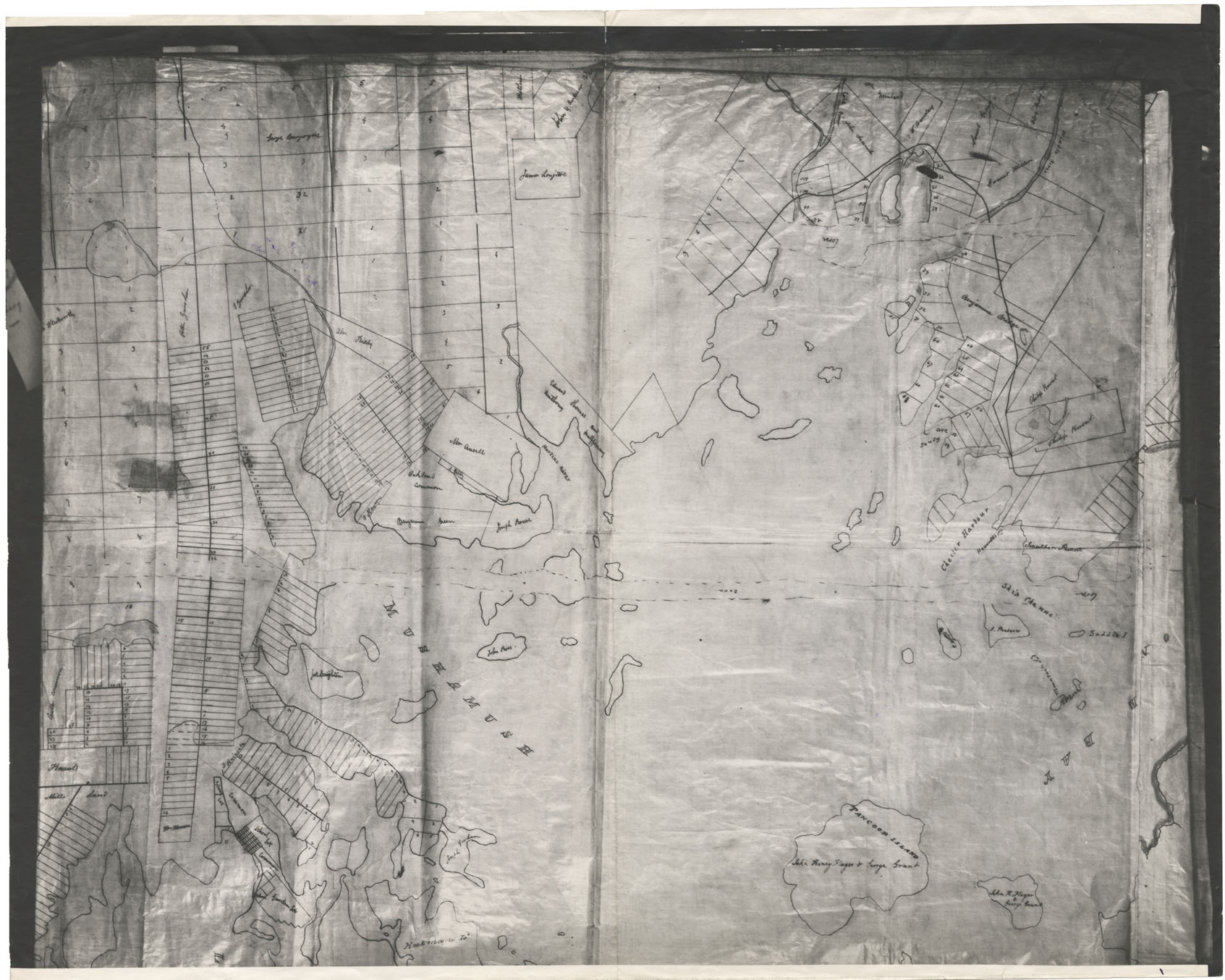
Lunenburg and New Dublin Townships
maps : 201402347
maps : 202012607
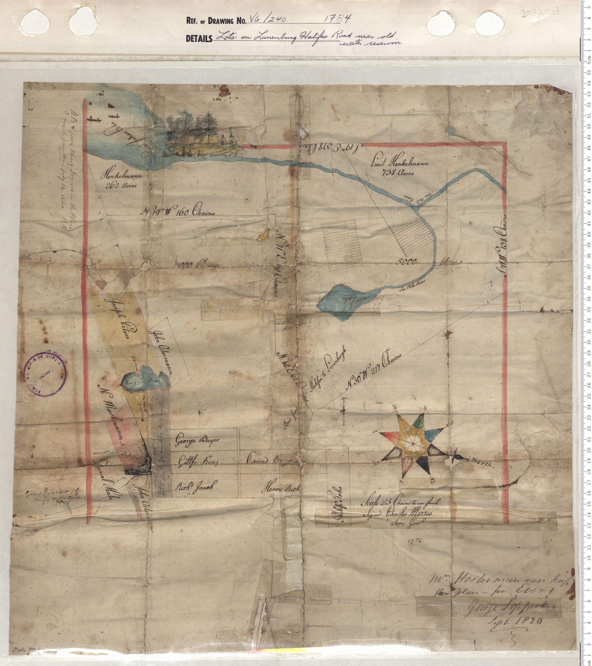
Lots on Lunenburg Halifax Road near old water resevoir
maps : 201320553
Lunenburg-Division into Town Plots
maps : 202012609
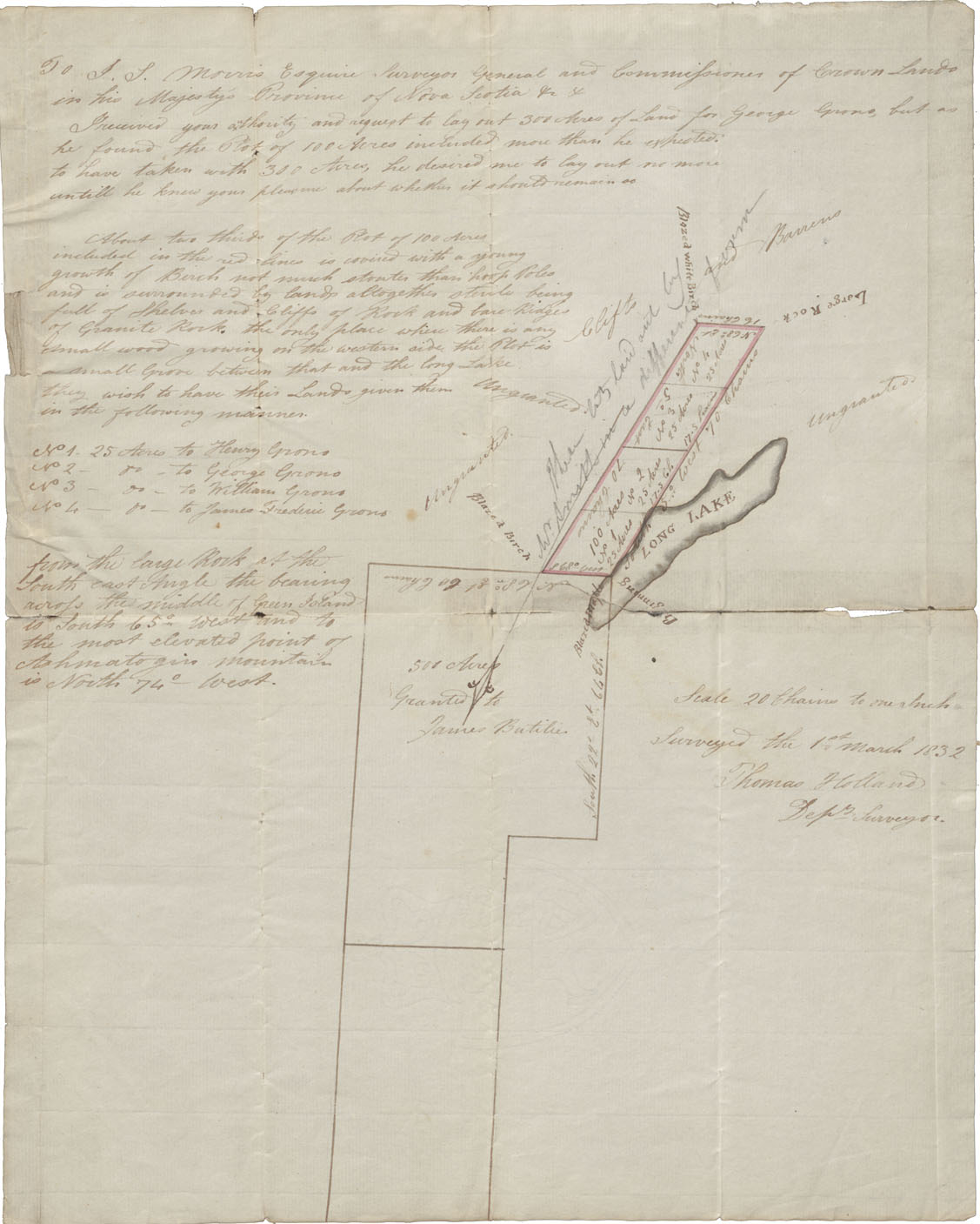
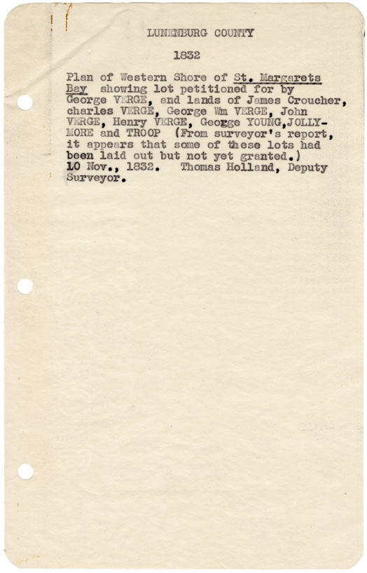
Lunenburg County Plan of Western Shore of St Margarets bay, 1832
maps : 202015059
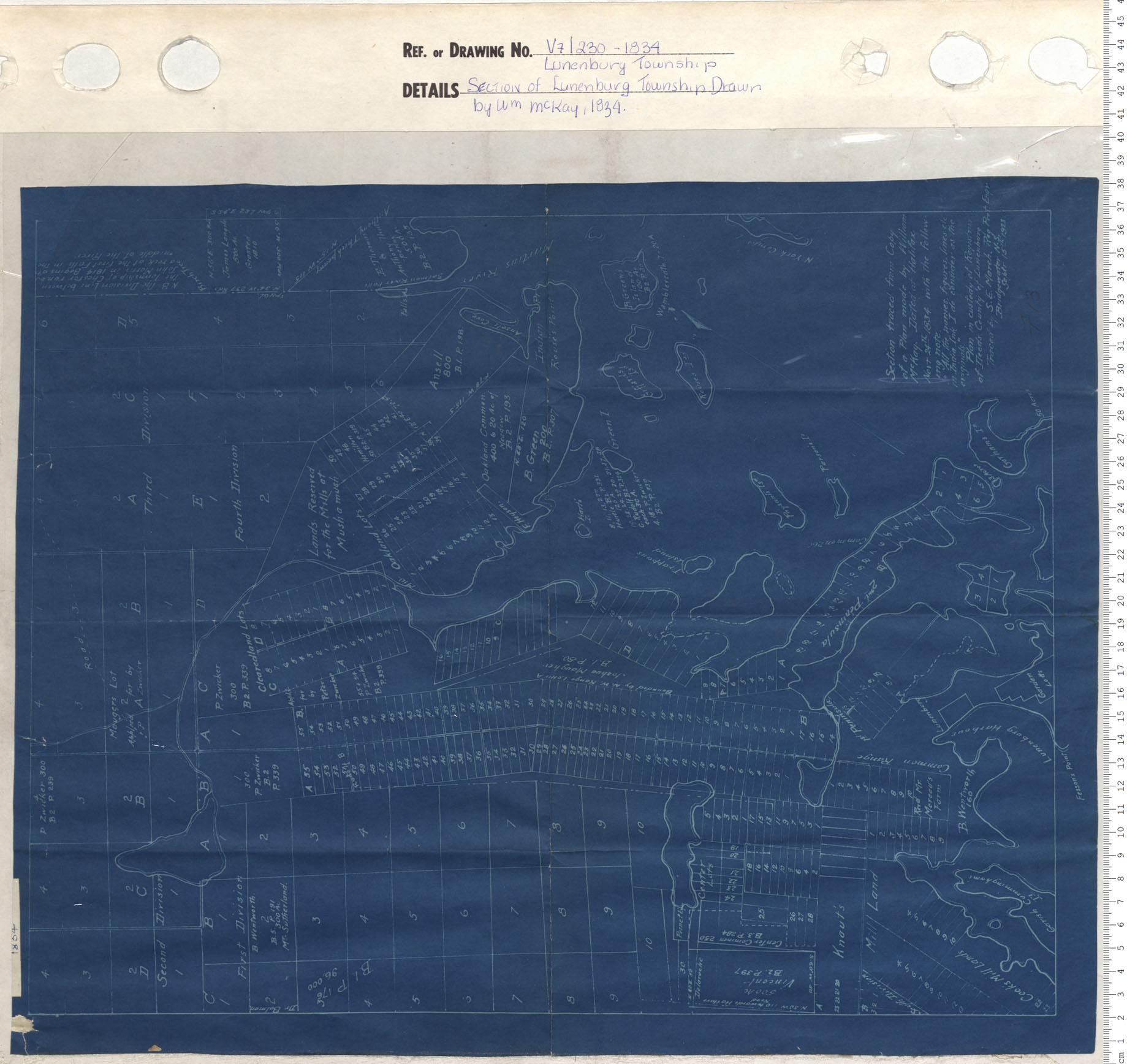
Section of Lunenburg Township Drawn by W.M. McKay, 1834
maps : 201402158
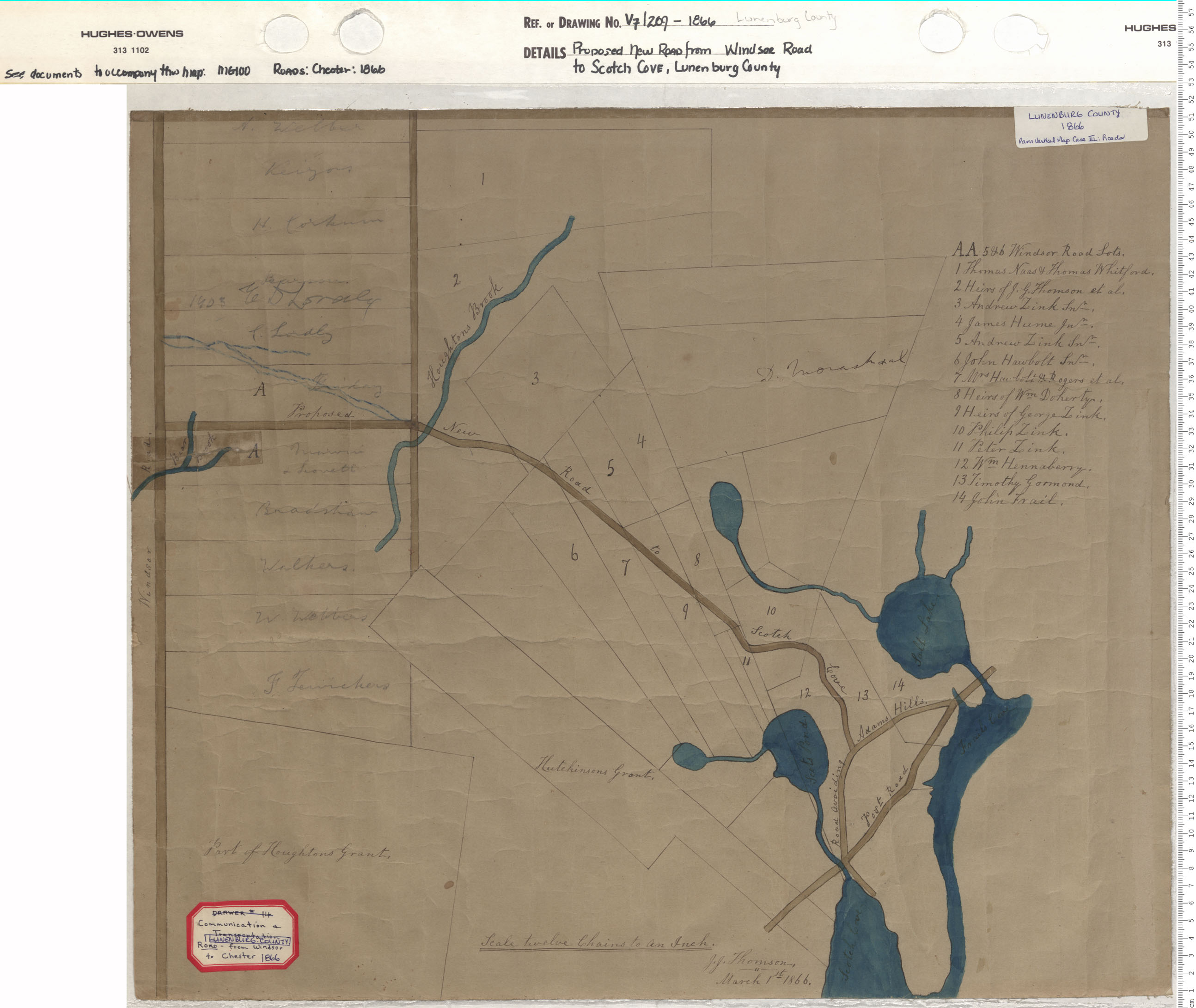
Proposed New Road from Windsor Road to Scotch Cove, Lunenburg County
maps : 201402146

Lunenburg, N.S. Birds Eye View
maps : 201402157


Inset of Bridgewater from A.F. Churchs Map of Lunenburg County
maps : 201402022


maps : 202012924

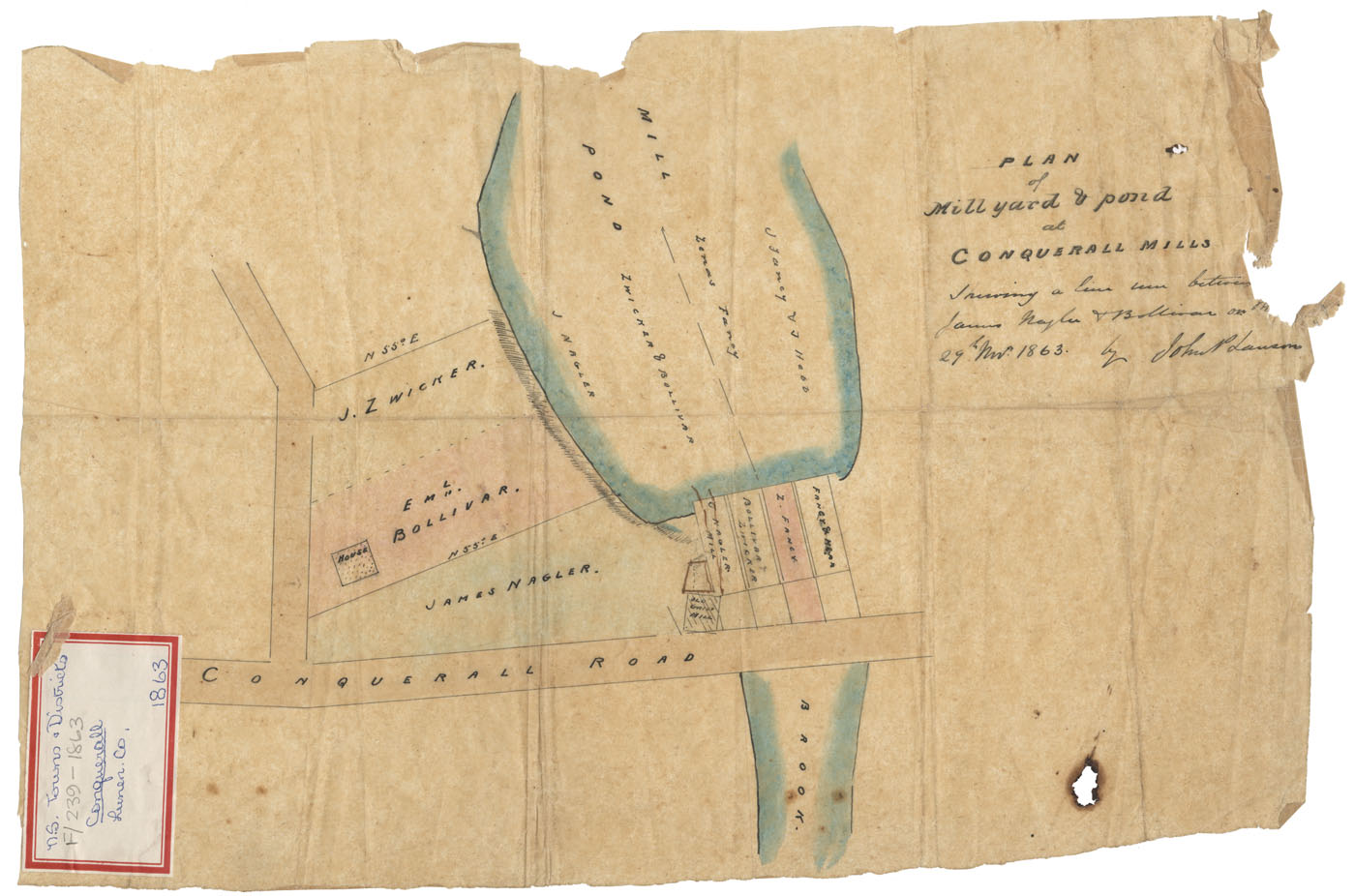
Plan of Division of Richards Estate situate at LaHave, Lunenburg Cy
maps : 202012565


Additional Search Tools
Need more results? The Search box in the top right corner looks for digitized content only and does not full-text search our website.
- To search our Nova Scotia Births, Marriages, and Deaths click the Nova Scotia Genealogy button below.
- To search descriptions in the archival holdings catalogue, click the Archival Holdings button below.
- To search items in the library holdings catalogue, click the Library Holdings button below.
- To Google search all our websites click the Google button below
Images Nova Scotia Genealogy Archival Holdings Library Holdings Google Site Search