Nova Scotia Archives
Historical Maps of Nova Scotia
Results 676 to 690 of 2074 from your search:
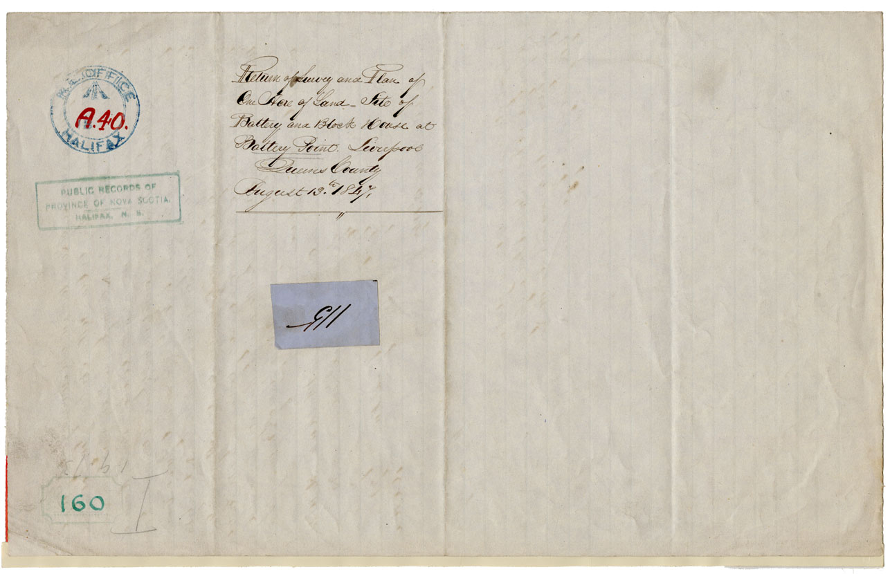
Survey & Plan of an acre of Land Site of Battery & Block House at Battery Point, Liverpool, Queens Co
Date: 13 August 1847
Reference: Nova Scotia Archives Map Collection: F/240 - 1847
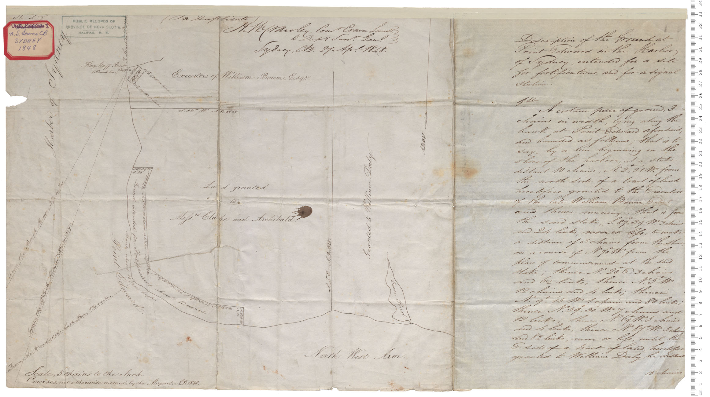
Point Edward, Sydney Harbour
Date: 1848
Reference: Nova Scotia Archives Royal Engineers Maps and Plans A.58
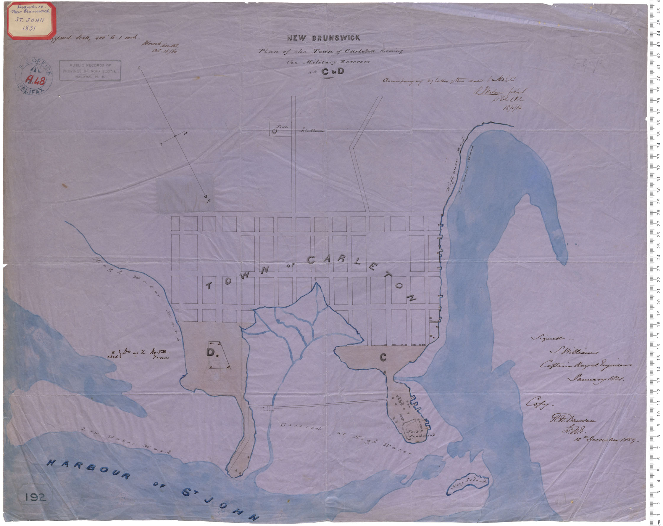
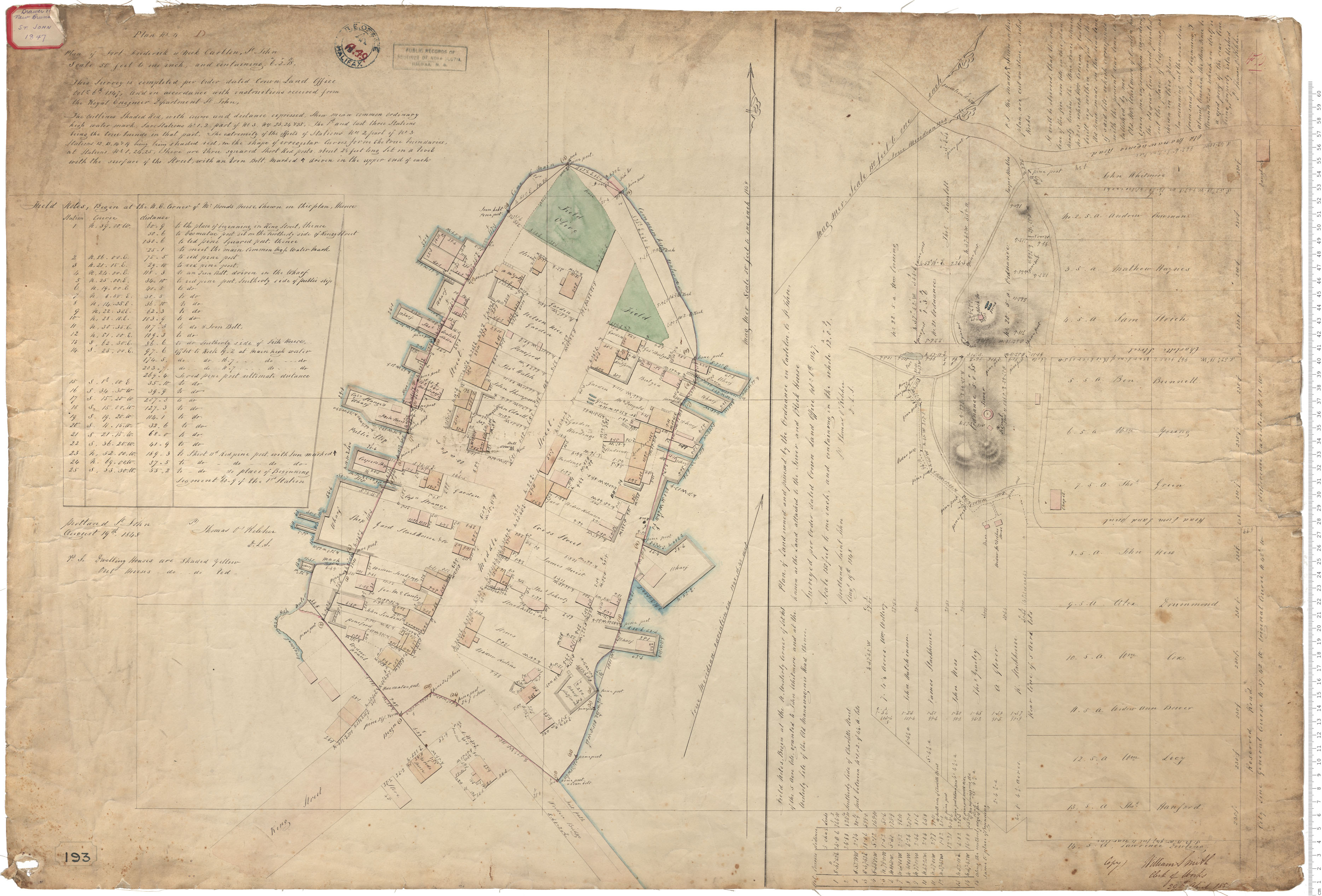
Plan of the Town of Carleton - military reserves
Date: January 1831
Reference: Nova Scotia Archives Royal Engineers Maps and Plans A.48
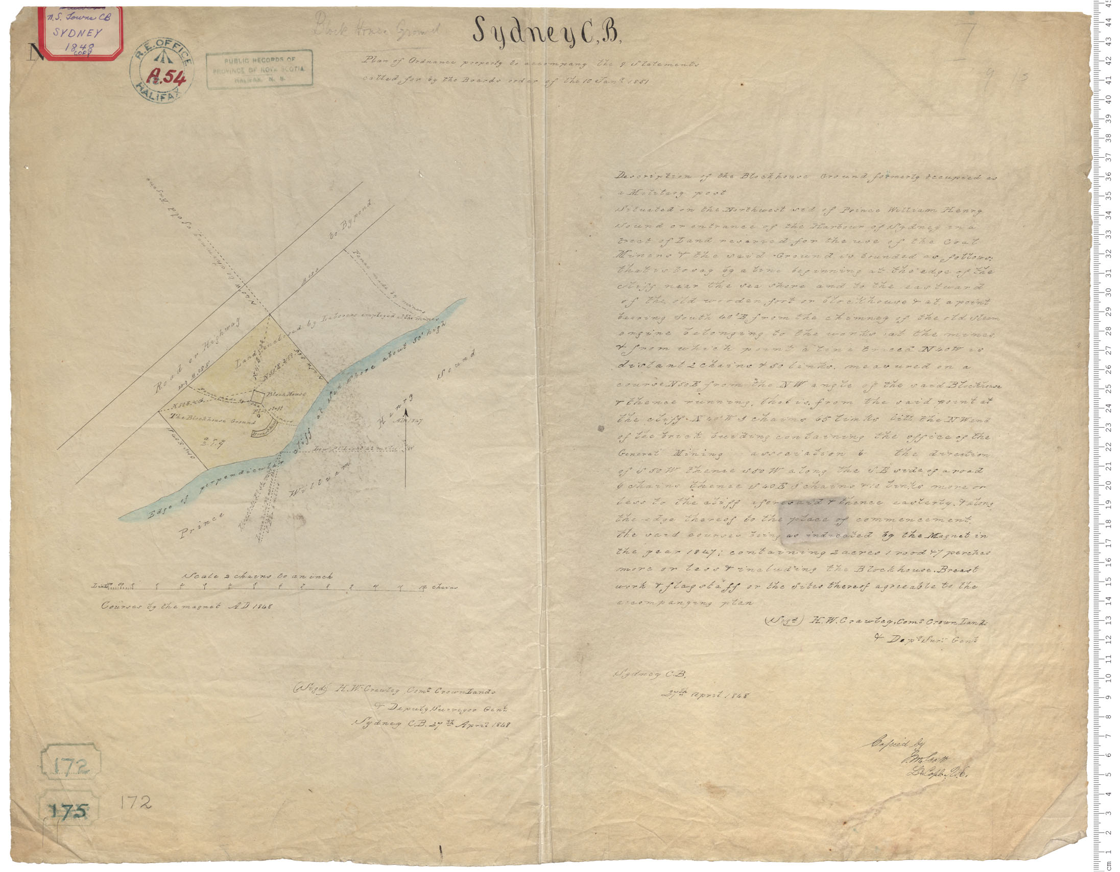
Blockhouse Ground
Date: 27 April 1848
Reference: Nova Scotia Archives Royal Engineers Maps and Plans A.54
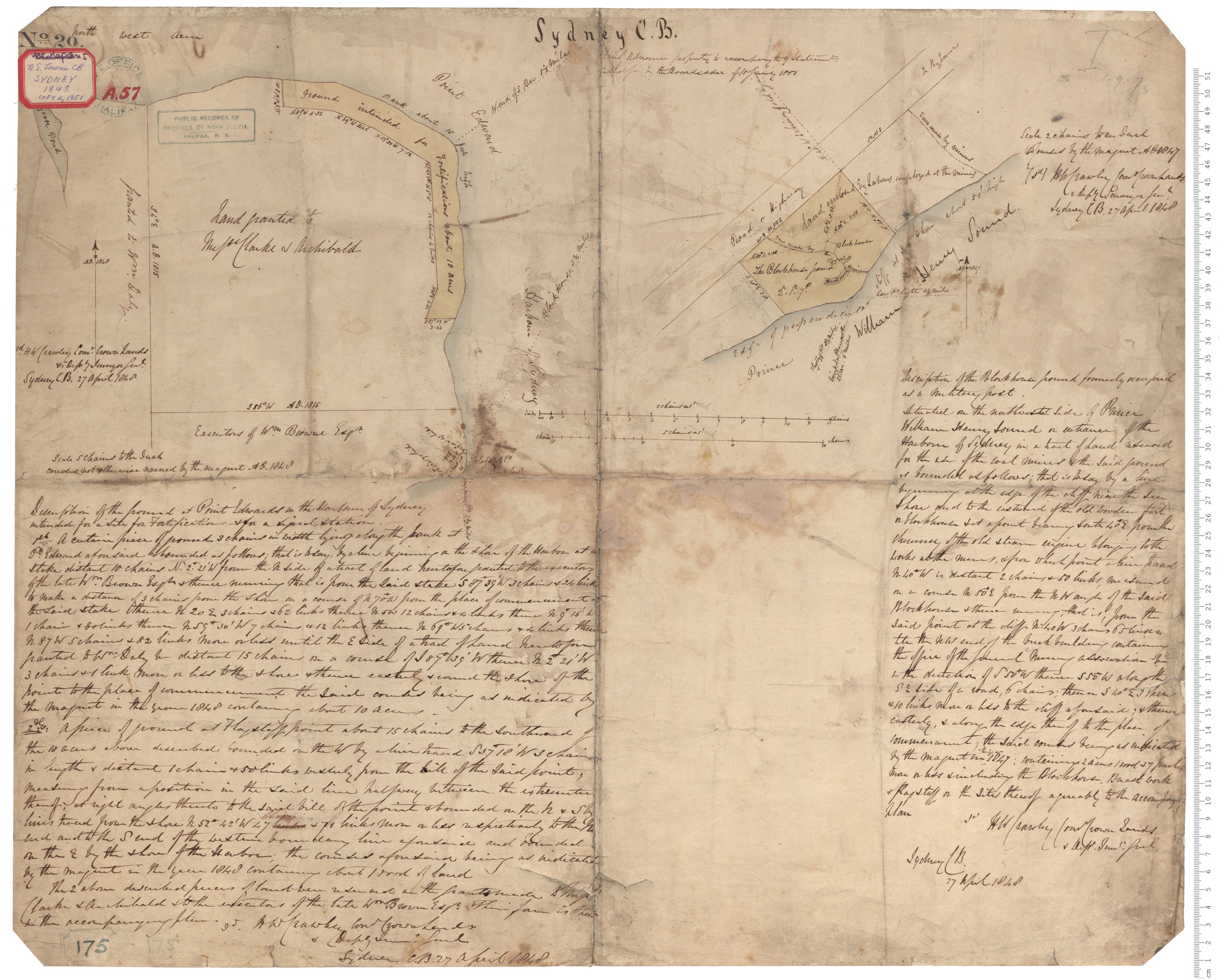
Prince William Henry Sound/ Point Edward
Date: 27 April 1848
Reference: Nova Scotia Archives Royal Engineers Maps and Plans A.57
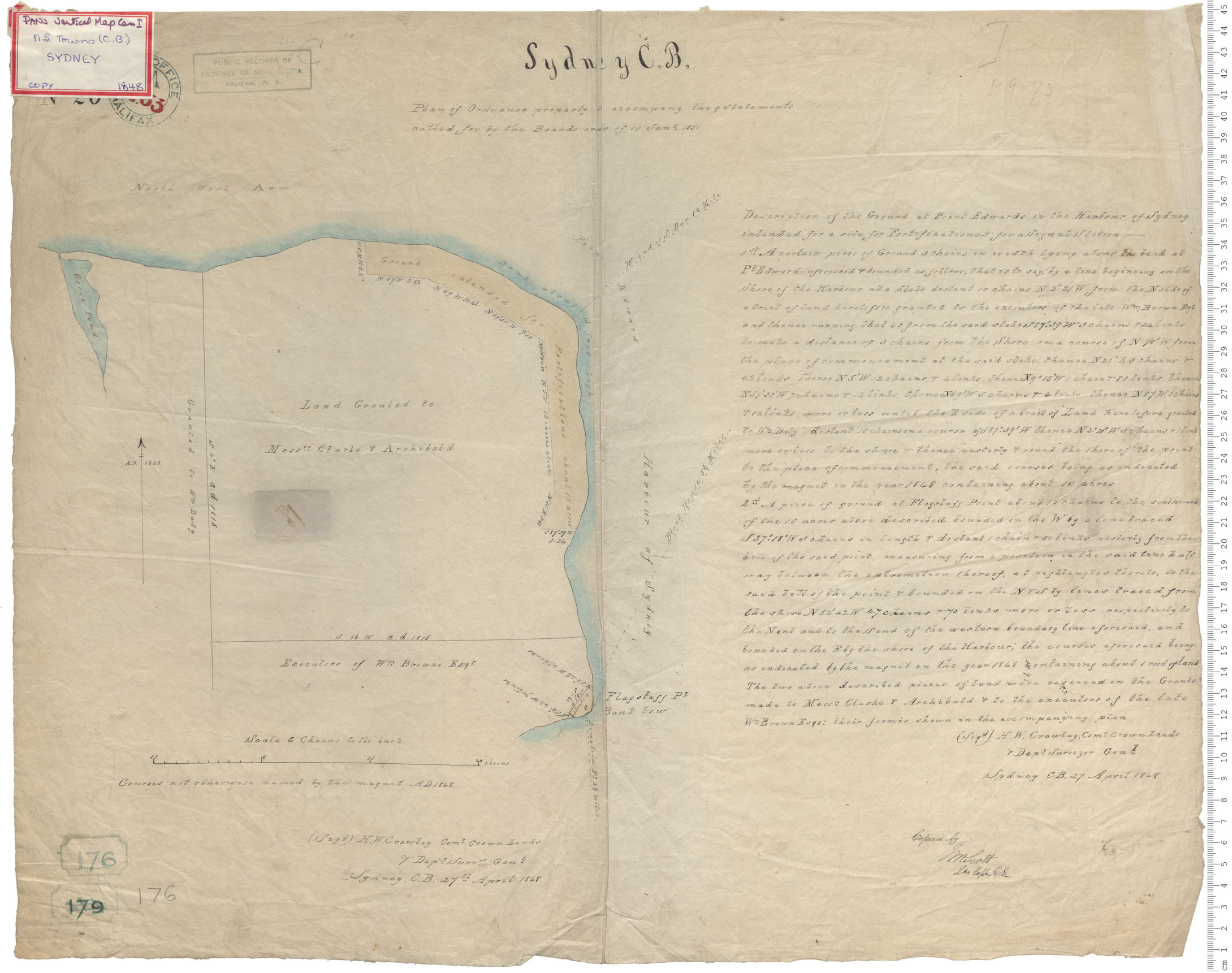
Sydney Harbour - Point Edward
Date: 27 April 1848
Reference: Nova Scotia Archives Royal Engineers Maps and Plans A.53

Blockhouse Ground
Date: 27 April 1848
Reference: Nova Scotia Archives Royal Engineers Maps and Plans A.52
Fort Frederick (or Neck Carleton)
Date: 19 August 1848
Reference: Nova Scotia Archives Royal Engineers Maps and Plans A.49
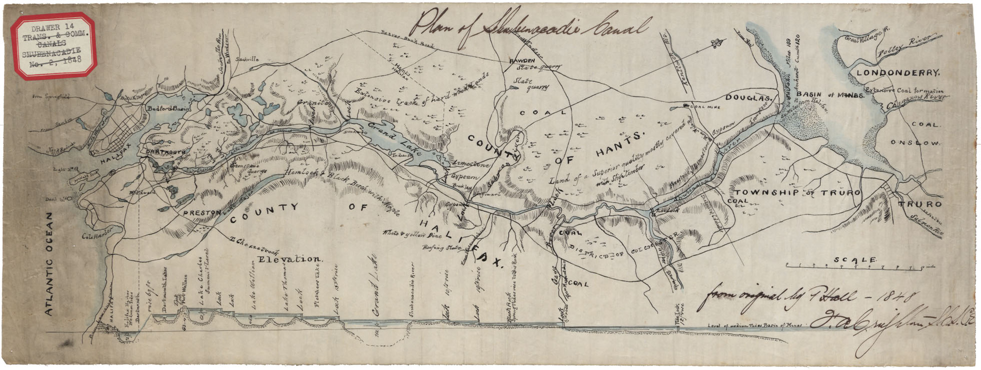
Plan of the Shubenacadie Canal
Date: 1848
Reference: Nova Scotia Archives Map Collection: F/210 - 1848
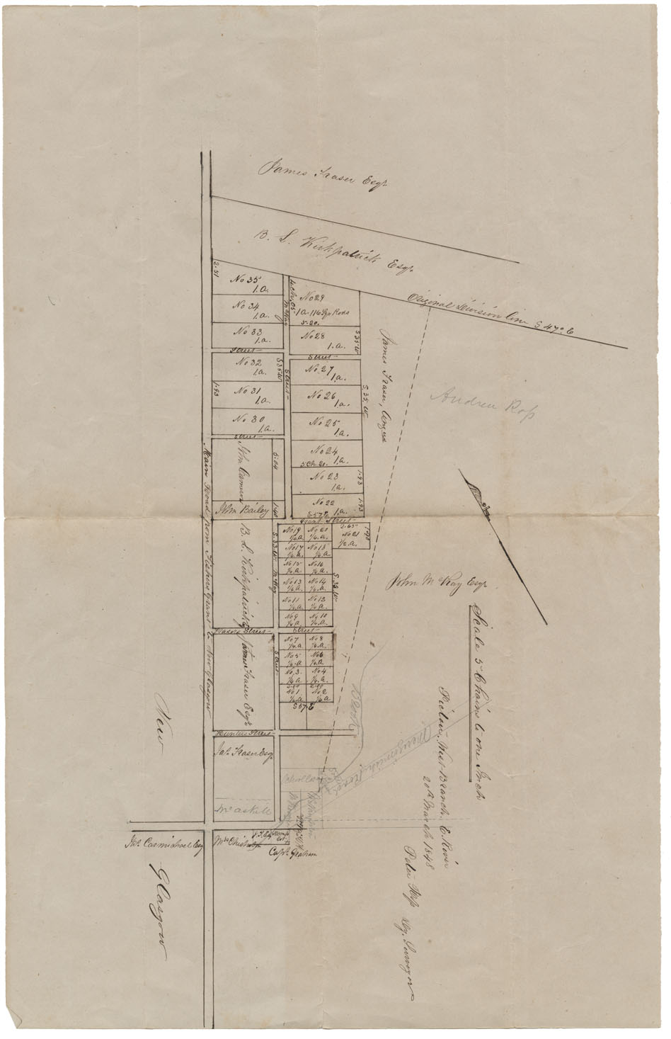
Pictou, West Branch, E River
Date: 20 March 1848
Reference: Nova Scotia Archives Map Collection: F/239 - 1848
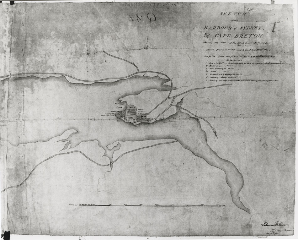
Sketch of the Harbour of Sydney in County of Cape Breton showing the sites of block houses, batteries, etc
Date: 1848
Reference: Nova Scotia Archives Map Collection: F/239 - 1848
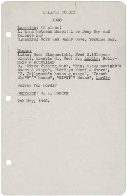
Halifax County (2 copies) 1) Land between Hospital or Deep Bay and Terence Bay 2) Mackrel Cove & Sandy Cove, Terence Bay, 1848
Date: 9 May 1848
Reference: Nova Scotia Archives Map Collection: F/240 - 1848
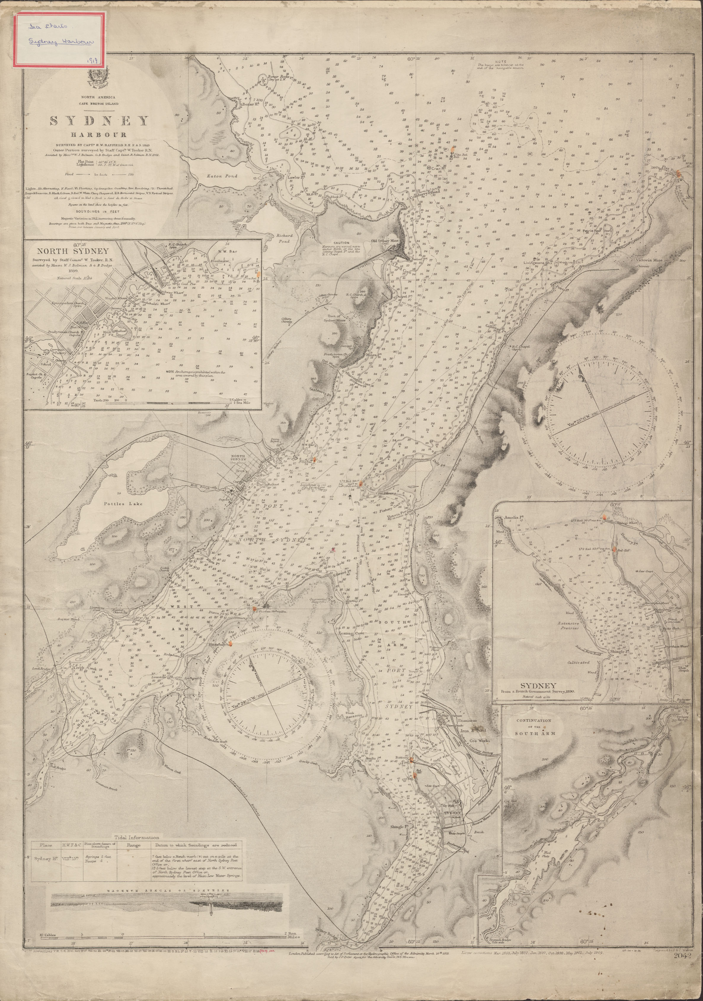
"North America Cape Breton Island Sydney Harbour", surveyed by Captain H.W. Bayfield
Date: 1849, with corrections to 1902
Reference: Nova Scotia Archives Map Collection: Great Britain Hydrographic Office, Chart No. 2042
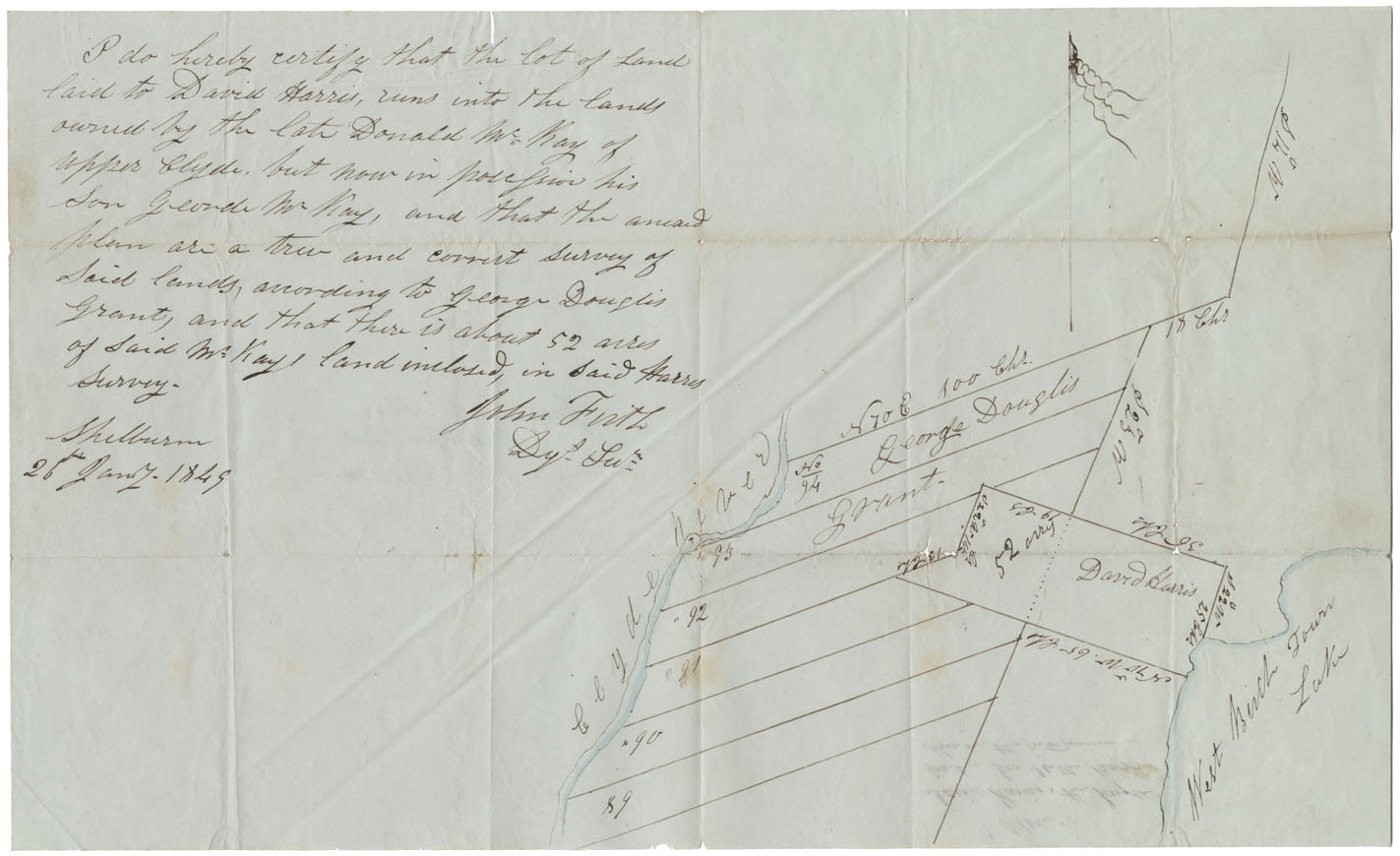
Shelburne County Between Clyde River and West Birch Town Lake, 1849
Date: 26 January 1849
Reference: Nova Scotia Archives Map Collection: F/230 - 1849
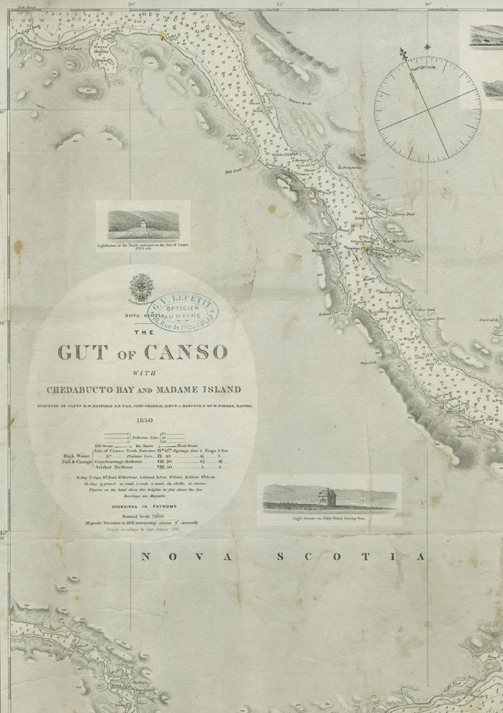
"Nova Scotia Gut of Canso with Chedabucto Bay and Madame Island"
Date: 1850
Reference: Nova Scotia Archives Map Collection: Great Britain Hydrographic Office, Chart No. 2342