Nova Scotia Archives
Historical Maps of Nova Scotia
Results 136 to 150 of 284 from your search: V6
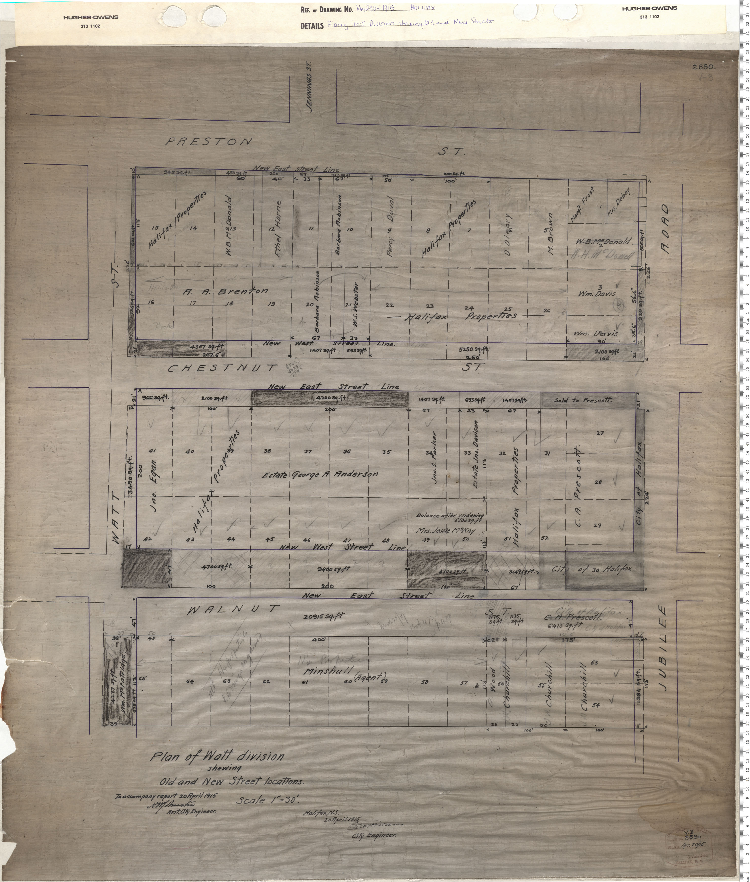
Plan of Watt Division Shewing Old and New Street locations
Date: 1915
Reference: Nova Scotia Archives Map Collection: V6 240 Halifax, Nova Scotia
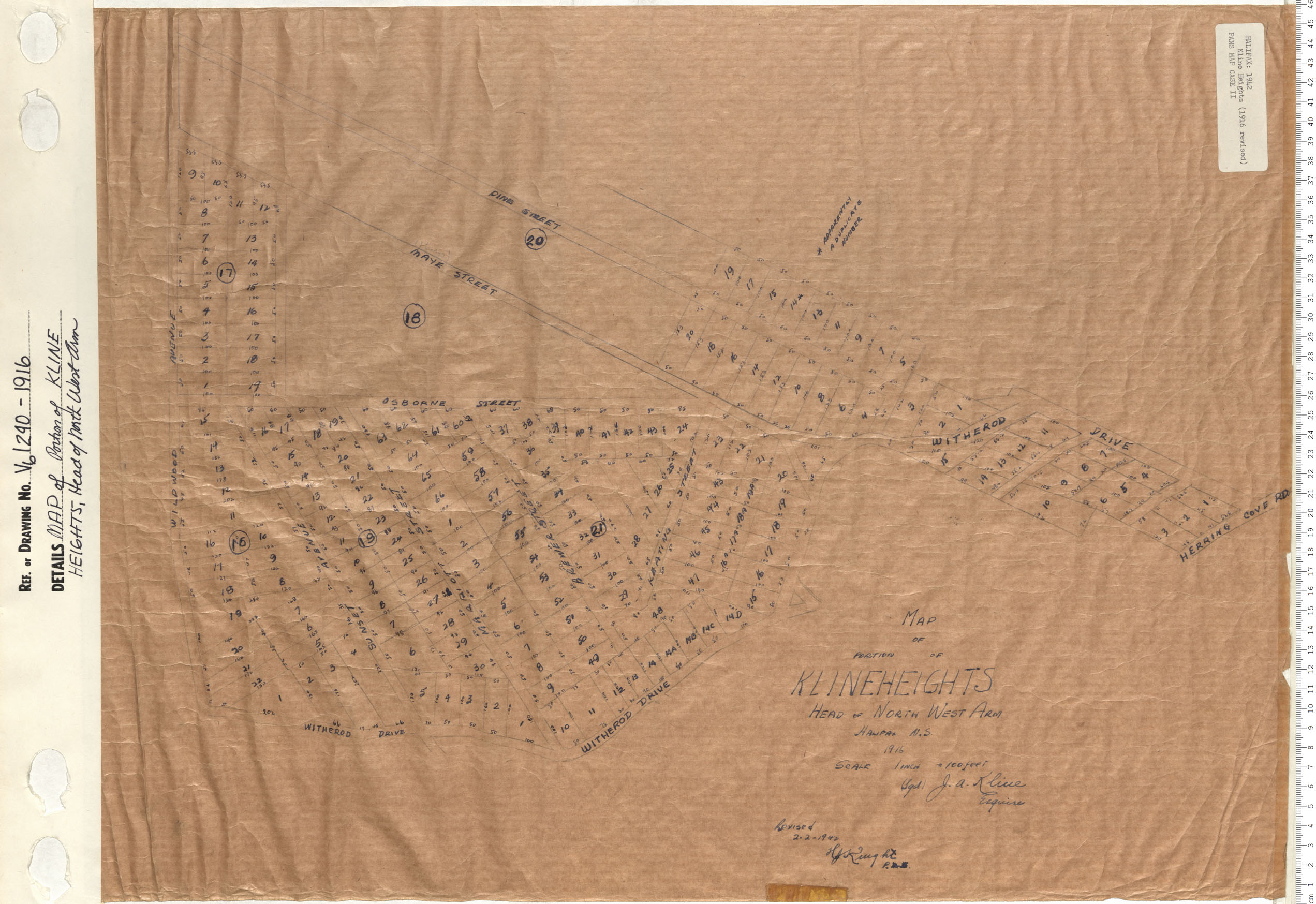
MAP of the Portion of KLINE HEIGHTS Head of North West Arm
Date: 1916
Reference: Nova Scotia Archives Map Collection: V6 240 Halifax, Nova Scotia
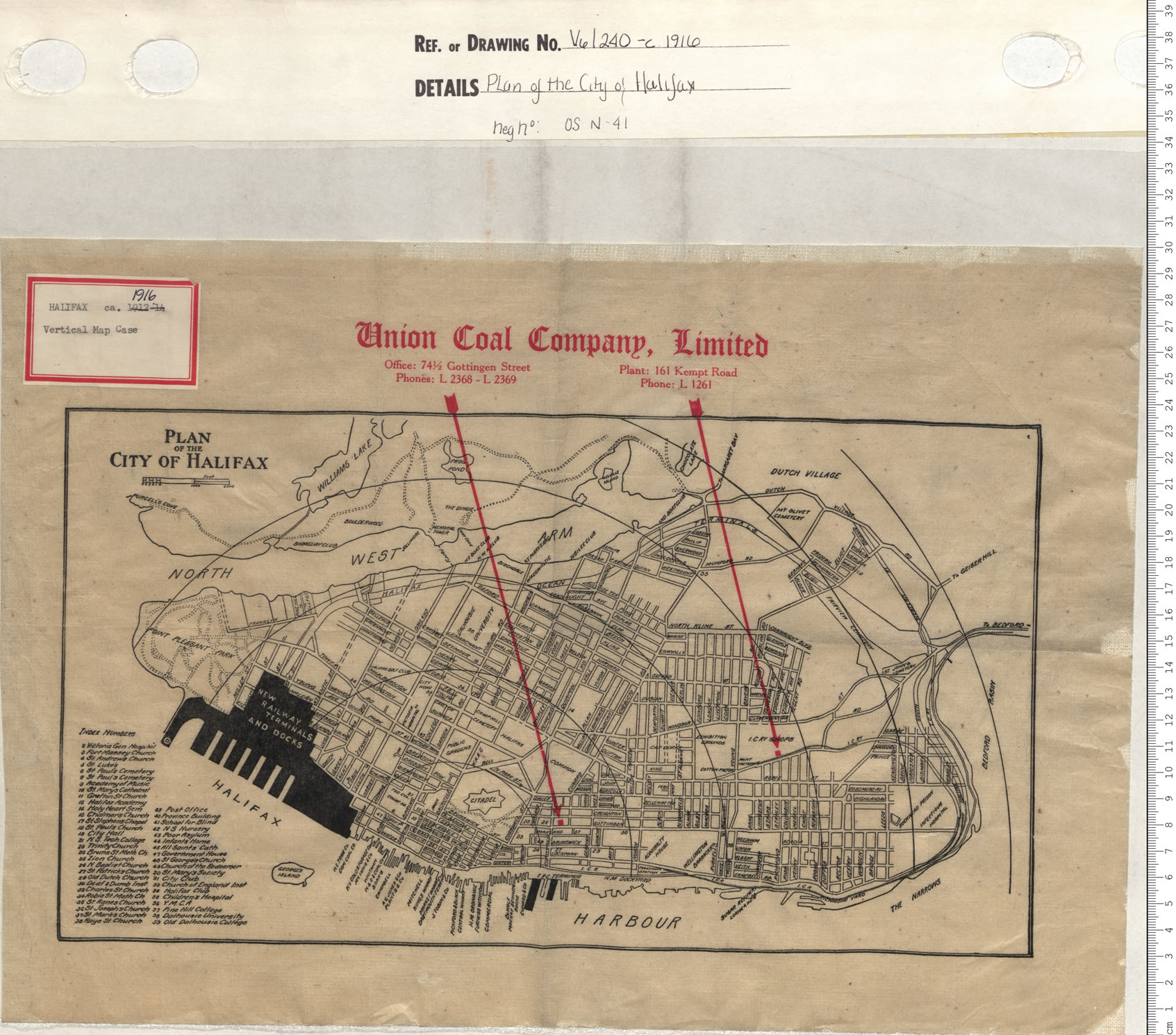
Plan of the City of Halifax
Date: 1916
Reference: Nova Scotia Archives Map Collection: V6 240 Halifax, Nova Scotia
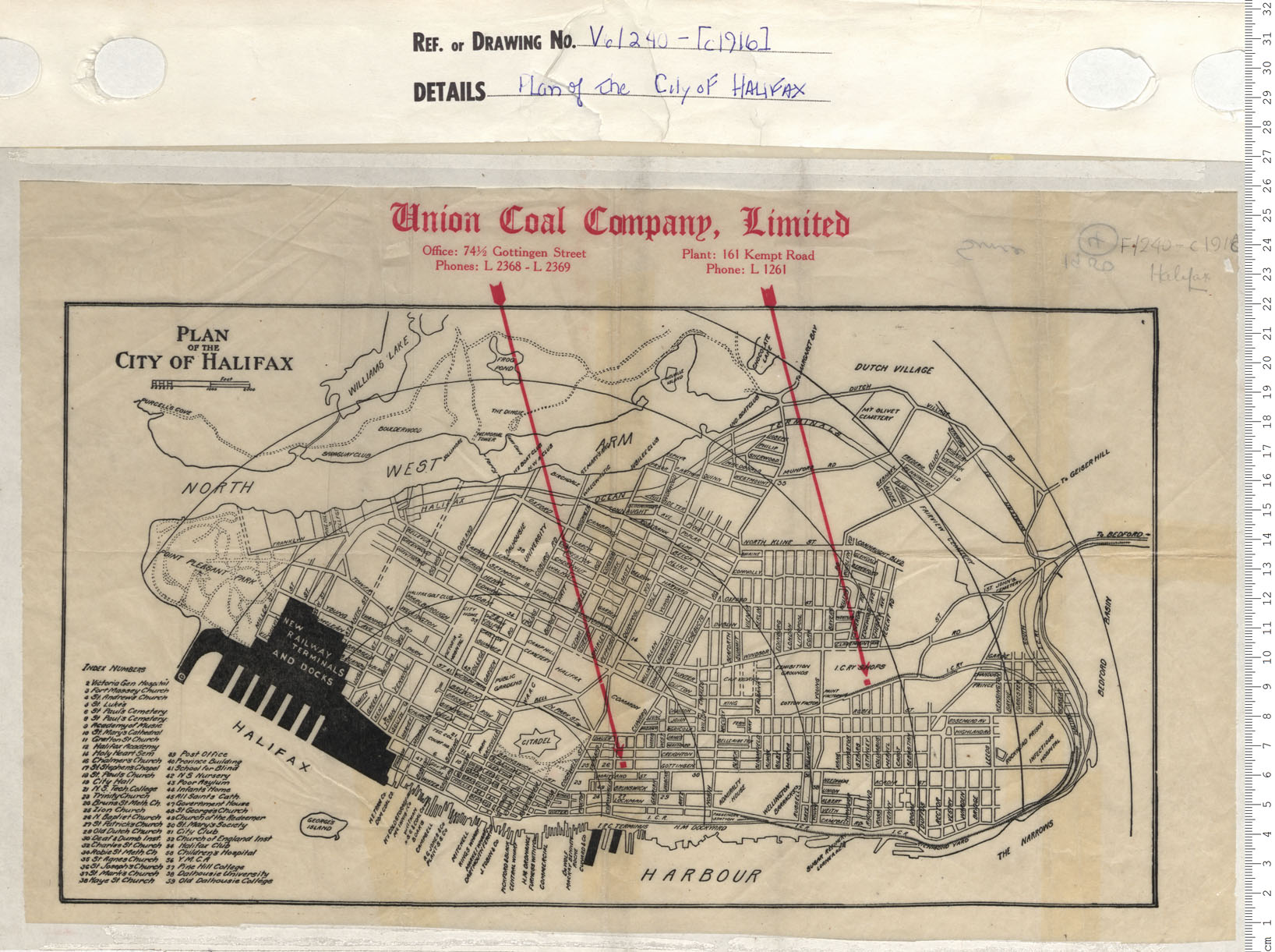
Plan of the City of Halifax
Date: 1916
Reference: Nova Scotia Archives Map Collection: V6 240 Halifax, Nova Scotia
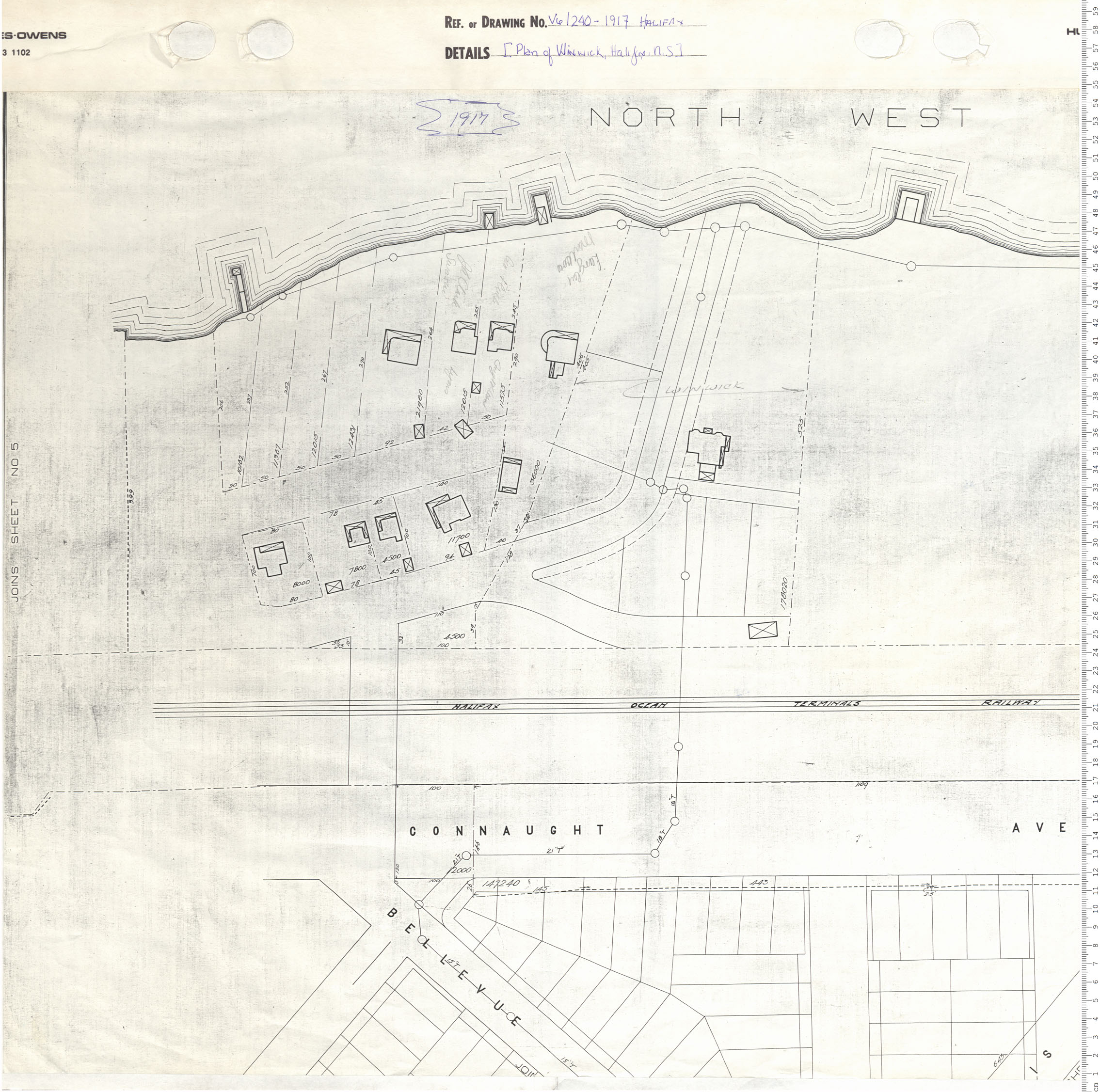
Plan of Winwick, Halifax, N.S.
Date: 1917
Reference: Nova Scotia Archives Map Collection: V6 240 Halifax, Nova Scotia
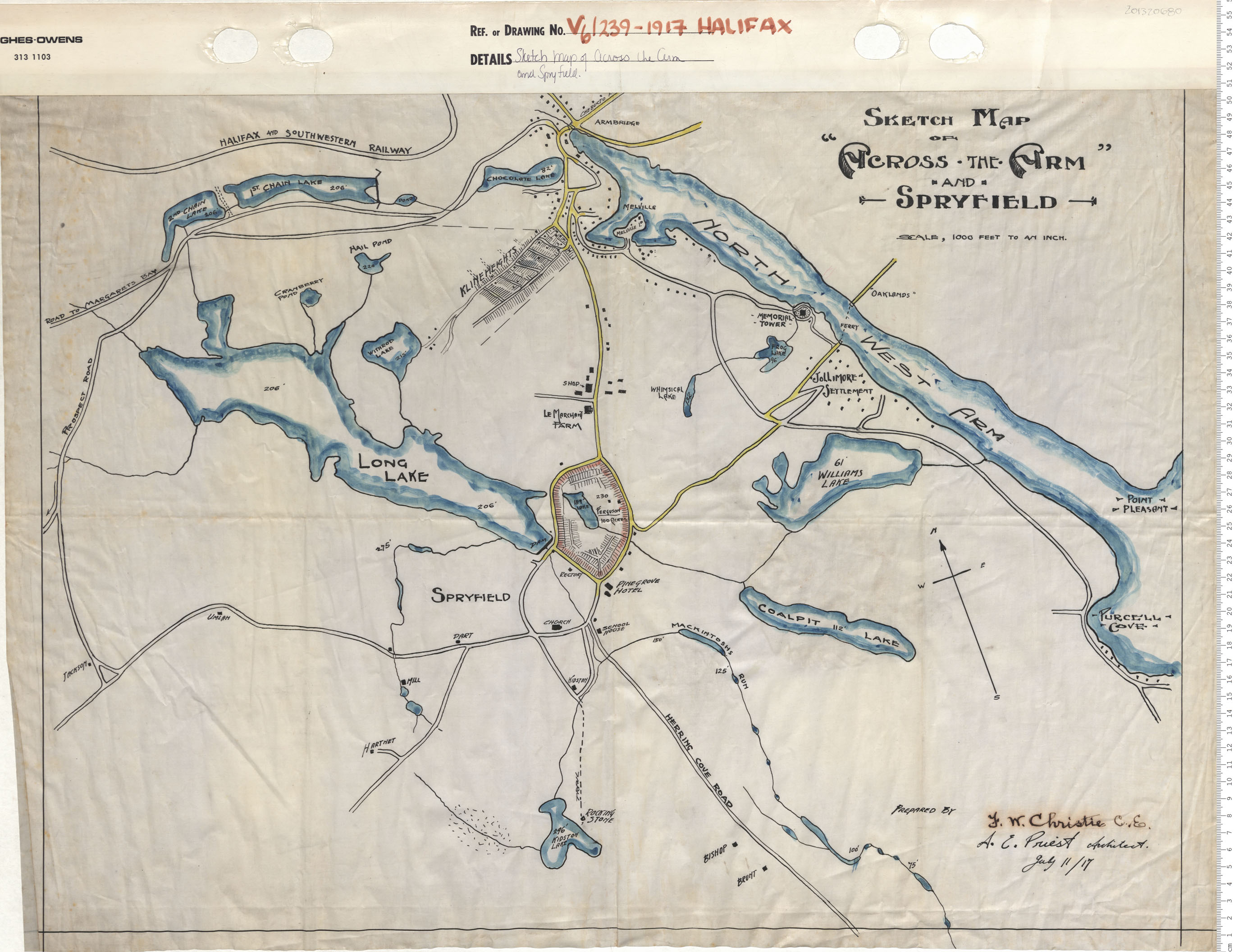
Sketch Map of Across the Arm and Srpyfield
Date: 1917
Reference: Nova Scotia Archives Map Collection: V6 239 Halifax, Nova Scotia
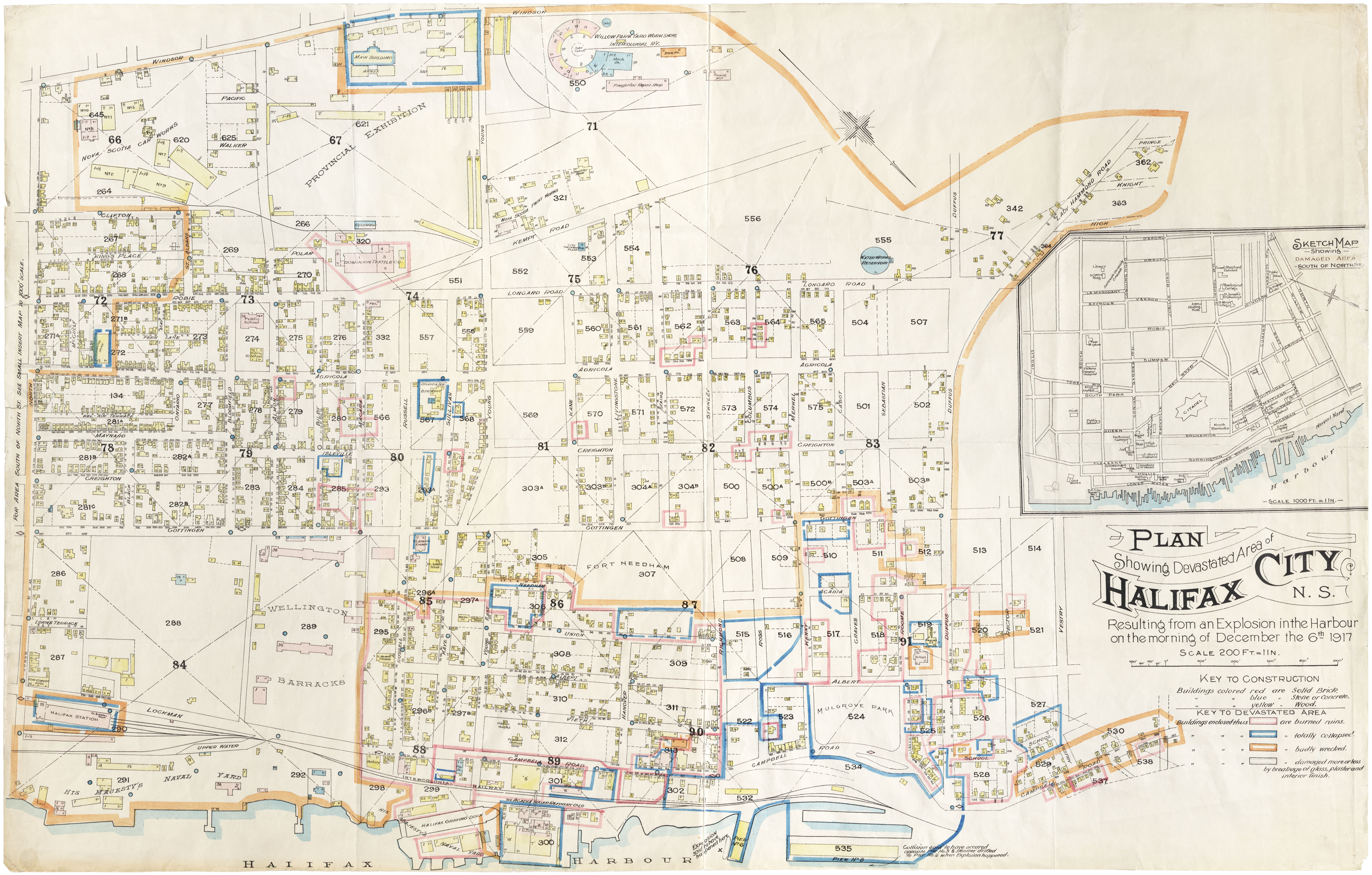
"Plan showing devastated area of Halifax City, N.S."
Date: 1918
Reference: N.S. Board of Insurance Underwriters Nova Scotia Archives Map Collection: V6 240
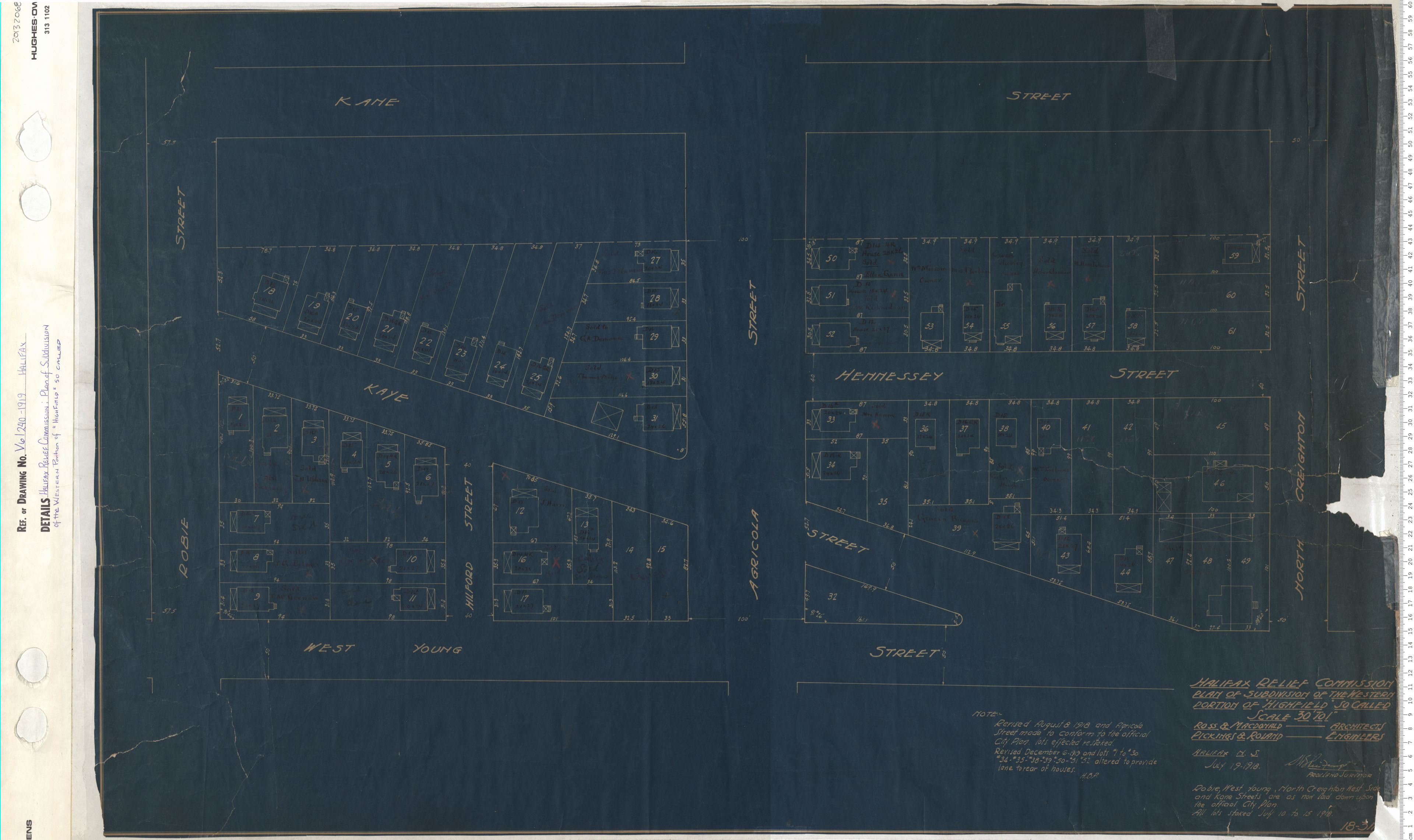
Halifax Relief Commission: Plan of Subdivsion of the Westren Portion of "Highfield" so called
Date: 1919
Reference: Nova Scotia Archives Map Collection: V6 240 Halifax, Nova Scotia
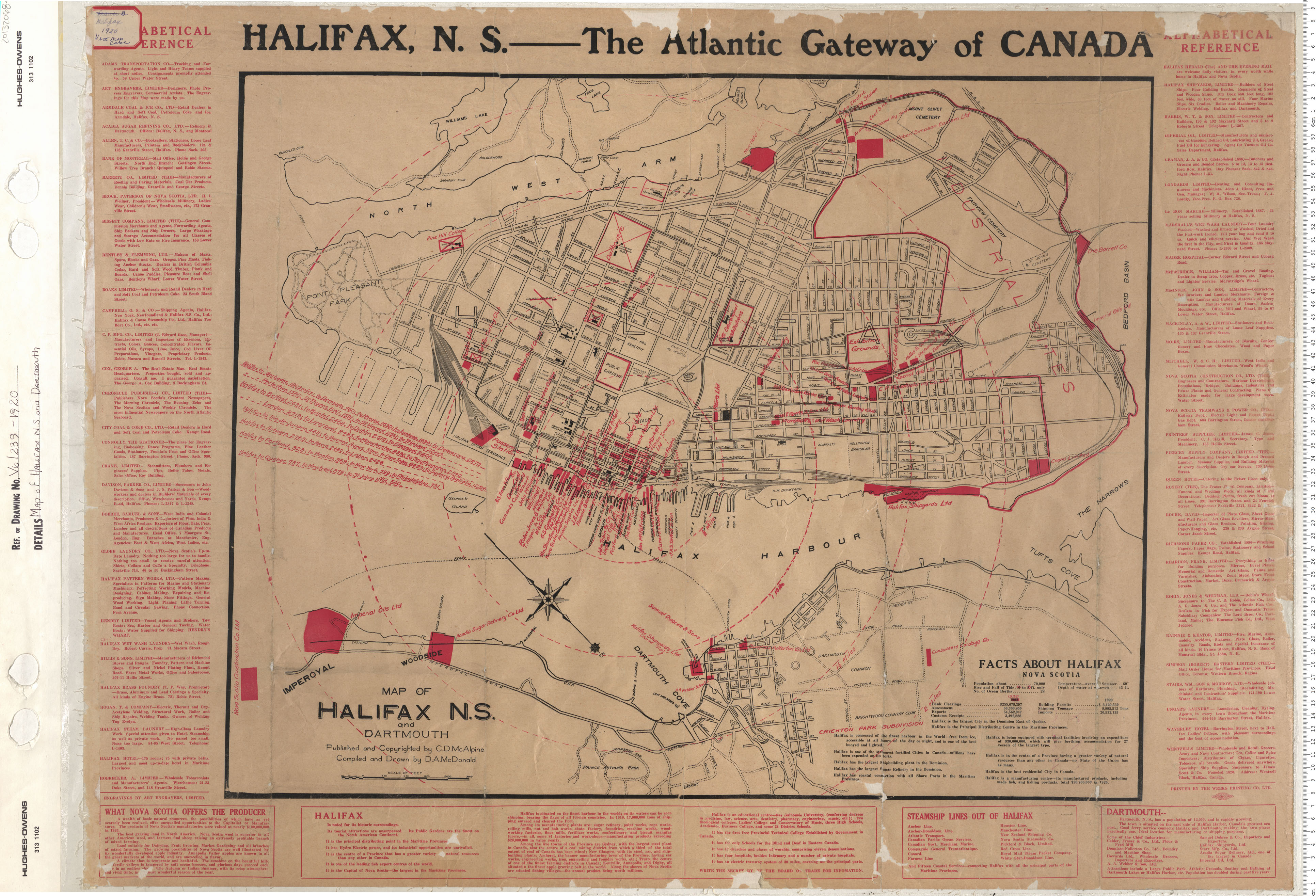
Map of Halifax and Dartmouth
Date: 1920
Reference: Nova Scotia Archives Map Collection: V6 239 Halifax, Nova Scotia
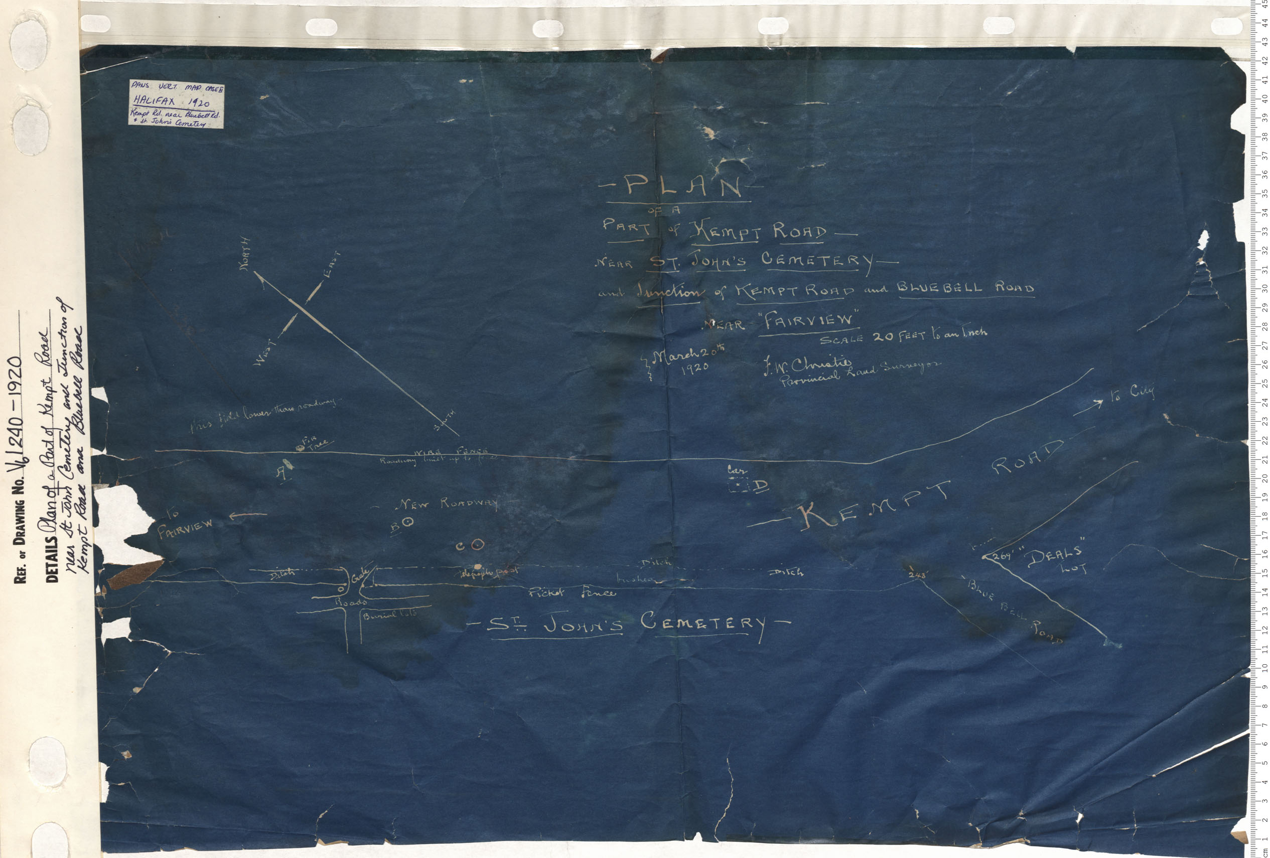
Plan of Part of Kempt Road Near Saint John Cematery and Junction of Kempt Road and Bluebell Road
Date: 1920
Reference: Nova Scotia Archives Map Collection: V6 240 Halifax, Nova Scotia
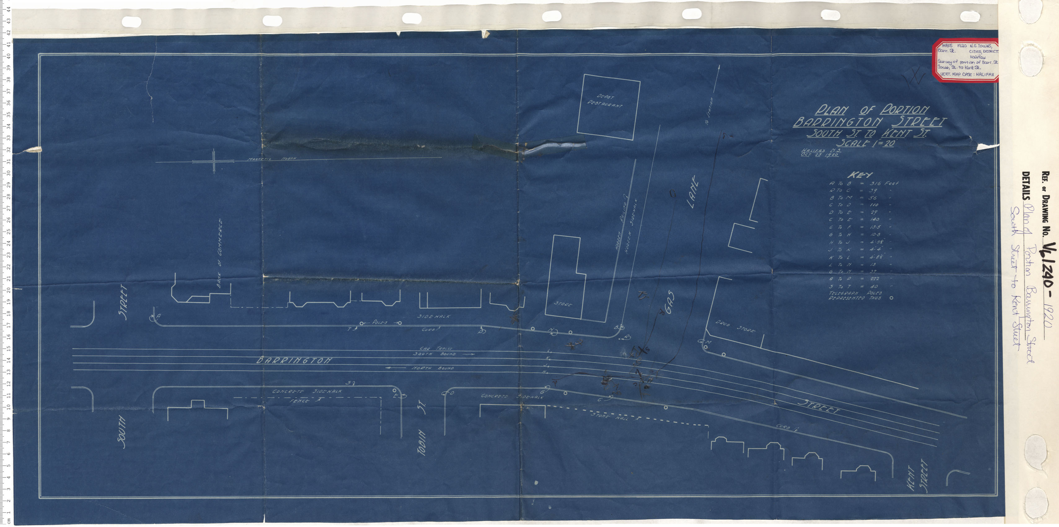
Plan of Portion Barrington Street South Street to Kent Street
Date: 1920
Reference: Nova Scotia Archives Map Collection: V6 240 Halifax, Nova Scotia
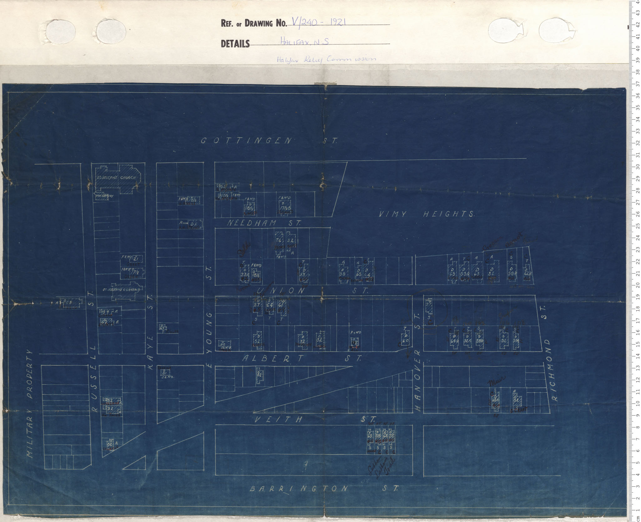
Halifax Relief Commission
Date: 1921
Reference: Nova Scotia Archives Map Collection: V6 240 Halifax, Nova Scotia
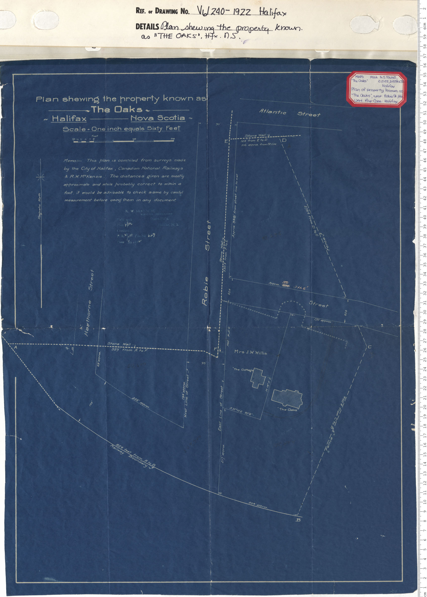
A plan Shewing the Property Known as "The Oaks" Halifax, N.S.
Date: 1922
Reference: Nova Scotia Archives Map Collection: V6 240 Halifax, Nova Scotia
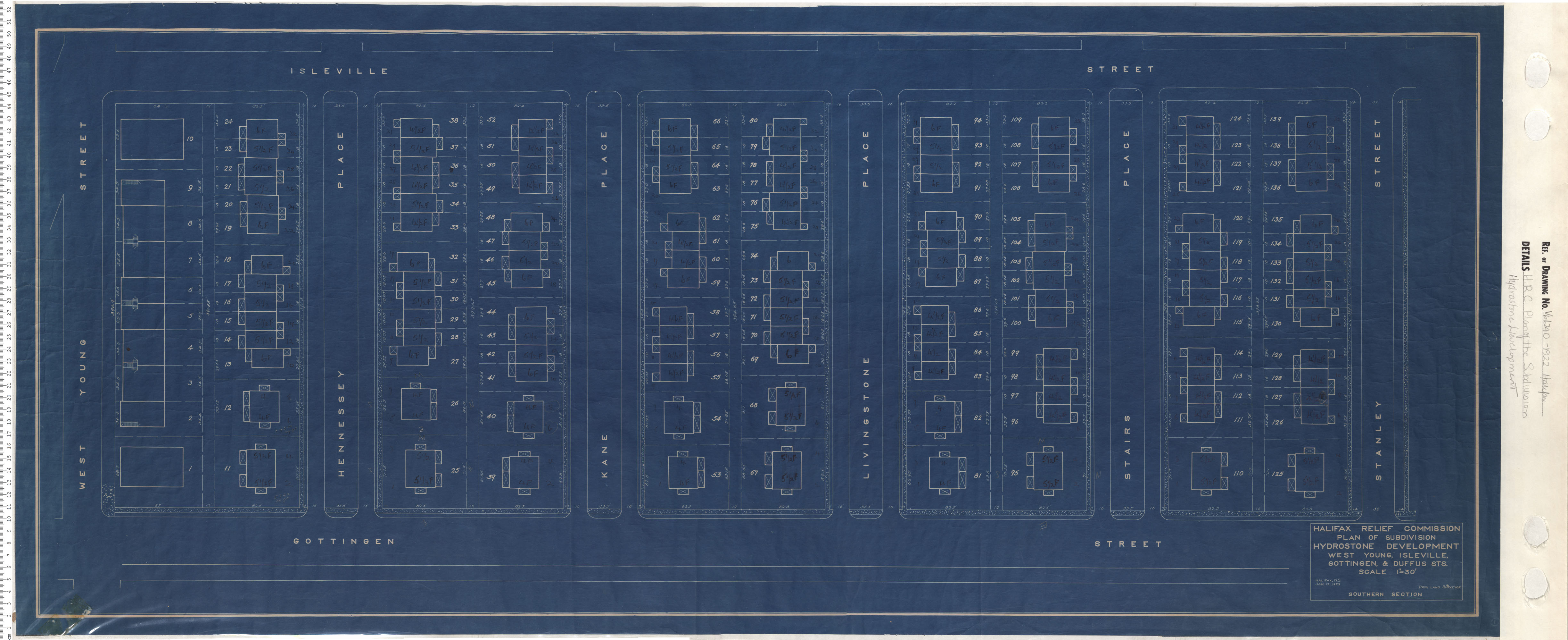
Plan of Subdivision Hydrostone Development West, Young, Isleville, Gottingen and Duffus Streets Southern Section
Date: 1922
Reference: Nova Scotia Archives Map Collection: V6 240 Halifax, Nova Scotia
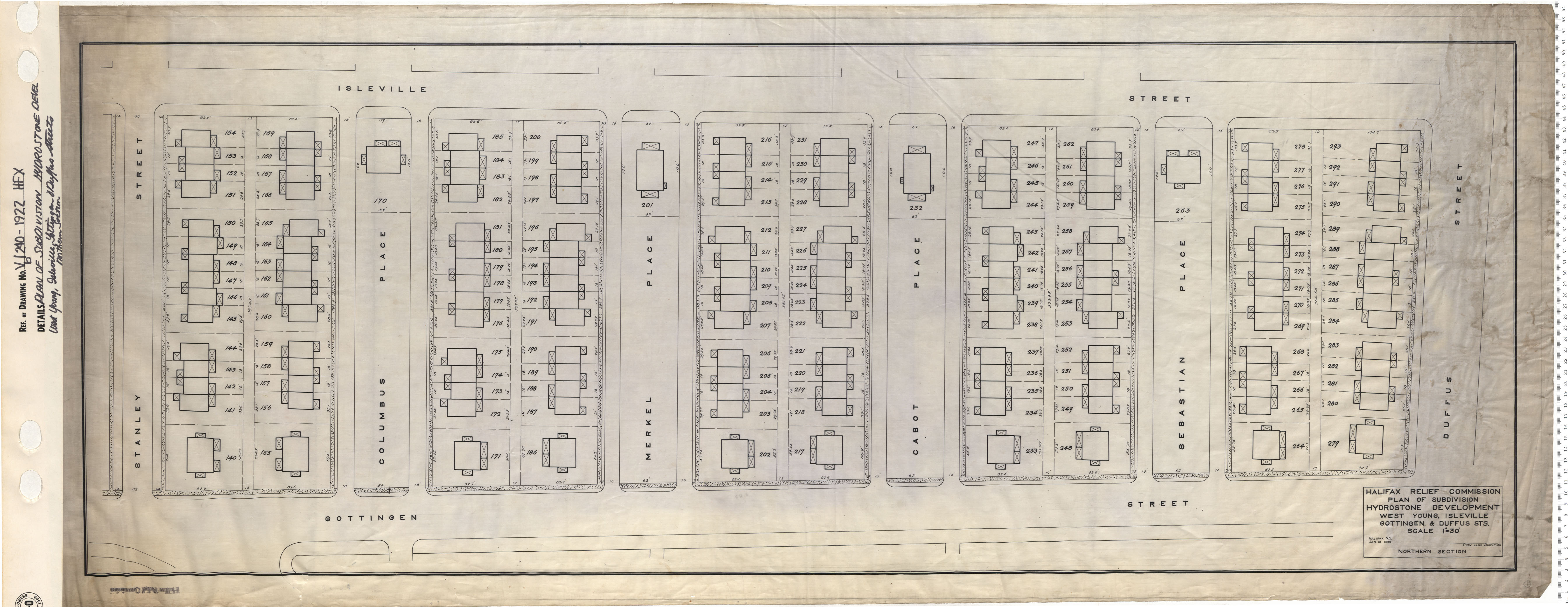
Plan of Subdivision Hydrostone Development West, Young, Isleville, Gottingen and Duffus Streets Northern Section
Date: 1922
Reference: Nova Scotia Archives Map Collection: V6 240 Halifax, Nova Scotia