Nova Scotia Archives
Historical Maps of Nova Scotia
Results 61 to 75 of 663 from your search: Halifax
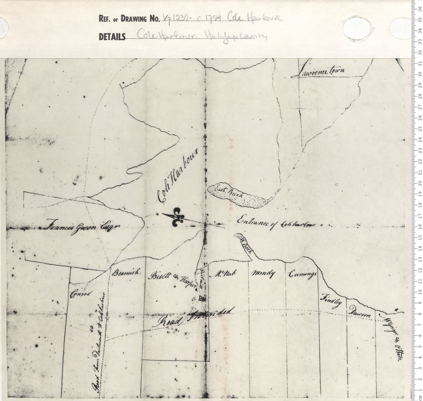
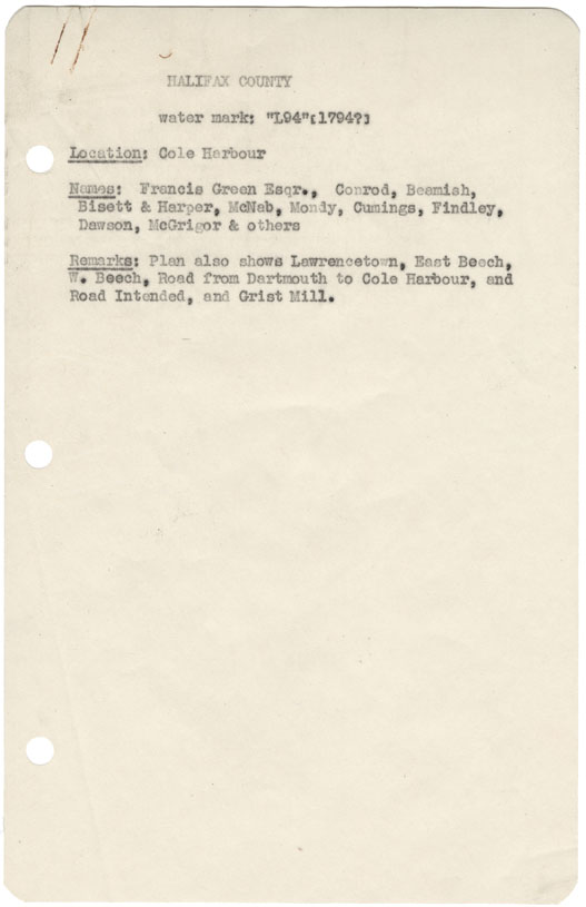
Cole Harbour Halifax County
Date: 1794
Reference: Nova Scotia Archives Map Collection: V7 239 Cole Harbour, Nova Scotia
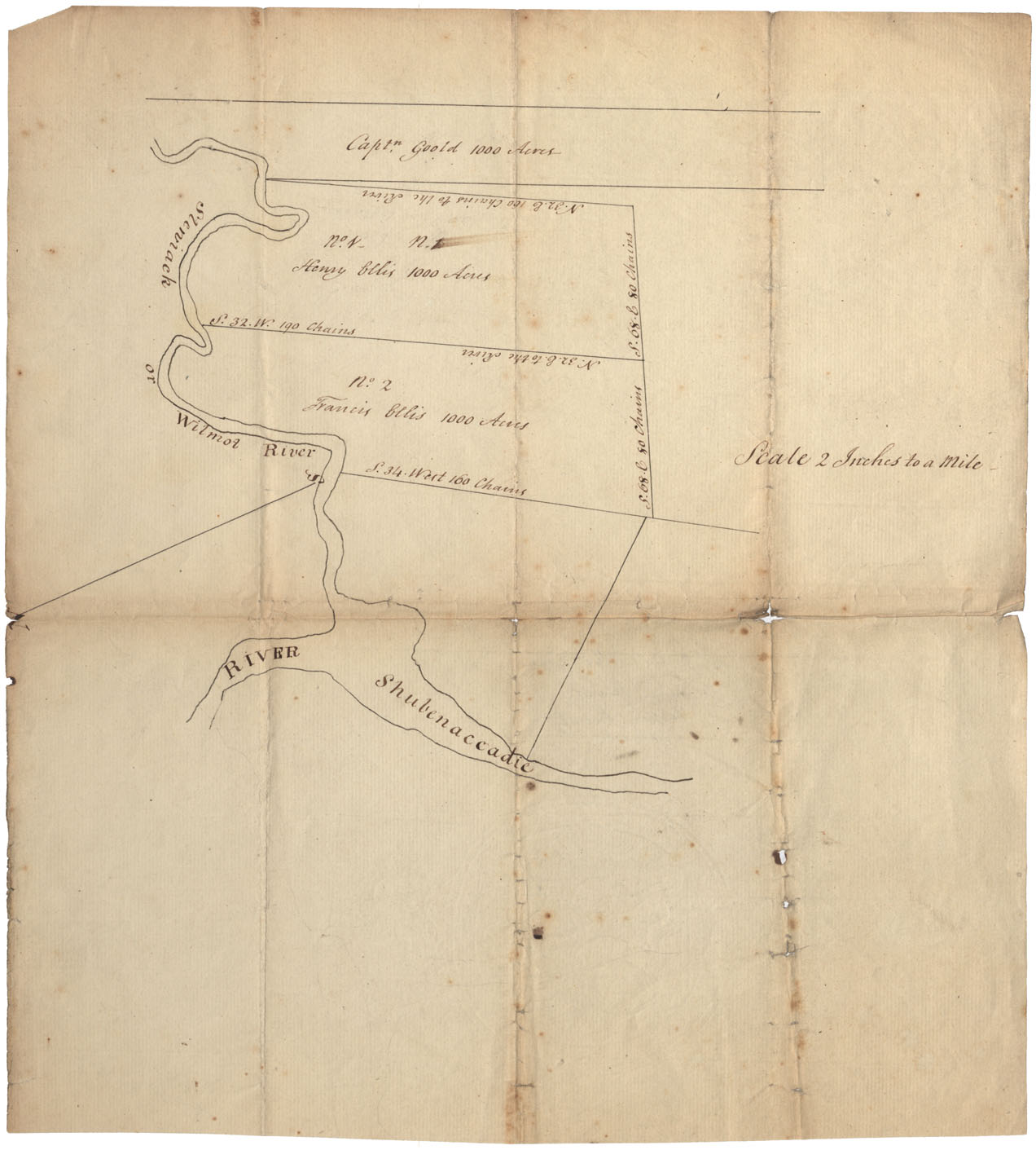
Colchester County Stewiacke or Wilmot River, and its junction with the Shubenacadie River w.m.1794
Date: 1794
Reference: Nova Scotia Archives Map Collection: F/230 - 1794
Halifax County Bedford Basin and Shubenacadie Lakes, wm 1794
Date: 1794
Reference: Nova Scotia Archives Map Collection: F/230 - 1794c
Halifax County Cole Harbour (1794?)
Date: 1794
Reference: Nova Scotia Archives Map Collection: F/239 - 1794
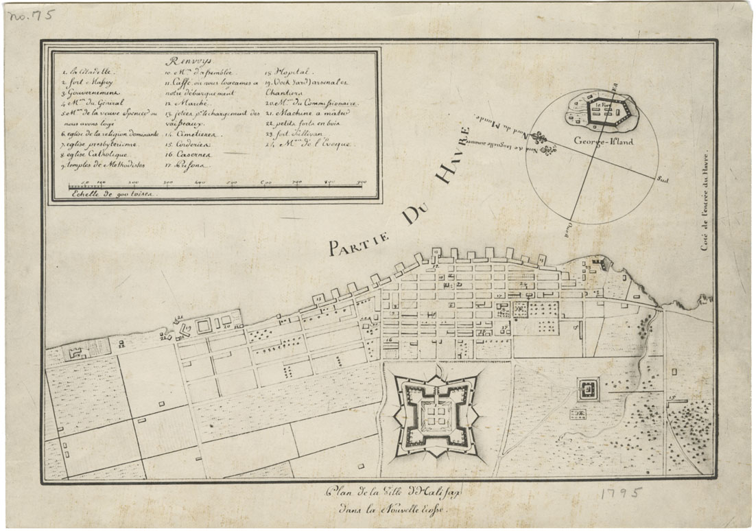
Plan de la Ville d'Halifax dans la Nouvelle Ecopse
Date: 1795
Reference: Nova Scotia Archives Map Collection: F/240 - 1795
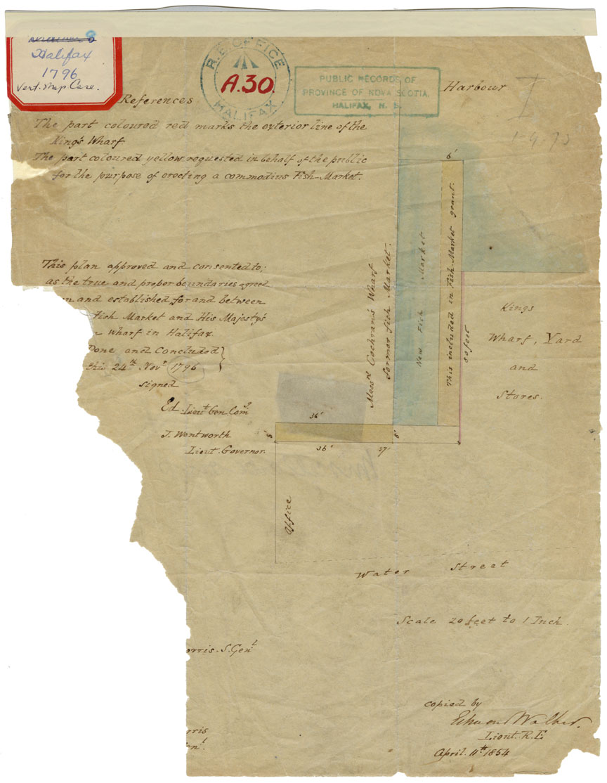
Plan of the True and Proper Boundaries agreed to and established for and between the New Fish Market and His majesty's Yard in Halifax
Date: 24 November 1796
Reference: Nova Scotia Archives Map Collection: F/240 - 1796
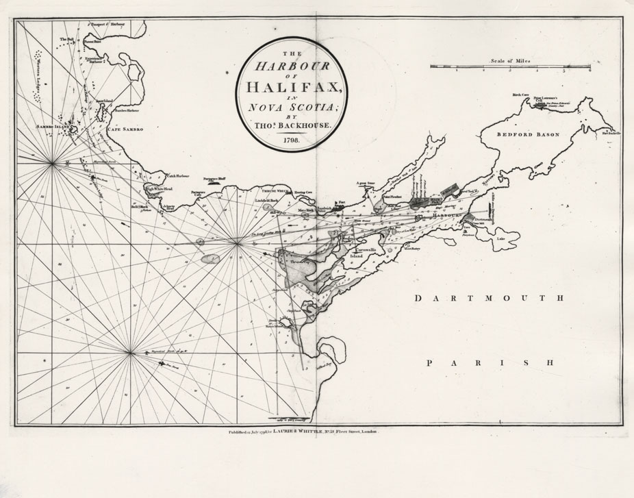
The Harbour of Halifax in Nova Scotia by Thos.Backhouse, 1798
Date: 1798
Reference: Nova Scotia Archives Map Collection: F/239 - 1798
Halifax County Great Shubenacadie Lake (Grand Lake)
Date: 1801
Reference: Nova Scotia Archives Map Collection: F/210 - 1801
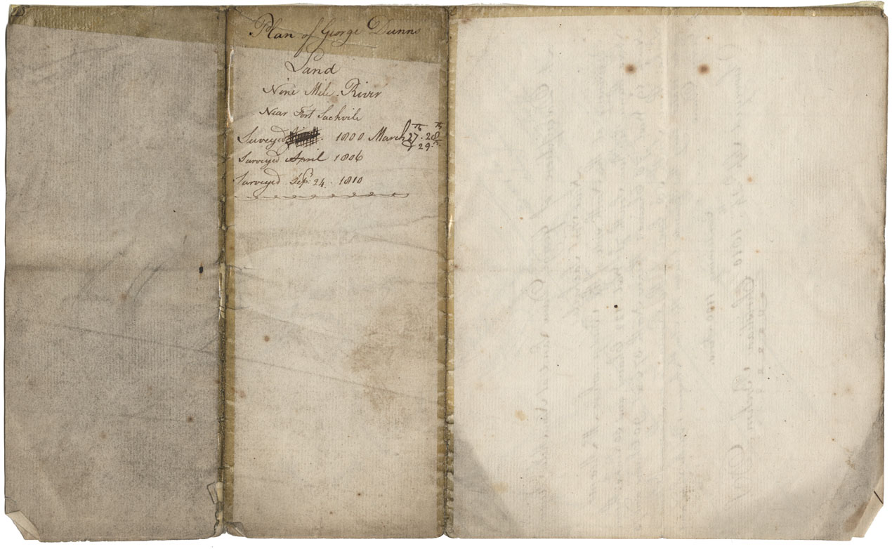
Halifax County Nine Mile River near Fort Sackville 1810
Date: September 1810
Reference: Nova Scotia Archives Map Collection: F/239 - 1810
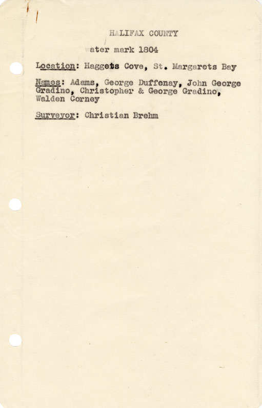
Halifax County Haggets Cove, St Margaret's bay w.m.1804
Date: 1804
Reference: Nova Scotia Archives Map Collection: F/240 - 1804
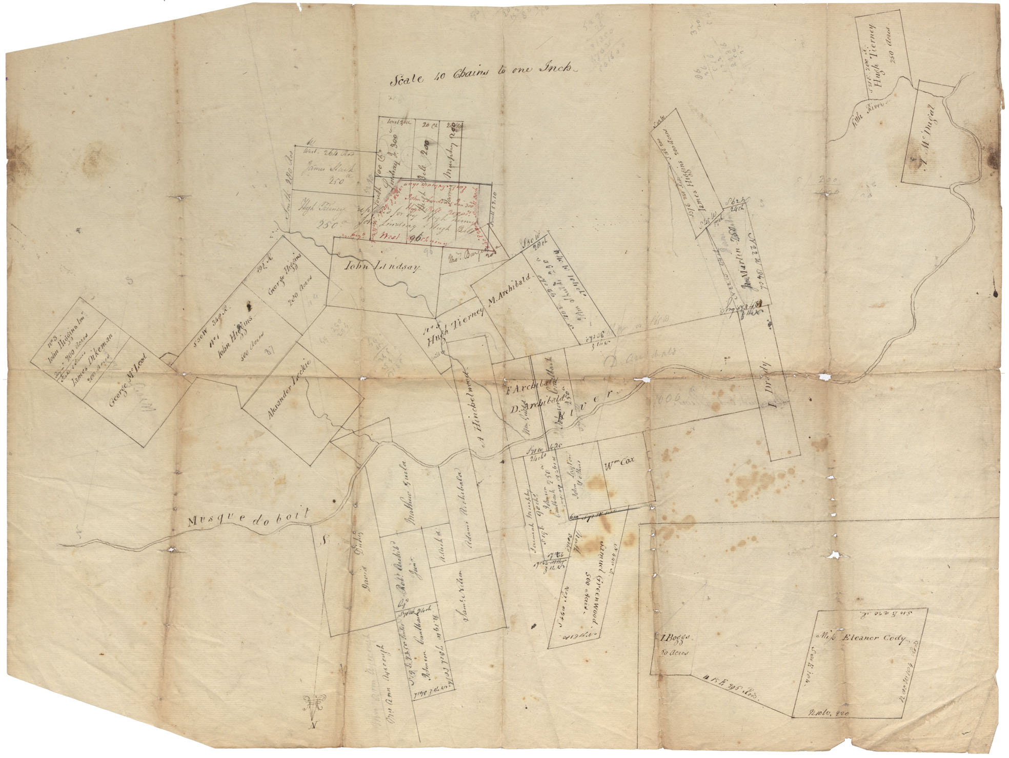
Halifax County Musquodoboit River w.m.1807
Date: 1807
Reference: Nova Scotia Archives Map Collection: F/210 - 1807
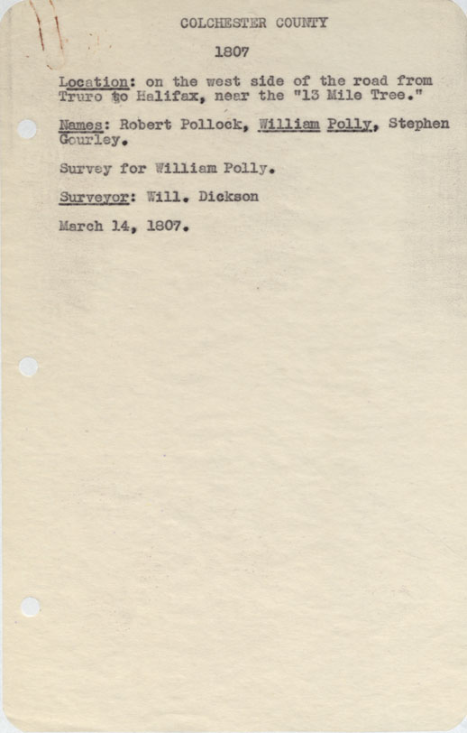
Colchester County On the west side of the Road from Truro to Halifax near the "Thirteen Mile Tree" 1807
Date: 14 March 1807
Reference: Nova Scotia Archives Map Collection: F/230 - 1807
Colchester County Land fronting on a lake on the west side of halifax Road known by the name Eleven Mile lake from truro 1807
Date: June 1807
Reference: Nova Scotia Archives Map Collection: F/230 - 1807
Peninsula and harbour of Halifax
Date: 1808
Reference: Nova Scotia Archives Royal Engineers Maps and Plans Y.26